Hopedale

Valley in Staffordshire Staffordshire Moorlands

England

Hopedale

The start of a footpath to Alstonefield A narrow flight of steps leads off a narrow back lane at the start of a footpath, which climbs steeply out of Milldale towards Alstonefield.
The start of a footpath to Alstonefield Credit: Ian Calderwood

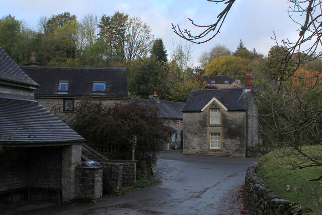
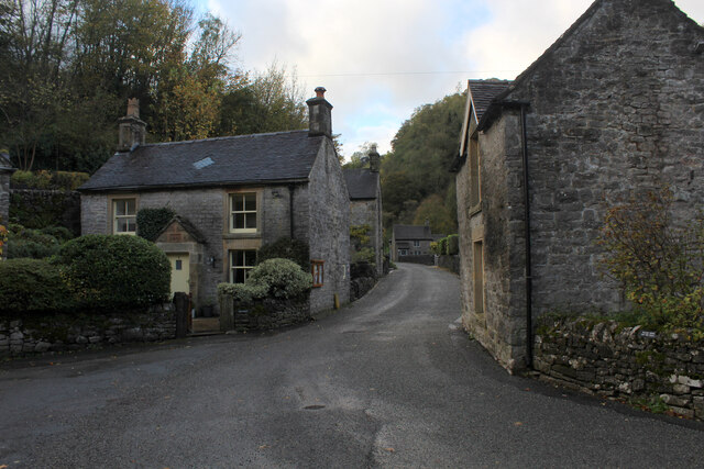
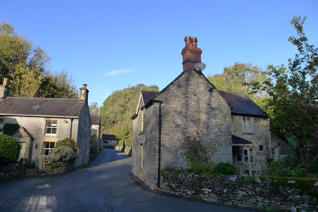
Hopedale, Staffordshire (Valley) is a picturesque rural village located in the heart of Staffordshire, England. Nestled within a beautiful valley, the village is surrounded by rolling hills and lush greenery, creating a stunning landscape that attracts visitors from far and wide.

The village is known for its charming and peaceful atmosphere, making it an ideal destination for those seeking a relaxing getaway. The quaint houses and cottages that line the streets add to the village's character and charm, giving it a timeless feel.

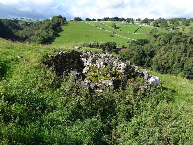
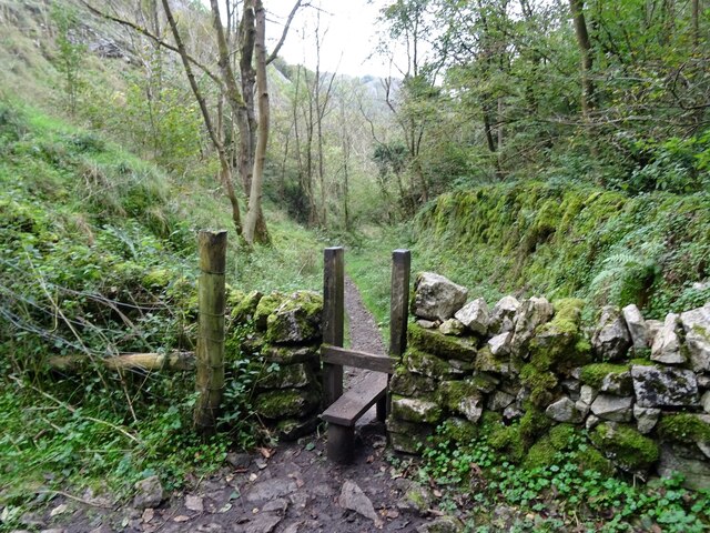
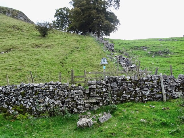
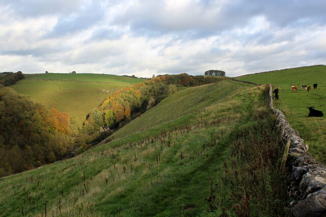
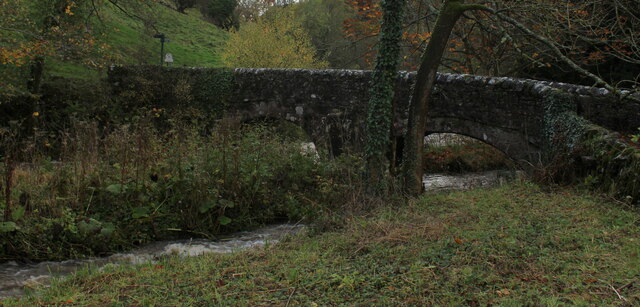
One of the highlights of Hopedale is its natural beauty, with the valley offering numerous walking and hiking trails for outdoor enthusiasts. Visitors can explore the stunning countryside, taking in breathtaking views of the surrounding hills and fields. The nearby river provides opportunities for fishing and boating, adding to the village's appeal for nature lovers.

Hopedale also boasts a rich history, with several historical landmarks scattered throughout the village. The village church, dating back centuries, stands as a testament to the area's heritage. Additionally, there are several old mills and farmhouses that give visitors a glimpse into the village's past.

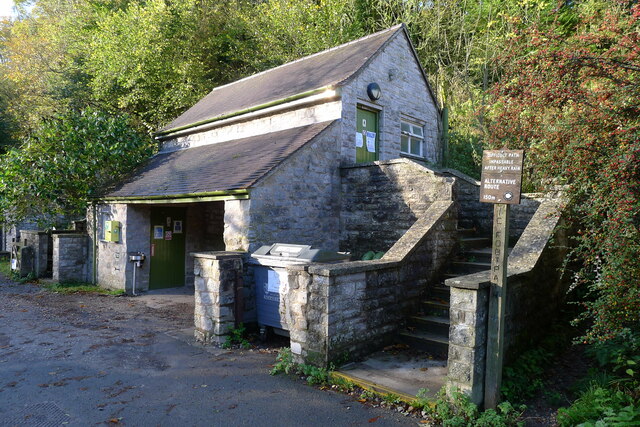
Despite its rural setting, Hopedale is well-connected to surrounding towns and cities, making it easily accessible for visitors. The village has a small but bustling community, with a range of amenities including quaint tea rooms, local shops, and a friendly pub where visitors can enjoy traditional food and drink.

Overall, Hopedale, Staffordshire (Valley) offers a tranquil and idyllic escape, combining natural beauty with a rich history, making it a must-visit destination for those seeking a quintessential English countryside experience.

If you have any feedback on the listing, please let us know in the comments section below.
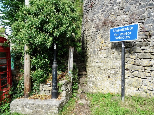
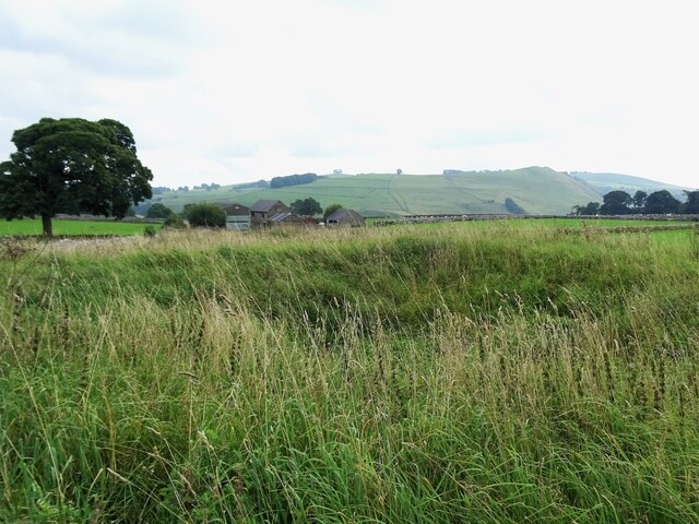
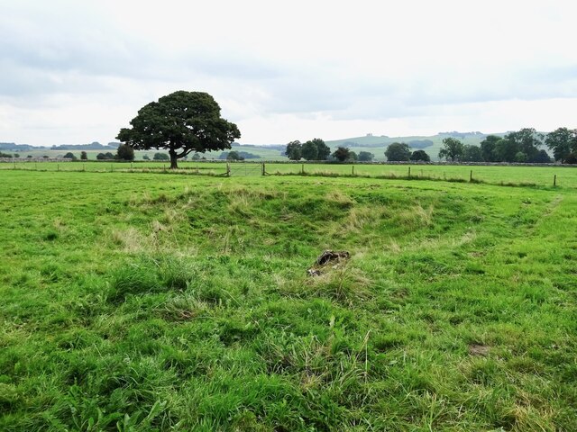
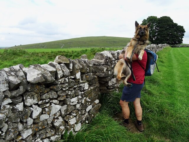
Hopedale Images

Images are sourced within 2km of 53.091325/-1.81228 or Grid Reference SK1254. Thanks to Geograph Open Source API. All images are credited.

The start of a footpath to Alstonefield A narrow flight of steps leads off a narrow back lane at the start of a footpath, which climbs steeply out of Milldale towards Alstonefield.
The start of a footpath to Alstonefield
A narrow flight of steps leads off a narrow back lane at the start of a footpath, which climbs steeply out of Milldale towards Alstonefield.
Old dew pond by Millway Lane A neglected dew pond sits dry, neglected and overgrown at the edge of Alstonefield.
Old dew pond by Millway Lane
A neglected dew pond sits dry, neglected and overgrown at the edge of Alstonefield.
Old dew pond by Gratton Lane An old dew pond sits dry and neglected in a field by Gratton Lane.
Old dew pond by Gratton Lane
An old dew pond sits dry and neglected in a field by Gratton Lane.
Negotiating a narrow squeeze stile Some squeeze stiles are much narrower at the bottom than at the top, which is fine for humans but can be problematic for dogs.
Negotiating a narrow squeeze stile
Some squeeze stiles are much narrower at the bottom than at the top, which is fine for humans but can be problematic for dogs.
A ruin above Mill Dale The remains of some kind of small building, pen or fold, marked on old OS maps as a plain, unlabelled rectangle.
A ruin above Mill Dale
The remains of some kind of small building, pen or fold, marked on old OS maps as a plain, unlabelled rectangle.
Stile in Hall Dale
Stile in Hall Dale
Step stile and sign at Allen's Bank in Hall Dale
Footpath to Pasture Lane The footpath from Hall Dale enters Stanshope via Pasture Lane.
Footpath to Pasture Lane
The footpath from Hall Dale enters Stanshope via Pasture Lane.
The remains of Highfields Lead Mine
Footpath High above Milldale The public footpath follows the wall, with ground falling away sharply to the left towards Milldale
Footpath High above Milldale
The public footpath follows the wall, with ground falling away sharply to the left towards Milldale
Milldale (1) Small village comprising several stone buildings, squeezed deep in the narrow valley of Dovedale - so narrow that sunshine finds difficulty in reaching the community.
Milldale (1)
Small village comprising several stone buildings, squeezed deep in the narrow valley of Dovedale - so narrow that sunshine finds difficulty in reaching the community.
Milldale (2) Delightful small village squeezed tightly between the valley sides of Dovedale - so tightly, that sunshine is at a premium.
A popular walk stretches south from here, running beside the River Dove to the stepping stones near Thorpe.
Milldale (2)
Delightful small village squeezed tightly between the valley sides of Dovedale - so tightly, that sunshine is at a premium. A popular walk stretches south from here, running beside the River Dove to the stepping stones near Thorpe.
Viator's Bridge Ancient packhorse bridge, which has been in use since medieval times. Izaak Walton wrote about this bridge in "The Compleat Angler" - referring to himself as Viator (Latin for traveller), which accounts for the structure's name.
Viator's Bridge
Ancient packhorse bridge, which has been in use since medieval times. Izaak Walton wrote about this bridge in "The Compleat Angler" - referring to himself as Viator (Latin for traveller), which accounts for the structure's name.
Public conveniences, Milldale
Milldale in Mill Dale A small village nestled in steep-sided valleys next to the River Dove. Very popular with walkers, with a large car park further along this road (and just within Staffordshire, the car park is free!)
Milldale in Mill Dale
A small village nestled in steep-sided valleys next to the River Dove. Very popular with walkers, with a large car park further along this road (and just within Staffordshire, the car park is free!)
Ravens Tor Steep limestone crag overlooking the deep trench of Dovedale - as seen from Nab Wood.
Popular with the rock climbing fraternity, who relish a challenge.
Ravens Tor
Steep limestone crag overlooking the deep trench of Dovedale - as seen from Nab Wood. Popular with the rock climbing fraternity, who relish a challenge.
Footpath in Nabs Wood Part of the famous path that follows the River Dove from Milldale down to the stepping stones near Thorpe. Fascinating hike, full of geological interest but busy with walkers like me!
Footpath in Nabs Wood
Part of the famous path that follows the River Dove from Milldale down to the stepping stones near Thorpe. Fascinating hike, full of geological interest but busy with walkers like me!
Gate and Walls above the Manifold Valley
Show me another place!

Hopedale is located at Grid Ref: SK1254 (Lat: 53.091325, Lng: -1.81228)

Administrative County: Staffordshire

District: Staffordshire Moorlands

Police Authority: Staffordshire

What 3 Words

///ranch.poorly.slices. Near Newhaven, Derbyshire

Related Wikis

Alstonefield

Alstonefield (alternative spelling: Alstonfield) is a village and civil parish in the Peak District National Park and the Staffordshire Moorlands district...

St Peter's Church, Alstonefield

The Church of St Peter in Alstonefield, Staffordshire Moorlands, England is a grade I listed Anglican parish church. The oldest parts are 12th century...

Long Low, Wetton

Long Low is a Neolithic and Bronze Age site in the English county of Staffordshire. It is about 2 km SE of Wetton (grid reference SK122539).It consists...

Wetton, Staffordshire

Wetton is a village in the Peak District National Park, North Staffordshire, at the top of the east side of the Manifold Valley. The population recorded...

Castern Wood

Castern Wood is a nature reserve of the Staffordshire Wildlife Trust. It is an ancient woodland, with scrub and grassland, on the eastern slopes of the...
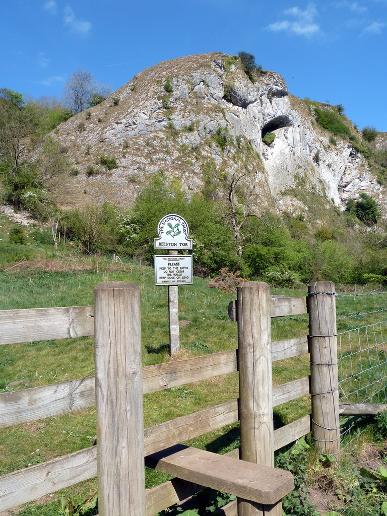
Beeston Tor

Beeston Tor (grid reference SK105540) is a limestone cliff in Staffordshire. It overlooks the confluence of the River Hamps with the River Manifold, and...

Beeston Tor railway station

Beeston Tor railway station was a minor station which served the Beeston Tor in Grindon, Staffordshire. The site is now part of the Manifold Way. ��2...

Tissington Trail

The Tissington Trail is a bridleway, footpath and cycleway in Derbyshire, England, along part of the trackbed of the former railway line connecting Ashbourne...

Nearby Amenities

Located within 500m of 53.091325,-1.81228
Hope
Is In: Staffordshire Moorlands
Place: hamlet
Lat/Long: 53.09357/-1.8150456
Hopedale
Place: hamlet
Lat/Long: 53.0915824/-1.8175041
Barrier: stile
Foot: yes
Stile: squeezer
Lat/Long: 53.0915414/-1.8091534
Bus Stop
The Watts Russell
Bus: yes
Naptan AtcoCode: 3800C845601
Naptan Bearing: N
Naptan CommonName: The Watts Russell
Naptan Indicator: Adj
Naptan Landmark: The Watts Russell
Naptan Street: Main Rd
Naptan Verified: no
Public Transport: platform
Source: naptan_import
Lat/Long: 53.0916943/-1.818242
Post Box
Brand: Royal Mail
Brand Wikidata: Q638098
Operator: Royal Mail
Operator Wikidata: Q638098
Ref: DE6 815
Lat/Long: 53.0923062/-1.818135
Top of Hope
Place: locality
Source: OS_OpenData_StreetView
Lat/Long: 53.0951452/-1.8105398
Barrier: stile
Foot: yes
Material: stone
Source: survey
Stile: squeezer
Lat/Long: 53.0891897/-1.8164986
Barrier: stile
Material: stone
Source: survey;gps
Stile: squeezer
Lat/Long: 53.0956376/-1.8141636
Barrier: stile
Material: wood
Source: survey
Stile: stepover
Lat/Long: 53.0934764/-1.8170805
Addr Housename: Hope Villa
Lat/Long: 53.0953059/-1.8101888
Addr Housename: Hope Mount Farm
Lat/Long: 53.0950338/-1.8107993
Addr Housename: Hope Villa
Lat/Long: 53.0952113/-1.8103341
Addr Housename: Top Of Hope
Lat/Long: 53.0950604/-1.81061
Barrier: stile
Material: stone
Source: survey;gps
Stile: squeezer
Lat/Long: 53.0890907/-1.8166062
Addr Housename: The Cottage
Source: survey;bing
Lat/Long: 53.0923767/-1.817851
Barrier: stile
Material: stone
Source: survey;gps
Stile: stepover
Lat/Long: 53.0919295/-1.8140595
Bench
Source: survey
Lat/Long: 53.0926596/-1.8177782
Barrier: stile
Material: stone
Source: survey;gps
Stile: squeezer
Lat/Long: 53.0928213/-1.817464
Barrier: stile
Material: stone
Source: survey;gps
Stile: squeezer
Lat/Long: 53.0929486/-1.8151821
Barrier: stile
Source: survey;gps
Stile: squeezer
Lat/Long: 53.0948793/-1.8099696
Barrier: stile
Lat/Long: 53.093334/-1.8185351
Information: route_marker
Tourism: information
Lat/Long: 53.0914848/-1.809134
Information: route_marker
Tourism: information
Lat/Long: 53.0916371/-1.8087881
Information: route_marker
Tourism: information
Lat/Long: 53.0917536/-1.8071083
Information: route_marker
Tourism: information
Lat/Long: 53.0925076/-1.8068916
Information: route_marker
Tourism: information
Lat/Long: 53.0913326/-1.8079593
Information: route_marker
Tourism: information
Lat/Long: 53.0912971/-1.8082998
The data included in this document is from www.openstreetmap.org. The data is made available under ODbL.

Have you been to Hopedale?

Leave your review of Hopedale below (or comments, questions and feedback).