Upper Reddale Clough
Valley in Derbyshire High Peak
England
Upper Reddale Clough
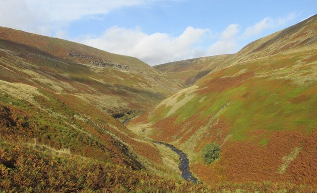
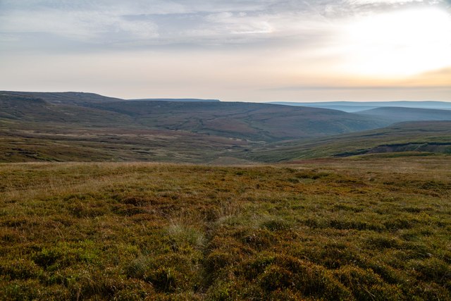
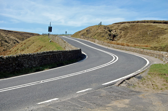
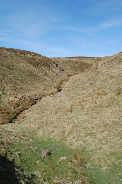
Upper Reddale Clough is a picturesque valley located in Derbyshire, England. Nestled within the Peak District National Park, it offers visitors breathtaking natural beauty and a tranquil escape from the bustling city life.
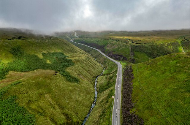
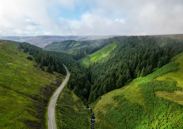
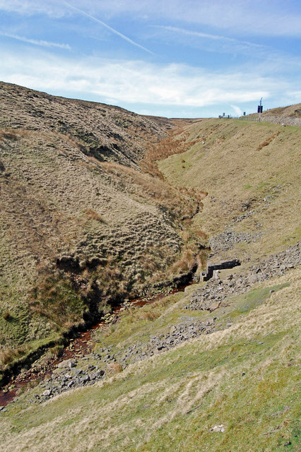
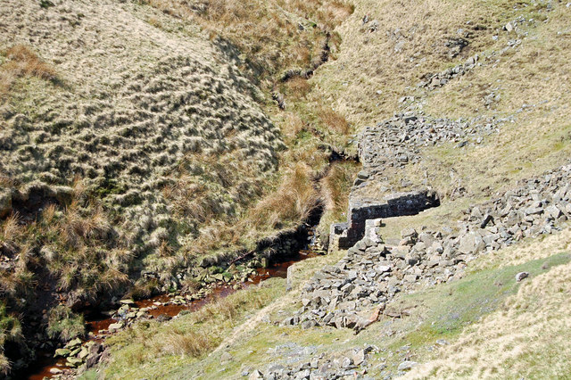
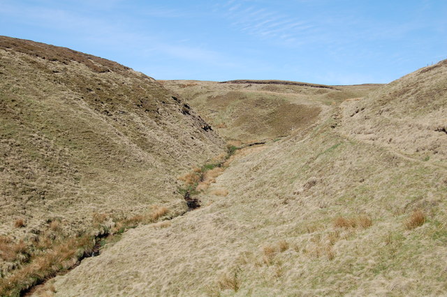
The valley is characterized by its rugged terrain, comprising steep slopes covered in a rich tapestry of greenery. Lush meadows, heather moorland, and dense woodlands create a diverse and thriving ecosystem. The clough is crisscrossed by several small streams, which cascade down rocky waterfalls, adding to the charm and serenity of the landscape.
Hiking enthusiasts are drawn to Upper Reddale Clough for its extensive network of walking trails. These trails cater to all levels of fitness, from leisurely strolls to more challenging uphill climbs. Along the way, visitors can spot a variety of wildlife, including deer, rabbits, and a plethora of bird species.
The valley boasts a rich history, with evidence of ancient settlements and mining activities. Ruins of old stone cottages and mine buildings can still be found, providing a glimpse into the region's past. The area is also known for its stone walls, which crisscross the landscape, adding to its rustic charm.
Upper Reddale Clough offers a sense of tranquility and solitude, making it a popular destination for those seeking respite from the demands of modern life. Whether it be taking in the breathtaking views, exploring the nature trails, or simply immersing oneself in the peaceful atmosphere, the valley provides a truly rejuvenating experience for nature lovers and outdoor enthusiasts alike.
If you have any feedback on the listing, please let us know in the comments section below.
Upper Reddale Clough Images
Images are sourced within 2km of 53.436192/-1.8266312 or Grid Reference SK1193. Thanks to Geograph Open Source API. All images are credited.


Upper Reddale Clough is located at Grid Ref: SK1193 (Lat: 53.436192, Lng: -1.8266312)
Administrative County: Derbyshire
District: High Peak
Police Authority: Derbyshire
What 3 Words
///nobody.handover.safety. Near High Peak, Derbyshire
Nearby Locations
Related Wikis

Featherbed Top
Featherbed Top is an open, flat-topped hill, 544 metres (1,785 ft) high, in the Peak District in the county of Derbyshire in England. == Description... ==

Snake Pass
Snake Pass is a hill pass in the Derbyshire section of the Peak District, crossing the Pennines between Glossop and the Ladybower Reservoir at Ashopton...

Bleaklow Bomber
The Bleaklow Bomber was a US Air Force (USAF) Boeing RB-29A Superfortress that crashed near Higher Shelf Stones on Bleaklow in the Peak District in 1948...

Alport Castles
The Alport Castles are a landslip feature in the Peak District National Park in Derbyshire. At over half a mile long, it is thought to be the largest landslide...

Bleaklow
Bleaklow is a high, largely peat-covered, gritstone moorland in the Derbyshire High Peak near the town of Glossop. It is north of Kinder Scout, across...

Dark Peak
The Dark Peak is the higher and wilder part of the Peak District in England, mostly forming the northern section but also extending south into its eastern...

River Alport
The River Alport flows for 5.6 miles (9 km) in the Dark Peak of the Peak District in Derbyshire, England. Its source is on Bleaklow, 3 miles (4.8 km)...

Hope Woodlands
Hope Woodlands is an extensive civil parish in the High Peak district of Derbyshire in England. The parish covers the Woodlands Valley, the western Upper...
Have you been to Upper Reddale Clough?
Leave your review of Upper Reddale Clough below (or comments, questions and feedback).