Over Wood Moss

Downs, Moorland in Derbyshire High Peak

England

Over Wood Moss

Alport Dale Looking towards Grindlesgrain Tor.
Alport Dale Credit: steven ruffles

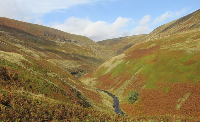
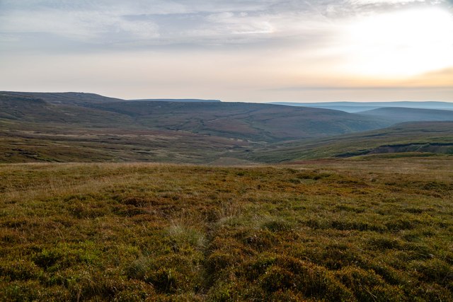
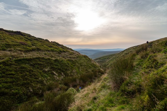
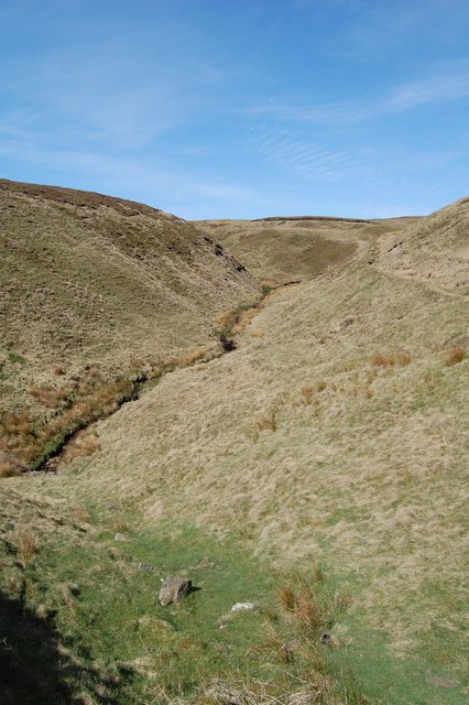
Over Wood Moss is a picturesque area located in Derbyshire, England. Situated within the renowned Peak District National Park, this stunning landscape is characterized by its rolling hills, extensive moorland, and enchanting woodlands. With its diverse ecosystem and natural beauty, Over Wood Moss attracts nature lovers, hikers, and outdoor enthusiasts from near and far.

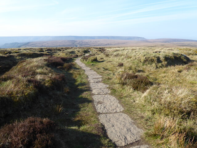
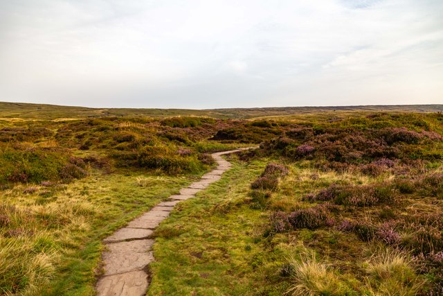
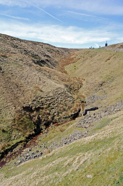
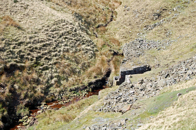
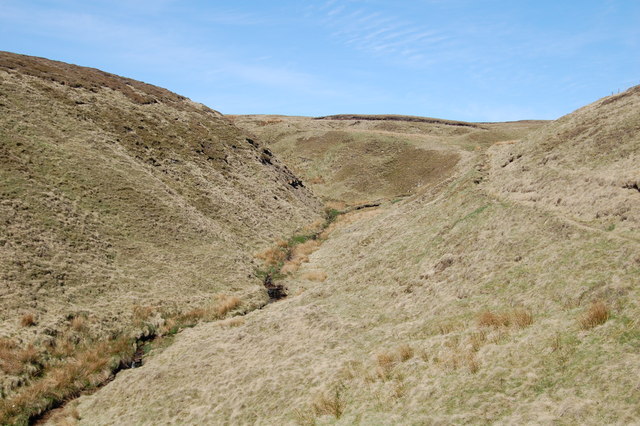
The area is predominantly covered in heather moorland, which blooms in vibrant hues of purple during the summer months, creating a stunning visual spectacle. The moorland is interspersed with patches of dense woodlands, adding to the charm and providing a habitat for various wildlife species. The woodlands are predominantly composed of oak, birch, and rowan trees, which offer a tranquil and secluded environment for exploration and relaxation.

Over Wood Moss is not only visually appealing but also rich in biodiversity. The area is home to a variety of wildlife, including red deer, foxes, badgers, and numerous bird species such as curlews, lapwings, and peregrine falcons. Birdwatchers flock to the area to catch a glimpse of these magnificent creatures in their natural habitat.

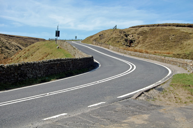
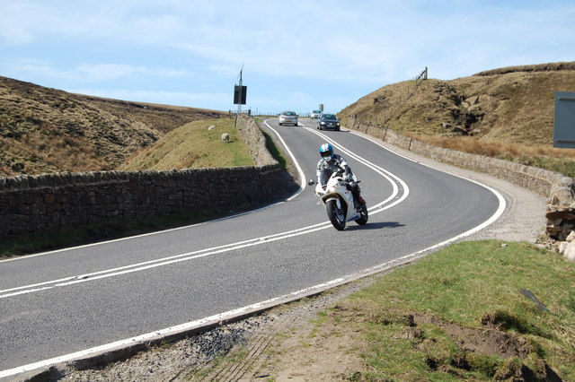
The landscape of Over Wood Moss is crisscrossed by a network of well-maintained footpaths and trails, making it an ideal destination for hikers and walkers of all abilities. The paths offer breathtaking views of the surrounding countryside, with opportunities to spot rare plant species and enjoy sweeping vistas of the Derbyshire Dales.

In summary, Over Wood Moss is a captivating destination in Derbyshire, boasting a diverse range of habitats, stunning moorland, and enchanting woodlands. It provides a haven for nature enthusiasts, offering a chance to immerse oneself in the beauty and tranquility of the Peak District National Park.

If you have any feedback on the listing, please let us know in the comments section below.

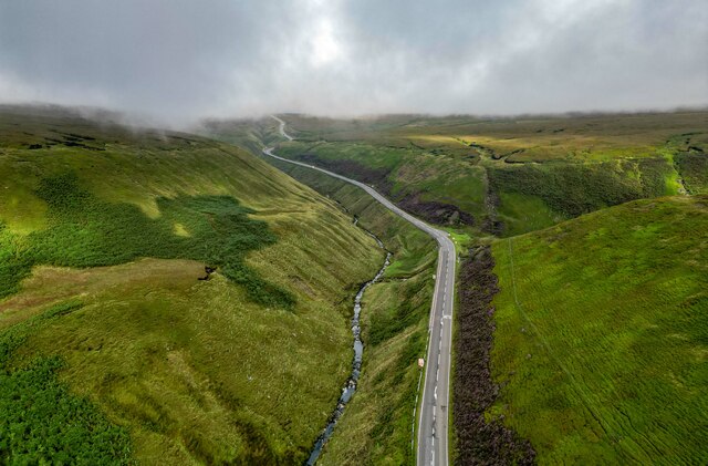
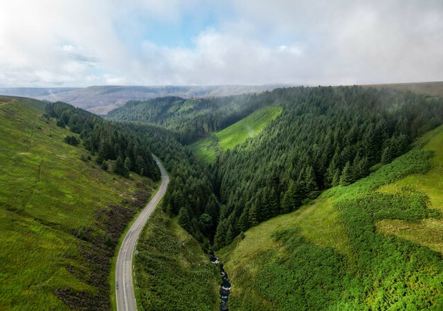
Over Wood Moss Images

Images are sourced within 2km of 53.440276/-1.8289931 or Grid Reference SK1193. Thanks to Geograph Open Source API. All images are credited.

Alport Dale Looking towards Grindlesgrain Tor.
Alport Dale
Looking towards Grindlesgrain Tor.
Lady Clough View up Lady Clough and the A57, Snake Pass.
Lady Clough
View up Lady Clough and the A57, Snake Pass.
Lady Clough View looking down Lady Clough and the A57, Snake Pass.
Lady Clough
View looking down Lady Clough and the A57, Snake Pass.
Grains in the Water
Grains in the Water
The Pennine Way near Alport Low
Pennine Way The Pennine Way above Alport Low.
Pennine Way
The Pennine Way above Alport Low.
Pennine Way Pile of stones alongside the Pennine Way.
Pennine Way
Pile of stones alongside the Pennine Way.
Hern Clough
Hern Clough
Hope Woodlands : Snake Pass The Snake Pass is on the higher reaches of the A57, where it crosses the Peak District between Manchester and Sheffield. More specifically, the name usually refers to the section between Glossop and Ladybower Reservoir, where the road passes over the high ground between the moorland plateaux of Kinder Scout and Bleaklow. The highest point is 512 metres (1,680 ft) above sea level.

The road was built in 1821 by Thomas Telford, as a toll road along the most direct route between the two cities. It passes through the National Trust's High Peak Estate. In the 20th century the more northerly Woodhead Pass, which is less steep and at a lower altitude, became the primary road link between Manchester and Sheffield.

The road has a poor accident record. In winter, it is often the first of the routes between Sheffield and Manchester to be closed due to snow. There are parts where the road surface has very poor skid resistance and a number of bends have adverse camber. There is a steep drop beside the road, railed off for long stretches by crash barriers. On 25 January 2008, a landslip due to heavy rain caused the road to be closed to all traffic, although access was still available to local premises and businesses. The repairs were completed in August 2008.

The name of the road matches its winding route, but derives from the emblem of the Snake Inn, one of the few buildings on the road. The pub's name and sign were derived from the serpent on the Cavendish arms of the Duke of Devonshire. In recent times, the Snake Inn was renamed the Snake Pass Inn. 

Wikipedia: <span class="nowrap"><a title="http://en.wikipedia.org/wiki/Snake_Pass" rel="nofollow ugc noopener" href="http://en.wikipedia.org/wiki/Snake_Pass">Link</a><img style="margin-left:2px;" alt="External link" title="External link - shift click to open in new window" src="https://s1.geograph.org.uk/img/external.png" width="10" height="10"/></span>
Hope Woodlands : Snake Pass
The Snake Pass is on the higher reaches of the A57, where it crosses the Peak District between Manchester and Sheffield. More specifically, the name usually refers to the section between Glossop and Ladybower Reservoir, where the road passes over the high ground between the moorland plateaux of Kinder Scout and Bleaklow. The highest point is 512 metres (1,680 ft) above sea level. The road was built in 1821 by Thomas Telford, as a toll road along the most direct route between the two cities. It passes through the National Trust's High Peak Estate. In the 20th century the more northerly Woodhead Pass, which is less steep and at a lower altitude, became the primary road link between Manchester and Sheffield. The road has a poor accident record. In winter, it is often the first of the routes between Sheffield and Manchester to be closed due to snow. There are parts where the road surface has very poor skid resistance and a number of bends have adverse camber. There is a steep drop beside the road, railed off for long stretches by crash barriers. On 25 January 2008, a landslip due to heavy rain caused the road to be closed to all traffic, although access was still available to local premises and businesses. The repairs were completed in August 2008. The name of the road matches its winding route, but derives from the emblem of the Snake Inn, one of the few buildings on the road. The pub's name and sign were derived from the serpent on the Cavendish arms of the Duke of Devonshire. In recent times, the Snake Inn was renamed the Snake Pass Inn. Wikipedia: LinkExternal link
Hope Woodlands : Lady Clough
Hope Woodlands : Doctor's Gate
Hope Woodlands : Snake Pass One of the first really sunny Sundays of spring, and the motorcyclists were out in their thousands!
Hope Woodlands : Snake Pass
One of the first really sunny Sundays of spring, and the motorcyclists were out in their thousands!
Snake Pass: pointing towards Glossop The A57 winds its way towards Glossop, a few miles distant. The chevrons alert motorists to one of many sharp bends on the way - important enough in glorious weather such as just now but potentially invaluable on this route susceptible to sudden changes in the weather.
Snake Pass: pointing towards Glossop
The A57 winds its way towards Glossop, a few miles distant. The chevrons alert motorists to one of many sharp bends on the way - important enough in glorious weather such as just now but potentially invaluable on this route susceptible to sudden changes in the weather.
Snake Pass: chevrons at  Doctor’s Gate Detail of road signs at a sharp bend on Snake Pass (see <a href="https://www.geograph.org.uk/photo/2359162">SE2138 : Low Hall Road</a>).

While the bend is worthy of chevrons in any conditions, this route on high ground is very susceptible to extremes and sudden changes in the weather, so in conditions less calm than today the arrows and their fluorescent border could well be invaluable.
Snake Pass: chevrons at Doctor’s Gate
Detail of road signs at a sharp bend on Snake Pass (see SE2138 : Low Hall Road). While the bend is worthy of chevrons in any conditions, this route on high ground is very susceptible to extremes and sudden changes in the weather, so in conditions less calm than today the arrows and their fluorescent border could well be invaluable.
Snake Pass: Doctor’s Gate Culvert A stream passes under the A57 Snake Pass by way of this rather attractive culvert, more a small tunnel well below the road surface. Although the wall clearly curves outwards towards us, the bend in the road is actually going the other way.
Snake Pass: Doctor’s Gate Culvert
A stream passes under the A57 Snake Pass by way of this rather attractive culvert, more a small tunnel well below the road surface. Although the wall clearly curves outwards towards us, the bend in the road is actually going the other way.
Snake Pass: looking into Doctor’s Gate Culvert A close-up view of the entrance to <a href="https://www.geograph.org.uk/photo/2395192">SK1092 : Snake Pass: Doctor’s Gate Culvert</a>, passing under the A57 Snake Pass.
Snake Pass: looking into Doctor’s Gate Culvert
A close-up view of the entrance to SK1092 : Snake Pass: Doctor’s Gate Culvert, passing under the A57 Snake Pass.
Show me another place!

Over Wood Moss is located at Grid Ref: SK1193 (Lat: 53.440276, Lng: -1.8289931)

Administrative County: Derbyshire

District: High Peak

Police Authority: Derbyshire

What 3 Words

///roofed.establish.grownup. Near Glossop, Derbyshire

Related Wikis

Bleaklow Bomber

The Bleaklow Bomber was a US Air Force (USAF) Boeing RB-29A Superfortress that crashed near Higher Shelf Stones on Bleaklow in the Peak District in 1948...

Snake Pass

Snake Pass is a hill pass in the Derbyshire section of the Peak District, crossing the Pennines between Glossop and the Ladybower Reservoir at Ashopton...

Featherbed Top

Featherbed Top is an open, flat-topped hill, 544 metres (1,785 ft) high, in the Peak District in the county of Derbyshire in England. == Description... ==

Bleaklow

Bleaklow is a high, largely peat-covered, gritstone moorland in the Derbyshire High Peak near the town of Glossop. It is north of Kinder Scout, across...

Alport Castles

The Alport Castles are a landslip feature in the Peak District National Park in Derbyshire. At over half a mile long, it is thought to be the largest landslide...

Dark Peak

The Dark Peak is the higher and wilder part of the Peak District in England, mostly forming the northern section but also extending south into its eastern...

River Alport

The River Alport flows for 5.6 miles (9 km) in the Dark Peak of the Peak District in Derbyshire, England. Its source is on Bleaklow, 3 miles (4.8 km)...

Hope Woodlands

Hope Woodlands is an extensive civil parish in the High Peak district of Derbyshire in England. The parish covers the Woodlands Valley, the western Upper...

Nearby Amenities

Located within 500m of 53.440276,-1.8289931
Over Wood Moss
Ele: 536
Ele Feet: 1759
Natural: peak
Source: user knowledge
Lat/Long: 53.4393485/-1.8340117
Waterfall
Lat/Long: 53.4428097/-1.8266858
The data included in this document is from www.openstreetmap.org. The data is made available under ODbL.

Have you been to Over Wood Moss?

Leave your review of Over Wood Moss below (or comments, questions and feedback).