Roberts Clough

Valley in Yorkshire

England

Roberts Clough

Old milestone Another West Riding CC late 19C milestone that was painted a few years ago.   The backing stone was left bare as it would have been when first set up.   The left face has the legend GREEN/FIELD/7½ MILES/OLDHAM//11¾ MILES.  The farm in the valley is Upper Knowl and beyond, over the hill is Digley Reservoir.   Grade II listed 1134873.
Old milestone Credit: Chris Minto

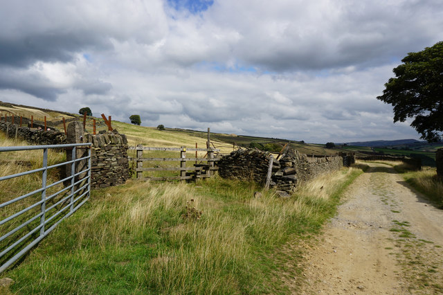
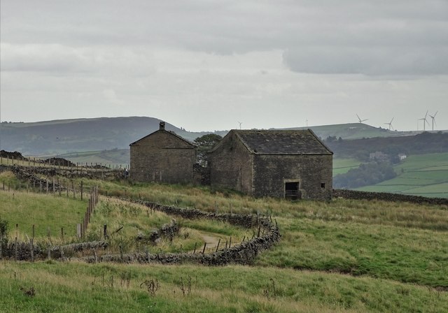
Roberts Clough is a picturesque valley situated in the county of Yorkshire, England. Nestled within the stunning Yorkshire Dales National Park, this valley offers breathtaking natural beauty and a peaceful escape from the hustle and bustle of city life.

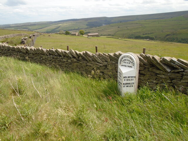
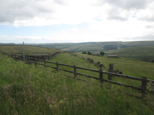
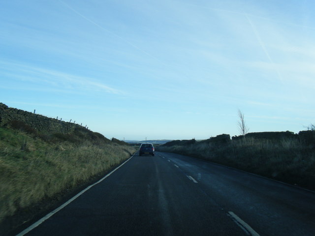
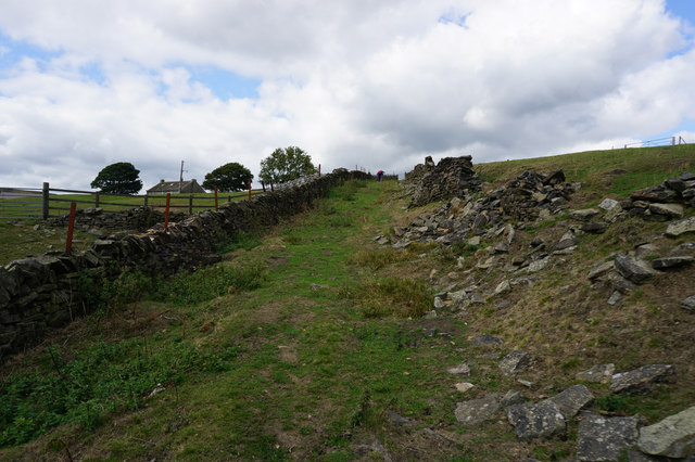
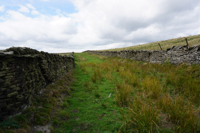
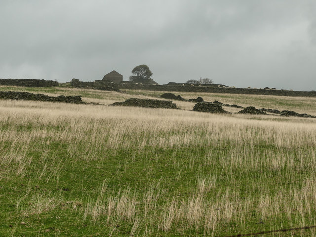
Characterized by its rolling hills, lush greenery, and meandering river, Roberts Clough is a haven for nature lovers and outdoor enthusiasts. The valley is home to a diverse range of flora and fauna, including wildflowers, oak trees, and various bird species. Visitors can explore the numerous walking trails that wind through the valley, offering panoramic views and opportunities for wildlife spotting.

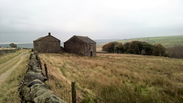
At the heart of Roberts Clough lies a charming village, complete with traditional stone cottages and a friendly community. The village provides a warm welcome to tourists, offering cozy accommodations, quaint tea rooms, and local pubs serving delicious Yorkshire fare.

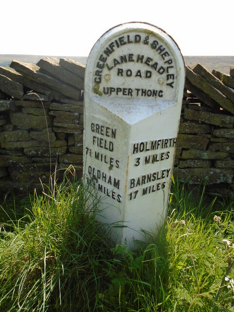
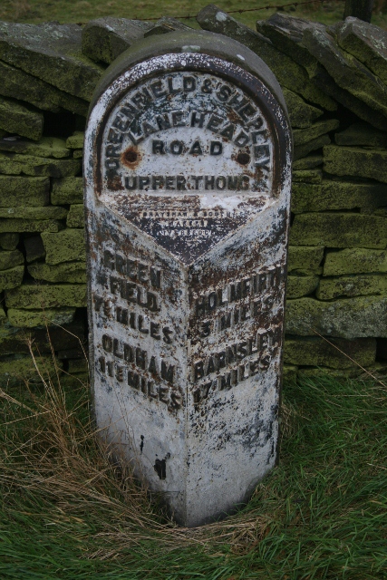
One of the highlights of Roberts Clough is its rich history and heritage. The valley boasts a number of historical sites, including ancient stone circles and remnants of medieval settlements. Visitors can delve into the past by visiting the nearby ruins of a 12th-century abbey or exploring the well-preserved medieval architecture in the surrounding villages.

Roberts Clough is a destination that appeals to all seasons. In the spring and summer, wildflowers carpet the valley, and the river offers a refreshing spot for picnics and paddling. In the autumn, the foliage transforms into a stunning display of reds and golds, while winter brings a quiet tranquility and the opportunity for scenic winter walks.

Overall, Roberts Clough is a hidden gem in Yorkshire, offering a unique blend of natural beauty, rich history, and a warm, welcoming atmosphere.

If you have any feedback on the listing, please let us know in the comments section below.

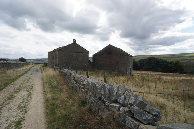
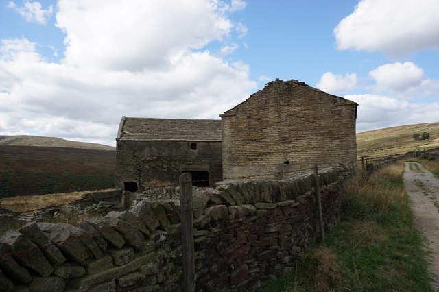
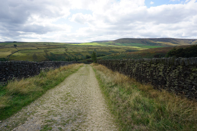
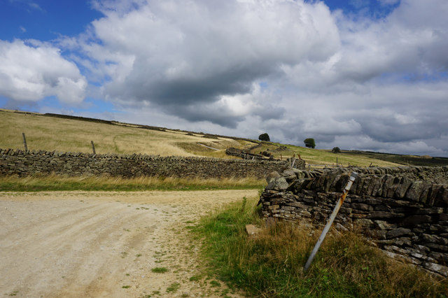
Roberts Clough Images

Images are sourced within 2km of 53.568403/-1.8268618 or Grid Reference SE1107. Thanks to Geograph Open Source API. All images are credited.

Old milestone Another West Riding CC late 19C milestone that was painted a few years ago.   The backing stone was left bare as it would have been when first set up.   The left face has the legend GREEN/FIELD/7½ MILES/OLDHAM//11¾ MILES.  The farm in the valley is Upper Knowl and beyond, over the hill is Digley Reservoir.   Grade II listed 1134873.
Old milestone
Another West Riding CC late 19C milestone that was painted a few years ago. The backing stone was left bare as it would have been when first set up. The left face has the legend GREEN/FIELD/7½ MILES/OLDHAM//11¾ MILES. The farm in the valley is Upper Knowl and beyond, over the hill is Digley Reservoir. Grade II listed 1134873.
Old milestone A closer view of the WRCC milestone that was set up in 1893/94.    The metal attachments on these milestones in this area were cast at the foundry of Brayshaw and Booth of Liversedge.  Altough not painted, raised lettering can just be made out on the bevel.
Old milestone
A closer view of the WRCC milestone that was set up in 1893/94. The metal attachments on these milestones in this area were cast at the foundry of Brayshaw and Booth of Liversedge. Altough not painted, raised lettering can just be made out on the bevel.
Footpath towards Upper Knowl
A635 and a lone tree at Knowl Height
Nether Lane at Greaves Head
Nether Lane towards Shay Lane
Hoowood Lane at Rye Close Lane
Rye Close Lane (left) at Shay Lane
Rye Close Lane towards the A635
Floodlights being prepared to help prevent floods There is a leak suspected on the Bilberry Reservoir dam below here and this was apparently the nearest point transport could drop off floodlights to illuminate the intended investigation and repair work. A long way to push them down the hill, but rather worse when they have to come back up!
Floodlights being prepared to help prevent floods
There is a leak suspected on the Bilberry Reservoir dam below here and this was apparently the nearest point transport could drop off floodlights to illuminate the intended investigation and repair work. A long way to push them down the hill, but rather worse when they have to come back up!
Moorland below Upper Knowl
Old Milestone by the A635, Greenfield Road, Holme Valley parish Metal plate attached to stone post by the A635, in parish of HOLME VALLEY (KIRKLEES District), Greenfield Road, in open country; Holme Moss in distance, just West of footpath, on South side of road. Brayshaw & Booth iron casting, erected by the County Council in the 19th century. 

Inscription reads:-
: GREEN / FIELD / 7½ MILES / OLDHAM / 11¾ MILES : : GREENFIELD & SHEPLEY / LANE HEAD / ROAD / UPPERTHONG : : HOLMFIRTH / 3 MILES / BARNSLEY / 17 MILES :
Maker:-
: BRAYSHAW & BOOTH / MAKERS / LIVERSEDGE :

Grade II listed.  
List Entry Number: 1134873 <span class="nowrap"><a title="https://historicengland.org.uk/listing/the-list/list-entry/1134873" rel="nofollow ugc noopener" href="https://historicengland.org.uk/listing/the-list/list-entry/1134873">Link</a><img style="margin-left:2px;" alt="External link" title="External link - shift click to open in new window" src="https://s1.geograph.org.uk/img/external.png" width="10" height="10"/></span>

Milestone Society National ID: YW_GFSLH07.
Old Milestone by the A635, Greenfield Road, Holme Valley parish
Metal plate attached to stone post by the A635, in parish of HOLME VALLEY (KIRKLEES District), Greenfield Road, in open country; Holme Moss in distance, just West of footpath, on South side of road. Brayshaw & Booth iron casting, erected by the County Council in the 19th century. Inscription reads:- : GREEN / FIELD / 7½ MILES / OLDHAM / 11¾ MILES : : GREENFIELD & SHEPLEY / LANE HEAD / ROAD / UPPERTHONG : : HOLMFIRTH / 3 MILES / BARNSLEY / 17 MILES : Maker:- : BRAYSHAW & BOOTH / MAKERS / LIVERSEDGE : Grade II listed. List Entry Number: 1134873 LinkExternal link Milestone Society National ID: YW_GFSLH07.
A635 towards Saddleworth Moor Looking west.
A635 towards Saddleworth Moor
Looking west.
Greaves Head
Greaves Head
Approaching Greaves Head
A view of Greaves Head Farm Disused and entering a state of severe dilapidation, Greaves Head is of similar construction and layout to nearby Bartin Farm. It is very likely that both of these farms reached the end of their natural lives with the construction of reservoirs in the valley below during the twentieth century.
A view of Greaves Head Farm
Disused and entering a state of severe dilapidation, Greaves Head is of similar construction and layout to nearby Bartin Farm. It is very likely that both of these farms reached the end of their natural lives with the construction of reservoirs in the valley below during the twentieth century.
Show me another place!

Roberts Clough is located at Grid Ref: SE1107 (Lat: 53.568403, Lng: -1.8268618)

Division: West Riding

Unitary Authority: Kirklees

Police Authority: West Yorkshire

What 3 Words

///flashing.fuse.discussed. Near Holmfirth, West Yorkshire

Nearby Locations

Flush House Roberts Clough

Related Wikis

Austonley

Austonley is a hamlet in the civil parish of Holme Valley, West Yorkshire, England, about 2 miles (3.2 km) west of Holmfirth.

Digley Reservoir

Digley Reservoir is a lake located downstream of Bilberry Reservoir, 2 miles (3.2 km) south west of Holmfirth, in West Yorkshire, England. The reservoir...

Moxon Huddersfield

Moxon Huddersfield Ltd is a high-end British textile manufacturer of luxury worsted and woollen suiting fabrics. It is located at Yew Tree Mills, Holmbridge...

Holmbridge

Holmbridge is a small village on the A6024 to the southwest of Holmfirth and south of Huddersfield in West Yorkshire, England. It is in the parish of...

Upperthong

Upperthong is a village approximately 807 feet (246 m) above sea level, near the town of Holmfirth in Holme Valley, approximately 7 miles (11 km) south...

Burnlee

Burnlee is a village in the Holme Valley in Kirklees, West Yorkshire, England. It is bordered by the settlements of Holmfirth, Upperthong and Hinchcliffe...

Holmfirth floods

The Holmfirth floods were a number of instances when severe flooding had occurred in the Holme Valley, West Yorkshire, England affecting Holmfirth and...

Underhill, Holme

Underhill at Holme, West Yorkshire, is a modern house designed by Arthur Quarmby in 1969 and built from 1973 to 1975. Underhill has been Grade II listed...

Nearby Amenities

Located within 500m of 53.568403,-1.8268618
Power: pole
Lat/Long: 53.5712453/-1.8215622
Power: pole
Lat/Long: 53.5711603/-1.8224511
Power: pole
Lat/Long: 53.5710669/-1.8233646
Power: pole
Lat/Long: 53.5709736/-1.8242828
Power: pole
Lat/Long: 53.5708529/-1.8255429
Power: pole
Lat/Long: 53.5712517/-1.826116
Power: pole
Lat/Long: 53.5717649/-1.8268493
Power: pole
Lat/Long: 53.5722507/-1.8275703
Power: pole
Lat/Long: 53.5723504/-1.8287934
Power: pole
Lat/Long: 53.57244/-1.8298795
Power: pole
Lat/Long: 53.5721583/-1.8307222
Power: pole
Lat/Long: 53.572/-1.8311566
The data included in this document is from www.openstreetmap.org. The data is made available under ODbL.

Have you been to Roberts Clough?

Leave your review of Roberts Clough below (or comments, questions and feedback).