Crowden Clough

Valley in Derbyshire High Peak

England

Crowden Clough

The Pennine Way at Lee Farm Passing through the National Trust owned Lee Farm on the Pennine Way.
The Pennine Way at Lee Farm Credit: Jeff Buck

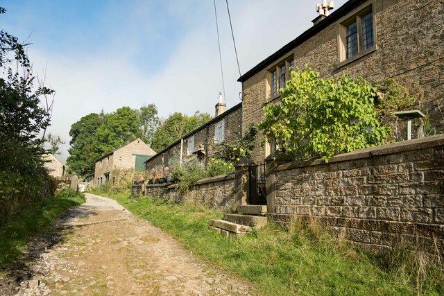
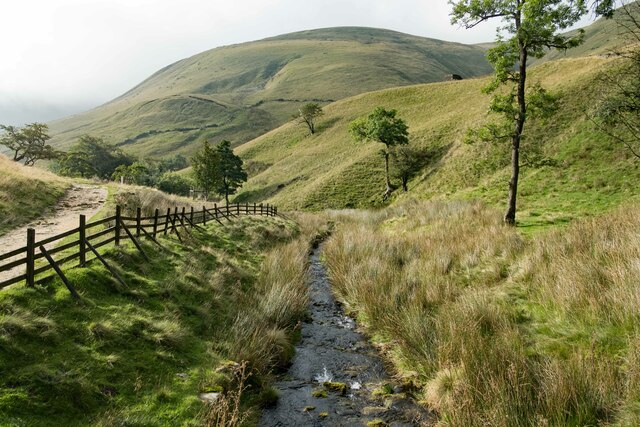
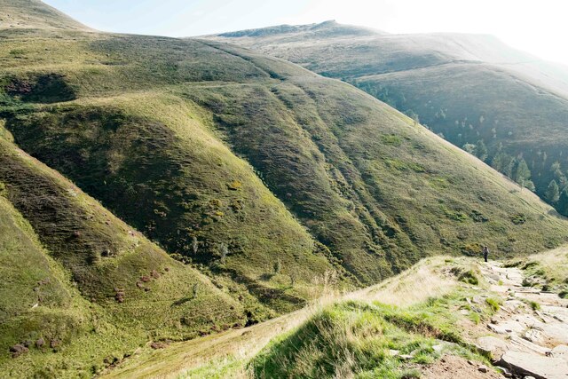
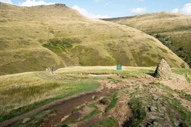
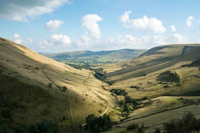
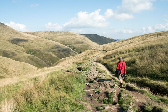
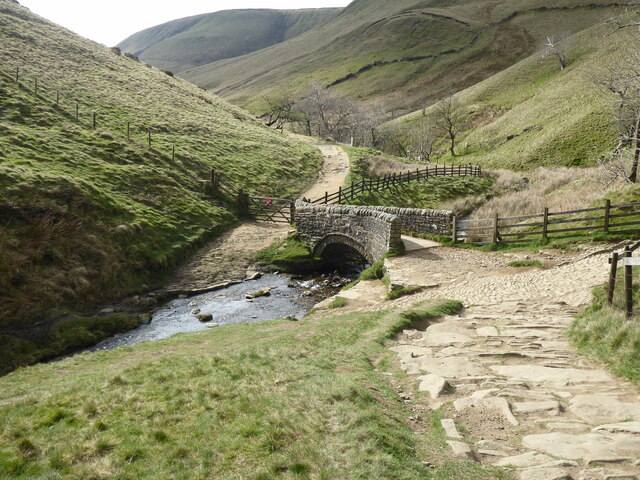
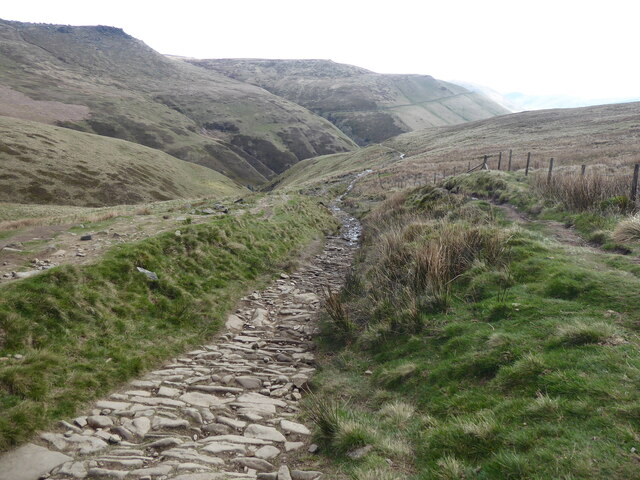
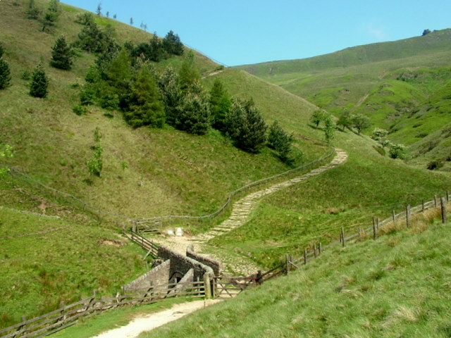
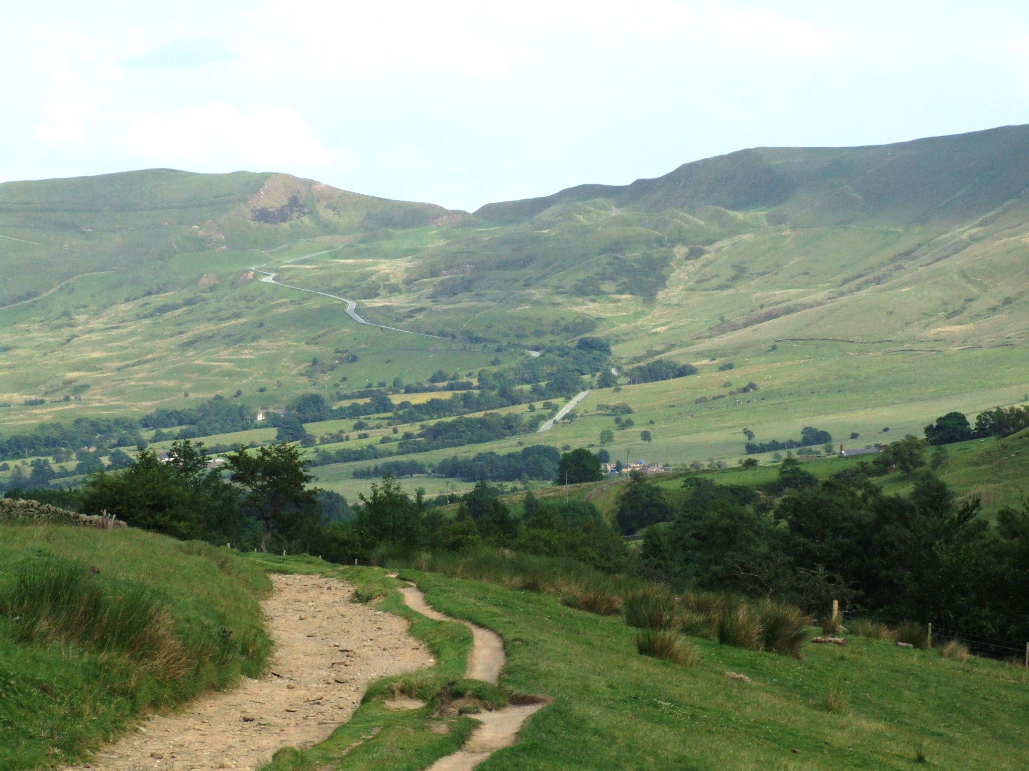
Crowden Clough is a picturesque valley located in the Derbyshire Peak District, England. Nestled within the rugged landscape of the Dark Peak, this area is known for its breathtaking natural beauty and tranquil atmosphere. The valley stretches for approximately 2 miles, running from the Crowden Brook to the Longdendale Reservoir.

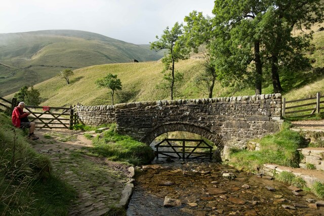
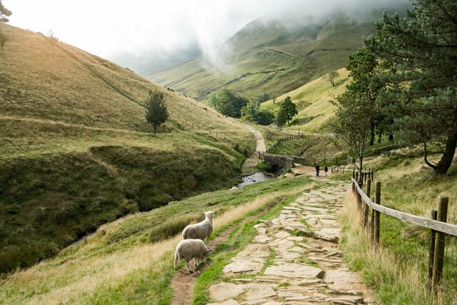
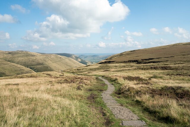
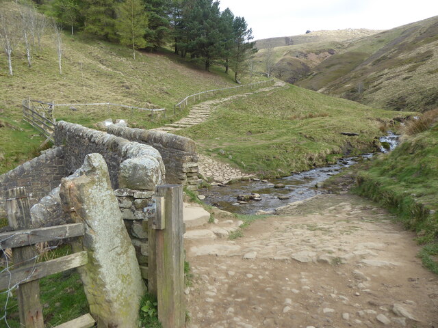
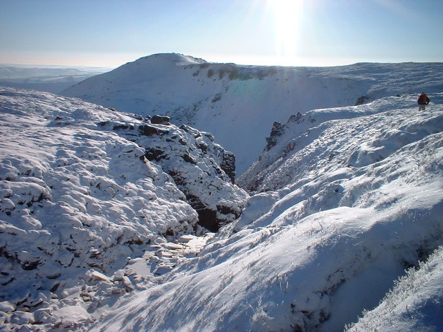
Characterized by its steep sides, lush greenery, and rocky outcrops, Crowden Clough offers a diverse range of habitats for wildlife and plant species. The area is home to an array of bird species, including peregrine falcons, buzzards, and kestrels, making it a popular spot for birdwatching enthusiasts. Additionally, the valley boasts a variety of plant life, with heather, bilberry, and cotton grass sprinkling the landscape.

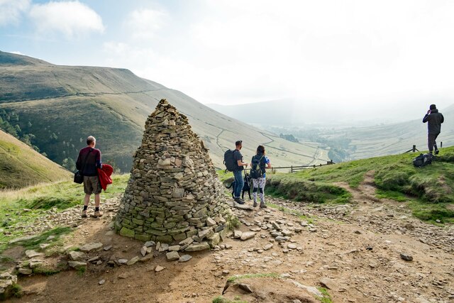
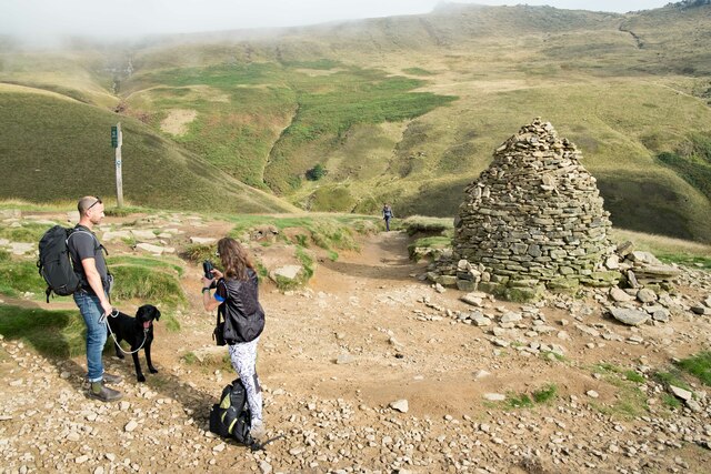
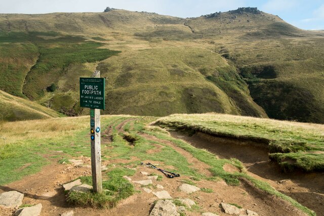
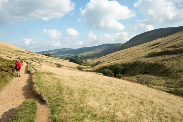
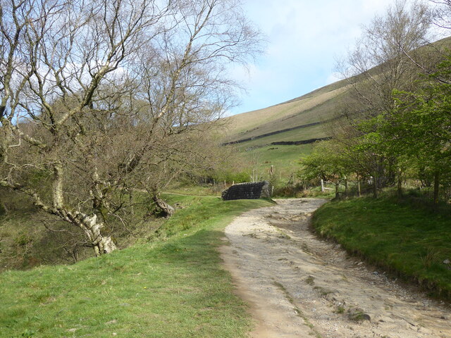
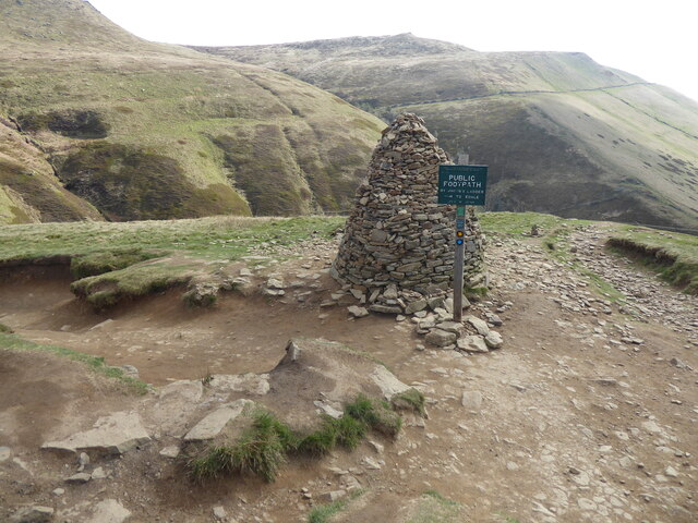
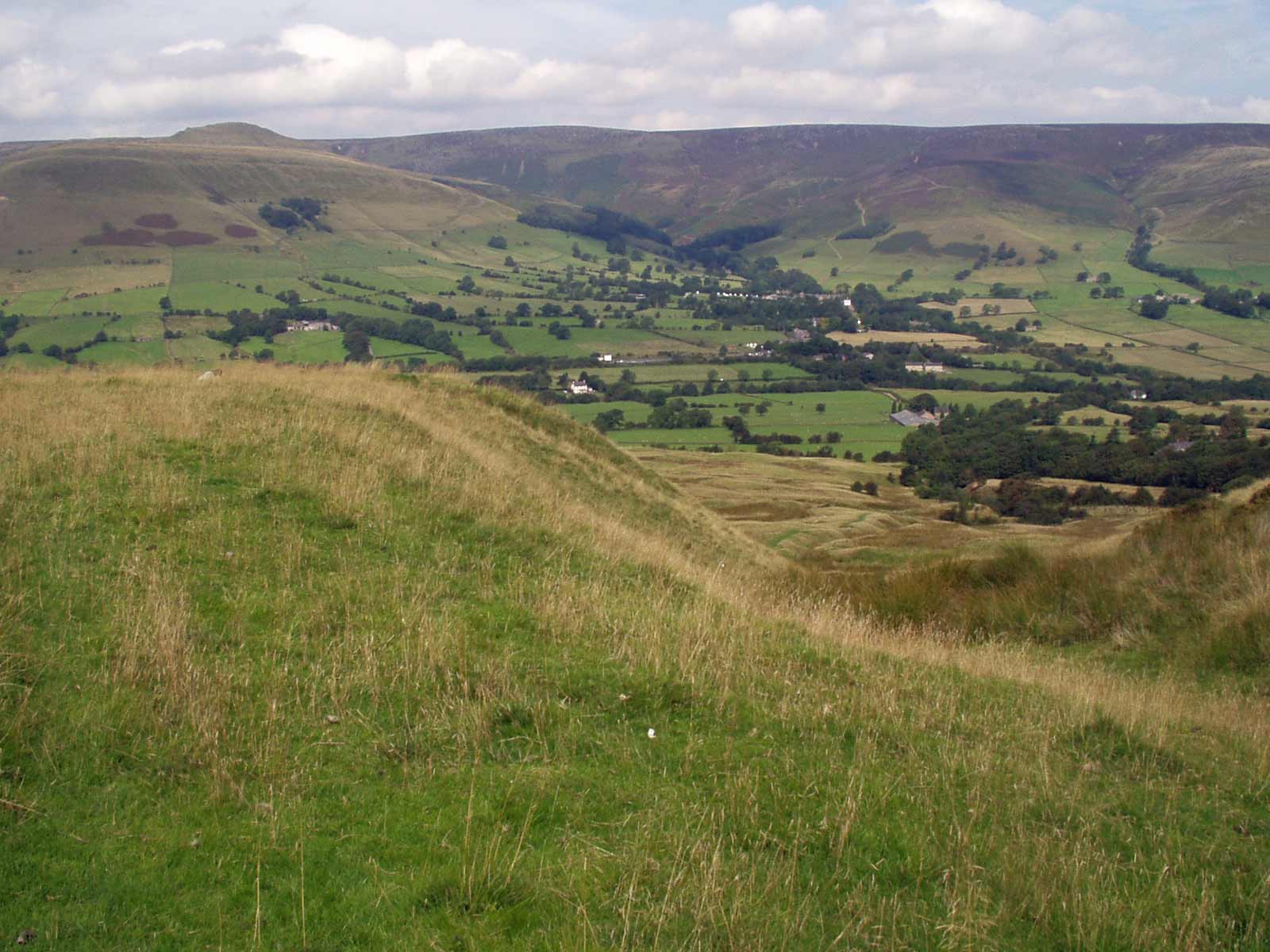
Crowden Clough is a haven for outdoor enthusiasts, attracting hikers, climbers, and nature lovers alike. There are several walking trails that traverse the valley, offering stunning views of the surrounding hills and moorlands. The Pennine Way, a long-distance footpath, passes through the area, making it a popular stop for those undertaking the renowned trail.

Aside from its natural beauty, the valley has a rich history. Evidence of prehistoric settlements and ancient burial sites can be found in the surrounding moorlands, adding an element of intrigue to the area. Additionally, the valley's close proximity to the Longdendale Reservoir provides visitors with the opportunity to learn about the area's industrial heritage, as the reservoir was created to supply water to the industrial hubs of Manchester and Sheffield.

Overall, Crowden Clough is a hidden gem in Derbyshire, offering visitors a chance to immerse themselves in the stunning beauty of the Peak District while exploring its rich history and diverse wildlife.

If you have any feedback on the listing, please let us know in the comments section below.

Crowden Clough Images

Images are sourced within 2km of 53.376901/-1.8517942 or Grid Reference SK0986. Thanks to Geograph Open Source API. All images are credited.

The Pennine Way at Lee Farm Passing through the National Trust owned Lee Farm on the Pennine Way.
The Pennine Way at Lee Farm
Passing through the National Trust owned Lee Farm on the Pennine Way.
The Pack Horse Bridge below Jacob's Ladder Walkers ascending Jacob's Ladder on the Pennine Way from Upper Booth will first of all walk across this ancient pack horse bridge which crosses the River Noe.
The Pack Horse Bridge below Jacob's Ladder
Walkers ascending Jacob's Ladder on the Pennine Way from Upper Booth will first of all walk across this ancient pack horse bridge which crosses the River Noe.
The River Noe below Jacob's Ladder Looking south along the River Noe from the old packhorse bridge below Jacob's Ladder.
The River Noe below Jacob's Ladder
Looking south along the River Noe from the old packhorse bridge below Jacob's Ladder.
On Jacob's Ladder Looking down on Jacob's Ladder towards the old packhorse bridge and the River Noe.
On Jacob's Ladder
Looking down on Jacob's Ladder towards the old packhorse bridge and the River Noe.
View from Jacob's Ladder View of the Peak District landscape from Jacob's Ladder.
View from Jacob's Ladder
View of the Peak District landscape from Jacob's Ladder.
Cairn at the top of Jacob's Ladder Walkers admire the view towards the Vale of Edale at the top of Jacob's Ladder.
Cairn at the top of Jacob's Ladder
Walkers admire the view towards the Vale of Edale at the top of Jacob's Ladder.
At the top of Jacob's Ladder The cairn at the top of Jacob's Ladder.
At the top of Jacob's Ladder
The cairn at the top of Jacob's Ladder.
The Pennine Way at the top of Jacob's Ladder The Pennine Way where it reaches the top of Jacob's Ladder.
The Pennine Way at the top of Jacob's Ladder
The Pennine Way where it reaches the top of Jacob's Ladder.
The Pennine Way The Pennine Way as it reaches the top of Jacob's Ladder.
The Pennine Way
The Pennine Way as it reaches the top of Jacob's Ladder.
The Vale of Edale The view southeast along the Vale of Edale from the top of Jacob's Ladder.
The Vale of Edale
The view southeast along the Vale of Edale from the top of Jacob's Ladder.
The Pennine Way along the Vale of Edale Walking the Pennine Way as it heads along the Vale of Edale towards Upper Booth.
The Pennine Way along the Vale of Edale
Walking the Pennine Way as it heads along the Vale of Edale towards Upper Booth.
Path near Edale Cross Not quite the Pennine Way at this point but a short cut before getting back on the path.
Path near Edale Cross
Not quite the Pennine Way at this point but a short cut before getting back on the path.
The Pennine Way near the Cloughs Heading east along the Pennine Way towards Jacobs Ladder. The area of landscape known as The Cloughs can be seen on the left.
The Pennine Way near the Cloughs
Heading east along the Pennine Way towards Jacobs Ladder. The area of landscape known as The Cloughs can be seen on the left.
The Pennine Way near Lee House
The Pennine Way at the start of Jacob's Ladder
The Pennine Way near to the bottom of Jacob's Ladder
The Pennine Way at the top of Jacob's Ladder
The Pennine Way looking towards Jacob's Ladder
Show me another place!

Crowden Clough is located at Grid Ref: SK0986 (Lat: 53.376901, Lng: -1.8517942)

Administrative County: Derbyshire

District: High Peak

Police Authority: Derbyshire

What 3 Words

///dumplings.catapult.repeating. Near High Peak, Derbyshire

Nearby Locations

Crowden Clough

Related Wikis

Vale of Edale

The Vale of Edale is the upper valley of the River Noe, in the Derbyshire Peak District of England. The village of Edale lies in the middle of the valley...

Grindslow Knoll

Grindslow Knoll is a hill in the Dark Peak area of the Peak District National Park in Derbyshire, England. It is joined to Kinder Scout by a high col though...

Kinder Scout

Kinder Scout is a moorland plateau and national nature reserve in the Dark Peak of the Derbyshire Peak District in England. Part of the moor, at 636 metres...

Jacob's Ladder, Derbyshire

Jacob's Ladder is a bridleway between Kinder Scout plateau and the hamlet of Upper Booth in the Vale of Edale, in the Derbyshire Peak District of England...

Brown Knoll

Brown Knoll is one of the highest hills in the Peak District in central England. It rises to a height of 569 metres (1,867 ft) above the head of the Edale...

Forest of High Peak

The Forest of High Peak was, in medieval times, a moorland forest covering most of the north west of Derbyshire, England, extending as far south as Tideswell...

The Church of the Holy and Undivided Trinity, Edale

The Church of the Holy and Undivided Trinity, Edale, is a Grade II listed parish church in the Church of England in Edale, Derbyshire. == History == The...

Edale

Edale is a village and civil parish in the Peak District, Derbyshire, England, whose population was 353 at the 2011 Census. Edale, with an area of 7,030...

Nearby Amenities

Located within 500m of 53.376901,-1.8517942
Crowden Clough
Place: locality
Source: Bing
Lat/Long: 53.3737319/-1.8491831
Crowden Clough
Place: locality
Source: Bing
Lat/Long: 53.3787746/-1.8541649
Ford: yes
Lat/Long: 53.3786288/-1.8536668
Ford: yes
Lat/Long: 53.3779552/-1.8526547
Ford: yes
Lat/Long: 53.3774842/-1.851681
Ford: yes
Lat/Long: 53.3783833/-1.8533395
Ford: yes
Lat/Long: 53.3760724/-1.8506355
Ford: yes
Lat/Long: 53.3730178/-1.8480423
Ford: yes
Lat/Long: 53.3766077/-1.8511916
The data included in this document is from www.openstreetmap.org. The data is made available under ODbL.

Have you been to Crowden Clough?

Leave your review of Crowden Clough below (or comments, questions and feedback).