Ashop Clough

Valley in Derbyshire High Peak

England

Ashop Clough

Alport Moor above Lady Clough National Trust volunteers removing conifers from the moor, seeded from nearby Forestry Commission woodlands
Alport Moor above Lady Clough Credit: Chris Morgan

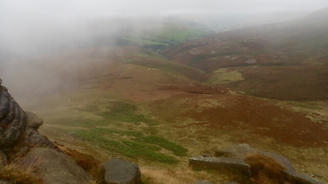
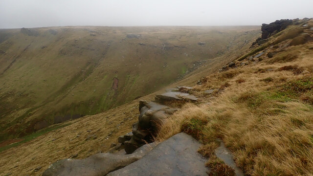
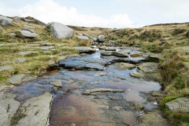
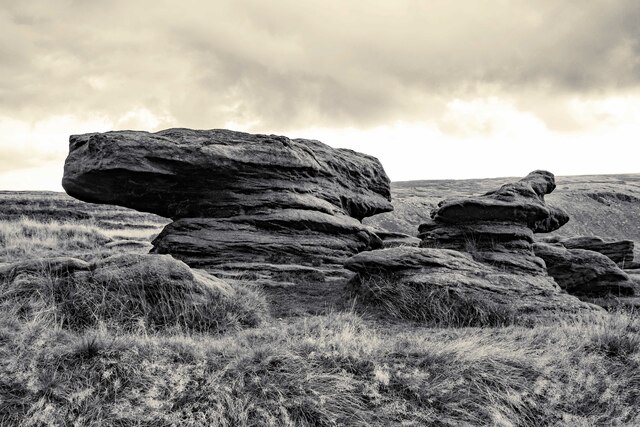
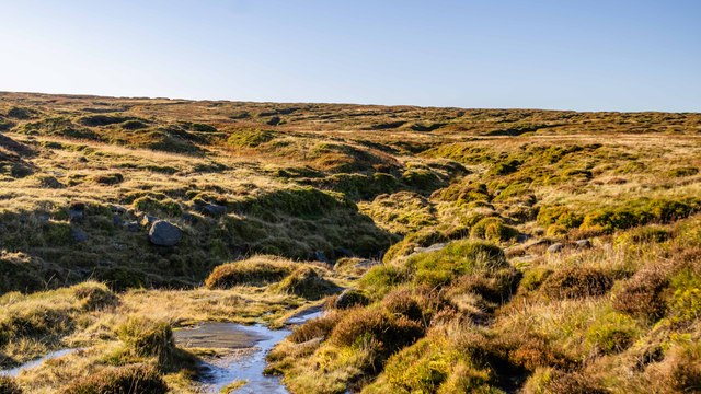
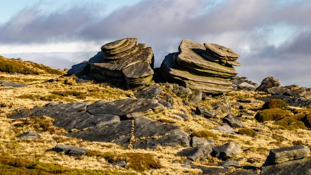
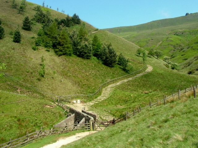
Ashop Clough is a picturesque valley located in Derbyshire, England. Situated in the heart of the Peak District National Park, it is renowned for its stunning natural beauty and rugged landscapes. The valley is formed by the Ashop River, which cuts through the surrounding hills, creating a deep and narrow gorge.

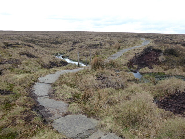
The valley is a popular destination for hikers, nature enthusiasts, and photographers due to its unspoiled and idyllic scenery. Visitors can enjoy walking along the well-maintained trails that wind through the valley, offering breathtaking views of the surrounding hills and the flowing river. The area is also home to a rich variety of flora and fauna, including rare species of plants and birds, making it a haven for wildlife enthusiasts.

Ashop Clough is dotted with charming stone cottages and farmhouses that add to its rural charm. The valley is also known for its historic significance, with remnants of old lead mining operations visible in certain areas. Visitors can explore these remnants and learn about the region's industrial past.

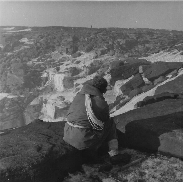
For those seeking a more adventurous experience, Ashop Clough offers opportunities for rock climbing and bouldering, with its rugged cliffs and outcrops providing a thrilling challenge for enthusiasts. Additionally, the valley is a popular spot for camping, with designated campsites available for overnight stays.

Overall, Ashop Clough is a haven of natural beauty and tranquility, offering visitors a chance to immerse themselves in the stunning landscapes of Derbyshire's Peak District.

If you have any feedback on the listing, please let us know in the comments section below.
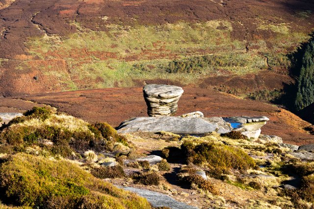
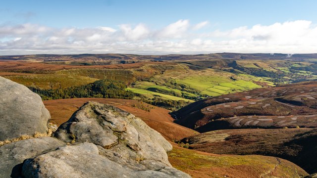
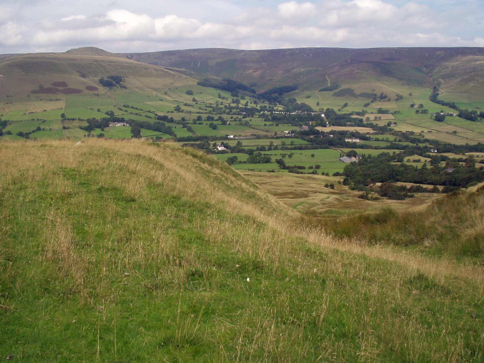
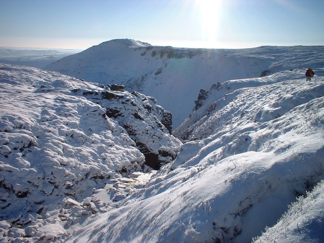
Ashop Clough Images

Images are sourced within 2km of 53.412003/-1.8681907 or Grid Reference SK0890. Thanks to Geograph Open Source API. All images are credited.

Alport Moor above Lady Clough National Trust volunteers removing conifers from the moor, seeded from nearby Forestry Commission woodlands
Alport Moor above Lady Clough
National Trust volunteers removing conifers from the moor, seeded from nearby Forestry Commission woodlands
The Pennine Way near Featherbed Moss
Ashop Clough from Fairbrook Naze
Fair Brook from Fairbrook Naze
Kinder Downfall The tallest waterfall in the Peak District was not so much a downfall as a trickle when I took this photo.

Wikipedia <span class="nowrap"><a title="https://en.wikipedia.org/wiki/River_Kinder" rel="nofollow ugc noopener" href="https://en.wikipedia.org/wiki/River_Kinder">Link</a><img style="margin-left:2px;" alt="External link" title="External link - shift click to open in new window" src="https://s1.geograph.org.uk/img/external.png" width="10" height="10"/></span>
Kinder Downfall
The tallest waterfall in the Peak District was not so much a downfall as a trickle when I took this photo. Wikipedia LinkExternal link
Above Kinder Downfall Seen from the Pennine Way as it crosses the River Kinder.
Above Kinder Downfall
Seen from the Pennine Way as it crosses the River Kinder.
River Kinder above Kinder Downfall The River Kinder above Kinder Downfall seen from the Pennine Way.

Wikipedia <span class="nowrap"><a title="https://en.wikipedia.org/wiki/River_Kinder" rel="nofollow ugc noopener" href="https://en.wikipedia.org/wiki/River_Kinder">Link</a><img style="margin-left:2px;" alt="External link" title="External link - shift click to open in new window" src="https://s1.geograph.org.uk/img/external.png" width="10" height="10"/></span>
River Kinder above Kinder Downfall
The River Kinder above Kinder Downfall seen from the Pennine Way. Wikipedia LinkExternal link
High Peak View View across the Peak District from the Pennine Way near Kinder Downfall.
High Peak View
View across the Peak District from the Pennine Way near Kinder Downfall.
View down the Valley Looking southwest from the edge of the Pennine Way, the River Kinder can be seen winding its way down the valley floor.
View down the Valley
Looking southwest from the edge of the Pennine Way, the River Kinder can be seen winding its way down the valley floor.
Gritstone Rocks next to the Pennine Way Unusual looking gritstone formations next to the Pennine Way between Kinder Downfall and the Sandy Heys outcrop.

Wikipedia Gritstone <span class="nowrap"><a title="https://en.wikipedia.org/wiki/Gritstone" rel="nofollow ugc noopener" href="https://en.wikipedia.org/wiki/Gritstone">Link</a><img style="margin-left:2px;" alt="External link" title="External link - shift click to open in new window" src="https://s1.geograph.org.uk/img/external.png" width="10" height="10"/></span>
Gritstone Rocks next to the Pennine Way
Unusual looking gritstone formations next to the Pennine Way between Kinder Downfall and the Sandy Heys outcrop. Wikipedia Gritstone LinkExternal link
Approaching Sandy Heys Heading west along the Pennine Way towards the outcrop of gritstone called Sandy Heys.

Wikipedia Gritstone <span class="nowrap"><a title="https://en.wikipedia.org/wiki/Gritstone" rel="nofollow ugc noopener" href="https://en.wikipedia.org/wiki/Gritstone">Link</a><img style="margin-left:2px;" alt="External link" title="External link - shift click to open in new window" src="https://s1.geograph.org.uk/img/external.png" width="10" height="10"/></span>
Approaching Sandy Heys
Heading west along the Pennine Way towards the outcrop of gritstone called Sandy Heys. Wikipedia Gritstone LinkExternal link
Gritstone in the Peak District Strange and fascinating gritstone rock formations next to the Pennine Way near Sandy Heys.

Wikipedia Gritstone <span class="nowrap"><a title="https://en.wikipedia.org/wiki/Gritstone" rel="nofollow ugc noopener" href="https://en.wikipedia.org/wiki/Gritstone">Link</a><img style="margin-left:2px;" alt="External link" title="External link - shift click to open in new window" src="https://s1.geograph.org.uk/img/external.png" width="10" height="10"/></span>
Gritstone in the Peak District
Strange and fascinating gritstone rock formations next to the Pennine Way near Sandy Heys. Wikipedia Gritstone LinkExternal link
The Pennine Way at Kinder Downfall
Kinder downfall frozen, March 1963 Photo taken after much of the snow had melted but the waterfall was still frozen. Date approximate.
Kinder downfall frozen, March 1963
Photo taken after much of the snow had melted but the waterfall was still frozen. Date approximate.
Fair Brook The catchment of Fair Brook on the Kinder Scout Plateau.
Fair Brook
The catchment of Fair Brook on the Kinder Scout Plateau.
Fairbrook Naze Rock outcrops on Fairbrook Naze.
Fairbrook Naze
Rock outcrops on Fairbrook Naze.
Fairbrook Naze Rock outcrops on Fairbrook Naze.
Fairbrook Naze
Rock outcrops on Fairbrook Naze.
View from Fairbrook Naze View looking down the valley of Fair Brook to the Ashop Valley.
View from Fairbrook Naze
View looking down the valley of Fair Brook to the Ashop Valley.
Show me another place!

Ashop Clough is located at Grid Ref: SK0890 (Lat: 53.412003, Lng: -1.8681907)

Administrative County: Derbyshire

District: High Peak

Police Authority: Derbyshire

What 3 Words

///harmless.saturate.readings. Near High Peak, Derbyshire

Related Wikis

Nearby Amenities

Located within 500m of 53.412003,-1.8681907
Ford: yes
Lat/Long: 53.4141793/-1.864337
Ashop Clough
Place: locality
Source: Bing
Lat/Long: 53.4117095/-1.8690363
Hunting Stand
Lockable: no
Lat/Long: 53.4148209/-1.8624674
Ford: yes
Lat/Long: 53.4130651/-1.8638193
Ford: yes
Lat/Long: 53.4109821/-1.8711395
The data included in this document is from www.openstreetmap.org. The data is made available under ODbL.

Have you been to Ashop Clough?

Leave your review of Ashop Clough below (or comments, questions and feedback).