Black Ashop Moor

Downs, Moorland in Derbyshire High Peak

England

Black Ashop Moor

Alport Moor above Lady Clough National Trust volunteers removing conifers from the moor, seeded from nearby Forestry Commission woodlands
Alport Moor above Lady Clough Credit: Chris Morgan

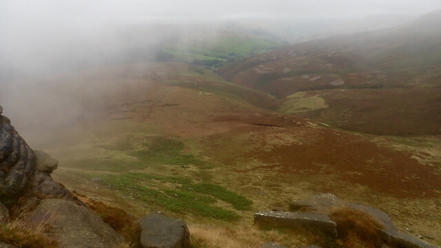
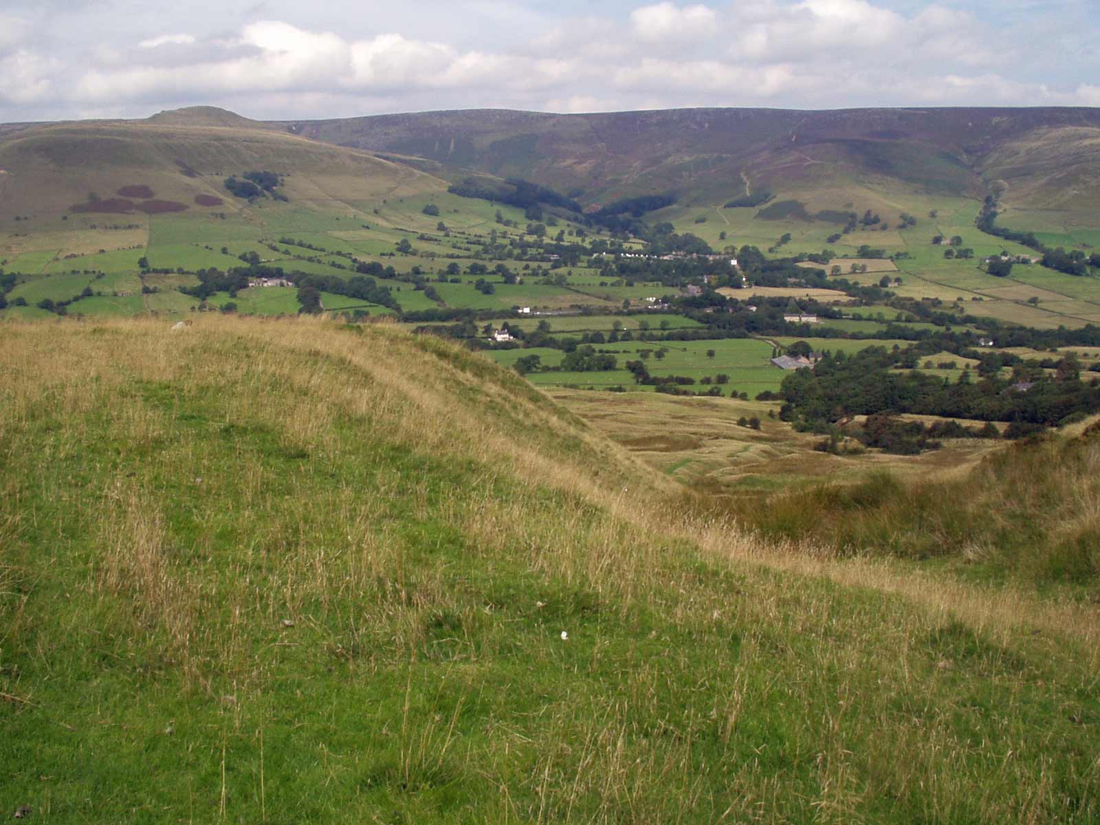
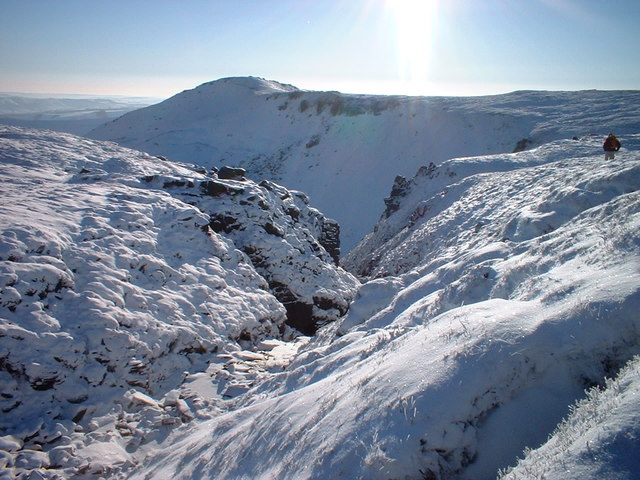
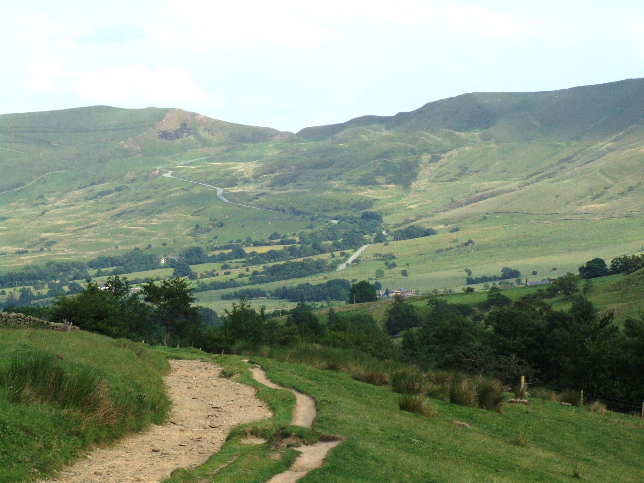
Black Ashop Moor is a vast expanse of land situated in Derbyshire, England. Covering an area of approximately 4.5 square miles, it is characterized by its rolling hills, heather-covered moorland, and breathtaking views. The moor is located in the Peak District National Park, making it a popular destination for nature lovers, hikers, and outdoor enthusiasts.

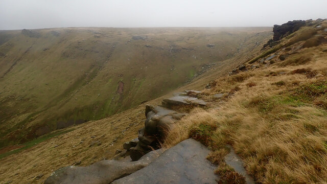
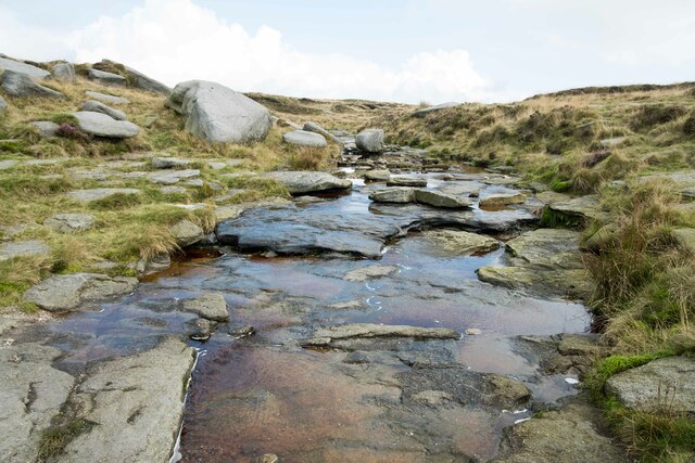
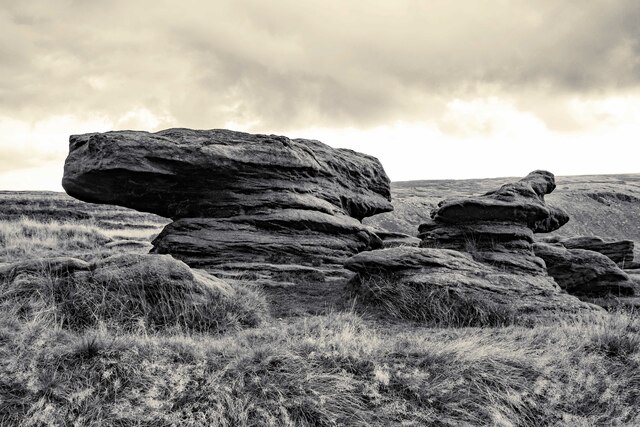
The terrain of Black Ashop Moor consists of peat bogs, gritstone outcrops, and scattered woodland areas. The moorland is predominantly made up of heather, which creates a stunning purple hue in the summer months, attracting photographers and visitors from far and wide. The landscape is dotted with streams and small bodies of water, adding to its natural beauty.

Wildlife thrives in Black Ashop Moor, with a diverse range of species calling it home. Visitors may spot birds such as the red grouse, curlew, and lapwing, as well as mammals like mountain hares and red deer. The moor is also home to a variety of plant species, including bilberry, cotton grass, and bog asphodel.

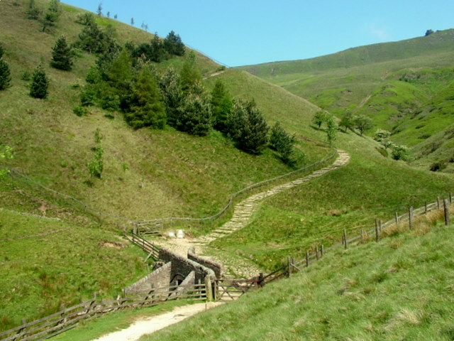
The area offers a network of walking trails, allowing visitors to explore its scenic beauty. Popular routes include the Pennine Way, which passes through the moor, and the Jacob's Ladder footpath, which leads to the summit of Kinder Scout. These trails provide stunning views of the surrounding countryside and are a delight for outdoor enthusiasts.

Overall, Black Ashop Moor offers a unique and picturesque landscape, making it a must-visit destination for those seeking natural beauty and tranquility in Derbyshire.

If you have any feedback on the listing, please let us know in the comments section below.

Black Ashop Moor Images

Images are sourced within 2km of 53.406932/-1.8665968 or Grid Reference SK0890. Thanks to Geograph Open Source API. All images are credited.

Alport Moor above Lady Clough National Trust volunteers removing conifers from the moor, seeded from nearby Forestry Commission woodlands
Alport Moor above Lady Clough
National Trust volunteers removing conifers from the moor, seeded from nearby Forestry Commission woodlands
Ashop Clough from Fairbrook Naze
Fair Brook from Fairbrook Naze
The Pennine Way below Kinder Scout Heading north along the Pennine Way towards Kinder Downfall below Kinder Scout.
The Pennine Way below Kinder Scout
Heading north along the Pennine Way towards Kinder Downfall below Kinder Scout.
Kinder Downfall The tallest waterfall in the Peak District was not so much a downfall as a trickle when I took this photo.

Wikipedia <span class="nowrap"><a title="https://en.wikipedia.org/wiki/River_Kinder" rel="nofollow ugc noopener" href="https://en.wikipedia.org/wiki/River_Kinder">Link</a><img style="margin-left:2px;" alt="External link" title="External link - shift click to open in new window" src="https://s1.geograph.org.uk/img/external.png" width="10" height="10"/></span>
Kinder Downfall
The tallest waterfall in the Peak District was not so much a downfall as a trickle when I took this photo. Wikipedia LinkExternal link
Above Kinder Downfall Seen from the Pennine Way as it crosses the River Kinder.
Above Kinder Downfall
Seen from the Pennine Way as it crosses the River Kinder.
River Kinder above Kinder Downfall The River Kinder above Kinder Downfall seen from the Pennine Way.

Wikipedia <span class="nowrap"><a title="https://en.wikipedia.org/wiki/River_Kinder" rel="nofollow ugc noopener" href="https://en.wikipedia.org/wiki/River_Kinder">Link</a><img style="margin-left:2px;" alt="External link" title="External link - shift click to open in new window" src="https://s1.geograph.org.uk/img/external.png" width="10" height="10"/></span>
River Kinder above Kinder Downfall
The River Kinder above Kinder Downfall seen from the Pennine Way. Wikipedia LinkExternal link
High Peak View View across the Peak District from the Pennine Way near Kinder Downfall.
High Peak View
View across the Peak District from the Pennine Way near Kinder Downfall.
View down the Valley Looking southwest from the edge of the Pennine Way, the River Kinder can be seen winding its way down the valley floor.
View down the Valley
Looking southwest from the edge of the Pennine Way, the River Kinder can be seen winding its way down the valley floor.
Gritstone Rocks next to the Pennine Way Unusual looking gritstone formations next to the Pennine Way between Kinder Downfall and the Sandy Heys outcrop.

Wikipedia Gritstone <span class="nowrap"><a title="https://en.wikipedia.org/wiki/Gritstone" rel="nofollow ugc noopener" href="https://en.wikipedia.org/wiki/Gritstone">Link</a><img style="margin-left:2px;" alt="External link" title="External link - shift click to open in new window" src="https://s1.geograph.org.uk/img/external.png" width="10" height="10"/></span>
Gritstone Rocks next to the Pennine Way
Unusual looking gritstone formations next to the Pennine Way between Kinder Downfall and the Sandy Heys outcrop. Wikipedia Gritstone LinkExternal link
Approaching Sandy Heys Heading west along the Pennine Way towards the outcrop of gritstone called Sandy Heys.

Wikipedia Gritstone <span class="nowrap"><a title="https://en.wikipedia.org/wiki/Gritstone" rel="nofollow ugc noopener" href="https://en.wikipedia.org/wiki/Gritstone">Link</a><img style="margin-left:2px;" alt="External link" title="External link - shift click to open in new window" src="https://s1.geograph.org.uk/img/external.png" width="10" height="10"/></span>
Approaching Sandy Heys
Heading west along the Pennine Way towards the outcrop of gritstone called Sandy Heys. Wikipedia Gritstone LinkExternal link
The Pennine Way at Sandy Heys Heading west along the Pennine Way at the outcrop of gritstone called Sandy Heys.

Wikipedia Gritstone <span class="nowrap"><a title="https://en.wikipedia.org/wiki/Gritstone" rel="nofollow ugc noopener" href="https://en.wikipedia.org/wiki/Gritstone">Link</a><img style="margin-left:2px;" alt="External link" title="External link - shift click to open in new window" src="https://s1.geograph.org.uk/img/external.png" width="10" height="10"/></span>
The Pennine Way at Sandy Heys
Heading west along the Pennine Way at the outcrop of gritstone called Sandy Heys. Wikipedia Gritstone LinkExternal link
Sandy Heys The outcrop of gritstone called Sandy Heys next to the Pennine Way.
Sandy Heys
The outcrop of gritstone called Sandy Heys next to the Pennine Way.
Gritstone Rocks at Sandy Heys Part of the outcrop of gritstone called Sandy Heys next to the Pennine Way.

Wikipedia Gritstone <span class="nowrap"><a title="https://en.wikipedia.org/wiki/Gritstone" rel="nofollow ugc noopener" href="https://en.wikipedia.org/wiki/Gritstone">Link</a><img style="margin-left:2px;" alt="External link" title="External link - shift click to open in new window" src="https://s1.geograph.org.uk/img/external.png" width="10" height="10"/></span>
Gritstone Rocks at Sandy Heys
Part of the outcrop of gritstone called Sandy Heys next to the Pennine Way. Wikipedia Gritstone LinkExternal link
View from Sandy Heys View towards Kinder Reservoir from the top of Sandy Heys in the Peak District.
View from Sandy Heys
View towards Kinder Reservoir from the top of Sandy Heys in the Peak District.
Gritstone in the Peak District Strange and fascinating gritstone rock formations next to the Pennine Way near Sandy Heys.

Wikipedia Gritstone <span class="nowrap"><a title="https://en.wikipedia.org/wiki/Gritstone" rel="nofollow ugc noopener" href="https://en.wikipedia.org/wiki/Gritstone">Link</a><img style="margin-left:2px;" alt="External link" title="External link - shift click to open in new window" src="https://s1.geograph.org.uk/img/external.png" width="10" height="10"/></span>
Gritstone in the Peak District
Strange and fascinating gritstone rock formations next to the Pennine Way near Sandy Heys. Wikipedia Gritstone LinkExternal link
The Pennine Way near Kinder Downfall
The Pennine Way at Kinder Downfall
Show me another place!

Black Ashop Moor is located at Grid Ref: SK0890 (Lat: 53.406932, Lng: -1.8665968)

Administrative County: Derbyshire

District: High Peak

Police Authority: Derbyshire

What 3 Words

///stable.ignore.tramps. Near High Peak, Derbyshire

Related Wikis

Nearby Amenities

Located within 500m of 53.406932,-1.8665968
Black Ashop Moor
Place: locality
Source: Bing
Lat/Long: 53.4074231/-1.8637744
The Edge
Place: locality
Source: Bing
Lat/Long: 53.4046809/-1.872633
The data included in this document is from www.openstreetmap.org. The data is made available under ODbL.

Have you been to Black Ashop Moor?

Leave your review of Black Ashop Moor below (or comments, questions and feedback).