Honeydown Bottom

Valley in Wiltshire

England

Honeydown Bottom

Rushall Down, Wiltshire A helpful sign post on Westdown Artillery Range, nestled between Rushall Down and East Down. This area is within the Westdown Artillery Range danger area, but is open to walkers on the bridleways when no red flags are displayed.
Rushall Down, Wiltshire Credit: Rebecca A Wills

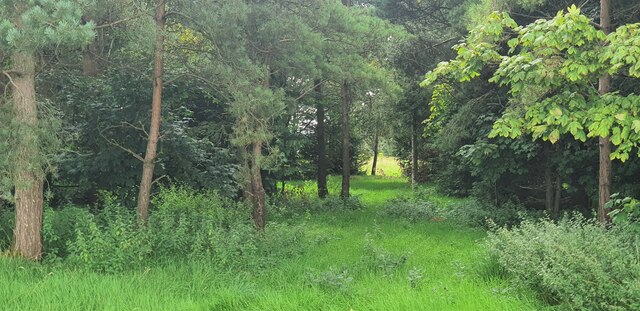
Honeydown Bottom is a picturesque valley located in the county of Wiltshire, England. Situated in the heart of the Salisbury Plain, it offers mesmerizing views and a peaceful retreat from the bustling city life. The valley is surrounded by rolling hills and lush greenery, making it an ideal destination for nature lovers and outdoor enthusiasts.

Covering an area of approximately 5 square kilometers, Honeydown Bottom is home to a diverse range of flora and fauna. The valley boasts a rich biodiversity, with various species of birds, mammals, and plants thriving in the area. Visitors can often spot deer, foxes, and rabbits during their exploration of the valley.

The landscape of Honeydown Bottom is dominated by gently sloping hills, creating a sense of serenity and tranquility. The valley is intersected by a meandering stream, which adds to its natural beauty. The stream is home to several species of fish and serves as a water source for the surrounding wildlife.

Honeydown Bottom offers several walking trails and hiking routes, allowing visitors to fully immerse themselves in its natural wonders. The valley is also a popular spot for picnics and camping, providing a fantastic opportunity to relax and enjoy the stunning surroundings.

Overall, Honeydown Bottom is a hidden gem in Wiltshire, offering a peaceful and scenic retreat for those seeking solace in nature. Its diverse wildlife, stunning landscape, and recreational activities make it a must-visit destination for both locals and tourists alike.

If you have any feedback on the listing, please let us know in the comments section below.

Honeydown Bottom Images

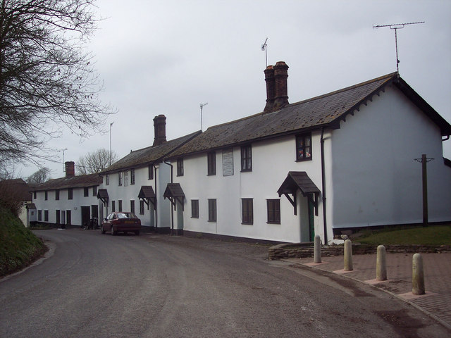
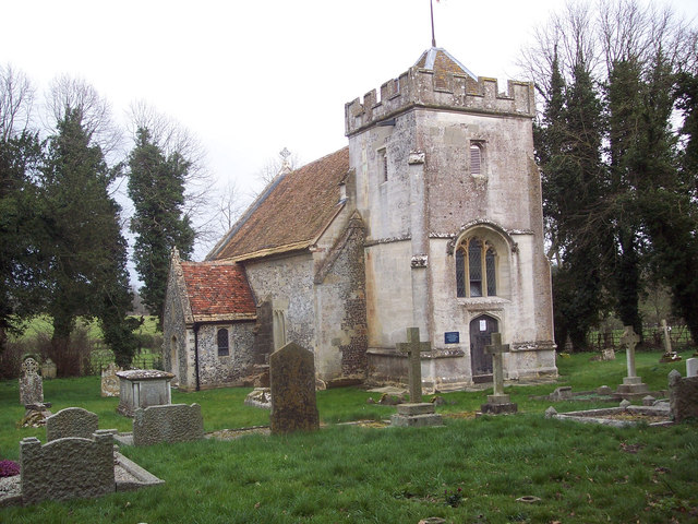
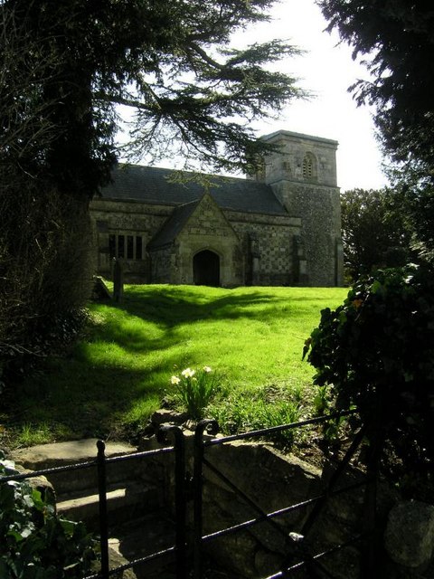
Images are sourced within 2km of 51.242205/-1.8815215 or Grid Reference SU0849. Thanks to Geograph Open Source API. All images are credited.

Rushall Down, Wiltshire A helpful sign post on Westdown Artillery Range, nestled between Rushall Down and East Down. This area is within the Westdown Artillery Range danger area, but is open to walkers on the bridleways when no red flags are displayed.
Rushall Down, Wiltshire
A helpful sign post on Westdown Artillery Range, nestled between Rushall Down and East Down. This area is within the Westdown Artillery Range danger area, but is open to walkers on the bridleways when no red flags are displayed.
Rushall Down, Wiltshire Overlooking an observation post and tank hulks on Rushall Down. This area is within the Westdown Artillery Range danger area, but is open to walkers on the bridleways when no red flags are displayed.
Rushall Down, Wiltshire
Overlooking an observation post and tank hulks on Rushall Down. This area is within the Westdown Artillery Range danger area, but is open to walkers on the bridleways when no red flags are displayed.
Orcheston Down, Wiltshire A view through a little un-named copse located between Prospect Clump and Honeydown Copse on Orcheston Down. This area is within the Westdown Artillery Range danger area, but is open to walkers on the bridleways when no red flags are displayed.
Orcheston Down, Wiltshire
A view through a little un-named copse located between Prospect Clump and Honeydown Copse on Orcheston Down. This area is within the Westdown Artillery Range danger area, but is open to walkers on the bridleways when no red flags are displayed.
East Down, Wiltshire Looking over East Down from the vicinity of Prospect Clump. This area is within the Westdown Artillery Range danger area, but is open to walkers on the bridleways when no red flags are displayed.
East Down, Wiltshire
Looking over East Down from the vicinity of Prospect Clump. This area is within the Westdown Artillery Range danger area, but is open to walkers on the bridleways when no red flags are displayed.
East Down, Wiltshire Looking south over East Down from the vicinity of Prospect Clump. This area is within the Westdown Artillery Range danger area, but is open to walkers on the bridleways when no red flags are displayed.
East Down, Wiltshire
Looking south over East Down from the vicinity of Prospect Clump. This area is within the Westdown Artillery Range danger area, but is open to walkers on the bridleways when no red flags are displayed.
Prospect Clump, Wiltshire A Timaracha beetle (Bloody-nosed beetle) enjoying some early blackberries.
Prospect Clump, Wiltshire
A Timaracha beetle (Bloody-nosed beetle) enjoying some early blackberries.
Westdown Camp - Clearing The Undergrowth Hawthorn being cleared and burnt.
Westdown Camp - Clearing The Undergrowth
Hawthorn being cleared and burnt.
Westdown Camp - Observation Post This observation post is used to observe accuracy of artillery fire on tank targets.
Westdown Camp - Observation Post
This observation post is used to observe accuracy of artillery fire on tank targets.
Westdown Camp - Target Tanks Tanks used for artillery practice.
Westdown Camp - Target Tanks
Tanks used for artillery practice.
Westdown Camp - Tank Turrets The remains of tanks that have been used for target practice.
Westdown Camp - Tank Turrets
The remains of tanks that have been used for target practice.
Westdown Camp - Tank Turrets The remains of tanks that have been used for target practice.
Westdown Camp - Tank Turrets
The remains of tanks that have been used for target practice.
Westdown Camp - Tank Turrets The remains of tanks that have been used for target practice.
Westdown Camp - Tank Turrets
The remains of tanks that have been used for target practice.
Westdown Camp - Observation Post Observation bunker on Salisbury Plain.
Westdown Camp - Observation Post
Observation bunker on Salisbury Plain.
Westdown Camp - Observation Post A small observation post on Salisbury Plain.
Westdown Camp - Observation Post
A small observation post on Salisbury Plain.
Westdown Camp - Observation Tower Observation tower on Salisbury Plain.
Westdown Camp - Observation Tower
Observation tower on Salisbury Plain.
Old Turnpike road across Westdown/Larkhill Impact area On the Salisbury Plain training area.
Old Turnpike road across Westdown/Larkhill Impact area
On the Salisbury Plain training area.
Old Turnpike road across Westdown/Larkhill ranges On the Salisbury Plain Training area, looking North.
Old Turnpike road across Westdown/Larkhill ranges
On the Salisbury Plain Training area, looking North.
Rushall Down on Larkhill artillery range Looking North East, and viewed from the former turnpike road, on the Salisbury Plain training area.
Rushall Down on Larkhill artillery range
Looking North East, and viewed from the former turnpike road, on the Salisbury Plain training area.
Show me another place!

Honeydown Bottom is located at Grid Ref: SU0849 (Lat: 51.242205, Lng: -1.8815215)

Unitary Authority: Wiltshire

Police Authority: Wiltshire

What 3 Words

///fumes.lamppost.rental. Near Shrewton, Wiltshire

Nearby Locations

Honeydown Bottom

Related Wikis

RAF Shrewton

Royal Air Force Shrewton or more simply RAF Shrewton is a former Royal Air Force satellite airfield located in Wiltshire, England. The following units...

Robin Hood's Ball

Robin Hood’s Ball is a Neolithic causewayed enclosure on Salisbury Plain in Wiltshire, England, approximately 5 miles (8 km) northwest of the town of Amesbury...

Appleford School

Appleford School is a private specialist dyslexia school near Shrewton in Wiltshire, England. == History == Appleford was founded in 1988 by Dr Peter Gardner...

Orcheston

Orcheston (OR-Chest-ton) is a civil parish and village in Wiltshire, England, lying on Salisbury Plain less than a mile north-west of neighbouring Shrewton...

Shrewton United F.C.

Shrewton United Football Club is a football club based in Shrewton, near Amesbury, in Wiltshire, England. They are currently members of the Wiltshire League...

St George's Church, Orcheston

St George's Church in Orcheston, Wiltshire, England, was built in the 13th century. It is recorded in the National Heritage List for England as a Grade...

Tilshead

Tilshead () is a village and civil parish in the county of Wiltshire in Southern England, about 9 miles (14 km) northwest of the town of Amesbury. It...

Maddington, Wiltshire

Maddington is a small settlement and former civil parish on Salisbury Plain in Wiltshire, England. It is on the River Till. Its nearest town is Amesbury...

Nearby Amenities

Located within 500m of 51.242205,-1.8815215
Man Made: survey_point
Ref: 10193
Lat/Long: 51.2388198/-1.8772741
The data included in this document is from www.openstreetmap.org. The data is made available under ODbL.

Have you been to Honeydown Bottom?

Leave your review of Honeydown Bottom below (or comments, questions and feedback).