Posforth Gill
Valley in Yorkshire Craven
England
Posforth Gill
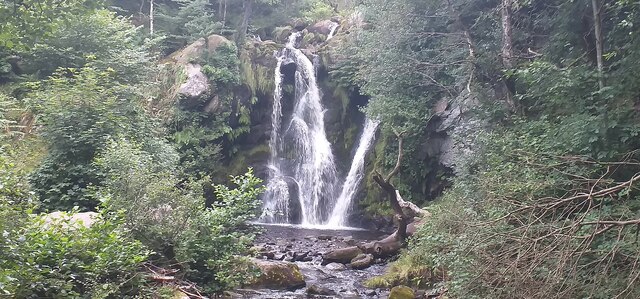
Posforth Gill is a picturesque valley located in the county of Yorkshire, England. Nestled in the heart of the Yorkshire Dales National Park, it is known for its stunning natural beauty and tranquil atmosphere. The valley is situated approximately 5 miles south-west of the market town of Skipton, making it easily accessible for visitors.
Posforth Gill is characterized by its lush green meadows, rolling hills, and babbling streams. The gill itself is a small beck that runs through the valley, adding to its charm. The surrounding landscape is dotted with ancient woodlands, giving the area a rich and diverse ecosystem.
The valley is a haven for wildlife enthusiasts, as it is home to a wide variety of flora and fauna. Visitors may spot red squirrels, otters, and different species of birds amidst the trees and along the water's edge. The gill also attracts a number of wildflowers, including bluebells and primroses, which create a vibrant tapestry of colors during the spring months.
For outdoor enthusiasts, Posforth Gill offers numerous walking trails and paths that meander through the valley and into the surrounding countryside. These routes provide breathtaking views of the valley from different vantage points, allowing visitors to fully appreciate its natural splendor.
In addition to its natural beauty, Posforth Gill is also steeped in history. The valley is dotted with remnants of ancient settlements, including stone circles and burial mounds, which offer a glimpse into the area's past.
Overall, Posforth Gill is a hidden gem in Yorkshire, offering a peaceful retreat for those seeking solace in nature. Its idyllic scenery, diverse wildlife, and historical significance make it a must-visit destination for nature lovers and history enthusiasts alike.
If you have any feedback on the listing, please let us know in the comments section below.
Posforth Gill Images
Images are sourced within 2km of 54.003822/-1.8837242 or Grid Reference SE0756. Thanks to Geograph Open Source API. All images are credited.
![A circular walk along the River Wharfe [1] Leaving the Cavendish Pavilion, the track enters woodland.
Starting from the Cavendish Pavilion, the walk follows the west bank of the River Wharfe upstream, passing The Strid, to the Barden Aqueduct Bridge. Crossing to the east bank, the walk continues downstream to return to the starting point. Just over 3½ miles.](https://s1.geograph.org.uk/geophotos/07/01/89/7018925_66eb2f66.jpg)
![A circular walk along the River Wharfe [2] The river, seen from the path near the Sulphur Well.
Starting from the Cavendish Pavilion, the walk follows the west bank of the River Wharfe upstream, passing The Strid, to the Barden Aqueduct Bridge. Crossing to the east bank, the walk continues downstream to return to the starting point. Just over 3½ miles.](https://s2.geograph.org.uk/geophotos/07/01/89/7018930_cd410f5d.jpg)
![A circular walk along the River Wharfe [3] The river looking upstream, seen from the path.
Starting from the Cavendish Pavilion, the walk follows the west bank of the River Wharfe upstream, passing The Strid, to the Barden Aqueduct Bridge. Crossing to the east bank, the walk continues downstream to return to the starting point. Just over 3½ miles.](https://s1.geograph.org.uk/geophotos/07/01/89/7018933_c493bcd6.jpg)
![A circular walk along the River Wharfe [4] Away from the main track, this lower path is close to the river.
Starting from the Cavendish Pavilion, the walk follows the west bank of the River Wharfe upstream, passing The Strid, to the Barden Aqueduct Bridge. Crossing to the east bank, the walk continues downstream to return to the starting point. Just over 3½ miles.](https://s0.geograph.org.uk/geophotos/07/01/89/7018940_5ab0786e.jpg)
![A circular walk along the River Wharfe [5] The way returns to the main track from the lower path.
Starting from the Cavendish Pavilion, the walk follows the west bank of the River Wharfe upstream, passing The Strid, to the Barden Aqueduct Bridge. Crossing to the east bank, the walk continues downstream to return to the starting point. Just over 3½ miles.](https://s0.geograph.org.uk/geophotos/07/01/89/7018944_0a842b84.jpg)
![A circular walk along the River Wharfe [6] The path leads through woodland alongside the river.
Starting from the Cavendish Pavilion, the walk follows the west bank of the River Wharfe upstream, passing The Strid, to the Barden Aqueduct Bridge. Crossing to the east bank, the walk continues downstream to return to the starting point. Just over 3½ miles.](https://s0.geograph.org.uk/geophotos/07/01/89/7018948_5c3f5f3b.jpg)
![A circular walk along the River Wharfe [7] The river is very tranquil along this stretch.
Starting from the Cavendish Pavilion, the walk follows the west bank of the River Wharfe upstream, passing The Strid, to the Barden Aqueduct Bridge. Crossing to the east bank, the walk continues downstream to return to the starting point. Just over 3½ miles.](https://s2.geograph.org.uk/geophotos/07/01/89/7018950_75e15b2b.jpg)
![A circular walk along the River Wharfe [8] The track is now somewhat higher above the water.
Starting from the Cavendish Pavilion, the walk follows the west bank of the River Wharfe upstream, passing The Strid, to the Barden Aqueduct Bridge. Crossing to the east bank, the walk continues downstream to return to the starting point. Just over 3½ miles.](https://s0.geograph.org.uk/geophotos/07/01/97/7019700_9fb6a40e.jpg)
![A circular walk along the River Wharfe [9] The river makes a bend to the right.
Starting from the Cavendish Pavilion, the walk follows the west bank of the River Wharfe upstream, passing The Strid, to the Barden Aqueduct Bridge. Crossing to the east bank, the walk continues downstream to return to the starting point. Just over 3½ miles.](https://s1.geograph.org.uk/geophotos/07/01/97/7019701_64868ed9.jpg)
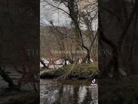
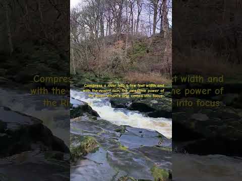
![A circular walk along the River Wharfe [10] The Strid is a 15 foot (4.6 m) deep underwater channel caused by the narrowing of the river from 90 ft (27 m) wide, just to the north, to the width of a long stride less than 300 ft (91 m) later. It is especially dangerous as both banks are undercut. Its name comes from the Old English Stryth, meaning 'turmoil'. This was later corrupted to Strid, referring to 'the possibility of striding across'.
Starting from the Cavendish Pavilion, the walk follows the west bank of the River Wharfe upstream, passing The Strid, to the Barden Aqueduct Bridge. Crossing to the east bank, the walk continues downstream to return to the starting point. Just over 3½ miles.](https://s2.geograph.org.uk/geophotos/07/01/97/7019702_55b158f6.jpg)
![A circular walk along the River Wharfe [11] This part of The Strid looks deceptively calm. The Strid is a 15 foot (4.6 m) deep underwater channel caused by the narrowing of the river from 90 ft (27 m) wide, just to the north, to the width of a long stride less than 300 ft (91 m) later. It is especially dangerous as both banks are undercut. Its name comes from the Old English Stryth, meaning 'turmoil'. This was later corrupted to Strid, referring to 'the possibility of striding across'.
Starting from the Cavendish Pavilion, the walk follows the west bank of the River Wharfe upstream, passing The Strid, to the Barden Aqueduct Bridge. Crossing to the east bank, the walk continues downstream to return to the starting point. Just over 3½ miles.](https://s3.geograph.org.uk/geophotos/07/01/97/7019703_05b8e8b5.jpg)
![A circular walk along the River Wharfe [12] A view of the top of The Strid as the river narrows. The Strid is a 15 foot (4.6 m) deep underwater channel caused by the narrowing of the river from 90 ft (27 m) wide, just to the north, to the width of a long stride less than 300 ft (91 m) later. It is especially dangerous as both banks are undercut. Its name comes from the Old English Stryth, meaning 'turmoil'. This was later corrupted to Strid, referring to 'the possibility of striding across'.
Starting from the Cavendish Pavilion, the walk follows the west bank of the River Wharfe upstream, passing The Strid, to the Barden Aqueduct Bridge. Crossing to the east bank, the walk continues downstream to return to the starting point. Just over 3½ miles.](https://s1.geograph.org.uk/geophotos/07/01/97/7019705_a9519a71.jpg)
![A circular walk along the River Wharfe [13] The path continues through calm and peaceful Strid Wood in contrast to the tumult of the river below.
Starting from the Cavendish Pavilion, the walk follows the west bank of the River Wharfe upstream, passing The Strid, to the Barden Aqueduct Bridge. Crossing to the east bank, the walk continues downstream to return to the starting point. Just over 3½ miles.](https://s3.geograph.org.uk/geophotos/07/01/97/7019707_818019fe.jpg)
![A circular walk along the River Wharfe [14] The river is wider here before it begins to narrow to The Strid.
Starting from the Cavendish Pavilion, the walk follows the west bank of the River Wharfe upstream, passing The Strid, to the Barden Aqueduct Bridge. Crossing to the east bank, the walk continues downstream to return to the starting point. Just over 3½ miles.](https://s0.geograph.org.uk/geophotos/07/01/97/7019708_1f2b9a50.jpg)
![A circular walk along the River Wharfe [15] The path is carried over Bardon Beck on this footbridge.
Starting from the Cavendish Pavilion, the walk follows the west bank of the River Wharfe upstream, passing The Strid, to the Barden Aqueduct Bridge. Crossing to the east bank, the walk continues downstream to return to the starting point. Just over 3½ miles.](https://s1.geograph.org.uk/geophotos/07/01/97/7019709_498db184.jpg)
![A circular walk along the River Wharfe [19] The view downstream from Barden Aqueduct Bridge which carries the Nidd Aqueduct over the river.
Starting from the Cavendish Pavilion, the walk follows the west bank of the River Wharfe upstream, passing The Strid, to the Barden Aqueduct Bridge. Crossing to the east bank, the walk continues downstream to return to the starting point. Just over 3½ miles.](https://s2.geograph.org.uk/geophotos/07/01/97/7019718_db26f0d4.jpg)
![A circular walk along the River Wharfe [20] An uncomfortable looking seat alongside the river.
Starting from the Cavendish Pavilion, the walk follows the west bank of the River Wharfe upstream, passing The Strid, to the Barden Aqueduct Bridge. Crossing to the east bank, the walk continues downstream to return to the starting point. Just over 3½ miles.](https://s2.geograph.org.uk/geophotos/07/01/97/7019722_2b6a5ea8.jpg)
Posforth Gill is located at Grid Ref: SE0756 (Lat: 54.003822, Lng: -1.8837242)
Division: West Riding
Administrative County: North Yorkshire
District: Craven
Police Authority: North Yorkshire
What 3 Words
///expiring.lunge.stood. Near Addingham, West Yorkshire
Nearby Locations
Related Wikis

Cavendish memorial fountain
The Cavendish memorial fountain is a drinking fountain erected in 1886 at Bolton Abbey, North Yorkshire, England as a memorial to Lord Frederick Cavendish...

Bolton Abbey
Bolton Abbey in Wharfedale, North Yorkshire, England, takes its name from the ruins of the 12th-century Augustinian monastery now known as Bolton Priory...
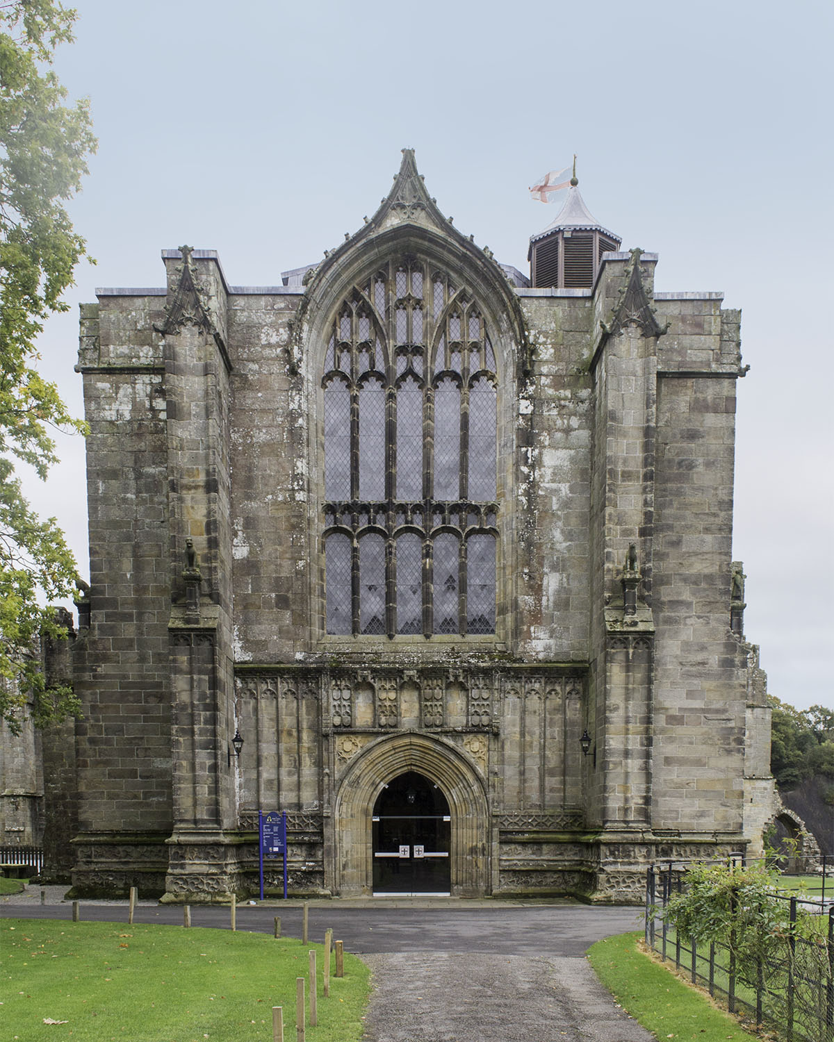
Bolton Priory
Bolton Priory, whose full title is The Priory Church of St Mary and St Cuthbert, Bolton Abbey, is a Grade I listed parish church of the Church of England...

Bolton Abbey (village)
Bolton Abbey is a village and civil parish in the Craven district of North Yorkshire, England, 22 miles (35 km) north-west of Leeds. The village lies in...

Hazlewood with Storiths
Hazlewood with Storiths is a civil parish in the Craven district of North Yorkshire, England. The population of the civil parish as of the 2011 census...

Barden Tower
Barden Tower is a ruined building in the Parish of Barden, in Wharfedale, North Yorkshire, England. The tower was used as a hunting lodge in the 15th and...

Barden, Craven
Barden is a civil parish in the Craven district of North Yorkshire, England. It consists of the hamlet of Drebley and a few scattered houses in Wharfedale...

Hazlewood
Hazlewood is a hamlet in the English county of North Yorkshire. Hazlewood lies to the east of the town of Skipton by 7.5 miles (12.1 km) and is located...
Related Videos
Walking at Barden Moor, Skipton, North Yorkshire
Enjoy the Scenery of some of Barden Moor above Skipton, North Yorkshire Apart from your travel costs, walking at Barden Moor is ...
![Valley of desolation | Bolton Abbey | Family day trip [Travel Beeps ]](https://i.ytimg.com/vi/akst3WPTZCM/hqdefault.jpg)
Valley of desolation | Bolton Abbey | Family day trip [Travel Beeps ]
TravelBeeps1#boltonabbey #family #familyfun #familytime #uk #london #uk07rider #ukdrill #intheuk #uktop40 #espnuk ...
Nearby Amenities
Located within 500m of 54.003822,-1.8837242Have you been to Posforth Gill?
Leave your review of Posforth Gill below (or comments, questions and feedback).