Coverdale

Valley in Yorkshire Richmondshire

England

Coverdale

Cottages at West Scrafton A view across the head of Caygill to cottages on the far side.
Cottages at West Scrafton Credit: Gordon Hatton

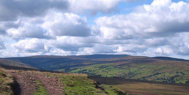
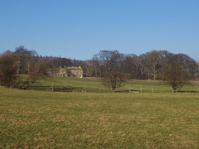
Coverdale is a picturesque valley located in the Yorkshire Dales National Park, in the county of Yorkshire, England. It is nestled between the valleys of Wensleydale and Swaledale, surrounded by rolling hills and stunning landscapes. The valley stretches for approximately nine miles and is characterized by its lush green meadows, meandering streams, and peaceful atmosphere.

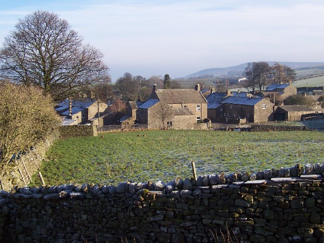
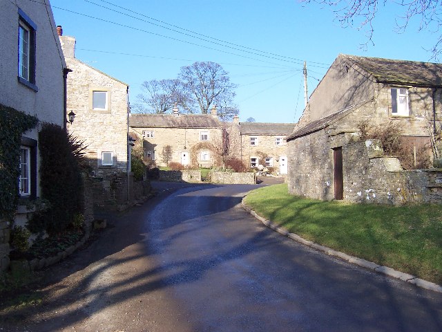
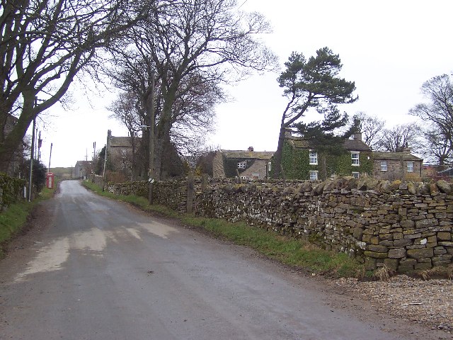
The main village in the valley is called Coverham, and it is home to a small community of around 200 people. Coverham is known for its charming stone-built houses and traditional architecture, which dates back several centuries. The village also features a historic church, St. Peter's, which was built in the 12th century and is a prominent landmark in the area.

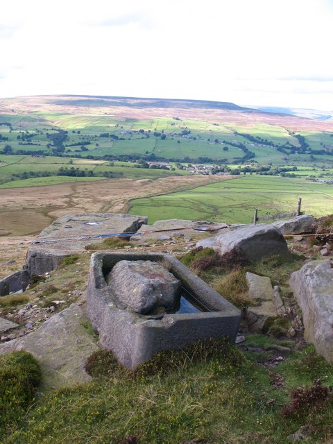
Coverdale is renowned for its natural beauty and is a popular destination for outdoor enthusiasts. The valley offers numerous walking and hiking trails, allowing visitors to explore the stunning countryside and enjoy breathtaking views. The area is also a haven for wildlife, with a variety of birds and animals inhabiting the valley, including red grouse, curlews, and even the occasional deer.

In addition to its natural attractions, Coverdale has a rich cultural heritage. The valley is home to several historic sites, including the ruins of Coverham Abbey, a former Cistercian monastery founded in the 13th century. The abbey's remains provide a glimpse into the region's medieval past and attract history enthusiasts from far and wide.

Overall, Coverdale in Yorkshire offers a peaceful retreat for those seeking tranquility amidst beautiful natural surroundings, with a dash of history thrown in.

If you have any feedback on the listing, please let us know in the comments section below.

Coverdale Images

Images are sourced within 2km of 54.245579/-1.8969655 or Grid Reference SE0683. Thanks to Geograph Open Source API. All images are credited.
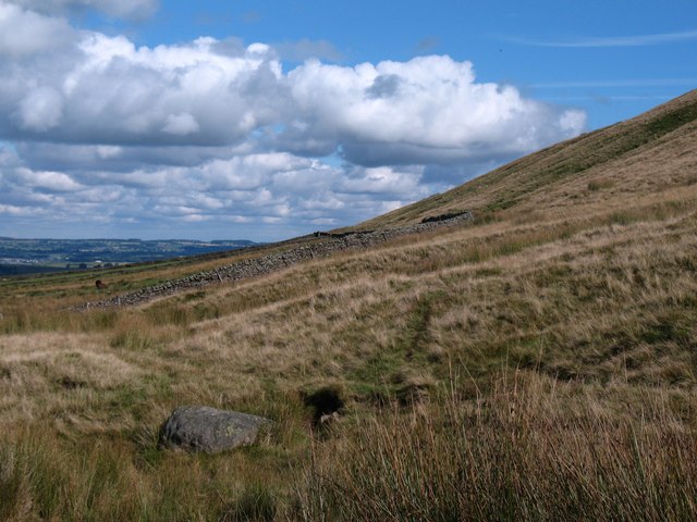
Cottages at West Scrafton A view across the head of Caygill to cottages on the far side.
Cottages at West Scrafton
A view across the head of Caygill to cottages on the far side.
Telephone kiosk and green at West Scrafton A very small Coverdale village with a suitably small green, at one side of which is the telephone kiosk.
Telephone kiosk and green at West Scrafton
A very small Coverdale village with a suitably small green, at one side of which is the telephone kiosk.
The post box in West Scrafton A 'VR' postbox set into the wall of a barn in West Scrafton.
The post box in West Scrafton
A 'VR' postbox set into the wall of a barn in West Scrafton.
Methodist chapel, West Scrafton Stone built chapel dated 1866 in West Scrafton.
Methodist chapel, West Scrafton
Stone built chapel dated 1866 in West Scrafton.
West Scrafton The view over the village from the moor track. Penhill dominates the distant skyline.
West Scrafton
The view over the village from the moor track. Penhill dominates the distant skyline.
Trees in Great Gill The moor above West Scrafton is largely treeless, but they are found along the minor valley of Great Gill.
Trees in Great Gill
The moor above West Scrafton is largely treeless, but they are found along the minor valley of Great Gill.
Great Gill A sizeable beck flows down the gill, passes through West Scrafton in a gorge and empties into the River Cover.
Great Gill
A sizeable beck flows down the gill, passes through West Scrafton in a gorge and empties into the River Cover.
A strange place for park benches Two rather dilapidated benches on the moor above West Scrafton. The fence encloses a water reservoir. In the distance can be seen the long whaleback which is Little Whernside, with a ridge of Great Whernside beyond.
A strange place for park benches
Two rather dilapidated benches on the moor above West Scrafton. The fence encloses a water reservoir. In the distance can be seen the long whaleback which is Little Whernside, with a ridge of Great Whernside beyond.
Bridleway to West Scrafton Walking uphill from the village, this bridleway makes a promising start, being well defined and relatively well drained, but once on the moor top and at the parish boundary the route disappears into heather and bog.
Bridleway to West Scrafton
Walking uphill from the village, this bridleway makes a promising start, being well defined and relatively well drained, but once on the moor top and at the parish boundary the route disappears into heather and bog.
Top wall on East Moor The wall marks the point where improved land meets the open moor, although even the enclosed pastures here seem to be reverting to moorland as sedges take over from grasses.
Top wall on East Moor
The wall marks the point where improved land meets the open moor, although even the enclosed pastures here seem to be reverting to moorland as sedges take over from grasses.
Moorland at Little Stockiner Poorly drained moorland on shales above West Scrafton. The view is up Coverdale towards the distant outlines of Little and Great Whernside [both left of centre].
Moorland at Little Stockiner
Poorly drained moorland on shales above West Scrafton. The view is up Coverdale towards the distant outlines of Little and Great Whernside [both left of centre].
Great Bank above West Scrafton A scattering of gritstone boulders litter the moorside here, whilst below are old coal tips, a thin seam of coal lying below the gritstone layer.
Great Bank above West Scrafton
A scattering of gritstone boulders litter the moorside here, whilst below are old coal tips, a thin seam of coal lying below the gritstone layer.
Track on Great Bank The clear track which ascends from West Scrafton makes a turn up on to the moor top at this point, although it is unclear whether the 4X4 track is following the true line of the bridleway. There is a splendid view over the upper reaches of Coverdale towards the distant dark outline of Buckden Pike.
Track on Great Bank
The clear track which ascends from West Scrafton makes a turn up on to the moor top at this point, although it is unclear whether the 4X4 track is following the true line of the bridleway. There is a splendid view over the upper reaches of Coverdale towards the distant dark outline of Buckden Pike.
Bridleway on West Scrafton Moor A rather wet moorside with a view across Coverdale towards Penhill.
Bridleway on West Scrafton Moor
A rather wet moorside with a view across Coverdale towards Penhill.
Gritstone outcrops near Little Roova Crag The big gritstone blocks and boulders here mark the beginning of Little Roova Crag which is off picture to the right. Ahead is the parish boundary fence leading towards Great Roova Crag.
Gritstone outcrops near Little Roova Crag
The big gritstone blocks and boulders here mark the beginning of Little Roova Crag which is off picture to the right. Ahead is the parish boundary fence leading towards Great Roova Crag.
Heading for Great Roova Crag Following the parish boundary fence across grouse moor towards Great Roova Crag.
Heading for Great Roova Crag
Following the parish boundary fence across grouse moor towards Great Roova Crag.
Oh Bother! Perhaps some stronger expletive was used by the stone mason who was carving this trough from the local gritstone when maybe his mallet and chisel slipped and a section of the rim fell off. Such a shame as there is some excellent detail work on the rest of the trough, which stands high up on Great Roova Crags.
Oh Bother!
Perhaps some stronger expletive was used by the stone mason who was carving this trough from the local gritstone when maybe his mallet and chisel slipped and a section of the rim fell off. Such a shame as there is some excellent detail work on the rest of the trough, which stands high up on Great Roova Crags.
On Great Roova Crags A prominent gritstone outcrop which overlooks Coverdale.
On Great Roova Crags
A prominent gritstone outcrop which overlooks Coverdale.
Show me another place!

Coverdale is located at Grid Ref: SE0683 (Lat: 54.245579, Lng: -1.8969655)

Division: North Riding

Administrative County: North Yorkshire

District: Richmondshire

Police Authority: North Yorkshire

What 3 Words

///sorry.clogging.access. Near Leyburn, North Yorkshire

Nearby Locations

Coverdale

Related Wikis

West Scrafton

West Scrafton is a village and civil parish in Coverdale in the Yorkshire Dales, England. It is located 4 miles (6.4 km) south west of Leyburn. It falls...

Coverdale, North Yorkshire

Coverdale is a dale in the far east of the Yorkshire Dales, North Yorkshire, England. It takes its name from the River Cover, a tributary of the River...

Gammersgill

Gammersgill is a hamlet in Coverdale in the Yorkshire Dales, North Yorkshire, England. It is about 7 miles (11 km) south-west of Leyburn. The toponym is...

Carlton, Richmondshire

Carlton is a village in the civil parish of Carlton Town in the Richmondshire district of North Yorkshire, England. According to the 2011 Census it had...

Melmerby in Coverdale

Melmerby is a village and civil parish in North Yorkshire, England. It lies in Coverdale in the Yorkshire Dales about 3 miles (4.8 km) south-west of Leyburn...

East Scrafton

East Scrafton is a hamlet in the Yorkshire Dales in the Richmondshire district of North Yorkshire, England. It is about 3 miles (5 km) south-west of Leyburn...

Horsehouse

Horsehouse is a village in Coverdale in the Yorkshire Dales, North Yorkshire, England. It is listed as a hamlet in many texts, but the presence of the...

Caldbergh

Caldbergh (Caldeber in the Domesday Book) is a hamlet within the Yorkshire Dales, North Yorkshire, England. It lies about four miles south of Leyburn....

Nearby Amenities

Located within 500m of 54.245579,-1.8969655
Ford: yes
Lat/Long: 54.2445064/-1.8941458
Historic: mine_adit
Source: OS 1:25k
Lat/Long: 54.2446558/-1.9044827
Passing Place
Lat/Long: 54.2493461/-1.8958683
Passing Place
Lat/Long: 54.2492655/-1.9002522
Gilbert Scar Lodge
Place: isolated_dwelling
Lat/Long: 54.2475276/-1.9017978
Building: yes
Lat/Long: 54.2440296/-1.8997392
The data included in this document is from www.openstreetmap.org. The data is made available under ODbL.

Have you been to Coverdale?

Leave your review of Coverdale below (or comments, questions and feedback).