Bourne Bottom

Valley in Dorset

England

Bourne Bottom

Vale Road, Branksome, Poole Vale Road is a residential road in Branksome, a suburb of Poole.

"No entry" signs restrict access to the road, prohibiting vehicles from making a right turn to enter the road.
Vale Road, Branksome, Poole Credit: Malc McDonald

Bourne Bottom is a picturesque valley located in the county of Dorset, England. Situated near the village of Winterborne Zelston, this charming area is known for its natural beauty and tranquil surroundings.

The valley is formed by the Bourne River, which meanders through the landscape, creating a serene atmosphere. The river is flanked by lush green meadows and rolling hills, providing a stunning backdrop for visitors and residents alike. The area is particularly popular among nature enthusiasts, as it offers numerous walking trails and opportunities for wildlife watching.

Bourne Bottom is also home to a diverse range of flora and fauna. The valley's rich biodiversity includes several species of birds, butterflies, and wildflowers. It is not uncommon to spot kingfishers, herons, or even otters along the riverbanks.

For those interested in history, Bourne Bottom boasts a few historical landmarks. The remains of a Roman villa have been discovered in the area, providing insights into the region's ancient past. Additionally, there are several traditional thatched cottages scattered throughout the valley, adding to its charm and character.

Despite its rural setting, Bourne Bottom is conveniently located near the towns of Blandford Forum and Poole, offering easy access to amenities such as shops, restaurants, and entertainment venues. Overall, Bourne Bottom is a peaceful and idyllic spot, perfect for those seeking a retreat from the hustle and bustle of modern life.

If you have any feedback on the listing, please let us know in the comments section below.

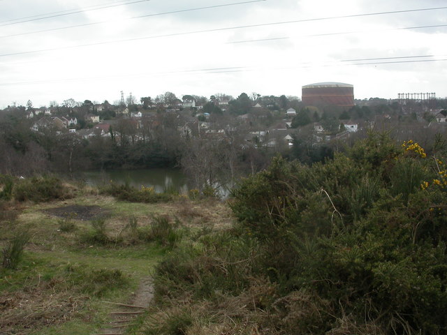
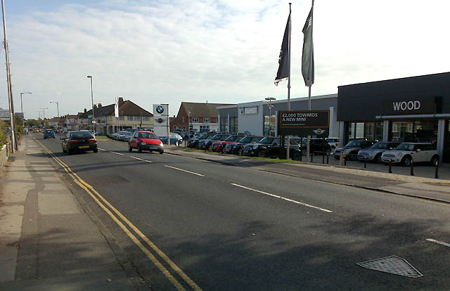
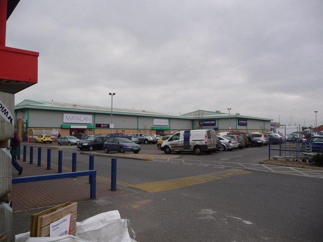
Bourne Bottom Images

Images are sourced within 2km of 50.743661/-1.9174905 or Grid Reference SZ0593. Thanks to Geograph Open Source API. All images are credited.

Vale Road, Branksome, Poole Vale Road is a residential road in Branksome, a suburb of Poole.

"No entry" signs restrict access to the road, prohibiting vehicles from making a right turn to enter the road.
Vale Road, Branksome, Poole
Vale Road is a residential road in Branksome, a suburb of Poole. "No entry" signs restrict access to the road, prohibiting vehicles from making a right turn to enter the road.
Gorleston Road, Branksome, Poole Gorleston Road is a residential road in Branksome, a suburb of Poole.
Gorleston Road, Branksome, Poole
Gorleston Road is a residential road in Branksome, a suburb of Poole.
Gorleston Road, Branksome, Poole Gorleston  Road is a residential road in Branksome, a suburb of Poole.
Gorleston Road, Branksome, Poole
Gorleston Road is a residential road in Branksome, a suburb of Poole.
Sheringham Road, Branksome, Poole Sheringham Road is a residential road in Branksome, a suburb of Poole.
Sheringham Road, Branksome, Poole
Sheringham Road is a residential road in Branksome, a suburb of Poole.
James Road, Branksome, Poole James Road is a residential road in Branksome, a suburb of Poole.  A sign indicates that a 20mph speed limit applies on this road.
James Road, Branksome, Poole
James Road is a residential road in Branksome, a suburb of Poole. A sign indicates that a 20mph speed limit applies on this road.
Railway bridge over Bourne Valley Road, Branksome, Poole An arch bridge carries the London to Weymouth railway line over Bourne Valley Road in Branksome, a suburb of Poole.  Yellow and black markings on the bridge warn drivers that the bridge is low, the triangular sign on the bridge indicates that the maximum vehicle height to pass under the bridge is 11 feet 6 inches.  Some of the markers have been dislodged, indicating that overheight vehicles have attempted to pass but have struck the bridge.

A train operated by South Western Railway crosses the bridge.  The train guard, travelling in the rear cab, is looking out of the cab window.
Railway bridge over Bourne Valley Road, Branksome, Poole
An arch bridge carries the London to Weymouth railway line over Bourne Valley Road in Branksome, a suburb of Poole. Yellow and black markings on the bridge warn drivers that the bridge is low, the triangular sign on the bridge indicates that the maximum vehicle height to pass under the bridge is 11 feet 6 inches. Some of the markers have been dislodged, indicating that overheight vehicles have attempted to pass but have struck the bridge. A train operated by South Western Railway crosses the bridge. The train guard, travelling in the rear cab, is looking out of the cab window.
Railway bridge over Bourne Valley Road, Branksome, Poole An arch bridge carrying the London to Weymouth railway line over Bourne Valley Road in Branksome, a suburb of Poole.  Yellow and black markers have been fitted to the bridge as an added warning to drivers that the bridge is low.  The triangular sign in the centre of the arch advises that the maximum height for vehicles passing beneath the bridge is 11 feet 6 inches.
Railway bridge over Bourne Valley Road, Branksome, Poole
An arch bridge carrying the London to Weymouth railway line over Bourne Valley Road in Branksome, a suburb of Poole. Yellow and black markers have been fitted to the bridge as an added warning to drivers that the bridge is low. The triangular sign in the centre of the arch advises that the maximum height for vehicles passing beneath the bridge is 11 feet 6 inches.
Arches over Surrey Road, Branksome, near Poole Surrey Road passes beneath two railway viaduct in quick succession.  The viaduct in the foreground is disused.  It used to carry trains into Bournemouth West station, which closed in 1965.  The viaduct in the background carries the main line between London and Weymouth.
Arches over Surrey Road, Branksome, near Poole
Surrey Road passes beneath two railway viaduct in quick succession. The viaduct in the foreground is disused. It used to carry trains into Bournemouth West station, which closed in 1965. The viaduct in the background carries the main line between London and Weymouth.
Path in Coy Pond Gardens, Branksome, near Bournemouth A path in Coy Pond Gardens in Branksome, near Bournemouth, with a bridge over The Bourne.  From this point, a series of gardens follows the course of The Bourne down to the centre of Bournemouth and to the seafront.
Path in Coy Pond Gardens, Branksome, near Bournemouth
A path in Coy Pond Gardens in Branksome, near Bournemouth, with a bridge over The Bourne. From this point, a series of gardens follows the course of The Bourne down to the centre of Bournemouth and to the seafront.
Coy Pond Gardens and Coy Pond Road, near Bournemouth A path in Coy Pond Gardens, with a view onto Coy Pond Road.  Although this location is close to Bournemouth, it lies within the neighbouring Borough of Poole.
Coy Pond Gardens and Coy Pond Road, near Bournemouth
A path in Coy Pond Gardens, with a view onto Coy Pond Road. Although this location is close to Bournemouth, it lies within the neighbouring Borough of Poole.
Coy Pond, near Bournemouth Coy Pond is an artificial pond created in 1888.  More information can be found on the websites of Friends of Coy Pond: <span class="nowrap"><a title="https://www.friendsofcoypond.co.uk/" rel="nofollow ugc noopener" href="https://www.friendsofcoypond.co.uk/">Link</a><img style="margin-left:2px;" alt="External link" title="External link - shift click to open in new window" src="https://s1.geograph.org.uk/img/external.png" width="10" height="10"/></span> and Visit Bournemouth: <span class="nowrap"><a title="https://www.visitbournemouth.com/attractions/coy-pond" rel="nofollow ugc noopener" href="https://www.visitbournemouth.com/attractions/coy-pond">Link</a><img style="margin-left:2px;" alt="External link" title="External link - shift click to open in new window" src="https://s1.geograph.org.uk/img/external.png" width="10" height="10"/></span>
Coy Pond, near Bournemouth
Coy Pond is an artificial pond created in 1888. More information can be found on the websites of Friends of Coy Pond: LinkExternal link and Visit Bournemouth: LinkExternal link
Path in Coy Pond Gardens, near Bournemouth A path in Coy Pond Gardens, near Bournemouth.
Path in Coy Pond Gardens, near Bournemouth
A path in Coy Pond Gardens, near Bournemouth.
Bridge over The Bourne, near Bournemouth A wooden bridge carrying a footpath over The Bourne in Coy Pond Gardens, near Bournemouth.
Bridge over The Bourne, near Bournemouth
A wooden bridge carrying a footpath over The Bourne in Coy Pond Gardens, near Bournemouth.
Bourne Valley Greenway, near Bournemouth The Bourne Valley Greenway entering Bournemouth's Upper Gardens.

The road in the foreground marks the boundary between the boroughs of Bournemouth and Poole.
Bourne Valley Greenway, near Bournemouth
The Bourne Valley Greenway entering Bournemouth's Upper Gardens. The road in the foreground marks the boundary between the boroughs of Bournemouth and Poole.
Bourne Valley Greenway, near Bournemouth A view of the Bourne Valley Greenway passing through Bournemouth's Upper Gardens.
Bourne Valley Greenway, near Bournemouth
A view of the Bourne Valley Greenway passing through Bournemouth's Upper Gardens.
Footbridge over The Bourne, near Bournemouth A wooden footbridge taking a path across The Bourne, in Bournemouth's Upper Gardens.
Footbridge over The Bourne, near Bournemouth
A wooden footbridge taking a path across The Bourne, in Bournemouth's Upper Gardens.
Ensbury Park: Montrose Drive A cul-de-sac of bungalows off Priestley Road.

The sign tells us that the road isn't modern: it looks like an ordinary 1980s sign mounted on tubular steel (such as the one at <a href="https://www.geograph.org.uk/photo/6447362">SZ0795 : Ensbury Park: Barnes Close</a>), but careful scrutiny will tell us that the lettering and black border is embossed in the metalwork and not put on adhesively like the more modern variety. This makes it one of the older, perhaps 1960s, nameplates.

This is photo no.277 of a series of 451 in my coronavirus lockdown walking project:
See <a title="https://www.geograph.org.uk/article/My-2020-Coronavirus-Lockdown-walking-project" href="https://www.geograph.org.uk/article/My-2020-Coronavirus-Lockdown-walking-project">Link</a> for the complete set of photos.
Ensbury Park: Montrose Drive
A cul-de-sac of bungalows off Priestley Road. The sign tells us that the road isn't modern: it looks like an ordinary 1980s sign mounted on tubular steel (such as the one at SZ0795 : Ensbury Park: Barnes Close), but careful scrutiny will tell us that the lettering and black border is embossed in the metalwork and not put on adhesively like the more modern variety. This makes it one of the older, perhaps 1960s, nameplates. This is photo no.277 of a series of 451 in my coronavirus lockdown walking project: See Link for the complete set of photos.
West Howe: Moorside Close A small cul-de-sac off Moorside Road, hence the name, Moorside Close actually takes the course of one of the original tracks when this was all fields, before the large 1950s West Howe council estate was built: Behind us to the right is Ericksen Road, while at the top of the hill ahead is a path onto the eastern leg of Tedder Road, which continues diagonally into Mount Road – and that whole route is recognisable, when looking at older maps, as an original track or lane.

The sign is the standard Bournemouth nameplate from the 1980s, affixed with tubular steel which protrudes at each side.

This is photo no.281 of a series of 453 in my coronavirus lockdown walking project:
See <a title="https://www.geograph.org.uk/article/My-2020-Coronavirus-Lockdown-walking-project" href="https://www.geograph.org.uk/article/My-2020-Coronavirus-Lockdown-walking-project">Link</a> for the complete set of photos.
West Howe: Moorside Close
A small cul-de-sac off Moorside Road, hence the name, Moorside Close actually takes the course of one of the original tracks when this was all fields, before the large 1950s West Howe council estate was built: Behind us to the right is Ericksen Road, while at the top of the hill ahead is a path onto the eastern leg of Tedder Road, which continues diagonally into Mount Road – and that whole route is recognisable, when looking at older maps, as an original track or lane. The sign is the standard Bournemouth nameplate from the 1980s, affixed with tubular steel which protrudes at each side. This is photo no.281 of a series of 453 in my coronavirus lockdown walking project: See Link for the complete set of photos.
Show me another place!

Bourne Bottom is located at Grid Ref: SZ0593 (Lat: 50.743661, Lng: -1.9174905)

Unitary Authority: Bournemouth, Christchurch and Poole

Police Authority: Dorset

What 3 Words

///sleepy.dairy.above. Near Parkstone, Dorset

Nearby Locations

Rossmore Bourne Bottom

Related Wikis

Alder Hills

Alder Hills is a suburb in Dorset that crosses the boundaries of Bournemouth and Poole. It is south of Wallisdown, east of Alderney and north of Parkstone...

Wallisdown

Wallisdown is a residential and commercial area situated partly in Bournemouth and partly in Poole, in southern England. The appropriate ward is called...

Brownsea Open Air Theatre

Brownsea Open Air Theatre (commonly abbreviated BOAT) is an open-air Shakespearean theatre company based in Poole, Dorset that have performed large theatrical...

Turbary Park

Turbary Park is an area of West Howe, Bournemouth in Dorset. Turbary Park is south of Kinson and north of Wallisdown. == Geography == Turbary Common is...

Nearby Amenities

Located within 500m of 50.743661,-1.9174905
Turning Circle
Lat/Long: 50.7407084/-1.9166261
Turning Circle
Lat/Long: 50.7411007/-1.9142962
Turning Circle
Lat/Long: 50.7418108/-1.9161762
Turning Circle
Lat/Long: 50.7406838/-1.9204463
Turning Circle
Lat/Long: 50.7410729/-1.9208582
Turning Circle
Lat/Long: 50.742344/-1.9234434
Turning Circle
Lat/Long: 50.7439289/-1.9166735
Turning Circle
Lat/Long: 50.7450347/-1.9152699
Turning Circle
Lat/Long: 50.7453156/-1.9151644
Turning Circle
Lat/Long: 50.7438839/-1.9148519
Barrier: bollard
Lat/Long: 50.7478687/-1.9186916
Post Box
Collection Times: Mo-Fr 09:00, Sa 07:00
Operator: Royal Mail
Operator Wikidata: Q638098
Post Box Type: pillar
Ref: BH12 314
Royal Cypher: EIIR
Royal Cypher Wikidata: Q33102113
Lat/Long: 50.7474093/-1.9160251
Power: tower
Source: Bing
Lat/Long: 50.7420956/-1.9129946
Power: tower
Source: Bing
Lat/Long: 50.7429437/-1.9154323
Power: tower
Source: Bing
Lat/Long: 50.7445354/-1.9201933
Power: tower
Source: Bing
Lat/Long: 50.7453698/-1.9230097
Power: tower
Source: Bing
Lat/Long: 50.7429873/-1.9227366
Power: tower
Source: Bing
Lat/Long: 50.7412835/-1.9198781
Turning Circle
Lat/Long: 50.7442009/-1.9124521
Turning Circle
Lat/Long: 50.7409789/-1.9192604
Turning Circle
Lat/Long: 50.7414083/-1.9198183
Turning Circle
Lat/Long: 50.7402991/-1.9198022
Turning Circle
Lat/Long: 50.7420431/-1.9170124
Turning Circle
Lat/Long: 50.7420234/-1.9224498
Crossing
Crossing: traffic_signals
Crossing Ref: toucan
Lat/Long: 50.7421749/-1.9121135
Traffic Signals
Crossing: traffic_signals
Crossing Ref: puffin
Lat/Long: 50.7404969/-1.912493
Turning Circle
Lat/Long: 50.7445656/-1.9143868
Material: wood
Power: pole
Source: bing
Lat/Long: 50.741344/-1.9117629
Material: wood
Power: pole
Source: bing
Lat/Long: 50.7414041/-1.9116789
Material: wood
Power: pole
Source: bing
Lat/Long: 50.7417386/-1.9128332
Material: wood
Power: pole
Source: bing
Lat/Long: 50.7421023/-1.9135143
Material: wood
Power: pole
Source: bing
Lat/Long: 50.7421781/-1.9140187
Material: wood
Power: pole
Source: bing
Lat/Long: 50.7427148/-1.9154012
Power: pole
Source: bing
Lat/Long: 50.7433877/-1.9168248
Material: wood
Power: pole
Source: bing
Lat/Long: 50.7433895/-1.9167523
Material: wood
Power: pole
Source: bing
Lat/Long: 50.7440826/-1.917384
Material: wood
Power: pole
Source: bing
Lat/Long: 50.7440907/-1.9175429
Material: wood
Power: pole
Source: bing
Lat/Long: 50.7446345/-1.9192645
Material: wood
Power: pole
Source: bing
Lat/Long: 50.7450548/-1.9206499
Material: wood
Power: pole
Source: bing
Lat/Long: 50.745467/-1.9219468
Material: wood
Power: pole
Source: bing
Lat/Long: 50.7455339/-1.9218763
Material: wood
Power: pole
Source: bing
Lat/Long: 50.7460652/-1.9232417
Turning Circle
Lat/Long: 50.7460379/-1.9180501
Turning Circle
Lat/Long: 50.7431698/-1.9195731
Bus Stop
Langside Avenue
Bus: yes
Naptan AtcoCode: 1280POA11720
Naptan Bearing: N
Naptan CommonName: Langside Avenue
Naptan Indicator: N-bound
Naptan NaptanCode: plejdpa
Naptan PlusbusZoneRef: BOMO
Naptan Street: Alder Road
Naptan Verified: no
Public Transport: platform
Lat/Long: 50.7431969/-1.9118436
Generator Method: photovoltaic
Generator Output Electricity: yes
Generator Source: solar
Generator Type: solar_photovoltaic_panel
Location: roof
Power: generator
Lat/Long: 50.7471439/-1.9186433
Generator Method: photovoltaic
Generator Output Electricity: yes
Generator Source: solar
Generator Type: solar_photovoltaic_panel
Location: roof
Power: generator
Lat/Long: 50.747634/-1.9195402
Generator Method: photovoltaic
Generator Output Electricity: yes
Generator Source: solar
Generator Type: solar_photovoltaic_panel
Location: roof
Power: generator
Lat/Long: 50.7476633/-1.9196136
Generator Method: photovoltaic
Generator Output Electricity: yes
Generator Source: solar
Generator Type: solar_photovoltaic_panel
Location: roof
Power: generator
Lat/Long: 50.7474053/-1.9198609
Generator Method: photovoltaic
Generator Output Electricity: yes
Generator Source: solar
Generator Type: solar_photovoltaic_panel
Location: roof
Power: generator
Lat/Long: 50.7474397/-1.9199207
Generator Method: photovoltaic
Generator Output Electricity: yes
Generator Source: solar
Generator Type: solar_photovoltaic_panel
Location: roof
Power: generator
Lat/Long: 50.7478421/-1.9199832
Generator Method: photovoltaic
Generator Output Electricity: yes
Generator Source: solar
Generator Type: solar_photovoltaic_panel
Location: roof
Power: generator
Lat/Long: 50.747923/-1.9191978
Generator Method: photovoltaic
Generator Output Electricity: yes
Generator Source: solar
Generator Type: solar_photovoltaic_panel
Location: roof
Power: generator
Lat/Long: 50.7460372/-1.9156054
Generator Method: photovoltaic
Generator Output Electricity: yes
Generator Source: solar
Generator Type: solar_photovoltaic_panel
Location: roof
Power: generator
Lat/Long: 50.7476289/-1.9203556
Generator Method: photovoltaic
Generator Output Electricity: yes
Generator Source: solar
Generator Type: solar_photovoltaic_panel
Location: roof
Power: generator
Lat/Long: 50.7474363/-1.9208883
Generator Method: photovoltaic
Generator Output Electricity: yes
Generator Source: solar
Generator Type: solar_photovoltaic_panel
Location: roof
Power: generator
Lat/Long: 50.747407/-1.9208095
Generator Method: photovoltaic
Generator Output Electricity: yes
Generator Source: solar
Generator Type: solar_photovoltaic_panel
Location: roof
Power: generator
Lat/Long: 50.7471611/-1.9202441
Generator Method: photovoltaic
Generator Output Electricity: yes
Generator Source: solar
Generator Type: solar_photovoltaic_panel
Location: roof
Power: generator
Lat/Long: 50.7470459/-1.9198446
Generator Method: photovoltaic
Generator Output Electricity: yes
Generator Source: solar
Generator Type: solar_photovoltaic_panel
Location: roof
Power: generator
Lat/Long: 50.7470218/-1.9208203
Generator Method: photovoltaic
Generator Output Electricity: yes
Generator Source: solar
Generator Type: solar_photovoltaic_panel
Location: roof
Power: generator
Lat/Long: 50.7471353/-1.9210595
Generator Method: photovoltaic
Generator Output Electricity: yes
Generator Source: solar
Generator Type: solar_photovoltaic_panel
Location: roof
Power: generator
Lat/Long: 50.7472299/-1.9212715
Generator Method: photovoltaic
Generator Output Electricity: yes
Generator Source: solar
Generator Type: solar_photovoltaic_panel
Location: roof
Power: generator
Lat/Long: 50.7473159/-1.92144
Generator Method: photovoltaic
Generator Output Electricity: yes
Generator Source: solar
Generator Type: solar_photovoltaic_panel
Location: roof
Power: generator
Lat/Long: 50.7469014/-1.9219129
Generator Method: photovoltaic
Generator Output Electricity: yes
Generator Source: solar
Generator Type: solar_photovoltaic_panel
Location: roof
Power: generator
Lat/Long: 50.7467157/-1.9223614
Generator Method: photovoltaic
Generator Output Electricity: yes
Generator Source: solar
Generator Type: solar_photovoltaic_panel
Location: roof
Power: generator
Lat/Long: 50.7466452/-1.9222391
Generator Method: photovoltaic
Generator Output Electricity: yes
Generator Source: solar
Generator Type: solar_photovoltaic_panel
Location: roof
Power: generator
Lat/Long: 50.7465455/-1.9220271
Generator Method: photovoltaic
Generator Output Electricity: yes
Generator Source: solar
Generator Type: solar_photovoltaic_panel
Location: roof
Power: generator
Lat/Long: 50.7466727/-1.9214645
Generator Method: photovoltaic
Generator Output Electricity: yes
Generator Source: solar
Generator Type: solar_photovoltaic_panel
Location: roof
Power: generator
Lat/Long: 50.7465661/-1.9212634
Generator Method: photovoltaic
Generator Output Electricity: yes
Generator Source: solar
Generator Type: solar_photovoltaic_panel
Location: roof
Power: generator
Lat/Long: 50.7464887/-1.9211519
Generator Method: photovoltaic
Generator Output Electricity: yes
Generator Source: solar
Generator Type: solar_photovoltaic_panel
Location: roof
Power: generator
Lat/Long: 50.7462428/-1.9214618
Generator Method: photovoltaic
Generator Output Electricity: yes
Generator Source: solar
Generator Type: solar_photovoltaic_panel
Location: roof
Power: generator
Lat/Long: 50.7463184/-1.9215922
Generator Method: photovoltaic
Generator Output Electricity: yes
Generator Source: solar
Generator Type: solar_photovoltaic_panel
Location: roof
Power: generator
Lat/Long: 50.7461516/-1.9212797
Generator Method: photovoltaic
Generator Output Electricity: yes
Generator Source: solar
Generator Type: solar_photovoltaic_panel
Location: roof
Power: generator
Lat/Long: 50.7461069/-1.9212226
Generator Method: photovoltaic
Generator Output Electricity: yes
Generator Source: solar
Generator Type: solar_photovoltaic_panel
Location: roof
Power: generator
Lat/Long: 50.7457114/-1.9205404
Generator Method: photovoltaic
Generator Output Electricity: yes
Generator Source: solar
Generator Type: solar_photovoltaic_panel
Location: roof
Power: generator
Lat/Long: 50.7456477/-1.9203501
Generator Method: photovoltaic
Generator Output Electricity: yes
Generator Source: solar
Generator Type: solar_photovoltaic_panel
Location: roof
Power: generator
Lat/Long: 50.7456237/-1.9203039
Generator Method: photovoltaic
Generator Output Electricity: yes
Generator Source: solar
Generator Type: solar_photovoltaic_panel
Location: roof
Power: generator
Lat/Long: 50.7458765/-1.9200919
Generator Method: photovoltaic
Generator Output Electricity: yes
Generator Source: solar
Generator Type: solar_photovoltaic_panel
Location: roof
Power: generator
Lat/Long: 50.7459435/-1.9202768
Generator Method: photovoltaic
Generator Output Electricity: yes
Generator Source: solar
Generator Type: solar_photovoltaic_panel
Location: roof
Power: generator
Lat/Long: 50.745787/-1.9198963
Generator Method: photovoltaic
Generator Output Electricity: yes
Generator Source: solar
Generator Type: solar_photovoltaic_panel
Location: roof
Power: generator
Lat/Long: 50.7457148/-1.9196897
Generator Method: photovoltaic
Generator Output Electricity: yes
Generator Source: solar
Generator Type: solar_photovoltaic_panel
Location: roof
Power: generator
Lat/Long: 50.7456374/-1.9194886
Generator Method: photovoltaic
Generator Output Electricity: yes
Generator Source: solar
Generator Type: solar_photovoltaic_panel
Location: roof
Power: generator
Lat/Long: 50.7456099/-1.9194233
Generator Method: photovoltaic
Generator Output Electricity: yes
Generator Source: solar
Generator Type: solar_photovoltaic_panel
Location: roof
Power: generator
Lat/Long: 50.7455635/-1.9193038
Generator Method: photovoltaic
Generator Output Electricity: yes
Generator Source: solar
Generator Type: solar_photovoltaic_panel
Location: roof
Power: generator
Lat/Long: 50.7454465/-1.9188091
Generator Method: photovoltaic
Generator Output Electricity: yes
Generator Source: solar
Generator Type: solar_photovoltaic_panel
Location: roof
Power: generator
Lat/Long: 50.7453141/-1.9183715
Generator Method: photovoltaic
Generator Output Electricity: yes
Generator Source: solar
Generator Type: solar_photovoltaic_panel
Location: roof
Power: generator
Lat/Long: 50.7452917/-1.9183172
Generator Method: photovoltaic
Generator Output Electricity: yes
Generator Source: solar
Generator Type: solar_photovoltaic_panel
Location: roof
Power: generator
Lat/Long: 50.74518/-1.9190591
Generator Method: photovoltaic
Generator Output Electricity: yes
Generator Source: solar
Generator Type: solar_photovoltaic_panel
Location: roof
Power: generator
Lat/Long: 50.745137/-1.9188689
Generator Method: photovoltaic
Generator Output Electricity: yes
Generator Source: solar
Generator Type: solar_photovoltaic_panel
Location: roof
Power: generator
Lat/Long: 50.7451937/-1.9179503
Generator Method: photovoltaic
Generator Output Electricity: yes
Generator Source: solar
Generator Type: solar_photovoltaic_panel
Location: roof
Power: generator
Lat/Long: 50.745137/-1.917722
Generator Method: photovoltaic
Generator Output Electricity: yes
Generator Source: solar
Generator Type: solar_photovoltaic_panel
Location: roof
Power: generator
Lat/Long: 50.7451249/-1.9176676
Generator Method: photovoltaic
Generator Output Electricity: yes
Generator Source: solar
Generator Type: solar_photovoltaic_panel
Location: roof
Power: generator
Lat/Long: 50.7450854/-1.91751
Generator Method: photovoltaic
Generator Output Electricity: yes
Generator Source: solar
Generator Type: solar_photovoltaic_panel
Location: roof
Power: generator
Lat/Long: 50.7450355/-1.9172762
Generator Method: photovoltaic
Generator Output Electricity: yes
Generator Source: solar
Generator Type: solar_photovoltaic_panel
Location: roof
Power: generator
Lat/Long: 50.7449787/-1.9170724
Generator Method: photovoltaic
Generator Output Electricity: yes
Generator Source: solar
Generator Type: solar_photovoltaic_panel
Location: roof
Power: generator
Lat/Long: 50.744965/-1.9169936
Generator Method: photovoltaic
Generator Output Electricity: yes
Generator Source: solar
Generator Type: solar_photovoltaic_panel
Location: roof
Power: generator
Lat/Long: 50.7451473/-1.9164391
Generator Method: photovoltaic
Generator Output Electricity: yes
Generator Source: solar
Generator Type: solar_photovoltaic_panel
Location: roof
Power: generator
Lat/Long: 50.7459384/-1.9141642
Generator Method: photovoltaic
Generator Output Electricity: yes
Generator Source: solar
Generator Type: solar_photovoltaic_panel
Location: roof
Power: generator
Lat/Long: 50.7459934/-1.9143599
Generator Method: photovoltaic
Generator Output Electricity: yes
Generator Source: solar
Generator Type: solar_photovoltaic_panel
Location: roof
Power: generator
Lat/Long: 50.7460484/-1.9146915
Generator Method: photovoltaic
Generator Output Electricity: yes
Generator Source: solar
Generator Type: solar_photovoltaic_panel
Location: roof
Power: generator
Lat/Long: 50.7460656/-1.9147921
Generator Method: photovoltaic
Generator Output Electricity: yes
Generator Source: solar
Generator Type: solar_photovoltaic_panel
Location: roof
Power: generator
Lat/Long: 50.7417002/-1.920467
Generator Method: photovoltaic
Generator Output Electricity: yes
Generator Source: solar
Generator Type: solar_photovoltaic_panel
Location: roof
Power: generator
Lat/Long: 50.7420227/-1.9221836
Generator Method: photovoltaic
Generator Output Electricity: yes
Generator Source: solar
Generator Type: solar_photovoltaic_panel
Location: roof
Power: generator
Lat/Long: 50.7424216/-1.9242221
Alder Hills
Place: suburb
Lat/Long: 50.7407355/-1.9128379
Bloxworth
Place: suburb
Lat/Long: 50.7437364/-1.9200048
Generator Method: photovoltaic
Generator Output Electricity: yes
Generator Source: solar
Generator Type: solar_photovoltaic_panel
Location: roof
Power: generator
Lat/Long: 50.7395836/-1.9178433
Generator Method: photovoltaic
Generator Output Electricity: yes
Generator Source: solar
Generator Type: solar_photovoltaic_panel
Location: roof
Power: generator
Lat/Long: 50.7396396/-1.9178997
Generator Method: photovoltaic
Generator Output Electricity: yes
Generator Source: solar
Generator Type: solar_photovoltaic_panel
Location: roof
Power: generator
Lat/Long: 50.7398346/-1.918253
Generator Method: photovoltaic
Generator Output Electricity: yes
Generator Source: solar
Generator Type: solar_photovoltaic_panel
Location: roof
Power: generator
Lat/Long: 50.739451/-1.91762
Generator Method: photovoltaic
Generator Output Electricity: yes
Generator Source: solar
Generator Type: solar_photovoltaic_panel
Location: roof
Power: generator
Lat/Long: 50.7394977/-1.9183348
Generator Method: photovoltaic
Generator Output Electricity: yes
Generator Source: solar
Generator Type: solar_photovoltaic_panel
Location: roof
Power: generator
Lat/Long: 50.7393059/-1.9174765
Generator Method: photovoltaic
Generator Output Electricity: yes
Generator Source: solar
Generator Type: solar_photovoltaic_panel
Location: roof
Power: generator
Lat/Long: 50.7392634/-1.9174095
Generator Method: photovoltaic
Generator Output Electricity: yes
Generator Source: solar
Generator Type: solar_photovoltaic_panel
Location: roof
Power: generator
Lat/Long: 50.7392397/-1.9180545
Generator Method: photovoltaic
Generator Output Electricity: yes
Generator Source: solar
Generator Type: solar_photovoltaic_panel
Location: roof
Power: generator
Lat/Long: 50.7398321/-1.9191059
Generator Method: photovoltaic
Generator Output Electricity: yes
Generator Source: solar
Generator Type: solar_photovoltaic_panel
Location: roof
Power: generator
Lat/Long: 50.7398244/-1.9191743
Generator Method: photovoltaic
Generator Output Electricity: yes
Generator Source: solar
Generator Type: solar_photovoltaic_panel
Location: roof
Power: generator
Lat/Long: 50.7403338/-1.9209936
Generator Method: photovoltaic
Generator Output Electricity: yes
Generator Source: solar
Generator Type: solar_photovoltaic_panel
Location: roof
Power: generator
Lat/Long: 50.7408507/-1.920374
Generator Method: photovoltaic
Generator Output Electricity: yes
Generator Source: solar
Generator Type: solar_photovoltaic_panel
Location: roof
Power: generator
Lat/Long: 50.7419387/-1.9167155
Generator Method: photovoltaic
Generator Output Electricity: yes
Generator Source: solar
Generator Type: solar_photovoltaic_panel
Location: roof
Power: generator
Lat/Long: 50.7434024/-1.9154795
Generator Method: photovoltaic
Generator Output Electricity: yes
Generator Source: solar
Generator Type: solar_photovoltaic_panel
Location: roof
Power: generator
Lat/Long: 50.743444/-1.9148616
Generator Method: photovoltaic
Generator Output Electricity: yes
Generator Source: solar
Generator Type: solar_photovoltaic_panel
Location: roof
Power: generator
Lat/Long: 50.7456489/-1.9171749
Generator Method: photovoltaic
Generator Output Electricity: yes
Generator Source: solar
Generator Type: solar_photovoltaic_panel
Location: roof
Power: generator
Lat/Long: 50.7446404/-1.9171432
Generator Method: photovoltaic
Generator Output Electricity: yes
Generator Source: solar
Generator Type: solar_photovoltaic_panel
Location: roof
Power: generator
Lat/Long: 50.7434249/-1.9149149
Generator Method: photovoltaic
Generator Output Electricity: yes
Generator Source: solar
Generator Type: solar_photovoltaic_panel
Location: roof
Power: generator
Lat/Long: 50.7446108/-1.9160015
Generator Method: photovoltaic
Generator Output Electricity: yes
Generator Source: solar
Generator Type: solar_photovoltaic_panel
Location: roof
Power: generator
Lat/Long: 50.7435242/-1.9153453
Generator Method: photovoltaic
Generator Output Electricity: yes
Generator Source: solar
Generator Type: solar_photovoltaic_panel
Location: roof
Power: generator
Lat/Long: 50.7411795/-1.9228993
Generator Method: photovoltaic
Generator Output Electricity: yes
Generator Source: solar
Generator Type: solar_photovoltaic_panel
Location: roof
Power: generator
Lat/Long: 50.7408824/-1.9204263
Post Box
Collection Times: Mo-Fr 09:00; Sa 07:00
Operator: Royal Mail
Operator Wikidata: Q638098
Post Box Type: pillar
Ref: BH12 103D
Royal Cypher: EIIR
Royal Cypher Wikidata: Q33102113
Lat/Long: 50.7397822/-1.9196221
Post Box
Collection Times: Mo-Fr 09:00; Sa 07:00
Operator: Royal Mail
Operator Wikidata: Q638098
Post Box Type: pillar
Ref: BH12 272D
Royal Cypher: EIIR
Royal Cypher Wikidata: Q33102113
Lat/Long: 50.7443149/-1.9208271
Post Box
Collection Times: Mo-Fr 09:00; Sa 07:00
Operator: Royal Mail
Operator Wikidata: Q638098
Post Box Type: pillar
Ref: BH12 255D
Royal Cypher: EIIR
Royal Cypher Wikidata: Q33102113
Lat/Long: 50.7415526/-1.9134396
Bus Stop
Langside Avenue
Bus: yes
Naptan AtcoCode: 1280POA11721
Naptan Bearing: S
Naptan CommonName: Langside Avenue
Naptan Indicator: S-bound
Naptan NaptanCode: plejdmw
Naptan PlusbusZoneRef: BOMO
Naptan Street: Alder Road
Naptan Verified: no
Public Transport: platform
Lat/Long: 50.7429155/-1.9118089
Bus Stop
Alder Road Sainsbury's
Bus: yes
Naptan AtcoCode: 1280POA11564
Naptan Bearing: NE
Naptan CommonName: Sainsburys
Naptan Indicator: NE-bound
Naptan NaptanCode: plejdmt
Naptan PlusbusZoneRef: BOMO
Naptan Street: Alder Road
Naptan Verified: no
Public Transport: platform
Lat/Long: 50.7403525/-1.9127932
Bus Stop
Astbury Avenue
Bench: no
Bin: no
Bus: yes
Lit: no
Naptan AtcoCode: 1290POA11715
Naptan NaptanCode: bouagmj
Public Transport: platform
Shelter: no
Tactile Paving: no
Lat/Long: 50.7472774/-1.9146681
Bus Stop
Astbury Avenue
Bench: no
Bin: no
Bus: yes
Lit: no
Naptan AtcoCode: 1280POA11714
Naptan Bearing: NW
Naptan CommonName: Astbury Avenue
Naptan Indicator: NW-bound
Naptan NaptanCode: plejdgj
Naptan PlusbusZoneRef: BOMO
Naptan Street: Wallisdown Road
Naptan Verified: no
Public Transport: platform
Shelter: no
Tactile Paving: no
Lat/Long: 50.7474132/-1.9159448
Barrier: yes
Lat/Long: 50.7400892/-1.9164561
Bus Stop
Broadmayne Road
Bus: yes
Naptan AtcoCode: 1280POA11562
Naptan Bearing: E
Naptan CommonName: Bloxworth Road
Naptan Indicator: E-bound
Naptan NaptanCode: plejdjw
Naptan PlusbusZoneRef: BOMO
Naptan Street: Bloxworth Road
Naptan Verified: no
Public Transport: platform
Lat/Long: 50.7418174/-1.9139949
Bus Stop
Bloxworth Estate, Bloxworth Road
Bus: yes
Naptan AtcoCode: 1280POA11559
Naptan Bearing: SE
Naptan CommonName: Bloxworth Road
Naptan Indicator: SE-bound
Naptan NaptanCode: plejdaw
Naptan PlusbusZoneRef: BOMO
Naptan Street: Bloxworth Road
Naptan Verified: no
Public Transport: platform
Lat/Long: 50.7426592/-1.9162694
Bus Stop
Bridport Road
Bus: yes
Naptan AtcoCode: 1280POA11558
Naptan Bearing: SE
Naptan CommonName: Bridport Road
Naptan Indicator: SE-bound
Naptan NaptanCode: plejamt
Naptan PlusbusZoneRef: BOMO
Naptan Street: Bridport Road
Naptan Verified: no
Public Transport: platform
Lat/Long: 50.742649/-1.9203919
Bus Stop
Gussage Road
Bus: yes
Naptan AtcoCode: 1280POA11555
Naptan Bearing: NW
Naptan CommonName: Gussage Road
Naptan Indicator: NW-bound
Naptan NaptanCode: plejagd
Naptan PlusbusZoneRef: BOMO
Naptan Street: Gussage Road
Naptan Verified: no
Public Transport: platform
Lat/Long: 50.7426134/-1.9229159
Crossing
Lat/Long: 50.7473613/-1.9156231
The data included in this document is from www.openstreetmap.org. The data is made available under ODbL.

Have you been to Bourne Bottom?

Leave your review of Bourne Bottom below (or comments, questions and feedback).