Whitton Dean

Valley in Northumberland

England

Whitton Dean

The path to Simonside The path leaves the car park for the ascent of this striking hill.
The path to Simonside Credit: Oliver Dixon

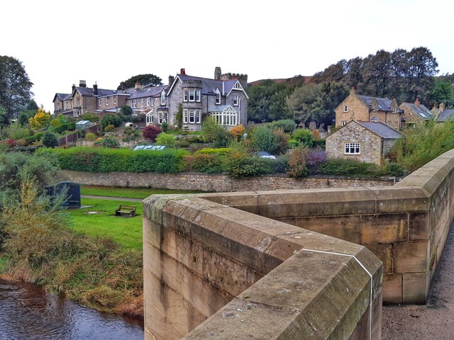
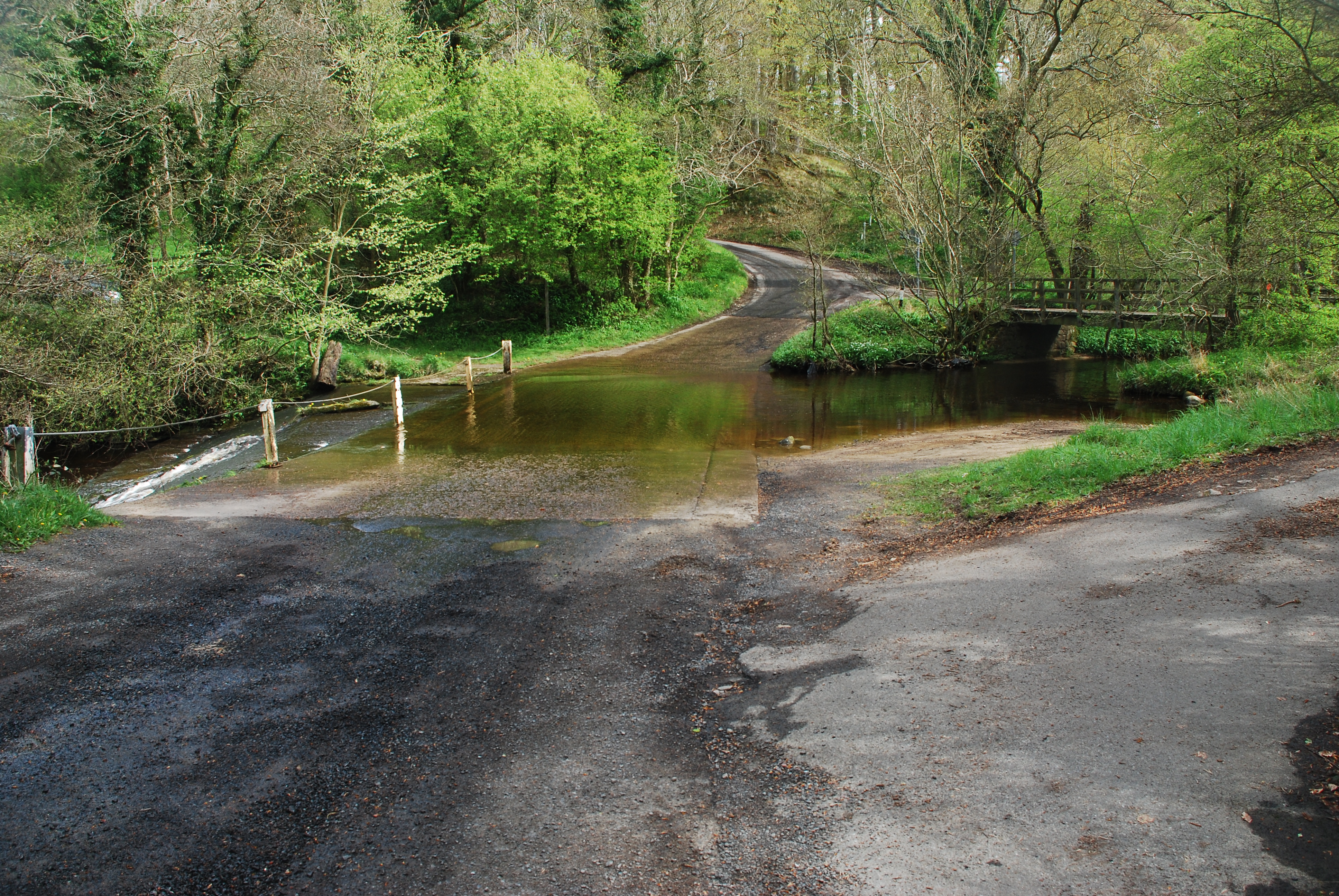
Whitton Dean is a picturesque village located in the valley of Northumberland, a county in the northeastern region of England. Situated amidst stunning natural beauty, the village is surrounded by rolling hills, lush green fields, and meandering streams.

With a population of around 300 residents, Whitton Dean is known for its close-knit community and peaceful atmosphere. The village is characterized by charming stone cottages, many of which date back several centuries, giving it a distinctly traditional and timeless feel. The local architecture is reflective of the region's rich history and heritage.

Despite its quaint size, Whitton Dean offers a range of amenities to its residents and visitors. The village has a well-maintained primary school, a village hall that hosts various community events, and a local pub that serves as a popular meeting spot for locals and visitors alike.

Nature enthusiasts are drawn to Whitton Dean for its stunning surroundings. The village serves as an excellent base for exploring the Northumberland National Park, which is renowned for its breathtaking landscapes, diverse wildlife, and extensive network of walking and cycling trails. Additionally, the nearby River Coquet offers opportunities for fishing and boating.

Overall, Whitton Dean offers a tranquil and idyllic escape from the hustle and bustle of city life. Its charming character, beautiful landscapes, and strong sense of community make it a hidden gem within Northumberland.

If you have any feedback on the listing, please let us know in the comments section below.

Whitton Dean Images

Images are sourced within 2km of 55.29603/-1.909623 or Grid Reference NU0500. Thanks to Geograph Open Source API. All images are credited.

The path to Simonside The path leaves the car park for the ascent of this striking hill.
The path to Simonside
The path leaves the car park for the ascent of this striking hill.
The slopes of the Simonside Hills Looking up towards the Beacon <a href="https://www.geograph.org.uk/gridref/NZ1498">NZ1498</a>, the easternmost summit.
The slopes of the Simonside Hills
Looking up towards the Beacon NZ1498, the easternmost summit.
Path below the Simonside Hills Garleigh Hill <a href="https://www.geograph.org.uk/gridref/NZ0699">NZ0699</a> on the skyline.
Path below the Simonside Hills
Garleigh Hill NZ0699 on the skyline.
Rothbury from River Coquet Bridge
Haw Hill, Rothbury from River Coquet Bridge
Bridge Street, Rothbury "A quiet street today; who would have thought that Bridge Street was once such a commercial area! 

Grocer and Drapers, Booksellers and Stationers, Game and Poultry Dealers, and Ironmongers, all plied their trade. There was even a Temperance Hotel, and at the southern most end of the bridge a Monumental Masons."

The building on the left was formerly the Boys' School built in 1841. The belfry and large windows were a particular feature of schools in this area. Its last use was that of a motor parts shop and it is currently Tomlinson's Cafe and Bunk house <a href="https://www.geograph.org.uk/photo/2515929">NU0501 : Tomlinson's Cafe and Bunkhouse</a>

<span class="nowrap"><a title="http://rothbury.co.uk/_viltrail/bridge.htm" rel="nofollow ugc noopener" href="http://rothbury.co.uk/_viltrail/bridge.htm">Link</a><img style="margin-left:2px;" alt="External link" title="External link - shift click to open in new window" src="https://s1.geograph.org.uk/img/external.png" width="10" height="10"/></span> <span class="nowrap"><a title="https://web.archive.org/web/20211025085917/http://rothbury.co.uk/_viltrail/bridge.htm" rel="nofollow ugc noopener" href="https://web.archive.org/web/20211025085917/http://rothbury.co.uk/_viltrail/bridge.htm">Archive Link</a><img style="margin-left:2px;" alt="External link" title="External link - shift click to open in new window" src="https://s1.geograph.org.uk/img/external.png" width="10" height="10"/></span>
Bridge Street, Rothbury
"A quiet street today; who would have thought that Bridge Street was once such a commercial area!  Grocer and Drapers, Booksellers and Stationers, Game and Poultry Dealers, and Ironmongers, all plied their trade. There was even a Temperance Hotel, and at the southern most end of the bridge a Monumental Masons." The building on the left was formerly the Boys' School built in 1841. The belfry and large windows were a particular feature of schools in this area. Its last use was that of a motor parts shop and it is currently Tomlinson's Cafe and Bunk house NU0501 : Tomlinson's Cafe and Bunkhouse LinkExternal link Archive LinkExternal link
All Saints Church sundial Clearly dated 1714 and with multiple dials, sadly missing its gnomons. This  substantial block of stone has apparently been removed from its original location and now rests on the ground beside the porch.  Excellent description at

<span class="nowrap"><a title="https://www.pendulumpublications.com/the-rothbury-sundials.html" rel="nofollow ugc noopener" href="https://www.pendulumpublications.com/the-rothbury-sundials.html">Link</a><img style="margin-left:2px;" alt="External link" title="External link - shift click to open in new window" src="https://s1.geograph.org.uk/img/external.png" width="10" height="10"/></span>
All Saints Church sundial
Clearly dated 1714 and with multiple dials, sadly missing its gnomons. This substantial block of stone has apparently been removed from its original location and now rests on the ground beside the porch. Excellent description at LinkExternal link
Surfeit of sundials These two 'scratch' or 'mass' sundials (the second one is just about visible 2½ stones to the left) are on the south wall of All Saints Church.  These are in addition to the 'main' one, <a href="https://www.geograph.org.uk/photo/7023460">NU0501 : All Saints Church sundial</a>
Surfeit of sundials
These two 'scratch' or 'mass' sundials (the second one is just about visible 2½ stones to the left) are on the south wall of All Saints Church. These are in addition to the 'main' one, NU0501 : All Saints Church sundial
Rothbury riverside path Beside the River Coquet and play park.
Rothbury riverside path
Beside the River Coquet and play park.
Inundated stepping stones With the River Coquet running high.
Crossing not recommended today!
Inundated stepping stones
With the River Coquet running high. Crossing not recommended today!
Storm Arwen devastation Reminiscent of Tunguska, there's not much left of the small area of forestry either side of the road at Lordenshaw.  As well as the many trees uprooted a large number have been simply snapped off by the storm's ferocity.
Storm Arwen devastation
Reminiscent of Tunguska, there's not much left of the small area of forestry either side of the road at Lordenshaw. As well as the many trees uprooted a large number have been simply snapped off by the storm's ferocity.
A prospect of Rothbury Seen from Dove Crag, the town of Rothbury in Coquetdale. Beyond the town, the plantations of the Cragside Estate.
A prospect of Rothbury
Seen from Dove Crag, the town of Rothbury in Coquetdale. Beyond the town, the plantations of the Cragside Estate.
A prospect of Rothbury The town of Rothbury in Coquetdale, with the woodlands of the Cragside Estate beyond. Seen from the Beacon in the Simonside Hills.
A prospect of Rothbury
The town of Rothbury in Coquetdale, with the woodlands of the Cragside Estate beyond. Seen from the Beacon in the Simonside Hills.
Memorial stone on the path to the Simonsides One could be excused for misreading the wording on this stone set in the path up to the Simonside Hills. Dr Alan Reece lived from 1927 to 2012. From 1956 to 1984 he was first lecturer and then reader in Agricultural Engineering at Newcastle University. He then left to run his own business as the Reece Engineering Group.
Memorial stone on the path to the Simonsides
One could be excused for misreading the wording on this stone set in the path up to the Simonside Hills. Dr Alan Reece lived from 1927 to 2012. From 1956 to 1984 he was first lecturer and then reader in Agricultural Engineering at Newcastle University. He then left to run his own business as the Reece Engineering Group.
Plantation beside the Newtown Park road Below the Simonside Hills.
Plantation beside the Newtown Park road
Below the Simonside Hills.
Descent from the Simonside Hills The car park on the Newtown Park Road can be seen at the foot of the hill. Garleigh Hill <a href="https://www.geograph.org.uk/gridref/NZ0699">NZ0699</a> can be seen beyond and to the right.
Descent from the Simonside Hills
The car park on the Newtown Park Road can be seen at the foot of the hill. Garleigh Hill NZ0699 can be seen beyond and to the right.
Tunguska, Lordenshaw Despite the devastation around it this dead tree and others remain upright. Presumably its lack of branches left it with significantly lower aerodynamic drag when Storm Arwen blasted this exposed ridge.
Tunguska, Lordenshaw
Despite the devastation around it this dead tree and others remain upright. Presumably its lack of branches left it with significantly lower aerodynamic drag when Storm Arwen blasted this exposed ridge.
Show me another place!

Whitton Dean is located at Grid Ref: NU0500 (Lat: 55.29603, Lng: -1.909623)

Unitary Authority: Northumberland

Police Authority: Northumbria

What 3 Words

///freedom.loses.haircuts. Near Rothbury, Northumberland

Related Wikis

Rothbury Community Hospital

Rothbury Community Hospital in Rothbury, Northumberland, England, is managed by the Northumbria Healthcare NHS Foundation Trust. == History == === Prior... ===

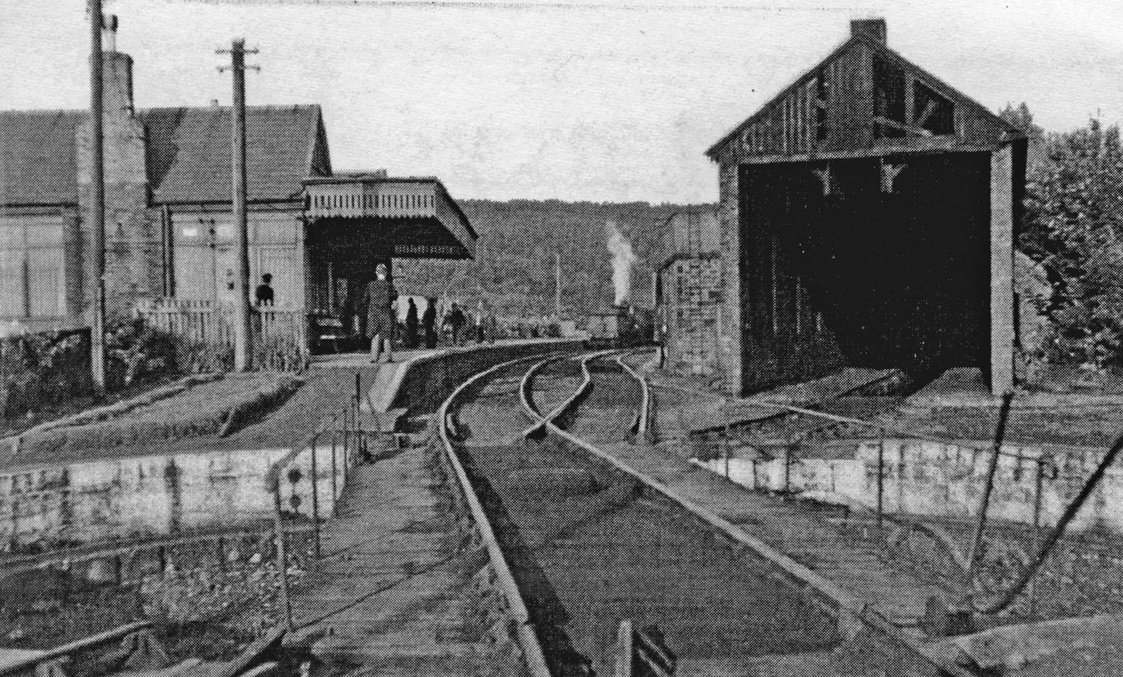
Rothbury railway station

Rothbury was a railway station in Northumberland, England at the end of the single-track Rothbury Branch that served the town of Rothbury. Rothbury was...

Rothbury

Rothbury is a market town and civil parish in Northumberland, England, on the River Coquet. It is 14 miles (22.5 km) northwest of Morpeth and 26 miles...

Thrum Mill, Rothbury, Northumberland

The Thrum Mill is a grade II-listed water mill in Rothbury, Northumberland, England. The water mill dates back to 1665. == Media == The renovation of Thrum...

Cragside

Cragside is a Victorian Tudor Revival country house near the town of Rothbury in Northumberland, England. It was the home of William Armstrong, 1st Baron...

Cragend Silo

Cragend Silo is a Grade II* listed building located at Cragend Farm near the town of Rothbury in Northumberland, England. It was designed and built by...

Brinkburn railway station

Brinkburn was a weatherboard- and corrugated-iron-built railway station in Northumberland on the Rothbury Branch built to serve the Healy Coate Colliery...

Hesleyhurst

Hesleyhurst is a civil parish in the county of Northumberland in England. At the 2011 Census the population was only minimal. It is served by a joint parish...

Nearby Amenities

Located within 500m of 55.29603,-1.909623
Power: pole
Lat/Long: 55.294112/-1.9160865
Power: pole
Lat/Long: 55.2946456/-1.9167909
Power: pole
Lat/Long: 55.2955866/-1.9173834
The data included in this document is from www.openstreetmap.org. The data is made available under ODbL.

Have you been to Whitton Dean?

Leave your review of Whitton Dean below (or comments, questions and feedback).