Leonardston

Settlement in Pembrokeshire

Wales

Leonardston

Neyland from Pembroke Dock
Neyland from Pembroke Dock Credit: Penny Mayes

The requested URL returned error: 429 Too Many Requests

If you have any feedback on the listing, please let us know in the comments section below.
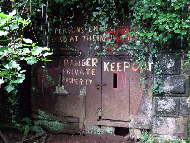
Leonardston Images

Images are sourced within 2km of 51.710128/-4.971171 or Grid Reference SM9405. Thanks to Geograph Open Source API. All images are credited.

Neyland from Pembroke Dock
Marina At Neyland On the northern side of the Milford Haven opposite Pembroke Dock.
Marina At Neyland
On the northern side of the Milford Haven opposite Pembroke Dock.
Pembroke Dock Pier near the ferry berth.
Pembroke Dock
Pier near the ferry berth.
Llanstadwell Village strung out along the north shore, opposite Pembroke Dock
Llanstadwell
Village strung out along the north shore, opposite Pembroke Dock
Hazelbeach Last greenery for a while, westward, before all the oil installations. The western edge of the village and small fields beside the classic ria of Milford Haven.  The sea now occupies a former river valley. The flooding occurred after the melting of the ice age glaciers (Northern Britain was like Greenland today).
Hazelbeach
Last greenery for a while, westward, before all the oil installations. The western edge of the village and small fields beside the classic ria of Milford Haven. The sea now occupies a former river valley. The flooding occurred after the melting of the ice age glaciers (Northern Britain was like Greenland today).
Roundabout  near Great Honeyborough At the junction of the A477 with the B4325.
Roundabout near Great Honeyborough
At the junction of the A477 with the B4325.
Llanstadwell Church With Pembroke Dock visible behind, across Milford Haven.
Llanstadwell Church
With Pembroke Dock visible behind, across Milford Haven.
Scoveston Fort  (disused) Looking from the B4325. The fort is there in amongst the scrub!
Scoveston Fort (disused)
Looking from the B4325. The fort is there in amongst the scrub!
Waterston Methodist Church Now surrounded by oil refinery.
Waterston Methodist Church
Now surrounded by oil refinery.
The Cleddau estuary View from the Pembroke Dock side of the Cleddau Bridge looking across the haven towards Neyland.
The Cleddau estuary
View from the Pembroke Dock side of the Cleddau Bridge looking across the haven towards Neyland.
Martello Tower (disused!) Looking west along Milford Haven from Pembroke Dock.
Martello Tower (disused!)
Looking west along Milford Haven from Pembroke Dock.
Martello Tower (disused!) Whilst the O.S. describe this as disused, the machine gun on top is, I believe, a more recent addition!
Looking towards Llanreath and Pennar Point.
Martello Tower (disused!)
Whilst the O.S. describe this as disused, the machine gun on top is, I believe, a more recent addition! Looking towards Llanreath and Pennar Point.
Pembroke Dock ferry terminal From Barrack Hill, looking across the Cleddau to Neyland.
Pembroke Dock ferry terminal
From Barrack Hill, looking across the Cleddau to Neyland.
Neyland from Hobbs Point Looking across the Cleddau.
Neyland from Hobbs Point
Looking across the Cleddau.
Looking down Milford Haven from Cleddau Bridge
Disused Dry Dock This dock is reputedy where the royal yacht Victoria and Albert was built
Disused Dry Dock
This dock is reputedy where the royal yacht Victoria and Albert was built
Oil storage tanks, Milford Haven The north shore of Milford Haven and the oil refinery storage tanks beyond, viewed from the Pembroke to Rosslare ferry.
Oil storage tanks, Milford Haven
The north shore of Milford Haven and the oil refinery storage tanks beyond, viewed from the Pembroke to Rosslare ferry.
Show me another place!

Leonardston is located at Grid Ref: SM9405 (Lat: 51.710128, Lng: -4.971171)

Unitary Authority: Pembrokeshire

Police Authority: Dyfed Powys

What 3 Words

///reckon.punctuate.farms. Near Neyland, Pembrokeshire

Nearby Locations

Hazelbank Leonardston

Related Wikis

Llanstadwell

Llanstadwell (Welsh: Llanudwal) is a small village, parish and community in south Pembrokeshire, Wales, on the north bank of the River Cleddau between...

Waterston

Waterston is a village near Milford Haven in Pembrokeshire, Wales, in the community and parish of Llanstadwell. The built-up area had a population of 335...

Scoveston Fort

Scoveston Fort, on the northern shore of Milford Haven, Pembrokeshire, Wales, U.K., is a Grade II Listed Building which belongs to a series of forts built...

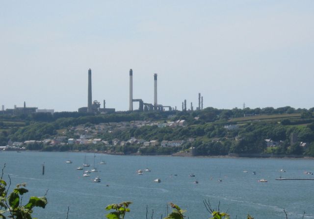
Gulf Refinery, Milford Haven

The Gulf Refinery at Milford Haven was an oil refinery situated on the Pembrokeshire coast in Wales. The refinery, originally owned and operated by Gulf...

Nearby Amenities

Located within 500m of 51.710128,-4.971171
Power: tower
Source: Bing
Lat/Long: 51.7136422/-4.9688245
Power: tower
Source: Bing
Lat/Long: 51.7129309/-4.9763991
Power: tower
Source: Bing
Lat/Long: 51.7133098/-4.9726333
Power: pole
Lat/Long: 51.7126665/-4.9769542
Power: pole
Lat/Long: 51.7139329/-4.9745187
Power: pole
Lat/Long: 51.714345/-4.9726948
Power: pole
Lat/Long: 51.7107703/-4.9644886
Power: pole
Lat/Long: 51.7107935/-4.9657975
Power: pole
Lat/Long: 51.7113702/-4.9670608
Power: pole
Lat/Long: 51.7119403/-4.9683148
Power: pole
Lat/Long: 51.712974/-4.9706376
Power: pole
Lat/Long: 51.7135307/-4.9718446
Power: pole
Lat/Long: 51.7139362/-4.9727994
Power: pole
Lat/Long: 51.7125203/-4.969613
Power: pole
Lat/Long: 51.7131917/-4.9694735
Power: pole
Lat/Long: 51.7139213/-4.969334
Direction: SSW
Generator Method: photovoltaic
Generator Output Electricity: yes
Generator Solar Modules: 15
Generator Source: solar
Generator Type: solar_photovoltaic_panel
Location: roof
Power: generator
Lat/Long: 51.7107968/-4.9710694
Direction: 165
Generator Method: photovoltaic
Generator Output Electricity: yes
Generator Solar Modules: 15
Generator Source: solar
Generator Type: solar_photovoltaic_panel
Location: roof
Power: generator
Lat/Long: 51.706429/-4.9693079
Direction: 190
Generator Method: photovoltaic
Generator Output Electricity: yes
Generator Solar Modules: 12
Generator Source: solar
Generator Type: solar_photovoltaic_panel
Location: roof
Power: generator
Lat/Long: 51.706495/-4.9717503
Direction: 190
Generator Method: photovoltaic
Generator Output Electricity: yes
Generator Solar Modules: 15
Generator Source: solar
Generator Type: solar_photovoltaic_panel
Location: roof
Power: generator
Lat/Long: 51.7061605/-4.9721745
Turning Circle
Lat/Long: 51.7063596/-4.97096
The data included in this document is from www.openstreetmap.org. The data is made available under ODbL.

Have you been to Leonardston?

Leave your review of Leonardston below (or comments, questions and feedback).