Lambskin Dale

Valley in Staffordshire Staffordshire Moorlands

England

Lambskin Dale

Old Milestone, Threapwood Head Cast iron post by the B5032, in parish of ALTON (STAFFORDSHIRE MOORLANDS District), by hedge, on North side of road. Cochrane iron casting, erected by the County Council in the 20th century.

Inscription reads:-
: ALTON 2½ / DENSTONE 4½ / ELLASTONE 6¼ / ASHBOURNE 11 : : ALTON / PARISH : : CHEADLE 2 :
Maker:- Cochrane & Co, Dudley. :

Milestone Society National ID: ST_ABCD11
Old Milestone, Threapwood Head Credit: Ivan Clare

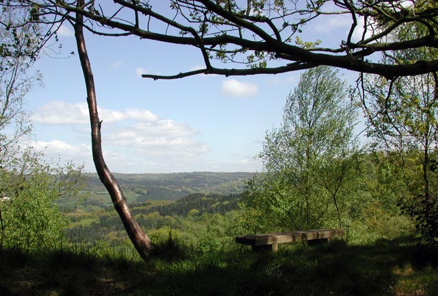
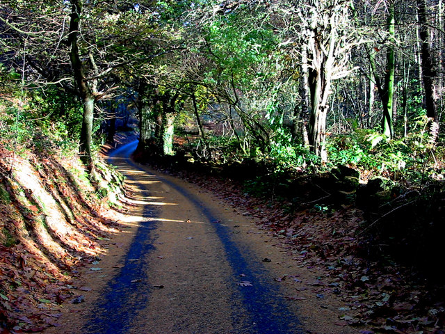
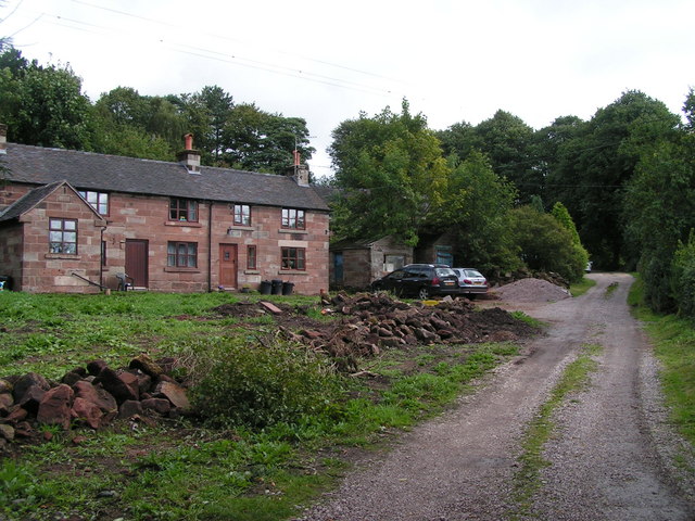
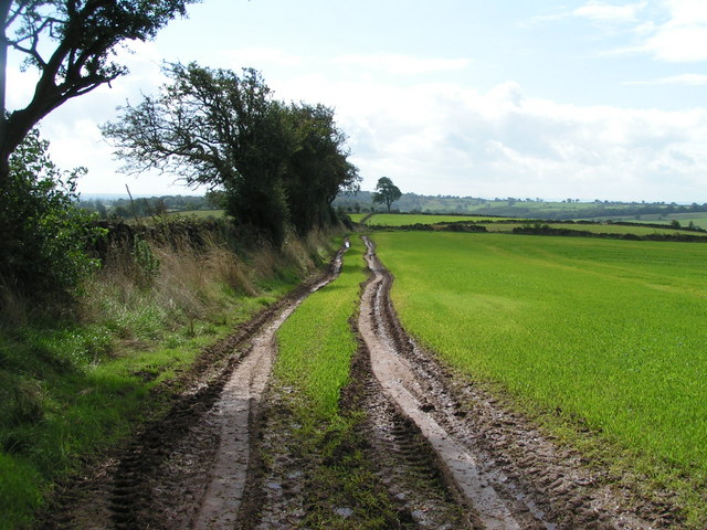
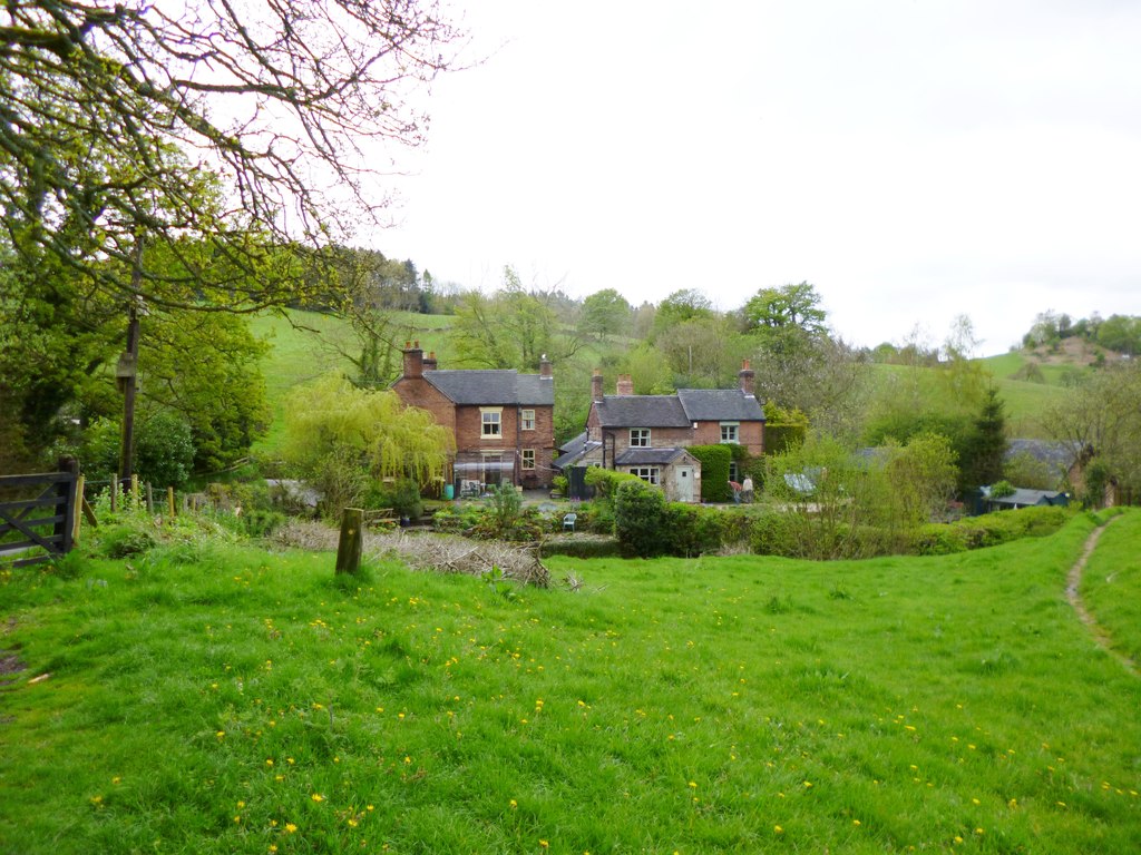
Lambskin Dale is a picturesque valley located in the county of Staffordshire, England. Situated within the Staffordshire Moorlands district, it is surrounded by rolling hills and lush green landscapes, offering a tranquil and idyllic setting for residents and visitors alike.

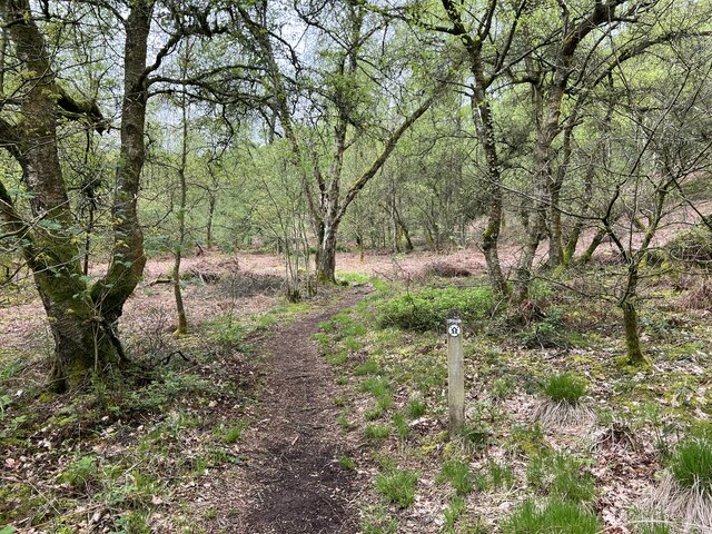
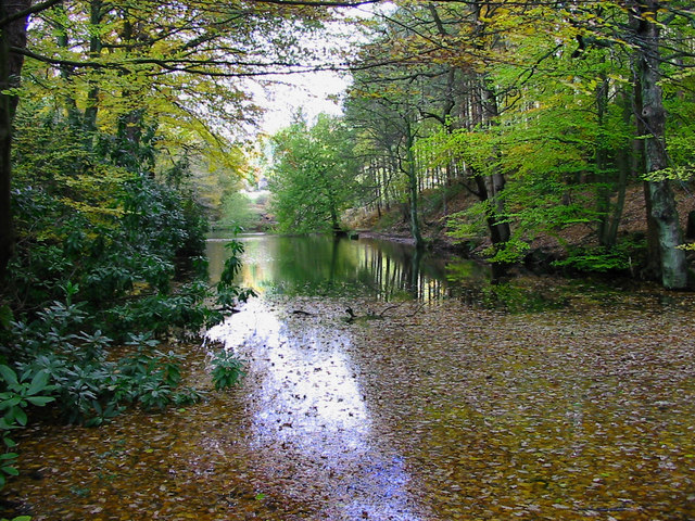
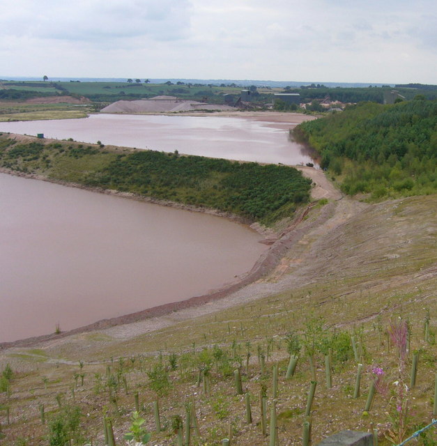
The valley is well-known for its natural beauty, with the River Trent meandering through it, adding to the charm and serenity of the area. The river serves as a popular spot for fishing and leisurely walks along its banks, allowing people to immerse themselves in the peacefulness of the surroundings.

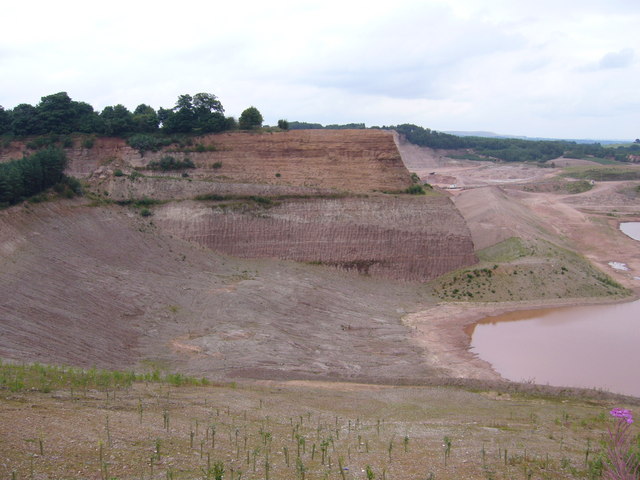
Lambskin Dale is also home to an abundance of wildlife, with various species of birds, mammals, and plants thriving in the area. Nature enthusiasts can enjoy spotting local wildlife and exploring the diverse flora and fauna that make the valley their habitat.

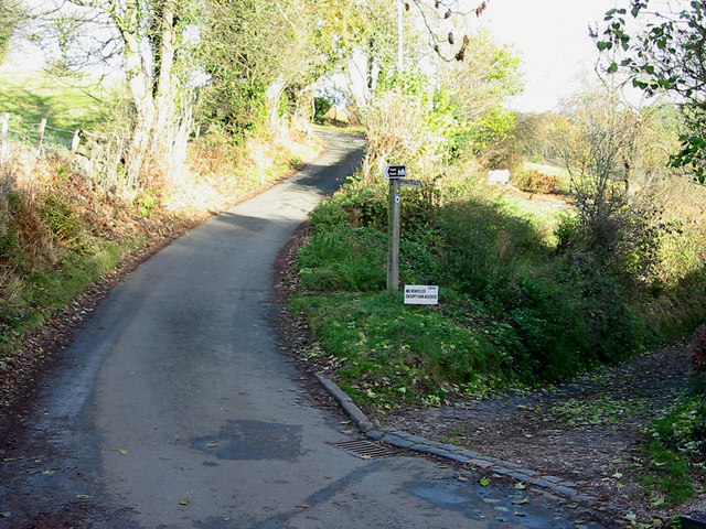
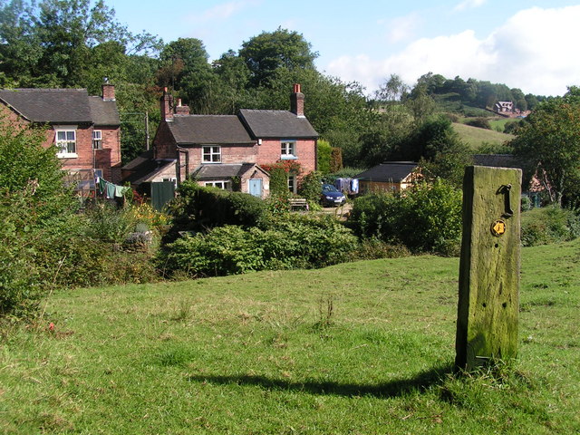
The village of Lambskin Dale itself is small and close-knit, with a population of around 500 residents. It boasts a strong sense of community, with a local pub, a village hall, and a primary school serving the needs of the inhabitants. The village is known for its friendly and welcoming atmosphere, making it an ideal place to live or visit for those seeking a peaceful retreat.

In addition to its natural beauty, Lambskin Dale offers opportunities for outdoor activities such as hiking, cycling, and picnicking, making it a popular destination for outdoor enthusiasts and nature lovers. With its serene surroundings and community spirit, Lambskin Dale, Staffordshire, truly embodies the charm and beauty of rural England.

If you have any feedback on the listing, please let us know in the comments section below.

Lambskin Dale Images

Images are sourced within 2km of 52.986559/-1.9504453 or Grid Reference SK0343. Thanks to Geograph Open Source API. All images are credited.

Old Milestone, Threapwood Head Cast iron post by the B5032, in parish of ALTON (STAFFORDSHIRE MOORLANDS District), by hedge, on North side of road. Cochrane iron casting, erected by the County Council in the 20th century.

Inscription reads:-
: ALTON 2½ / DENSTONE 4½ / ELLASTONE 6¼ / ASHBOURNE 11 : : ALTON / PARISH : : CHEADLE 2 :
Maker:- Cochrane & Co, Dudley. :

Milestone Society National ID: ST_ABCD11
Old Milestone, Threapwood Head
Cast iron post by the B5032, in parish of ALTON (STAFFORDSHIRE MOORLANDS District), by hedge, on North side of road. Cochrane iron casting, erected by the County Council in the 20th century. Inscription reads:- : ALTON 2½ / DENSTONE 4½ / ELLASTONE 6¼ / ASHBOURNE 11 : : ALTON / PARISH : : CHEADLE 2 : Maker:- Cochrane & Co, Dudley. : Milestone Society National ID: ST_ABCD11
Highshutt entrance to Hawksmoor NT Hawksmoor is an ancient steep-sided oak woodland
Highshutt entrance to Hawksmoor NT
Hawksmoor is an ancient steep-sided oak woodland
Path through Hawksmoor NT Hawksmoor is an ancient steep-sided oak woodland east of Cheadle in Staffordshire towards Oakamoor. It is managed by the National Trust. The habitat attracts specialised bird species such as Wood Warbler and Pied Flycatcher.
Path through Hawksmoor NT
Hawksmoor is an ancient steep-sided oak woodland east of Cheadle in Staffordshire towards Oakamoor. It is managed by the National Trust. The habitat attracts specialised bird species such as Wood Warbler and Pied Flycatcher.
Car parking for Hawksmoor NT 'Limited parking for approx. 6 cars' states the National Trust website, and this is it. However even more limited off-road parking is possible at Highshutt further west outside the entrance shown here <a title="https://www.geograph.org.uk/photo/7667028" href="https://www.geograph.org.uk/photo/7667028">Link</a>
Car parking for Hawksmoor NT
'Limited parking for approx. 6 cars' states the National Trust website, and this is it. However even more limited off-road parking is possible at Highshutt further west outside the entrance shown here Link
Path through Hawksmoor NT Hawksmoor is an ancient steep-sided oak woodland east of Cheadle in Staffordshire towards Oakamoor. It is managed by the National Trust. The habitat attracts specialised bird species such as Wood Warbler and Pied Flycatcher.
Path through Hawksmoor NT
Hawksmoor is an ancient steep-sided oak woodland east of Cheadle in Staffordshire towards Oakamoor. It is managed by the National Trust. The habitat attracts specialised bird species such as Wood Warbler and Pied Flycatcher.
Les Oakes's Place This remarkable structure was built from salvaged materials by scrap dealer Les Oakes. It incorporates doors, windows, and name stones from demolished buildings, and was described as "agricultural" to avoid having to get planning permission. This and other buildings on the site house a vast collection of vintage memorabilia, including horse-drawn vehicles from around the country. Sadly Mr Oakes was killed in a road accident in 2000, but his sons maintain the tradition of the business as "architectural reclamation".
Les Oakes's Place
This remarkable structure was built from salvaged materials by scrap dealer Les Oakes. It incorporates doors, windows, and name stones from demolished buildings, and was described as "agricultural" to avoid having to get planning permission. This and other buildings on the site house a vast collection of vintage memorabilia, including horse-drawn vehicles from around the country. Sadly Mr Oakes was killed in a road accident in 2000, but his sons maintain the tradition of the business as "architectural reclamation".
Door, Les Oakes's Place A doorway salvaged from a pub, typical of the material used by scrap dealer Les Oakes to construct a building to house his vast collection of memorabilia. The door leads nowhere.
Door, Les Oakes's Place
A doorway salvaged from a pub, typical of the material used by scrap dealer Les Oakes to construct a building to house his vast collection of memorabilia. The door leads nowhere.
View from Hawksmoor Reserve (NT)
Dimmingsdale in Autumn Autumnal leaves cover one of several ponds in Dimmingsdale in the Staffordshire Moorlands.
Dimmingsdale in Autumn
Autumnal leaves cover one of several ponds in Dimmingsdale in the Staffordshire Moorlands.
Country Lane The Threapwood to Oakamoor road showing the western entrance to Dimmingsdale
Country Lane
The Threapwood to Oakamoor road showing the western entrance to Dimmingsdale
Autumn Lane A country lane near Oakamoor in the Staffordshire Moorlands covered in pine needles.
Autumn Lane
A country lane near Oakamoor in the Staffordshire Moorlands covered in pine needles.
Croxden Quarry Freehay. Until a few years ago Counslow Road ran more or less level from the photographer's position to the top of the far cliff (a point about one third of the picture width from the left hand edge). The current Multimap aerial image <span class="nowrap"><a title="http://www.multimap.com/map/photo.cgi?x=402638&y=341787&scale=10000" rel="nofollow ugc noopener" href="http://www.multimap.com/map/photo.cgi?x=402638&y=341787&scale=10000">Link</a><img style="margin-left:2px;" alt="External link" title="External link - shift click to open in new window" src="https://s1.geograph.org.uk/img/external.png" width="10" height="10"/></span> shows the road intact and the new Counslow Road being constructed in a sweeping curve to the west and north. The new road opened in 2000 at a cost of £2 million. Since then Tarmac, the quarry operators have carved out this great trench.
Croxden Quarry
Freehay. Until a few years ago Counslow Road ran more or less level from the photographer's position to the top of the far cliff (a point about one third of the picture width from the left hand edge). The current Multimap aerial image LinkExternal link shows the road intact and the new Counslow Road being constructed in a sweeping curve to the west and north. The new road opened in 2000 at a cost of £2 million. Since then Tarmac, the quarry operators have carved out this great trench.
Croxden Quarry in Freehay. From the same viewpoint as <a href="https://www.geograph.org.uk/photo/223705">SK0241 : Croxden Quarry</a>. The sand and gravel processing plants can be seen in the distance. In the foreground the quarry operators, Tarmac have already started tree planting for the eventual restoration of the site.
Croxden Quarry
in Freehay. From the same viewpoint as SK0241 : Croxden Quarry. The sand and gravel processing plants can be seen in the distance. In the foreground the quarry operators, Tarmac have already started tree planting for the eventual restoration of the site.
Croxden Quarry near Freehay. In this area the contractors, Tarmac have got no further than removing the overburden. But within the next ten years this area will be dug out to a depth of 30 metres or more. In the foreground there is a curious metal "wall" with a curved top about a metre high. This may well be to keep some species of small furry animal out of the dangerous site.
Croxden Quarry
near Freehay. In this area the contractors, Tarmac have got no further than removing the overburden. But within the next ten years this area will be dug out to a depth of 30 metres or more. In the foreground there is a curious metal "wall" with a curved top about a metre high. This may well be to keep some species of small furry animal out of the dangerous site.
Oldfurnace Cottages at Oldfurnace from the footpath to Newton.
Oldfurnace
Cottages at Oldfurnace from the footpath to Newton.
Newton Newly renovated cottages in the local pink stone. Newton is a cluster of cottages set back from the road down a gravelled track.
Newton
Newly renovated cottages in the local pink stone. Newton is a cluster of cottages set back from the road down a gravelled track.
Ridge above Bradley Elms A footpath follows the crest of this broad ridge from Newton to Great Gate, with views to the quarries to the west and Alton Towers to the northeast.
Ridge above Bradley Elms
A footpath follows the crest of this broad ridge from Newton to Great Gate, with views to the quarries to the west and Alton Towers to the northeast.
View from Alton Common Looking west with (I think) the Weaver Hills (<a href="https://www.geograph.org.uk/gridref/SK0946">SK0946</a>) in the distance, left.
View from Alton Common
Looking west with (I think) the Weaver Hills (SK0946) in the distance, left.
Show me another place!

Lambskin Dale is located at Grid Ref: SK0343 (Lat: 52.986559, Lng: -1.9504453)

Administrative County: Staffordshire

District: Staffordshire Moorlands

Police Authority: Staffordshire

What 3 Words

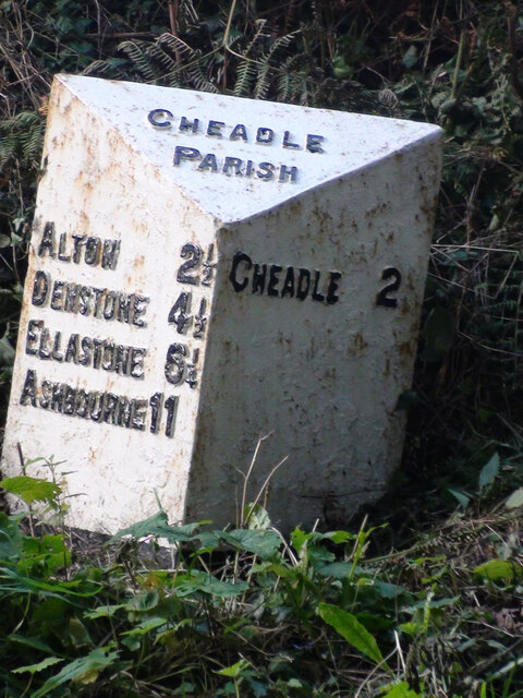
///onion.cuddled.warnings. Near Cheadle, Staffordshire

Related Wikis

The Old Furnace

The Old Furnace is a colloquial name given to an historic site in Oakamoor, Staffordshire, England, that supported the development of medieval and post...

Woodhead Hall

Woodhead Hall is a country house at Cheadle in Staffordshire. It is a Grade II listed building. == History == Woodhead Hall was originally commissioned...

Oakamoor railway station

Oakamoor railway station is a closed railway station in the Churnet Valley, Staffordshire. The station was opened in 1849 as part of the Churnet Valley...

Oakamoor Tunnel

Oakamoor Tunnel is a disused 497-yard (454 m) long tunnel located north of Oakamoor railway station on the former Uttoxeter to North Rode section of the...

Freehay

Freehay is a small village located 2 miles from the centre of Cheadle in Staffordshire, England. The village centre is at the main Freehay Bank (or Church...

Cheadle, Staffordshire

Cheadle is a market town and civil parish in the Staffordshire Moorlands District of Staffordshire, England, with a population of 12,000 at the 2021 census...

Tean Road Sports Ground

Tean Road Sports Ground is a cricket ground in Cheadle, Staffordshire. The ground is located south of the town centre along the Tean Road, which itself...

St Giles' Catholic Church, Cheadle

St. Giles' Church is a Roman Catholic church in the town of Cheadle, Staffordshire, England. The Grade I listed Gothic Revival church was designed by Augustus...

Nearby Amenities

Located within 500m of 52.986559,-1.9504453
Man Made: tower
Tower Type: communication
Lat/Long: 52.9889488/-1.9561324
Barrier: stile
Stile: stepover
Lat/Long: 52.9902842/-1.9542992
The data included in this document is from www.openstreetmap.org. The data is made available under ODbL.

Have you been to Lambskin Dale?

Leave your review of Lambskin Dale below (or comments, questions and feedback).