Green Owlers Clough

Valley in Yorkshire

England

Green Owlers Clough

Hades A farm just above Marsden. Those with local knowledge might know whether this is pronounced "haids" or "haideez".
Hades Credit: John Illingworth

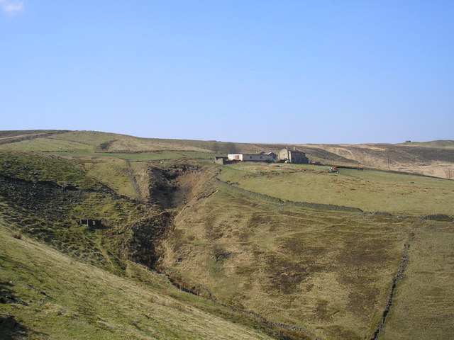
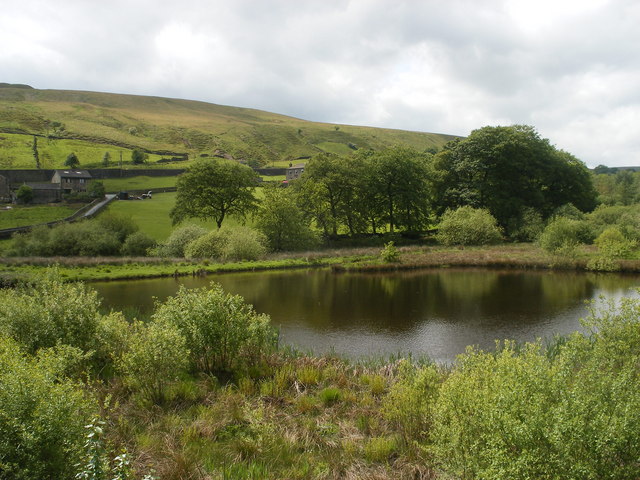
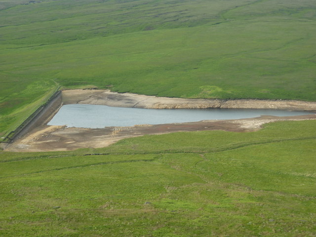
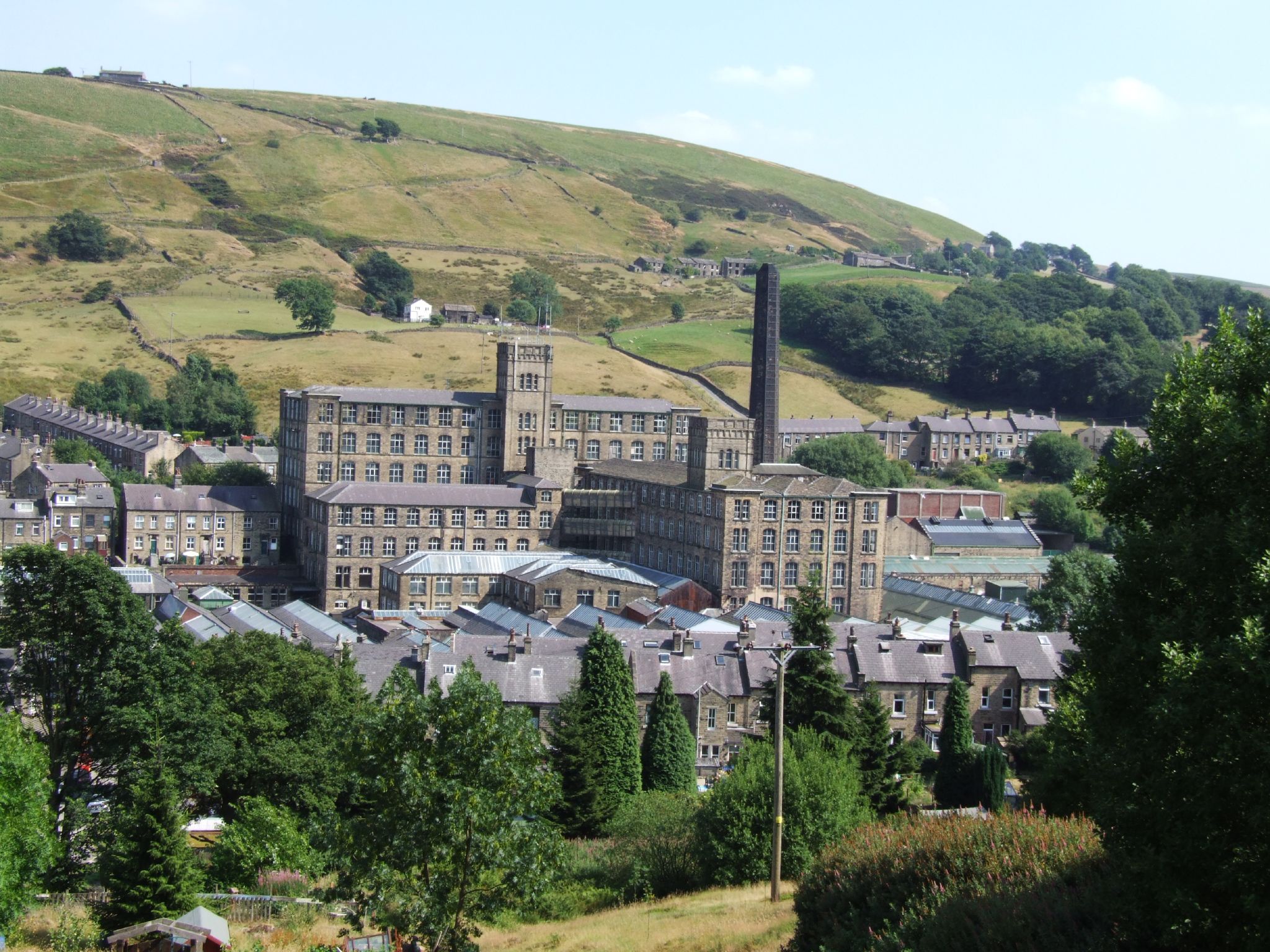
Green Owlers Clough is a picturesque valley located in Yorkshire, England. Nestled within the breathtaking landscape of the Peak District National Park, this enchanting natural wonder is a haven for nature enthusiasts and hikers alike.

The valley is characterized by its lush greenery, rolling hills, and meandering streams. It stretches for approximately two miles, offering visitors a tranquil escape from the hustle and bustle of city life. The name "Clough" refers to the steep-sided valley, which was carved out by glaciers during the ice age.

The area is renowned for its diverse range of flora and fauna. Visitors can spot a variety of bird species, including the elusive green owler, after which the clough is named. The valley is also home to an array of wildflowers, adding a splash of color to the landscape during the spring and summer months.

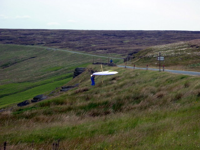
Hiking trails crisscross the valley, allowing visitors to explore its natural beauty at their own pace. The routes cater to all levels of fitness, with options for leisurely strolls or more challenging hikes up the surrounding hills. Along the way, hikers can enjoy breathtaking panoramic views of the Yorkshire countryside.

Green Owlers Clough is a popular destination for outdoor activities such as picnicking, photography, and wildlife spotting. Its serene atmosphere and unspoiled beauty make it a must-visit location for anyone seeking a peaceful retreat in the heart of nature.

If you have any feedback on the listing, please let us know in the comments section below.

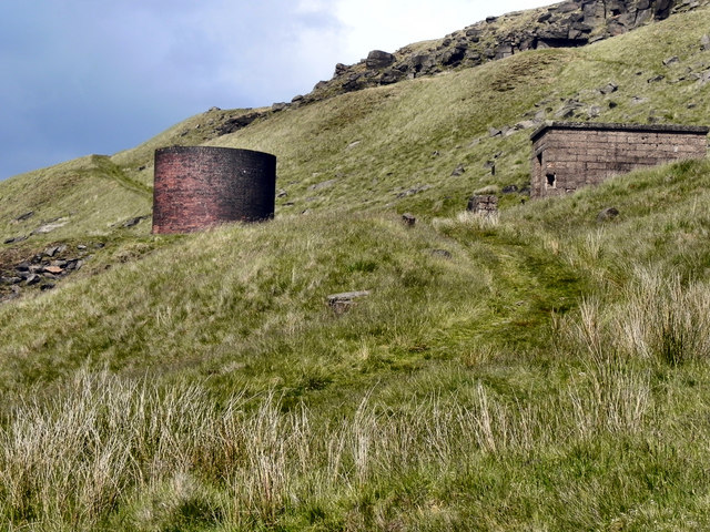
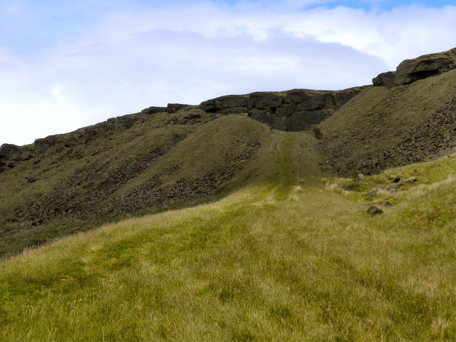
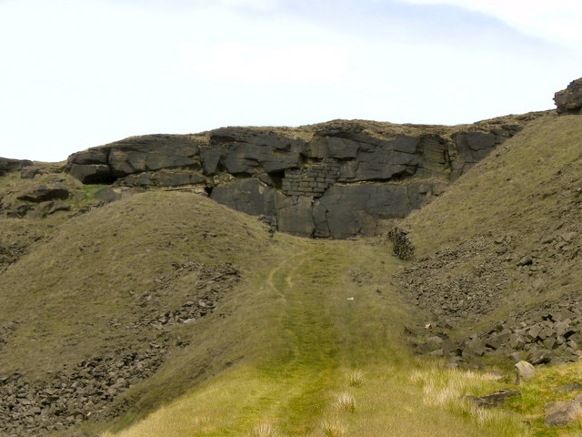
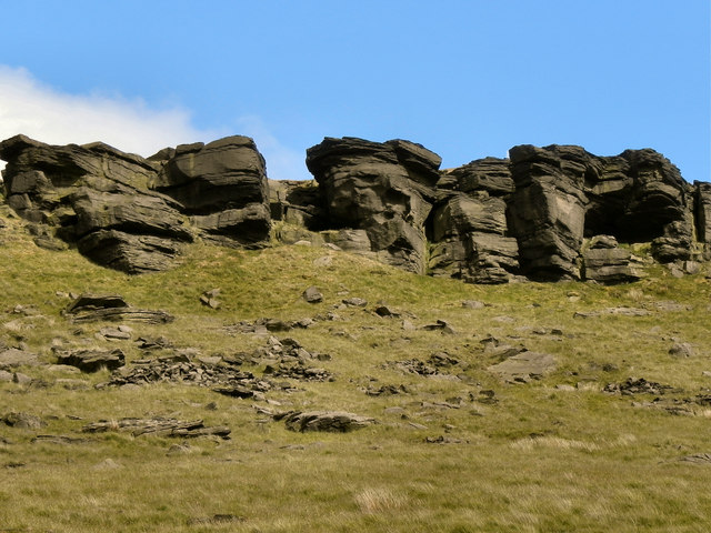
Green Owlers Clough Images

Images are sourced within 2km of 53.60993/-1.9597279 or Grid Reference SE0212. Thanks to Geograph Open Source API. All images are credited.

Hades A farm just above Marsden. Those with local knowledge might know whether this is pronounced "haids" or "haideez".
Hades
A farm just above Marsden. Those with local knowledge might know whether this is pronounced "haids" or "haideez".
Trip Boat on the Huddersfield Narrow Canal The boat takes visitors into the nearby Standedge canal tunnel (there are four tunnels at this point - three railway and one canal).

Unfortunately on this day, there wasn't enough water in the canal for tunnel tripping!
Trip Boat on the Huddersfield Narrow Canal
The boat takes visitors into the nearby Standedge canal tunnel (there are four tunnels at this point - three railway and one canal). Unfortunately on this day, there wasn't enough water in the canal for tunnel tripping!
A62 near Tunnel End
A62 near Tunnel End
Small reservoir above Tunnel End
Cottages near Tunnel End
New Hey Road at Dean Head Moss
New Hey Road at Cupwith Hill Moss
Buckstone Edge
Buckstone Edge
March Haigh Reservoir from Buckstones
Getting ready for take off A hang glider is just about to take off, Buckstones of New Hey Road.
Getting ready for take off
A hang glider is just about to take off, Buckstones of New Hey Road.
Over Standedge Tunnels Three railway tunnels (two disused) and a canal tunnel pass under here. The round, brick tower houses a ventilation shaft. I'm not sure about the derelict building in the foreground, but that may also have been connected with the construction of the tunnel.
Over Standedge Tunnels
Three railway tunnels (two disused) and a canal tunnel pass under here. The round, brick tower houses a ventilation shaft. I'm not sure about the derelict building in the foreground, but that may also have been connected with the construction of the tunnel.
Standedge Tunnel Ventilation Tower Standedge is a moorland escarpment in the Pennines, between Marsden and Diggle. It has been a major moorland crossing point since Roman times and possibly earlier. 

Four parallel tunnels run under Standedge from Diggle to Marsden. The canal tunnel is the oldest of these, having been opened in 1811 as part of the Huddersfield Narrow Canal, and is still in use. The three railway tunnels were opened respectively in 1848, 1871 and 1894; only the 1894 tunnel still carries rail traffic. (<span class="nowrap"><a title="http://en.wikipedia.org/wiki/Standedge" rel="nofollow ugc noopener" href="http://en.wikipedia.org/wiki/Standedge">Link</a><img style="margin-left:2px;" alt="External link" title="External link - shift click to open in new window" src="https://s1.geograph.org.uk/img/external.png" width="10" height="10"/></span> )

This is one of the ventilation shafts providing air to the tunnels.
Standedge Tunnel Ventilation Tower
Standedge is a moorland escarpment in the Pennines, between Marsden and Diggle. It has been a major moorland crossing point since Roman times and possibly earlier. Four parallel tunnels run under Standedge from Diggle to Marsden. The canal tunnel is the oldest of these, having been opened in 1811 as part of the Huddersfield Narrow Canal, and is still in use. The three railway tunnels were opened respectively in 1848, 1871 and 1894; only the 1894 tunnel still carries rail traffic. (LinkExternal link ) This is one of the ventilation shafts providing air to the tunnels.
Ventilation Shafts Above The Standedge Tunnels Four parallel tunnels run under Standedge from Diggle to Marsden. The canal tunnel is the oldest of these, having been opened in 1811 as part of the Huddersfield Narrow Canal, and is still in use. The three railway tunnels were opened respectively in 1848, 1871 and 1894; only the 1894 tunnel still carries rail traffic.

This is one of the ventilation shafts providing air to the tunnels.
Ventilation Shafts Above The Standedge Tunnels
Four parallel tunnels run under Standedge from Diggle to Marsden. The canal tunnel is the oldest of these, having been opened in 1811 as part of the Huddersfield Narrow Canal, and is still in use. The three railway tunnels were opened respectively in 1848, 1871 and 1894; only the 1894 tunnel still carries rail traffic. This is one of the ventilation shafts providing air to the tunnels.
Pule Hill Quarry Incline Quarried grit used to be taken down to the road. This is taken from about half way up the 65 foot rise.
Pule Hill Quarry Incline
Quarried grit used to be taken down to the road. This is taken from about half way up the 65 foot rise.
Former Quarry, Pule Hill, Standedge
Millstone Grit Escarpment, Pule Hill, Standedge
View from the Side of Pule Hill Looking north, on the west slope of Pule Hill. Ahead is <a href="https://www.geograph.org.uk/photo/2464113">SE0210 : Standedge Tunnel Ventilation Tower</a>, below is the A62, Standedge cutting.
View from the Side of Pule Hill
Looking north, on the west slope of Pule Hill. Ahead is SE0210 : Standedge Tunnel Ventilation Tower, below is the A62, Standedge cutting.
Standedge Tunnel Ventilation
Show me another place!

Green Owlers Clough is located at Grid Ref: SE0212 (Lat: 53.60993, Lng: -1.9597279)

Division: West Riding

Unitary Authority: Kirklees

Police Authority: West Yorkshire

What 3 Words

///wolves.removals.about. Near Marsden, West Yorkshire

Related Wikis

Marsden Moor Estate

The Marsden Moor Estate is a large expanse of moorland in the South Pennines, between the conurbations of West Yorkshire and Greater Manchester in the...

Marsden railway station

Marsden railway station serves the village of Marsden near Huddersfield in West Yorkshire, England. The station is on the Huddersfield Line, operated by...

A640 road

The A640 is a road in England which runs between Rochdale in Greater Manchester and Huddersfield in West Yorkshire. The road's most westbound point as...

Marsden, West Yorkshire

Marsden is a large village in the Colne Valley, in the metropolitan borough of Kirklees, West Yorkshire, England. It is in the South Pennines close to...

Nearby Amenities

Located within 500m of 53.60993,-1.9597279
Passing Place
Lat/Long: 53.6076385/-1.9582939
Green Owlers
Place: hamlet
Lat/Long: 53.6102396/-1.9578416
Ford: yes
Note: You just step over the stream, or perhaps use a rock to step on
Lat/Long: 53.6109636/-1.9624334
Barrier: stile
Material: wood
Lat/Long: 53.6110124/-1.962233
Whitehall Farm
Fixme: This needs doing properly, perhaps with a relation
Lat/Long: 53.6112428/-1.9621405
Barrier: stile
Material: stone
Stile: squeezer
Width: 0.4
Lat/Long: 53.6086656/-1.956654
Barrier: stile
Material: wood
Lat/Long: 53.6086543/-1.9566353
Barrier: stile
Material: wood
Lat/Long: 53.6077005/-1.9555693
Barrier: stile
Material: stone
Stile: squeezer
Width: 0.3
Lat/Long: 53.607697/-1.9555647
Ford: stepping_stones
Lat/Long: 53.6057103/-1.958899
Ford: yes
Lat/Long: 53.6057398/-1.9589066
Man Made: marker_post
Material: wood
Lat/Long: 53.6057251/-1.9591807
Bench
Backrest: yes
Material: wood
Lat/Long: 53.6096873/-1.9556321
Information: guidepost
Tourism: information
Lat/Long: 53.6110628/-1.9589451
Information: guidepost
Tourism: information
Lat/Long: 53.6101767/-1.9577896
Ford: yes
Lat/Long: 53.6063662/-1.9600725
Ford: yes
Lat/Long: 53.6069653/-1.9606217
Ford: yes
Lat/Long: 53.608861/-1.9626472
Man Made: mast
Tower Type: communication
Lat/Long: 53.6096869/-1.9581432
Man Made: mast
Tower Type: communication
Lat/Long: 53.6096649/-1.9586935
Material: wood
Power: pole
Lat/Long: 53.6100496/-1.9581965
Material: wood
Power: pole
Lat/Long: 53.6097746/-1.9578082
Material: wood
Power: pole
Lat/Long: 53.6093525/-1.9572492
Material: wood
Power: pole
Lat/Long: 53.6104837/-1.9587616
Material: wood
Power: pole
Lat/Long: 53.6089877/-1.9559037
Material: wood
Power: pole
Lat/Long: 53.6086925/-1.9547692
Material: wood
Power: pole
Lat/Long: 53.6083145/-1.9533704
Material: wood
Power: pole
Lat/Long: 53.6109641/-1.9594058
Material: wood
Power: pole
Lat/Long: 53.6115402/-1.9607783
Bench
Backrest: no
Direction: NE
Material: wood
Lat/Long: 53.6055914/-1.9586972
Bench
Backrest: no
Direction: NW;SE
Material: wood
Lat/Long: 53.6056249/-1.958885
The data included in this document is from www.openstreetmap.org. The data is made available under ODbL.

Have you been to Green Owlers Clough?

Leave your review of Green Owlers Clough below (or comments, questions and feedback).