Crabtree Valley

Valley in Staffordshire Stafford

England

Crabtree Valley

The fernery at the Wolseley Centre A plaque reads 'Planted in memory of Margaret Kingston (1934 - 2011) from dionations given to Friends of Cannock Chase in her memory'. The Wolseley Centre is the HQ of the Staffordshire Wildlife Trust, with extensive grounds, two lakes, a cafe and a gift shop.
The fernery at the Wolseley Centre Credit: Christine Johnstone

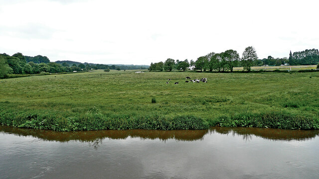
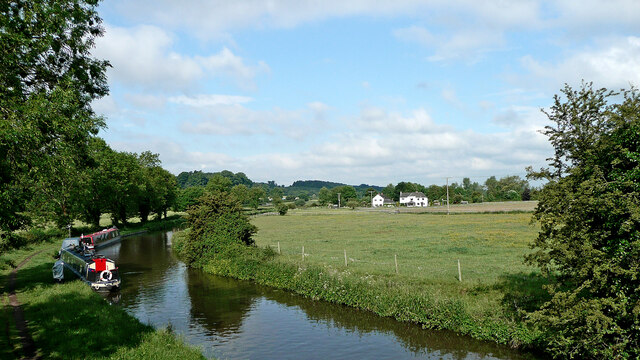
Crabtree Valley, located in Staffordshire, is a picturesque and serene valley that offers visitors a tranquil escape from the hustle and bustle of daily life. Nestled amidst rolling hills and lush greenery, this valley is a popular destination for nature lovers and outdoor enthusiasts.

Crabtree Valley is renowned for its breathtaking beauty, with its panoramic views and diverse wildlife. The valley is home to a variety of flora and fauna, including ancient oak trees, wildflowers, and a plethora of bird species. Walking trails wind their way through the valley, allowing visitors to immerse themselves in the natural splendor and experience the peacefulness that the valley has to offer.

For those seeking adventure, Crabtree Valley also offers opportunities for hiking, cycling, and horseback riding. The valley's rugged terrain and well-maintained paths provide a challenge for outdoor enthusiasts of all skill levels. Additionally, the nearby Crabtree Farm offers horse riding lessons and guided treks, allowing visitors to explore the valley from a unique perspective.

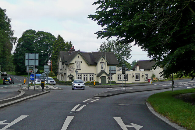
Crabtree Valley is also home to a charming café and gift shop, where visitors can relax and enjoy a cup of tea or browse through locally made crafts and souvenirs. The café's outdoor seating area provides stunning views of the valley, making it a perfect spot to unwind after a day of exploring.

Overall, Crabtree Valley in Staffordshire is a hidden gem that offers a peaceful retreat in the heart of nature. Its scenic beauty, diverse wildlife, and range of outdoor activities make it a must-visit destination for anyone seeking tranquility and a connection with the natural world.

If you have any feedback on the listing, please let us know in the comments section below.

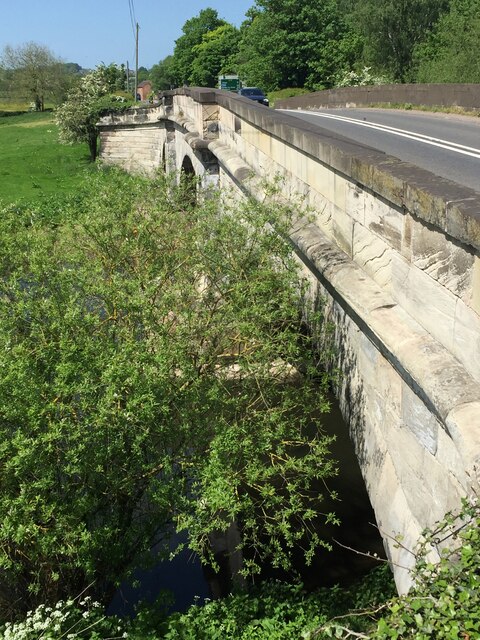
Crabtree Valley Images

Images are sourced within 2km of 52.764873/-1.98124 or Grid Reference SK0118. Thanks to Geograph Open Source API. All images are credited.

The fernery at the Wolseley Centre A plaque reads 'Planted in memory of Margaret Kingston (1934 - 2011) from dionations given to Friends of Cannock Chase in her memory'. The Wolseley Centre is the HQ of the Staffordshire Wildlife Trust, with extensive grounds, two lakes, a cafe and a gift shop.
The fernery at the Wolseley Centre
A plaque reads 'Planted in memory of Margaret Kingston (1934 - 2011) from dionations given to Friends of Cannock Chase in her memory'. The Wolseley Centre is the HQ of the Staffordshire Wildlife Trust, with extensive grounds, two lakes, a cafe and a gift shop.
Half-buried structure at the Wolseley Centre Possibly the remains of an ice house? The Wolseley Centre is the HQ of the Staffordshire Wildlife Trust, with extensive grounds, two lakes, a cafe and a gift shop.
Half-buried structure at the Wolseley Centre
Possibly the remains of an ice house? The Wolseley Centre is the HQ of the Staffordshire Wildlife Trust, with extensive grounds, two lakes, a cafe and a gift shop.
London Road near Little Haywood, Staffordshire This is the A51 London Road, looking south-east towards the A513 junction, and Rugeley. The bridge ahead crosses the River Trent.
London Road near Little Haywood, Staffordshire
This is the A51 London Road, looking south-east towards the A513 junction, and Rugeley. The bridge ahead crosses the River Trent.
River Trent near Little Haywood in Staffordshire Looking downstream, north-west from London Road (A51) at Wolseley Bridge.
River Trent near Little Haywood in Staffordshire
Looking downstream, north-west from London Road (A51) at Wolseley Bridge.
Pasture by the River Trent in Staffordshire Looking across the River Trent from Wolseley Bridge, south-east of Colwich. The lin of trees beyond the grazing cattle is by the Trent and Mersey Canal.
Pasture by the River Trent in Staffordshire
Looking across the River Trent from Wolseley Bridge, south-east of Colwich. The lin of trees beyond the grazing cattle is by the Trent and Mersey Canal.
The Wolseley Arms near Colwich in Staffordshire Looking west-north-west along the A51 London Road, this is at the junction with the A513 to Stafford, off to the left.
The Wolseley Arms near Colwich in Staffordshire
Looking west-north-west along the A51 London Road, this is at the junction with the A513 to Stafford, off to the left.
The Wolseley Arms near Colwich in Staffordshire Looking west-north-west on the A51 London Road, this is at the junction with the A513 to Stafford, leading off to the left.
The Wolseley Arms near Colwich in Staffordshire
Looking west-north-west on the A51 London Road, this is at the junction with the A513 to Stafford, leading off to the left.
The Wolseley Arms near Colwich in Staffordshire The Wolseley Arms is south-east of Little haywood and Colwich, by the A51 London Road at the junction with the A513 to Stafford.
The Wolseley Arms near Colwich in Staffordshire
The Wolseley Arms is south-east of Little haywood and Colwich, by the A51 London Road at the junction with the A513 to Stafford.
Canal and pasture near Colwich in Staffordshire This is the Trent and Mersey Canal, looking west from the A51 London Road at Wolseley Bridge, No 70.
Canal and pasture near Colwich in Staffordshire
This is the Trent and Mersey Canal, looking west from the A51 London Road at Wolseley Bridge, No 70.
Canal boat Chumpy, Trent & Mersey Canal
Canal boat Olympus, Trent & Mersey Canal
Wolseley Arms Standing in the shadows on a sunny day.  Busy indoors, and out
Wolseley Arms
Standing in the shadows on a sunny day. Busy indoors, and out
River Trent, Wolseley Bridge Alongside Wolseley Arms pub/restaurant
River Trent, Wolseley Bridge
Alongside Wolseley Arms pub/restaurant
Fine Sunny Day at Wolseley View of lowlands alongside River Trent, beside Wolseley Arms, from river bridge, looking across river, in direction of Trent and Mersey canal and Staffordshire Way (that runs along it)
Fine Sunny Day at Wolseley
View of lowlands alongside River Trent, beside Wolseley Arms, from river bridge, looking across river, in direction of Trent and Mersey canal and Staffordshire Way (that runs along it)
Riverside, River Trent, Wolseley Wolseley Bridge, from riverside and Wolseley Arms car park
Riverside, River Trent, Wolseley
Wolseley Bridge, from riverside and Wolseley Arms car park
Decorative urn, Cannock Chase AONB Just south of the A513. Seen from a boat on the Trent and Mersey canal.
Decorative urn, Cannock Chase AONB
Just south of the A513. Seen from a boat on the Trent and Mersey canal.
Cannock Chase AONB, near Wet Slade In the Trent valley, north-west of Rugeley. All the land in the photo is in the AONB.
Cannock Chase AONB, near Wet Slade
In the Trent valley, north-west of Rugeley. All the land in the photo is in the AONB.
The Wolseley Arms, Bishton
Show me another place!

Crabtree Valley is located at Grid Ref: SK0118 (Lat: 52.764873, Lng: -1.98124)

Administrative County: Staffordshire

District: Stafford

Police Authority: Staffordshire

What 3 Words

///earl.attends.alike. Near Colwich, Staffordshire

Related Wikis

Etchinghill, Staffordshire

Etchinghill, also known as Etching Hill, was once a singular village, until it was engulfed by the simultaneous growth of Rugeley, Staffordshire. It is...

Fair Oak Academy

Fair Oak Academy was a mixed secondary school located in Rugeley in the English county of Staffordshire.Previously known as Fair Oak High School, the school...

Slitting Mill

Slitting Mill is a small village on the outskirts of Rugeley, Staffordshire. At the 2001 census, it had a population of 265.The village is within Rugeley...

Wolseley Hall

Wolseley Hall was a stately home near the village of Colwich, in Staffordshire, England. It was demolished in 1966; the former gardens are now a nature...

Nearby Amenities

Located within 500m of 52.764873,-1.98124
Power: pole
Source: Bing
Lat/Long: 52.7605415/-1.980067
The data included in this document is from www.openstreetmap.org. The data is made available under ODbL.

Have you been to Crabtree Valley?

Leave your review of Crabtree Valley below (or comments, questions and feedback).