Gorse Covert

Wood, Forest in Staffordshire Stafford

England

Gorse Covert

Bridleway passing through a car park near the Army Cadet HQ The vehicle access gate is locked and the car park out of use.
Bridleway passing through a car park near the Army Cadet HQ Credit: Christine Johnstone

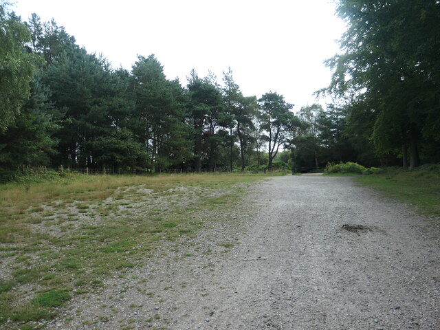
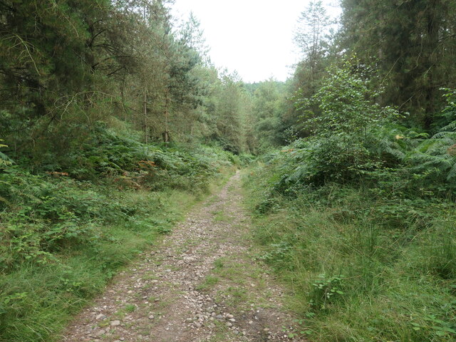
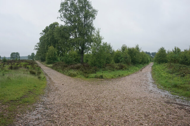
Gorse Covert is a small wood or forest located in the county of Staffordshire, England. Situated near the town of Cannock, it spans an area of approximately 200 acres. The wood is predominantly made up of native broadleaf trees such as oak, beech, and birch, creating a diverse and vibrant ecosystem.

The forest floor of Gorse Covert is covered in a thick carpet of moss, ferns, and wildflowers, adding to its natural beauty. The wood is also home to a variety of wildlife, including deer, foxes, and numerous species of birds. These animals find shelter and food within the dense undergrowth and can often be spotted by visitors.

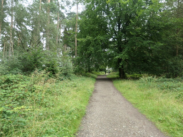
Gorse Covert is a popular destination for nature lovers and outdoor enthusiasts. It offers numerous walking trails and paths that wind through the wood, allowing visitors to explore its tranquil surroundings. The forest also features a designated picnic area, providing a perfect spot for families and friends to enjoy a meal amidst nature.

Additionally, Gorse Covert is well-maintained by local authorities, ensuring its preservation and accessibility to the public. It serves as a valuable green space for the local community, providing opportunities for recreation, relaxation, and education.

Overall, Gorse Covert in Staffordshire is a picturesque woodland, offering a peaceful retreat from the hustle and bustle of everyday life. With its diverse flora and fauna, it presents a rich and enchanting habitat for both humans and wildlife alike.

If you have any feedback on the listing, please let us know in the comments section below.

Gorse Covert Images

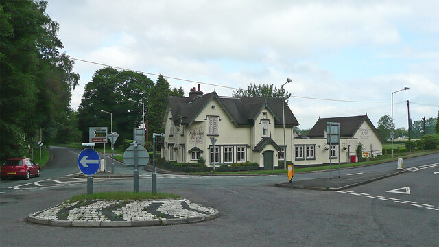
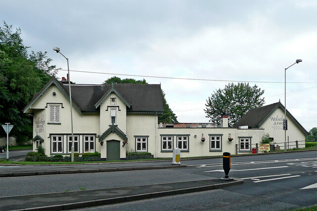
Images are sourced within 2km of 52.764136/-1.981596 or Grid Reference SK0118. Thanks to Geograph Open Source API. All images are credited.

Bridleway passing through a car park near the Army Cadet HQ The vehicle access gate is locked and the car park out of use.
Bridleway passing through a car park near the Army Cadet HQ
The vehicle access gate is locked and the car park out of use.
'Follow the wide track away from the army buildings' Public bridleway heading south the Rifle Range corner. The quote comes from Staffordshire County Council's 'Cannock Chase Circular Walk'.
'Follow the wide track away from the army buildings'
Public bridleway heading south the Rifle Range corner. The quote comes from Staffordshire County Council's 'Cannock Chase Circular Walk'.
'Take the path opposite ... through the young pine plantation' The quote comes from Staffordshire County Council's 'Cannock Chase Circular Walk'.
'Take the path opposite ... through the young pine plantation'
The quote comes from Staffordshire County Council's 'Cannock Chase Circular Walk'.
The Wolseley Arms near Colwich in Staffordshire Looking west-north-west along the A51 London Road, this is at the junction with the A513 to Stafford, off to the left.
The Wolseley Arms near Colwich in Staffordshire
Looking west-north-west along the A51 London Road, this is at the junction with the A513 to Stafford, off to the left.
The Wolseley Arms near Colwich in Staffordshire Looking west-north-west on the A51 London Road, this is at the junction with the A513 to Stafford, leading off to the left.
The Wolseley Arms near Colwich in Staffordshire
Looking west-north-west on the A51 London Road, this is at the junction with the A513 to Stafford, leading off to the left.
The Wolseley Arms near Colwich in Staffordshire The Wolseley Arms is south-east of Little haywood and Colwich, by the A51 London Road at the junction with the A513 to Stafford.
The Wolseley Arms near Colwich in Staffordshire
The Wolseley Arms is south-east of Little haywood and Colwich, by the A51 London Road at the junction with the A513 to Stafford.
Wolseley Arms Standing in the shadows on a sunny day.  Busy indoors, and out
Wolseley Arms
Standing in the shadows on a sunny day. Busy indoors, and out
Fine Sunny Day at Wolseley View of lowlands alongside River Trent, beside Wolseley Arms, from river bridge, looking across river, in direction of Trent and Mersey canal and Staffordshire Way (that runs along it)
Fine Sunny Day at Wolseley
View of lowlands alongside River Trent, beside Wolseley Arms, from river bridge, looking across river, in direction of Trent and Mersey canal and Staffordshire Way (that runs along it)
Riverside, River Trent, Wolseley Wolseley Bridge, from riverside and Wolseley Arms car park
Riverside, River Trent, Wolseley
Wolseley Bridge, from riverside and Wolseley Arms car park
Decorative urn, Cannock Chase AONB Just south of the A513. Seen from a boat on the Trent and Mersey canal.
Decorative urn, Cannock Chase AONB
Just south of the A513. Seen from a boat on the Trent and Mersey canal.
Cannock Chase AONB, near Wet Slade In the Trent valley, north-west of Rugeley. All the land in the photo is in the AONB.
Cannock Chase AONB, near Wet Slade
In the Trent valley, north-west of Rugeley. All the land in the photo is in the AONB.
The Wolseley Arms, Bishton
Junction on the A51, Bishton Joining the A513
Junction on the A51, Bishton
Joining the A513
The Shimla Palace, Bishton
Path near Pepper Slade One of the network of paths on Cannock Chase.
Path near Pepper Slade
One of the network of paths on Cannock Chase.
The Butts trig point Viewed on a very cold day. The Butts is a reminder of the former land use as a firing range.
The Butts trig point
Viewed on a very cold day. The Butts is a reminder of the former land use as a firing range.
Diverging paths on Cannock Chase Tracks relating to the former firing range have been upgraded to allow lots of visitors to this Area of Outstanding Natural Beauty.
Diverging paths on Cannock Chase
Tracks relating to the former firing range have been upgraded to allow lots of visitors to this Area of Outstanding Natural Beauty.
Flooded and overgrown path on Cannock Chase There are a lot of broad and easy paths, but this is one of the narrower ones. It was necessary to go through the scrub to the right to get along it.
Flooded and overgrown path on Cannock Chase
There are a lot of broad and easy paths, but this is one of the narrower ones. It was necessary to go through the scrub to the right to get along it.
Show me another place!

Gorse Covert is located at Grid Ref: SK0118 (Lat: 52.764136, Lng: -1.981596)

Administrative County: Staffordshire

District: Stafford

Police Authority: Staffordshire

What 3 Words

///cycle.directors.dabbled. Near Colwich, Staffordshire

Related Wikis

Etchinghill, Staffordshire

Etchinghill, also known as Etching Hill, was once a singular village, until it was engulfed by the simultaneous growth of Rugeley, Staffordshire. It is...

Fair Oak Academy

Fair Oak Academy was a mixed secondary school located in Rugeley in the English county of Staffordshire.Previously known as Fair Oak High School, the school...

Slitting Mill

Slitting Mill is a small village on the outskirts of Rugeley, Staffordshire. At the 2001 census, it had a population of 265.The village is within Rugeley...

Wolseley Hall

Wolseley Hall was a stately home near the village of Colwich, in Staffordshire, England. It was demolished in 1966; the former gardens are now a nature...

Nearby Amenities

Located within 500m of 52.764136,-1.981596
Power: pole
Source: Bing
Lat/Long: 52.7605415/-1.980067
The data included in this document is from www.openstreetmap.org. The data is made available under ODbL.

Have you been to Gorse Covert?

Leave your review of Gorse Covert below (or comments, questions and feedback).