Jingle Pot Gill

Valley in Yorkshire Richmondshire

England

Jingle Pot Gill

Above Carperby One of several Landrover tracks which make for easy walking over bleak moorlands.
Above Carperby Credit: Colin Gregory

Jingle Pot Gill, located in the picturesque county of Yorkshire, England, is a captivating valley that enchants visitors with its natural beauty and rich history. Nestled between rolling hills and meandering rivers, this idyllic location offers a serene and tranquil escape from the bustling city life.

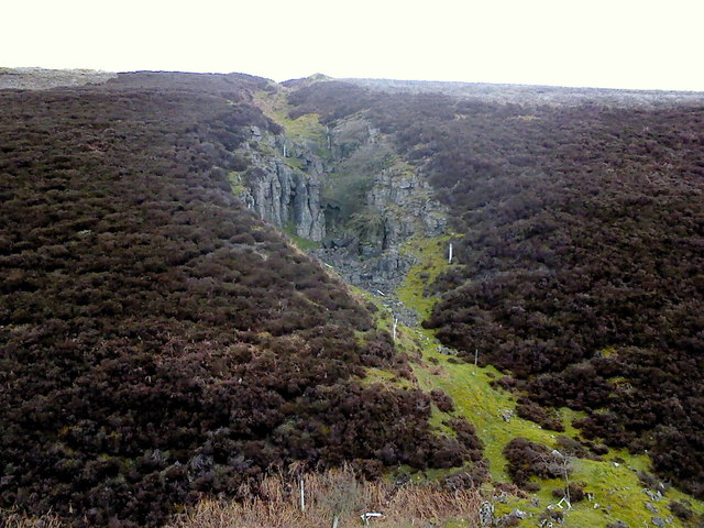
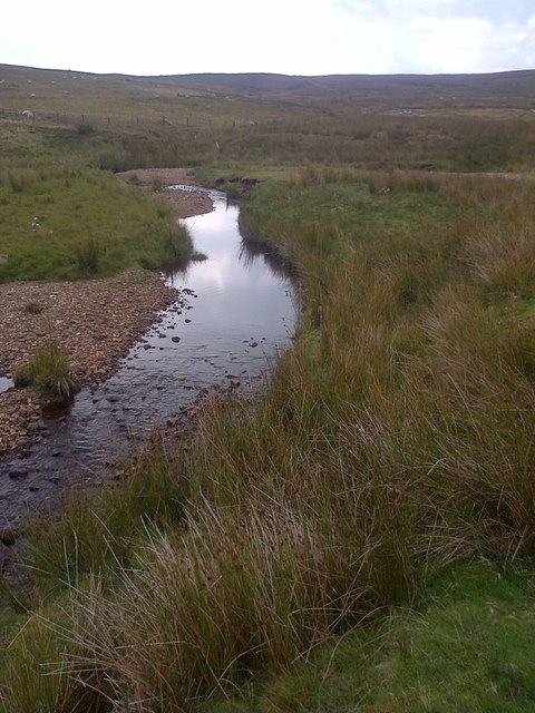
The name "Jingle Pot Gill" is derived from the old English word "gill," meaning a ravine or narrow valley, and "jingle pot," which refers to the sound of water flowing over pebbles in a stream. True to its name, the gill is characterized by a charming stream that meanders through the valley, creating a symphony of gentle water sounds as it cascades over rocks and through leafy groves.

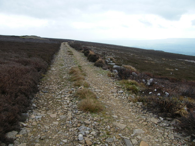
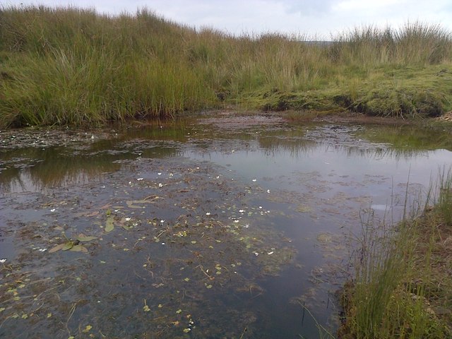
The valley is adorned with lush greenery, forming a perfect backdrop for leisurely walks or hikes. The area is a haven for nature enthusiasts, offering a diverse range of flora and fauna. Visitors can spot a variety of bird species, including kingfishers and herons, or perhaps catch a glimpse of elusive mammals like otters and foxes.

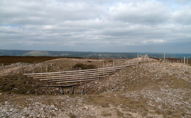
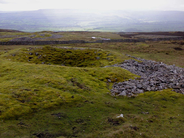
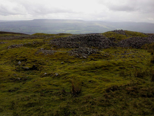
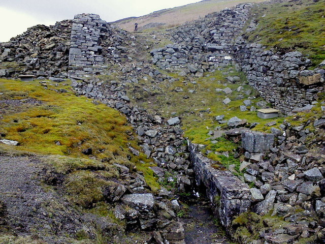
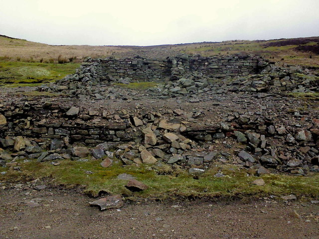
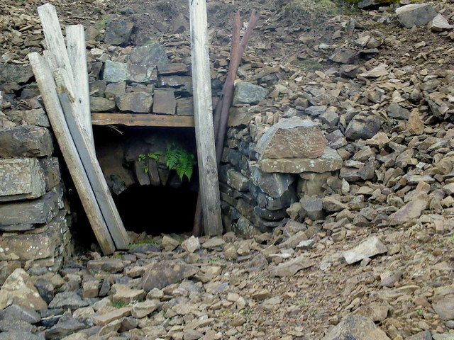
In addition to its natural allure, Jingle Pot Gill boasts a rich historical heritage. The valley was once home to ancient settlements, evidenced by the ruins of stone cottages and remnants of dry-stone walls. Exploring these remnants offers a fascinating glimpse into the lives of past inhabitants and their close connection with the land.

Jingle Pot Gill, with its enchanting landscapes and historical significance, truly embodies the charm and beauty of Yorkshire's countryside. Whether one seeks a peaceful retreat or a journey through time, this valley promises an unforgettable experience for all who venture into its embrace.

If you have any feedback on the listing, please let us know in the comments section below.

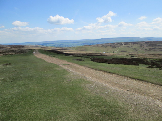
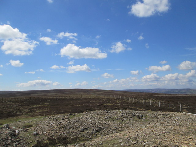
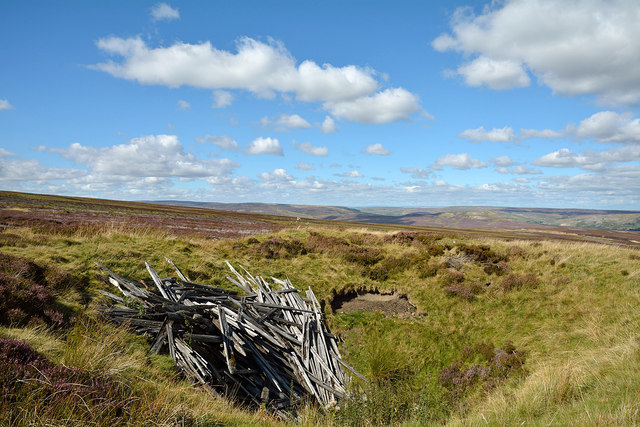
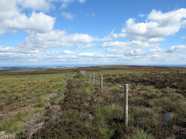
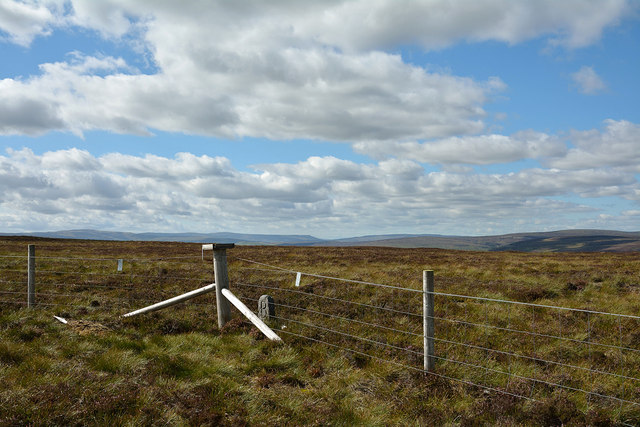
Jingle Pot Gill Images

Images are sourced within 2km of 54.350287/-1.9826276 or Grid Reference SE0194. Thanks to Geograph Open Source API. All images are credited.

Above Carperby One of several Landrover tracks which make for easy walking over bleak moorlands.
Above Carperby
One of several Landrover tracks which make for easy walking over bleak moorlands.
Disturbed ground on Height of Greets Height of Greets, (Greets Hill on OS Landraner 98), is a local high point at a little over 500m on the Swaledale/Wensleydale watershed. There has been much metal mining activity in the surrounding valleys and the disturbance to the ground seen here is also due to minor scale mine workings. The view is to the north, over Swaledale.
Disturbed ground on Height of Greets
Height of Greets, (Greets Hill on OS Landraner 98), is a local high point at a little over 500m on the Swaledale/Wensleydale watershed. There has been much metal mining activity in the surrounding valleys and the disturbance to the ground seen here is also due to minor scale mine workings. The view is to the north, over Swaledale.
Bell Pits on Bobscar Rake One of several old lead mine shafts on East Bolton Moor, part of the Bobscar Mine which stretches over the moor on a North-South axis.
Bell Pits on Bobscar Rake
One of several old lead mine shafts on East Bolton Moor, part of the Bobscar Mine which stretches over the moor on a North-South axis.
Shafts and Spoil More old shafts on Bobscar Rake where the vein cuts Rowantree Scar. This mine was recorded by Leland in 1546 for Lord Scrope, of Castle Bolton. In the distance, on the farside of Wensleydale is Penhill.
Shafts and Spoil
More old shafts on Bobscar Rake where the vein cuts Rowantree Scar. This mine was recorded by Leland in 1546 for Lord Scrope, of Castle Bolton. In the distance, on the farside of Wensleydale is Penhill.
Apedale Mine The wheelpit from the new crushing mill, built in 1870 following the sinking of a new shaft at Apedale Mine.
Apedale Mine
The wheelpit from the new crushing mill, built in 1870 following the sinking of a new shaft at Apedale Mine.
Dressing Floor & Bouse Teams Part of the Apedale Lead Mine.
Dressing Floor & Bouse Teams
Part of the Apedale Lead Mine.
Mine Level near Apedale Beck The level was covered over by these wooden posts and has recently been dug out, judging by the colour of the spoil around the entrance.
Mine Level near Apedale Beck
The level was covered over by these wooden posts and has recently been dug out, judging by the colour of the spoil around the entrance.
Old Hush, Apedale Head Mine Apedale Head Mine had its own community of houses for the miners working around here. The mine was begun in the 1760's and worked continuously until 1883.
Old Hush, Apedale Head Mine
Apedale Head Mine had its own community of houses for the miners working around here. The mine was begun in the 1760's and worked continuously until 1883.
Apedale Looking SE across Apedale.
Apedale
Looking SE across Apedale.
Greets Hill Looking NW.
Greets Hill
Looking NW.
Old mine shaft near Gibbon Hill The tops of mine shafts often show well on moorland as they are surrounded, as here, by a grassed-over collar of mine spoil. The shaft seen here appears not to be open but is probably sealed in some rudimentary way - to walk on its base might be unwise. It's possible of course that the shaft was of no great depth. The dumped timber surely has no connection with the mine's history but is simply a mass of old fencing wood dumped there.
Old mine shaft near Gibbon Hill
The tops of mine shafts often show well on moorland as they are surrounded, as here, by a grassed-over collar of mine spoil. The shaft seen here appears not to be open but is probably sealed in some rudimentary way - to walk on its base might be unwise. It's possible of course that the shaft was of no great depth. The dumped timber surely has no connection with the mine's history but is simply a mass of old fencing wood dumped there.
Fence line heading towards Greets Hill The fence connects two moorland hill tops, Gibbon Hill and Greets Hill; those tops are actually very minor rises indeed along the ridge dividing Swaledale and Apedale.
Fence line heading towards Greets Hill
The fence connects two moorland hill tops, Gibbon Hill and Greets Hill; those tops are actually very minor rises indeed along the ridge dividing Swaledale and Apedale.
Summit area of High Carl High Carl is a moorland hill top near to Apedale Head. The fence crosses close to the hill's highest point which may well be just beyond the fence line - OS mapping gives a spot height in that direction, west of the fence angle, at 555m. The low boundary stone is cut with a 'B' on the south side which is in view; there's the letter 'F' on the other side.
Summit area of High Carl
High Carl is a moorland hill top near to Apedale Head. The fence crosses close to the hill's highest point which may well be just beyond the fence line - OS mapping gives a spot height in that direction, west of the fence angle, at 555m. The low boundary stone is cut with a 'B' on the south side which is in view; there's the letter 'F' on the other side.
Apedale Beck
Apedale Beck
Pool on Apedale Beck
Disturbed Ground On Greets Hill, resulting from years of the lead extraction activities.
Disturbed Ground
On Greets Hill, resulting from years of the lead extraction activities.
Grouse Butt, Greets Hill
South Grain With evidence of former lead mining activities.
South Grain
With evidence of former lead mining activities.
Show me another place!

Jingle Pot Gill is located at Grid Ref: SE0194 (Lat: 54.350287, Lng: -1.9826276)

Division: North Riding

Administrative County: North Yorkshire

District: Richmondshire

Police Authority: North Yorkshire

What 3 Words

///nuns.jelly.complies. Near Leyburn, North Yorkshire

Related Wikis

Richmondshire

Richmondshire was a local government district of North Yorkshire, England, from 1974 to 2023. It covered a large northern area of the Yorkshire Dales including...

Maiden Castle, North Yorkshire

Maiden Castle is a settlement in Grinton, North Yorkshire (grid reference SE02189808) which probably dates from the Iron Age. It is listed as a Scheduled...

St Oswald's Church, Castle Bolton

St Oswald's Church, Castle Bolton is a Grade II* listed parish church in the Church of England: 106  located in Castle Bolton, North Yorkshire. == History... ==

Castle Bolton

Castle Bolton is a village in North Yorkshire, England. It is in Wensleydale, one of the Yorkshire Dales. The village takes its name from Bolton Castle...

Bolton Castle

Bolton Castle is a 14th-century castle located in Wensleydale, Yorkshire, England (grid reference SE03379183). The nearby village of Castle Bolton takes...

Grinton Smelt Mill

Grinton Smelt Mill (also known as How Mill) is a ruined lead mining and processing site on Cogden Moor, south of Grinton in Swaledale, North Yorkshire...

Healaugh, Richmondshire

Healaugh (pronounced "hee-law") is a small village in the civil parish of Reeth, Fremington and Healaugh, in Swaledale in the Yorkshire Dales. It is in...

Crackpot, North Yorkshire

Crackpot is a village in Swaledale, North Yorkshire, England. Its name derives from the Old English kraka (crow) and the Viking word pot (usually a pit...

Nearby Amenities

Located within 500m of 54.350287,-1.9826276
Hunting Stand
Source: aerial imagery
Lat/Long: 54.3535391/-1.9780038
Hunting Stand
Source: aerial imagery
Lat/Long: 54.3531052/-1.978169
Hunting Stand
Source: aerial imagery
Lat/Long: 54.3527119/-1.9783407
Hunting Stand
Source: aerial imagery
Lat/Long: 54.3523192/-1.9785091
Hunting Stand
Source: aerial imagery
Lat/Long: 54.3519591/-1.9786561
Hunting Stand
Source: aerial imagery
Lat/Long: 54.3515833/-1.9788063
Hunting Stand
Source: aerial imagery
Lat/Long: 54.3512256/-1.9789683
Hunting Stand
Source: aerial imagery
Lat/Long: 54.3506235/-1.9793213
The data included in this document is from www.openstreetmap.org. The data is made available under ODbL.

Have you been to Jingle Pot Gill?

Leave your review of Jingle Pot Gill below (or comments, questions and feedback).