Corbie Cleugh

Valley in Northumberland

England

Corbie Cleugh

The River Breamish This is a quiet stretch of the River Breamish, caught between the steep flanks of Hartside Hill and Brough Law. Access from this point on foot along the right hand bank of the river is blocked by a fairly substantial rocky outcrop. For a selection of detailed free to download walking routes in the area visit <span class="nowrap"><a title="www.cheviotwalks.co.uk" rel="nofollow ugc noopener" href="http://www.cheviotwalks.co.uk">Link</a><img style="margin-left:2px;" alt="External link" title="External link - shift click to open in new window" src="https://s1.geograph.org.uk/img/external.png" width="10" height="10"/></span>
The River Breamish Credit: Geoff Holland

Corbie Cleugh is a picturesque valley located in the county of Northumberland, England. It is situated approximately 6 miles southwest of the market town of Hexham. The name "Corbie Cleugh" derives from the Old English words "corbin" meaning raven, and "cleugh" meaning narrow valley or ravine, aptly describing the landscape of this area.

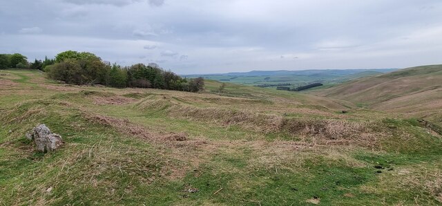
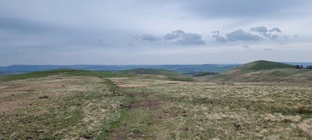
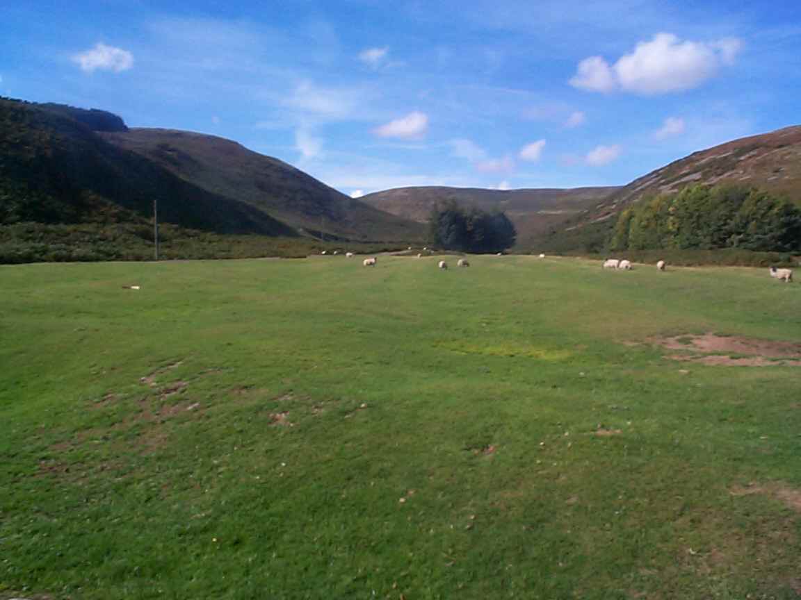
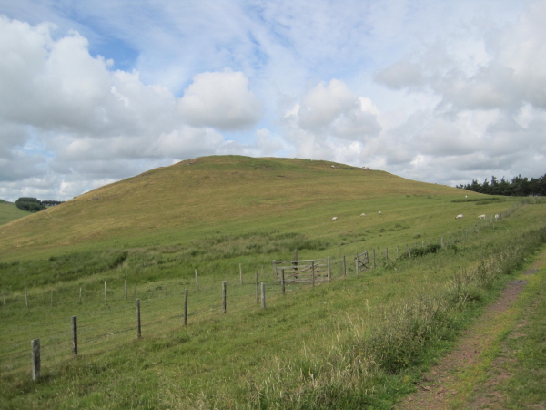
The valley is renowned for its stunning natural beauty, characterized by rolling hills, meandering streams, and dense woodlands. It is a haven for nature enthusiasts, offering a range of outdoor activities such as hiking, birdwatching, and wildlife spotting. The diverse flora and fauna found here includes various species of birds, mammals, and wildflowers, making it a popular destination for nature lovers.

Corbie Cleugh is also steeped in history, with evidence of human habitation dating back to prehistoric times. The remnants of ancient settlements, including hillforts and burial mounds, can still be seen in the area. Additionally, the valley boasts several notable historic landmarks, such as the 13th-century Aydon Castle and the medieval Hexham Abbey, which provide fascinating insights into the region's rich heritage.

The tranquility and unspoiled beauty of Corbie Cleugh make it a perfect retreat for those seeking a peaceful getaway. Visitors can enjoy scenic walks along the numerous trails, taking in the breathtaking views and immersing themselves in the serenity of the surroundings. Whether it's exploring the history, admiring the wildlife, or simply taking in the stunning landscapes, Corbie Cleugh offers a captivating experience for all who visit.

If you have any feedback on the listing, please let us know in the comments section below.

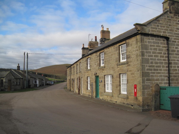
Corbie Cleugh Images

Images are sourced within 2km of 55.427522/-1.9864942 or Grid Reference NU0014. Thanks to Geograph Open Source API. All images are credited.

The River Breamish This is a quiet stretch of the River Breamish, caught between the steep flanks of Hartside Hill and Brough Law. Access from this point on foot along the right hand bank of the river is blocked by a fairly substantial rocky outcrop. For a selection of detailed free to download walking routes in the area visit <span class="nowrap"><a title="www.cheviotwalks.co.uk" rel="nofollow ugc noopener" href="http://www.cheviotwalks.co.uk">Link</a><img style="margin-left:2px;" alt="External link" title="External link - shift click to open in new window" src="https://s1.geograph.org.uk/img/external.png" width="10" height="10"/></span>
The River Breamish
This is a quiet stretch of the River Breamish, caught between the steep flanks of Hartside Hill and Brough Law. Access from this point on foot along the right hand bank of the river is blocked by a fairly substantial rocky outcrop. For a selection of detailed free to download walking routes in the area visit LinkExternal link
Brough Law, Northumberland Looking west over moorland from Brough Law Hillfort. The stone wall in the foreground is part of the remains of the Iron Age hillfort settlement.
Brough Law, Northumberland
Looking west over moorland from Brough Law Hillfort. The stone wall in the foreground is part of the remains of the Iron Age hillfort settlement.
Brough Law, Northumberland Looking west from the south of Brough Law.
Brough Law, Northumberland
Looking west from the south of Brough Law.
The fort on Brough Law This is an Iron age fort showing three lines of concentric walls.
The fort on Brough Law
This is an Iron age fort showing three lines of concentric walls.
Looking over the valley of the Chesters Burn On the Ingram Hill Forts Trail.
Looking over the valley of the Chesters Burn
On the Ingram Hill Forts Trail.
Brough Law Iron Age bivallet hillfort and hut circle ‘Heritage Gateway - Results’. 2012. Heritagegateway.org.uk <<span class="nowrap"><a title="https://www.heritagegateway.org.uk/Gateway/Results_Single.aspx?resourceID=304&uid=1865423" rel="nofollow ugc noopener" href="https://www.heritagegateway.org.uk/Gateway/Results_Single.aspx?resourceID=304&uid=1865423">Link</a><img style="margin-left:2px;" alt="External link" title="External link - shift click to open in new window" src="https://s1.geograph.org.uk/img/external.png" width="10" height="10"/></span> > [accessed 28 October 2022]

‌‘Heritage Gateway - Results’. 2012. Heritagegateway.org.uk <<span class="nowrap"><a title="https://www.heritagegateway.org.uk/Gateway/Results_Single.aspx?resourceID=304&uid=1865422" rel="nofollow ugc noopener" href="https://www.heritagegateway.org.uk/Gateway/Results_Single.aspx?resourceID=304&uid=1865422">Link</a><img style="margin-left:2px;" alt="External link" title="External link - shift click to open in new window" src="https://s1.geograph.org.uk/img/external.png" width="10" height="10"/></span> > [accessed 28 October 2022]‌
Brough Law Iron Age bivallet hillfort and hut circle
‘Heritage Gateway - Results’. 2012. Heritagegateway.org.uk <LinkExternal link > [accessed 28 October 2022] ‌‘Heritage Gateway - Results’. 2012. Heritagegateway.org.uk <LinkExternal link > [accessed 28 October 2022]‌
View to Hartside Hill
The River Breamish from the Air
Bound for Ingram Having headed over East Hill, the route takes the walker down towards Ingram Mill and offers a beautiful view over this section of the Breamish Valley.

This photograph was taken during the Coronavirus (COVID-19) pandemic of 2020/21.
Bound for Ingram
Having headed over East Hill, the route takes the walker down towards Ingram Mill and offers a beautiful view over this section of the Breamish Valley. This photograph was taken during the Coronavirus (COVID-19) pandemic of 2020/21.
Brough Law, Northumberland Looking east-northeast from the vicinity of Brough Law in the direction of the village of Ingram.
Brough Law, Northumberland
Looking east-northeast from the vicinity of Brough Law in the direction of the village of Ingram.
Ewe Hill, Northumberland Looking south across moorland towards Ewe Hill.
Ewe Hill, Northumberland
Looking south across moorland towards Ewe Hill.
Middle Dean, Northumberland Looking over the perimeter of Middle Dean Hillfort, to the right is the deep gully of Middledean Burn,
Middle Dean, Northumberland
Looking over the perimeter of Middle Dean Hillfort, to the right is the deep gully of Middledean Burn,
Cochrane Pike, Northumberland Looking east-northeast from west of Cochrane Pike. In the middle distance (left to right) can be seen Wether Hill, West Hill and Old Fawdon Hill. On top of both Wether Hill and Old Fawden Hill can be found the remains of ancient settlements.
Cochrane Pike, Northumberland
Looking east-northeast from west of Cochrane Pike. In the middle distance (left to right) can be seen Wether Hill, West Hill and Old Fawdon Hill. On top of both Wether Hill and Old Fawden Hill can be found the remains of ancient settlements.
Ingram Farm, Northumberland Looking over farmland towards Ingram Farm to the west of the hamlet of Ingram.
Ingram Farm, Northumberland
Looking over farmland towards Ingram Farm to the west of the hamlet of Ingram.
Ingram Hill, Northumberland Looking north-northeast across moorland from Ingram Hill.
Ingram Hill, Northumberland
Looking north-northeast across moorland from Ingram Hill.
The bridge at Ingram Taken from the small car park.
The bridge at Ingram
Taken from the small car park.
Entering Ingram
Entering Ingram
The car park at the start of the Ingram Hill Forts Trail The foreground shows the start of the track leading up to Brough Law.
The car park at the start of the Ingram Hill Forts Trail
The foreground shows the start of the track leading up to Brough Law.
Show me another place!

Corbie Cleugh is located at Grid Ref: NU0014 (Lat: 55.427522, Lng: -1.9864942)

Unitary Authority: Northumberland

Police Authority: Northumbria

What 3 Words

///smiled.doped.songbird. Near Whittingham, Northumberland

Related Wikis

Ingram, Northumberland

Ingram is a small village and civil parish in Northumberland, England. It is located in the Cheviots on the River Breamish, and on the edge of Northumberland...

Castle Knowe, Northumberland

Castle Knowe, also known as Clinch Castle, is the site of an Iron Age hillfort in Northumberland, England, about 1 mile south-east of the village of Ingram...

Unthank, Alnham

Unthank is a hamlet and former civil parish, now in the parish of Alnham in Northumberland, England. In 1951 the parish had a population of 11. == History... ==

Branton, Northumberland

Branton is a village and former civil parish, now in the parish of Ingram, in Northumberland, England. It is about 9 miles (14 km) west of Alnwick. In...

Eslington Park

Eslington Park is a privately owned 18th-century mansion house west of Whittingham, Northumberland, near the River Aln. It is the family seat of Lord...

Alnham

Alnham is a hamlet and civil parish in Northumberland, England. It is about 14 miles (23 km) west of Alnwick, about 6 miles (9.7 km) from Scotland and...

Church of St Michael, Alnham

The Church of St Michael in Alnham, in the English county of Northumberland, is a medieval structure dating from circa 1200. Built on a Roman camp site...

Brandon, Northumberland

Brandon is a village and former civil parish, now in the parish of Ingram, in Northumberland, in England. It is about 9 miles (14 km) north-west of Alnwick...

Nearby Amenities

Located within 500m of 55.427522,-1.9864942
Middle Dean
Place: locality
Lat/Long: 55.4279983/-1.9889645
Wether Hill
Ele: 306
Natural: peak
Lat/Long: 55.4273269/-1.9797779
Barrier: stile
Lat/Long: 55.4307689/-1.9875509
The data included in this document is from www.openstreetmap.org. The data is made available under ODbL.

Have you been to Corbie Cleugh?

Leave your review of Corbie Cleugh below (or comments, questions and feedback).