Abraham's Valley

Valley in Staffordshire Stafford

England

Abraham's Valley

Lock Cottage with balloon Looking north from Colwich Lock, Little Haywood, in Staffordshire
Lock Cottage with balloon Credit: Roger Kidd

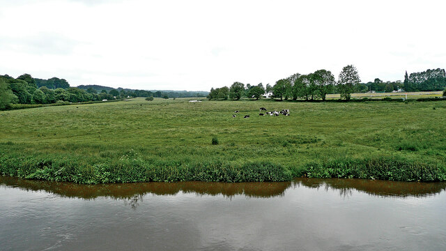
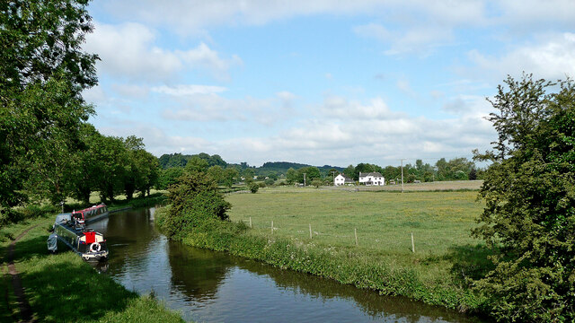
Abraham's Valley, located in Staffordshire, is a picturesque and serene valley nestled in the heart of the English countryside. The valley, named after the famous biblical character Abraham, offers a breathtaking landscape with rolling hills, lush green meadows, and a meandering river that adds to its natural beauty.

Stretching over several miles, Abraham's Valley is known for its tranquil atmosphere and untouched surroundings. It is a popular destination for nature lovers, hikers, and photographers who are captivated by its idyllic scenery and abundant wildlife. The valley is home to a diverse range of flora and fauna, including rare species of plants and animals that thrive in its undisturbed ecosystem.

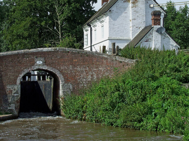
In addition to its natural splendor, Abraham's Valley boasts a rich historical and cultural heritage. The area is dotted with ancient ruins, including remnants of old settlements, castles, and churches, which provide a glimpse into its past. Visitors can explore these sites and learn about the valley's intriguing history.

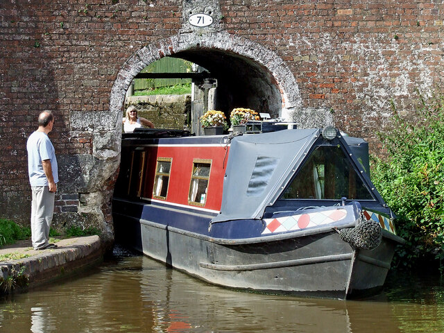
Moreover, Abraham's Valley offers various recreational activities for visitors. The river that runs through the valley provides opportunities for fishing and boating, while the surrounding trails are perfect for hiking, cycling, and horse riding. The valley also hosts several annual events and festivals that celebrate its heritage and promote local traditions.

Overall, Abraham's Valley in Staffordshire is a hidden gem that offers a perfect blend of natural beauty, historical significance, and recreational opportunities. Whether you seek a peaceful retreat or an adventure-filled getaway, this valley is sure to leave a lasting impression on all who visit.

If you have any feedback on the listing, please let us know in the comments section below.

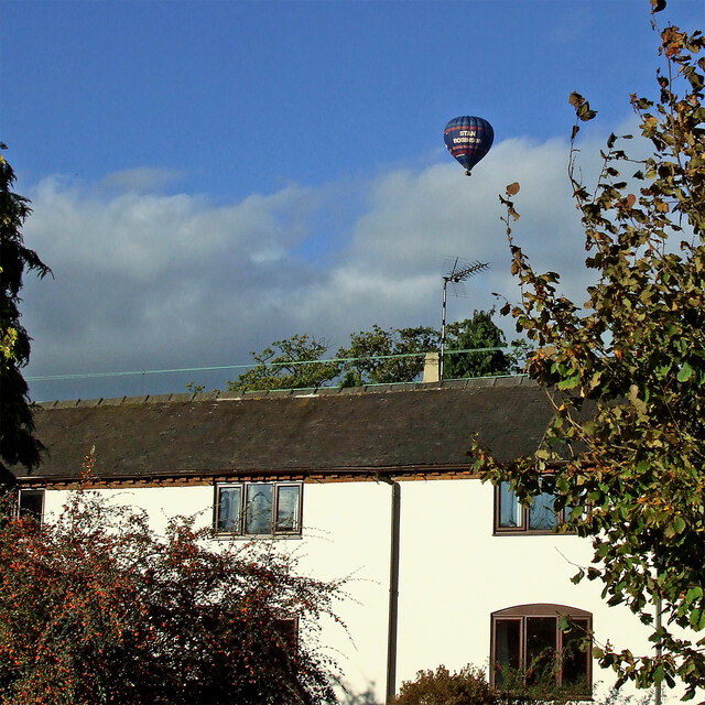
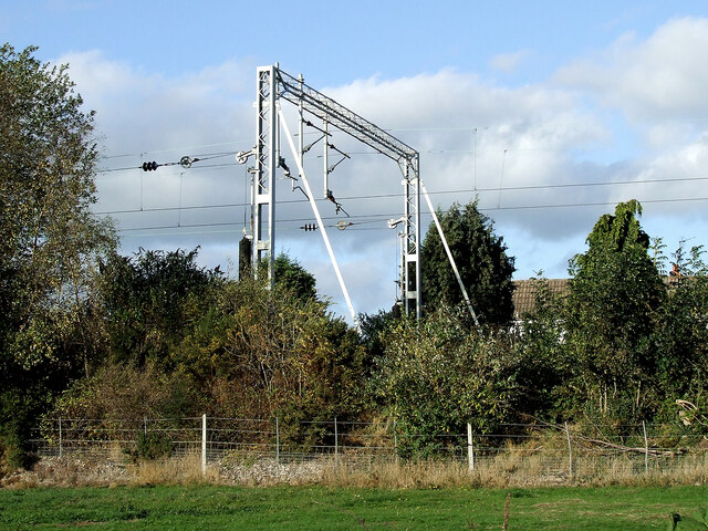
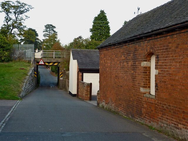
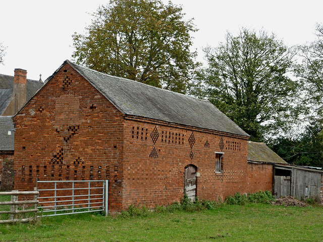
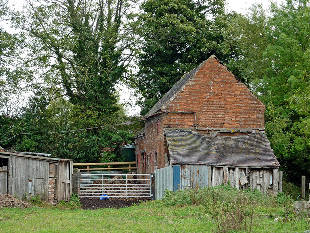
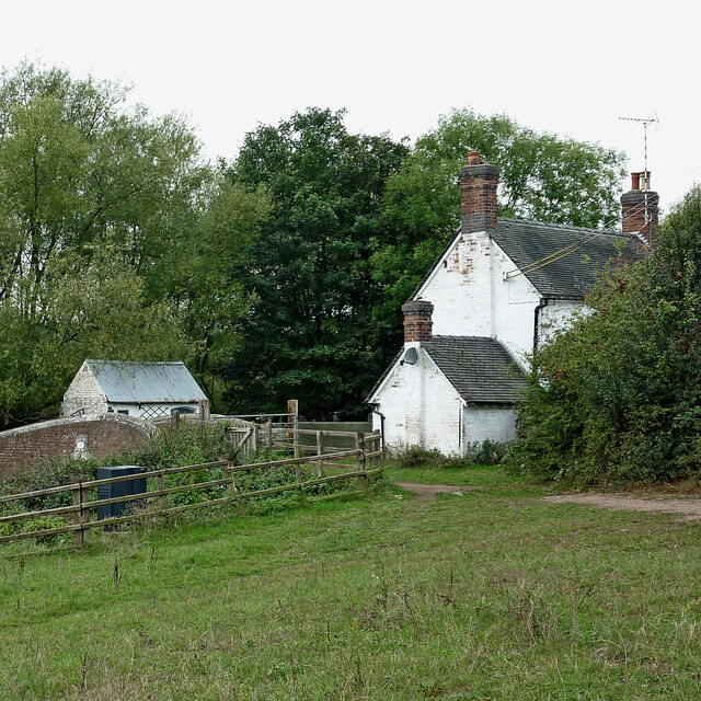
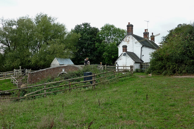
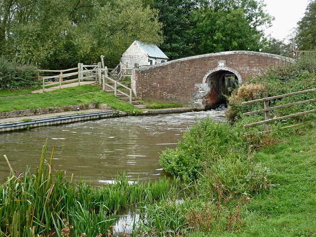
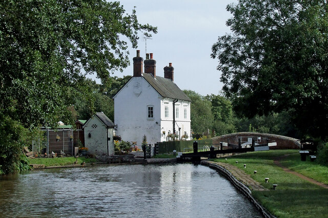
Abraham's Valley Images

Images are sourced within 2km of 52.772138/-1.9967264 or Grid Reference SK0019. Thanks to Geograph Open Source API. All images are credited.

Lock Cottage with balloon Looking north from Colwich Lock, Little Haywood, in Staffordshire
Lock Cottage with balloon
Looking north from Colwich Lock, Little Haywood, in Staffordshire
Railway gantry near Little Haywood in Staffordshire Looking north from the canal towpath. The house is in Hawkesmore Drive. The railway line is between Rugeley and Stone.
Railway gantry near Little Haywood in Staffordshire
Looking north from the canal towpath. The house is in Hawkesmore Drive. The railway line is between Rugeley and Stone.
Meadow Lane in Little Haywood, Staffordshire Looking north-east towards Main Road from near the canal bridge.
Meadow Lane in Little Haywood, Staffordshire
Looking north-east towards Main Road from near the canal bridge.
Canalside barns in Colwich, Staffordshire Seen from the towpath of the Trent and Mersey Canal.
Canalside barns in Colwich, Staffordshire
Seen from the towpath of the Trent and Mersey Canal.
Old barn in Colwich, Staffordshire Seen from the towpath of the Trent and Mersey Canal.
Old barn in Colwich, Staffordshire
Seen from the towpath of the Trent and Mersey Canal.
Barn with dilapidated shed in Colwich, Staffordshire Seen from the towpath of the Trent and Mersey Canal.
Barn with dilapidated shed in Colwich, Staffordshire
Seen from the towpath of the Trent and Mersey Canal.
Cottage by Colwich Lock in Staffordshire Colwich Lock (No 21) is on the Trent and Mersey Canal near Little Haywood. A public footpath crosses the bridge here.
Cottage by Colwich Lock in Staffordshire
Colwich Lock (No 21) is on the Trent and Mersey Canal near Little Haywood. A public footpath crosses the bridge here.
Cottage and canal bridge near Colwich in Staffordshire Colwich Lock (No 21) is on the Trent and Mersey Canal near Little Haywood. A public footpath crosses the bridge here.
Cottage and canal bridge near Colwich in Staffordshire
Colwich Lock (No 21) is on the Trent and Mersey Canal near Little Haywood. A public footpath crosses the bridge here.
Colwich Bridge near Little Haywood in Staffordshire Bridge No 72 across the Trent and Mersey Canal is immediately below Colwich Lock.
Notice the turbulence in the water below the bridge. The lock paddles have bee raised, and water is gushing through. A narrowboat will emerge very soon.

<a href="https://www.geograph.org.uk/photo/2662653">SK0021 : Colwich Bridge near Little Haywood in Staffordshire</a>

The Trent and Mersey Canal is 93.5 miles in length from Derwent Mouth to Preston Brook. The first sod was cut by Josiah Wedgwood in July 1766 at Middleport (Stoke-on-Trent). The eastern section between Derwent Mouth and Shugborough (the junction with the Staffordshire and Worcestershire Canal) was already operational by 1770 and the whole canal through to Preston Brook, where it linked with the Bridgewater Canal was open for business by 1777. James Brindley was the engineer until his death in 1772.
Colwich Bridge near Little Haywood in Staffordshire
Bridge No 72 across the Trent and Mersey Canal is immediately below Colwich Lock. Notice the turbulence in the water below the bridge. The lock paddles have bee raised, and water is gushing through. A narrowboat will emerge very soon. SK0021 : Colwich Bridge near Little Haywood in Staffordshire The Trent and Mersey Canal is 93.5 miles in length from Derwent Mouth to Preston Brook. The first sod was cut by Josiah Wedgwood in July 1766 at Middleport (Stoke-on-Trent). The eastern section between Derwent Mouth and Shugborough (the junction with the Staffordshire and Worcestershire Canal) was already operational by 1770 and the whole canal through to Preston Brook, where it linked with the Bridgewater Canal was open for business by 1777. James Brindley was the engineer until his death in 1772.
Pasture by the River Trent in Staffordshire Looking across the River Trent from Wolseley Bridge, south-east of Colwich. The lin of trees beyond the grazing cattle is by the Trent and Mersey Canal.
Pasture by the River Trent in Staffordshire
Looking across the River Trent from Wolseley Bridge, south-east of Colwich. The lin of trees beyond the grazing cattle is by the Trent and Mersey Canal.
The Wolseley Arms near Colwich in Staffordshire Looking west-north-west along the A51 London Road, this is at the junction with the A513 to Stafford, off to the left.
The Wolseley Arms near Colwich in Staffordshire
Looking west-north-west along the A51 London Road, this is at the junction with the A513 to Stafford, off to the left.
The Wolseley Arms near Colwich in Staffordshire Looking west-north-west on the A51 London Road, this is at the junction with the A513 to Stafford, leading off to the left.
The Wolseley Arms near Colwich in Staffordshire
Looking west-north-west on the A51 London Road, this is at the junction with the A513 to Stafford, leading off to the left.
The Wolseley Arms near Colwich in Staffordshire The Wolseley Arms is south-east of Little haywood and Colwich, by the A51 London Road at the junction with the A513 to Stafford.
The Wolseley Arms near Colwich in Staffordshire
The Wolseley Arms is south-east of Little haywood and Colwich, by the A51 London Road at the junction with the A513 to Stafford.
Canal and pasture near Colwich in Staffordshire This is the Trent and Mersey Canal, looking west from the A51 London Road at Wolseley Bridge, No 70.
Canal and pasture near Colwich in Staffordshire
This is the Trent and Mersey Canal, looking west from the A51 London Road at Wolseley Bridge, No 70.
Colwich Lock and Bridge in Staffordshire Colwich Bridge is No 71 across the Trent and Mersey Canal. It carries a farm track and public footpath. The Lock is No 21 and provides a rise (or fall) of 6ft 6in (two metres).
There is turbulence below the bridge because the paddles have been raised to drain the lock. An approaching boat is in the lock, and a boat is waiting to use it.
Colwich Lock and Bridge in Staffordshire
Colwich Bridge is No 71 across the Trent and Mersey Canal. It carries a farm track and public footpath. The Lock is No 21 and provides a rise (or fall) of 6ft 6in (two metres). There is turbulence below the bridge because the paddles have been raised to drain the lock. An approaching boat is in the lock, and a boat is waiting to use it.
Terraced cottages in Little Haywood, Staffordshire The cottages are by Main Street, and are seen here from the canal below Colwich Lock.
Terraced cottages in Little Haywood, Staffordshire
The cottages are by Main Street, and are seen here from the canal below Colwich Lock.
Narrowboat leaving Colwich Lock in Staffordshire Colwich Bridge is No 71 across the Trent and Mersey Canal near Little Haywood. It carries a farm track and public footpath. The Lock is No 21 and provides a rise (or fall) of 6ft 6in (two metres).
'Just Heaven' is leaving the lock very carefully.
Narrowboat leaving Colwich Lock in Staffordshire
Colwich Bridge is No 71 across the Trent and Mersey Canal near Little Haywood. It carries a farm track and public footpath. The Lock is No 21 and provides a rise (or fall) of 6ft 6in (two metres). 'Just Heaven' is leaving the lock very carefully.
Canal at Colwich Lock in Staffordshire Looking south-east towards Rugeley, this is the Trent and Mersey Canal at Colwich Lock (No 21) and Colwich Lock Bridge (No 71).
Canal at Colwich Lock in Staffordshire
Looking south-east towards Rugeley, this is the Trent and Mersey Canal at Colwich Lock (No 21) and Colwich Lock Bridge (No 71).
Show me another place!

Abraham's Valley is located at Grid Ref: SK0019 (Lat: 52.772138, Lng: -1.9967264)

Administrative County: Staffordshire

District: Stafford

Police Authority: Staffordshire

What 3 Words

///devalued.emphasis.transmit. Near Colwich, Staffordshire

Related Wikis

Colwich rail crash

The Colwich rail crash occurred on the evening of Friday 19 September 1986 at Colwich Junction, Staffordshire, England. It was significant in that it...

Colwich railway station

Colwich railway station is a disused railway station in Colwich, Staffordshire, England. The former station is adjacent to Colwich Junction, where the...

Colwich, Staffordshire

Colwich is a civil parish and village in Staffordshire, England. It is situated off the A51 road, about 3 miles (5 km) north-west of Rugeley and 7 miles...

St Mary's Abbey, Colwich

Saint Mary's Abbey in Colwich, Staffordshire was a monastery of Roman Catholic nuns of the English Benedictine Congregation, founded in 1623 at Cambrai...

Colwich Junction

Colwich Junction is a rail junction near the village of Little Haywood, in the county of Staffordshire, England. It is the junction between two routes...

Little Haywood

Little Haywood is a village in Staffordshire, England. For population details as taken at the 2011 census see under Colwich. It lies beside a main arterial...

Wolseley Hall

Wolseley Hall was a stately home near the village of Colwich, in Staffordshire, England. It was demolished in 1966; the former gardens are now a nature...

Wolseley Centre

The Wolseley Centre is a visitor centre and nature reserve of the Staffordshire Wildlife Trust, in Staffordshire, England, about 2 miles (3 km) north-west...

Related Videos

WALK WITH THOMAS | CANAL WALK | STAFFORDSHIRE

Walk with me as I take you on adventure, this time we are walking along the Great Haywood towpath towards the Shugborough ...

Walking Ambience - Cannock Chase #1 - ASMR

Welcome back to another ASMR walking video! Today, I'm out on a section of Cannock Chase, not far from Stafford (my home ...

Luminate Light Trail - '23,Shugborough Estate , Staffordshire. 16.12.2023.

Luminate Light Trail - 2023,Shugborough Estate , Staffordshire. 16.12.2023. #luminatelighttrail #luminate #shugborogh ...

Have you been to Abraham's Valley?

Leave your review of Abraham's Valley below (or comments, questions and feedback).