Mill Bottom

Valley in Yorkshire Richmondshire

England

Mill Bottom

Bleaberry Gill Ford This is Bleaberry Gill Ford shown under a Hunter Moon.
Bleaberry Gill Ford Credit: John Walton

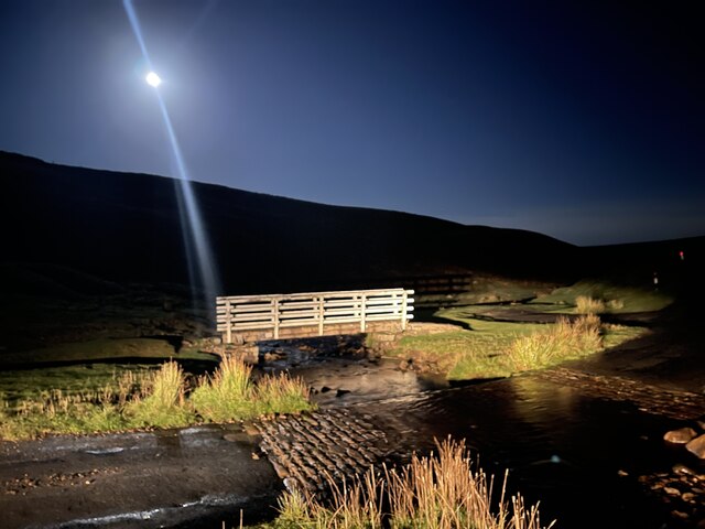
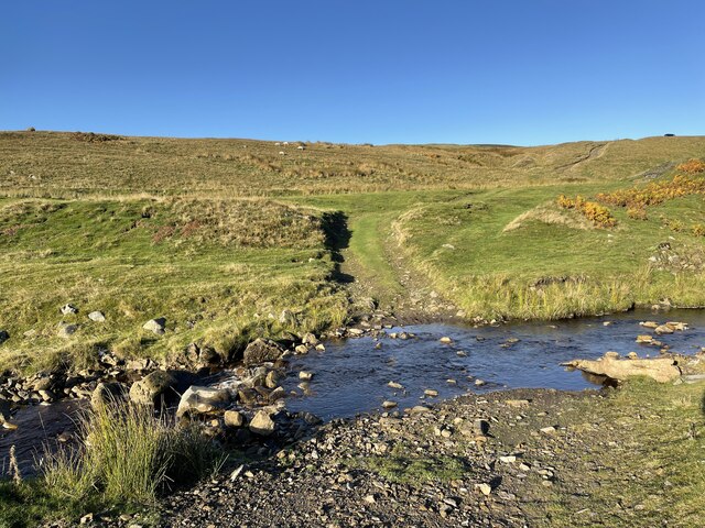
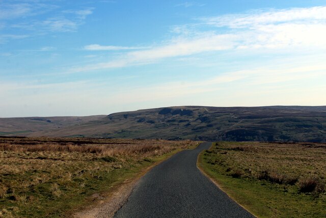
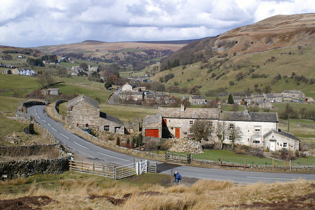
Mill Bottom is a picturesque valley located in the county of Yorkshire, England. Nestled amidst rolling hills and verdant countryside, this idyllic location is renowned for its natural beauty and tranquility. Situated in the heart of Yorkshire, the valley is surrounded by charming villages and is a popular destination for nature enthusiasts and outdoor adventurers.

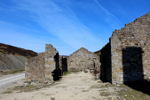
The valley gets its name from the old mill that once stood at the bottom of the valley, which was powered by the flowing waters of a nearby stream. Although the mill is no longer in operation, its remnants can still be seen, adding a touch of history to the landscape.

Mill Bottom boasts a diverse range of flora and fauna, making it a haven for wildlife lovers. The valley is home to numerous species of birds, including kingfishers, herons, and ducks, which can often be spotted along the banks of the stream. The surrounding woodland provides a habitat for deer, badgers, and foxes, adding to the area's natural charm.

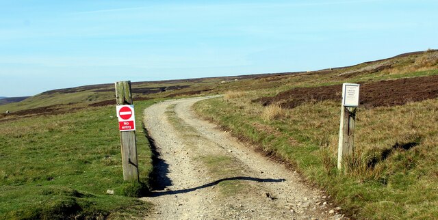
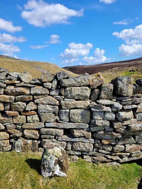
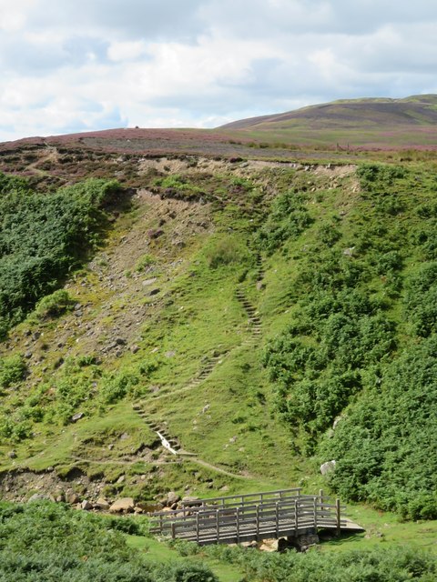
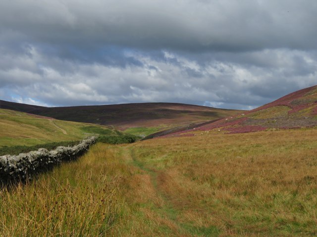
The valley is also a popular spot for outdoor activities such as hiking, cycling, and picnicking. Several well-maintained trails wind through the valley, offering breathtaking views of the surrounding countryside. Visitors can also enjoy a leisurely stroll along the stream, taking in the peaceful ambiance and immersing themselves in nature.

In conclusion, Mill Bottom, Yorkshire, is a hidden gem tucked away in the Yorkshire countryside. With its stunning scenery, rich wildlife, and recreational opportunities, it is a must-visit destination for those seeking a peaceful retreat in nature.

If you have any feedback on the listing, please let us know in the comments section below.

Mill Bottom Images

Images are sourced within 2km of 54.396912/-2.013859 or Grid Reference NY9900. Thanks to Geograph Open Source API. All images are credited.

Bleaberry Gill Ford This is Bleaberry Gill Ford shown under a Hunter Moon.
Bleaberry Gill Ford
This is Bleaberry Gill Ford shown under a Hunter Moon.
Cringley Ford This is another ford on Blueberry Gill.
Cringley Ford
This is another ford on Blueberry Gill.
Track leading onto Turf Moor Heads away from the moorland road between Arkengarthdale and Low Row
Track leading onto Turf Moor
Heads away from the moorland road between Arkengarthdale and Low Row
On Turf Moor Moorland road between Low Row in Swaledale and Arkengarthdale
On Turf Moor
Moorland road between Low Row in Swaledale and Arkengarthdale
Old Gang Smelting Mill (1) Ruins of a once thriving lead smelting operation, which brought much prosperity to the area in the 19th Century.
Grade II Listed building, thus hoping this will ensure no more deterioration will take place.
Wainwright's Coast to Coast walk passes by.
Old Gang Smelting Mill (1)
Ruins of a once thriving lead smelting operation, which brought much prosperity to the area in the 19th Century. Grade II Listed building, thus hoping this will ensure no more deterioration will take place. Wainwright's Coast to Coast walk passes by.
Old Gang Smelting Mill (2) Ruins of a once thriving lead smelting operation, which brought much prosperity to the area in the 19th Century.
Grade II Listed building, thus hoping this will ensure no more deterioration will take place.
Wainwright's Coast to Coast walk passes by.
Old Gang Smelting Mill (2)
Ruins of a once thriving lead smelting operation, which brought much prosperity to the area in the 19th Century. Grade II Listed building, thus hoping this will ensure no more deterioration will take place. Wainwright's Coast to Coast walk passes by.
Old Gang Smelting Mill (3) Ruins of a once thriving lead smelting operation, which brought much prosperity to the area in the 19th Century.
Grade II Listed building, thus hoping this will ensure no more deterioration will take place.
Wainwright's Coast to Coast walk passes by.
Old Gang Smelting Mill (3)
Ruins of a once thriving lead smelting operation, which brought much prosperity to the area in the 19th Century. Grade II Listed building, thus hoping this will ensure no more deterioration will take place. Wainwright's Coast to Coast walk passes by.
Shooting Hut beside Old Gang Beck Amidst the ruins of the Old Gang Smelting Mill complex, there appears to be one structure in one piece - a luncheon hut for the shooting fraternity, which is of very much more recent construction
Shooting Hut beside Old Gang Beck
Amidst the ruins of the Old Gang Smelting Mill complex, there appears to be one structure in one piece - a luncheon hut for the shooting fraternity, which is of very much more recent construction
Moorland Track heading North West to Surrender Ground
Moorland Track descending over Barras End
Kay Hushes The landscape has taken heavy punishment from a long dead lead mining industry
Kay Hushes
The landscape has taken heavy punishment from a long dead lead mining industry
Surrender Smelt Mill, old chimney The ruin is that of the original chimney where the flue terminated having carried fumes from the lead smelting process in the Surrender Mill, below in the valley. The flue was extended at a later time to at least one other chimney higher on the moor.
Surrender Smelt Mill, old chimney
The ruin is that of the original chimney where the flue terminated having carried fumes from the lead smelting process in the Surrender Mill, below in the valley. The flue was extended at a later time to at least one other chimney higher on the moor.
Old Boundary Marker at Fore Gill Gate Parish Boundary Marker on the east side of the minor road at Fore Gill Gate between Langthwaite and Feetham. Before 1866 this might have marked the boundary of Grinton and Arkengarthdate parishes, but now on the boundary of Arkengarthdale and Reeth, Fremington and Healaugh parishes.

Milestone Society National ID: YN_REEARK05pb
Old Boundary Marker at Fore Gill Gate
Parish Boundary Marker on the east side of the minor road at Fore Gill Gate between Langthwaite and Feetham. Before 1866 this might have marked the boundary of Grinton and Arkengarthdate parishes, but now on the boundary of Arkengarthdale and Reeth, Fremington and Healaugh parishes. Milestone Society National ID: YN_REEARK05pb
Bridge and steps at Cringley Bottom The bridge replaces one first erected some 12 years ago. On the far side are some 82 steps which make the ascent to the moor edge rather easier. There could be further improvements here using new funding, as the Coast to Coast path is now designated as an official long distance path.
Bridge and steps at Cringley Bottom
The bridge replaces one first erected some 12 years ago. On the far side are some 82 steps which make the ascent to the moor edge rather easier. There could be further improvements here using new funding, as the Coast to Coast path is now designated as an official long distance path.
Moorland in late summer The view along the wallside above Cringley Bottom, looking towards Fore Gill Gate. On the fellsides the heather is in full bloom.
Moorland in late summer
The view along the wallside above Cringley Bottom, looking towards Fore Gill Gate. On the fellsides the heather is in full bloom.
Grouse butts above Bleaberry Gill I suspect these rather basic wooden butts are along the same line as some stone and turf butts that I photographed in 2012. If so, the butts appear to have gone further 'down market'.
Grouse butts above Bleaberry Gill
I suspect these rather basic wooden butts are along the same line as some stone and turf butts that I photographed in 2012. If so, the butts appear to have gone further 'down market'.
Ford And Footbridge Food as seen in the title sequence of All Creatures Great And Small near to Kearton, North Yorkshire.
Ford And Footbridge
Food as seen in the title sequence of All Creatures Great And Small near to Kearton, North Yorkshire.
Cattle grid at Fore Gill Gate The road heads across Turf Moor towards the CB Inn.
Cattle grid at Fore Gill Gate
The road heads across Turf Moor towards the CB Inn.
Show me another place!

Mill Bottom is located at Grid Ref: NY9900 (Lat: 54.396912, Lng: -2.013859)

Division: North Riding

Administrative County: North Yorkshire

District: Richmondshire

Police Authority: North Yorkshire

What 3 Words

///betrayal.clustered.tones. Near Bowes, Co. Durham

Related Wikis

Kearton

Kearton is a hamlet in the Yorkshire Dales, North Yorkshire, England. Kearton is situated near Low Row and Reeth. == References == == External links... ==

Feetham

Feetham is a hamlet opposite Low Row in the Yorkshire Dales, North Yorkshire, England. The origin of the place-name is from Old Norse and means place at...

Calver Hill

Calver Hill is a fell in the Yorkshire Dales National Park in North Yorkshire, England. It is composed of limestone and is situated at grid reference NZ012003...

Low Row

Low Row is a village in Swaledale, in the Yorkshire Dales, North Yorkshire, England. It lies about 3 miles west of Reeth and is between Healaugh and Gunnerside...

Langthwaite

Langthwaite is one of the few villages in Arkengarthdale, North Yorkshire, England. It is 3.5 miles (5.6 km) north of Reeth and sits 870 feet (270 m) above...

Arkle Town

Arkle Town is a hamlet in Arkengarthdale in the Richmondshire district of North Yorkshire, England. It is situated 0.4 miles (0.64 km) to the south of...

Healaugh, Richmondshire

Healaugh (pronounced "hee-law") is a small village in the civil parish of Reeth, Fremington and Healaugh, in Swaledale in the Yorkshire Dales. It is in...

Booze, North Yorkshire

Booze is a hamlet in Arkengarthdale, in the Richmondshire district of North Yorkshire, England. It is about 1 mile (1.6 km) east of Langthwaite. There...

Nearby Amenities

Located within 500m of 54.396912,-2.013859
Access: yes
Barrier: cattle_grid
Lat/Long: 54.3944017/-2.0191546
Cringley Bottom
Place: locality
Lat/Long: 54.3974568/-2.0085602
Ford: yes
Lat/Long: 54.4008601/-2.0107879
Surrender Bridge
Note: actually the bridge's name but a locality as well, showing up on signposts
Place: locality
Lat/Long: 54.3945987/-2.0189591
Hunting Stand
Hunting Stand: grouse_butt
Source: aerial imagery
Lat/Long: 54.3997505/-2.0194674
Hunting Stand
Hunting Stand: grouse_butt
Source: aerial imagery
Lat/Long: 54.3994158/-2.0191069
Hunting Stand
Hunting Stand: grouse_butt
Source: aerial imagery
Lat/Long: 54.3990385/-2.0187292
Hunting Stand
Hunting Stand: grouse_butt
Source: aerial imagery
Lat/Long: 54.3986425/-2.0183258
Hunting Stand
Hunting Stand: grouse_butt
Source: aerial imagery
Lat/Long: 54.3982566/-2.0179525
Ford: yes
Lat/Long: 54.3946315/-2.0084054
The data included in this document is from www.openstreetmap.org. The data is made available under ODbL.

Have you been to Mill Bottom?

Leave your review of Mill Bottom below (or comments, questions and feedback).