Cote Bottom

Valley in Yorkshire Richmondshire

England

Cote Bottom

Flout Moor Lane Ford This ford on Haw Beck is found on Flout Moor Lane.
Flout Moor Lane Ford Credit: John Walton

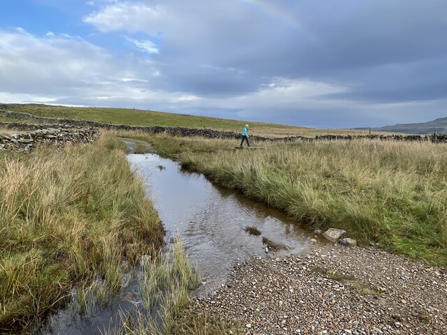
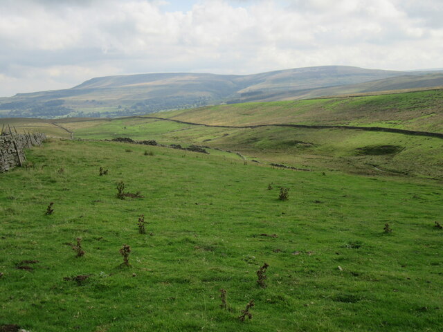
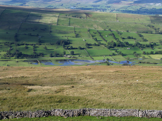
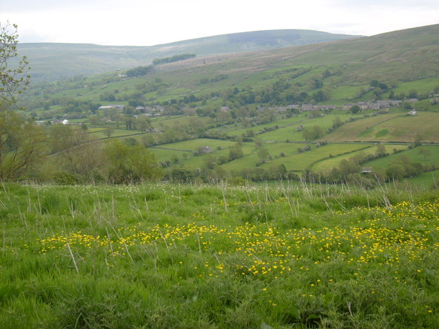
Cote Bottom is a picturesque valley located in the county of Yorkshire, England. Situated within the Yorkshire Dales National Park, it is renowned for its natural beauty and tranquility. The valley is nestled between rolling hills and is characterized by its lush green meadows, sparkling streams, and abundant wildlife.

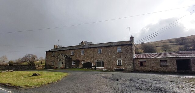
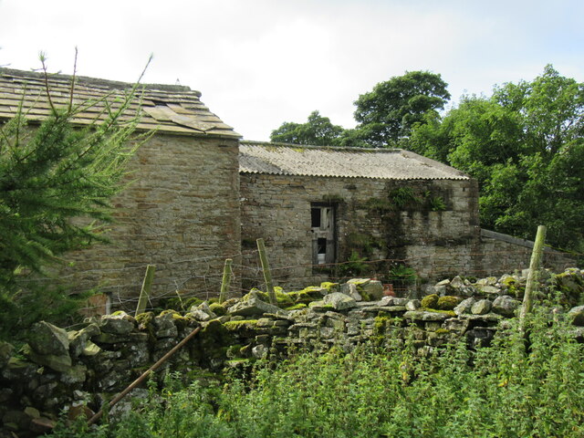
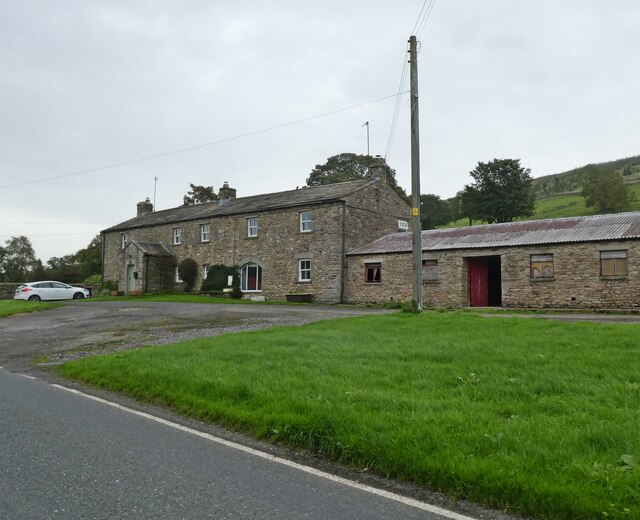
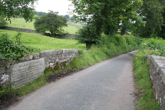
The name Cote Bottom originates from the Old Norse word "kot," meaning a shelter or a small farmstead, which reflects the valley's agricultural history. It is home to a number of traditional stone-built farmhouses and barns, which add to its rustic charm.

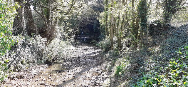
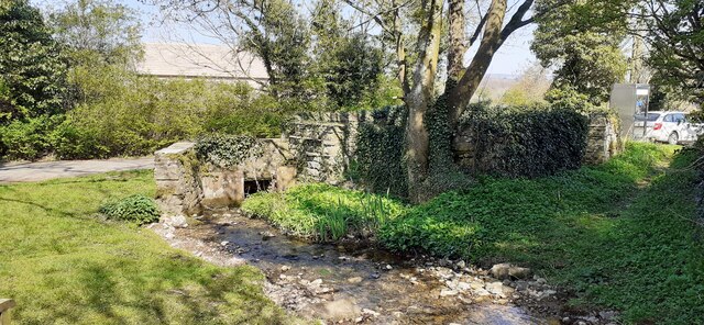
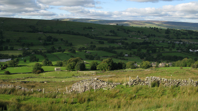
The landscape of Cote Bottom is dominated by the River Wharfe, which meanders through the valley, creating picturesque scenes and providing a habitat for various species of fish and birds. The surrounding hills offer breathtaking views and are popular among hikers and nature enthusiasts. The valley also boasts a diverse range of flora, including wildflowers, ferns, and ancient woodlands.

Cote Bottom attracts visitors throughout the year who come to enjoy its peaceful ambiance and natural wonders. It provides opportunities for outdoor activities such as hiking, birdwatching, fishing, and picnicking. The valley is also a haven for wildlife, with sightings of rabbits, foxes, deer, and a variety of bird species, including kingfishers and herons.

Overall, Cote Bottom is a hidden gem within the Yorkshire Dales, inviting visitors to immerse themselves in the beauty of nature and experience the tranquility of this idyllic valley.

If you have any feedback on the listing, please let us know in the comments section below.
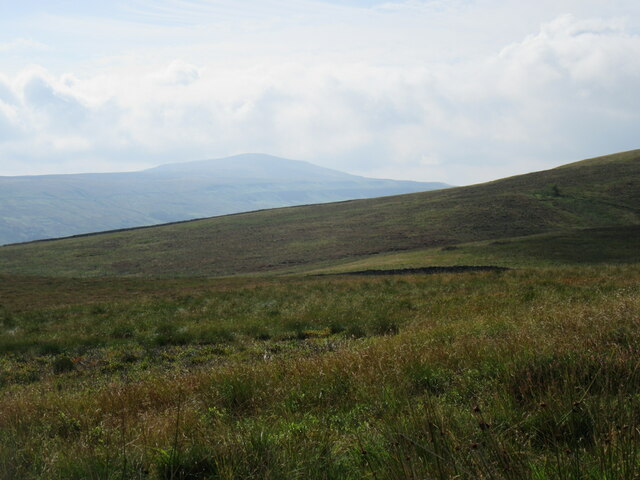
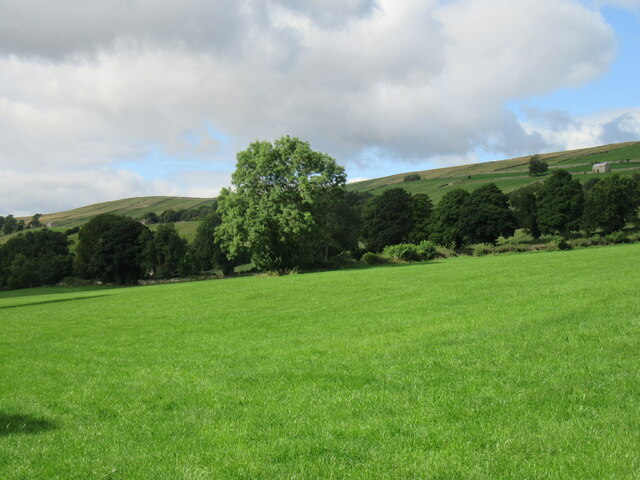
Cote Bottom Images

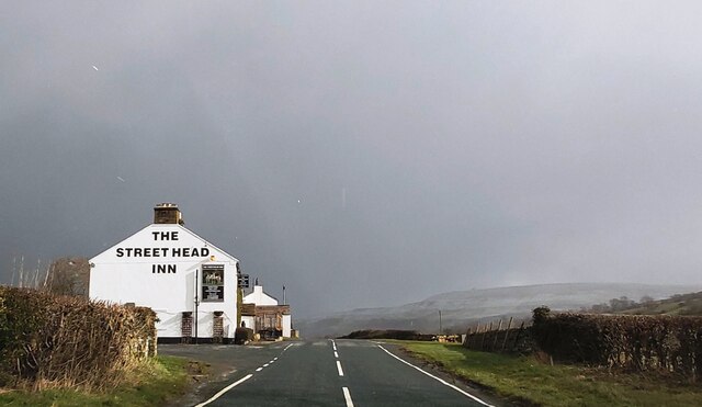
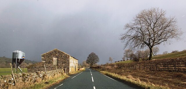
Images are sourced within 2km of 54.265202/-2.0327441 or Grid Reference SD9785. Thanks to Geograph Open Source API. All images are credited.

Flout Moor Lane Ford This ford on Haw Beck is found on Flout Moor Lane.
Flout Moor Lane Ford
This ford on Haw Beck is found on Flout Moor Lane.
The Street Head Inn
The Street Head Inn
East Lane House
East Lane House
B6160 in Bishopdale
B6160 in Bishopdale
View SE along Mill Beck
Mill Beck approaching Millbeck Bridge The footpath to the right passes a Telephone Call Box
Mill Beck approaching Millbeck Bridge
The footpath to the right passes a Telephone Call Box
Gayle Ing Unoccupied Farm on the moors above Thornton Rust.
Gayle Ing
Unoccupied Farm on the moors above Thornton Rust.
Gayle Ing Beck valley Looking east down into the Gayle Ing Beck valley.
Gayle Ing Beck valley
Looking east down into the Gayle Ing Beck valley.
Stake Road view Looking SE from Stake Road.
Stake Road view
Looking SE from Stake Road.
Bishopdale near Thoralby Looking NW.
Bishopdale near Thoralby
Looking NW.
East Lane House
East Lane House
Fields near to Newbiggin in Bishopdale Wasset Fell Road is a track climbing from the village of Newbiggin, southwards on to the hill ridge rising eventually to Buckden Pike. The roofs of Newbiggin are seen here over enclosures of rough pasture from the descent of the road.
Fields near to Newbiggin in Bishopdale
Wasset Fell Road is a track climbing from the village of Newbiggin, southwards on to the hill ridge rising eventually to Buckden Pike. The roofs of Newbiggin are seen here over enclosures of rough pasture from the descent of the road.
Roughly grassed enclosure below Wasset Fell Road Wasset Fell road descends to Newbiggin from the high ridge on the south-east side of Bishopdale. The view here is from the road at Floutgate Scar over fields to the valley bottom where flooding testifies to the extent of recent rain.
Roughly grassed enclosure below Wasset Fell Road
Wasset Fell road descends to Newbiggin from the high ridge on the south-east side of Bishopdale. The view here is from the road at Floutgate Scar over fields to the valley bottom where flooding testifies to the extent of recent rain.
View from Side Road The view across Bishopdale to Newbiggin, taken from Side Road.
View from Side Road
The view across Bishopdale to Newbiggin, taken from Side Road.
Littleburn Bridge over Littleburn Beck The bridge, YNR 432, is a listed structure described as:
Bridge. Dated 1814. For the 4th Lord Rokeby of Littleburn House (qv).
Rubble. Single segmental arch. Parapets terminate in square ashlar
pedestals, with panelled sides and pyramidal tops. Ashlar coping, stones
cramped together on parapet. On inside of downstream parapet, stone
inscribed "AD 1814". On inside of upstream parapet, ashlar sandstone plaque
with Latin inscription describing the destructive force of water and
commemorating the Duke of Wellington's victories.
Littleburn Bridge over Littleburn Beck
The bridge, YNR 432, is a listed structure described as: Bridge. Dated 1814. For the 4th Lord Rokeby of Littleburn House (qv). Rubble. Single segmental arch. Parapets terminate in square ashlar pedestals, with panelled sides and pyramidal tops. Ashlar coping, stones cramped together on parapet. On inside of downstream parapet, stone inscribed "AD 1814". On inside of upstream parapet, ashlar sandstone plaque with Latin inscription describing the destructive force of water and commemorating the Duke of Wellington's victories.
Benchmark on stone in wall of Haw Lane at Hacker Gill Ordnance Survey pivot benchmark described on the Bench Mark Database at <span class="nowrap"><a title="http://www.bench-marks.org.uk/bm44115" rel="nofollow ugc noopener" href="http://www.bench-marks.org.uk/bm44115">Link</a><img style="margin-left:2px;" alt="External link" title="External link - shift click to open in new window" src="https://s1.geograph.org.uk/img/external.png" width="10" height="10"/></span>
Benchmark on stone in wall of Haw Lane at Hacker Gill
Ordnance Survey pivot benchmark described on the Bench Mark Database at LinkExternal link
Haw Lane at Hacker Gill There is an OS benchmark <a href="https://www.geograph.org.uk/photo/3063655">SD9886 : Benchmark on stone in wall of Haw Lane at Hacker Gill</a> on a stone at the base of the wall at the left hand side of the image
Haw Lane at Hacker Gill
There is an OS benchmark SD9886 : Benchmark on stone in wall of Haw Lane at Hacker Gill on a stone at the base of the wall at the left hand side of the image
Street Head Inn Newbiggin
Show me another place!

Cote Bottom is located at Grid Ref: SD9785 (Lat: 54.265202, Lng: -2.0327441)

Division: North Riding

Administrative County: North Yorkshire

District: Richmondshire

Police Authority: North Yorkshire

What 3 Words

///tumblers.fidgeted.subsets. Near Leyburn, North Yorkshire

Related Wikis

Castle Dykes Henge

Castle Dykes Henge is a Class I Neolithic henge earthwork in the Yorkshire Dales National Park in North Yorkshire, England, situated between the villages...

Newbiggin, south Wensleydale

Newbiggin is a village and civil parish in Bishopdale, a side dale on the south side of Wensleydale, in the Yorkshire Dales in North Yorkshire, England...

Thoralby

Thoralby is a village and civil parish in the Richmondshire district of North Yorkshire, England. It lies south of Aysgarth, is within a mile of both Newbiggin...

Yorkshire Dales

The Yorkshire Dales are an upland area of the Pennines in England. Most of the area is in the county of North Yorkshire, but it extends into Cumbria and...

Nearby Amenities

Located within 500m of 54.265202,-2.0327441
Barker
Place: isolated_dwelling
Source: os_25k_firstseries
Lat/Long: 54.2639526/-2.0376044
Blind Sike
Is In Country Code: GB
Is In County: North Yorkshire
Is In Municipality: Richmondshire
Place: isolated_dwelling
Source: os_25k_firstseries
Lat/Long: 54.2658408/-2.0312922
Cote Bottom
Is In Country Code: GB
Is In County: North Yorkshire
Is In Municipality: Richmondshire
Place: isolated_dwelling
Source: os_25k_firstseries
Lat/Long: 54.2653163/-2.0322257
Ford: yes
Lat/Long: 54.2654352/-2.0401851
Power: pole
Lat/Long: 54.2612207/-2.0308439
Power: pole
Lat/Long: 54.2618289/-2.031953
Power: pole
Lat/Long: 54.262122/-2.0325252
Power: pole
Lat/Long: 54.2631187/-2.0322015
Power: pole
Lat/Long: 54.2638383/-2.0320032
Power: pole
Lat/Long: 54.2643454/-2.0323319
Power: pole
Lat/Long: 54.2650312/-2.0327786
The data included in this document is from www.openstreetmap.org. The data is made available under ODbL.

Have you been to Cote Bottom?

Leave your review of Cote Bottom below (or comments, questions and feedback).