Leighton Buzzard

Settlement in Bedfordshire

England

Leighton Buzzard

Grand Union Canal Looking West
Grand Union Canal Credit: Peter Roberts

Leighton Buzzard is a town located in the county of Bedfordshire, England. Situated between Luton and Milton Keynes, it lies approximately 40 miles north of London. With a population of around 40,000, it is the largest town in the South Bedfordshire district.

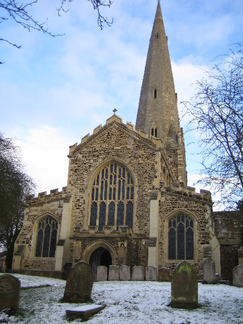
The town has a rich history, dating back to Roman times when it served as a stopping point on the route between London and the Midlands. In the medieval period, Leighton Buzzard became known for its thriving market and as a center for the brewing industry.

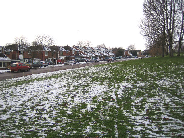
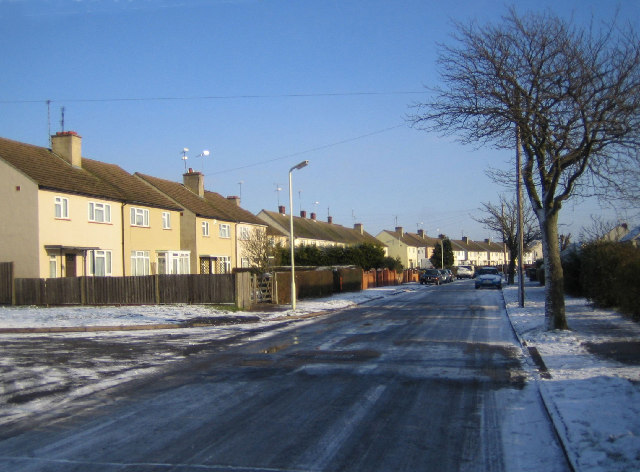
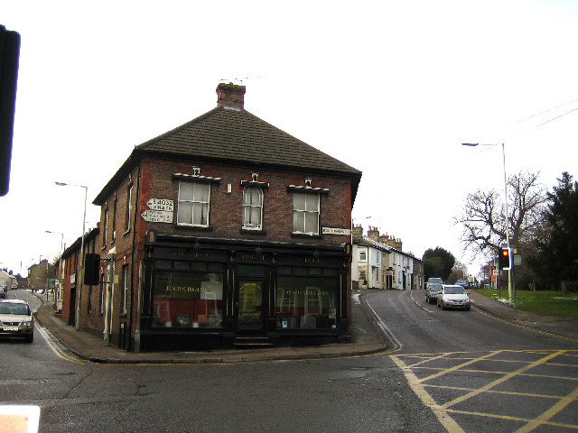
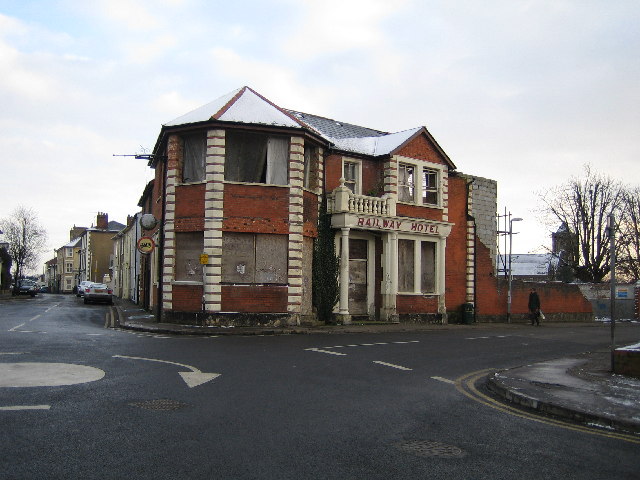
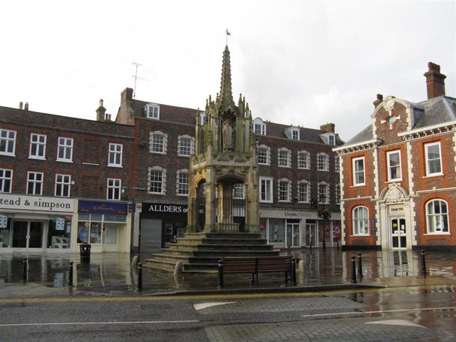
Today, Leighton Buzzard is a vibrant and bustling town with a mix of modern developments and historic architecture. The town center features a variety of shops, restaurants, and cafes, catering to both residents and visitors. Leighton Buzzard is also home to several industrial estates, providing employment opportunities for the local population.

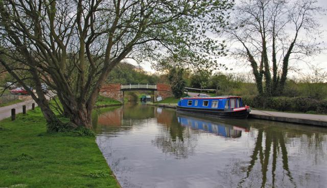
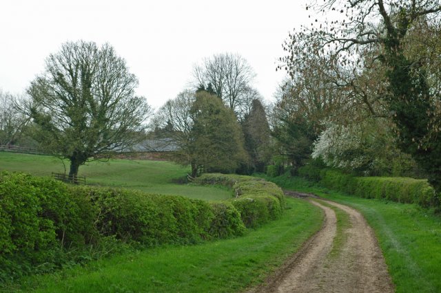
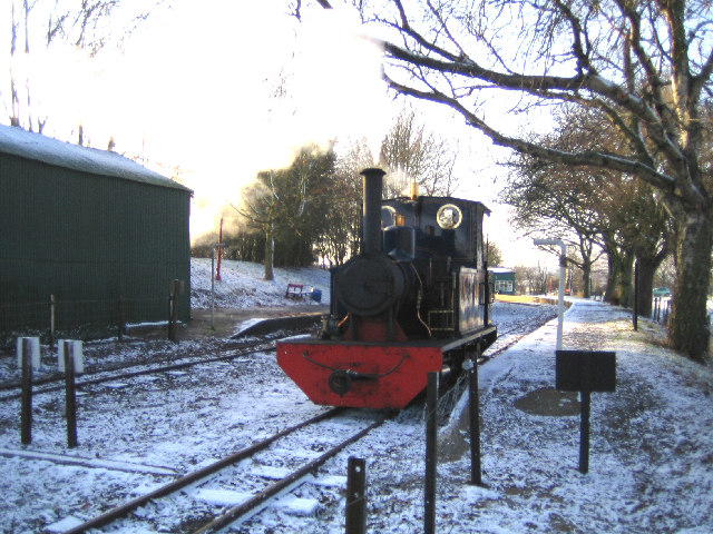
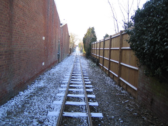
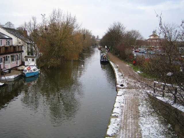
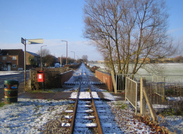
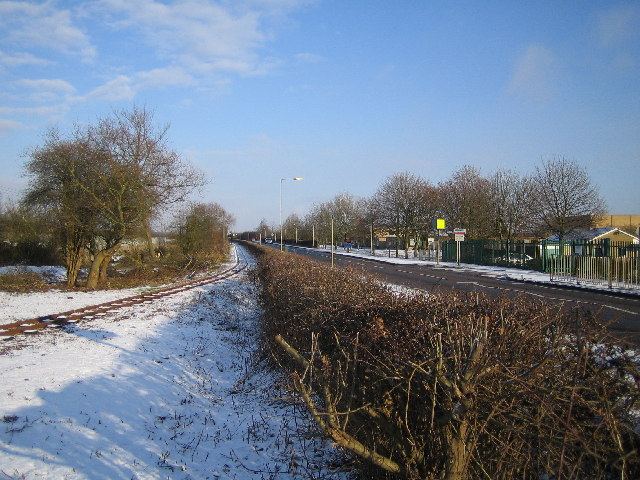
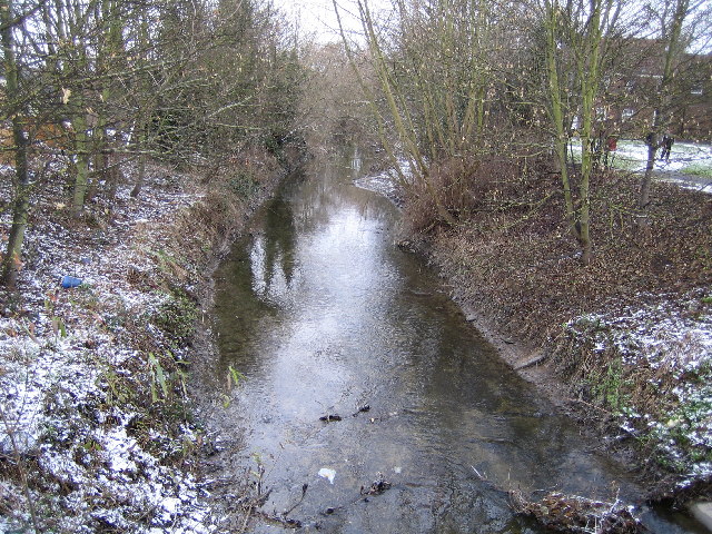
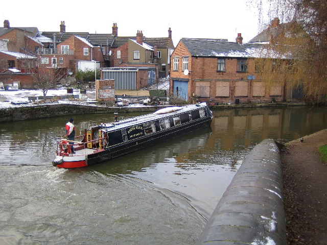
Nature enthusiasts can enjoy the beautiful countryside surrounding the town, including the nearby Grand Union Canal and the Bedfordshire Green Belt. The town is also known for the Leighton Buzzard Railway, a heritage railway that offers steam train rides along a 3.5-mile track.

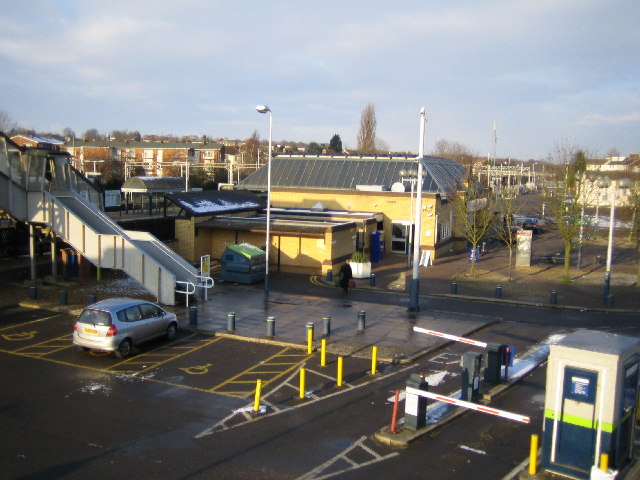
Transportation links are well-developed, with Leighton Buzzard being served by a train station that provides regular services to London and other major cities. The town is also conveniently located near major road networks, including the M1 motorway.

In summary, Leighton Buzzard is a historic and lively town in Bedfordshire, offering a mix of modern amenities, beautiful countryside, and excellent transport links.

If you have any feedback on the listing, please let us know in the comments section below.

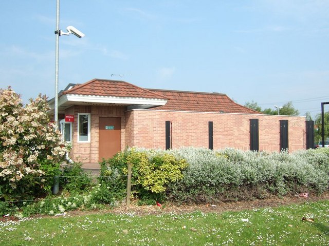
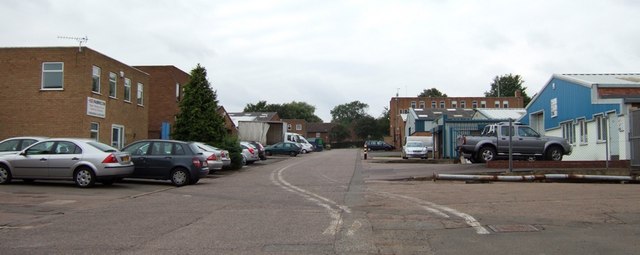
Leighton Buzzard Images

Images are sourced within 2km of 51.916362/-0.66146243 or Grid Reference SP9225. Thanks to Geograph Open Source API. All images are credited.

Grand Union Canal Looking West
Grand Union Canal
Looking West
Looking towards the SW corner of Linslade.
Leighton Buzzard: Market Square The 15th Century pentagonal market cross in the Market Square at the top end of the High Street.
Leighton Buzzard: Market Square
The 15th Century pentagonal market cross in the Market Square at the top end of the High Street.
Leighton Buzzard: All Saints Church A church has stood on the site of the present building in Leighton Buzzard for more than 1,000 years. Today's church dates from 1277 and has a 60 metre high broach spire on a squat tower, which is a prominent landmark in the locality. Inside it boasts a magnificent 15th Century roof adorned with angels and saints contrasting with 25 ferocious gargoyles around the outside. The Church was severely damaged by fire in 1985. The fire happened just as a restoration programme was nearing completion. It destroyed most of the nave and chancel roofs and caused serious structural damage to the tower, spire, and the vestry areas and a number of the windows were damaged beyond repair. The ring of ten bells was lost as were both the organs. The total cost of the damage exceeded £1.5 million pounds. <span class="nowrap"><a title="http://www.allsaintslb.org.uk/" rel="nofollow ugc noopener" href="http://www.allsaintslb.org.uk/">Link</a><img style="margin-left:2px;" alt="External link" title="External link - shift click to open in new window" src="https://s1.geograph.org.uk/img/external.png" width="10" height="10"/></span> for the Church's website.
Leighton Buzzard: All Saints Church
A church has stood on the site of the present building in Leighton Buzzard for more than 1,000 years. Today's church dates from 1277 and has a 60 metre high broach spire on a squat tower, which is a prominent landmark in the locality. Inside it boasts a magnificent 15th Century roof adorned with angels and saints contrasting with 25 ferocious gargoyles around the outside. The Church was severely damaged by fire in 1985. The fire happened just as a restoration programme was nearing completion. It destroyed most of the nave and chancel roofs and caused serious structural damage to the tower, spire, and the vestry areas and a number of the windows were damaged beyond repair. The ring of ten bells was lost as were both the organs. The total cost of the damage exceeded £1.5 million pounds. LinkExternal link for the Church's website.
Leighton Buzzard: Doll Doll being the name of this 1919 built steam engine on the narrow gauge Leighton Buzzard Railway. This photograph was taken at the Page's Park terminus station. The railway was originally built in 1919 to carry sand from nearby quarries to the now dismantled Leighton Buzzard to Dunstable standard gauge railway line close to Page's Park. It closed as an industrial line in 1969, but was taken over by volunteers to be run as a heritage railway. The railway has a very informative website here <span class="nowrap"><a title="http://www.buzzrail.co.uk/" rel="nofollow ugc noopener" href="http://www.buzzrail.co.uk/">Link</a><img style="margin-left:2px;" alt="External link" title="External link - shift click to open in new window" src="https://s1.geograph.org.uk/img/external.png" width="10" height="10"/></span>
Leighton Buzzard: Doll
Doll being the name of this 1919 built steam engine on the narrow gauge Leighton Buzzard Railway. This photograph was taken at the Page's Park terminus station. The railway was originally built in 1919 to carry sand from nearby quarries to the now dismantled Leighton Buzzard to Dunstable standard gauge railway line close to Page's Park. It closed as an industrial line in 1969, but was taken over by volunteers to be run as a heritage railway. The railway has a very informative website here LinkExternal link
Leighton Buzzard: Narrow gauge railway A light dusting of snow covers the railway sleepers in this view taken looking southwards towards the Page's Park terminus from the Stanbridge Road level crossing. Residential properties and factories have been built up to the line here where it used to run in open countryside. The very informative Leighton Buzzard Railway website can be found here <span class="nowrap"><a title="http://www.buzzrail.co.uk/" rel="nofollow ugc noopener" href="http://www.buzzrail.co.uk/">Link</a><img style="margin-left:2px;" alt="External link" title="External link - shift click to open in new window" src="https://s1.geograph.org.uk/img/external.png" width="10" height="10"/></span>
Leighton Buzzard: Narrow gauge railway
A light dusting of snow covers the railway sleepers in this view taken looking southwards towards the Page's Park terminus from the Stanbridge Road level crossing. Residential properties and factories have been built up to the line here where it used to run in open countryside. The very informative Leighton Buzzard Railway website can be found here LinkExternal link
Linslade: Grand Union Canal Viewed looking northwards from the A4146 Leighton Road overbridge. The Tesco supermarket, in their own house style complete with clock tower, is just visible to the right.
Linslade: Grand Union Canal
Viewed looking northwards from the A4146 Leighton Road overbridge. The Tesco supermarket, in their own house style complete with clock tower, is just visible to the right.
Linslade: Bideford Green Part of the large 1970s housing development on the western side of Linslade, viewed from the grassy embankment up to Soulbury Road, with a light dusting of snow on the ground. The road naming committee were obviously uninspired as every small cul-de-sac on the estate is on Bideford Green, and the house numbers run to 450 and beyond.
Linslade: Bideford Green
Part of the large 1970s housing development on the western side of Linslade, viewed from the grassy embankment up to Soulbury Road, with a light dusting of snow on the ground. The road naming committee were obviously uninspired as every small cul-de-sac on the estate is on Bideford Green, and the house numbers run to 450 and beyond.
Leighton Buzzard: Narrow gauge railway The railway was originally built in 1919 to carry sand from nearby quarries to the now dismantled Leighton Buzzard to Dunstable standard gauge railway line close to Page's Park. It closed as an industrial line in 1969, but was taken over by volunteers to be run as a heritage railway. The railway has a very informative website here <span class="nowrap"><a title="http://www.buzzrail.co.uk/" rel="nofollow ugc noopener" href="http://www.buzzrail.co.uk/">Link</a><img style="margin-left:2px;" alt="External link" title="External link - shift click to open in new window" src="https://s1.geograph.org.uk/img/external.png" width="10" height="10"/></span> A light dusting of snow covers the ground in this view, taken looking north westwards where the railway runs parallel to the road called Meadway on the left. The brick walls are the parapets of the railway bridge over Clipstone Brook, a tributary of the River Ouzel.
Leighton Buzzard: Narrow gauge railway
The railway was originally built in 1919 to carry sand from nearby quarries to the now dismantled Leighton Buzzard to Dunstable standard gauge railway line close to Page's Park. It closed as an industrial line in 1969, but was taken over by volunteers to be run as a heritage railway. The railway has a very informative website here LinkExternal link A light dusting of snow covers the ground in this view, taken looking north westwards where the railway runs parallel to the road called Meadway on the left. The brick walls are the parapets of the railway bridge over Clipstone Brook, a tributary of the River Ouzel.
Leighton Buzzard: Churchill Road Viewed looking eastwards with a light covering of snow on the ground.
Leighton Buzzard: Churchill Road
Viewed looking eastwards with a light covering of snow on the ground.
Leighton Buzzard: Narrow gauge railway The railway was originally built in 1919 to carry sand from nearby quarries to the now dismantled Leighton Buzzard to Dunstable standard gauge railway line close to Page's Park. It closed as an industrial line in 1969, but was taken over by volunteers to be run as a heritage railway. The railway has a very informative website here <span class="nowrap"><a title="http://www.buzzrail.co.uk/" rel="nofollow ugc noopener" href="http://www.buzzrail.co.uk/">Link</a><img style="margin-left:2px;" alt="External link" title="External link - shift click to open in new window" src="https://s1.geograph.org.uk/img/external.png" width="10" height="10"/></span> Viewed looking north eastwards, the railway runs parallel to Vandyke Road here. The buildings of Vandyke Upper School are visible on the right of the road. The School's website is here <span class="nowrap"><a title="http://www.vandyke.beds.sch.uk/" rel="nofollow ugc noopener" href="http://www.vandyke.beds.sch.uk/">Link</a><img style="margin-left:2px;" alt="External link" title="External link - shift click to open in new window" src="https://s1.geograph.org.uk/img/external.png" width="10" height="10"/></span>
Leighton Buzzard: Narrow gauge railway
The railway was originally built in 1919 to carry sand from nearby quarries to the now dismantled Leighton Buzzard to Dunstable standard gauge railway line close to Page's Park. It closed as an industrial line in 1969, but was taken over by volunteers to be run as a heritage railway. The railway has a very informative website here LinkExternal link Viewed looking north eastwards, the railway runs parallel to Vandyke Road here. The buildings of Vandyke Upper School are visible on the right of the road. The School's website is here LinkExternal link
Linslade: Leighton Buzzard railway station Anyone arriving at Leighton Buzzard railway station expecting to be in the town centre would be disappointed because the station is in Linslade on the opposite side of the valley of the River Ouzel and about 1 kilometre away from Leighton Buzzard to the west. This view was taken looking northwards from the footbridge to the south of the station.
Linslade: Leighton Buzzard railway station
Anyone arriving at Leighton Buzzard railway station expecting to be in the town centre would be disappointed because the station is in Linslade on the opposite side of the valley of the River Ouzel and about 1 kilometre away from Leighton Buzzard to the west. This view was taken looking northwards from the footbridge to the south of the station.
Leighton Buzzard: River Ouzel Viewed looking northwards and downstream from the A4146 road bridge with a light dusting of snow on the ground.
Leighton Buzzard: River Ouzel
Viewed looking northwards and downstream from the A4146 road bridge with a light dusting of snow on the ground.
Linslade: Laura Alice in action Laura Alice of Great Amwell being the name of the narrow boat on the Grand Union Canal making the turn to go northwards under the A4146 road bridge.

Update September 2013. Please see <a href="https://www.geograph.org.uk/photo/3694843">SP9124 : Grand Union Canal: Bridge Number 114A</a> for a view in the opposite direction!
Linslade: Laura Alice in action
Laura Alice of Great Amwell being the name of the narrow boat on the Grand Union Canal making the turn to go northwards under the A4146 road bridge. Update September 2013. Please see SP9124 : Grand Union Canal: Bridge Number 114A for a view in the opposite direction!
Linslade: Decisions, decisions Old style road direction signs on the wall of the building at the road junction offer the choice of taking the B4032 to Winslow to the left or the road to Stoke Hammond to the right. Those undecided who go straight on will meet their makers courtesy of Dillamore Funeral Service...
Linslade: Decisions, decisions
Old style road direction signs on the wall of the building at the road junction offer the choice of taking the B4032 to Winslow to the left or the road to Stoke Hammond to the right. Those undecided who go straight on will meet their makers courtesy of Dillamore Funeral Service...
Linslade: The Railway Hotel An icon of a long since departed way of life, that of the commercial traveller who used the railways to get around, Linslade's version of The Railway Hotel, with its balustraded balcony over the front door, stands derelict and boarded up. Station Road, inevitably, is to the right, New Road to the left.
Linslade: The Railway Hotel
An icon of a long since departed way of life, that of the commercial traveller who used the railways to get around, Linslade's version of The Railway Hotel, with its balustraded balcony over the front door, stands derelict and boarded up. Station Road, inevitably, is to the right, New Road to the left.
McDonald's near Leighton Buzzard Just off the A505/A4146 roundabout is this ubiquitous feature of modern Britain (and the rest of the world for that matter) a McDonald's fast food "restaurant". The photo was taken from the adjoining service station.
McDonald's near Leighton Buzzard
Just off the A505/A4146 roundabout is this ubiquitous feature of modern Britain (and the rest of the world for that matter) a McDonald's fast food "restaurant". The photo was taken from the adjoining service station.
Industrial Estate, Leighton Buzzard This Industrial Estate is on the northern side of the road to Stanbridge out of Leighton Buzzard.
Industrial Estate, Leighton Buzzard
This Industrial Estate is on the northern side of the road to Stanbridge out of Leighton Buzzard.
Show me another place!

Leighton Buzzard is located at Grid Ref: SP9225 (Lat: 51.916362, Lng: -0.66146243)

Unitary Authority: Central Bedfordshire

Police Authority: Bedfordshire

What 3 Words

///grapes.whites.ally. Near Leighton Buzzard, Bedfordshire

Nearby Locations

Leighton Buzzard

Related Wikis

Leighton Buzzard Urban District

The town of Leighton Buzzard in Bedfordshire, England was administered as a Local Government District from 1891 to 1894 and an Urban District from 1894...

Leighton Buzzard

Leighton Buzzard ( LAY-tən BUZ-ərd) is a market town in Bedfordshire, England, in the southwest of the county and close to the Buckinghamshire border...

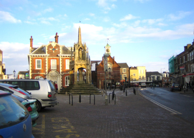
Old Town Hall, Leighton Buzzard

The Old Town Hall is a municipal building in the Market Square, Leighton Buzzard, Bedfordshire, England. The town hall, which is currently used as a restaurant...

Bedfordshire Greensand Ridge

Bedfordshire Greensand Ridge is an escarpment which runs through Buckinghamshire, Bedfordshire, and Cambridgeshire in the south and east of England. A...

Nearby Amenities

Located within 500m of 51.916362,-0.66146243
Direction: backward
Traffic Calming: table
Lat/Long: 51.9171278/-0.6646717
Mini Roundabout
Direction: clockwise
Lat/Long: 51.9155133/-0.6589475
Leighton Buzzard
Is In: Bedfordshire
Name En: Leighton Buzzard
Name Ru: Лейтон-Баззард
Place: town
Population: 37000
Wikidata: Q2462645
Wikipedia: en:Leighton Buzzard
Lat/Long: 51.9165794/-0.6620551
Mini Roundabout
Direction: clockwise
Lat/Long: 51.9132985/-0.656779
Mini Roundabout
Direction: clockwise
Lat/Long: 51.9135462/-0.6558751
Access: no
Barrier: bollard
Bicycle: yes
Bollard: removable
Bus: yes
Foot: yes
Material: metal
Motor Vehicle: permit
Lat/Long: 51.9159565/-0.6639342
Crossing
Crossing: marked
Crossing Island: no
Tactile Paving: yes
Traffic Calming: table
Lat/Long: 51.9161511/-0.6665848
Recycling
Lat/Long: 51.9148318/-0.6555748
Atm
Wheelchair: yes
Lat/Long: 51.9151164/-0.6567322
Post Box
Collection Times: Mo-Fr 17:30; Sa 12:15
Ref: LU7 87
Source: survey
Lat/Long: 51.915056/-0.6566384
Mini Roundabout
Direction: clockwise
Lat/Long: 51.9141725/-0.6578631
Post Box
Collection Times: Mo-Fr 18:30; Sa 12:00
Ref: LU7 5
Source: survey
Lat/Long: 51.915448/-0.6592151
Recycling
Lat/Long: 51.9154473/-0.6609658
Historic: memorial
Memorial: war_memorial
Lat/Long: 51.9151392/-0.6645867
Turning Circle
Turning Circle: circle
Lat/Long: 51.9148291/-0.662174
Telephone
Booth: K6
Covered: booth
Listed Status: Grade II
Operator: BT
Phone: +44 1525 372101
Lat/Long: 51.9157305/-0.6648737
Post Box
Collection Times: Mo-Fr 18:45; Sa 12:30
Post Box Design: type_c
Post Box Type: pillar
Ref: LU7 86
Royal Cypher: EIIR
Royal Cypher Wikidata: Q33102113
Lat/Long: 51.9153313/-0.6643766
Bus Stop
High Street (Stop 4), Leighton Buzzard
Bench: yes
Bus: yes
Local Ref: 4
Naptan AtcoCode: 021014022
Naptan NaptanCode: ahladtjw
Public Transport: platform
Shelter: yes
Lat/Long: 51.9158481/-0.6642758
Bus Stop
Leighton Buzzard High Street (Stop 3)
Bench: yes
Bin: yes
Bus: yes
Departures Board: realtime
Lit: no
Local Ref: 3
Naptan AtcoCode: 021014021
Naptan NaptanCode: ahladtjt
Passenger Information Display: yes
Public Transport: platform
Shelter: yes
Tactile Paving: no
Lat/Long: 51.9159699/-0.6640336
Telephone
Booth: KX100
Covered: booth
Lat/Long: 51.9158739/-0.6641747
Turning Circle
Turning Circle: knuckle
Lat/Long: 51.9160254/-0.6545124
Theatre
Leighton Buzzard Theatre
Addr City: Leighton Buzzard
Addr Country: GB
Addr Postcode: LU7 1RX
Addr Street: Lake Street
Fhrs Authority: Central Bedfordshire
Fhrs Id: 1173448
Fhrs Local Authority Id: 69293
Phone: +44 300 300 8125
Wheelchair: yes
Wikidata: Q41487632
Lat/Long: 51.9157907/-0.6594293
Crossing
Crossing: marked
Traffic Calming: table
Lat/Long: 51.9169547/-0.665105
Crossing
Crossing: unmarked
Crossing Island: yes
Tactile Paving: yes
Lat/Long: 51.9173655/-0.6579613
Barrier: bollard
Lat/Long: 51.9189583/-0.6598732
Post Box
Collection Times: Mo-Fr 18:15; Sa 12:30
Ref: LU7 13
Royal Cypher: EIIR
Royal Cypher Wikidata: Q33102113
Source: survey
Lat/Long: 51.9162868/-0.6619254
Post Box
Collection Times: Mo-Fr 18:30; Sa 12:30
Operator: Royal Mail
Post Box Type: wall
Ref: LU7 1
Royal Cypher: EIIR
Royal Cypher Wikidata: Q33102113
Source: survey
Lat/Long: 51.9180669/-0.6556395
Mini Roundabout
Direction: clockwise
Lat/Long: 51.9162852/-0.6667013
Direction: forward
Traffic Calming: table
Lat/Long: 51.916811/-0.6654498
Crossing
Crossing: marked
Crossing Island: no
Tactile Paving: yes
Traffic Calming: table
Lat/Long: 51.916211/-0.6669562
Barrier: bollard
Bollard: fixed
Lat/Long: 51.9160085/-0.6650803
Post Box
Collection Times: Mo-Fr 18:30; Sa 11:30
Operator: Royal Mail
Post Box Type: pillar
Ref: LU7 6
Royal Cypher: EIIR
Royal Cypher Wikidata: Q33102113
Source: survey
Lat/Long: 51.9194019/-0.6601803
Recycling
Lat/Long: 51.9166184/-0.6590538
Crossing
Crossing: zebra
Crossing Island: yes
Tactile Paving: yes
Lat/Long: 51.9174533/-0.6585731
Crossing
Crossing: zebra
Crossing Island: yes
Tactile Paving: yes
Lat/Long: 51.9170877/-0.6582508
Crossing
Crossing: zebra
Crossing Island: yes
Tactile Paving: yes
Lat/Long: 51.9175101/-0.6584971
Crossing
Crossing: zebra
Crossing Island: yes
Tactile Paving: yes
Lat/Long: 51.9171246/-0.6580833
Crossing
Lat/Long: 51.914912/-0.6586359
Traffic Signals
Lat/Long: 51.9191636/-0.6601423
Mo's Mini Market
Addr City: Leighton Buzzard
Addr Country: GB
Addr Housenumber: 1-5
Addr Postcode: LU7 4TG
Addr Street: Billington Road
Fhrs Authority: Central Bedfordshire
Fhrs Id: 450524
Fhrs Local Authority Id: 47207
Shop: convenience
Lat/Long: 51.9130823/-0.6565762
Bus Stop
Leighton Buzzard, Lake Street adjacent Morrisons
Bench: yes
Bus: yes
Departures Board: timetable
Naptan AtcoCode: 021014025
Naptan NaptanCode: ahladtmg
Public Transport: platform
Shelter: yes
Lat/Long: 51.9137531/-0.6573664
Source: survey; Bing
Survey Date: 2017-01-01
Lat/Long: 51.9188564/-0.6601091
Crossing
Crossing: unmarked
Lat/Long: 51.9133367/-0.656626
Recycling
Lat/Long: 51.916457/-0.6595577
Bench
Backrest: yes
Check Date: 2023-01-28
Material: metal
Lat/Long: 51.9161228/-0.6669942
Bus Stop
Bus: yes
Naptan AtcoCode: 021014008
Naptan NaptanCode: ahladtdw
Public Transport: platform
Shelter: no
Source: survey
Lat/Long: 51.917628/-0.6573754
Bus Stop
Bus: yes
Public Transport: platform
Shelter: no
Source: survey
Lat/Long: 51.9176901/-0.6568997
Post Box
Collection Times: Mo-Fr 18:45; Sa 12:30
Post Box Design: type_k
Post Box Type: pillar
Ref: LU7 96
Royal Cypher: EIIR
Royal Cypher Wikidata: Q33102113
Lat/Long: 51.9153234/-0.6644152
Crossing
Crossing: marked
Traffic Calming: table
Lat/Long: 51.9174837/-0.6634139
Crossing
Crossing: marked
Traffic Calming: table
Lat/Long: 51.9177164/-0.6610282
Crossing
Crossing: marked
Crossing Island: no
Tactile Paving: yes
Traffic Calming: table
Lat/Long: 51.9177407/-0.6600677
Crossing
Lat/Long: 51.9179244/-0.6606077
Bench
Backrest: yes
Lat/Long: 51.9144019/-0.6620591
Bench
Backrest: yes
Lat/Long: 51.9143795/-0.6627135
Bench
Backrest: yes
Lat/Long: 51.9143705/-0.6619294
Bench
Backrest: yes
Material: metal
Lat/Long: 51.9170029/-0.6651561
Bench
Backrest: yes
Lat/Long: 51.9141943/-0.6615542
Bench
Backrest: yes
Lat/Long: 51.914385/-0.6625764
Bench
Backrest: yes
Lat/Long: 51.9140668/-0.6613845
Bench
Backrest: yes
Lat/Long: 51.9138549/-0.6611614
Bench
Backrest: yes
Lat/Long: 51.9144008/-0.6622474
Bench
Backrest: yes
Lat/Long: 51.9143523/-0.6632555
Bicycle Parking
Capacity: 7
Covered: no
Fee: no
Lat/Long: 51.9164105/-0.6613235
Atm
Check Date: 2022-04-03
Currency GBP: yes
Drive Through: no
Fee: no
Operator: Natwest Bank
Lat/Long: 51.9161697/-0.6633262
Atm
Check Date: 2022-08-23
Currency GBP: yes
Drive Through: no
Fee: no
Operator: Nationwide
Wheelchair: yes
Lat/Long: 51.9162907/-0.6628885
Market Cross
Historic: monument
Lat/Long: 51.9164644/-0.6617358
Atm
Currency GBP: yes
Fee: no
Operator: Lloyds TSB
Lat/Long: 51.9166121/-0.6614835
Noexit: yes
Lat/Long: 51.9148485/-0.661649
Noexit: yes
Lat/Long: 51.9153914/-0.6608569
Noexit: yes
Lat/Long: 51.9154452/-0.6617996
Noexit: yes
Lat/Long: 51.915477/-0.6610372
Noexit: yes
Lat/Long: 51.9155204/-0.6613161
Atm
Santander
Brand: Santander
Brand Wikidata: Q7420065
Brand Wikipedia: en:Santander UK
Currency GBP: yes
Fee: no
Operator: Santander
Operator Wikidata: Q7420065
Lat/Long: 51.916746/-0.6607399
Traffic Calming: table
Lat/Long: 51.9163278/-0.660719
Crossing
Crossing: uncontrolled
Crossing Ref: zebra
Lat/Long: 51.918115/-0.6554491
Bench
Backrest: yes
Check Date: 2022-09-04
Lat/Long: 51.915863/-0.6640354
Bench
Backrest: yes
Lat/Long: 51.9164135/-0.6617375
Bench
Backrest: yes
Lat/Long: 51.9164169/-0.6616955
Bench
Backrest: yes
Lat/Long: 51.9164216/-0.6616662
Bench
Backrest: yes
Check Date: 2021-08-02
Lat/Long: 51.9159741/-0.6640869
Bench
Backrest: yes
Check Date: 2023-03-26
Lat/Long: 51.9166506/-0.6645092
Covered: no
Leisure: picnic_table
Lat/Long: 51.9122384/-0.6616113
Covered: no
Leisure: picnic_table
Lat/Long: 51.9122781/-0.6618032
Bus Stop
Lake Street opposite Morrisons, Leighton Buzzard
Bench: yes
Bin: no
Bus: yes
Departures Board: realtime
Naptan AtcoCode: 021016523
Naptan NaptanCode: ahlajptp
Passenger Information Display: yes
Public Transport: platform
Shelter: yes
Lat/Long: 51.9145079/-0.6583408
Bus Stop
Bench: yes
Bus: yes
Fixme: Bus stop status probably needs checking, it doesn't look to be in quite the right location
Public Transport: platform
Shelter: yes
Lat/Long: 51.9166874/-0.6609205
Crossing
Crossing Ref: zebra
Traffic Calming: table
Lat/Long: 51.9139426/-0.6576286
Crossing
Crossing Ref: zebra
Lat/Long: 51.9142411/-0.6576871
Crossing
Crossing Ref: zebra
Lat/Long: 51.9143105/-0.6580322
White House Stores
Addr City: Leighton Buzzard
Addr Country: GB
Addr Housenumber: 82
Addr Postcode: LU7 1HJ
Addr Street: Hockliffe Street
Fhrs Authority: Central Bedfordshire
Fhrs Id: 1138603
Fhrs Local Authority Id: 156855
Shop: convenience
Source: survey
Lat/Long: 51.9180071/-0.6556856
Fast Food
Dilraj
Addr City: Leighton Buzzard
Addr Country: GB
Addr Housenumber: 81
Addr Postcode: LU7 1EZ
Addr Street: Hockliffe Street
Cuisine: indian
Fhrs Authority: Central Bedfordshire
Fhrs Id: 450761
Fhrs Local Authority Id: 68903
Source: survey
Lat/Long: 51.9180872/-0.6561416
Addr City: Leighton Buzzard
Addr Country: GB
Addr Housenumber: 50
Addr Street: Hockliffe Street
Lat/Long: 51.9176241/-0.656855
Addr City: Leighton Buzzard
Addr Country: GB
Addr Housenumber: 80
Addr Street: Hockliffe Street
Lat/Long: 51.9179686/-0.6557976
Fast Food
Istanbul
Addr City: Leighton Buzzard
Addr Country: GB
Addr Housenumber: 49
Addr Postcode: LU7 1EZ
Addr Street: Hockliffe Street
Cuisine: kebab
Fhrs Authority: Central Bedfordshire
Fhrs Id: 450760
Fhrs Local Authority Id: 68896
Source: survey
Lat/Long: 51.9176949/-0.6572747
Fast Food
Med Fish Bar
Addr City: Leighton Buzzard
Addr Country: GB
Addr Housenumber: 53
Addr Postcode: LU7 1EZ
Addr Street: Hockliffe Street
Cuisine: burger
Fhrs Authority: Central Bedfordshire
Fhrs Id: 943749
Fhrs Local Authority Id: 160756
Source: survey
Survey Date: 2018-12-19
Lat/Long: 51.9177244/-0.6571506
Fast Food
Mandarin Inn
Addr City: Leighton Buzzard
Addr Country: GB
Addr Housenumber: 51
Addr Postcode: LU7 1EZ
Addr Street: Hockliffe Street
Cuisine: chinese
Fhrs Authority: Central Bedfordshire
Fhrs Id: 492390
Fhrs Local Authority Id: 68898
Source: survey
Lat/Long: 51.9177094/-0.6572067
Mela Laundrette Ltd
Shop: laundry
Source: survey
Lat/Long: 51.9181895/-0.6555873
63.63.63
Office: company
Source: survey
Lat/Long: 51.9181233/-0.6561072
Clinic
Crombie House
Addr Housename: Crombie House
Addr Street: Hockliffe Street
Healthcare: clinic
Lat/Long: 51.9174343/-0.6573714
Addr City: Leighton Buzzard
Addr Country: GB
Addr Housenumber: 41
Addr Street: Hockliffe Street
Lat/Long: 51.9176419/-0.6575149
Addr City: Leighton Buzzard
Addr Country: GB
Addr Housenumber: 47
Addr Street: Hockliffe Street
Lat/Long: 51.9176839/-0.6573328
Addr City: Leighton Buzzard
Addr Country: GB
Addr Housenumber: 55
Addr Street: Hockliffe Street
Lat/Long: 51.9177462/-0.6570551
Addr City: Leighton Buzzard
Addr Country: GB
Addr Housenumber: 75
Addr Street: Hockliffe Street
Lat/Long: 51.9179345/-0.6564041
Addr City: Leighton Buzzard
Addr Housenumber: 77
Lat/Long: 51.9179867/-0.656336
Addr City: Leighton Buzzard
Addr Country: GB
Addr Housenumber: 79
Addr Street: Hockliffe Street
Lat/Long: 51.9180366/-0.6562201
Addr City: Leighton Buzzard
Addr Country: GB
Addr Housenumber: 85
Addr Street: Hockliffe Street
Lat/Long: 51.9181591/-0.6560859
Addr City: Leighton Buzzard
Addr Country: GB
Addr Housenumber: 87
Addr Street: Hockliffe Street
Lat/Long: 51.9182805/-0.6558358
Dentist
Pear Tree Dental Practice
Addr Housenumber: 28
Addr Street: Hockliffe Street
Healthcare: dentist
Source: survey
Lat/Long: 51.9172789/-0.6578275
Taxi
Lat/Long: 51.9159392/-0.6641798
Bench
Lat/Long: 51.9134036/-0.6566951
Crossing
Crossing: unmarked
Crossing Island: yes
Tactile Paving: yes
Lat/Long: 51.9171836/-0.6585401
Bus Stop
Opposite Bridge Street (on Leighton Road)
Bench: yes
Bus: yes
Departures Board: realtime
Naptan AtcoCode: 021014007
Naptan NaptanCode: ahladtdt
Passenger Information Display: yes
Public Transport: platform
Shelter: yes
Lat/Long: 51.9161833/-0.6674908
Addr Housenumber: 4
Lat/Long: 51.9159293/-0.6570782
Addr Housenumber: 1
Lat/Long: 51.9158379/-0.6572311
Crossing
Crossing Ref: zebra
Lat/Long: 51.9151662/-0.6569004
Crossing
Crossing Ref: zebra
Lat/Long: 51.9152584/-0.6570546
Traffic Calming: table
Lat/Long: 51.9140883/-0.658053
Addr Housenumber: 4
Addr Street: Old Chapel Mews
Lat/Long: 51.9148132/-0.6591826
Addr Housenumber: 1
Addr Street: Old Chapel Mews
Lat/Long: 51.9149547/-0.6588728
Car Wash
Lat/Long: 51.9156102/-0.6584616
Addr Housenumber: 8
Addr Street: Old Chapel Mews
Lat/Long: 51.9148489/-0.6594626
Addr Housenumber: 5
Addr Street: Old Chapel Mews
Lat/Long: 51.9147306/-0.6593077
Crossing
Crossing: unmarked
Lat/Long: 51.9135158/-0.6560102
Addr Housenumber: 51
Addr Street: North Street
Lat/Long: 51.918716/-0.6605603
Addr Housenumber: 33
Addr Street: North Street
Lat/Long: 51.9184381/-0.6606978
Addr Housenumber: 15
Addr Street: Bossard Court
Lat/Long: 51.9179297/-0.6613326
Addr Housenumber: 12
Addr Street: Bossard Court
Lat/Long: 51.9180984/-0.6613547
Addr Housenumber: 33
Addr Street: Bossard Court
Lat/Long: 51.9182255/-0.6627322
Addr Housenumber: 25
Addr Street: Bossard Court
Lat/Long: 51.9178277/-0.662684
Addr Housenumber: 24
Addr Street: Bossard Court
Lat/Long: 51.9178833/-0.6622586
Addr Housenumber: 20
Addr Street: Bossard Court
Lat/Long: 51.9180901/-0.6622854
Addr Housenumber: 19
Addr Street: Bossard Court
Lat/Long: 51.9180802/-0.6617919
Addr Housenumber: 16
Addr Street: Bossard Court
Lat/Long: 51.9179206/-0.6617731
Addr Housenumber: 11
Addr Street: Bossard Court
Lat/Long: 51.9182953/-0.661568
Addr Housenumber: 8
Addr Street: Bossard Court
Lat/Long: 51.9182837/-0.6618295
Addr Housenumber: 7
Addr Street: Bossard Court
Lat/Long: 51.9182969/-0.6619233
Addr Housenumber: 1
Addr Street: Bossard Court
Lat/Long: 51.9182787/-0.6623887
Barrier: bollard
Source: survey; Bing
Survey Date: 2017-01-01
Lat/Long: 51.9189407/-0.6601401
Barrier: bollard
Source: survey; Bing
Survey Date: 2017-01-01
Lat/Long: 51.9188811/-0.6601763
Barrier: bollard
Source: survey; Bing
Survey Date: 2017-01-01
Lat/Long: 51.9188964/-0.6601669
Barrier: bollard
Source: survey; Bing
Survey Date: 2017-01-01
Lat/Long: 51.9189115/-0.6601578
Barrier: bollard
Source: survey; Bing
Survey Date: 2017-01-01
Lat/Long: 51.9189257/-0.6601492
Barrier: bollard
Source: survey; Bing
Survey Date: 2017-01-01
Lat/Long: 51.9189554/-0.6601311
Barrier: bollard
Source: survey; Bing
Survey Date: 2017-01-01
Lat/Long: 51.9189723/-0.6601209
Barrier: bollard
Lat/Long: 51.9164724/-0.6613849
Barrier: bollard
Lat/Long: 51.9164645/-0.6614083
Barrier: bollard
Lat/Long: 51.9164565/-0.6614295
Barrier: bollard
Lat/Long: 51.9164439/-0.6614442
Barrier: bollard
Lat/Long: 51.9164288/-0.6614459
Bicycle Parking
Bicycle Parking: stands
Lat/Long: 51.9165897/-0.6609711
Bicycle Parking
Bicycle Parking: stands
Lat/Long: 51.9165861/-0.6609844
Bicycle Parking
Bicycle Parking: stands
Lat/Long: 51.9165826/-0.6609976
Barrier: bollard
Source: survey; Bing
Survey Date: 2017-01-01
Lat/Long: 51.9165911/-0.6610077
Barrier: bollard
Source: survey; Bing
Survey Date: 2017-01-01
Lat/Long: 51.9165937/-0.6609943
Barrier: bollard
Source: survey; Bing
Survey Date: 2017-01-01
Lat/Long: 51.9165964/-0.6609809
Barrier: bollard
Source: survey; Bing
Survey Date: 2017-01-01
Lat/Long: 51.916599/-0.6609675
Barrier: bollard
Source: survey; Bing
Survey Date: 2017-01-01
Lat/Long: 51.9166017/-0.660954
Barrier: bollard
Source: survey; Bing
Survey Date: 2017-01-01
Lat/Long: 51.9164246/-0.6615246
Barrier: bollard
Source: survey; Bing
Survey Date: 2017-01-01
Lat/Long: 51.9164391/-0.6615253
Barrier: bollard
Source: survey; Bing
Survey Date: 2017-01-01
Lat/Long: 51.9164523/-0.6615236
Barrier: bollard
Source: survey; Bing
Survey Date: 2017-01-01
Lat/Long: 51.9164656/-0.6615173
Barrier: bollard
Source: survey; Bing
Survey Date: 2017-01-01
Lat/Long: 51.9164769/-0.6615086
Barrier: bollard
Source: survey; Bing
Survey Date: 2017-01-01
Lat/Long: 51.9164712/-0.6620259
Barrier: bollard
Source: survey; Bing
Survey Date: 2017-01-01
Lat/Long: 51.9164611/-0.6620628
Barrier: bollard
Source: survey; Bing
Survey Date: 2017-01-01
Lat/Long: 51.9164511/-0.662097
Barrier: bollard
Source: survey; Bing
Survey Date: 2017-01-01
Lat/Long: 51.91644/-0.6621278
Barrier: bollard
Source: survey; Bing
Survey Date: 2017-01-01
Lat/Long: 51.9164292/-0.662166
Barrier: bollard
Source: survey; Bing
Survey Date: 2017-01-01
Lat/Long: 51.9164187/-0.6621999
Barrier: bollard
Source: survey; Bing
Survey Date: 2017-01-01
Lat/Long: 51.9164104/-0.6622344
Barrier: bollard
Source: survey; Bing
Survey Date: 2017-01-01
Lat/Long: 51.9164021/-0.6622706
Barrier: bollard
Source: survey; Bing
Survey Date: 2017-01-01
Lat/Long: 51.916392/-0.6623102
Barrier: bollard
Source: survey; Bing
Survey Date: 2017-01-01
Lat/Long: 51.9163814/-0.6623578
Barrier: bollard
Source: survey; Bing
Survey Date: 2017-01-01
Lat/Long: 51.9164253/-0.6619307
Barrier: bollard
Source: survey; Bing
Survey Date: 2017-01-01
Lat/Long: 51.9164372/-0.6619438
Barrier: bollard
Source: survey; Bing
Survey Date: 2017-01-01
Lat/Long: 51.9164491/-0.6619568
Barrier: bollard
Source: survey; Bing
Survey Date: 2017-01-01
Lat/Long: 51.916461/-0.6619699
Barrier: bollard
Source: survey; Bing
Survey Date: 2017-01-01
Lat/Long: 51.9164729/-0.6619829
Barrier: bollard
Source: survey; Bing
Survey Date: 2017-01-01
Lat/Long: 51.9164849/-0.661996
Bench
Backrest: yes
Lat/Long: 51.9168192/-0.6637924
Crossing
Crossing: unmarked
Crossing Island: yes
Tactile Paving: yes
Lat/Long: 51.9172463/-0.658594
Crossing
Crossing: unmarked
Crossing Island: yes
Tactile Paving: yes
Lat/Long: 51.9174373/-0.6580102
Addr Housenumber: 31
Addr Street: North Street
Lat/Long: 51.9183893/-0.660722
Addr Housenumber: 27
Addr Street: North Street
Lat/Long: 51.9182934/-0.6607541
Bus Stop
Leighton Buzzard, near Library on Lake Street
Bench: no
Bus: yes
Departures Board: timetable
Naptan AtcoCode: 021016539
Naptan NaptanCode: ahlajtgw
Passenger Information Display: no
Public Transport: platform
Shelter: no
Lat/Long: 51.9157056/-0.659393
Bus Stop
Lake Street opposite Library, Leighton Buzzard
Bench: no
Bin: no
Bus: yes
Departures Board: timetable
Lit: no
Naptan AtcoCode: 021014024
Naptan NaptanCode: ahladtmd
Passenger Information Display: no
Public Transport: platform
Shelter: no
Tactile Paving: no
Lat/Long: 51.9159902/-0.6600482
Kindergarten
Aristo-Tots Nursery School
Addr City: Leighton Buzzard
Addr Country: GB
Addr Postcode: LU7 1FD
Addr Street: Hockliffe Street
Addr Unit: 1 White House Court
Fhrs Authority: Central Bedfordshire
Fhrs Id: 775618
Fhrs Local Authority Id: 157679
Lat/Long: 51.9180998/-0.6581806
Bar
Leighton Town Football Club
Addr City: Leighton Buzzard
Addr Country: GB
Addr Postcode: LU7 1RX
Addr Street: Lake Street
Addr Unit: Bell Close
Fhrs Authority: Central Bedfordshire
Fhrs Id: 450770
Fhrs Local Authority Id: 69123
Lat/Long: 51.9125301/-0.6602097
Kindergarten
Footsteps Private Day Nursery
Addr City: Leighton Buzzard
Addr Country: GB
Addr Housenumber: 11
Addr Postcode: LU7 1NS
Addr Street: Albany Road
Fhrs Id: 450522
Fhrs Local Authority Id: 46012
Lat/Long: 51.916486/-0.6551537
Bicycle Parking
Bicycle Parking: stands
Capacity: 8
Covered: no
Fee: no
Lat/Long: 51.9159622/-0.664389
Crossing
Crossing: unmarked
Tactile Paving: no
Lat/Long: 51.9165681/-0.6641638
Access: no
Barrier: lift_gate
Bicycle: yes
Bus: yes
Foot: yes
Material: metal
Motor Vehicle: permit
Wheelchair: yes
Lat/Long: 51.9163633/-0.6615909
Taxi
Lat/Long: 51.9158736/-0.6641229
Bus Stop
West Street (Eastbound)
Bench: yes
Bus: yes
Departures Board: realtime
Public Transport: platform
Shelter: yes
Lat/Long: 51.9176826/-0.6627774
Bus Stop
West Street (Westbound)
Bench: yes
Bus: yes
Departures Board: realtime
Public Transport: platform
Shelter: yes
Lat/Long: 51.9172804/-0.6640071
Cafe in the Park
Opening Hours: Mo-Su 10:00-17:00
Shop: kiosk
Lat/Long: 51.9132104/-0.6615617
Toilets
Changing Table: yes
Fee: no
Unisex: yes
Wheelchair: yes
Lat/Long: 51.9132128/-0.661443
Crossing
Lat/Long: 51.9151346/-0.6587161
Crossing
Lat/Long: 51.9157394/-0.6587286
Crossing
Lat/Long: 51.9154201/-0.6588201
Crossing
Lat/Long: 51.9150175/-0.658854
Bicycle Parking
Leighton Buzzard Library
Lat/Long: 51.9159289/-0.6594523
Crossing
Crossing: marked
Crossing Island: no
Lat/Long: 51.9183475/-0.6559823
Traffic Calming: island
Lat/Long: 51.9180265/-0.6560314
Direction: 135
Fixme: survey for panel count
Generator Method: photovoltaic
Generator Output Electricity: yes
Generator Solar Modules: 14
Generator Source: solar
Generator Type: solar_photovoltaic_panel
Location: roof
Power: generator
Lat/Long: 51.9167447/-0.6565134
Direction: 235
Fixme: survey for panel count
Generator Method: photovoltaic
Generator Output Electricity: yes
Generator Solar Modules: 8
Generator Source: solar
Generator Type: solar_photovoltaic_panel
Location: roof
Power: generator
Lat/Long: 51.9137063/-0.6578745
Direction: 55
Generator Method: photovoltaic
Generator Output Electricity: yes
Generator Solar Modules: 4
Generator Source: solar
Generator Type: solar_photovoltaic_panel
Location: roof
Power: generator
Lat/Long: 51.9137349/-0.6577984
Crossing
Crossing: unmarked
Lat/Long: 51.9147191/-0.6582676
Direction: 220
Fixme: survey for panel count
Generator Method: photovoltaic
Generator Output Electricity: yes
Generator Solar Modules: 8
Generator Source: solar
Generator Type: solar_photovoltaic_panel
Location: roof
Power: generator
Lat/Long: 51.9136985/-0.6597299
Direction: 90
Generator Method: photovoltaic
Generator Output Electricity: yes
Generator Solar Modules: 4
Generator Source: solar
Generator Type: solar_photovoltaic_panel
Power: generator
Lat/Long: 51.9160393/-0.6614046
Direction: 270
Generator Method: photovoltaic
Generator Output Electricity: yes
Generator Solar Modules: 4
Generator Source: solar
Generator Type: solar_photovoltaic_panel
Location: roof
Power: generator
Lat/Long: 51.9160391/-0.6614133
Bus Stop
Bus: yes
Public Transport: platform
Lat/Long: 51.9157953/-0.6648441
Parking Space
Capacity: 6
Lat/Long: 51.9164112/-0.6580666
Parking Space
Capacity: 4
Lat/Long: 51.9166063/-0.6577853
Parking
Capacity: 12
Operator: Pear Tree Dental Practice
Operator Type: business
Lat/Long: 51.9169918/-0.657603
Parking
Lat/Long: 51.9183274/-0.6569672
Direction: 200
Generator Method: photovoltaic
Generator Output Electricity: yes
Generator Solar Modules: 16
Generator Source: solar
Generator Type: solar_photovoltaic_panel
Location: roof
Power: generator
Lat/Long: 51.9191817/-0.6597704
Direction: 235
Generator Method: photovoltaic
Generator Output Electricity: yes
Generator Solar Modules: 5
Generator Source: solar
Generator Type: solar_photovoltaic_panel
Location: roof
Power: generator
Lat/Long: 51.9198846/-0.6579224
Direction: 265
Generator Method: photovoltaic
Generator Output Electricity: yes
Generator Solar Modules: 7
Generator Source: solar
Generator Type: solar_photovoltaic_panel
Location: roof
Power: generator
Lat/Long: 51.9199379/-0.6606834
Parking
Lat/Long: 51.9206901/-0.66178
Parking Space
Capacity: 6
Lat/Long: 51.9179699/-0.6662305
Turning Circle
Turning Circle: knuckle
Lat/Long: 51.918385/-0.6660992
Direction: 70
Generator Method: photovoltaic
Generator Output Electricity: yes
Generator Solar Modules: 8
Generator Source: solar
Generator Type: solar_photovoltaic_panel
Location: roof
Power: generator
Lat/Long: 51.918128/-0.6662587
Direction: 160
Generator Method: photovoltaic
Generator Output Electricity: yes
Generator Solar Modules: 3
Generator Source: solar
Generator Type: solar_photovoltaic_panel
Location: roof
Power: generator
Lat/Long: 51.9180888/-0.6663308
Direction: 160
Generator Method: photovoltaic
Generator Output Electricity: yes
Generator Solar Modules: 52
Generator Source: solar
Generator Type: solar_photovoltaic_panel
Location: roof
Power: generator
Lat/Long: 51.91803/-0.66409
Telephone
Booth: K6
Covered: booth
Listed Status: Grade II
Operator: BT
Phone: +44 1525 373299
Lat/Long: 51.9157171/-0.6648667
Bench
Lat/Long: 51.9157907/-0.6649157
Turning Circle
Lat/Long: 51.9159861/-0.6638031
Defibrillator
Defibrillator Location: outside Leighton Buzzard old Post Office - next to pillar boxes
Emergency: defibrillator
Indoor: no
Not Ref GB The Circuit: 2A7345D1-F6B8-4E8C-98D2-AFBE00C51771
Lat/Long: 51.9153256/-0.6643461
Turning Circle
Turning Circle: knuckle
Lat/Long: 51.9156641/-0.6552148
Direction: 100
Generator Method: photovoltaic
Generator Output Electricity: yes
Generator Solar Modules: 7
Generator Source: solar
Generator Type: solar_photovoltaic_panel
Location: roof
Power: generator
Lat/Long: 51.9173988/-0.6677993
Direction: 280
Generator Method: photovoltaic
Generator Output Electricity: yes
Generator Solar Modules: 7
Generator Source: solar
Generator Type: solar_photovoltaic_panel
Location: roof
Power: generator
Lat/Long: 51.9173994/-0.6678188
Direction: 190
Generator Method: photovoltaic
Generator Output Electricity: yes
Generator Solar Modules: 6
Generator Source: solar
Generator Type: solar_photovoltaic_panel
Location: roof
Power: generator
Lat/Long: 51.917393/-0.6677297
Fix: more solar panels?
Lat/Long: 51.9173033/-0.6677235
Fix: more solar panels?
Lat/Long: 51.917043/-0.6678064
Direction: 280
Generator Method: photovoltaic
Generator Output Electricity: yes
Generator Solar Modules: 7
Generator Source: solar
Generator Type: solar_photovoltaic_panel
Location: roof
Power: generator
Lat/Long: 51.9171323/-0.6678462
Direction: 100
Generator Method: photovoltaic
Generator Output Electricity: yes
Generator Solar Modules: 7
Generator Source: solar
Generator Type: solar_photovoltaic_panel
Location: roof
Power: generator
Lat/Long: 51.9171312/-0.6678254
Turning Circle
Turning Circle: knuckle
Lat/Long: 51.9203524/-0.6646819
Direction: 110
Generator Method: photovoltaic
Generator Output Electricity: yes
Generator Solar Modules: 8
Generator Source: solar
Generator Type: solar_photovoltaic_panel
Location: roof
Power: generator
Lat/Long: 51.9204045/-0.6592139
Crossing
Crossing: unmarked
Crossing Island: no
Tactile Paving: yes
Lat/Long: 51.9175383/-0.6582476
Crossing
Crossing: unmarked
Lat/Long: 51.9175263/-0.6578438
Playground: structure
Lat/Long: 51.9204917/-0.6611595
Playground: swing
Lat/Long: 51.920411/-0.6610402
Baby: yes
Playground: swing
Lat/Long: 51.9204116/-0.6610276
Baby: yes
Playground: swing
Lat/Long: 51.9204129/-0.6610016
Playground: swing
Lat/Long: 51.9204137/-0.660986
Playground: rotator
Playground Theme: teacup
Lat/Long: 51.9204324/-0.6612644
Capacity: 3
Description: Three way springy/seesaw
Playground: springy
Lat/Long: 51.9204936/-0.6613187
Playground: rotator
Standing: yes
Lat/Long: 51.9205014/-0.6612716
Capacity: 1
Playground: springy
Lat/Long: 51.9205188/-0.6613137
Waste Basket
Lat/Long: 51.9205606/-0.6612477
Bench
Backrest: yes
Lat/Long: 51.9205569/-0.6611856
Waste Basket
Lat/Long: 51.9204477/-0.6613657
Playground: teenshelter
Lat/Long: 51.9128705/-0.6623521
Waste Basket
Lat/Long: 51.9136113/-0.6629703
Bench
Giant Pencil
Artist Name: Martin Heron
Artwork Type: sculpture
Backrest: no
Bench Theme: pencil
Tourism: artwork
Lat/Long: 51.9141664/-0.6631427
Bench
Backrest: no
Lat/Long: 51.9130151/-0.6619756
Bench
Backrest: no
Lat/Long: 51.9130403/-0.6618461
Covered: no
Leisure: picnic_table
Lat/Long: 51.9130236/-0.6619055
Bench
Backrest: no
Lat/Long: 51.9132196/-0.6617975
Bench
Backrest: no
Lat/Long: 51.9132953/-0.6618371
Covered: no
Leisure: picnic_table
Lat/Long: 51.9131553/-0.6616228
Covered: no
Leisure: picnic_table
Lat/Long: 51.913203/-0.6616426
Covered: no
Leisure: picnic_table
Lat/Long: 51.9132508/-0.6616624
Covered: no
Leisure: picnic_table
Lat/Long: 51.9132396/-0.6617331
Covered: no
Leisure: picnic_table
Lat/Long: 51.9131919/-0.6617134
Covered: no
Leisure: picnic_table
Lat/Long: 51.9131441/-0.6616936
Covered: no
Leisure: picnic_table
Lat/Long: 51.9132986/-0.6616822
Covered: no
Leisure: picnic_table
Lat/Long: 51.9132874/-0.6617529
Leisure: pitch
Sport: table_tennis
Lat/Long: 51.9134129/-0.6621695
Leisure: pitch
Sport: table_tennis
Lat/Long: 51.9133852/-0.6622579
Man Made: flagpole
Lat/Long: 51.9133994/-0.6622125
Covered: no
Leisure: picnic_table
Lat/Long: 51.9133371/-0.6621348
Covered: no
Leisure: picnic_table
Lat/Long: 51.9133619/-0.6619913
Waste Basket
Lat/Long: 51.9133776/-0.661882
Bench
Backrest: no
Lat/Long: 51.913347/-0.662059
Waste Basket
Lat/Long: 51.9129686/-0.6618787
Entrance: yes
Lat/Long: 51.9141789/-0.6620217
Bench
Backrest: yes
Lat/Long: 51.9142227/-0.6634994
Waste Basket
Lat/Long: 51.9142326/-0.6634102
Waste Basket
Waste: dog_excrement
Lat/Long: 51.9142822/-0.6635339
Recycling
Recycling Type: container
Lat/Long: 51.9143379/-0.6635916
Barrier: bollard
Lat/Long: 51.9143112/-0.6637074
Barrier: bollard
Lat/Long: 51.914352/-0.6637148
Barrier: bollard
Lat/Long: 51.9134235/-0.6604888
Bench
Backrest: yes
Lat/Long: 51.9121777/-0.6613201
Bench
Backrest: yes
Lat/Long: 51.912176/-0.6615146
Bench
Backrest: no
Lat/Long: 51.9124693/-0.6620838
Waste Basket
Lat/Long: 51.9122952/-0.6616882
Bench
Backrest: no
Lat/Long: 51.9127469/-0.6612141
Bench
Backrest: no
Lat/Long: 51.9128064/-0.6614555
Bench
Backrest: no
Lat/Long: 51.9129462/-0.6613523
Bicycle Parking
Bicycle Parking: stands
Capacity: 10
Covered: no
Fee: no
Lat/Long: 51.9132556/-0.6614606
Studio 44
Addr City: Leighton Buzzard
Addr Floor: 1
Addr Housenumber: 44
Addr Postcode: LU7 1EA
Addr Street: High Street
Level: 1
Shop: tattoo
Lat/Long: 51.9161803/-0.6623078
Fade Studio
Addr City: Leighton Buzzard
Addr Housenumber: 44
Addr Postcode: LU7 1EA
Addr Street: High Street
Level: 0
Shop: hairdresser
Lat/Long: 51.9161741/-0.6623742
Check Date: 2021-05-29
Disused Shop: shoes
Old Name: Clarks
Lat/Long: 51.9163784/-0.6626035
The Pavement Light Company
Addr City: Leighton Buzzard
Addr Housenumber: 46
Addr Postcode: LU7 1BE
Addr Street: Doggett Street
Opening Hours: Mo-Fr 08:00-18:00
Operator: The Pavement Light Company
Source: pavement lights;https://thepavementlightcompany.com/;gps
Source Website: https://thepavementlightcompany.com/
Website: https://thepavementlightcompany.com/
Website Menu: https://thepavementlightcompany.com/products-and-services
Lat/Long: 51.9185881/-0.6624057
Addr Country: GB
Addr Housenumber: 40
Lat/Long: 51.9195044/-0.6571426
Bicycle Parking
Access: yes
Bicycle Parking: post_hoop
Capacity: 4
Fee: no
Lat/Long: 51.9164269/-0.6616029
Bench
Backrest: no
Material: metal
Lat/Long: 51.9138055/-0.6615553
Playground: basketswing
Sitting Disability: yes
Lat/Long: 51.9134689/-0.6624923
Baby: no
Playground: swing
Lat/Long: 51.9134354/-0.6624656
Baby: no
Playground: swing
Lat/Long: 51.913445/-0.6624733
Playground: bridge
Lat/Long: 51.9135749/-0.6627368
Playground: monkey_bars
Lat/Long: 51.9136283/-0.6627799
Playground: monkey_bars
Lat/Long: 51.9135966/-0.6627856
Playground: climbingframe
Lat/Long: 51.9136476/-0.6627407
Playground: slide
Lat/Long: 51.9136548/-0.6626317
Playground: climbingframe
Lat/Long: 51.9136367/-0.6626729
Playground: tunnel
Lat/Long: 51.9136167/-0.6627118
Playground: climbingframe
Lat/Long: 51.9136002/-0.6626364
Playground: slide
Lat/Long: 51.9135092/-0.6627148
Playground: table
Lat/Long: 51.9133482/-0.6624037
Playground: musical_instrument
Lat/Long: 51.9132721/-0.6623268
Playground: springy
Lat/Long: 51.9132901/-0.6623863
Playground: springy
Lat/Long: 51.9132812/-0.6624268
Playground: musical_instrument
Lat/Long: 51.9132779/-0.6624596
Playground: slide
Lat/Long: 51.9133593/-0.6624667
Bench
Backrest: yes
Lat/Long: 51.9132733/-0.6623537
Baby: yes
Playground: swing
Lat/Long: 51.9131954/-0.662522
Baby: yes
Playground: swing
Lat/Long: 51.913205/-0.6625297
Playground: swing
Sitting Disability: yes
Lat/Long: 51.9132244/-0.6625451
Adult: yes
Baby: yes
Capacity: 2
Description: Twin adult and baby swing
Playground: swing
Lat/Long: 51.9132341/-0.6625528
Playground: rotator
Lat/Long: 51.9132766/-0.6625574
Playground: slide
Lat/Long: 51.9134084/-0.66244
Playground: bridge
Sensory: audible
Wheelchair: yes
Lat/Long: 51.9133153/-0.6626352
Playground: activitypanel
Sensory: visual
Lat/Long: 51.9133393/-0.6626235
Playground: roundabout
Wheelchair: yes
Lat/Long: 51.9135119/-0.662513
Playground: rope_swing
Lat/Long: 51.9133862/-0.6627366
Playground: activitypanel
Sensory: tactile
Lat/Long: 51.9133532/-0.6626106
Playground: activitypanel
Sensory: visual
Lat/Long: 51.9133572/-0.6625908
Covered: yes
Playground: rotator
Lat/Long: 51.9133334/-0.6625894
Playground: excavator
Lat/Long: 51.9133143/-0.6624007
Playground: peak
Lat/Long: 51.9132279/-0.6624045
Bench
Backrest: yes
Lat/Long: 51.9134054/-0.6624996
Playground: rotator
Lat/Long: 51.9132852/-0.6622921
Playground: seesaw
Lat/Long: 51.9133042/-0.6623295
Playground: aerialrotator
Sitting Disability: yes
Lat/Long: 51.9134995/-0.6623236
Backrest: no
Covered: no
Leisure: picnic_table
Lat/Long: 51.9134159/-0.6625737
Backrest: no
Covered: no
Leisure: picnic_table
Lat/Long: 51.9134159/-0.6626169
Backrest: no
Covered: no
Leisure: picnic_table
Lat/Long: 51.9134496/-0.6625827
Backrest: no
Covered: no
Leisure: picnic_table
Lat/Long: 51.9134471/-0.6626267
Noexit: yes
Lat/Long: 51.9132008/-0.6608514
'Fly Past' Monument
Access: yes
Description: The centre of the design represents the propeller of a Vimy bomber biplane which were constructed until 1919 at the Morgan & Co. factory at Vimy Road (i.e. the land where the current Tescos supermarket is sited).
Historic: monument
Source: streetlevel imagery
Lat/Long: 51.9161268/-0.6668383
The data included in this document is from www.openstreetmap.org. The data is made available under ODbL.

Have you been to Leighton Buzzard?

Leave your review of Leighton Buzzard below (or comments, questions and feedback).