Leighton Bromswold

Settlement in Huntingdonshire Huntingdonshire

England

Leighton Bromswold

Leighton Bromswold, St Mary
Leighton Bromswold, St Mary Credit: Dave Kelly

Leighton Bromswold is a small village located in the district of Huntingdonshire, in the county of Cambridgeshire, England. It is situated approximately 12 miles west of Huntingdon and 5 miles south of the market town of St Neots. The village has a population of around 300 residents.

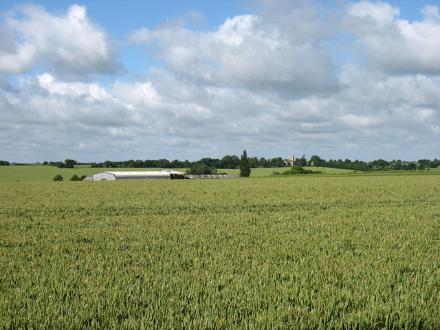
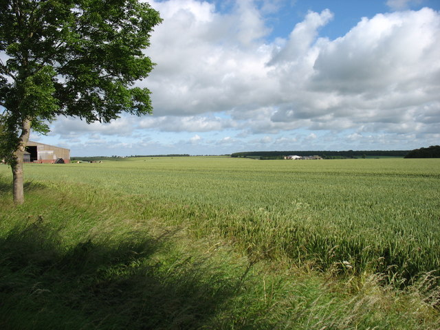
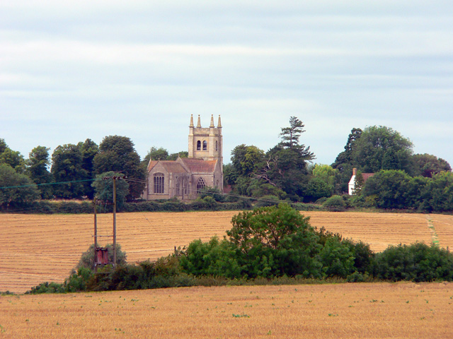
The village is known for its picturesque setting, surrounded by rolling countryside and farmland. It is characterized by its charming thatched cottages and historic buildings, which give it a traditional English village feel. The centerpiece of Leighton Bromswold is the beautiful 12th-century St. Mary's Church, a Grade I listed building that attracts visitors from near and far.

Leighton Bromswold has a close-knit community and a friendly atmosphere. It offers a range of amenities to its residents, including a village hall, a primary school, and a local pub. The village also has various clubs and societies that cater to different interests, fostering a sense of community spirit.

The surrounding area provides ample opportunities for outdoor activities, such as walking and cycling, with numerous footpaths and bridleways crisscrossing the countryside. The nearby River Kym flows through the village, offering fishing and boating opportunities.

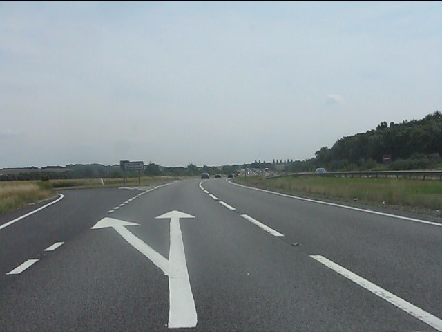
Despite its small size, Leighton Bromswold enjoys good transport links. It is conveniently located near major road networks, with the A1 and A14 easily accessible. The village is also within a short distance of St Neots railway station, offering connections to London, Cambridge, and other major cities.

If you have any feedback on the listing, please let us know in the comments section below.

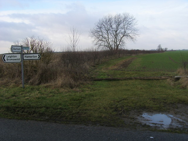
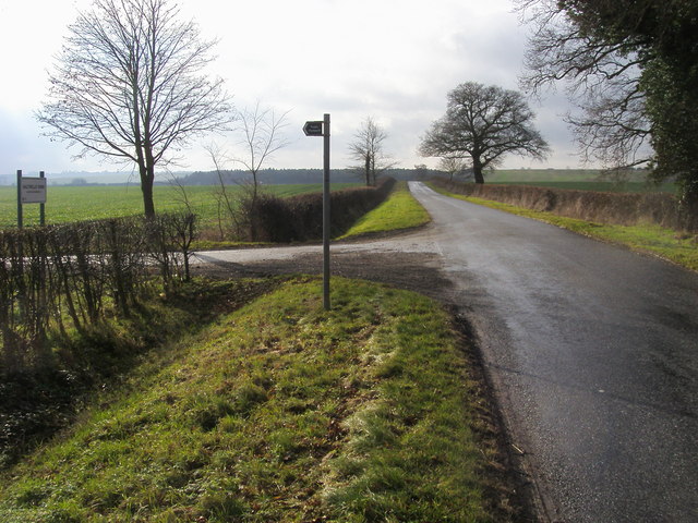
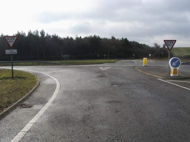
Leighton Bromswold Images

Images are sourced within 2km of 52.36708/-0.363798 or Grid Reference TL1175. Thanks to Geograph Open Source API. All images are credited.

Leighton Bromswold, St Mary
Former Chapel, Leighton Bromswold
Footpath to Old Weston Off the road to Leighton Bromswold the footpath to Old Weston
Footpath to Old Weston
Off the road to Leighton Bromswold the footpath to Old Weston
St Mary's church Leighton Bromswold From Sheep Street looking to St Mary's church Leighton Bromswold
St Mary's church Leighton Bromswold
From Sheep Street looking to St Mary's church Leighton Bromswold
The road down to the A14 at the footpath to Saltwells From Staunch Hill the road down to the A14 at the footpath to Saltwells
The road down to the A14 at the footpath to Saltwells
From Staunch Hill the road down to the A14 at the footpath to Saltwells
Joining the A14 dual carriageway From Leighton Bromswold the road joining the A14 dual carriageway
Joining the A14 dual carriageway
From Leighton Bromswold the road joining the A14 dual carriageway
Leighton Bromswold A remote place surrounded by miles of unpopulated farmland. The building on the left is shown on the OS map as a public house but seems now to be closed.
Leighton Bromswold
A remote place surrounded by miles of unpopulated farmland. The building on the left is shown on the OS map as a public house but seems now to be closed.
Leighton Bromswold Looking south-east towards the church along The Avenue.
Leighton Bromswold
Looking south-east towards the church along The Avenue.
East Lodge Farm St Mary’s church, Leighton Bromswold, is on the horizon just right of centre.
East Lodge Farm
St Mary’s church, Leighton Bromswold, is on the horizon just right of centre.
Farmland near Top Lodge Farm
St Mary's church, Leighton Bromswold
The lane to Old Weston
A14 at Little Catworth Gorse The sign in the distance indicates the junction for Leighton Bromswold.
A14 at Little Catworth Gorse
The sign in the distance indicates the junction for Leighton Bromswold.
A14 at the junction for Leighton Bromswold A simple junction on the flat, made safer by a wide central reservation for turning traffic.
A14 at the junction for Leighton Bromswold
A simple junction on the flat, made safer by a wide central reservation for turning traffic.
A14 climbs a small rise near Leighton Bromswold
Emergency layby on the A14 Between the A605 and A1 junctions, several laybys are provided on the A14 solely for emergencies.  Note the double yellow lines within the layby. A typically muddled, penny-pinching British approach to road building: not enough investment to make what is a hugely important transport artery a proper free-flow highway with appropriate safety features.
Emergency layby on the A14
Between the A605 and A1 junctions, several laybys are provided on the A14 solely for emergencies. Note the double yellow lines within the layby. A typically muddled, penny-pinching British approach to road building: not enough investment to make what is a hugely important transport artery a proper free-flow highway with appropriate safety features.
Eastbound A14 near Leighton Bromswold The A14 is a major road which runs for 129 miles from the Port of Felixstowe to the Catthorpe Interchange, the junction of the M1 and M6 motorways near Rugby.

The route linking Rugby (and therefore the West Midlands and the north of England via the motorway network) to East Anglia and the ports of Felixstowe and Harwich is incredibly important and incredibly busy (Felixstowe is the UK's principal container port and the A14 is the road between Felixstowe and everywhere else) but it didn't exist in any coherent form until about 1992.

Prior to the current A14 the main route from Birmingham to the Haven ports followed the old A45 road via Coventry, Rugby, Northampton, St Neots, Cambridge and then through all the towns on the A14, from there to Ipswich where it ended on the A12 – not the fast route required for transporting goods across the country with the sudden rise in container shipping during the latter part of the twentieth century.

Most of the current A14 route is a collection of bits of dual carriageway acquired from other roads (most notably the A45) with occasional stretches of new road to bolt it all together. Because of its importance to the country’s economy, there are plans to upgrade it further.

Prior to its use for the current route the A14 designation had been used for a section of road between the A10 at Royston and the A1 at Alconbury following part of the route of the Roman road, Ermine Street, which is now mostly designated as the A1198. The only bit of the current A14 that follows that number's original route is the spur linking junction 23 to the A1.

<span class="nowrap"><a title="http://www.cbrd.co.uk/motorway/a14" rel="nofollow ugc noopener" href="http://www.cbrd.co.uk/motorway/a14">Link</a><img style="margin-left:2px;" alt="External link" title="External link - shift click to open in new window" src="https://s1.geograph.org.uk/img/external.png" width="10" height="10"/></span> Chris's British Road Directory
<span class="nowrap"><a title="http://en.wikipedia.org/wiki/A14_road_(England)" rel="nofollow ugc noopener" href="http://en.wikipedia.org/wiki/A14_road_(England)">Link</a><img style="margin-left:2px;" alt="External link" title="External link - shift click to open in new window" src="https://s1.geograph.org.uk/img/external.png" width="10" height="10"/></span>  Wikipedia
Eastbound A14 near Leighton Bromswold
The A14 is a major road which runs for 129 miles from the Port of Felixstowe to the Catthorpe Interchange, the junction of the M1 and M6 motorways near Rugby. The route linking Rugby (and therefore the West Midlands and the north of England via the motorway network) to East Anglia and the ports of Felixstowe and Harwich is incredibly important and incredibly busy (Felixstowe is the UK's principal container port and the A14 is the road between Felixstowe and everywhere else) but it didn't exist in any coherent form until about 1992. Prior to the current A14 the main route from Birmingham to the Haven ports followed the old A45 road via Coventry, Rugby, Northampton, St Neots, Cambridge and then through all the towns on the A14, from there to Ipswich where it ended on the A12 – not the fast route required for transporting goods across the country with the sudden rise in container shipping during the latter part of the twentieth century. Most of the current A14 route is a collection of bits of dual carriageway acquired from other roads (most notably the A45) with occasional stretches of new road to bolt it all together. Because of its importance to the country’s economy, there are plans to upgrade it further. Prior to its use for the current route the A14 designation had been used for a section of road between the A10 at Royston and the A1 at Alconbury following part of the route of the Roman road, Ermine Street, which is now mostly designated as the A1198. The only bit of the current A14 that follows that number's original route is the spur linking junction 23 to the A1. LinkExternal link Chris's British Road Directory LinkExternal link Wikipedia
Show me another place!

Leighton Bromswold is located at Grid Ref: TL1175 (Lat: 52.36708, Lng: -0.363798)

Administrative County: Cambridgeshire

District: Huntingdonshire

Police Authority: Cambridgeshire

What 3 Words

///amused.repay.multiples. Near Alconbury, Cambridgeshire

Related Wikis

Leighton Bromswold

Leighton Bromswold (also known as Leighton) is a small village and civil parish in Cambridgeshire, England. Leighton lies approximately 10 miles (16 km...

Barham and Woolley

Barham and Woolley is a civil parish in the Huntingdonshire district of Cambridgeshire, England. The parish includes the villages of Barham and Woolley...

Old Weston

Old Weston – in Huntingdonshire (now part of Cambridgeshire), England – is a village near Molesworth west of Huntingdon.In 1870–1872, John Wilson, who...

Barham, Huntingdonshire

Barham is a village and former civil parish, now in the parish of Barham and Woolley, in Cambridgeshire, England. Barham lies approximately 7 miles (11...

Nearby Amenities

Located within 500m of 52.36708,-0.363798
Created By: Merkaartor 0.12
Lat/Long: 52.3646171/-0.3678917
Created By: Merkaartor 0.12
Lat/Long: 52.368563/-0.357985
Created By: Merkaartor 0.12
Lat/Long: 52.3675618/-0.3595339
Created By: Merkaartor 0.12
Lat/Long: 52.3643189/-0.3642219
Public Bookcase
Defibrillator
Booth: K6
Defibrillator Location: inside red phone box (that is now book exchange) in Leighton Bromswold
Disused Amenity: telephone
Emergency: defibrillator
Man Made: telephone_box
Note: now book exchange
Public Bookcase Type: phone_box
Lat/Long: 52.3659793/-0.3671538
Leighton Bromswold
Alt Name: Leighton
Is In: Cambridgeshire, England, UK
Place: village
Source: survey
Wikidata: Q768741
Lat/Long: 52.3658127/-0.3660785
Bus Stop
Staunch Hill
Bus: yes
Naptan AtcoCode: 0500HLEIG001
Naptan Bearing: NW
Naptan CommonName: Staunch Hill
Naptan Indicator: near
Naptan Landmark: Staunch Hill
Naptan NaptanCode: cmbdpmjt
Naptan ShortCommonName: Staunch Hill
Naptan Street: The Avenue
Naptan Verified: no
Public Transport: platform
Source: naptan_import
Lat/Long: 52.3657693/-0.3669659
Bus Stop
Staunch Hill
Bus: yes
Naptan AtcoCode: 0500HLEIG002
Naptan Bearing: SE
Naptan CommonName: Staunch Hill
Naptan Indicator: opp
Naptan Landmark: Staunch Hill
Naptan NaptanCode: cmbdpmjw
Naptan ShortCommonName: Staunch Hill
Naptan Street: The Avenue
Public Transport: platform
Source: naptan_import; survey
Lat/Long: 52.3658226/-0.3669199
Post Box
Post Box Mounting: brick_pillar
Post Box Type: wall
Ref: PE28 157
Lat/Long: 52.3652915/-0.3662217
War Memorial
Historic: memorial
Lat/Long: 52.3645431/-0.3643249
Leighton Stone
Historic: ruins
Note: approx 1000 yrs old ancient seat of judgement
Lat/Long: 52.3642831/-0.3640498
Power: pole
Lat/Long: 52.364134/-0.3654912
Power: pole
Lat/Long: 52.363736/-0.3660785
Power: pole
Lat/Long: 52.3644387/-0.369179
Barrier: stile
Lat/Long: 52.3677445/-0.3595267
The data included in this document is from www.openstreetmap.org. The data is made available under ODbL.

Have you been to Leighton Bromswold?

Leave your review of Leighton Bromswold below (or comments, questions and feedback).