Coombe

Valley in Dorset

England

Coombe

Motor Vessel Oklahoma (formerly MTB 453), Long Island, 1957 MV Oklahoma moored at Long Island in 1957. Formerly HMS MTB 453, she was built for wartime service for the Royal Navy as a fast motor torpedo boat by the British Power Boat Co. at Hythe, near Southampton in 1943. She subsequently took part with distinction in Operation Neptune, the code name for the naval phase of the Allied Invasion of Normandy.  

Almost 72 feet long (22 metres), she was powered by three 1250 H.P. Packard Engines giving 40 Knots max, 35 Knots continuous. Crewed by 2 officers and 12 ratings, her armament comprised a 6 pdr gun, twin 20 mm Oerlikons, two twin Vickers Gas Operated Guns, two Mk VII Depth Charges, and two 18" Torpedo Tubes. 

After the war, MTB 453 was sold off, probably one of the 127 former Royal Navy motor torpedo boats beached on the sands off Shipstal Point in 1945. Offered by the Director of Small Craft Disposals as suitable for conversion into 'floating homes', it was seen as one answer to the post-war housing problem, although most probably went for scrap in the end.

On holiday on Long Island in 1957, guests of the owners of MV Oklahoma. Scanned from a tiny print taken with a Kodak Brownie 127, my first camera; sadly, the camera was subsequently swept overboard from the deck of "Oklahoma" by a gust of wind, ending up in the water.
Motor Vessel Oklahoma (formerly MTB 453), Long Island, 1957 Credit: Mike Searle

Coombe is a picturesque village located in the county of Dorset, England. Situated in a valley, the village is known for its stunning natural beauty and charming rural atmosphere. Coombe is nestled within the Dorset Area of Outstanding Natural Beauty, making it a popular destination for nature enthusiasts and hikers.

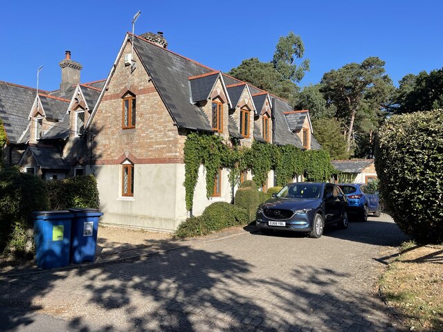
The village is characterized by its quaint thatched cottages, traditional stone buildings, and well-maintained gardens. The local community takes great pride in preserving the village's historic charm, resulting in a visually appealing and harmonious environment. Coombe is also home to a small but vibrant community, with friendly residents who welcome visitors with open arms.

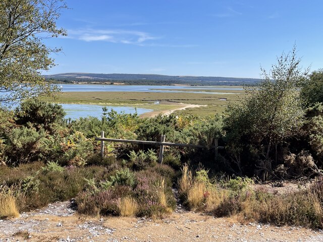
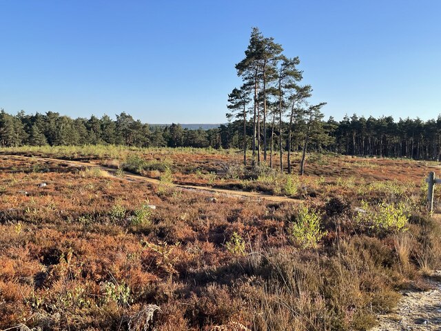
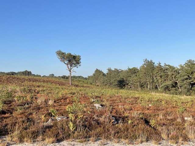
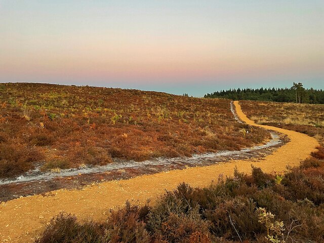
The surrounding countryside of Coombe offers breathtaking views and plenty of outdoor activities. The valley is dotted with meandering streams and rolling hills, creating a peaceful and idyllic setting. There are numerous walking and cycling trails that wind through the countryside, allowing visitors to fully immerse themselves in the natural beauty of the area.

Despite its tranquil setting, Coombe is conveniently located near several amenities. The nearby town of Dorchester offers a range of shops, restaurants, and services, ensuring that residents have easy access to everyday necessities.

In summary, Coombe, Dorset is a charming village nestled in a picturesque valley. With its stunning natural beauty, well-preserved historic buildings, and welcoming community, it is an ideal destination for those seeking a peaceful and idyllic countryside experience.

If you have any feedback on the listing, please let us know in the comments section below.
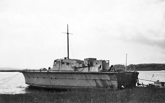
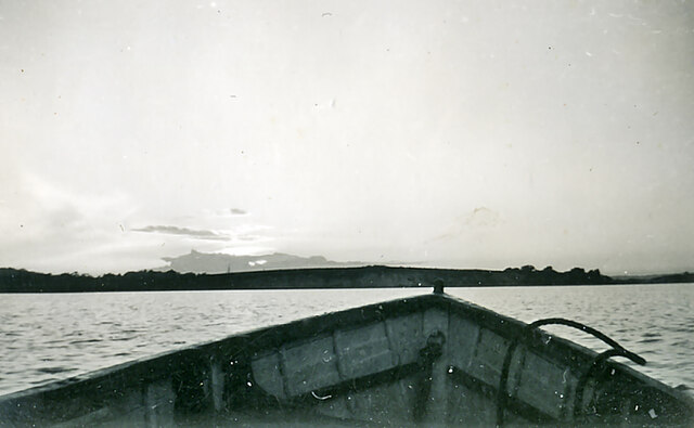
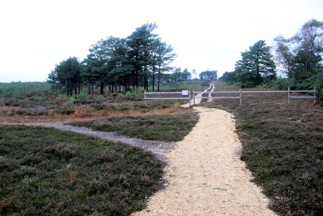
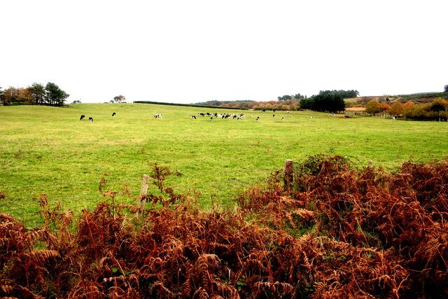
Coombe Images

Images are sourced within 2km of 50.686229/-2.0387338 or Grid Reference SY9787. Thanks to Geograph Open Source API. All images are credited.

Motor Vessel Oklahoma (formerly MTB 453), Long Island, 1957 MV Oklahoma moored at Long Island in 1957. Formerly HMS MTB 453, she was built for wartime service for the Royal Navy as a fast motor torpedo boat by the British Power Boat Co. at Hythe, near Southampton in 1943. She subsequently took part with distinction in Operation Neptune, the code name for the naval phase of the Allied Invasion of Normandy.  

Almost 72 feet long (22 metres), she was powered by three 1250 H.P. Packard Engines giving 40 Knots max, 35 Knots continuous. Crewed by 2 officers and 12 ratings, her armament comprised a 6 pdr gun, twin 20 mm Oerlikons, two twin Vickers Gas Operated Guns, two Mk VII Depth Charges, and two 18" Torpedo Tubes. 

After the war, MTB 453 was sold off, probably one of the 127 former Royal Navy motor torpedo boats beached on the sands off Shipstal Point in 1945. Offered by the Director of Small Craft Disposals as suitable for conversion into 'floating homes', it was seen as one answer to the post-war housing problem, although most probably went for scrap in the end.

On holiday on Long Island in 1957, guests of the owners of MV Oklahoma. Scanned from a tiny print taken with a Kodak Brownie 127, my first camera; sadly, the camera was subsequently swept overboard from the deck of "Oklahoma" by a gust of wind, ending up in the water.
Motor Vessel Oklahoma (formerly MTB 453), Long Island, 1957
MV Oklahoma moored at Long Island in 1957. Formerly HMS MTB 453, she was built for wartime service for the Royal Navy as a fast motor torpedo boat by the British Power Boat Co. at Hythe, near Southampton in 1943. She subsequently took part with distinction in Operation Neptune, the code name for the naval phase of the Allied Invasion of Normandy. Almost 72 feet long (22 metres), she was powered by three 1250 H.P. Packard Engines giving 40 Knots max, 35 Knots continuous. Crewed by 2 officers and 12 ratings, her armament comprised a 6 pdr gun, twin 20 mm Oerlikons, two twin Vickers Gas Operated Guns, two Mk VII Depth Charges, and two 18" Torpedo Tubes. After the war, MTB 453 was sold off, probably one of the 127 former Royal Navy motor torpedo boats beached on the sands off Shipstal Point in 1945. Offered by the Director of Small Craft Disposals as suitable for conversion into 'floating homes', it was seen as one answer to the post-war housing problem, although most probably went for scrap in the end. On holiday on Long Island in 1957, guests of the owners of MV Oklahoma. Scanned from a tiny print taken with a Kodak Brownie 127, my first camera; sadly, the camera was subsequently swept overboard from the deck of "Oklahoma" by a gust of wind, ending up in the water.
Mid channel, south of Shipstal Point in 1957 Mid-channel outward from Long Island, heading for the shore below Shipstal Point in 1957.
Mid channel, south of Shipstal Point in 1957
Mid-channel outward from Long Island, heading for the shore below Shipstal Point in 1957.
Heathland Track on the Arne Peninsula This track leads north across the heath off the Arne Road. The track is just inside an area of access land.
Heathland Track on the Arne Peninsula
This track leads north across the heath off the Arne Road. The track is just inside an area of access land.
Pasture Field on the Arne Peninsula The bracken round this field of dairy cows had already died back to a golden brown.
Pasture Field on the Arne Peninsula
The bracken round this field of dairy cows had already died back to a golden brown.
Path on Grip Heath Part of the RSPB’s Arne Nature Reserve on the Arne peninsula
Path on Grip Heath
Part of the RSPB’s Arne Nature Reserve on the Arne peninsula
View over Wych Channel to Round Island From the RSPB nature reserve on the Arne peninsula
View over Wych Channel to Round Island
From the RSPB nature reserve on the Arne peninsula
Parched fields on the Arne peninsula  During a summer that has been much hotter and drier than usual
Parched fields on the Arne peninsula
During a summer that has been much hotter and drier than usual
Bank Gate Cottages On Arne Road on the Arne peninsula
Bank Gate Cottages
On Arne Road on the Arne peninsula
View over Wych Channel From the path to Shipstal Point
View over Wych Channel
From the path to Shipstal Point
Hyde’s Heath Part of the RSPB’s Arne Nature Reserve
Hyde’s Heath
Part of the RSPB’s Arne Nature Reserve
Solitary tree on Hyde’s Heath On RSPB’s Arne Nature Reserve
Solitary tree on Hyde’s Heath
On RSPB’s Arne Nature Reserve
Stepped path in the RSPB Arne Nature Reserve
Sunset over Wareham Channel Seen from Hydes Heath on the RSPB National Nature Reserve
Sunset over Wareham Channel
Seen from Hydes Heath on the RSPB National Nature Reserve
Conifer trees in Salterns Copse Heathland on the Arne peninsula
Conifer trees in Salterns Copse
Heathland on the Arne peninsula
Moonrise over Saltern's Copse A not quite Supermoon (that was the next day) seen from RSPB's Hyde's Heath Nature Reserve
Moonrise over Saltern's Copse
A not quite Supermoon (that was the next day) seen from RSPB's Hyde's Heath Nature Reserve
Path on Hyde's Heath On RSPB's Arne nature reserve
Path on Hyde's Heath
On RSPB's Arne nature reserve
View across to Poole harbour Looking east from road through Arne
View across to Poole harbour
Looking east from road through Arne
Scrub & salt marsh taken in NE corner of grid SY9788 looking NE
Scrub & salt marsh
taken in NE corner of grid SY9788 looking NE
Show me another place!

Coombe is located at Grid Ref: SY9787 (Lat: 50.686229, Lng: -2.0387338)

Unitary Authority: Dorset

Police Authority: Dorset

What 3 Words

///coins.public.faded. Near Poole, Dorset

Related Wikis

Arne RSPB reserve

Arne RSPB reserve is a 5.634-square-kilometre (1,392-acre) nature reserve and Site of Special Scientific Interest (SSSI) maintained by the RSPB and located...
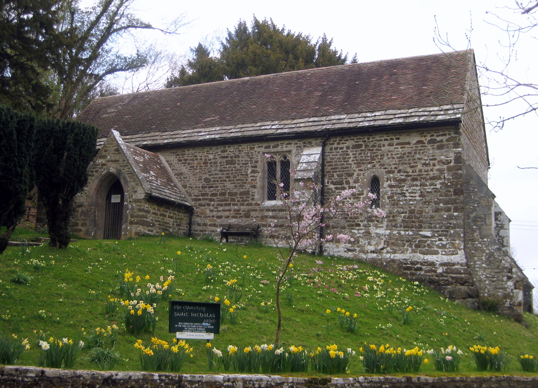
Arne, Dorset

Arne is a village and civil parish in Dorset, England, situated 4 miles (6.4 km) east of Wareham. The local travel links are located at Wareham railway...

Long Island (Dorset)

Long Island is an uninhabited island in Poole Harbour in the English county of Dorset. It lies just off the shore of the Arne Peninsular in the south-west...

Round Island (Dorset)

Round Island is an island in Poole Harbour in the English county of Dorset. It lies just off the shore of the Arne Peninsula in the south-west of the harbour...

Nearby Amenities

Located within 500m of 50.686229,-2.0387338
Source: PGS
Lat/Long: 50.6829752/-2.0344405
Source: PGS
Lat/Long: 50.6830003/-2.0342008
Source: PGS
Lat/Long: 50.6830746/-2.0339968
Source: PGS
Lat/Long: 50.6832016/-2.0337918
RSPB Arne
Leisure: nature_reserve
Wikidata: Q4794643
Lat/Long: 50.6900441/-2.0401048
Passing Place
Lat/Long: 50.6887377/-2.0427028
Bicycle Parking
Bicycle Parking: stands
Capacity: 10
Covered: no
Lat/Long: 50.690205/-2.0411668
Toilets
Lat/Long: 50.6894224/-2.0407651
RSPB Arne
Board Type: wildlife
Information: board
Tourism: information
Lat/Long: 50.690307/-2.0410756
Crossing: informal
Lat/Long: 50.6903306/-2.0412621
Bench
Lat/Long: 50.6866816/-2.040651
Leisure: bird_hide
Lat/Long: 50.6852867/-2.0373082
Bench
Backrest: no
Lat/Long: 50.6901827/-2.0387646
Bench
Backrest: no
Lat/Long: 50.6902319/-2.0385829
Bench
Backrest: no
Lat/Long: 50.690561/-2.0370338
Barrier: cycle_barrier
Lat/Long: 50.687845/-2.0449295
Bench
Backrest: no
Lat/Long: 50.6837841/-2.0419813
Bench
Backrest: no
Lat/Long: 50.6837459/-2.0419588
Bench
Lat/Long: 50.6839749/-2.0339654
Tourism: information
Lat/Long: 50.686616/-2.0406594
Bus Stop
2RN
Bus: yes
Departures Board: no
Naptan AtcoCode: 1200DOA91271
Naptan Bearing: SW
Naptan BusStopType: CUS
Naptan CommonName: Arne RSPB Nature Reserve
Naptan Indicator: SW-bound
Naptan NaptanCode: dordtpwj
Naptan Verified: no
Public Transport: platform
Shelter: no
Lat/Long: 50.6895652/-2.0414436
Information: guidepost
Operator: RSPB
Ref: 1
Tourism: information
Lat/Long: 50.6905539/-2.039423
Information: guidepost
Operator: RSPB
Ref: 6
Tourism: information
Lat/Long: 50.6871792/-2.0420983
Bicycle Parking
Bicycle Parking: stands
Capacity: 6
Covered: no
Lat/Long: 50.6899264/-2.0412305
The data included in this document is from www.openstreetmap.org. The data is made available under ODbL.

Have you been to Coombe?

Leave your review of Coombe below (or comments, questions and feedback).