Bolli Hope

Valley in Durham

England

Bolli Hope

Cairn and rocks at Bollihope Carrs The ridge reaching Carrs Top between the Wear Valley and Bollihope is almost entirely grassy but at Bollihope Carrs there's an extensive if low rock outcrop with angular boulders exposed at the crest; some smaller rocks have been gathered to form a cairn. The distant view is to the north side of Weardale with the side valley of Rook Hope, tree lined and seen to the left of the cairn.
Cairn and rocks at Bollihope Carrs Credit: Trevor Littlewood

Bolli Hope, Durham, also known as Valley, is a small village located in County Durham, England. Situated in the northeast part of the country, it is nestled within the picturesque landscape of the Durham Dales. With a population of around 300 residents, Bolli Hope offers a tranquil and close-knit community for its inhabitants.

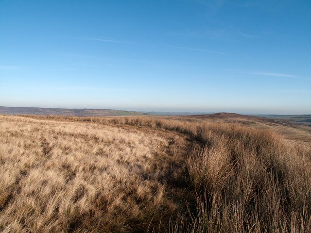
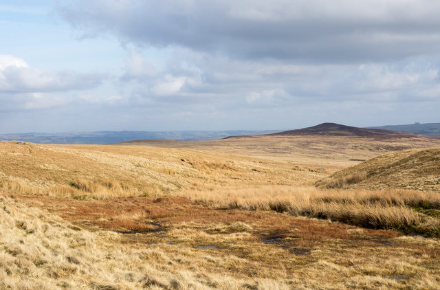
The village is renowned for its stunning natural beauty, surrounded by rolling hills, lush green fields, and meandering rivers. Bolli Hope is a paradise for outdoor enthusiasts, offering numerous walking trails and cycling routes that showcase the area's natural wonders.

Historically, Bolli Hope has its roots in mining and farming, with evidence of coal mining activities dating back to the 19th century. Today, however, the village is primarily residential, with many of its residents commuting to nearby towns for work.

Despite its small size, Bolli Hope boasts a strong sense of community spirit. The village has a local pub, The Hope Inn, which serves as a hub for social gatherings and events. Additionally, residents can participate in various community activities, such as the annual village fete and local sports teams.

Bolli Hope is well-connected to the surrounding areas, with regular bus services providing transport links to nearby towns and villages. For amenities such as shops and schools, residents typically travel to the nearby town of Stanhope, which is approximately three miles away.

Overall, Bolli Hope, Durham, offers a peaceful and idyllic setting for those seeking a slower pace of life amidst the stunning natural surroundings of the Durham Dales.

If you have any feedback on the listing, please let us know in the comments section below.
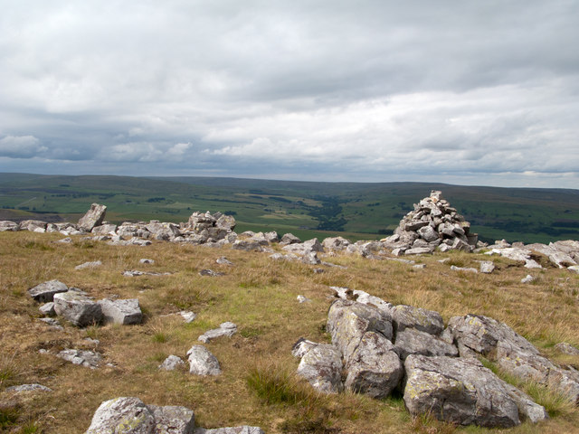
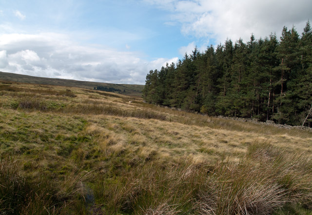
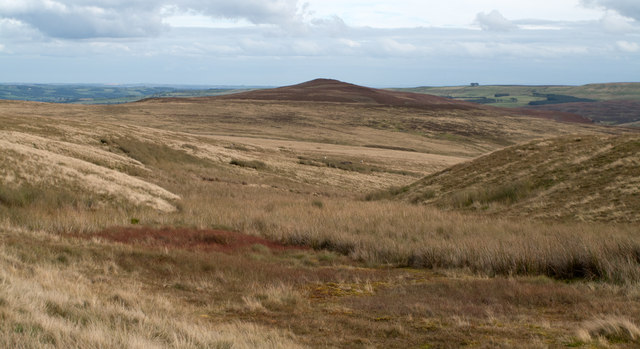
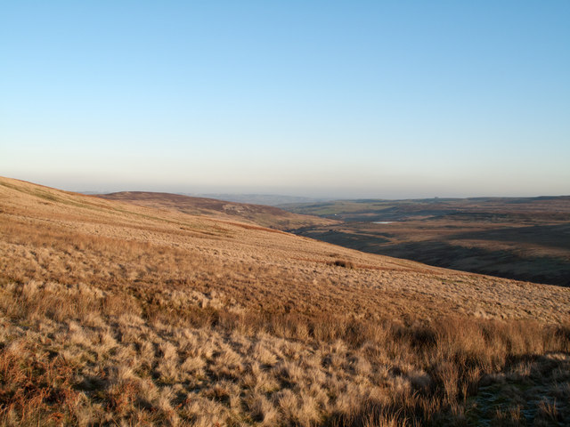
Bolli Hope Images

Images are sourced within 2km of 54.707714/-2.0429574 or Grid Reference NY9734. Thanks to Geograph Open Source API. All images are credited.

Cairn and rocks at Bollihope Carrs The ridge reaching Carrs Top between the Wear Valley and Bollihope is almost entirely grassy but at Bollihope Carrs there's an extensive if low rock outcrop with angular boulders exposed at the crest; some smaller rocks have been gathered to form a cairn. The distant view is to the north side of Weardale with the side valley of Rook Hope, tree lined and seen to the left of the cairn.
Cairn and rocks at Bollihope Carrs
The ridge reaching Carrs Top between the Wear Valley and Bollihope is almost entirely grassy but at Bollihope Carrs there's an extensive if low rock outcrop with angular boulders exposed at the crest; some smaller rocks have been gathered to form a cairn. The distant view is to the north side of Weardale with the side valley of Rook Hope, tree lined and seen to the left of the cairn.
Archaeological dig north of Bollihope Burn A group led from Newcastle University had excavated what was thought to be a seventeenth century dwelling or possibly an old mine shop on the west side of an enclosure north of Bollihope Burn. When the image was recorded the digging out had been completed; the on-going activity was to re-cover what had been exposed and to reinstate the site. Beyond the dig site grassy slopes rise to the north-west and the ridge leading to Carrs Top.
Archaeological dig north of Bollihope Burn
A group led from Newcastle University had excavated what was thought to be a seventeenth century dwelling or possibly an old mine shop on the west side of an enclosure north of Bollihope Burn. When the image was recorded the digging out had been completed; the on-going activity was to re-cover what had been exposed and to reinstate the site. Beyond the dig site grassy slopes rise to the north-west and the ridge leading to Carrs Top.
Snapegate Plantation The southern side of Snapegate Plantation is seen in this image where it abuts on to grassy moorland rising (leftwards) towards the ridge of Carrs Top.
Snapegate Plantation
The southern side of Snapegate Plantation is seen in this image where it abuts on to grassy moorland rising (leftwards) towards the ridge of Carrs Top.
Feeding stream of Jopla Sike The 'bruised line' of a quad bike route descends from Carrs Top over Turfhill End and from there has this view through one of the shallow feeding streams of Jopla Sike. The heather covered hill in the distance is Catterick, looking uncharacteristically shapely in this view.
Feeding stream of Jopla Sike
The 'bruised line' of a quad bike route descends from Carrs Top over Turfhill End and from there has this view through one of the shallow feeding streams of Jopla Sike. The heather covered hill in the distance is Catterick, looking uncharacteristically shapely in this view.
Frozen pool south of Scot Hill West from Catterick - the County Durham hill not the Yorkshire garrison town -  lies Scot Hill which is in view immediately beyond the pool - the merest disturbance of a contour line! In the distance is Collier Law on the north side of the Wear Valley.
Frozen pool south of Scot Hill
West from Catterick - the County Durham hill not the Yorkshire garrison town - lies Scot Hill which is in view immediately beyond the pool - the merest disturbance of a contour line! In the distance is Collier Law on the north side of the Wear Valley.
Slope of northern side of upper Bollihope The Bollihope Burn is a significant tributary of the River Wear. The view here is along the grassy northern flank of the upper valley with the hill, Catterick in view left of centre. The Bollihope Burn is of course down-slope to the right.
Slope of northern side of upper Bollihope
The Bollihope Burn is a significant tributary of the River Wear. The view here is along the grassy northern flank of the upper valley with the hill, Catterick in view left of centre. The Bollihope Burn is of course down-slope to the right.
A 'Watter Rord' east of Carr's Top Once when walking in the area east of Carr's Top between the Bollihope Burn and Weardale, there was shepherding activity and coming upon a farmer we were asked to avoid disturbance by keeping to the 'watter rord' - the water road - meaning a water cut or leet around the slope of the hill; this is not that cut but another. The purpose of these leets was two fold; to intercept streams draining down hill and to transport their water to another location for use. In this part of County Durham that would almost certainly be in the metal mining industry.
A 'Watter Rord' east of Carr's Top
Once when walking in the area east of Carr's Top between the Bollihope Burn and Weardale, there was shepherding activity and coming upon a farmer we were asked to avoid disturbance by keeping to the 'watter rord' - the water road - meaning a water cut or leet around the slope of the hill; this is not that cut but another. The purpose of these leets was two fold; to intercept streams draining down hill and to transport their water to another location for use. In this part of County Durham that would almost certainly be in the metal mining industry.
Bollihope quarry, disused
Disused quarries by Bollihope Burn
Bollihope Shield lead mines (disused)
Woodland alongside Bollihope Burn
The B6278 road to Stanhope winding up Bridget Hill
The B6278 Stanhope to Eggleston Road (1)
The B6278 Stanhope to Eggleston road (2)
Bollihope Burn Looking downstream along the burn which flows into the Wear a few miles east of here.
Bollihope Burn
Looking downstream along the burn which flows into the Wear a few miles east of here.
Bollihope Quarry Old limestone quarry with bedding plane floor. Other quarries visible across the valley of Bollihope Burn.
Bollihope Quarry
Old limestone quarry with bedding plane floor. Other quarries visible across the valley of Bollihope Burn.
Stream head near Turfhill End The stream is one of the 'Jopla Grains' - a series of streamlets that feed water into Bollihope Burn, a tributary of the River Wear. Catterick is the hill darkened by its heather covering and by cloud shadow.
Stream head near Turfhill End
The stream is one of the 'Jopla Grains' - a series of streamlets that feed water into Bollihope Burn, a tributary of the River Wear. Catterick is the hill darkened by its heather covering and by cloud shadow.
Bollihope Burn Taken from the road bridge over Bollihope Burn.
Bollihope Burn
Taken from the road bridge over Bollihope Burn.
Show me another place!

Bolli Hope is located at Grid Ref: NY9734 (Lat: 54.707714, Lng: -2.0429574)

Unitary Authority: County Durham

Police Authority: Durham

What 3 Words

///sprains.lifelong.conveying. Near Stanhope, Co. Durham

Nearby Locations

Bolli Hope Red Brae

Related Wikis

West Newlandside Meadows

West Newlandside Meadows is a Site of Special Scientific Interest in the Wear Valley district of County Durham, England. It lies 3 km south-west of the...

Cornish Hush Mine

The Cornish Hush Mine was a British lead ore and fluorspar mine in Weardale. == Location == The mine was located in the Howden Burn valley in the Bollihope...

Horsley Hall

Horsley Hall is a 17th-century country house, now in use as a hotel, near Stanhope, County Durham, England. It is a Grade II listed building. The manor...

Fairy Holes Cave

Fairy Holes Cave is a Site of Special Scientific Interest in the Wear Valley district of west County Durham, England. It is located on the western flanks...

Nearby Amenities

Located within 500m of 54.707714,-2.0429574
Description: old shaft
Historic: mine_shaft
Note: exact location uncertain
Resource: lead
Source: NLS-OS-NatGrid-110k-1940-60
Source Mineral: NLS-OS-NatGrid-110k-1940-60
Lat/Long: 54.7071695/-2.0407512
Description: old shaft
Historic: mine_level
Resource: lead
Source: NLS-OS-NatGrid-110k-1940-60
Source Mineral: NLS-OS-NatGrid-110k-1940-60
Lat/Long: 54.7078507/-2.0374253
The data included in this document is from www.openstreetmap.org. The data is made available under ODbL.

Have you been to Bolli Hope?

Leave your review of Bolli Hope below (or comments, questions and feedback).