Acton Cleugh

Valley in Northumberland

England

Acton Cleugh

Line of grouse butts on Blanchland Moor An estate road alongside the grouse butt line heading east over the flat heather moor.
Line of grouse butts on Blanchland Moor Credit: Trevor Littlewood

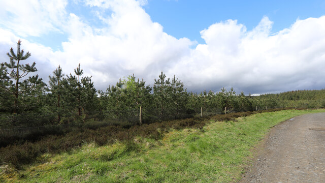
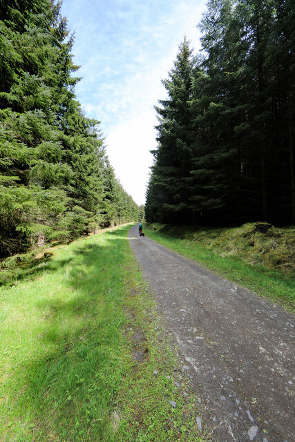
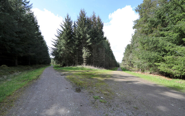
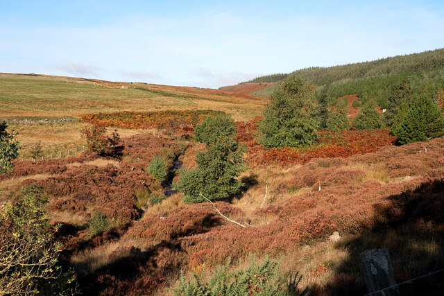
Acton Cleugh, Northumberland (Valley) is a small and picturesque village located in the county of Northumberland, England. Situated in the scenic Northumberland National Park, Acton Cleugh is known for its stunning natural beauty and tranquil atmosphere.

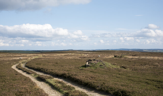
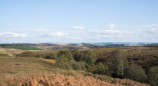
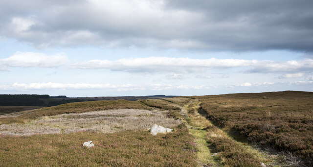
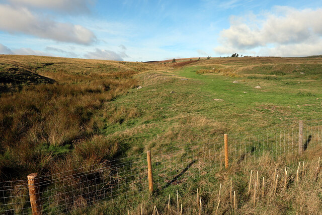
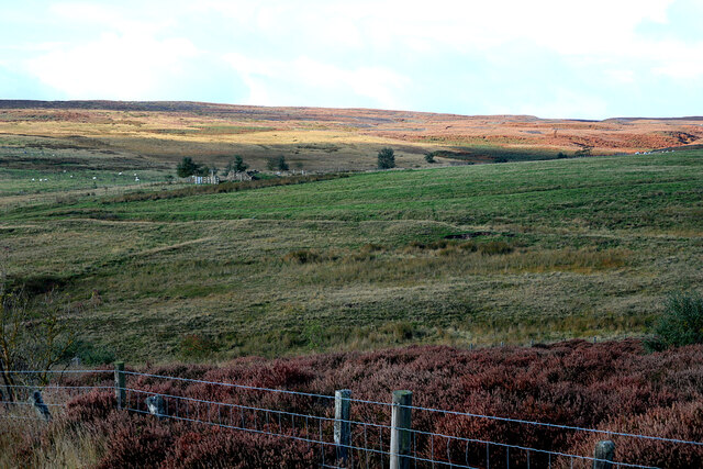
Surrounded by rolling hills and lush green meadows, the village offers breathtaking views of the Northumberland countryside. The area is abundant in wildlife, making it a popular destination for nature lovers and birdwatchers. Visitors can often spot various species of birds, including owls, falcons, and buzzards, soaring through the skies.

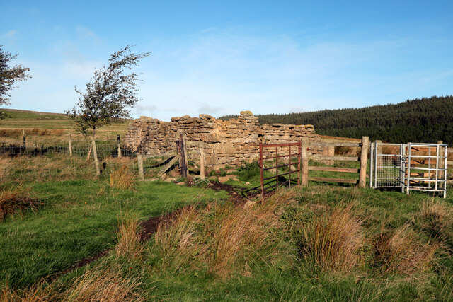
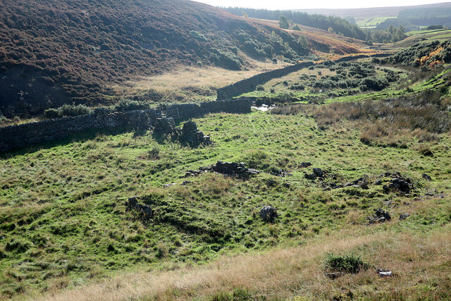
Acton Cleugh is also rich in history and heritage. The village is home to several historic landmarks, such as the medieval Acton Cleugh Tower. This tower stands as a reminder of the area's past and provides visitors with a glimpse into the region's fascinating history.

The village itself is small and has a close-knit community. It boasts a traditional village pub, where locals and visitors alike can enjoy a pint of local ale and indulge in hearty pub meals. The friendly and welcoming atmosphere of the pub makes it a popular gathering spot for residents and tourists to socialize and unwind.

Acton Cleugh offers a range of outdoor activities for those looking to explore the surrounding countryside. Popular activities include hiking, cycling, and horse riding along the numerous scenic trails that crisscross the area. The village also serves as a gateway to the wider Northumberland National Park, providing access to even more opportunities for outdoor adventures.

Overall, Acton Cleugh, Northumberland (Valley) is a charming village that offers a peaceful escape into nature and a chance to immerse oneself in the rich history and heritage of the region.

If you have any feedback on the listing, please let us know in the comments section below.
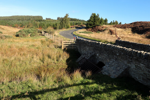
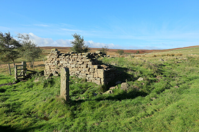
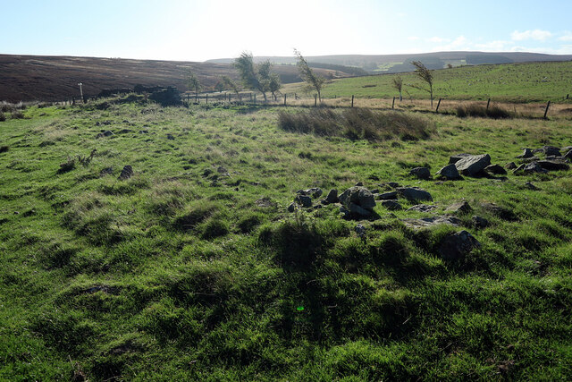
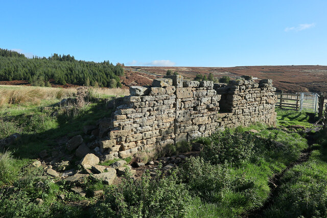
Acton Cleugh Images

Images are sourced within 2km of 54.88127/-2.0441404 or Grid Reference NY9754. Thanks to Geograph Open Source API. All images are credited.

Line of grouse butts on Blanchland Moor An estate road alongside the grouse butt line heading east over the flat heather moor.
Line of grouse butts on Blanchland Moor
An estate road alongside the grouse butt line heading east over the flat heather moor.
Tree tops showing in valley of Potter Burn Potter Burn is a stream of little note draining Blanchland Moor, but the short stretch in view where Ravens Crags are located is quite incised with the sides broken by rock exposures.
Tree tops showing in valley of Potter Burn
Potter Burn is a stream of little note draining Blanchland Moor, but the short stretch in view where Ravens Crags are located is quite incised with the sides broken by rock exposures.
Track crossing heather moor on Dean Rigg Dean Rigg is a minor ridge of ground on Cowbyers Moor to the south of Potter Burn; the estate road or track follows the ridge before moving to the north side of Acton Dean.
Track crossing heather moor on Dean Rigg
Dean Rigg is a minor ridge of ground on Cowbyers Moor to the south of Potter Burn; the estate road or track follows the ridge before moving to the north side of Acton Dean.
Harvesting a section of Slaley Forest Signs at the entrance to the eastern end of Slaley Forest warn of a number of closed tracks as a diamond-shaped section of the plantation was being actively clear-cut. The noise of chainsaws filled the air, which a tractor dragged cut logs on a trailer, using a crane to lift these into stacks. A big road-legal timber truck was the other side of the logpile using its own crane to take them off again and away to become glamourous new products like fenceposts or newsprint.
Harvesting a section of Slaley Forest
Signs at the entrance to the eastern end of Slaley Forest warn of a number of closed tracks as a diamond-shaped section of the plantation was being actively clear-cut. The noise of chainsaws filled the air, which a tractor dragged cut logs on a trailer, using a crane to lift these into stacks. A big road-legal timber truck was the other side of the logpile using its own crane to take them off again and away to become glamourous new products like fenceposts or newsprint.
Regenerating Slaley Forest Areas of the forest have been harvested on a cycle, and this patch seems to have been cut some years ago. Whilst much of the mature plantation is Sitka Spruce, this area has been repopulated with pine. Forestry does not feel obliged to stick with native species, and the trees aren't big enough yet that I could identify whether they are Scots Pine (which are native), Austrian/Corsican Pine (which have been widely used for shelter in the UK) or an American species like Lodgepole Pine (the coast range subspecies of which, Shore Pine, is used in forestry). They certainly aren't that widely planted and very fast-growing species much used for timber or woodpulp in somewhat warmer climes, Pinus radiata (Monterrey Pine).
Regenerating Slaley Forest
Areas of the forest have been harvested on a cycle, and this patch seems to have been cut some years ago. Whilst much of the mature plantation is Sitka Spruce, this area has been repopulated with pine. Forestry does not feel obliged to stick with native species, and the trees aren't big enough yet that I could identify whether they are Scots Pine (which are native), Austrian/Corsican Pine (which have been widely used for shelter in the UK) or an American species like Lodgepole Pine (the coast range subspecies of which, Shore Pine, is used in forestry). They certainly aren't that widely planted and very fast-growing species much used for timber or woodpulp in somewhat warmer climes, Pinus radiata (Monterrey Pine).
Forest track in Slaley Forest A byway is shown on maps running roughly east-west for a kilometre and a half in this area of Slaley Forest, but on the ground, the line it supposedly takes is just densely planted forest. Instead, one is obliged to take a longer route via a number of SW-NE and SE-NW forest tracks such as this one, which are not rights of way of any description (though the bulk of the forest is CROW Access Land).
Forest track in Slaley Forest
A byway is shown on maps running roughly east-west for a kilometre and a half in this area of Slaley Forest, but on the ground, the line it supposedly takes is just densely planted forest. Instead, one is obliged to take a longer route via a number of SW-NE and SE-NW forest tracks such as this one, which are not rights of way of any description (though the bulk of the forest is CROW Access Land).
Forest track branches off byway, Slaley Forest The route to the right is supposedly a byway, though the line of that right of way some way ahead seems to have been wholly effaced by the forest leaving only rather longer routes on the forest tracks (with signage making clear that these are not for vehicles). The route to the left is one of these tracks, and the one we have just taken to reach this point (in the absence of any trace of the byway we'd intended to use starting about two kilometres away).
Forest track branches off byway, Slaley Forest
The route to the right is supposedly a byway, though the line of that right of way some way ahead seems to have been wholly effaced by the forest leaving only rather longer routes on the forest tracks (with signage making clear that these are not for vehicles). The route to the left is one of these tracks, and the one we have just taken to reach this point (in the absence of any trace of the byway we'd intended to use starting about two kilometres away).
Acton Burn
Acton Burn
Actonmill Bridge
Actonmill Bridge
Ruin near site of Acton High Mill The ruin is named as Acton Mill on the first edition OS map (1865).

The OS Name Book (c.1860) describes "A cottage and garden so called from the Smelting Mill which formerly stood near here" <span class="nowrap"><a title="http://namebooks.org.uk/browse/main/?OSref=411&Page=35.0" rel="nofollow ugc noopener" href="http://namebooks.org.uk/browse/main/?OSref=411&Page=35.0">Link</a><img style="margin-left:2px;" alt="External link" title="External link - shift click to open in new window" src="https://s1.geograph.org.uk/img/external.png" width="10" height="10"/></span> <span class="nowrap"><a title="https://web.archive.org/web/20221009161928/http://namebooks.org.uk/browse/main/?OSref=411&Page=35.0" rel="nofollow ugc noopener" href="https://web.archive.org/web/20221009161928/http://namebooks.org.uk/browse/main/?OSref=411&Page=35.0">Archive Link</a><img style="margin-left:2px;" alt="External link" title="External link - shift click to open in new window" src="https://s1.geograph.org.uk/img/external.png" width="10" height="10"/></span>

A property shown as High Actonmill, about 250m to the north-east, is described in the Name Books as "A small cottage with garden attached occupying a very bleak situation. It derives its name from a Smelting Mill which formerly stood South East of this cottage". <span class="nowrap"><a title="http://namebooks.org.uk/browse/main/?OSref=411&Page=17.0" rel="nofollow ugc noopener" href="http://namebooks.org.uk/browse/main/?OSref=411&Page=17.0">Link</a><img style="margin-left:2px;" alt="External link" title="External link - shift click to open in new window" src="https://s1.geograph.org.uk/img/external.png" width="10" height="10"/></span> <span class="nowrap"><a title="https://web.archive.org/web/20221009162706/http://namebooks.org.uk/browse/main/?OSref=411&Page=17.0" rel="nofollow ugc noopener" href="https://web.archive.org/web/20221009162706/http://namebooks.org.uk/browse/main/?OSref=411&Page=17.0">Archive Link</a><img style="margin-left:2px;" alt="External link" title="External link - shift click to open in new window" src="https://s1.geograph.org.uk/img/external.png" width="10" height="10"/></span>
Ruin near site of Acton High Mill
The ruin is named as Acton Mill on the first edition OS map (1865). The OS Name Book (c.1860) describes "A cottage and garden so called from the Smelting Mill which formerly stood near here" LinkExternal link Archive LinkExternal link A property shown as High Actonmill, about 250m to the north-east, is described in the Name Books as "A small cottage with garden attached occupying a very bleak situation. It derives its name from a Smelting Mill which formerly stood South East of this cottage". LinkExternal link Archive LinkExternal link
Ruin near site of Acton High Mill The ruin is named as Acton Mill on the first edition OS map (1865).

The OS Name Book (c.1860) describes "A cottage and garden so called from the Smelting Mill which formerly stood near here" <span class="nowrap"><a title="http://namebooks.org.uk/browse/main/?OSref=411&Page=35.0" rel="nofollow ugc noopener" href="http://namebooks.org.uk/browse/main/?OSref=411&Page=35.0">Link</a><img style="margin-left:2px;" alt="External link" title="External link - shift click to open in new window" src="https://s1.geograph.org.uk/img/external.png" width="10" height="10"/></span> <span class="nowrap"><a title="https://web.archive.org/web/20221009161928/http://namebooks.org.uk/browse/main/?OSref=411&Page=35.0" rel="nofollow ugc noopener" href="https://web.archive.org/web/20221009161928/http://namebooks.org.uk/browse/main/?OSref=411&Page=35.0">Archive Link</a><img style="margin-left:2px;" alt="External link" title="External link - shift click to open in new window" src="https://s1.geograph.org.uk/img/external.png" width="10" height="10"/></span>

A property shown as High Actonmill, about 250m to the north-east, is described in the Name Books as "A small cottage with garden attached occupying a very bleak situation. It derives its name from a Smelting Mill which formerly stood South East of this cottage". <span class="nowrap"><a title="http://namebooks.org.uk/browse/main/?OSref=411&Page=17.0" rel="nofollow ugc noopener" href="http://namebooks.org.uk/browse/main/?OSref=411&Page=17.0">Link</a><img style="margin-left:2px;" alt="External link" title="External link - shift click to open in new window" src="https://s1.geograph.org.uk/img/external.png" width="10" height="10"/></span> <span class="nowrap"><a title="https://web.archive.org/web/20221009162706/http://namebooks.org.uk/browse/main/?OSref=411&Page=17.0" rel="nofollow ugc noopener" href="https://web.archive.org/web/20221009162706/http://namebooks.org.uk/browse/main/?OSref=411&Page=17.0">Archive Link</a><img style="margin-left:2px;" alt="External link" title="External link - shift click to open in new window" src="https://s1.geograph.org.uk/img/external.png" width="10" height="10"/></span>

An interesting feature of the building are the deep depressions apparently carved into the face of many of the stones. These have the appearance of weathered prehistoric cup-marks but perhaps more likely to the decorative work of a more recent stonemason.
Ruin near site of Acton High Mill
The ruin is named as Acton Mill on the first edition OS map (1865). The OS Name Book (c.1860) describes "A cottage and garden so called from the Smelting Mill which formerly stood near here" LinkExternal link Archive LinkExternal link A property shown as High Actonmill, about 250m to the north-east, is described in the Name Books as "A small cottage with garden attached occupying a very bleak situation. It derives its name from a Smelting Mill which formerly stood South East of this cottage". LinkExternal link Archive LinkExternal link An interesting feature of the building are the deep depressions apparently carved into the face of many of the stones. These have the appearance of weathered prehistoric cup-marks but perhaps more likely to the decorative work of a more recent stonemason.
Ruin near site of Acton High Mill The ruin is named as Acton Mill on the first edition OS map (1865).

The OS Name Book (c.1860) describes "A cottage and garden so called from the Smelting Mill which formerly stood near here" <span class="nowrap"><a title="http://namebooks.org.uk/browse/main/?OSref=411&Page=35.0" rel="nofollow ugc noopener" href="http://namebooks.org.uk/browse/main/?OSref=411&Page=35.0">Link</a><img style="margin-left:2px;" alt="External link" title="External link - shift click to open in new window" src="https://s1.geograph.org.uk/img/external.png" width="10" height="10"/></span> <span class="nowrap"><a title="https://web.archive.org/web/20221009161928/http://namebooks.org.uk/browse/main/?OSref=411&Page=35.0" rel="nofollow ugc noopener" href="https://web.archive.org/web/20221009161928/http://namebooks.org.uk/browse/main/?OSref=411&Page=35.0">Archive Link</a><img style="margin-left:2px;" alt="External link" title="External link - shift click to open in new window" src="https://s1.geograph.org.uk/img/external.png" width="10" height="10"/></span>

A property shown as High Actonmill, about 250m to the north-east, is described in the Name Books as "A small cottage with garden attached occupying a very bleak situation. It derives its name from a Smelting Mill which formerly stood South East of this cottage". <span class="nowrap"><a title="http://namebooks.org.uk/browse/main/?OSref=411&Page=17.0" rel="nofollow ugc noopener" href="http://namebooks.org.uk/browse/main/?OSref=411&Page=17.0">Link</a><img style="margin-left:2px;" alt="External link" title="External link - shift click to open in new window" src="https://s1.geograph.org.uk/img/external.png" width="10" height="10"/></span> <span class="nowrap"><a title="https://web.archive.org/web/20221009162706/http://namebooks.org.uk/browse/main/?OSref=411&Page=17.0" rel="nofollow ugc noopener" href="https://web.archive.org/web/20221009162706/http://namebooks.org.uk/browse/main/?OSref=411&Page=17.0">Archive Link</a><img style="margin-left:2px;" alt="External link" title="External link - shift click to open in new window" src="https://s1.geograph.org.uk/img/external.png" width="10" height="10"/></span>
Ruin near site of Acton High Mill
The ruin is named as Acton Mill on the first edition OS map (1865). The OS Name Book (c.1860) describes "A cottage and garden so called from the Smelting Mill which formerly stood near here" LinkExternal link Archive LinkExternal link A property shown as High Actonmill, about 250m to the north-east, is described in the Name Books as "A small cottage with garden attached occupying a very bleak situation. It derives its name from a Smelting Mill which formerly stood South East of this cottage". LinkExternal link Archive LinkExternal link
Field north of Potter Burn This field at the confluence of Potter Burn and Acton Burn shows signs of much disturbance and/or possible spoil heaps. The ruin I have called, Acton Mill <a href="https://www.geograph.org.uk/photo/7305517">NY9753 : Ruin near site of Acton High Mill</a> is on the skyline, right of centre. Another ruin, High Actonmill, is even higher uphill, well out of sight.

A plan by J.M. Dodds in Pirt & Dodds (2002), page 152, shows the location of both the Old and New smelt mills (both marked 'in ruins'). Acton High Mill (Old) is located in the confluence of the Potter & Acton Burns (NY 981 534) approximately 140m SE of the Acton Mill ruin.

Also see here <a href="https://www.geograph.org.uk/photo/7305736">NY9853 : Field north of Potter Burn</a>
Field north of Potter Burn
This field at the confluence of Potter Burn and Acton Burn shows signs of much disturbance and/or possible spoil heaps. The ruin I have called, Acton Mill NY9753 : Ruin near site of Acton High Mill is on the skyline, right of centre. Another ruin, High Actonmill, is even higher uphill, well out of sight. A plan by J.M. Dodds in Pirt & Dodds (2002), page 152, shows the location of both the Old and New smelt mills (both marked 'in ruins'). Acton High Mill (Old) is located in the confluence of the Potter & Acton Burns (NY 981 534) approximately 140m SE of the Acton Mill ruin. Also see here NY9853 : Field north of Potter Burn
View to ruin of Acton Mill from north-east The ruin is shown here: <a href="https://www.geograph.org.uk/photo/7305474">NY9753 : Ruin near site of Acton High Mill</a>

The line running from left to right on the land directly below the ruin are likely the course of a water leat supplying the original Acton High Smelt Mill located approximately 140m SE of the Acton Mill ruin.
View to ruin of Acton Mill from north-east
The ruin is shown here: NY9753 : Ruin near site of Acton High Mill The line running from left to right on the land directly below the ruin are likely the course of a water leat supplying the original Acton High Smelt Mill located approximately 140m SE of the Acton Mill ruin.
B6306 near Actonmill Bridge Two lead smelting mills along the Acton Burn are referred to in the historical record: Acton High (Old) Mill and Acton Low (New) Mill. However, there appears to be some confusion between the sites in the archaeology literature. I discuss here four locations, in order from north to south, all west of Acton Burn, west and south of Actonmill Bridge on the B6306 road to Blanchland (NY 9810 5343).

1. High Actonmill
An extant ruined building located at NY 9770 5358. It is shown and named as High Actonmill on the first edition OS map.
Keys to the Past (N8434): <span class="nowrap"><a title="https://keystothepast.info/search-records/results-of-search/results-of-search-2/Site-Details/?PRN=N8434" rel="nofollow ugc noopener" href="https://keystothepast.info/search-records/results-of-search/results-of-search-2/Site-Details/?PRN=N8434">Link</a><img style="margin-left:2px;" alt="External link" title="External link - shift click to open in new window" src="https://s1.geograph.org.uk/img/external.png" width="10" height="10"/></span>
Archaeology Data Service: <span class="nowrap"><a title="https://archaeologydataservice.ac.uk/archsearch/record?titleId=962582" rel="nofollow ugc noopener" href="https://archaeologydataservice.ac.uk/archsearch/record?titleId=962582">Link</a><img style="margin-left:2px;" alt="External link" title="External link - shift click to open in new window" src="https://s1.geograph.org.uk/img/external.png" width="10" height="10"/></span>
K2P describes: "This is the site of an 18th and 19th century lead mine. The ruins of a house and attached buildings can be seen. Lots of slag can be seen in the area, suggesting that lead was smelted at the site."
The longer record at ADS, has two descriptions. The first describes: "Leat ending above an area of bare polluted land with black glassy slag and scattered thin housebricks. One stone foundation visible. Consists of leat, housing, slag, foundation. Precise site of smeltmill not apparent."  The second: "Ruins of a house and attached farmbuildings, with remains of walls of attached fields, and privy attached to existing wall to north east. 18th and early 19th century. Built of coursed rubble and roughly-squared stone, some cut dressings."
There is no evidence at this site of any lead mining or smelting. The only leat visible in the vicinity is outside the field to the west (NY 9754 5360), shown on the 1st edition OS map, as an aqueduct taking water from the Acton Burn near Slatequarry Cleugh (NY 9636 5446) a long distance south to Shildon (north of Blanchland). The map shows two short sections of water-courses, probably feeding the aqueduct from local springs, at approx. NY 9747 5350. This aqueduct crosses Potter Burn in the vicinity of Lucy Stilton's Spring at NY 9711 5333.
The OS Name Book (c.1860) describes High Actonmill as "A small cottage with garden attached occupying a very bleak situation. It derives its name from a Smelting Mill which formerly stood South East of this cottage". <span class="nowrap"><a title="http://namebooks.org.uk/browse/main/?OSref=411&Page=17.0" rel="nofollow ugc noopener" href="http://namebooks.org.uk/browse/main/?OSref=411&Page=17.0">Link</a><img style="margin-left:2px;" alt="External link" title="External link - shift click to open in new window" src="https://s1.geograph.org.uk/img/external.png" width="10" height="10"/></span> <span class="nowrap"><a title="https://web.archive.org/web/20221009162706/http://namebooks.org.uk/browse/main/?OSref=411&Page=17.0" rel="nofollow ugc noopener" href="https://web.archive.org/web/20221009162706/http://namebooks.org.uk/browse/main/?OSref=411&Page=17.0">Archive Link</a><img style="margin-left:2px;" alt="External link" title="External link - shift click to open in new window" src="https://s1.geograph.org.uk/img/external.png" width="10" height="10"/></span> 

2. Acton Mill
An extant ruined building located at NY 9794 5344, about 270m SE of High Actonmill. It is shown and named as Acton Mill on the first edition OS map.
The OS Name Book (c.1860) describes "A cottage and garden so called from the Smelting Mill which formerly stood near here" <span class="nowrap"><a title="http://namebooks.org.uk/browse/main/?OSref=411&Page=35.0" rel="nofollow ugc noopener" href="http://namebooks.org.uk/browse/main/?OSref=411&Page=35.0">Link</a><img style="margin-left:2px;" alt="External link" title="External link - shift click to open in new window" src="https://s1.geograph.org.uk/img/external.png" width="10" height="10"/></span> <span class="nowrap"><a title="https://web.archive.org/web/20221009161928/http://namebooks.org.uk/browse/main/?OSref=411&Page=35.0" rel="nofollow ugc noopener" href="https://web.archive.org/web/20221009161928/http://namebooks.org.uk/browse/main/?OSref=411&Page=35.0">Archive Link</a><img style="margin-left:2px;" alt="External link" title="External link - shift click to open in new window" src="https://s1.geograph.org.uk/img/external.png" width="10" height="10"/></span>
Keys to the Past (N8435): <span class="nowrap"><a title="https://keystothepast.info/search-records/results-of-search/results-of-search-2/Site-Details/?PRN=N8435" rel="nofollow ugc noopener" href="https://keystothepast.info/search-records/results-of-search/results-of-search-2/Site-Details/?PRN=N8435">Link</a><img style="margin-left:2px;" alt="External link" title="External link - shift click to open in new window" src="https://s1.geograph.org.uk/img/external.png" width="10" height="10"/></span>
Archaeology Data Service: <span class="nowrap"><a title="https://archaeologydataservice.ac.uk/archsearch/record?titleId=962583" rel="nofollow ugc noopener" href="https://archaeologydataservice.ac.uk/archsearch/record?titleId=962583">Link</a><img style="margin-left:2px;" alt="External link" title="External link - shift click to open in new window" src="https://s1.geograph.org.uk/img/external.png" width="10" height="10"/></span>
K2P describes: "These are the ruins of an 18th century house which was once part of a lead mill. The site of a wheel pit can also be seen. There are also the earthwork remains of other buildings though their purpose in not known."
ADS has two descriptions. The first: "Slight above ground building ruins, part incorporated into a sheep-fold. Wheelpit and storage bay discernible. No visible slag or flue. Possible head race visible some distance up Acton Burn. Slight earthwork roadway. Identified as smeltmill on 1st ed OS map, but no evidence of smelting." This appears to be a dscription of the Acton Low Mill and is not relevent here.
The second description is "Ruins of the eastern part of an 18th century house at Acton Mill. Possibly extended to the west in early 19th century. Built of coursed roughly-squared stone with cut quoins. Ruins of field walls to the west. To the south are rectilinear earthworks which may indicate other buildings". This would be a correct description of the remains. The building may have originally been built as part of Acton High Smelt Mill or used masonry when that structure was demolished.

3. Acton High Smelt Mill
No extant remains but clearly disturbed ground with probable building platforms, slag heaps and areas of bare ground on land at the confluence of Acton & Potter Burns, just west of the road at NY 9806 5338, about 140m SE of the Acton Mill ruin. The possibility of buildings here is indicated on satellite imagery, LIDAR and on the ground.
Keys to the Past (N8490): <span class="nowrap"><a title="https://keystothepast.info/search-records/results-of-search/results-of-search-2/Site-Details/?PRN=N8490" rel="nofollow ugc noopener" href="https://keystothepast.info/search-records/results-of-search/results-of-search-2/Site-Details/?PRN=N8490">Link</a><img style="margin-left:2px;" alt="External link" title="External link - shift click to open in new window" src="https://s1.geograph.org.uk/img/external.png" width="10" height="10"/></span> describes: "Piles of earth and other material associated with areas of mining to the west can be seen at this site."
The location is in agreement with the location of the High Smelt Mill indicated on J.M. Dodd's 'Plan of Acton Burn showing location of old and new mills', Fig 44 (Pirt & Dodds 2002).
Observation on the ground of a feature shown on the 1st edition OS map as a linear marsh indicate a probable water leat (or linear reservoir) fed from the Acton Burn to the north (around NY 9789 5371) leading to what could be a deep water course about 60m east of the Acton Mill ruin, just north of the modern track (NY 9800 5345). If this is not a later feature, a water supply from here could have provided a source of power to the Acton High Smelt Mill site to the south-east.

4. Acton Low Smelt Mill (NY 98235 52987)
Described in K2P as "The ruins of a large lead-smelting mill stand on the west bank of Acton Cleugh. They were probably built in the 18th century".
Keys to the Past (N8487): <span class="nowrap"><a title="https://keystothepast.info/search-records/results-of-search/results-of-search-2/Site-Details/?PRN=N8487" rel="nofollow ugc noopener" href="https://keystothepast.info/search-records/results-of-search/results-of-search-2/Site-Details/?PRN=N8487">Link</a><img style="margin-left:2px;" alt="External link" title="External link - shift click to open in new window" src="https://s1.geograph.org.uk/img/external.png" width="10" height="10"/></span> <span class="nowrap"><a title="https://web.archive.org/web/20221009115212/https://keystothepast.info/search-records/results-of-search/results-of-search-2/Site-Details/?PRN=N8487" rel="nofollow ugc noopener" href="https://web.archive.org/web/20221009115212/https://keystothepast.info/search-records/results-of-search/results-of-search-2/Site-Details/?PRN=N8487">Archive Link</a><img style="margin-left:2px;" alt="External link" title="External link - shift click to open in new window" src="https://s1.geograph.org.uk/img/external.png" width="10" height="10"/></span>
ADS describes: "Ruins of a lead smelting mill on west bank of Acton Cleugh, 400m south of Actonmill Bridge. Extensive but low ruins, of coursed roughly-squared stone, somewhat confused by late 19th century washfold built over part of the site".
Archaeology Data Service: <span class="nowrap"><a title="https://archaeologydataservice.ac.uk/archsearch/record?titleId=962635" rel="nofollow ugc noopener" href="https://archaeologydataservice.ac.uk/archsearch/record?titleId=962635">Link</a><img style="margin-left:2px;" alt="External link" title="External link - shift click to open in new window" src="https://s1.geograph.org.uk/img/external.png" width="10" height="10"/></span>
The location of Acton Low Smelt Mill is shown on J.M. Dodd's 'Plan of Acton Burn showing location of old and new mills', Fig 44 (Pirt & Dodds 2002) where a water-course is shown running from the confluence of the Potter & Acton Burns to a position just west of the mill. The first edition OS shows "Old Smelting Mill' but not the water-course. 

OS 6" Northumberland Sheet CVIII Surveyed: 1860, Published: 1865 <span class="nowrap"><a title="https://maps.nls.uk/view/102346521" rel="nofollow ugc noopener" href="https://maps.nls.uk/view/102346521">Link</a><img style="margin-left:2px;" alt="External link" title="External link - shift click to open in new window" src="https://s1.geograph.org.uk/img/external.png" width="10" height="10"/></span>
OS 6" Northumberland Sheet CIII Surveyed: 1860, Published: 1865 <span class="nowrap"><a title="https://maps.nls.uk/view/102346500" rel="nofollow ugc noopener" href="https://maps.nls.uk/view/102346500">Link</a><img style="margin-left:2px;" alt="External link" title="External link - shift click to open in new window" src="https://s1.geograph.org.uk/img/external.png" width="10" height="10"/></span>
OS 25" Revised: 1895, Published: 1896 <span class="nowrap"><a title="https://maps.nls.uk/geo/explore/side-by-side/#zoom=17.8&lat=54.87589&lon=-2.03374&layers=168&right=BingSat" rel="nofollow ugc noopener" href="https://maps.nls.uk/geo/explore/side-by-side/#zoom=17.8&lat=54.87589&lon=-2.03374&layers=168&right=BingSat">Link</a><img style="margin-left:2px;" alt="External link" title="External link - shift click to open in new window" src="https://s1.geograph.org.uk/img/external.png" width="10" height="10"/></span>
Northern Mine Research Society: <span class="nowrap"><a title="https://www.nmrs.org.uk/mines-map/smelt-mills/smelting-g/acton/" rel="nofollow ugc noopener" href="https://www.nmrs.org.uk/mines-map/smelt-mills/smelting-g/acton/">Link</a><img style="margin-left:2px;" alt="External link" title="External link - shift click to open in new window" src="https://s1.geograph.org.uk/img/external.png" width="10" height="10"/></span> <span class="nowrap"><a title="https://web.archive.org/web/20221009114436/https://www.nmrs.org.uk/mines-map/smelt-mills/smelting-g/acton/" rel="nofollow ugc noopener" href="https://web.archive.org/web/20221009114436/https://www.nmrs.org.uk/mines-map/smelt-mills/smelting-g/acton/">Archive Link</a><img style="margin-left:2px;" alt="External link" title="External link - shift click to open in new window" src="https://s1.geograph.org.uk/img/external.png" width="10" height="10"/></span>
British Mining Monograph No.70: Lead Mining in the Derwent Valley by W.K. Pirt & J.M. Dodds (2002), Northern Mine Research Society. <span class="nowrap"><a title="https://www.nmrs.org.uk/wp-content/uploads/2016/08/bm70.pdf" rel="nofollow ugc noopener" href="https://www.nmrs.org.uk/wp-content/uploads/2016/08/bm70.pdf">Link</a><img style="margin-left:2px;" alt="External link" title="External link - shift click to open in new window" src="https://s1.geograph.org.uk/img/external.png" width="10" height="10"/></span> <span class="nowrap"><a title="https://web.archive.org/web/20200621153834/https://www.nmrs.org.uk/wp-content/uploads/2016/08/bm70.pdf" rel="nofollow ugc noopener" href="https://web.archive.org/web/20200621153834/https://www.nmrs.org.uk/wp-content/uploads/2016/08/bm70.pdf">Archive Link</a><img style="margin-left:2px;" alt="External link" title="External link - shift click to open in new window" src="https://s1.geograph.org.uk/img/external.png" width="10" height="10"/></span>
B6306 near Actonmill Bridge
Two lead smelting mills along the Acton Burn are referred to in the historical record: Acton High (Old) Mill and Acton Low (New) Mill. However, there appears to be some confusion between the sites in the archaeology literature. I discuss here four locations, in order from north to south, all west of Acton Burn, west and south of Actonmill Bridge on the B6306 road to Blanchland (NY 9810 5343). 1. High Actonmill An extant ruined building located at NY 9770 5358. It is shown and named as High Actonmill on the first edition OS map. Keys to the Past (N8434): LinkExternal link Archaeology Data Service: LinkExternal link K2P describes: "This is the site of an 18th and 19th century lead mine. The ruins of a house and attached buildings can be seen. Lots of slag can be seen in the area, suggesting that lead was smelted at the site." The longer record at ADS, has two descriptions. The first describes: "Leat ending above an area of bare polluted land with black glassy slag and scattered thin housebricks. One stone foundation visible. Consists of leat, housing, slag, foundation. Precise site of smeltmill not apparent." The second: "Ruins of a house and attached farmbuildings, with remains of walls of attached fields, and privy attached to existing wall to north east. 18th and early 19th century. Built of coursed rubble and roughly-squared stone, some cut dressings." There is no evidence at this site of any lead mining or smelting. The only leat visible in the vicinity is outside the field to the west (NY 9754 5360), shown on the 1st edition OS map, as an aqueduct taking water from the Acton Burn near Slatequarry Cleugh (NY 9636 5446) a long distance south to Shildon (north of Blanchland). The map shows two short sections of water-courses, probably feeding the aqueduct from local springs, at approx. NY 9747 5350. This aqueduct crosses Potter Burn in the vicinity of Lucy Stilton's Spring at NY 9711 5333. The OS Name Book (c.1860) describes High Actonmill as "A small cottage with garden attached occupying a very bleak situation. It derives its name from a Smelting Mill which formerly stood South East of this cottage". LinkExternal link Archive LinkExternal link 2. Acton Mill An extant ruined building located at NY 9794 5344, about 270m SE of High Actonmill. It is shown and named as Acton Mill on the first edition OS map. The OS Name Book (c.1860) describes "A cottage and garden so called from the Smelting Mill which formerly stood near here" LinkExternal link Archive LinkExternal link Keys to the Past (N8435): LinkExternal link Archaeology Data Service: LinkExternal link K2P describes: "These are the ruins of an 18th century house which was once part of a lead mill. The site of a wheel pit can also be seen. There are also the earthwork remains of other buildings though their purpose in not known." ADS has two descriptions. The first: "Slight above ground building ruins, part incorporated into a sheep-fold. Wheelpit and storage bay discernible. No visible slag or flue. Possible head race visible some distance up Acton Burn. Slight earthwork roadway. Identified as smeltmill on 1st ed OS map, but no evidence of smelting." This appears to be a dscription of the Acton Low Mill and is not relevent here. The second description is "Ruins of the eastern part of an 18th century house at Acton Mill. Possibly extended to the west in early 19th century. Built of coursed roughly-squared stone with cut quoins. Ruins of field walls to the west. To the south are rectilinear earthworks which may indicate other buildings". This would be a correct description of the remains. The building may have originally been built as part of Acton High Smelt Mill or used masonry when that structure was demolished. 3. Acton High Smelt Mill No extant remains but clearly disturbed ground with probable building platforms, slag heaps and areas of bare ground on land at the confluence of Acton & Potter Burns, just west of the road at NY 9806 5338, about 140m SE of the Acton Mill ruin. The possibility of buildings here is indicated on satellite imagery, LIDAR and on the ground. Keys to the Past (N8490): LinkExternal link describes: "Piles of earth and other material associated with areas of mining to the west can be seen at this site." The location is in agreement with the location of the High Smelt Mill indicated on J.M. Dodd's 'Plan of Acton Burn showing location of old and new mills', Fig 44 (Pirt & Dodds 2002). Observation on the ground of a feature shown on the 1st edition OS map as a linear marsh indicate a probable water leat (or linear reservoir) fed from the Acton Burn to the north (around NY 9789 5371) leading to what could be a deep water course about 60m east of the Acton Mill ruin, just north of the modern track (NY 9800 5345). If this is not a later feature, a water supply from here could have provided a source of power to the Acton High Smelt Mill site to the south-east. 4. Acton Low Smelt Mill (NY 98235 52987) Described in K2P as "The ruins of a large lead-smelting mill stand on the west bank of Acton Cleugh. They were probably built in the 18th century". Keys to the Past (N8487): LinkExternal link Archive LinkExternal link ADS describes: "Ruins of a lead smelting mill on west bank of Acton Cleugh, 400m south of Actonmill Bridge. Extensive but low ruins, of coursed roughly-squared stone, somewhat confused by late 19th century washfold built over part of the site". Archaeology Data Service: LinkExternal link The location of Acton Low Smelt Mill is shown on J.M. Dodd's 'Plan of Acton Burn showing location of old and new mills', Fig 44 (Pirt & Dodds 2002) where a water-course is shown running from the confluence of the Potter & Acton Burns to a position just west of the mill. The first edition OS shows "Old Smelting Mill' but not the water-course. OS 6" Northumberland Sheet CVIII Surveyed: 1860, Published: 1865 LinkExternal link OS 6" Northumberland Sheet CIII Surveyed: 1860, Published: 1865 LinkExternal link OS 25" Revised: 1895, Published: 1896 LinkExternal link Northern Mine Research Society: LinkExternal link Archive LinkExternal link British Mining Monograph No.70: Lead Mining in the Derwent Valley by W.K. Pirt & J.M. Dodds (2002), Northern Mine Research Society. LinkExternal link Archive LinkExternal link
Acton Low Mill A plan by J. M. Dodds in Pirt & Dodds (2002), page 152, shows the location of the Old and New smelt mills (both marked 'in ruins'). Acton Low Mill (New) is located south of Acton Burn, here in a deep valley called Acton Cleugh. The plan also shows a 'Water Course' running south from the confluence of Potter Burn and Acton Burn, to a position just west and above the Low Mill site, although this can no longer be seen. Acton High Mill (Old) is located by the Dodd's plan in the confluence of the Potter and Acton Burns (NY 98068 53384) approximately 149m SE of the Acton Mill ruin.
Acton Low Mill
A plan by J. M. Dodds in Pirt & Dodds (2002), page 152, shows the location of the Old and New smelt mills (both marked 'in ruins'). Acton Low Mill (New) is located south of Acton Burn, here in a deep valley called Acton Cleugh. The plan also shows a 'Water Course' running south from the confluence of Potter Burn and Acton Burn, to a position just west and above the Low Mill site, although this can no longer be seen. Acton High Mill (Old) is located by the Dodd's plan in the confluence of the Potter and Acton Burns (NY 98068 53384) approximately 149m SE of the Acton Mill ruin.
Show me another place!

Acton Cleugh is located at Grid Ref: NY9754 (Lat: 54.88127, Lng: -2.0441404)

Unitary Authority: Northumberland

Police Authority: Northumbria

What 3 Words

///roaming.weary.drifters. Near Slaley, Northumberland

Related Wikis

Colpitts Grange

Colpitts Grange is a hamlet in Northumberland, England. It is about 7 miles (11 km) to the south-east of Hexham. == Governance == Colpitts Grange is in...

Slaley Hall

Slaley Hall is a country house golf resort in Northumberland in North East England, built by local developers Seamus O'Carroll and John Rourke which hosted...

Blanchland Abbey

Blanchland Abbey at Blanchland, in the English county of Northumberland, was founded as a premonstratensian priory in 1165 by Walter de Bolbec II, and...

Slaley, Northumberland

Slaley is a village in Northumberland, England. It is situated to the southeast of Hexham. It is surrounded by the following villages: Ruffside, Whitley...

Blanchland

Blanchland is a village in Northumberland, England, on the County Durham boundary. The population of the civil parish at the 2011 census was 135.Set beside...

Baybridge, Northumberland

Baybridge is a small village in Northumberland, England, just to the west of Blanchland and on the border with County Durham. It is situated to the west...

Derwent Reservoir (North East England)

The Derwent Reservoir is a reservoir on the River Derwent, on the border between County Durham and Northumberland, in England. It is west of Consett. It...

Pow Hill Bog

Pow Hill Bog is a Site of Special Scientific Interest in the Wear Valley district of County Durham, England. It lies alongside Derwent Reservoir, approximately...

Have you been to Acton Cleugh?

Leave your review of Acton Cleugh below (or comments, questions and feedback).