Cowloughton Clough

Valley in Yorkshire Craven

England

Cowloughton Clough

The Pennine Way near Ickornshaw
The Pennine Way near Ickornshaw Credit: Dave Kelly

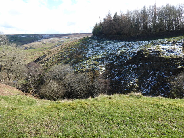
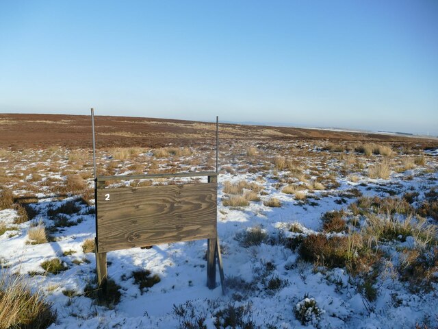
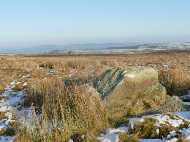
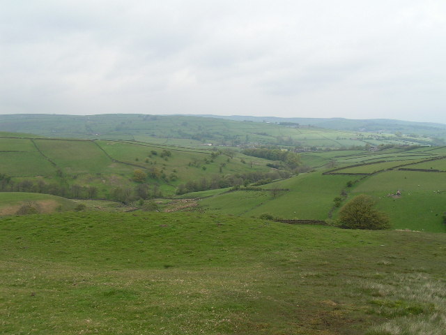
Cowloughton Clough is a picturesque valley located in the county of Yorkshire, England. Situated in the heart of the countryside, it is known for its stunning natural beauty and tranquil atmosphere. The valley stretches for approximately 5 miles, encompassing rolling hills, dense woodlands, and meandering streams.

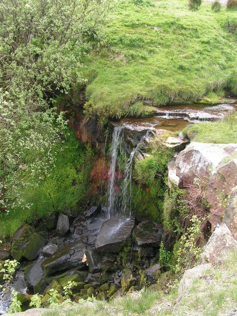
One of the notable features of Cowloughton Clough is its rich biodiversity. The valley is home to a wide range of plant and animal species, making it a popular destination for nature lovers and wildlife enthusiasts. Ancient oak and beech trees dominate the landscape, providing a habitat for numerous bird species, including woodpeckers, song thrushes, and owls. The streams that flow through the valley are home to various species of fish, such as brown trout and grayling.

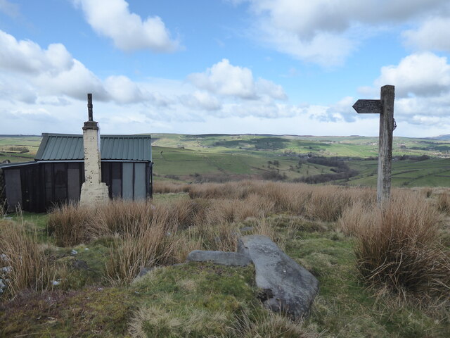
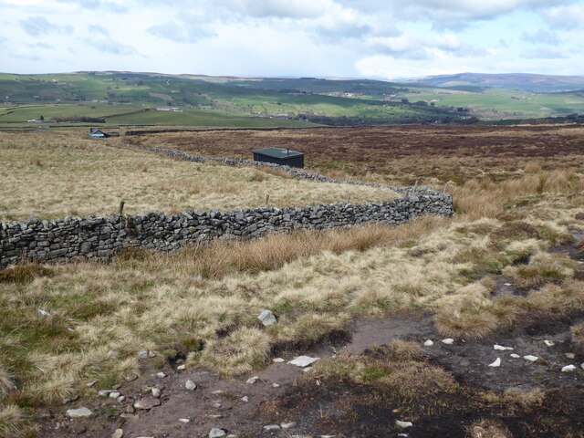
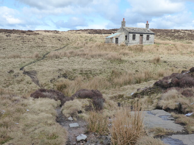
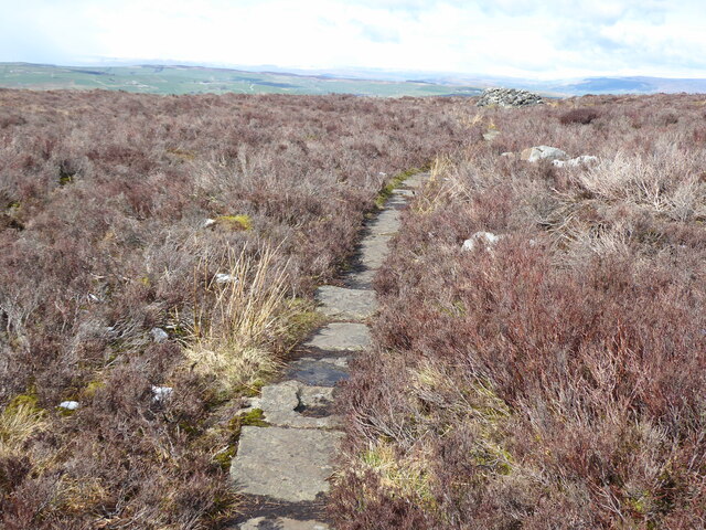
The valley offers a range of recreational activities for visitors to enjoy. There are several well-marked walking trails that meander through the valley, providing opportunities for hikers and nature walkers to explore the stunning scenery. Additionally, the valley is a haven for cyclists, with numerous off-road trails and quiet country lanes to explore.

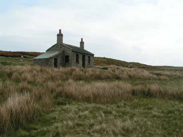
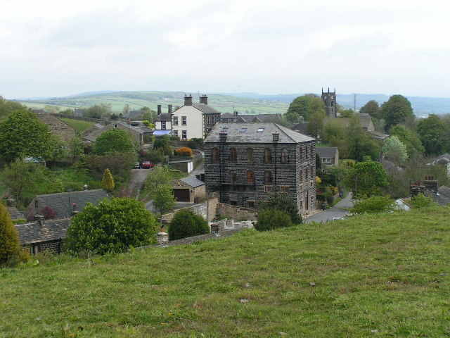
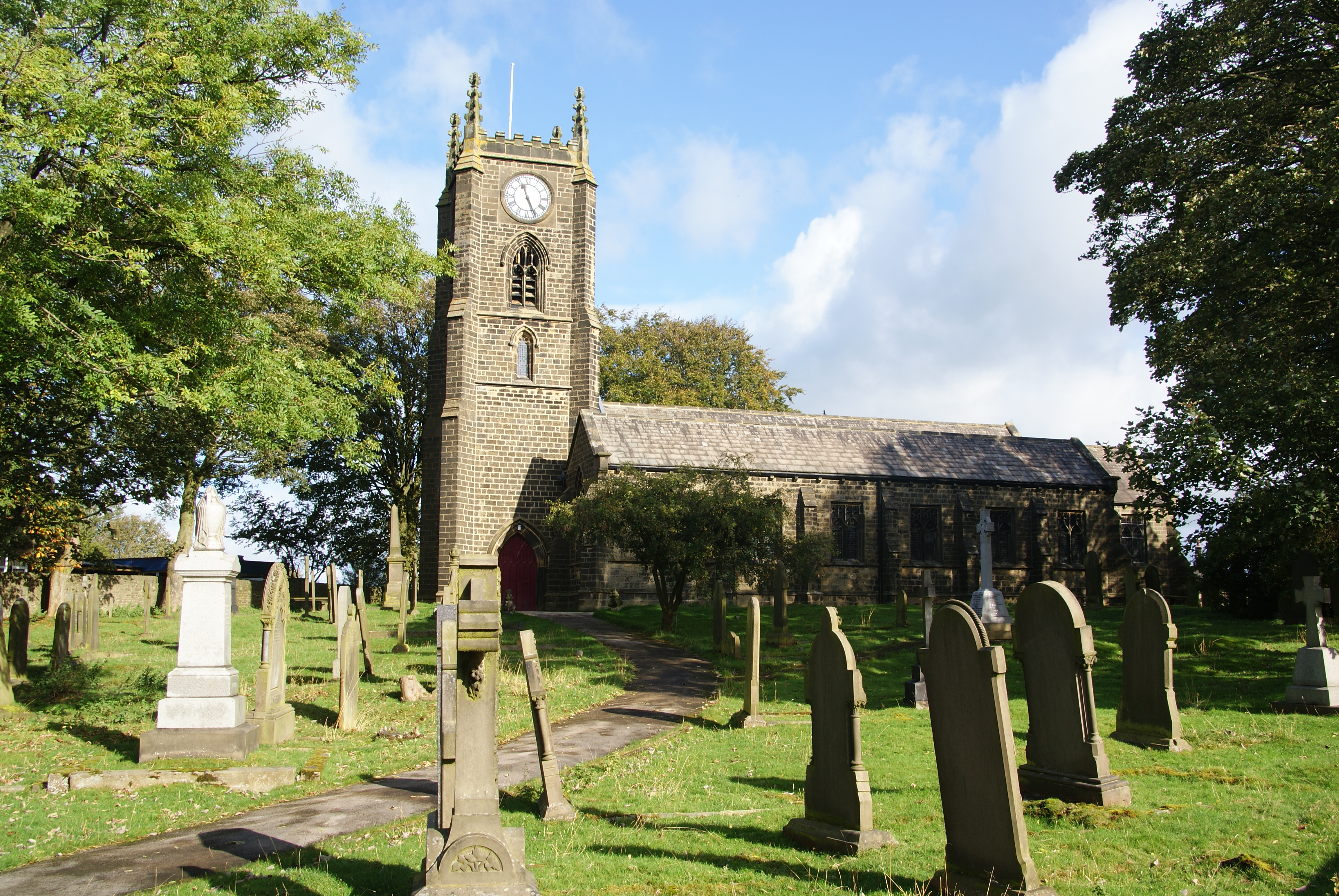
Cowloughton Clough also holds historical significance. The valley is dotted with remnants of old mills and farmhouses, serving as a reminder of its industrial past. These historical sites provide a glimpse into the region's history and offer an interesting insight into the lives of the people who once lived and worked in the area.

Overall, Cowloughton Clough is a hidden gem in Yorkshire, offering a peaceful retreat from the hustle and bustle of city life. With its natural beauty, diverse wildlife, and historical charm, it is a must-visit destination for those seeking a tranquil escape in the heart of the English countryside.

If you have any feedback on the listing, please let us know in the comments section below.

Cowloughton Clough Images

Images are sourced within 2km of 53.869957/-2.0543162 or Grid Reference SD9641. Thanks to Geograph Open Source API. All images are credited.

The Pennine Way near Ickornshaw
The view from the Pennine Way near Ickornshaw
The Pennine Way near Lumb
The Pennine Way near Further Dean Hole
The Pennine Way near High End Lowe
The Pennine Way near Brown Hill
The Pennine Way near Cat Stone Hill
Wall and fence enclosed Moss End Lane Looking north-westward.
Wall and fence enclosed Moss End Lane
Looking north-westward.
Old milestone This West Riding County Council milestone set up in 1893/94 is now just on the Lancashire border.  The grass had to be trampled down to reveal the milestone and it also revealed a discarded NHS crutch!  It is on the north side of the A6068 Colne Road/Keighley Road near the bus-stop.  This left face has mileages to Keighley, Addingham and Ilkley with Colne and Burnley on the right-hand side.  With Cowling on the header it is possible that there has been a slight change to the boundary since the late 19C.
Old milestone
This West Riding County Council milestone set up in 1893/94 is now just on the Lancashire border. The grass had to be trampled down to reveal the milestone and it also revealed a discarded NHS crutch! It is on the north side of the A6068 Colne Road/Keighley Road near the bus-stop. This left face has mileages to Keighley, Addingham and Ilkley with Colne and Burnley on the right-hand side. With Cowling on the header it is possible that there has been a slight change to the boundary since the late 19C.
Grouse butt no.2 on Keighley Moor The GPS co-ordinates put this as near as makes no difference on the county boundary between West and North Yorkshire (right & left respectively).
Grouse butt no.2 on Keighley Moor
The GPS co-ordinates put this as near as makes no difference on the county boundary between West and North Yorkshire (right & left respectively).
The Lunching Stone One of many glacial erratics in this area, and far from the largest. Unlike its bigger neighbours the Hitching Stone, Maw Stone, Kid Stone, Winter Hill Stone, etc., it has no name on the map, so I've given it one: the rock is the right height for a couple of adults to sit on, and the rock platform at its base keeps one's rucksack out of the bog. The symmetrical grid reference (SD98414198) is also pleasing. The view is eastwards across Airedale, but Pendle was clearly visible to the west, and Sharp Haw to the north.
The Lunching Stone
One of many glacial erratics in this area, and far from the largest. Unlike its bigger neighbours the Hitching Stone, Maw Stone, Kid Stone, Winter Hill Stone, etc., it has no name on the map, so I've given it one: the rock is the right height for a couple of adults to sit on, and the rock platform at its base keeps one's rucksack out of the bog. The symmetrical grid reference (SD98414198) is also pleasing. The view is eastwards across Airedale, but Pendle was clearly visible to the west, and Sharp Haw to the north.
Shooting Hut, Ickornshaw Moor This shooting hut is just in SD9640 - the sheep are probably in SD9641! The hut is known as the New Stone Hut - see <span class="nowrap"><a title="http://www.cowlingweb.co.uk/oldgallery/displayimage.asp?imageID=1743" rel="nofollow ugc noopener" href="http://www.cowlingweb.co.uk/oldgallery/displayimage.asp?imageID=1743">Link</a><img style="margin-left:2px;" alt="External link" title="External link - shift click to open in new window" src="https://s1.geograph.org.uk/img/external.png" width="10" height="10"/></span> for a picture of the grand opening in 1902. The lean-to appears to be a more modern addition.
Shooting Hut, Ickornshaw Moor
This shooting hut is just in SD9640 - the sheep are probably in SD9641! The hut is known as the New Stone Hut - see LinkExternal link for a picture of the grand opening in 1902. The lean-to appears to be a more modern addition.
View from Eller Hill Looking north from the Pennine Way
View from Eller Hill
Looking north from the Pennine Way
Ickornshaw from the Pennine Way Looking northeast from approx. SD965428. Cowling church (SD968431) is in the background.
Ickornshaw from the Pennine Way
Looking northeast from approx. SD965428. Cowling church (SD968431) is in the background.
Waterfall below Lumb Farm From the Pennine Way
Waterfall below Lumb Farm
From the Pennine Way
Church at Ickornshaw Looking through the churchyard from Gill Lane, just off the Pennine Way.
Church at Ickornshaw
Looking through the churchyard from Gill Lane, just off the Pennine Way.
Milepost on the A6068 Somewhat neglected and hidden in the weeds on the roadside verge, the milepost reads: Blackburn Addingham and Cocking End Road Cowling
Milepost on the A6068
Somewhat neglected and hidden in the weeds on the roadside verge, the milepost reads: Blackburn Addingham and Cocking End Road Cowling
Show me another place!

Cowloughton Clough is located at Grid Ref: SD9641 (Lat: 53.869957, Lng: -2.0543162)

Division: West Riding

Administrative County: North Yorkshire

District: Craven

Police Authority: North Yorkshire

What 3 Words

///line.horses.pianists. Near Glusburn, North Yorkshire

Related Wikis

Cowling, Craven

Cowling is a village, electoral division and civil parish in the Craven district of North Yorkshire, England. It is situated on the borders with the adjacent...

Middleton, Cowling

Middleton is a hamlet in the Craven district of North Yorkshire, England, part of the civil parish of Cowling. It is near the border with West Yorkshire...

The Hitching Stone

The Hitching Stone is a gritstone erratic block on Keighley Moor, North Yorkshire, near Earl Crag and the village of Cowling. It is very close to the...

Wainman's Pinnacle

Wainman's Pinnacle, originally built as a folly (and still used as a folly), is a stone obelisk in Sutton-in-Craven, North Yorkshire. It tends to be referred...
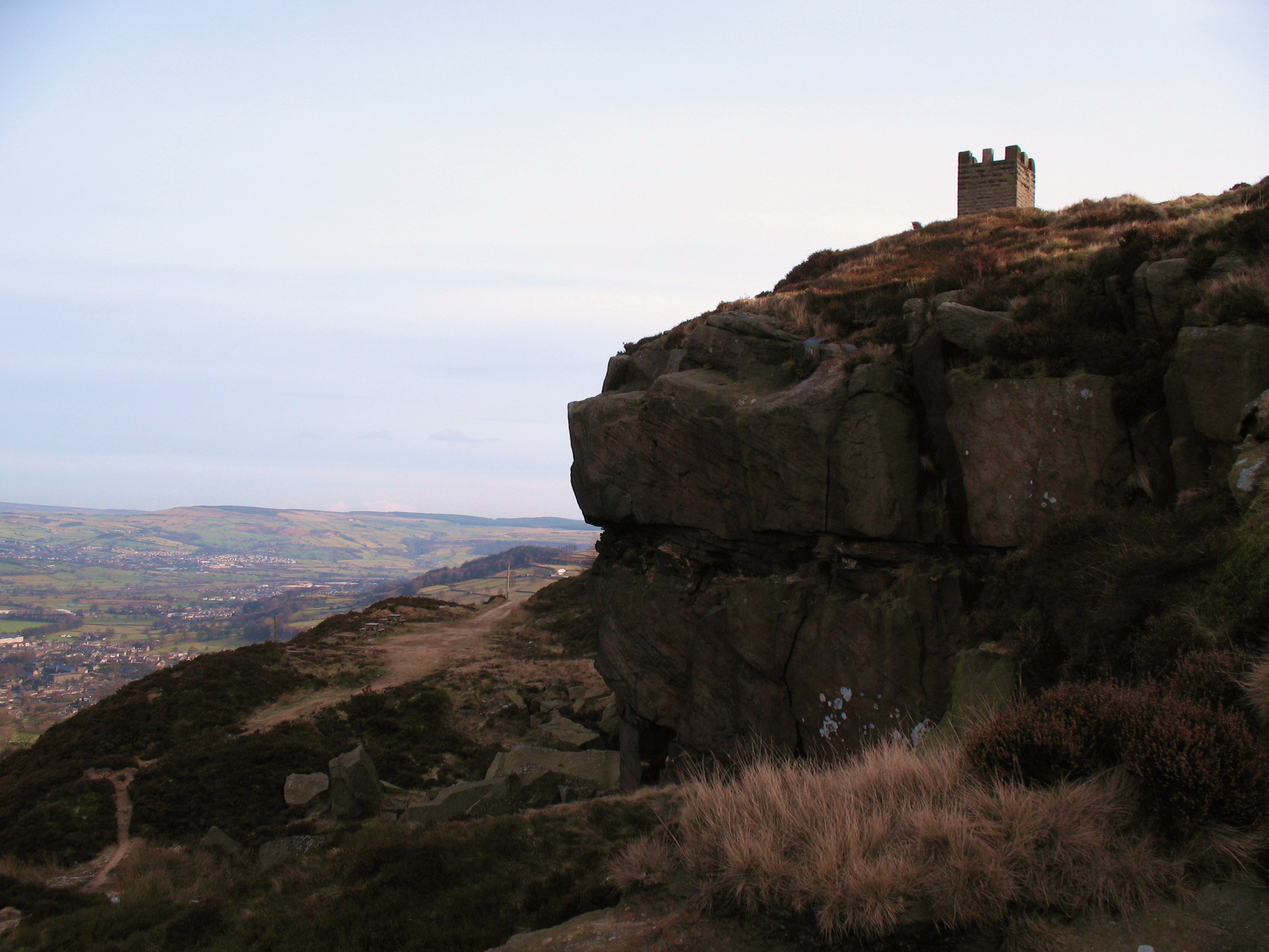
Earl Crag

Earl Crag is a gritstone crag and climbing area in Craven, North Yorkshire, England. It is home to Lund's Tower, Wainman's Pinnacle, and The Hitching...
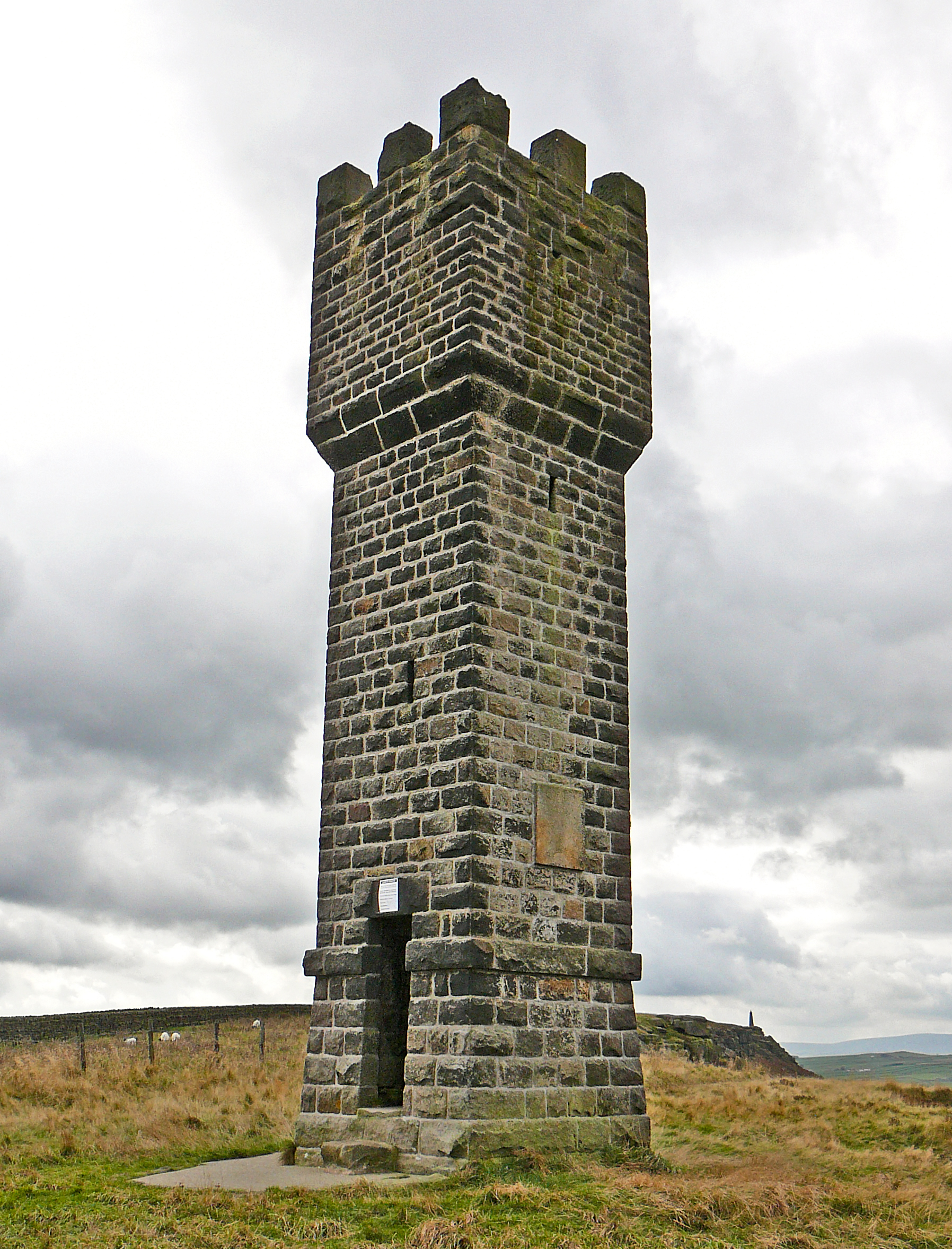
Lund's Tower

Lund's Tower is a stone-built folly situated to the south-west of the North Yorkshire village of Sutton-in-Craven. It is also known as Cowling Pinnacle...

Watersheddles Reservoir

Watersheddles Reservoir is an upland artificial lake in Lancashire, England. The reservoir was opened in 1877 by the Keighley Corporation Water Works,...

Malsis School

Malsis School located at a mansion known as Malsis Hall in the village of Crosshills, in North Yorkshire, England, was a co-educational independent pre...

Nearby Amenities

Located within 500m of 53.869957,-2.0543162
Barrier: stile
Lat/Long: 53.8710946/-2.0557621
Barrier: stile
Stile: stepover
Lat/Long: 53.8688635/-2.0613527
Barrier: stile
Stile: ladder
Lat/Long: 53.8669448/-2.0544092
Ford: yes
Lat/Long: 53.8667115/-2.0535302
Barrier: stile
Stile: wall
Lat/Long: 53.8704262/-2.0575548
The data included in this document is from www.openstreetmap.org. The data is made available under ODbL.

Have you been to Cowloughton Clough?

Leave your review of Cowloughton Clough below (or comments, questions and feedback).