Rowton Clough

Valley in Lancashire

England

Rowton Clough

Butchers Arms public house, Mossley
Butchers Arms public house, Mossley Credit: Ian S

Rowton Clough is a picturesque valley located in the county of Lancashire, England. Nestled amidst the rolling hills and verdant countryside, this tranquil haven offers breathtaking views and a peaceful retreat for nature lovers and outdoor enthusiasts.

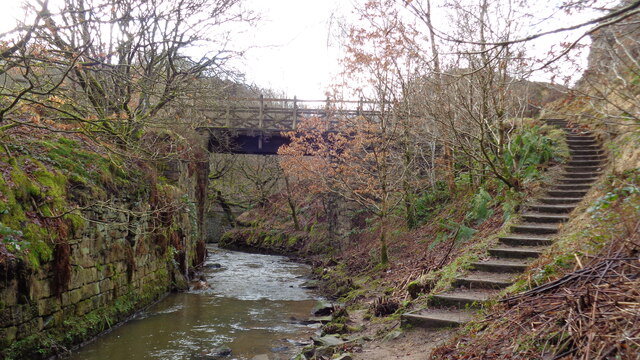
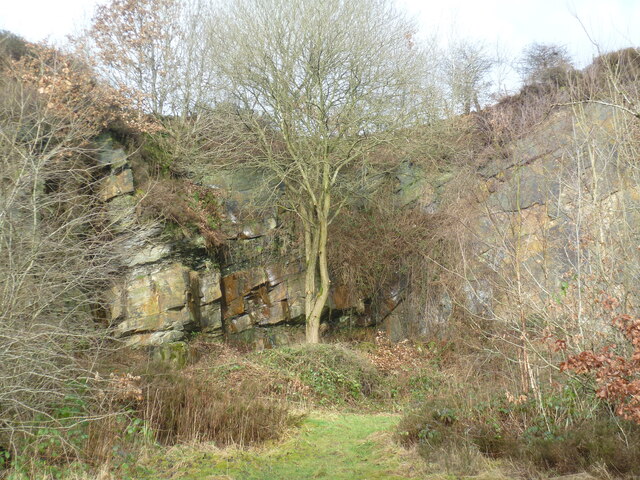
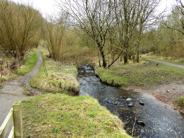
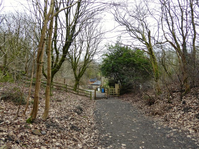
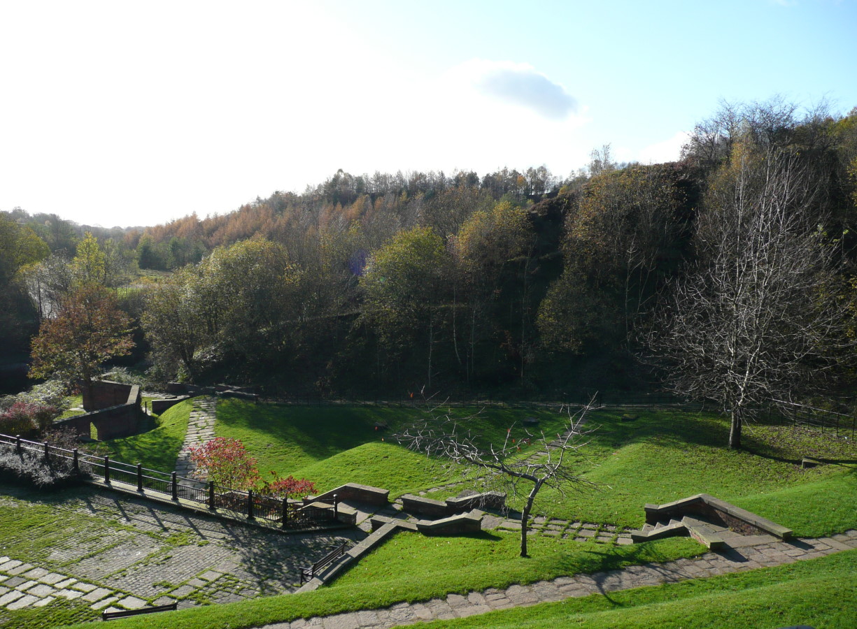
Situated near the village of Rowton, the Clough is known for its natural beauty and diverse wildlife. The valley is characterized by lush greenery, dense woodlands, and a meandering stream that adds to its charm. The area is home to a variety of plants, flowers, and trees, creating a vibrant and colorful landscape throughout the seasons.

Rowton Clough is a haven for birdwatchers, as it attracts a wide range of avian species. Visitors can spot birds such as robins, blackbirds, and even the elusive kingfisher. The valley also provides a habitat for small mammals like rabbits, squirrels, and foxes.

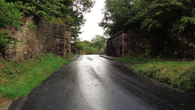
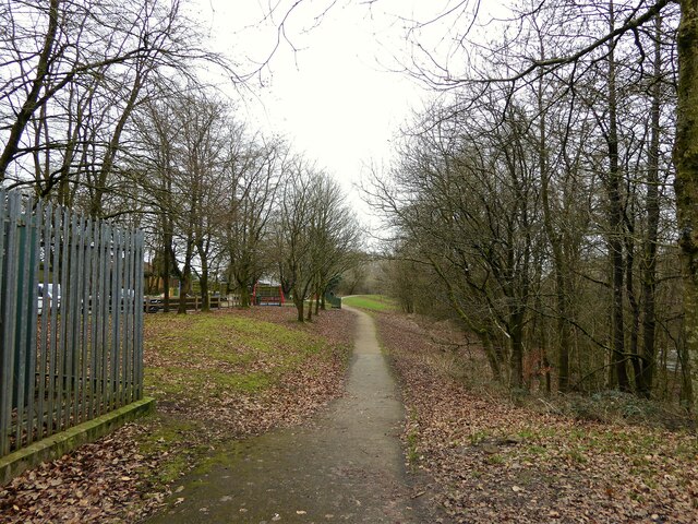
For those seeking outdoor activities, Rowton Clough offers several walking trails and paths that allow visitors to explore the area's natural wonders. The paths wind through the valley, providing stunning views of the surrounding countryside. Additionally, the stream offers a peaceful spot for picnics or a moment of relaxation.

The Clough is easily accessible, with a nearby car park and public transportation options. It is a popular destination for locals and tourists alike, providing a welcome escape from the hustle and bustle of everyday life.

In summary, Rowton Clough in Lancashire is a captivating valley that offers a serene escape into nature. With its stunning landscapes, diverse wildlife, and peaceful atmosphere, it is a must-visit destination for anyone looking to immerse themselves in the beauty of the countryside.

If you have any feedback on the listing, please let us know in the comments section below.

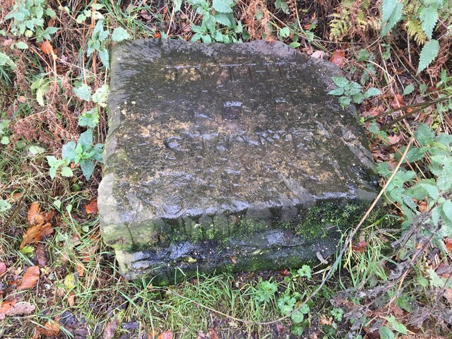
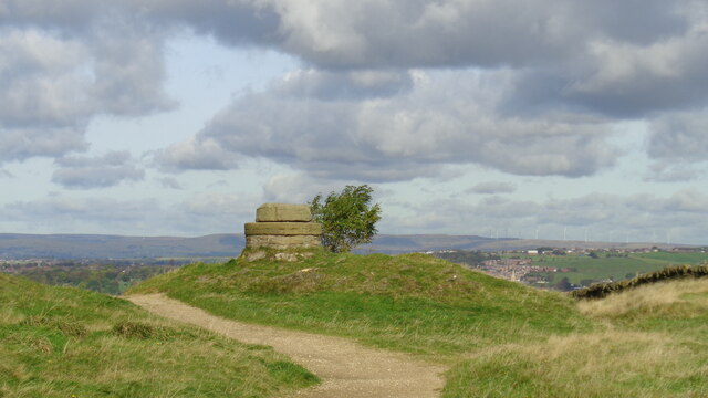
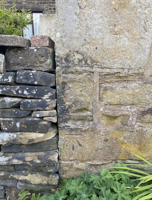
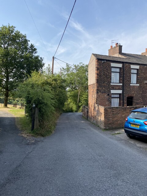
Rowton Clough Images

Images are sourced within 2km of 53.526143/-2.0731209 or Grid Reference SD9503. Thanks to Geograph Open Source API. All images are credited.

Butchers Arms public house, Mossley
Inscribed stone on the south side of Twirl Hill Road, Hartshead Inscribed stone on the south side of Twirl Hill Road. In the former Ashton under Lyne parish to 1894 and Hartshead parish from 1894 to 1974. This stone is thought to be the collection place for the northern part of the ancient parish of Ashton-under-Lyne and is situated at a place called Twirl Hill between the hamlets of Alt Hill and Hartshead, just below the local viewpoint of Hartshead Pike. The practice of paying tithes was abandoned in the 1830’s. The “Tythe Stone” inscription is thought to have been made by local man John Coulthard in 1840 to ensure its preservation. See also <span class="nowrap"><a title="http://www.marland.org/places/marlandplaces-twarlhill.htm" rel="nofollow ugc noopener" href="http://www.marland.org/places/marlandplaces-twarlhill.htm">Link</a><img style="margin-left:2px;" alt="External link" title="External link - shift click to open in new window" src="https://s1.geograph.org.uk/img/external.png" width="10" height="10"/></span>

Milestone Society National ID: LA_HARTS01cm
Inscribed stone on the south side of Twirl Hill Road, Hartshead
Inscribed stone on the south side of Twirl Hill Road. In the former Ashton under Lyne parish to 1894 and Hartshead parish from 1894 to 1974. This stone is thought to be the collection place for the northern part of the ancient parish of Ashton-under-Lyne and is situated at a place called Twirl Hill between the hamlets of Alt Hill and Hartshead, just below the local viewpoint of Hartshead Pike. The practice of paying tithes was abandoned in the 1830’s. The “Tythe Stone” inscription is thought to have been made by local man John Coulthard in 1840 to ensure its preservation. See also LinkExternal link Milestone Society National ID: LA_HARTS01cm
Hartshead Pike Rebuilt to commemorate the marriage of Edward, Prince of Wales in 1863
Hartshead Pike
Rebuilt to commemorate the marriage of Edward, Prince of Wales in 1863
Hartshead Pike Well Often marked as a well on maps is this the site of the original tower on the summit of the hill?
Hartshead Pike Well
Often marked as a well on maps is this the site of the original tower on the summit of the hill?
Park Bridge Heritage Centre View from Alt Hill Road of the chimneys of the ironworks roller shop to the left and cotton mill to the right
Park Bridge Heritage Centre
View from Alt Hill Road of the chimneys of the ironworks roller shop to the left and cotton mill to the right
Old Tramway Bridge Over the River Medlock at the Park Bridge industrial heritage site
Old Tramway Bridge
Over the River Medlock at the Park Bridge industrial heritage site
Old Quarry On the Park Bridge industrial heritage site
Old Quarry
On the Park Bridge industrial heritage site
Brown Edge Trig Point Flush Bracket S2784
Views towards Hartshead Pike Tower
The Rock Trig Point Flush Bracket S2786
OS Cut Mark - Park Bridge, Keverlow Farm <span class="nowrap"><a title="https://www.bench-marks.org.uk/bm60764" rel="nofollow ugc noopener" href="https://www.bench-marks.org.uk/bm60764">Link</a><img style="margin-left:2px;" alt="External link" title="External link - shift click to open in new window" src="https://s1.geograph.org.uk/img/external.png" width="10" height="10"/></span>
OS Cut Mark - Park Bridge, Keverlow Farm
Mill Brow
Mill Brow
Railway Bridge Abutments On Alt Hill Lane for the former Oldham and Ashton railway route
Railway Bridge Abutments
On Alt Hill Lane for the former Oldham and Ashton railway route
Cycle route following line of former railway This view across Cranbrook Street just off the path shows the route is on the top of infill, since only the bridge parapet is visible of the former railway bridge. The path is on the  former Oldham to Greenfield line.
Cycle route following line of former railway
This view across Cranbrook Street just off the path shows the route is on the top of infill, since only the bridge parapet is visible of the former railway bridge. The path is on the former Oldham to Greenfield line.
Cycle path following route of former railway The path is approaching the former railway bridge at St. John Street which is one of the few not infilled on the route. The path runs from Oldham to Grotton along the former line to Greenfield.
Cycle path following route of former railway
The path is approaching the former railway bridge at St. John Street which is one of the few not infilled on the route. The path runs from Oldham to Grotton along the former line to Greenfield.
River Medlock at Lees View on the Medlock Valley Way from a footbridge
River Medlock at Lees
View on the Medlock Valley Way from a footbridge
The end of the cycle path View towards Old Mill Lane at Grotton. The cycle path has followed the route of the former Oldham to Greenfield railway but deviates here to join Old Mill Lane.
The end of the cycle path
View towards Old Mill Lane at Grotton. The cycle path has followed the route of the former Oldham to Greenfield railway but deviates here to join Old Mill Lane.
Route of former railway at Grotton View from the former Grotton Station towards Lees on the Greenfield to Oldham railway route. A cycle path exists on the Grotton to Oldham portion of the route.
Route of former railway at Grotton
View from the former Grotton Station towards Lees on the Greenfield to Oldham railway route. A cycle path exists on the Grotton to Oldham portion of the route.
Show me another place!

Rowton Clough is located at Grid Ref: SD9503 (Lat: 53.526143, Lng: -2.0731209)

Unitary Authority: Oldham

Police Authority: Greater Manchester

What 3 Words

///fever.loser.focal. Near Mossley, Manchester

Related Wikis

Alt, Greater Manchester

Alt is a semi-rural and suburban area lying on the borders of the towns of Oldham and Ashton-under-Lyne in Greater Manchester. Alt was formerly a civil...

Abbey Hills

Abbey Hills (archaically Wabbow Hills) is an area of Oldham in Greater Manchester. It is contiguous with Glodwick and Alt. Lying on the eastern border...
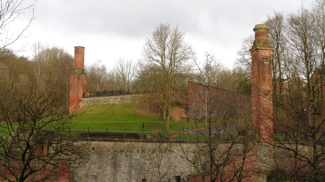
Park Bridge

Park Bridge is an area of Ashton-under-Lyne, in the Metropolitan Borough of Tameside, in Greater Manchester, England. It is situated in the Medlock Valley...

Breeze Hill School

Breeze Hill School was a mixed-sex comprehensive secondary school for 11- to 16-year-olds in Oldham, Greater Manchester, England. It was a specialist Humanities...

Oasis Academy Leesbrook

Oasis Academy Leesbrook is coeducational secondary school located in the Oldham in Greater Manchester, England. It is part of the Oasis Community Learning...
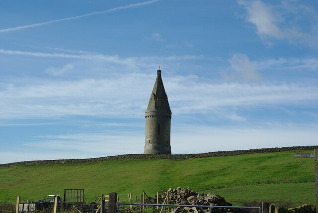
Hartshead Pike

Hartshead Pike is a hill in Tameside in Greater Manchester, England, and its name is associated with the monument on its summit. It overlooks Ashton-under...

Lees, Greater Manchester

Lees is a village in the Metropolitan Borough of Oldham, Greater Manchester, England, amongst the Pennines east of the River Medlock, 1.8 miles (2.9 km...

Glodwick

Glodwick is an area of Oldham, Greater Manchester, England. It is south-east of Oldham town centre. Glodwick is a multi-ethnic residential area in the...

Nearby Amenities

Located within 500m of 53.526143,-2.0731209
Bus Stop
Alt, Abbeyhills Road / opposite Lees New Road
Bus: yes
Naptan AtcoCode: 1800ED08821
Naptan Bearing: NW
Naptan CommonName: Abbeyhills Road/Lees New Road
Naptan Indicator: Grassland
Naptan Landmark: GRASSLAND
Naptan NaptanCode: manamgda
Naptan PlusbusZoneRef: MNCRPIC
Naptan ShortCommonName: Lees New Road
Naptan Street: ABBEYHILLS ROAD
Naptan Verified: no
Network: TfGM
Operator: TfGM
Public Transport: platform
Source: naptan_import
Lat/Long: 53.5254975/-2.0781382
Bus Stop
Alt, Abbeyhills Road / near Lees New Road
Bus: yes
Naptan AtcoCode: 1800ED08831
Naptan Bearing: SE
Naptan CommonName: Abbeyhills Road/Lees New Road
Naptan Indicator: Nr Grass Land
Naptan Landmark: NR GRASS LAND
Naptan NaptanCode: manamgdg
Naptan PlusbusZoneRef: MNCRPIC
Naptan ShortCommonName: Lees New Road
Naptan Street: ABBEYHILLS ROAD
Naptan Verified: no
Network: TfGM
Operator: TfGM
Public Transport: platform
Source: naptan_import
Lat/Long: 53.5256503/-2.0781988
Bus Stop
Holts, Lees New Road / near Abbeyhills Road
Bus: yes
Naptan AtcoCode: 1800ED08841
Naptan Bearing: SW
Naptan CommonName: Lees New Road/Abbeyhills Road
Naptan Indicator: Grassland
Naptan Landmark: GRASSLAND
Naptan NaptanCode: manamgdj
Naptan PlusbusZoneRef: MNCRPIC
Naptan ShortCommonName: Abbeyhills Road
Naptan Street: LEES NEW ROAD
Naptan Verified: no
Network: TfGM
Operator: TfGM
Public Transport: platform
Source: naptan_import
Lat/Long: 53.5254178/-2.0762978
Bus Stop
Wildmoor Avenue/Lavender Road
Bus: yes
Naptan AtcoCode: 1800ED08851
Naptan Bearing: SE
Naptan CommonName: Wildmoor Avenue/Lavender Road
Naptan Indicator: House No. 8
Naptan Landmark: HOUSE 4
Naptan NaptanCode: manamgdm
Naptan PlusbusZoneRef: MNCRPIC
Naptan ShortCommonName: Lavender Road
Naptan Street: WILDMOOR AVENUE
Naptan Verified: no
Network: TfGM
Public Transport: platform
Source: naptan_import
Lat/Long: 53.5270554/-2.0736759
Bus Stop
Holts, Wildmoor Avenue / near Lavender Road
Bus: yes
Naptan AtcoCode: 1800ED08861
Naptan Bearing: NW
Naptan CommonName: Wildmoor Avenue/Lavender Road
Naptan Indicator: Grassland
Naptan Landmark: FLATS
Naptan NaptanCode: manamgdp
Naptan PlusbusZoneRef: MNCRPIC
Naptan ShortCommonName: Lavender Road
Naptan Street: WILDMOOR AVENUE
Naptan Verified: no
Network: TfGM
Operator: TfGM
Public Transport: platform
Source: naptan_import
Lat/Long: 53.527145/-2.0740532
Bus Stop
Wildmoor Avenue/Rowden Road
Bus: yes
Naptan AtcoCode: 1800ED08871
Naptan Bearing: SW
Naptan CommonName: Wildmoor Avenue/Rowden Road
Naptan Indicator: O/s House 76
Naptan Landmark: HOUSE 76
Naptan NaptanCode: manamgdt
Naptan PlusbusZoneRef: MNCRPIC
Naptan ShortCommonName: Rowden Road
Naptan Street: WILDMOOR AVENUE
Naptan Verified: no
Network: TfGM
Public Transport: platform
Source: naptan_import
Lat/Long: 53.5300301/-2.0745259
Bus Stop
Holts, Wildmoor Avenue / near Rowden Road
Bus: yes
Naptan AtcoCode: 1800ED08881
Naptan Bearing: NE
Naptan CommonName: Wildmoor Avenue/Rowden Road
Naptan Indicator: O/s House 83
Naptan Landmark: HOUSE 83
Naptan NaptanCode: manamgdw
Naptan PlusbusZoneRef: MNCRPIC
Naptan ShortCommonName: Rowden Road
Naptan Street: WILDMOOR AVENUE
Naptan Verified: no
Network: TfGM
Operator: TfGM
Public Transport: platform
Source: naptan_import
Lat/Long: 53.5304977/-2.0741646
Bus Stop
Holts, Lees New Road / opposite Red Rose Inn
Bus: yes
Naptan AtcoCode: 1800ED09621
Naptan Bearing: SW
Naptan CommonName: Lees New Road/Red Rose Inn
Naptan Indicator: Red Rose Pub
Naptan Landmark: RED ROSE PUB
Naptan NaptanCode: mantgpwa
Naptan PlusbusZoneRef: MNCRPIC
Naptan ShortCommonName: Red Rose Inn
Naptan Street: LEES NEW ROAD
Naptan Verified: no
Network: TfGM
Operator: TfGM
Public Transport: platform
Source: naptan_import
Lat/Long: 53.5278295/-2.0718066
Bus Stop
Lees New Road/Red Rose Inn
Bus: yes
Naptan AtcoCode: 1800ED00761
Naptan Bearing: NE
Naptan CommonName: Lees New Road/Red Rose Inn
Naptan Indicator: Red Rose Pub
Naptan Landmark: RED ROSE STORE
Naptan NaptanCode: manajpwd
Naptan PlusbusZoneRef: MNCRPIC
Naptan ShortCommonName: Red Rose Inn
Naptan Street: LEES NEW ROAD
Naptan Verified: no
Network: TfGM
Public Transport: platform
Source: naptan_import
Lat/Long: 53.5279014/-2.0719425
Mini Roundabout
Direction: clockwise
Lat/Long: 53.5268349/-2.0733179
Mini Roundabout
Direction: clockwise
Lat/Long: 53.5288133/-2.0705168
Post Office
Holts Post Office
Addr Postcode: OL4 5PZ
Branch: Holts
Brand: Post Office
Brand Wikidata: Q1783168
Check Date: 2020-02-20
Contact Website: https://www.postoffice.co.uk/branch-finder/1804243/holts
Ref Pol Id: 5304
Lat/Long: 53.529511/-2.0714447
Barrier: stile
Material: wood
Stile: stepover
Lat/Long: 53.5245759/-2.0760771
Noexit: yes
Lat/Long: 53.526901/-2.0752489
Generator Method: photovoltaic
Generator Output Electricity: yes
Generator Source: solar
Generator Type: solar_photovoltaic_panel
Location: roof
Power: generator
Lat/Long: 53.5273077/-2.0735765
Generator Method: photovoltaic
Generator Output Electricity: yes
Generator Source: solar
Generator Type: solar_photovoltaic_panel
Location: roof
Power: generator
Lat/Long: 53.5285656/-2.0749405
Generator Method: photovoltaic
Generator Output Electricity: yes
Generator Source: solar
Generator Type: solar_photovoltaic_panel
Location: roof
Power: generator
Lat/Long: 53.5290468/-2.073832
Generator Method: photovoltaic
Generator Output Electricity: yes
Generator Source: solar
Generator Type: solar_photovoltaic_panel
Location: roof
Power: generator
Lat/Long: 53.5294556/-2.0755276
Generator Method: photovoltaic
Generator Output Electricity: yes
Generator Source: solar
Generator Type: solar_photovoltaic_panel
Location: roof
Power: generator
Lat/Long: 53.5294707/-2.0756255
Barrier: bollard
Lat/Long: 53.5280281/-2.0727335
Barrier: bollard
Lat/Long: 53.5280379/-2.0727158
Barrier: bollard
Lat/Long: 53.5280511/-2.0727006
Barrier: bollard
Lat/Long: 53.5280632/-2.0726833
Barrier: bollard
Lat/Long: 53.5280729/-2.0726711
Golf: pin
Lat/Long: 53.5274575/-2.0719498
Golf: pin
Lat/Long: 53.528424/-2.0695332
Golf: pin
Lat/Long: 53.5265171/-2.0692658
Golf: pin
Lat/Long: 53.5256364/-2.0729778
Golf: pin
Lat/Long: 53.52488/-2.0717196
Golf: pin
Lat/Long: 53.5252815/-2.0701599
Golf: pin
Lat/Long: 53.5259568/-2.0678141
Golf: pin
Lat/Long: 53.5270723/-2.0683223
Golf: pin
Lat/Long: 53.5296127/-2.0683578
Holts
Place: suburb
Lat/Long: 53.5296513/-2.0727326
Barrier: stile
Material: wood
Stile: stepover
Lat/Long: 53.522326/-2.0723732
Ford: yes
Lat/Long: 53.5247604/-2.0763763
The data included in this document is from www.openstreetmap.org. The data is made available under ODbL.

Have you been to Rowton Clough?

Leave your review of Rowton Clough below (or comments, questions and feedback).