Moss Bottom

Valley in Yorkshire Craven

England

Moss Bottom

The Pennine Way near Ickornshaw
The Pennine Way near Ickornshaw Credit: Dave Kelly

Moss Bottom, located in the picturesque region of Yorkshire, is a serene valley that boasts breathtaking natural beauty and a tranquil atmosphere. Nestled amidst rolling hills and lush greenery, this idyllic destination is a perfect retreat for nature enthusiasts and those seeking a peaceful escape from the hustle and bustle of city life.

The valley is named after the abundance of moss that carpets the ground, giving it a unique and enchanting charm. Moss Bottom is known for its diverse flora and fauna, making it a haven for wildlife and a dream destination for birdwatchers and nature photographers. Visitors can often spot a variety of bird species, including the magnificent red kite, soaring above the valley.

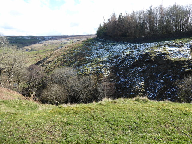
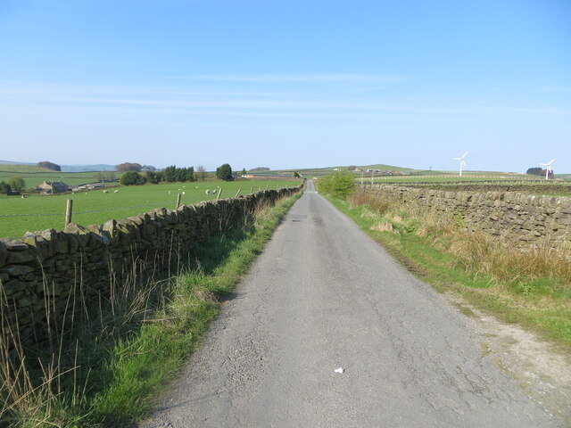
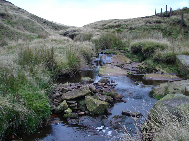
The landscape of Moss Bottom is characterized by gentle slopes and meandering streams, which add to its picturesque allure. The valley is crisscrossed by numerous walking trails, allowing visitors to explore its beauty at their own pace. Hikers can embark on an adventure and discover hidden gems such as cascading waterfalls, ancient woodlands, and panoramic viewpoints that offer stunning vistas of the surrounding countryside.

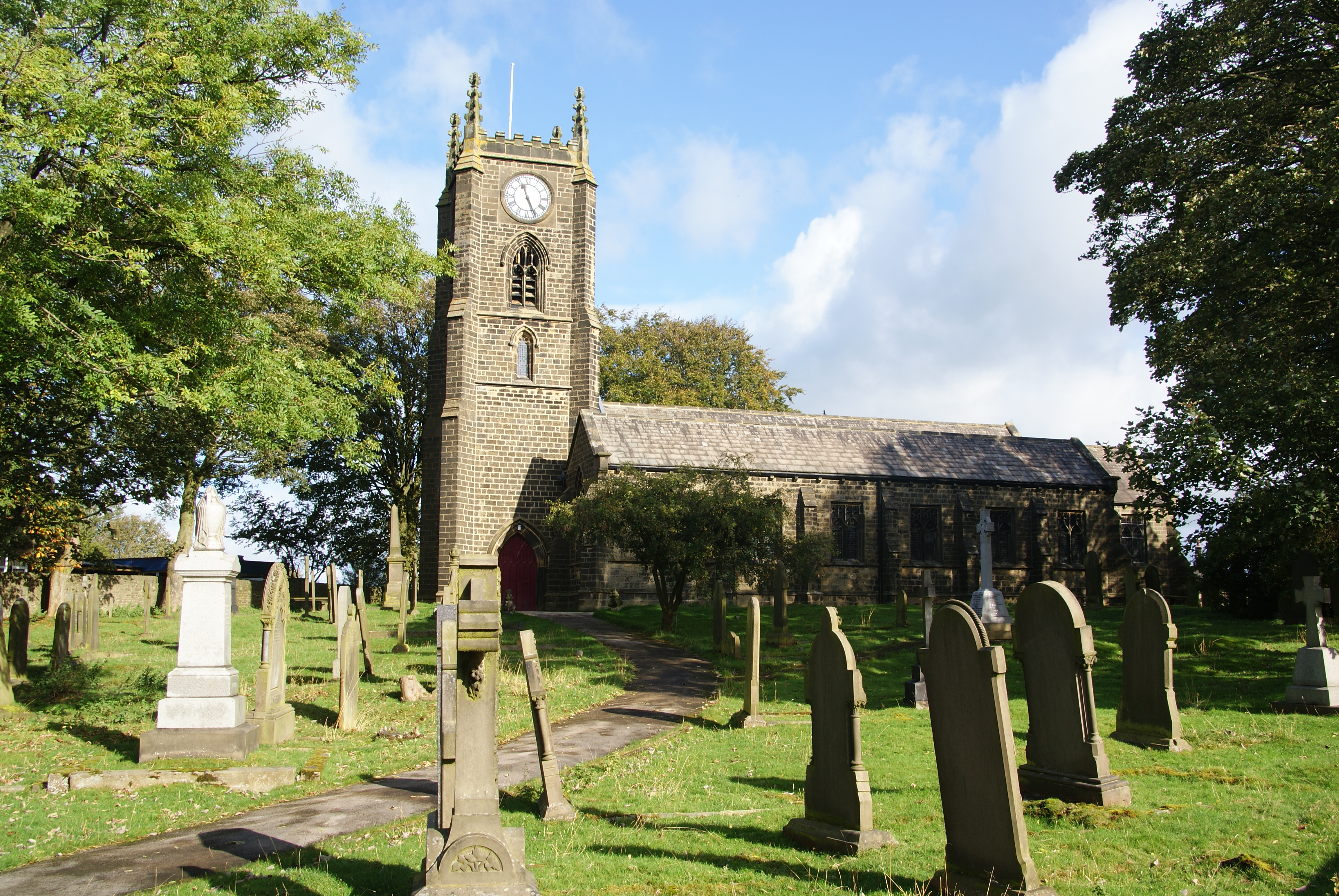
In addition to its natural wonders, Moss Bottom is also home to a small, close-knit community. The locals are known for their warm hospitality, and visitors can immerse themselves in the local culture by visiting quaint villages and charming country pubs that dot the area.

Overall, Moss Bottom is a captivating destination that offers a harmonious blend of natural beauty and a welcoming community. Whether one seeks tranquility in nature or an authentic rural experience, this hidden gem in Yorkshire promises an unforgettable journey.

If you have any feedback on the listing, please let us know in the comments section below.
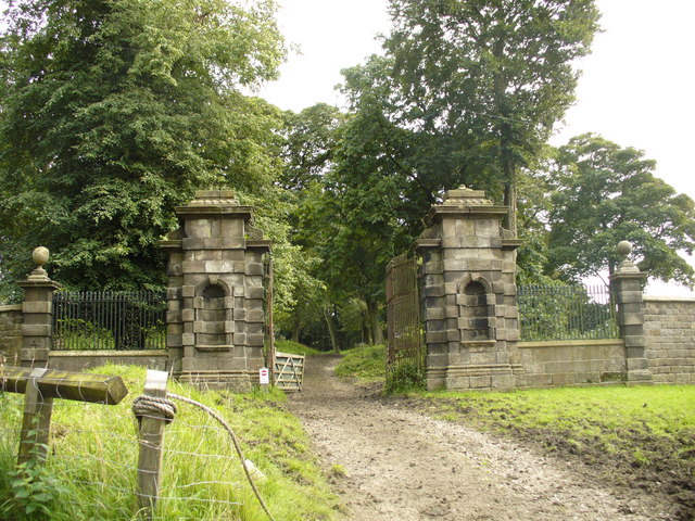
Moss Bottom Images

Images are sourced within 2km of 53.877765/-2.0761232 or Grid Reference SD9542. Thanks to Geograph Open Source API. All images are credited.

The Pennine Way near Ickornshaw
The view from the Pennine Way near Ickornshaw
The Pennine Way near Lumb
Sandyforth Lane approaching Mosside Looking south-westward.
Sandyforth Lane approaching Mosside
Looking south-westward.
Wall and fence enclosed Moss End Lane Looking north-westward.
Wall and fence enclosed Moss End Lane
Looking north-westward.
Ordnance Survey Cut Mark Surface Block This mark and block can be found in the grass verge of Sandyforth Lane near to Mosside.
The recorded details give  a height of 297.116 metres above sea level.
For more detail see : <span class="nowrap"><a title="https://www.bench-marks.org.uk/bm119214" rel="nofollow ugc noopener" href="https://www.bench-marks.org.uk/bm119214">Link</a><img style="margin-left:2px;" alt="External link" title="External link - shift click to open in new window" src="https://s1.geograph.org.uk/img/external.png" width="10" height="10"/></span>
Ordnance Survey Cut Mark Surface Block
This mark and block can be found in the grass verge of Sandyforth Lane near to Mosside. The recorded details give a height of 297.116 metres above sea level. For more detail see : LinkExternal link
Old milestone This West Riding County Council milestone set up in 1893/94 is now just on the Lancashire border.  The grass had to be trampled down to reveal the milestone and it also revealed a discarded NHS crutch!  It is on the north side of the A6068 Colne Road/Keighley Road near the bus-stop.  This left face has mileages to Keighley, Addingham and Ilkley with Colne and Burnley on the right-hand side.  With Cowling on the header it is possible that there has been a slight change to the boundary since the late 19C.
Old milestone
This West Riding County Council milestone set up in 1893/94 is now just on the Lancashire border. The grass had to be trampled down to reveal the milestone and it also revealed a discarded NHS crutch! It is on the north side of the A6068 Colne Road/Keighley Road near the bus-stop. This left face has mileages to Keighley, Addingham and Ilkley with Colne and Burnley on the right-hand side. With Cowling on the header it is possible that there has been a slight change to the boundary since the late 19C.
Footpath below Eller Hill This footpath climbs beside stream to reach the Pennine Way near Lumb Farm.
Footpath below Eller Hill
This footpath climbs beside stream to reach the Pennine Way near Lumb Farm.
Pennine Way leading off Eller Hill Part of the descent off Ickornshaw Moor along the National Trail
Pennine Way leading off Eller Hill
Part of the descent off Ickornshaw Moor along the National Trail
Access Lane to Fleet Access leading down to the dwelling of Fleet from Pad Cote Lane
Access Lane to Fleet
Access leading down to the dwelling of Fleet from Pad Cote Lane
Pad Cote Lane Gives access to farms and dwellings by Ickornshaw Moor onto the A6068
Pad Cote Lane
Gives access to farms and dwellings by Ickornshaw Moor onto the A6068
Track by Coal Pit Sike Taken from the access lane to Lower Coppy this looks northwards towards a square of plantation on Reedshaw Moss
Track by Coal Pit Sike
Taken from the access lane to Lower Coppy this looks northwards towards a square of plantation on Reedshaw Moss
Access Lane from Lower Coppy Long access lane leading down from Lower Coppy, at this point heading towards Pad Cote Farm
Access Lane from Lower Coppy
Long access lane leading down from Lower Coppy, at this point heading towards Pad Cote Farm
Looking towards Coppy Hill Looking west from the edge of Hart Hill Moor
Looking towards Coppy Hill
Looking west from the edge of Hart Hill Moor
On Hart Hill Following the fence on Open Access Land over Hart Hill
On Hart Hill
Following the fence on Open Access Land over Hart Hill
A Gateway to Wreck A very faint track utilises this gate which runs down this upland pasture to a structure called Wreck
A Gateway to Wreck
A very faint track utilises this gate which runs down this upland pasture to a structure called Wreck
Rebuilding a wall near Green Syke Farm A footpath crosses this wall but for the time being it is easier to go through the gate on the left.
Rebuilding a wall near Green Syke Farm
A footpath crosses this wall but for the time being it is easier to go through the gate on the left.
Show me another place!

Moss Bottom is located at Grid Ref: SD9542 (Lat: 53.877765, Lng: -2.0761232)

Division: West Riding

Administrative County: North Yorkshire

District: Craven

Police Authority: North Yorkshire

What 3 Words

///offstage.await.competing. Near Glusburn, North Yorkshire

Nearby Locations

Bent Hill Park Moss Bottom

Related Wikis

Middleton, Cowling

Middleton is a hamlet in the Craven district of North Yorkshire, England, part of the civil parish of Cowling. It is near the border with West Yorkshire...

Cowling, Craven

Cowling ( COH-ling) is a village, electoral division and civil parish in the Craven district of North Yorkshire, England. It is situated on the borders...

River Laneshaw

The River Laneshaw is a river in Northern England. It runs for 1.9 miles (3 km) from Laneshaw Reservoir to Laneshaw Bridge alongside the A6068 road and...

Emmott Hall

Emmott Hall was a country house in the village of Laneshawbridge, Colne, Lancashire, England. It stood on high ground two and a half miles east of Colne...

Nearby Amenities

Located within 500m of 53.877765,-2.0761232
Parking
Description: Layby
Ele: 252.0000000
Lat/Long: 53.8762715/-2.0762481
Place: farm
Lat/Long: 53.8810031/-2.0722407
Bus Stop
Green Syke
Public Transport: platform
Lat/Long: 53.8786541/-2.0698408
Bus Stop
Green Syke
Naptan AtcoCode: 3200YNF10317
Naptan NaptanCode: 32010317
Public Transport: platform
Lat/Long: 53.8787714/-2.069771
Barrier: stile
Lat/Long: 53.87873/-2.0774998
The data included in this document is from www.openstreetmap.org. The data is made available under ODbL.

Have you been to Moss Bottom?

Leave your review of Moss Bottom below (or comments, questions and feedback).