Carswell Cleugh
Valley in Northumberland
England
Carswell Cleugh
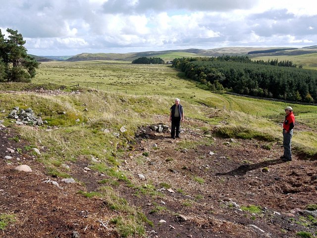
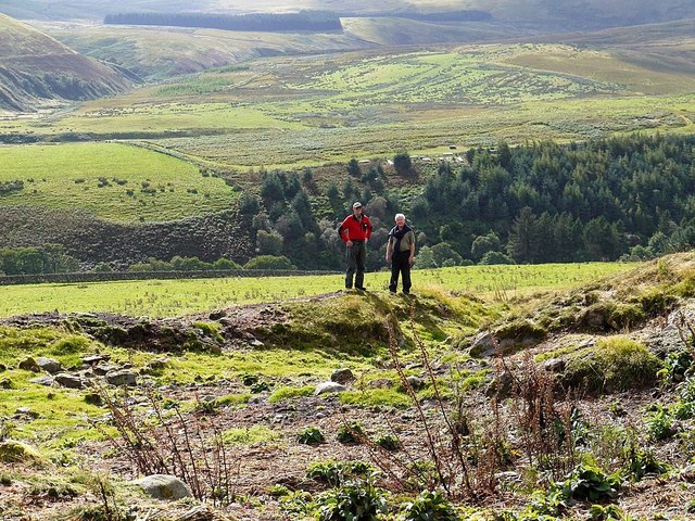
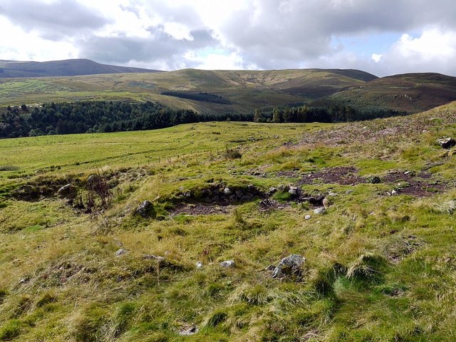
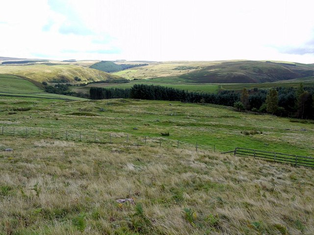
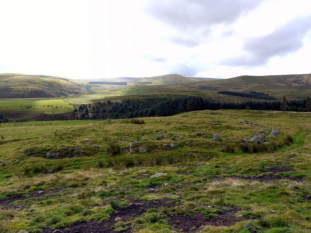
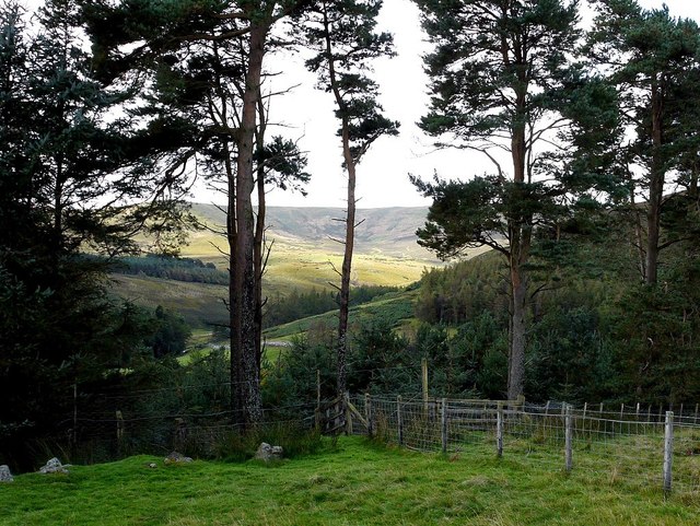
Carswell Cleugh is a small valley located in Northumberland, England. Situated near the border with Scotland, it lies within the heart of the North Pennines Area of Outstanding Natural Beauty. The valley is known for its stunning natural landscapes and rich history, making it a popular destination for nature enthusiasts and history buffs alike.
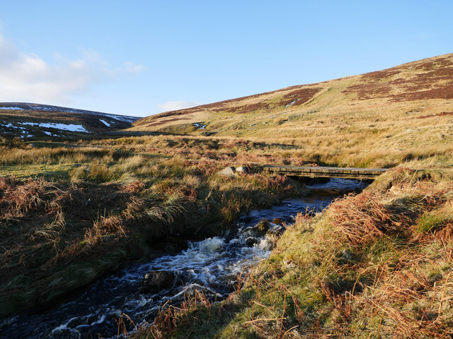
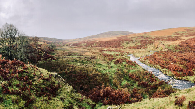
The main feature of Carswell Cleugh is the River Allen, which meanders through the valley, providing a picturesque setting for visitors. The river is flanked by rolling hills and lush green meadows, creating a tranquil and idyllic atmosphere. The valley is also home to a variety of wildlife, including otters, kingfishers, and rare bird species, making it a haven for nature lovers.
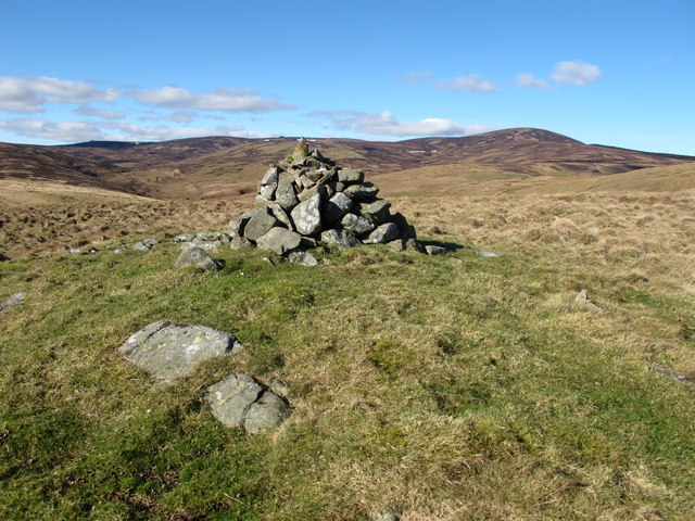
In addition to its natural beauty, Carswell Cleugh boasts a fascinating historical heritage. The valley was once a thriving mining area, with evidence of lead mining dating back to the Roman era. Visitors can explore the remnants of old mine workings and discover the industrial past of the region.
For those seeking outdoor activities, Carswell Cleugh offers numerous walking and cycling trails, allowing visitors to immerse themselves in the stunning countryside. The valley is also a perfect spot for picnicking, fishing, and simply enjoying the peaceful surroundings.
Overall, Carswell Cleugh is a hidden gem in Northumberland, offering a harmonious blend of natural beauty and historical intrigue. Whether you are seeking a peaceful retreat or an adventure in the great outdoors, this valley has something to offer for everyone.
If you have any feedback on the listing, please let us know in the comments section below.
Carswell Cleugh Images
Images are sourced within 2km of 55.442293/-2.0841423 or Grid Reference NT9416. Thanks to Geograph Open Source API. All images are credited.
![From fields to forts â Greaves Ashâs role in Roman Britain I see some squiggly lines on the map, paired with fancy Gothic writing, and I just can’t resist taking a look. And more often than not, it turns up a gem.
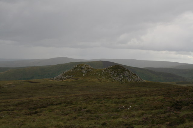
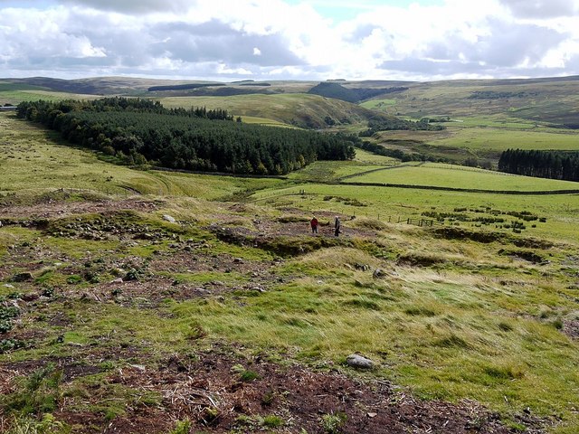
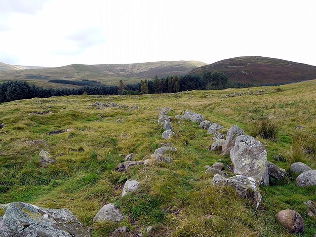
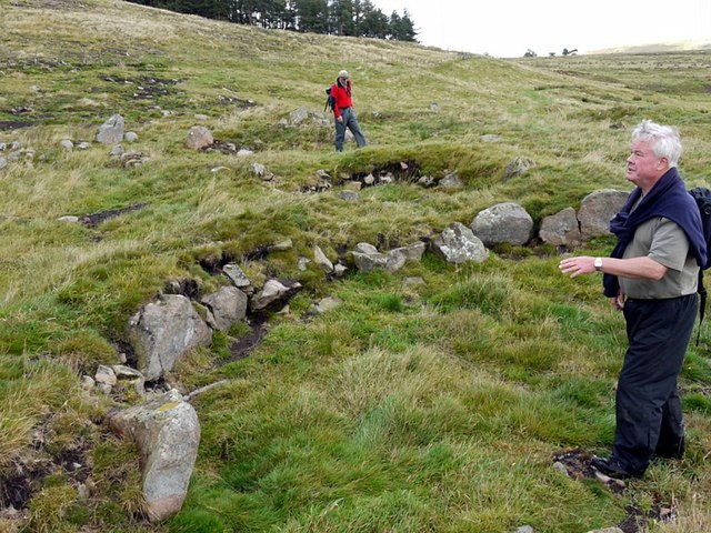
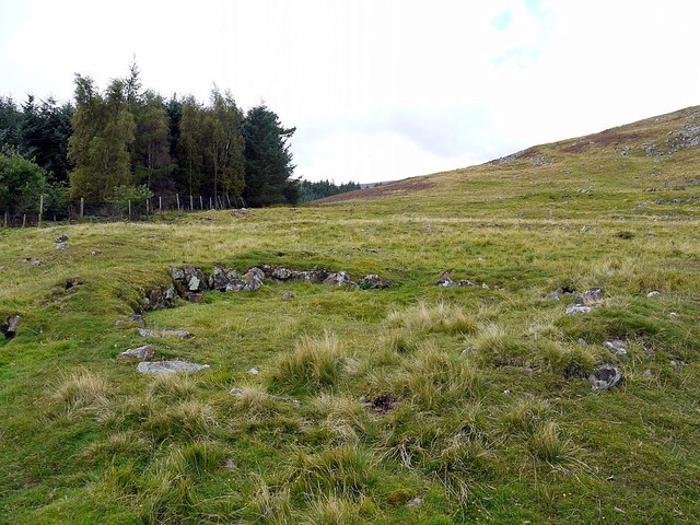
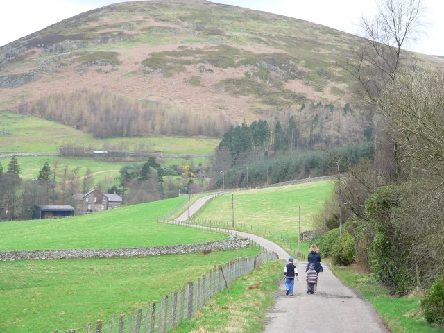
This is Greaves Ash, close to Linhope, high up in the Breamish Valley. Turns out, it is a big Romano-British settlement, with the obvious remains of many roundhouses, walls, and trackways to look at. There were some excavations back in the 1850/60s, but modern archaeologists have re-evaluated it, along with all sites in the Breamish valley.
Greaves Ash is one of, if not the biggest, settlements in the valley. It has clear connections to other settlements and hill-forts, spread across a landscape of fields and boundaries. That’s a sure sign that folks put a lot of effort into making this land thrive, a land which has nutritious, volcanic soil. It drains well — although that’s hard to believe this weekend — and is easy to plough and hoe. You can see large swathes of terraces carved into the hillsides lower down the valley. Up on the Cheviot meadows, sheep grazing is good.
And they didn’t just keep it all for themselves. There’s evidence that back in the 2nd century AD, the locals here sold the surplus to the Roman armies. And it seems like they did pretty well for themselves, because the villages they built were quite substantial, like the one at Greaves Ash. Sheep, wool, and grains were sent to the forts along Hadrian’s Wall. They might have even traded craft items with the forts and the town at Corbridge.
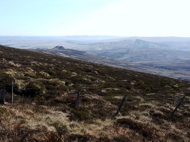
The land to the north of Hadrian’s Wall was always on the edge of the Roman Empire. Even when the Antonine Wall briefly was built across Scotland’s central belt, they certainly weren’t at the heart of things. But that’s not to say the Romans didn’t leave their mark. Rome’s interests went beyond their borders, and the folks out on the edge of the Empire were sure to be interested in what was happening inside it. The tribes of the Cheviots seemed to have been on good terms with the Romans, perhaps acting as a buffer with the Picts further north.
The Breamish Valley drains eastward, providing to a natural route out of the hills to the coast at Berwick and, by a Roman road, south to the forts and towns of Hadrian’s Wall. But let’s not forget, the tribes of the Cheviots were considered barbarians, so their traders probably had to wait in line at the Wall’s gates and prove they were legit before being allowed to pass through.
From my blog ‘From Fields to Forts — Greaves Ash’s Role in Roman Britain’. 2023. Out &amp; About ... &lt;<span class="nowrap"><a title="http://www.fhithich.uk/?p=33533" rel="nofollow ugc noopener" href="http://www.fhithich.uk/?p=33533">Link</a><img style="margin-left:2px;" alt="External link" title="External link - shift click to open in new window" src="https://s1.geograph.org.uk/img/external.png" width="10" height="10"/></span> &gt; [accessed 4 November 2023]
](https://s2.geograph.org.uk/geophotos/07/64/37/7643786_4c4fa762.jpg)
Carswell Cleugh is located at Grid Ref: NT9416 (Lat: 55.442293, Lng: -2.0841423)
Unitary Authority: Northumberland
Police Authority: Northumbria
What 3 Words
///linked.exam.woodstove. Near Kirknewton, Northumberland
Nearby Locations
Related Wikis
Linhope
Linhope is a small village in Northumberland, England. It is located in the Cheviots on the River Breamish, and within Northumberland National Park. Linhope...

Hedgehope Hill
Hedgehope Hill is a mountain in the Cheviot Hills of north Northumberland in northeast England, and categorised as a Hewitt. At a height of 714 metres...

Threestoneburn Stone Circle
Threestoneburn Stone Circle is an archaeological site, a stone circle near the village of Ilderton and about 5 miles (8 km) south of Wooler, in Northumberland...

Kidland
Kidland is a former civil parish, now in the parish of Alwinton in Northumberland, England, about 2 miles (3 km) northwest of Alwinton village. In 1951...
Have you been to Carswell Cleugh?
Leave your review of Carswell Cleugh below (or comments, questions and feedback).