Stone House Clough

Valley in Lancashire

England

Stone House Clough

Boundary stone on Todmorden Road Marks the division of the old Littleborough Urban District and the Borough of Todmorden. Now the local authorities are Rochdale and Calderdale respectively. Or, in tribal terms, the boundary between Lancashire and Yorkshire.
Boundary stone on Todmorden Road Credit: michael ely

Stone House Clough is a picturesque valley located in the county of Lancashire, England. Nestled within the stunning countryside, this valley offers visitors a tranquil and scenic retreat from the bustling urban areas.

The valley is named after the prominent Stone House, a historic building that dates back to the 17th century. This stone-built house adds to the charm and character of the area and serves as a reminder of the region's rich heritage. Surrounding the house, lush green fields and rolling hills create a stunning backdrop, making it a popular spot for nature lovers and photographers.

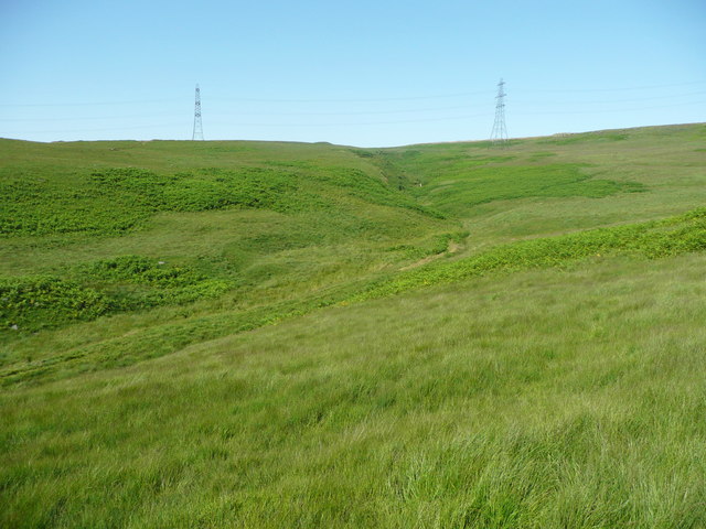
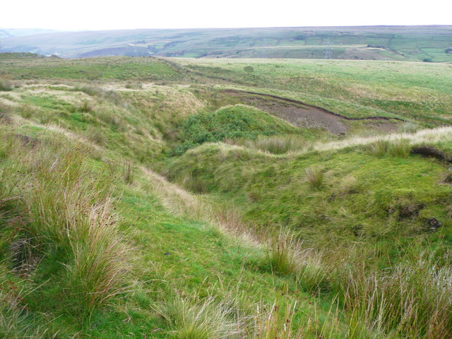
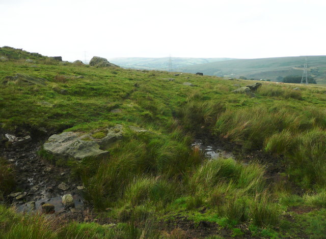
The valley is renowned for its natural beauty, with a meandering river flowing through it. This river not only adds to the visual appeal but also provides a habitat for various species of wildlife. Visitors can expect to spot birds, butterflies, and small mammals as they explore the area.

Stone House Clough offers numerous walking and hiking trails, providing opportunities for outdoor enthusiasts to explore the valley's natural wonders. The trails vary in difficulty, catering to both novice and experienced hikers. Along these paths, visitors can enjoy breathtaking views of the surrounding landscape, including waterfalls and panoramic vistas.

In addition to its natural attractions, Stone House Clough is also home to a charming village, with traditional stone cottages and a friendly community. The village offers a range of amenities, including quaint tea rooms and pubs, where visitors can relax and immerse themselves in the local culture.

Overall, Stone House Clough is a hidden gem in Lancashire, offering visitors a peaceful and idyllic retreat amidst stunning natural beauty.

If you have any feedback on the listing, please let us know in the comments section below.

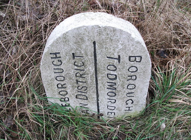
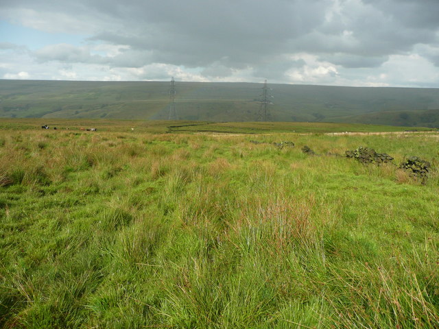
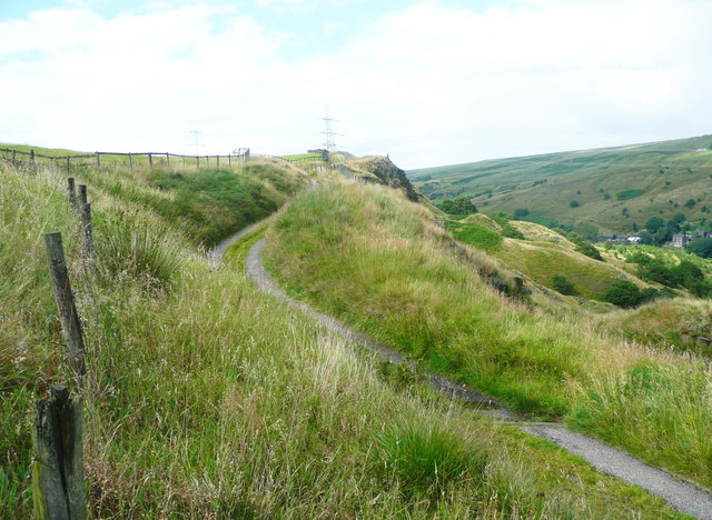
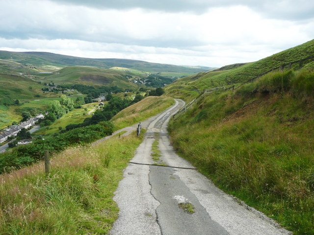
Stone House Clough Images

Images are sourced within 2km of 53.684686/-2.0875228 or Grid Reference SD9420. Thanks to Geograph Open Source API. All images are credited.

Boundary stone on Todmorden Road Marks the division of the old Littleborough Urban District and the Borough of Todmorden. Now the local authorities are Rochdale and Calderdale respectively. Or, in tribal terms, the boundary between Lancashire and Yorkshire.
Boundary stone on Todmorden Road
Marks the division of the old Littleborough Urban District and the Borough of Todmorden. Now the local authorities are Rochdale and Calderdale respectively. Or, in tribal terms, the boundary between Lancashire and Yorkshire.
Longlees Lock, Rochdale Canal Lock no 36 and the start of the summit pound.
Longlees Lock, Rochdale Canal
Lock no 36 and the start of the summit pound.
Light Hazzles Farm across the infant River Roch
Light Hazzles Farm
Light Hazzles Farm
A6033 at Steanor Bottom Toll House
View from Todmorden Road near Summit The hillside is 'access land', and also a footpath goes across the view, climbing towards the right. There are spoil heaps from quarries on the skyline. It looks to be a nice area to explore some time.
View from Todmorden Road near Summit
The hillside is 'access land', and also a footpath goes across the view, climbing towards the right. There are spoil heaps from quarries on the skyline. It looks to be a nice area to explore some time.
Looking across Light Hazzles Clough towards Light Hazzles Farm
Light Hazzles Clough (the River Roch) The modern map captions this stream 'River Roch' but on old maps it is Light Hazzles Clough and the river name starts in Summit village.
Light Hazzles Clough (the River Roch)
The modern map captions this stream 'River Roch' but on old maps it is Light Hazzles Clough and the river name starts in Summit village.
Rocks on The Lowe, Chelburn Moor These are shown on the 1850 six-inch map but omitted ever since, which seems strange.
Rocks on The Lowe, Chelburn Moor
These are shown on the 1850 six-inch map but omitted ever since, which seems strange.
Rocks on The Lowe, Chelburn Moor See also <a href="https://www.geograph.org.uk/photo/5470123">SD9519 : Rocks on The Lowe, Chelburn Moor</a>.
Rocks on The Lowe, Chelburn Moor
View of Light Hazzles Clough, Chelburn Moor
The breached dam of Low Slack Reservoir This reservoir is shown on the 1851 six-inch map and the caption includes "To supply the Rochdale Reservoir". The 1893 1:2500 map shows it just as it is today. Does anyone know what happened?
The breached dam of Low Slack Reservoir
This reservoir is shown on the 1851 six-inch map and the caption includes "To supply the Rochdale Reservoir". The 1893 1:2500 map shows it just as it is today. Does anyone know what happened?
Bed of the former Low Slack Reservoir See also <a href="https://www.geograph.org.uk/photo/5475685">SD9519 : The breached dam of Low Slack Reservoir</a>. The cotton grass likes the marshy ground.
Bed of the former Low Slack Reservoir
See also SD9519 : The breached dam of Low Slack Reservoir. The cotton grass likes the marshy ground.
The infant Owler Clough, next to the Rochdale Way
The Rochdale Way crossing a stream near Ferny Hill This is where the rain started, banishing thoughts of taking photographs of the rocks.
The Rochdale Way crossing a stream near Ferny Hill
This is where the rain started, banishing thoughts of taking photographs of the rocks.
Not quite on the Rochdale Way, Walsden After passing the Ferny Hill rocks I lost the footpath, so headed for the intake wall and picked my way through the rushes. The shower of rain has finished here and is crossing the valley in the distance.
Not quite on the Rochdale Way, Walsden
After passing the Ferny Hill rocks I lost the footpath, so headed for the intake wall and picked my way through the rushes. The shower of rain has finished here and is crossing the valley in the distance.
The Pennine Bridleway and Reddyshaw Scout, Walsden A 'scout' is the top of a very steep hillside, giving a view over the valley. The lumpy hills below might be spoil from the construction of the railway tunnel.
The Pennine Bridleway and Reddyshaw Scout, Walsden
A 'scout' is the top of a very steep hillside, giving a view over the valley. The lumpy hills below might be spoil from the construction of the railway tunnel.
The Pennine Bridleway joining the driveway to Reddyshore Farm, Walsden The bridleway on Reddyshaw Scout Gate comes in from the left, and from the junction the driveway is an adopted highway, at least as far as the Rochdale boundary.
The Pennine Bridleway joining the driveway to Reddyshore Farm, Walsden
The bridleway on Reddyshaw Scout Gate comes in from the left, and from the junction the driveway is an adopted highway, at least as far as the Rochdale boundary.
Show me another place!

Stone House Clough is located at Grid Ref: SD9420 (Lat: 53.684686, Lng: -2.0875228)

Unitary Authority: Calderdale

Police Authority: West Yorkshire

What 3 Words

///remedy.blindfold.simmer. Near Walsden, West Yorkshire

Related Wikis

Summit Tunnel

Summit Tunnel in England is one of the world's oldest railway tunnels. It was constructed between 1838 and 1841 by the Manchester and Leeds Railway Company...

Summit Tunnel fire

The Summit Tunnel fire occurred on 20 December 1984, when a dangerous goods train caught fire while passing through the Summit Tunnel on the railway line...

Walsden

Walsden (; WOLZ-dən) is a large village in the civil parish of Todmorden in the Metropolitan Borough of Calderdale, West Yorkshire, England. It was historically...

Walsden railway station

Walsden railway station (; WOLZ-dən) serves the village of Walsden, Todmorden in West Yorkshire, England, on the edge of the Pennines. It is served by...

Nearby Amenities

Located within 500m of 53.684686,-2.0875228
Seamark Type: gate
Waterway: lock_gate
Lat/Long: 53.6842841/-2.0914287
Seamark Type: gate
Waterway: lock_gate
Lat/Long: 53.6854151/-2.0931567
Seamark Type: gate
Waterway: lock_gate
Lat/Long: 53.6852598/-2.0928806
Seamark Type: gate
Waterway: lock_gate
Lat/Long: 53.6840959/-2.0912525
Bus Stop
Rochdale Road
Bus: yes
Local Ref: 45018950
Naptan AtcoCode: 450018950
Naptan Bearing: NW
Naptan CommonName: Rochdale Road
Naptan Crossing: Dean Royd Road
Naptan Indicator: Stop 45018950
Naptan PlusbusZoneRef: LEEDS
Naptan ShortCommonName: Dean Royd Road
Naptan Street: Rochdale Road
Naptan Verified: no
Public Transport: platform
Source: naptan_import
Lat/Long: 53.6847082/-2.0943766
Bus Stop
Rochdale Road
Bus: yes
Local Ref: 45018951
Naptan AtcoCode: 450018951
Naptan Bearing: SE
Naptan CommonName: Rochdale Road
Naptan Crossing: Dean Royd Road
Naptan Indicator: Stop 45018951
Naptan PlusbusZoneRef: LEEDS
Naptan ShortCommonName: Dean Royd Road
Naptan Street: Rochdale Road
Naptan Verified: no
Public Transport: platform
Source: naptan_import
Lat/Long: 53.6845647/-2.0940129
Bus Stop
Rochdale Road
Bus: yes
Local Ref: 45018952
Naptan AtcoCode: 450018952
Naptan Bearing: NW
Naptan CommonName: Rochdale Road
Naptan Crossing: Top o The Close Road
Naptan Indicator: Stop 45018952
Naptan PlusbusZoneRef: LEEDS
Naptan ShortCommonName: Top O The Close Rd
Naptan Street: Rochdale Road
Naptan Verified: no
Public Transport: platform
Shelter: yes
Source: naptan_import
Lat/Long: 53.6835232/-2.0925419
Bus Stop
Rochdale Road
Bus: yes
Local Ref: 45018953
Naptan AtcoCode: 450018953
Naptan Bearing: E
Naptan CommonName: Rochdale Road
Naptan Crossing: Bottomley Road
Naptan Indicator: Stop 45018953
Naptan PlusbusZoneRef: LEEDS
Naptan ShortCommonName: Bottomley Road
Naptan Street: Rochdale Road
Naptan Verified: no
Public Transport: platform
Source: naptan_import
Lat/Long: 53.6835146/-2.0920119
Bus Stop
Rochdale Road
Bus: yes
Local Ref: 45018954
Naptan AtcoCode: 450018954
Naptan Bearing: NW
Naptan CommonName: Rochdale Road
Naptan Crossing: Top O The Close Road
Naptan Indicator: Stop 45018954
Naptan Landmark: Stone House Bridge
Naptan PlusbusZoneRef: LEEDS
Naptan ShortCommonName: Stone House Bridge
Naptan Street: Rochdale Road
Naptan Verified: no
Public Transport: platform
Source: naptan_import
Lat/Long: 53.6825182/-2.0902686
Bus Stop
Rochdale Road
Bus: yes
Local Ref: 45018955
Naptan AtcoCode: 450018955
Naptan Bearing: SW
Naptan CommonName: Rochdale Road
Naptan Crossing: Top O The Close Road
Naptan Indicator: Stop 45018955
Naptan Landmark: Stone House Bridge
Naptan PlusbusZoneRef: LEEDS
Naptan ShortCommonName: Stone House Bridge
Naptan Street: Rochdale Road
Naptan Verified: no
Public Transport: platform
Source: naptan_import
Lat/Long: 53.6824735/-2.0899656
Crossing
Lat/Long: 53.6823315/-2.0899079
Ford: yes
Lat/Long: 53.6847792/-2.0838017
Crossing
Bicycle: yes
Horse: yes
Segregated: no
Lat/Long: 53.6819949/-2.0894625
Ford: yes
Lat/Long: 53.6845528/-2.0879169
Ford: yes
Lat/Long: 53.6848861/-2.0841813
Turning Circle
Lat/Long: 53.6828919/-2.0918231
Turning Circle
Lat/Long: 53.6828044/-2.0917022
The data included in this document is from www.openstreetmap.org. The data is made available under ODbL.

Have you been to Stone House Clough?

Leave your review of Stone House Clough below (or comments, questions and feedback).