Turnhole Clough

Valley in Lancashire Pendle

England

Turnhole Clough

Wooden bridge . Crossing over Turnhole Clough.
Wooden bridge . Credit: Stephen Shaw

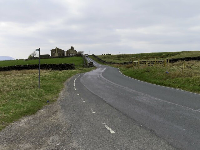
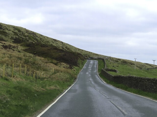
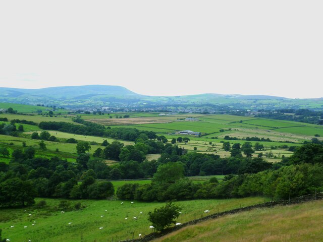
Turnhole Clough is a picturesque valley located in Lancashire, England. Situated near the town of Bacup, the clough is surrounded by stunning natural beauty and offers a tranquil escape from the hustle and bustle of urban life.

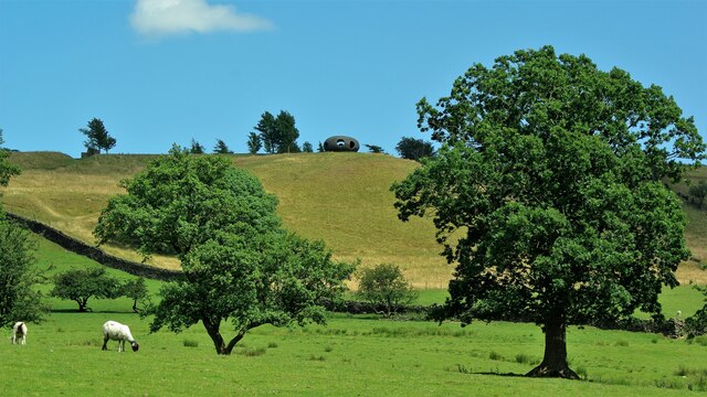
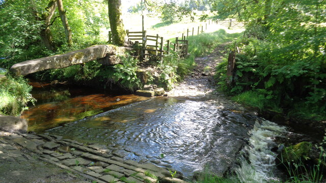
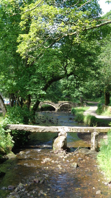
The valley is characterized by its deep and narrow ravine, carved out by the River Irwell over thousands of years. Lush greenery covers the slopes, creating a dense and verdant landscape that is home to a diverse range of flora and fauna. The clough is particularly known for its ancient woodland, which contains a rich variety of tree species, including oak, birch, and beech.

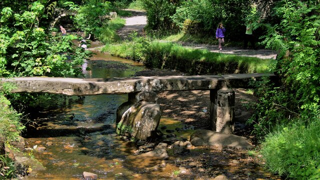
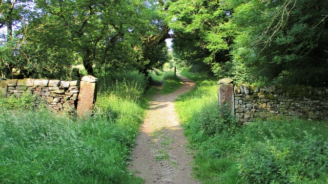
Numerous walking trails wind their way through the clough, providing visitors with the opportunity to explore and appreciate its natural splendor. These trails lead to hidden waterfalls, babbling brooks, and peaceful meadows, all of which contribute to the serene atmosphere of the area.

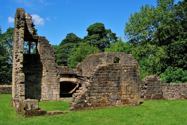
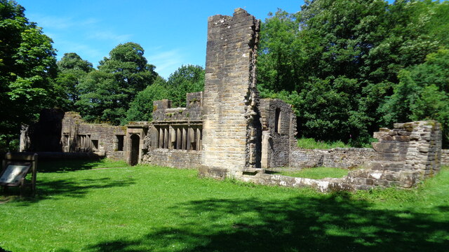
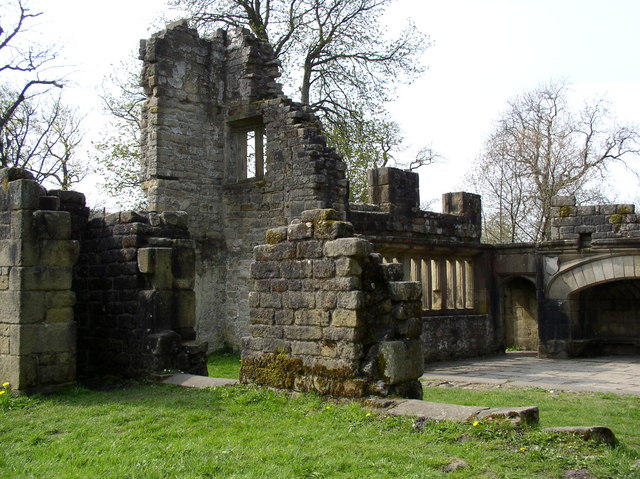
Turnhole Clough is also of historical significance, as it was once a thriving hub of industry during the Industrial Revolution. The clough was home to several cotton mills, which harnessed the power of the river to fuel their machinery. Although the mills are now long gone, remnants of their existence can still be seen, adding an interesting historical dimension to the valley.

Overall, Turnhole Clough is a hidden gem in Lancashire, offering visitors the chance to immerse themselves in nature, discover its rich history, and enjoy the tranquility of this idyllic valley.

If you have any feedback on the listing, please let us know in the comments section below.

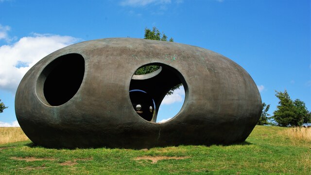
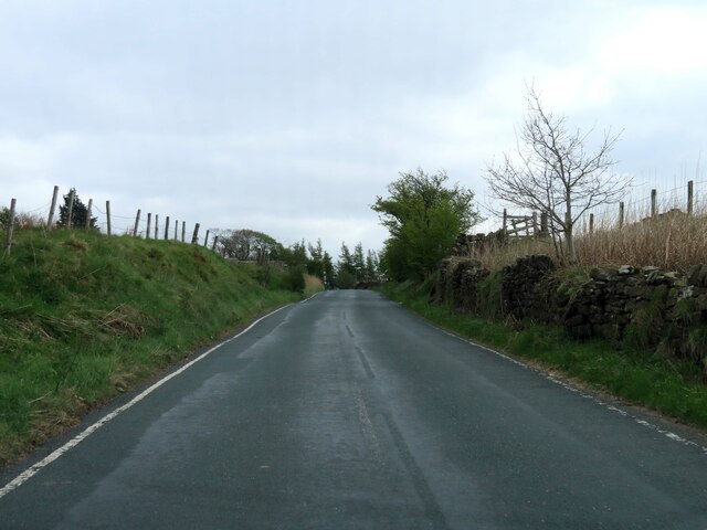
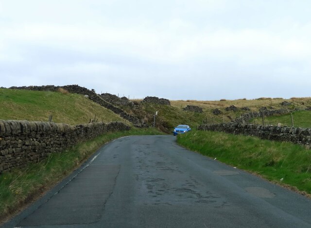
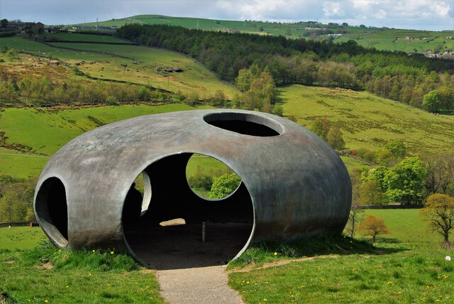
Turnhole Clough Images

Images are sourced within 2km of 53.843086/-2.0944802 or Grid Reference SD9338. Thanks to Geograph Open Source API. All images are credited.

Wooden bridge . Crossing over Turnhole Clough.
Wooden bridge .
Crossing over Turnhole Clough.
"The Atom", Wycoller Country Park Panopticons (2003 – 2007) was a unique creative project created by the East Lancashire Environmental Arts Network (ELEAN). 

The project was set up to erect a series of 21st-century landmarks, or Panopticons (structures providing a comprehensive view), located across East Lancashire as symbols of the renaissance of the area. 

The Panopticons are a unique series of 21st century landmarks, designed to attract visitors into the countryside to enjoy the stunning landscapes and wealth of attractions on offer in Pennine Lancashire. Each Panopticon is situated on a high point site commanding spectacular views, and are all within easy reach of the M65 motorway.

The four structures are: Atom near Wycoller <a href="https://www.geograph.org.uk/photo/2537477">SD9339 : The Panopticon Above Wycoller</a>, Colourfields in Blackburn <a href="https://www.geograph.org.uk/photo/6603058">SD6729 : Colourfields, the Panopticon in Corporation Park</a>, Halo <a href="https://www.geograph.org.uk/photo/3353727">SD7923 : The Halo at Top o'Slate</a> at Haslingden and The Singing Ringing Tree above Burnley <a href="https://www.geograph.org.uk/photo/3346256">SD8528 : The Singing Ringing Tree above Burnley</a>.
"The Atom", Wycoller Country Park
Panopticons (2003 – 2007) was a unique creative project created by the East Lancashire Environmental Arts Network (ELEAN). The project was set up to erect a series of 21st-century landmarks, or Panopticons (structures providing a comprehensive view), located across East Lancashire as symbols of the renaissance of the area. The Panopticons are a unique series of 21st century landmarks, designed to attract visitors into the countryside to enjoy the stunning landscapes and wealth of attractions on offer in Pennine Lancashire. Each Panopticon is situated on a high point site commanding spectacular views, and are all within easy reach of the M65 motorway. The four structures are: Atom near Wycoller SD9339 : The Panopticon Above Wycoller, Colourfields in Blackburn SD6729 : Colourfields, the Panopticon in Corporation Park, Halo SD7923 : The Halo at Top o'Slate at Haslingden and The Singing Ringing Tree above Burnley SD8528 : The Singing Ringing Tree above Burnley.
The Clapper Bridge Close to the Wycoller Hall remains
The Clapper Bridge
Close to the Wycoller Hall remains
Wycoller Hall View from the south of the remains
Wycoller Hall
View from the south of the remains
The Atom Panoptican Viewed from the Bronte Way by Wycoller Beck
The Atom Panoptican
Viewed from the Bronte Way by Wycoller Beck
The Atom Panopticon In this view the Atom has its silvered ball reflector which subsequently went missing
The Atom Panopticon
In this view the Atom has its silvered ball reflector which subsequently went missing
Lancashire Moor Road heading towards Haworth
The Atom Panopticon One of East Lacashire's Panopticons. The silvered ball inside the Atom was now missing.
The Atom Panopticon
One of East Lacashire's Panopticons. The silvered ball inside the Atom was now missing.
Looking up Lancashire Moor Road towards Laneshawbridge
Looking down to Smithy Clough
Looking over the wall to Coombe House
Lancashire Moor Road up to Near Combe Hill Cross
Atom Panoptican View The first line of trees marks the line of the carriage drive down to Wycoller Hall. Pendle Hill is on the skyline
Atom Panoptican View
The first line of trees marks the line of the carriage drive down to Wycoller Hall. Pendle Hill is on the skyline
Wycoller Hall remains
Ancient Clam Bridge With the ford across Wycoller Beck
Ancient Clam Bridge
With the ford across Wycoller Beck
Wycoller Beck Bridges The ancient clapper bridge and the packhorse bridge downstream
Wycoller Beck Bridges
The ancient clapper bridge and the packhorse bridge downstream
The Old Carriage Drive Behind Wycoller Hall and connects with the Colne to Stanbury Road
The Old Carriage Drive
Behind Wycoller Hall and connects with the Colne to Stanbury Road
Show me another place!

Turnhole Clough is located at Grid Ref: SD9338 (Lat: 53.843086, Lng: -2.0944802)

Administrative County: Lancashire

District: Pendle

Police Authority: Lancashire

What 3 Words

///lousy.prosper.masking. Near Colne, Lancashire

Nearby Locations

Turnhole Clough

Related Wikis

Wycoller Hall

Wycoller Hall was a late sixteenth-century manor house in the village of Wycoller, Lancashire, England. The hall was the centre of a sizeable estate but...

Wycoller

Wycoller is a village in the civil parish of Trawden Forest in Pendle, Lancashire, England. It is 3 miles (4.8 km) east of Colne, near to the junction...

Wycoller Beck

Wycoller Beck is a stream in Lancashire, running through Wycoller Country Park and the village of Wycoller in Pendle. It is 3.76 miles (6.05 km) long and...

Trawden Brook

Trawden Brook is a minor river in Lancashire, England. It is 3.48 miles (5.6 km) long and has a catchment area of 4.40 square miles (11.4 km2).Rising on...

Nearby Amenities

Located within 500m of 53.843086,-2.0944802
Barrier: stile
Lat/Long: 53.8445161/-2.0957269
Ford: yes
Lat/Long: 53.8457076/-2.0941552
Barrier: stile
Lat/Long: 53.846321/-2.0988948
Waterway: waterfall
Lat/Long: 53.8450725/-2.0915287
Ford: yes
Lat/Long: 53.8463616/-2.0989657
The data included in this document is from www.openstreetmap.org. The data is made available under ODbL.

Have you been to Turnhole Clough?

Leave your review of Turnhole Clough below (or comments, questions and feedback).