Robin Scar

Valley in Lancashire Pendle

England

Robin Scar

Wooden bridge . Crossing over Turnhole Clough.
Wooden bridge . Credit: Stephen Shaw

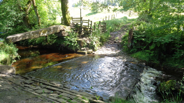
Robin Scar is a small valley located in the county of Lancashire, England. Situated in the northwest region of the country, it is nestled amidst the picturesque countryside, offering stunning views and a tranquil environment.

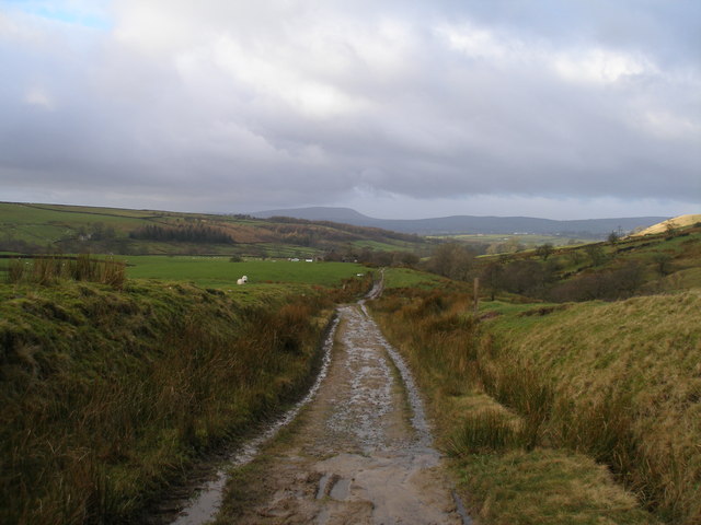
This idyllic valley is known for its natural beauty, with lush green landscapes, rolling hills, and meandering streams. It is a popular destination for nature enthusiasts and hikers, who can explore the numerous walking trails that crisscross the area. The valley is home to a diverse range of flora and fauna, including wildflowers, birds, and small mammals.

The history of Robin Scar dates back centuries, with evidence of human habitation in the area dating back to the prehistoric era. Archaeological finds suggest that the valley was once inhabited by ancient civilizations, and remnants of their settlements can still be seen today.

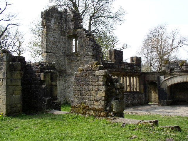
The valley is also known for its cultural significance, with several historical landmarks and sites of interest. One such notable feature is Robin Scar Castle, a medieval fortress that stands as a testament to the valley's rich heritage. Visitors can explore the ruins and learn about the castle's intriguing past.

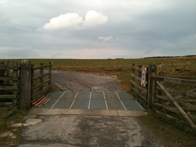
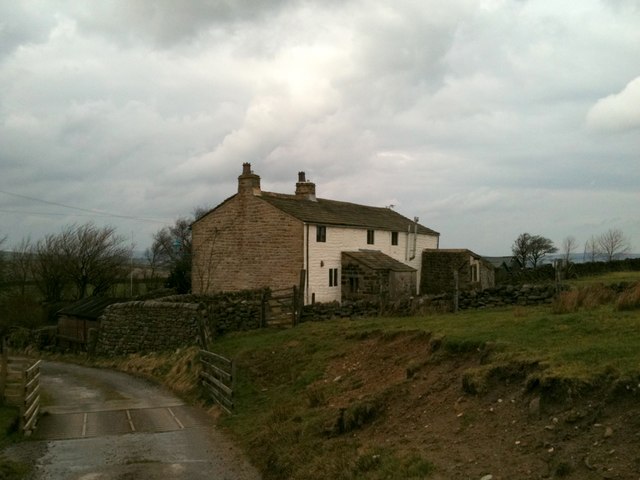
In terms of amenities, Robin Scar offers limited facilities, with a small village nearby providing essential services such as accommodation, dining options, and shops. The valley's remote location adds to its charm and appeal, providing a peaceful escape from the hustle and bustle of city life.

Overall, Robin Scar in Lancashire is a hidden gem, offering a perfect blend of natural beauty, rich history, and tranquility for those seeking a peaceful retreat in the heart of the English countryside.

If you have any feedback on the listing, please let us know in the comments section below.

Robin Scar Images

Images are sourced within 2km of 53.830903/-2.0993755 or Grid Reference SD9337. Thanks to Geograph Open Source API. All images are credited.

Wooden bridge . Crossing over Turnhole Clough.
Wooden bridge .
Crossing over Turnhole Clough.
Ancient Clam Bridge With the ford across Wycoller Beck
Ancient Clam Bridge
With the ford across Wycoller Beck
Clam Bridge, Wycoller Clam Bridge next to the Ford along the path from the village
Clam Bridge, Wycoller
Clam Bridge next to the Ford along the path from the village
Turnhole Clough Looking upstream from the Pendle Way / Bronte Way bridge.
Turnhole Clough
Looking upstream from the Pendle Way / Bronte Way bridge.
Boundary stone near Brink Ends Engraved JW Junr
Boundary stone near Brink Ends
Engraved JW Junr
Bridge over Turnhole Clough This modern wooden bridge carries the Pendle Way / Bronte Way bridleway.
It appears that the crossing point used to be in the foreground.
Bridge over Turnhole Clough
This modern wooden bridge carries the Pendle Way / Bronte Way bridleway. It appears that the crossing point used to be in the foreground.
Boulsworth Dyke Farm The Pendle Way / Bronte Way bridleway passes in front of the farm.
Boulsworth Dyke Farm
The Pendle Way / Bronte Way bridleway passes in front of the farm.
Dry stone wall above Turnhole Clough
Cattle grid on the track to Beaver
Cottages at Beaver
Cottages at Beaver
Enclosed footpath south of Wycoller
Copy House Bridge One of seven bridges over Wycoller Beck, Copy House Bridge was rebuilt in 1992.
Copy House Bridge
One of seven bridges over Wycoller Beck, Copy House Bridge was rebuilt in 1992.
Clam Bridge and Ford over Wycoller Beck The Clam bridge is a single gritstone slab laid across the beck with small holes on one side showing the former position of handrail supports. The bridge is believed to be more than 1000 years old and is a scheduled Ancient Monument. On may 19th 1989 there was a cloud burst on Haworth Moor and Boulsworth Hill above Wycoller and in the resulting flash flood the stone slab was swept from its foundations and cracked in two. The bridge was repaired and put back into position, only to be swept away and broken again in a further flood in August 1990. It was restored and replaced in June 1991.  <span class="nowrap"><a title="http://www.lancashire.gov.uk/environment/countryside/sites/wbridges.asp" rel="nofollow ugc noopener" href="http://www.lancashire.gov.uk/environment/countryside/sites/wbridges.asp">Link</a><img style="margin-left:2px;" alt="External link" title="External link - shift click to open in new window" src="https://s1.geograph.org.uk/img/external.png" width="10" height="10"/></span> (Lancashire County Council)
Clam Bridge and Ford over Wycoller Beck
The Clam bridge is a single gritstone slab laid across the beck with small holes on one side showing the former position of handrail supports. The bridge is believed to be more than 1000 years old and is a scheduled Ancient Monument. On may 19th 1989 there was a cloud burst on Haworth Moor and Boulsworth Hill above Wycoller and in the resulting flash flood the stone slab was swept from its foundations and cracked in two. The bridge was repaired and put back into position, only to be swept away and broken again in a further flood in August 1990. It was restored and replaced in June 1991. LinkExternal link (Lancashire County Council)
Wycoller Beck Looking back towards Wycoller from <a href="https://www.geograph.org.uk/photo/2537229">SD9338 : Clam Bridge and Ford over Wycoller Beck</a>. The path to the right hand side of the beck is part of The Brontë Way.
Wycoller Beck
Looking back towards Wycoller from SD9338 : Clam Bridge and Ford over Wycoller Beck. The path to the right hand side of the beck is part of The Brontë Way.
Boulder in Wycoller Beck
The Willow Tunnel The Willow Tunnel alongside Wycoller Beck.
The Willow Tunnel
The Willow Tunnel alongside Wycoller Beck.
View from the Panopticon Looking from <a href="https://www.geograph.org.uk/photo/2537477">SD9339 : The Panopticon Above Wycoller</a>, towards the Wycoller Country Park.

Panopticons (2003-7) was a creative project to erect a series of 21st century landmarks across  East Lancashire to symbolise the renaissance of the area.

“Atom”, the Panopticon chosen for Pendle was designed by Peter Meacock and Katrina Novomestska. It is constructed in ferro-cement with a surface coating of metal-based paint.

It is intended to be an intriguing and beautiful object which will not only enhance the landscape as but also act as a viewing point and a shelter. It is sited on the hill above Wycoller.

(See <a href="https://www.geograph.org.uk/photo/1430105">SD9339 : The Panopticon for Pendle--Atom, Information board</a>)
View from the Panopticon
Looking from SD9339 : The Panopticon Above Wycoller, towards the Wycoller Country Park. Panopticons (2003-7) was a creative project to erect a series of 21st century landmarks across East Lancashire to symbolise the renaissance of the area. “Atom”, the Panopticon chosen for Pendle was designed by Peter Meacock and Katrina Novomestska. It is constructed in ferro-cement with a surface coating of metal-based paint. It is intended to be an intriguing and beautiful object which will not only enhance the landscape as but also act as a viewing point and a shelter. It is sited on the hill above Wycoller. (See SD9339 : The Panopticon for Pendle--Atom, Information board)
The Pendle Way near Parson Lee
Show me another place!

Robin Scar is located at Grid Ref: SD9337 (Lat: 53.830903, Lng: -2.0993755)

Administrative County: Lancashire

District: Pendle

Police Authority: Lancashire

What 3 Words

///nibbles.harsh.regret. Near Colne, Lancashire

Related Wikis

Boulsworth Hill

Boulsworth Hill is a large expanse of moorland, the highest point of the South Pennines of south-eastern Lancashire, England, separating the Borough of...

Trawden Brook

Trawden Brook is a minor river in Lancashire, England. It is 3.48 miles (5.6 km) long and has a catchment area of 4.40 square miles (11.4 km2).Rising on...

Wycoller

Wycoller is a village in the civil parish of Trawden Forest in Pendle, Lancashire, England. It is 3 miles (4.8 km) east of Colne, near to the junction...

Wycoller Hall

Wycoller Hall was a late sixteenth-century manor house in the village of Wycoller, Lancashire, England. The hall was the centre of a sizeable estate but...

Nearby Amenities

Located within 500m of 53.830903,-2.0993755
Ford: yes
Lat/Long: 53.8318844/-2.1015998
The data included in this document is from www.openstreetmap.org. The data is made available under ODbL.

Have you been to Robin Scar?

Leave your review of Robin Scar below (or comments, questions and feedback).