Brown Hill Moor

Downs, Moorland in Lancashire Pendle

England

Brown Hill Moor

Wooden bridge . Crossing over Turnhole Clough.
Wooden bridge . Credit: Stephen Shaw

Brown Hill Moor is a picturesque area located in Lancashire, England. Stretching over a vast expanse, it is characterized by its rolling hills, open moorland, and stunning natural beauty. The moor is situated in the southern part of the county, near the town of Oswaldtwistle.

Covering an area of approximately 10 square miles, Brown Hill Moor is a haven for nature enthusiasts and outdoor lovers alike. The landscape is dominated by heather-clad hills and expansive open spaces, providing a refuge for a diverse range of flora and fauna. Visitors can expect to see an array of bird species, including the iconic red grouse, as well as various mammals such as hares and shrews.

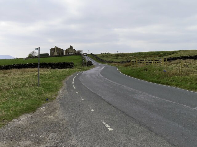
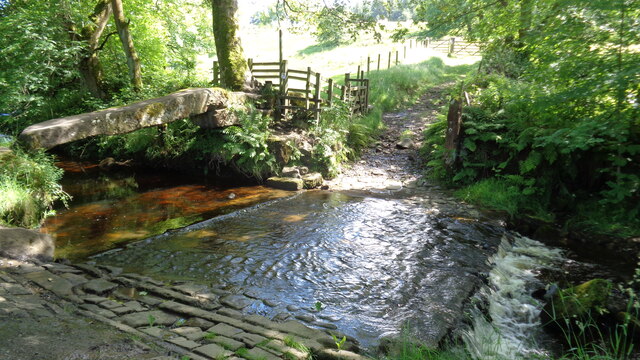
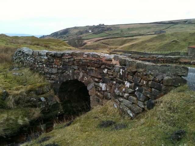
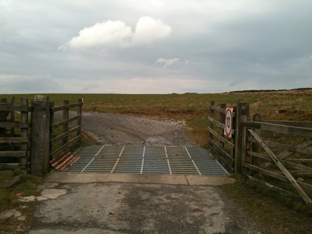
The moorland is intersected by numerous footpaths and trails, making it an ideal destination for walkers and hikers. These paths allow visitors to explore the area and take in the breathtaking views from the hilltops. The undulating terrain offers both challenging routes for experienced hikers and more leisurely strolls for those seeking a gentler experience.

In addition to its natural beauty, Brown Hill Moor also holds historical significance. Standing stones and ancient burial mounds can be found scattered across the landscape, serving as reminders of the area's rich heritage.

Overall, Brown Hill Moor is a captivating destination that offers a tranquil escape from the hustle and bustle of everyday life. Whether you are seeking an adventure-filled hike or a peaceful retreat in nature, this moorland in Lancashire is sure to leave a lasting impression.

If you have any feedback on the listing, please let us know in the comments section below.

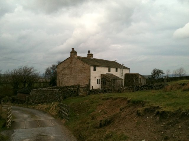
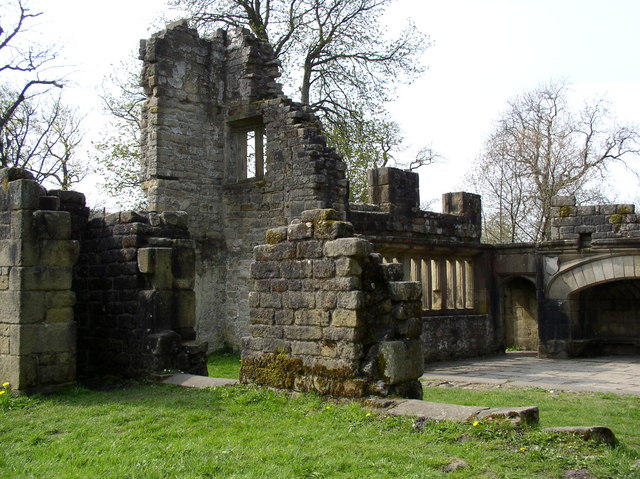
Brown Hill Moor Images

Images are sourced within 2km of 53.831132/-2.0943621 or Grid Reference SD9337. Thanks to Geograph Open Source API. All images are credited.

Wooden bridge . Crossing over Turnhole Clough.
Wooden bridge .
Crossing over Turnhole Clough.
Looking up Lancashire Moor Road towards Laneshawbridge
Looking down to Smithy Clough
Looking over the wall to Coombe House
Ancient Clam Bridge With the ford across Wycoller Beck
Ancient Clam Bridge
With the ford across Wycoller Beck
Clam Bridge, Wycoller Clam Bridge next to the Ford along the path from the village
Clam Bridge, Wycoller
Clam Bridge next to the Ford along the path from the village
Turnhole Clough Looking upstream from the Pendle Way / Bronte Way bridge.
Turnhole Clough
Looking upstream from the Pendle Way / Bronte Way bridge.
Boundary stone near Brink Ends Engraved JW Junr
Boundary stone near Brink Ends
Engraved JW Junr
Bridge over Turnhole Clough This modern wooden bridge carries the Pendle Way / Bronte Way bridleway.
It appears that the crossing point used to be in the foreground.
Bridge over Turnhole Clough
This modern wooden bridge carries the Pendle Way / Bronte Way bridleway. It appears that the crossing point used to be in the foreground.
Boulsworth Dyke Farm The Pendle Way / Bronte Way bridleway passes in front of the farm.
Boulsworth Dyke Farm
The Pendle Way / Bronte Way bridleway passes in front of the farm.
Foster's Leap, Wycoller
Bridge in Smithy Clough
Dry stone wall above Turnhole Clough
Cattle grid on the track to Beaver
Cottages at Beaver
Cottages at Beaver
Enclosed footpath south of Wycoller
Copy House Bridge One of seven bridges over Wycoller Beck, Copy House Bridge was rebuilt in 1992.
Copy House Bridge
One of seven bridges over Wycoller Beck, Copy House Bridge was rebuilt in 1992.
Clam Bridge and Ford over Wycoller Beck The Clam bridge is a single gritstone slab laid across the beck with small holes on one side showing the former position of handrail supports. The bridge is believed to be more than 1000 years old and is a scheduled Ancient Monument. On may 19th 1989 there was a cloud burst on Haworth Moor and Boulsworth Hill above Wycoller and in the resulting flash flood the stone slab was swept from its foundations and cracked in two. The bridge was repaired and put back into position, only to be swept away and broken again in a further flood in August 1990. It was restored and replaced in June 1991.  <span class="nowrap"><a title="http://www.lancashire.gov.uk/environment/countryside/sites/wbridges.asp" rel="nofollow ugc noopener" href="http://www.lancashire.gov.uk/environment/countryside/sites/wbridges.asp">Link</a><img style="margin-left:2px;" alt="External link" title="External link - shift click to open in new window" src="https://s1.geograph.org.uk/img/external.png" width="10" height="10"/></span> (Lancashire County Council)
Clam Bridge and Ford over Wycoller Beck
The Clam bridge is a single gritstone slab laid across the beck with small holes on one side showing the former position of handrail supports. The bridge is believed to be more than 1000 years old and is a scheduled Ancient Monument. On may 19th 1989 there was a cloud burst on Haworth Moor and Boulsworth Hill above Wycoller and in the resulting flash flood the stone slab was swept from its foundations and cracked in two. The bridge was repaired and put back into position, only to be swept away and broken again in a further flood in August 1990. It was restored and replaced in June 1991. LinkExternal link (Lancashire County Council)
Show me another place!

Brown Hill Moor is located at Grid Ref: SD9337 (Lat: 53.831132, Lng: -2.0943621)

Administrative County: Lancashire

District: Pendle

Police Authority: Lancashire

What 3 Words

///mailing.flick.crusaders. Near Colne, Lancashire

Related Wikis

Boulsworth Hill

Boulsworth Hill is a large expanse of moorland, the highest point of the South Pennines of south-eastern Lancashire, England, separating the Borough of...

Wycoller

Wycoller is a village in the civil parish of Trawden Forest in Pendle, Lancashire, England. It is 3 miles (4.8 km) east of Colne, near to the junction...

Wycoller Hall

Wycoller Hall was a late sixteenth-century manor house in the village of Wycoller, Lancashire, England. The hall was the centre of a sizeable estate but...

Wycoller Beck

Wycoller Beck is a stream in Lancashire, running through Wycoller Country Park and the village of Wycoller in Pendle. It is 3.76 miles (6.05 km) long and...

Trawden Brook

Trawden Brook is a minor river in Lancashire, England. It is 3.48 miles (5.6 km) long and has a catchment area of 4.40 square miles (11.4 km2).Rising on...

Trawden

Trawden is a village in the Trawden Forest parish of Pendle, at the foot of Boulsworth Hill, in Lancashire, England. The village co-operatively owns and...

Watersheddles Reservoir

Watersheddles Reservoir is an upland artificial lake in Lancashire, England. The reservoir was opened in 1877 by the Keighley Corporation Water Works,...

Trawden Forest

Trawden Forest is a civil parish in the Pendle district of Lancashire, England. It has a population of 2,765, and contains the village of Trawden (formerly...

Nearby Amenities

Located within 500m of 53.831132,-2.0943621
Ford: yes
Lat/Long: 53.8318844/-2.1015998
The data included in this document is from www.openstreetmap.org. The data is made available under ODbL.

Have you been to Brown Hill Moor?

Leave your review of Brown Hill Moor below (or comments, questions and feedback).