Downshaw Clough

Valley in Lancashire

England

Downshaw Clough

Inscribed stone on the south side of Twirl Hill Road, Hartshead Inscribed stone on the south side of Twirl Hill Road. In the former Ashton under Lyne parish to 1894 and Hartshead parish from 1894 to 1974. This stone is thought to be the collection place for the northern part of the ancient parish of Ashton-under-Lyne and is situated at a place called Twirl Hill between the hamlets of Alt Hill and Hartshead, just below the local viewpoint of Hartshead Pike. The practice of paying tithes was abandoned in the 1830’s. The “Tythe Stone” inscription is thought to have been made by local man John Coulthard in 1840 to ensure its preservation. See also <span class="nowrap"><a title="http://www.marland.org/places/marlandplaces-twarlhill.htm" rel="nofollow ugc noopener" href="http://www.marland.org/places/marlandplaces-twarlhill.htm">Link</a><img style="margin-left:2px;" alt="External link" title="External link - shift click to open in new window" src="https://s1.geograph.org.uk/img/external.png" width="10" height="10"/></span>

Milestone Society National ID: LA_HARTS01cm
Inscribed stone on the south side of Twirl Hill Road, Hartshead Credit: D Garside

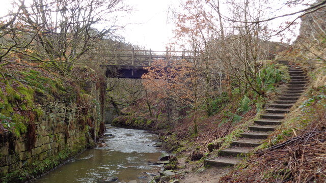
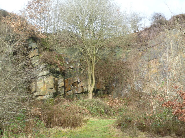
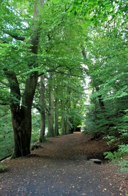
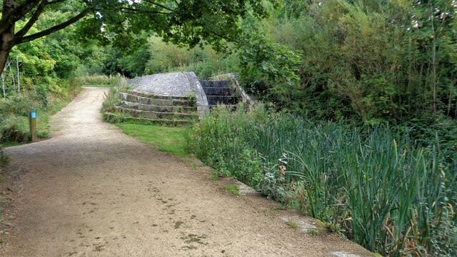
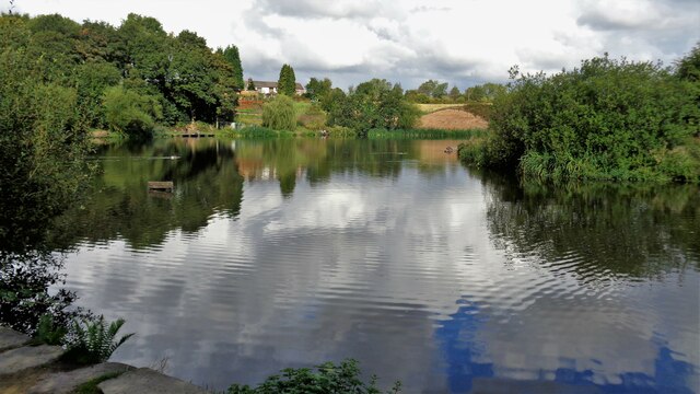
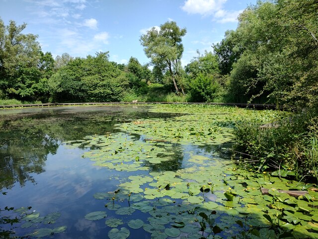
Downshaw Clough is a picturesque valley located in Lancashire, England. Nestled within the Pennine Hills, this enchanting landscape stretches for approximately 2 miles and is surrounded by a lush canopy of trees and rolling green hills. The valley is renowned for its natural beauty and tranquil atmosphere, making it a popular destination for nature enthusiasts and hikers.

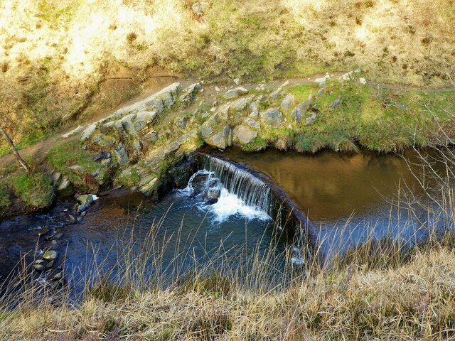
The Clough is home to a diverse range of flora and fauna, including oak, birch, and beech trees, as well as various species of birds, butterflies, and small mammals. The meandering stream that runs through the valley adds to its charm, providing a peaceful ambiance and serving as a watering hole for local wildlife.

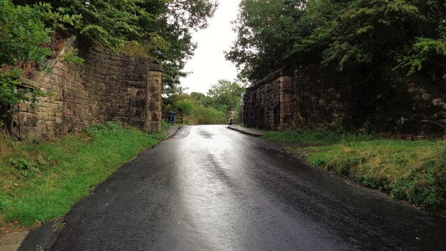
The terrain of Downshaw Clough is varied, with some sections featuring gentle slopes and others boasting steeper inclines. This diversity makes it an ideal location for outdoor activities such as walking, hiking, and cycling. Several well-maintained trails crisscross the valley, offering visitors the opportunity to explore its hidden treasures and enjoy stunning panoramic views.

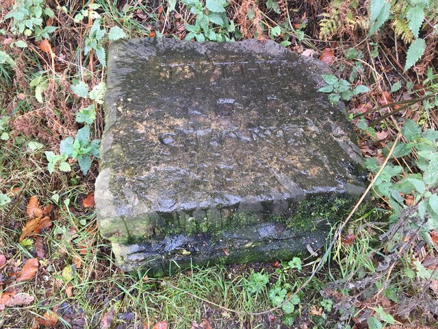
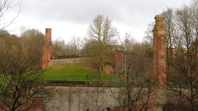
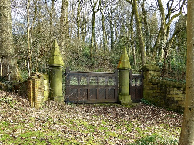
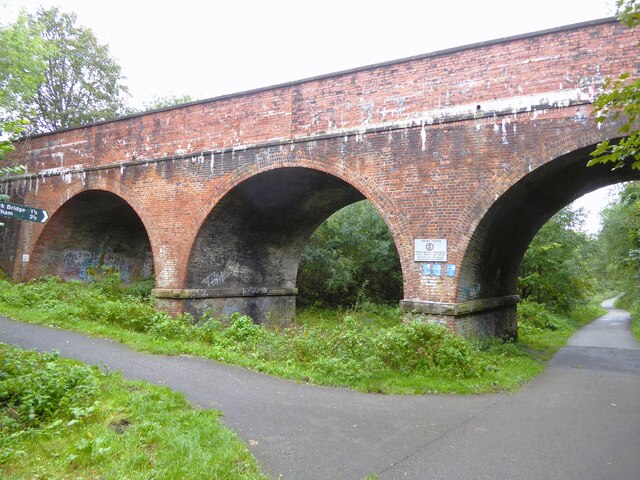
The valley's rich history is also worth noting, as it was once a significant industrial area during the 19th century. The remnants of old mills and factories can still be found scattered throughout the landscape, serving as a reminder of Lancashire's industrial past.

Overall, Downshaw Clough is a captivating destination that showcases the natural beauty and historical significance of Lancashire. With its tranquil atmosphere, diverse wildlife, and breathtaking scenery, it is a must-visit location for anyone seeking a peaceful retreat in the heart of nature.

If you have any feedback on the listing, please let us know in the comments section below.

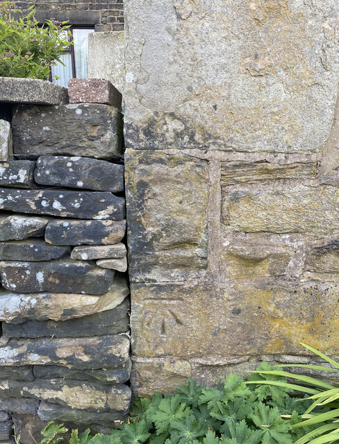
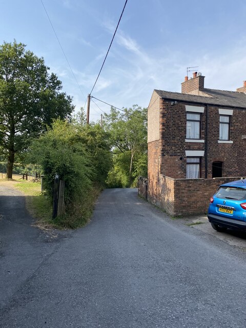
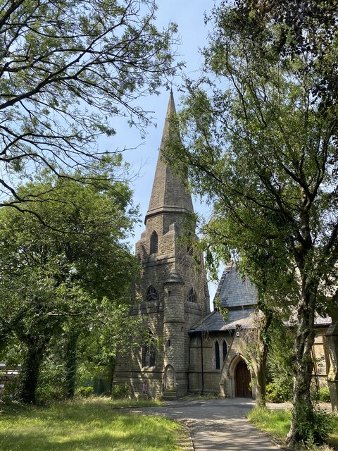
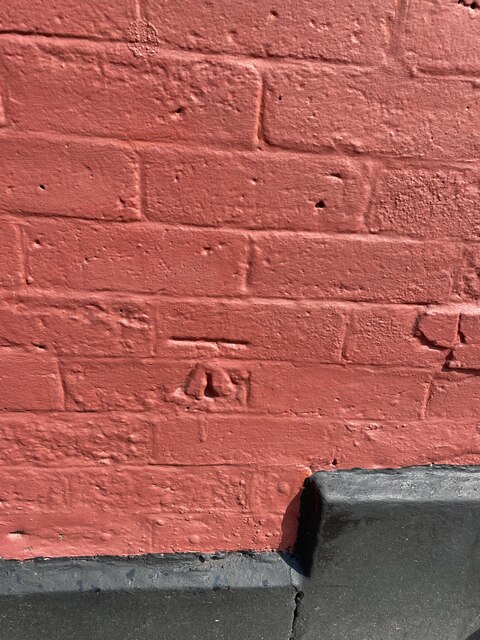
Downshaw Clough Images

Images are sourced within 2km of 53.50386/-2.0994512 or Grid Reference SD9300. Thanks to Geograph Open Source API. All images are credited.

Inscribed stone on the south side of Twirl Hill Road, Hartshead Inscribed stone on the south side of Twirl Hill Road. In the former Ashton under Lyne parish to 1894 and Hartshead parish from 1894 to 1974. This stone is thought to be the collection place for the northern part of the ancient parish of Ashton-under-Lyne and is situated at a place called Twirl Hill between the hamlets of Alt Hill and Hartshead, just below the local viewpoint of Hartshead Pike. The practice of paying tithes was abandoned in the 1830’s. The “Tythe Stone” inscription is thought to have been made by local man John Coulthard in 1840 to ensure its preservation. See also <span class="nowrap"><a title="http://www.marland.org/places/marlandplaces-twarlhill.htm" rel="nofollow ugc noopener" href="http://www.marland.org/places/marlandplaces-twarlhill.htm">Link</a><img style="margin-left:2px;" alt="External link" title="External link - shift click to open in new window" src="https://s1.geograph.org.uk/img/external.png" width="10" height="10"/></span>

Milestone Society National ID: LA_HARTS01cm
Inscribed stone on the south side of Twirl Hill Road, Hartshead
Inscribed stone on the south side of Twirl Hill Road. In the former Ashton under Lyne parish to 1894 and Hartshead parish from 1894 to 1974. This stone is thought to be the collection place for the northern part of the ancient parish of Ashton-under-Lyne and is situated at a place called Twirl Hill between the hamlets of Alt Hill and Hartshead, just below the local viewpoint of Hartshead Pike. The practice of paying tithes was abandoned in the 1830’s. The “Tythe Stone” inscription is thought to have been made by local man John Coulthard in 1840 to ensure its preservation. See also LinkExternal link Milestone Society National ID: LA_HARTS01cm
Park Bridge Heritage Centre View from Alt Hill Road of the chimneys of the ironworks roller shop to the left and cotton mill to the right
Park Bridge Heritage Centre
View from Alt Hill Road of the chimneys of the ironworks roller shop to the left and cotton mill to the right
Old Tramway Bridge Over the River Medlock at the Park Bridge industrial heritage site
Old Tramway Bridge
Over the River Medlock at the Park Bridge industrial heritage site
Old Quarry On the Park Bridge industrial heritage site
Old Quarry
On the Park Bridge industrial heritage site
OS Cut Mark - Park Bridge, Keverlow Farm <span class="nowrap"><a title="https://www.bench-marks.org.uk/bm60764" rel="nofollow ugc noopener" href="https://www.bench-marks.org.uk/bm60764">Link</a><img style="margin-left:2px;" alt="External link" title="External link - shift click to open in new window" src="https://s1.geograph.org.uk/img/external.png" width="10" height="10"/></span>
OS Cut Mark - Park Bridge, Keverlow Farm
Mill Brow
Mill Brow
St John the Evangelist
OS Cut Mark - Ashton-under-Lyne, #10 Hurst Cross <span class="nowrap"><a title="https://www.bench-marks.org.uk/bm91192" rel="nofollow ugc noopener" href="https://www.bench-marks.org.uk/bm91192">Link</a><img style="margin-left:2px;" alt="External link" title="External link - shift click to open in new window" src="https://s1.geograph.org.uk/img/external.png" width="10" height="10"/></span>
OS Cut Mark - Ashton-under-Lyne, #10 Hurst Cross
Location of OS Cut Mark - Ashton-under-Lyne, #10 Hurst Cross
Nook Lane
Nook Lane
Broad Track from Valley Bridge A former carriage drive from the now demolished Riversvale Hall?
Broad Track from Valley Bridge
A former carriage drive from the now demolished Riversvale Hall?
Former Lock No.19 On the Hollinwood Canal with the site of the lower lock gates now a concrete stepped weir
Former Lock No.19
On the Hollinwood Canal with the site of the lower lock gates now a concrete stepped weir
Crime Lake A former supply reservoir for the now abandoned Hollinwood Branch canal. The canal actually passed through the reservoir.
Crime Lake
A former supply reservoir for the now abandoned Hollinwood Branch canal. The canal actually passed through the reservoir.
Railway Bridge Abutments On Alt Hill Lane for the former Oldham and Ashton railway route
Railway Bridge Abutments
On Alt Hill Lane for the former Oldham and Ashton railway route
Carriage drive gates to Dean House At Park Bridge
Carriage drive gates to Dean House
At Park Bridge
Weir on River Medlock This had a mill race that served the industrial complex at Park Bridge. The Medlock is in a narrow steep sided valley at this point.
Weir on River Medlock
This had a mill race that served the industrial complex at Park Bridge. The Medlock is in a narrow steep sided valley at this point.
Sammie's Basin
Sammie's Basin
Cranbourne Road viaduct Across the former railway between Ashton and Oldham, now a cycle path.
Cranbourne Road viaduct
Across the former railway between Ashton and Oldham, now a cycle path.
Show me another place!

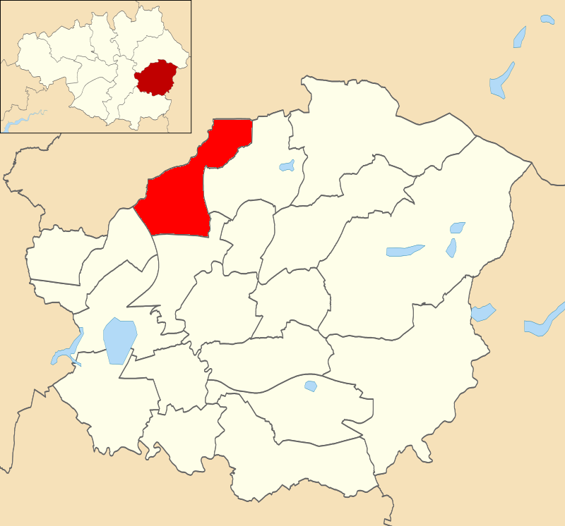
Downshaw Clough is located at Grid Ref: SD9300 (Lat: 53.50386, Lng: -2.0994512)

Unitary Authority: Tameside

Police Authority: Greater Manchester

What 3 Words

///cover.senses.tested. Near Ashton-under-Lyne, Manchester

Related Wikis

Ashton Waterloo (ward)

Ashton Waterloo is an electoral ward of Tameside, England. It is represented in Westminster by Angela Rayner Labour MP for Ashton-under-Lyne. == Councillors... ==

Oldham Below Town

Oldham Below Town was, from 1851 until 1905, a statistical unit used for the gathering and organising of civil registration information, and output of...

County Borough of Oldham

Oldham was, from 1849 to 1974, a local government district in the northwest of England coterminous with the town of Oldham. == History == === Improvement... ===

Oldham Above Town

Oldham Above Town was, from 1851 until 1905, a statistical unit used for the gathering and organising of civil registration information, and output of...

Rock Mill, Ashton-under-Lyne

Rock Mill was cotton spinning mill in the Waterloo district of Ashton-under-Lyne, Greater Manchester, in England. It was built between 1891 and 1893 for...

Atlas Mill, Ashton-under-Lyne

Atlas Mill was a cotton spinning mill in the Waterloo district of Ashton-under-Lyne, Greater Manchester, in England. It was built between 1898 and 1900...

Great Academy Ashton

Great Academy Ashton (formerly New Charter Academy) is a coeducational secondary school with academy status in Ashton-under-Lyne, Greater Manchester,...

Bardsley, Greater Manchester

Bardsley is a suburban area of Oldham, in Greater Manchester, England. It lies on undulating land by the River Medlock, on Oldham's southern boundary with...

Related Videos

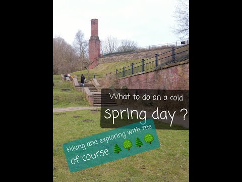
Hiking in spring..🪵...not a ride.🎠...but still fun....😝

Hi funfellows, this time no rides. But a very enjoyable hiking trip with family. Incredible historical heritage and lots of nature.

Croatia 2023 summer holiday, Game of thrones filming locations.

Derek in this video takes us on the family summer holiday 2023 to Cavtat, Dubrovnik in Croatia.In the video they go to Dubrovnik ...

Cockfields Farm in Oldham near Manchester - by The Family Holiday Guide

Watch our video of a day out at Cockfields Farm in Oldham with our two children. See our full review of the attraction at ...

Nearby Amenities

Located within 500m of 53.50386,-2.0994512
Place Of Worship
Waterloo Methodist Church
Denomination: methodist
Religion: christian
Lat/Long: 53.5028416/-2.104661
Bus Stop
Wilshaw Lane/Vicarage Road
Bus: yes
Naptan AtcoCode: 1800EH02011
Naptan Bearing: W
Naptan CommonName: Wilshaw Lane/Vicarage Road
Naptan Indicator: Tiverton Place
Naptan Landmark: RESOURCE CENTRE
Naptan NaptanCode: manawajd
Naptan PlusbusZoneRef: MNCRPIC
Naptan ShortCommonName: Vicarage Road
Naptan Street: WILSHAW LANE
Naptan Verified: no
Network: TfGM
Public Transport: platform
Source: naptan_import
Lat/Long: 53.4994685/-2.0995426
Bus Stop
Alt Road/Gambrel Bank Road
Bus: yes
Naptan AtcoCode: 1800EH20711
Naptan Bearing: N
Naptan CommonName: Alt Road/Gambrel Bank Road
Naptan Indicator: O/s House 27
Naptan Landmark: HOUSE 27
Naptan NaptanCode: mandagad
Naptan PlusbusZoneRef: MNCRPIC
Naptan ShortCommonName: Gambrel Bank Road
Naptan Street: ALT ROAD
Naptan Verified: no
Network: TfGM
Public Transport: platform
Source: naptan_import
Lat/Long: 53.5026939/-2.092913
Bus Stop
Limehurst, Springwood Way / near Oldham Road
Bus: yes
Naptan AtcoCode: 1800EH07001
Naptan Bearing: SW
Naptan CommonName: Springwood Way/Oldham Road
Naptan Indicator: Opp House 524
Naptan Landmark: HOUSE 125
Naptan NaptanCode: manawjdw
Naptan PlusbusZoneRef: MNCRPIC
Naptan ShortCommonName: Oldham Road
Naptan Street: SPRINGWOOD WAY
Naptan Verified: no
Network: TfGM
Operator: TfGM
Public Transport: platform
Source: naptan_import
Lat/Long: 53.5043492/-2.1043016
Bus Stop
Waterloo, Oldham Road / opposite Anglesey Road
Bus: yes
Naptan AtcoCode: 1800EH20991
Naptan Bearing: S
Naptan CommonName: Oldham Road/Limehurst Post Office
Naptan Indicator: Nr Post Office
Naptan Landmark: HAIRDRESSERS
Naptan NaptanCode: mandagpa
Naptan PlusbusZoneRef: MNCRPIC
Naptan ShortCommonName: Limehurst PO
Naptan Street: OLDHAM ROAD
Naptan Verified: no
Network: TfGM
Operator: TfGM
Public Transport: platform
Source: naptan_import
Lat/Long: 53.5008395/-2.1044907
Bus Stop
Waterloo, Oldham Road / near Anglesey Road
Bus: yes
Naptan AtcoCode: 1800EH21001
Naptan Bearing: N
Naptan CommonName: Oldham Road/Anglesey Road
Naptan Indicator: Pet Shop
Naptan Landmark: SCHOOL
Naptan NaptanCode: mandagpd
Naptan Notes: LOCATION AMENDED
Naptan PlusbusZoneRef: MNCRPIC
Naptan ShortCommonName: Anglesey Road
Naptan Street: OLDHAM ROAD
Naptan Verified: no
Network: TfGM
Operator: TfGM
Public Transport: platform
Source: naptan_import
Lat/Long: 53.5018727/-2.105036
Bus Stop
Waterloo, Oldham Road / opposite Downshaw Road
Bus: yes
Naptan AtcoCode: 1800EH21511
Naptan Bearing: N
Naptan CommonName: Oldham Road/Downshaw Road
Naptan Indicator: Waterloo Tavern
Naptan Landmark: WATERLOO TAVERN
Naptan NaptanCode: mandajpa
Naptan PlusbusZoneRef: MNCRPIC
Naptan ShortCommonName: Downshaw Road
Naptan Street: OLDHAM ROAD
Naptan Verified: no
Network: TfGM
Operator: TfGM
Public Transport: platform
Source: naptan_import
Lat/Long: 53.502987/-2.1054458
Bus Stop
Waterloo, Oldham Road / near Downshaw Road
Bus: yes
Naptan AtcoCode: 1800EH21521
Naptan Bearing: S
Naptan CommonName: Oldham Road/Downshaw Lane
Naptan Indicator: Downshaw Lodge
Naptan Landmark: DOWNSHAW LODGE
Naptan NaptanCode: mandajpd
Naptan PlusbusZoneRef: MNCRPIC
Naptan ShortCommonName: Downshaw Lane
Naptan Street: OLDHAM ROAD
Naptan Verified: no
Network: TfGM
Operator: TfGM
Public Transport: platform
Source: naptan_import
Lat/Long: 53.5031309/-2.1052803
Bus Stop
Limehurst, Oldham Road / opposite Tree House Avenue
Bus: yes
Naptan AtcoCode: 1800EH21531
Naptan Bearing: S
Naptan CommonName: Oldham Road/Tree House Avenue
Naptan Indicator: House 560
Naptan Landmark: HOUSE 560
Naptan NaptanCode: mandajpg
Naptan Notes: INDICATOR AMENDED
Naptan PlusbusZoneRef: MNCRPIC
Naptan ShortCommonName: Tree House Avenue
Naptan Street: OLDHAM ROAD
Naptan Verified: no
Network: TfGM
Operator: TfGM
Public Transport: platform
Source: naptan_import
Lat/Long: 53.50509/-2.1058129
Bus Stop
Limehurst, Oldham Road / near Tree House Avenue
Bus: yes
Naptan AtcoCode: 1800EH21541
Naptan Bearing: N
Naptan CommonName: Oldham Road/Tree House Avenue
Naptan Indicator: Depot
Naptan Landmark: THE OLD CHAPEL
Naptan NaptanCode: mandajpj
Naptan PlusbusZoneRef: MNCRPIC
Naptan ShortCommonName: Tree House Avenue
Naptan Street: OLDHAM ROAD
Naptan Verified: no
Network: TfGM
Operator: TfGM
Public Transport: platform
Source: naptan_import
Lat/Long: 53.5046585/-2.105857
Bus Stop
Wilshaw Lane/Vicarage Road
Bus: yes
Naptan AtcoCode: 1800EH21591
Naptan Bearing: NE
Naptan CommonName: Wilshaw Lane/Vicarage Road
Naptan Indicator: Field
Naptan Landmark: FIELD
Naptan NaptanCode: mandajtd
Naptan PlusbusZoneRef: MNCRPIC
Naptan ShortCommonName: Vicarage Road
Naptan Street: WILSHAW LANE
Naptan Verified: no
Network: TfGM
Public Transport: platform
Source: naptan_import
Lat/Long: 53.4997926/-2.0989102
Bus Stop
Waterloo, Vicarage Road / near Wilshaw Lane
Bus: yes
Naptan AtcoCode: 1800EH21601
Naptan Bearing: S
Naptan CommonName: Vicarage Road/Wilshaw Lane
Naptan Indicator: Opp House 69
Naptan Landmark: HOUSE 32
Naptan NaptanCode: mandajtg
Naptan PlusbusZoneRef: MNCRPIC
Naptan ShortCommonName: Wilshaw Lane
Naptan Street: VICARAGE ROAD
Naptan Verified: no
Network: TfGM
Operator: TfGM
Public Transport: platform
Source: naptan_import
Lat/Long: 53.4994332/-2.0987586
Bus Stop
Wood Lane/Gambrel Bank Road (Stop A)
Bus: yes
Local Ref: A
Naptan AtcoCode: 1800EH21611
Naptan Bearing: W
Naptan CommonName: Wood Lane/Gambrel Bank Road (Stop A)
Naptan Indicator: Stop A
Naptan Landmark: NEAR ELS 5
Naptan NaptanCode: mandajtj
Naptan PlusbusZoneRef: MNCRPIC
Naptan ShortCommonName: Gambrel Bank Road
Naptan Street: WOOD LANE
Naptan Verified: no
Network: TfGM
Public Transport: platform
Source: naptan_import
Lat/Long: 53.5008831/-2.0953247
Bus Stop
Wood Lane/Gambrel Bank Road (Stop B)
Bus: yes
Local Ref: B
Naptan AtcoCode: 1800EH21621
Naptan Bearing: E
Naptan CommonName: Wood Lane/Gambrel Bank Road (Stop B)
Naptan Indicator: Stop B
Naptan Landmark: NEAR ELS 6
Naptan NaptanCode: mandajtm
Naptan PlusbusZoneRef: MNCRPIC
Naptan ShortCommonName: Gambrel Bank Road
Naptan Street: Gambrel Bank Road
Naptan Verified: no
Network: TfGM
Public Transport: platform
Source: naptan_import
Lat/Long: 53.500893/-2.0942392
Turning Circle
Lat/Long: 53.4999211/-2.0971426
Turning Circle
Lat/Long: 53.5026034/-2.0965956
Turning Circle
Lat/Long: 53.5053055/-2.0979133
Turning Circle
Lat/Long: 53.5058563/-2.1017495
Power: tower
Lat/Long: 53.507951/-2.0971405
Power: tower
Lat/Long: 53.506879/-2.1006917
Power: tower
Lat/Long: 53.5057018/-2.1045863
Power: tower
Lat/Long: 53.5049617/-2.0977287
Power: tower
Lat/Long: 53.5051532/-2.0931529
Power: tower
Lat/Long: 53.504106/-2.1037762
Power: tower
Lat/Long: 53.505698/-2.1045649
Power: tower
Lat/Long: 53.5068928/-2.1006542
Power: tower
Lat/Long: 53.507952/-2.0971191
Barrier: cycle_barrier
Bicycle: dismount
Foot: yes
Horse: no
Motor Vehicle: no
Lat/Long: 53.5011599/-2.0974917
Generator Method: photovoltaic
Generator Output Electricity: yes
Generator Source: solar
Generator Type: solar_photovoltaic_panel
Location: roof
Power: generator
Lat/Long: 53.503708/-2.1019851
Generator Method: photovoltaic
Generator Output Electricity: yes
Generator Source: solar
Generator Type: solar_photovoltaic_panel
Location: roof
Power: generator
Lat/Long: 53.5036381/-2.1028963
Generator Method: photovoltaic
Generator Output Electricity: yes
Generator Source: solar
Generator Type: solar_photovoltaic_panel
Location: roof
Power: generator
Lat/Long: 53.5037159/-2.1022356
Generator Method: photovoltaic
Generator Output Electricity: yes
Generator Source: solar
Generator Type: solar_photovoltaic_panel
Location: roof
Power: generator
Lat/Long: 53.5037198/-2.1017661
Generator Method: photovoltaic
Generator Output Electricity: yes
Generator Source: solar
Generator Type: solar_photovoltaic_panel
Location: roof
Power: generator
Lat/Long: 53.5036322/-2.1030032
Generator Method: photovoltaic
Generator Output Electricity: yes
Generator Source: solar
Generator Type: solar_photovoltaic_panel
Location: roof
Power: generator
Lat/Long: 53.5037237/-2.1021494
Generator Method: photovoltaic
Generator Output Electricity: yes
Generator Source: solar
Generator Type: solar_photovoltaic_panel
Location: roof
Power: generator
Lat/Long: 53.5036912/-2.1025213
Generator Method: photovoltaic
Generator Output Electricity: yes
Generator Source: solar
Generator Type: solar_photovoltaic_panel
Location: roof
Power: generator
Lat/Long: 53.503745/-2.1013725
Generator Method: photovoltaic
Generator Output Electricity: yes
Generator Source: solar
Generator Type: solar_photovoltaic_panel
Location: roof
Power: generator
Lat/Long: 53.5037258/-2.1016537
Generator Method: photovoltaic
Generator Output Electricity: yes
Generator Source: solar
Generator Type: solar_photovoltaic_panel
Location: roof
Power: generator
Lat/Long: 53.503714/-2.1018725
Generator Method: photovoltaic
Generator Output Electricity: yes
Generator Source: solar
Generator Type: solar_photovoltaic_panel
Location: roof
Power: generator
Lat/Long: 53.5037582/-2.1011499
Generator Method: photovoltaic
Generator Output Electricity: yes
Generator Source: solar
Generator Type: solar_photovoltaic_panel
Location: roof
Power: generator
Lat/Long: 53.5036446/-2.1027793
Generator Method: photovoltaic
Generator Output Electricity: yes
Generator Source: solar
Generator Type: solar_photovoltaic_panel
Location: roof
Power: generator
Lat/Long: 53.5016634/-2.1012254
Generator Method: photovoltaic
Generator Output Electricity: yes
Generator Source: solar
Generator Type: solar_photovoltaic_panel
Location: roof
Power: generator
Lat/Long: 53.5022893/-2.1007687
Generator Method: photovoltaic
Generator Output Electricity: yes
Generator Source: solar
Generator Type: solar_photovoltaic_panel
Location: roof
Power: generator
Lat/Long: 53.5016048/-2.1003696
Generator Method: photovoltaic
Generator Output Electricity: yes
Generator Source: solar
Generator Type: solar_photovoltaic_panel
Location: roof
Power: generator
Lat/Long: 53.5020897/-2.1020854
Generator Method: photovoltaic
Generator Output Electricity: yes
Generator Source: solar
Generator Type: solar_photovoltaic_panel
Location: roof
Power: generator
Lat/Long: 53.5021237/-2.1018336
Generator Method: photovoltaic
Generator Output Electricity: yes
Generator Source: solar
Generator Type: solar_photovoltaic_panel
Location: roof
Power: generator
Lat/Long: 53.5014772/-2.1044755
Generator Method: photovoltaic
Generator Output Electricity: yes
Generator Source: solar
Generator Type: solar_photovoltaic_panel
Location: roof
Power: generator
Lat/Long: 53.5025517/-2.1008344
Generator Method: photovoltaic
Generator Output Electricity: yes
Generator Source: solar
Generator Type: solar_photovoltaic_panel
Location: roof
Power: generator
Lat/Long: 53.5017631/-2.1034927
Generator Method: photovoltaic
Generator Output Electricity: yes
Generator Source: solar
Generator Type: solar_photovoltaic_panel
Location: roof
Power: generator
Lat/Long: 53.5023437/-2.1021996
Generator Method: photovoltaic
Generator Output Electricity: yes
Generator Source: solar
Generator Type: solar_photovoltaic_panel
Location: roof
Power: generator
Lat/Long: 53.5015786/-2.1005441
Generator Method: photovoltaic
Generator Output Electricity: yes
Generator Source: solar
Generator Type: solar_photovoltaic_panel
Location: roof
Power: generator
Lat/Long: 53.5024625/-2.1014229
Generator Method: photovoltaic
Generator Output Electricity: yes
Generator Source: solar
Generator Type: solar_photovoltaic_panel
Location: roof
Power: generator
Lat/Long: 53.502322/-2.1023219
Generator Method: photovoltaic
Generator Output Electricity: yes
Generator Source: solar
Generator Type: solar_photovoltaic_panel
Location: roof
Power: generator
Lat/Long: 53.5024445/-2.1015423
Generator Method: photovoltaic
Generator Output Electricity: yes
Generator Source: solar
Generator Type: solar_photovoltaic_panel
Location: roof
Power: generator
Lat/Long: 53.502281/-2.100867
Generator Method: photovoltaic
Generator Output Electricity: yes
Generator Source: solar
Generator Type: solar_photovoltaic_panel
Location: roof
Power: generator
Lat/Long: 53.5018828/-2.1005792
Generator Method: photovoltaic
Generator Output Electricity: yes
Generator Source: solar
Generator Type: solar_photovoltaic_panel
Location: roof
Power: generator
Lat/Long: 53.5018792/-2.1004214
Generator Method: photovoltaic
Generator Output Electricity: yes
Generator Source: solar
Generator Type: solar_photovoltaic_panel
Location: roof
Power: generator
Lat/Long: 53.5018768/-2.1005274
Generator Method: photovoltaic
Generator Output Electricity: yes
Generator Source: solar
Generator Type: solar_photovoltaic_panel
Location: roof
Power: generator
Lat/Long: 53.5015944/-2.1004724
Generator Method: photovoltaic
Generator Output Electricity: yes
Generator Source: solar
Generator Type: solar_photovoltaic_panel
Location: roof
Power: generator
Lat/Long: 53.5006804/-2.1006708
Generator Method: photovoltaic
Generator Output Electricity: yes
Generator Source: solar
Generator Type: solar_photovoltaic_panel
Location: roof
Power: generator
Lat/Long: 53.500682/-2.1007996
Generator Method: photovoltaic
Generator Output Electricity: yes
Generator Source: solar
Generator Type: solar_photovoltaic_panel
Location: roof
Power: generator
Lat/Long: 53.5037991/-2.1006437
Generator Method: photovoltaic
Generator Output Electricity: yes
Generator Source: solar
Generator Type: solar_photovoltaic_panel
Location: roof
Power: generator
Lat/Long: 53.5036079/-2.1033939
Generator Method: photovoltaic
Generator Output Electricity: yes
Generator Source: solar
Generator Type: solar_photovoltaic_panel
Location: roof
Power: generator
Lat/Long: 53.5032777/-2.10374
Generator Method: photovoltaic
Generator Output Electricity: yes
Generator Source: solar
Generator Type: solar_photovoltaic_panel
Location: roof
Power: generator
Lat/Long: 53.5032497/-2.1041446
Generator Method: photovoltaic
Generator Output Electricity: yes
Generator Source: solar
Generator Type: solar_photovoltaic_panel
Location: roof
Power: generator
Lat/Long: 53.5029427/-2.106235
Generator Method: photovoltaic
Generator Output Electricity: yes
Generator Source: solar
Generator Type: solar_photovoltaic_panel
Location: roof
Power: generator
Lat/Long: 53.5048405/-2.1024604
Generator Method: photovoltaic
Generator Output Electricity: yes
Generator Source: solar
Generator Type: solar_photovoltaic_panel
Location: roof
Power: generator
Lat/Long: 53.5054915/-2.1015726
Generator Method: photovoltaic
Generator Output Electricity: yes
Generator Source: solar
Generator Type: solar_photovoltaic_panel
Location: roof
Power: generator
Lat/Long: 53.50534/-2.1011139
Generator Method: photovoltaic
Generator Output Electricity: yes
Generator Source: solar
Generator Type: solar_photovoltaic_panel
Location: roof
Power: generator
Lat/Long: 53.5058393/-2.0982118
Generator Method: photovoltaic
Generator Output Electricity: yes
Generator Source: solar
Generator Type: solar_photovoltaic_panel
Location: roof
Power: generator
Lat/Long: 53.5066081/-2.0980562
Generator Method: photovoltaic
Generator Output Electricity: yes
Generator Source: solar
Generator Type: solar_photovoltaic_panel
Location: roof
Power: generator
Lat/Long: 53.5060163/-2.0976109
Generator Method: photovoltaic
Generator Output Electricity: yes
Generator Source: solar
Generator Type: solar_photovoltaic_panel
Location: roof
Power: generator
Lat/Long: 53.5060179/-2.0976807
Generator Method: photovoltaic
Generator Output Electricity: yes
Generator Source: solar
Generator Type: solar_photovoltaic_panel
Location: roof
Power: generator
Lat/Long: 53.5059908/-2.101712
Generator Method: photovoltaic
Generator Output Electricity: yes
Generator Source: solar
Generator Type: solar_photovoltaic_panel
Location: roof
Power: generator
Lat/Long: 53.5062955/-2.1020554
Generator Method: photovoltaic
Generator Output Electricity: yes
Generator Source: solar
Generator Type: solar_photovoltaic_panel
Location: roof
Power: generator
Lat/Long: 53.5053671/-2.1040804
Generator Method: photovoltaic
Generator Output Electricity: yes
Generator Source: solar
Generator Type: solar_photovoltaic_panel
Location: roof
Power: generator
Lat/Long: 53.505383/-2.1039356
Generator Method: photovoltaic
Generator Output Electricity: yes
Generator Source: solar
Generator Type: solar_photovoltaic_panel
Location: roof
Power: generator
Lat/Long: 53.5077806/-2.0980937
Generator Method: photovoltaic
Generator Output Electricity: yes
Generator Source: solar
Generator Type: solar_photovoltaic_panel
Location: roof
Power: generator
Lat/Long: 53.5060144/-2.0952121
Generator Method: photovoltaic
Generator Output Electricity: yes
Generator Source: solar
Generator Type: solar_photovoltaic_panel
Location: roof
Power: generator
Lat/Long: 53.5056347/-2.0945469
Generator Method: photovoltaic
Generator Output Electricity: yes
Generator Source: solar
Generator Type: solar_photovoltaic_panel
Location: roof
Power: generator
Lat/Long: 53.5039118/-2.0960972
Generator Method: photovoltaic
Generator Output Electricity: yes
Generator Source: solar
Generator Type: solar_photovoltaic_panel
Location: roof
Power: generator
Lat/Long: 53.5063781/-2.0948634
Generator Method: photovoltaic
Generator Output Electricity: yes
Generator Source: solar
Generator Type: solar_photovoltaic_panel
Location: roof
Power: generator
Lat/Long: 53.5064642/-2.0945362
Generator Method: photovoltaic
Generator Output Electricity: yes
Generator Source: solar
Generator Type: solar_photovoltaic_panel
Location: roof
Power: generator
Lat/Long: 53.5064898/-2.0943591
Generator Method: photovoltaic
Generator Output Electricity: yes
Generator Source: solar
Generator Type: solar_photovoltaic_panel
Location: roof
Power: generator
Lat/Long: 53.5071087/-2.0944771
Generator Method: photovoltaic
Generator Output Electricity: yes
Generator Source: solar
Generator Type: solar_photovoltaic_panel
Location: roof
Power: generator
Lat/Long: 53.5068179/-2.0941674
Generator Method: photovoltaic
Generator Output Electricity: yes
Generator Source: solar
Generator Type: solar_photovoltaic_panel
Location: roof
Power: generator
Lat/Long: 53.507113/-2.0967691
Generator Method: photovoltaic
Generator Output Electricity: yes
Generator Source: solar
Generator Type: solar_photovoltaic_panel
Location: roof
Power: generator
Lat/Long: 53.5071162/-2.0968174
Generator Method: photovoltaic
Generator Output Electricity: yes
Generator Source: solar
Generator Type: solar_photovoltaic_panel
Location: roof
Power: generator
Lat/Long: 53.5062181/-2.0969059
Generator Method: photovoltaic
Generator Output Electricity: yes
Generator Source: solar
Generator Type: solar_photovoltaic_panel
Location: roof
Power: generator
Lat/Long: 53.5074895/-2.0990999
Direction: SSE
Generator Method: photovoltaic
Generator Output Electricity: yes
Generator Solar Modules: 8
Generator Source: solar
Generator Type: solar_photovoltaic_panel
Location: roof
Power: generator
Lat/Long: 53.5035213/-2.0924128
Direction: SSE
Generator Method: photovoltaic
Generator Output Electricity: yes
Generator Solar Modules: 8
Generator Source: solar
Generator Type: solar_photovoltaic_panel
Location: roof
Power: generator
Lat/Long: 53.5035359/-2.0923592
Direction: SSE
Generator Method: photovoltaic
Generator Output Electricity: yes
Generator Solar Modules: 8
Generator Source: solar
Generator Type: solar_photovoltaic_panel
Location: roof
Power: generator
Lat/Long: 53.5035496/-2.0923094
Direction: SSE
Generator Method: photovoltaic
Generator Output Electricity: yes
Generator Solar Modules: 8
Generator Source: solar
Generator Type: solar_photovoltaic_panel
Location: roof
Power: generator
Lat/Long: 53.5035619/-2.0922644
Direction: SSE
Generator Method: photovoltaic
Generator Output Electricity: yes
Generator Solar Modules: 8
Generator Source: solar
Generator Type: solar_photovoltaic_panel
Location: roof
Power: generator
Lat/Long: 53.5035747/-2.0922176
Direction: SSE
Generator Method: photovoltaic
Generator Output Electricity: yes
Generator Solar Modules: 8
Generator Source: solar
Generator Type: solar_photovoltaic_panel
Location: roof
Power: generator
Lat/Long: 53.5035851/-2.0921793
Direction: SSE
Generator Method: photovoltaic
Generator Output Electricity: yes
Generator Solar Modules: 8
Generator Source: solar
Generator Type: solar_photovoltaic_panel
Location: roof
Power: generator
Lat/Long: 53.5035997/-2.0921258
Direction: SSE
Generator Method: photovoltaic
Generator Output Electricity: yes
Generator Solar Modules: 8
Generator Source: solar
Generator Type: solar_photovoltaic_panel
Location: roof
Power: generator
Lat/Long: 53.5036464/-2.0919253
Direction: SSE
Generator Method: photovoltaic
Generator Output Electricity: yes
Generator Solar Modules: 8
Generator Source: solar
Generator Type: solar_photovoltaic_panel
Location: roof
Power: generator
Lat/Long: 53.5030476/-2.0920286
Direction: SSE
Generator Method: photovoltaic
Generator Output Electricity: yes
Generator Solar Modules: 8
Generator Source: solar
Generator Type: solar_photovoltaic_panel
Location: roof
Power: generator
Lat/Long: 53.5030155/-2.0921595
Direction: SSE
Generator Method: photovoltaic
Generator Output Electricity: yes
Generator Solar Modules: 8
Generator Source: solar
Generator Type: solar_photovoltaic_panel
Location: roof
Power: generator
Lat/Long: 53.5030028/-2.0922114
Direction: SSE
Generator Method: photovoltaic
Generator Output Electricity: yes
Generator Solar Modules: 8
Generator Source: solar
Generator Type: solar_photovoltaic_panel
Location: roof
Power: generator
Lat/Long: 53.5029564/-2.0924009
Direction: SSE
Generator Method: photovoltaic
Generator Output Electricity: yes
Generator Solar Modules: 8
Generator Source: solar
Generator Type: solar_photovoltaic_panel
Location: roof
Power: generator
Lat/Long: 53.502946/-2.0924435
Direction: SSE
Generator Method: photovoltaic
Generator Output Electricity: yes
Generator Solar Modules: 8
Generator Source: solar
Generator Type: solar_photovoltaic_panel
Location: roof
Power: generator
Lat/Long: 53.5029346/-2.0924901
Barrier: lift_gate
Lat/Long: 53.5066152/-2.0999673
Turning Circle
Lat/Long: 53.5064443/-2.1005325
Tesco Express
Addr Country: GB
Addr Housenumber: 397
Addr Postcode: OL7 9NR
Addr Street: Oldham Road
Brand: Tesco Express
Brand Wikidata: Q98456772
Contact Website: https://www.tesco.com/store-locator/ashton-under-lyne/397-oldham-rd
Fhrs Id: 444657
Shop: convenience
Lat/Long: 53.5034335/-2.1056722
Bus Stop
Alt Road/Timperley Road
Bus: yes
Naptan AtcoCode: 1800EH20721
Naptan Bearing: S
Naptan Landmark: HOUSE 30
Naptan NaptanCode: MANDAGAG
Naptan Street: ALT ROAD
Naptan Verified: no
Network: TfGM
Public Transport: platform
Source: naptan_import
Lat/Long: 53.5026606/-2.0927882
Post Box
Operator: Royal Mail
Operator Wikidata: Q638098
Post Box Mounting: pier
Post Box Type: lamp
Ref: OL7 109
Royal Cypher: EIIR
Royal Cypher Wikidata: Q33102113
Lat/Long: 53.5001902/-2.098182
Post Box
Operator: Royal Mail
Operator Wikidata: Q638098
Post Box Mounting: pier
Post Box Type: lamp
Ref: OL7 158
Royal Cypher: EIIR
Royal Cypher Wikidata: Q33102113
Lat/Long: 53.5019039/-2.1000132
Post Box
Operator: Royal Mail
Operator Wikidata: Q638098
Post Box Design: type_b
Post Box Type: pillar
Ref: OL7 37
Royal Cypher: EIIR
Royal Cypher Wikidata: Q33102113
Lat/Long: 53.5008016/-2.1044445
Bus Stop
Waterloo, northbound Wilshaw Grove
Bus: yes
Network: TfGM
Operator: TfGM
Public Transport: platform
Lat/Long: 53.50203/-2.0983438
Bus Stop
Waterloo, westbound Downshaw Road
Bus: yes
Network: TfGM
Operator: TfGM
Public Transport: platform
Lat/Long: 53.5035188/-2.1022629
Bus Stop
Limehurst, NE-bound Spingwood Way
Bus: yes
Network: TfGM
Operator: TfGM
Public Transport: platform
Lat/Long: 53.5044689/-2.1044986
Bus Stop
Limehurst, eastbound Camberwell Drive
Bus: yes
Network: TfGM
Operator: TfGM
Public Transport: platform
Lat/Long: 53.5062048/-2.1030506
Bus Stop
Limehurst, westbound Camberwell Drive
Bus: yes
Network: TfGM
Operator: TfGM
Public Transport: platform
Lat/Long: 53.5049765/-2.1025249
Bus Stop
Waterloo, eastbound Downshaw Road
Bus: yes
Network: TfGM
Operator: TfGM
Public Transport: platform
Lat/Long: 53.5035754/-2.1024151
Bus Stop
Waterloo, southbound Wilshaw Grove
Bus: yes
Network: TfGM
Operator: TfGM
Public Transport: platform
Lat/Long: 53.5020314/-2.0981863
Barrier: kerb
Tactile Paving: no
Wheelchair: limited
Lat/Long: 53.5058388/-2.0966837
Barrier: kerb
Tactile Paving: no
Wheelchair: yes
Lat/Long: 53.5058373/-2.0965417
Barrier: cycle_barrier
Bicycle: yes
Foot: yes
Wheelchair: limited
Lat/Long: 53.5052462/-2.0996496
Barrier: cycle_barrier
Bicycle: yes
Foot: yes
Wheelchair: limited
Lat/Long: 53.5051396/-2.0997705
Turning Circle
Lat/Long: 53.5055167/-2.1031586
Communication Mobile Phone: yes
Man Made: mast
Tower Type: communication
Lat/Long: 53.5049402/-2.0922714
The data included in this document is from www.openstreetmap.org. The data is made available under ODbL.

Have you been to Downshaw Clough?

Leave your review of Downshaw Clough below (or comments, questions and feedback).