Wham Bottom

Valley in Yorkshire Richmondshire

England

Wham Bottom

Gritstone edge of Water Crag The whole of the north-facing slope of Water Crag is dominated by an outcrop of the Pickersett Edge Grit, a part of the Silsden formation of Arnsbergian age (this is the second of seven substages of the Namurian in the Lower Carboniferous, of which only the lower two outcrop in this area, being truncated by an unconformity and overlain by Permian rocks). This is an alluvial deposit, noticeably cross-bedded and weathering to a uniform grey colour. The rather flat top of Water Crag represents the top of this bed, but the southern slopes are formed in slightly younger and softer rocks, downfaulted along an east-west fault of significant extent, accounting for the gentler and peatier slopes on the other side of the hill. There are few paths up here (only sketchy gamekeeper's routes), the main bridleway serving the mining area lower down (Tan Hill Coal) seeing no reason to visit these barren slopes.
Gritstone edge of Water Crag Credit: Andy Waddington

Wham Bottom is a small picturesque valley located in the county of Yorkshire, England. Situated amidst the rolling hills and green landscapes, it is known for its natural beauty and tranquility. The valley is part of the wider Yorkshire Dales National Park, which attracts tourists and nature enthusiasts from around the world.

Surrounded by lush green meadows and dotted with charming stone cottages, Wham Bottom offers a peaceful retreat away from the bustling city life. The area is famous for its breathtaking views, with the valley being nestled between towering hills and cliffs. Visitors can enjoy leisurely walks along the numerous trails that crisscross the valley, immersing themselves in its natural charm.

The valley is also home to a variety of wildlife, including rare bird species and indigenous flora. It provides an ideal habitat for numerous animals, making it a popular spot for birdwatching and wildlife photography. The peaceful atmosphere and unspoiled nature of Wham Bottom make it a haven for those seeking a break from the noise and pollution of urban areas.

Although a small community, Wham Bottom offers a warm welcome to visitors with its friendly locals. The valley boasts a few amenities, including a cozy pub and a small cafe, serving delicious local cuisine. It is an ideal destination for those looking to explore the beauty of Yorkshire, with nearby attractions including charming villages, ancient ruins, and scenic drives through the countryside.

In summary, Wham Bottom is a hidden gem in the heart of Yorkshire, offering a peaceful haven and stunning natural beauty to all who visit.

If you have any feedback on the listing, please let us know in the comments section below.
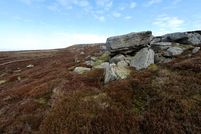
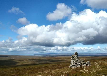
Wham Bottom Images

Images are sourced within 2km of 54.427971/-2.1148295 or Grid Reference NY9203. Thanks to Geograph Open Source API. All images are credited.

Gritstone edge of Water Crag The whole of the north-facing slope of Water Crag is dominated by an outcrop of the Pickersett Edge Grit, a part of the Silsden formation of Arnsbergian age (this is the second of seven substages of the Namurian in the Lower Carboniferous, of which only the lower two outcrop in this area, being truncated by an unconformity and overlain by Permian rocks). This is an alluvial deposit, noticeably cross-bedded and weathering to a uniform grey colour. The rather flat top of Water Crag represents the top of this bed, but the southern slopes are formed in slightly younger and softer rocks, downfaulted along an east-west fault of significant extent, accounting for the gentler and peatier slopes on the other side of the hill. There are few paths up here (only sketchy gamekeeper's routes), the main bridleway serving the mining area lower down (Tan Hill Coal) seeing no reason to visit these barren slopes.
Gritstone edge of Water Crag
The whole of the north-facing slope of Water Crag is dominated by an outcrop of the Pickersett Edge Grit, a part of the Silsden formation of Arnsbergian age (this is the second of seven substages of the Namurian in the Lower Carboniferous, of which only the lower two outcrop in this area, being truncated by an unconformity and overlain by Permian rocks). This is an alluvial deposit, noticeably cross-bedded and weathering to a uniform grey colour. The rather flat top of Water Crag represents the top of this bed, but the southern slopes are formed in slightly younger and softer rocks, downfaulted along an east-west fault of significant extent, accounting for the gentler and peatier slopes on the other side of the hill. There are few paths up here (only sketchy gamekeeper's routes), the main bridleway serving the mining area lower down (Tan Hill Coal) seeing no reason to visit these barren slopes.
Quad bike route from Water Crag There are no real walkers' routes on the little-visited Water Crag, but there is grouse shooting in the area and it is clear that the plateau is mainly frequented by gamekeepers who get here by quad bike from the proper track which leads to Punchard Coal Level and Great Punchard Head. There are no shooting butts on the top, but various medicated grit feeding stations as required to maintain the unnaturally high grouse populations and these need periodic attention. My own route from this point was exit stage left off-piste to reach the bridleway a kilometre to the north and a return to William Gill.
Quad bike route from Water Crag
There are no real walkers' routes on the little-visited Water Crag, but there is grouse shooting in the area and it is clear that the plateau is mainly frequented by gamekeepers who get here by quad bike from the proper track which leads to Punchard Coal Level and Great Punchard Head. There are no shooting butts on the top, but various medicated grit feeding stations as required to maintain the unnaturally high grouse populations and these need periodic attention. My own route from this point was exit stage left off-piste to reach the bridleway a kilometre to the north and a return to William Gill.
Blakethwaite Gill of Gunnerside Moor Snow cover over the hills of Swaledale with Blakethwaite Gill below the shooting hut in the foreground. The lower part of the valley is Gunnerside Gill which empties its water into the River Swale.
Blakethwaite Gill of Gunnerside Moor
Snow cover over the hills of Swaledale with Blakethwaite Gill below the shooting hut in the foreground. The lower part of the valley is Gunnerside Gill which empties its water into the River Swale.
Summit cairn at Rogan's Seat
Trig Point at Water Crag Surprisingly there is a fairly good path running up to this trig point leaving the track to the southwest and running parallel with the fence before crossing open ground.
Trig Point at Water Crag
Surprisingly there is a fairly good path running up to this trig point leaving the track to the southwest and running parallel with the fence before crossing open ground.
Faint moorland path above Annaside Edge This faint path runs towards the Tan Hill Hill but is not clear on the ground in places. Wooden posts with painted blue tops aids the way in places but the route doesn't always agree with the path shown on the map. There are a few fairly boggy bits which have to be skirted around even in the dry summer of 2022.
Faint moorland path above Annaside Edge
This faint path runs towards the Tan Hill Hill but is not clear on the ground in places. Wooden posts with painted blue tops aids the way in places but the route doesn't always agree with the path shown on the map. There are a few fairly boggy bits which have to be skirted around even in the dry summer of 2022.
Gate across estate road on Rogan's Seat The road is a disgracefully bulldozed scar right across the summit area of one of the highest hills of the Yorkshire Dales National Park! It's there simply to convey 'guns' to the butts further along the moor where there was also a shooting hut, but aerial imagery suggests that it's no longer there.
The snowed hills in the distance are Little Fell and Mickle Fell.
Gate across estate road on Rogan's Seat
The road is a disgracefully bulldozed scar right across the summit area of one of the highest hills of the Yorkshire Dales National Park! It's there simply to convey 'guns' to the butts further along the moor where there was also a shooting hut, but aerial imagery suggests that it's no longer there. The snowed hills in the distance are Little Fell and Mickle Fell.
Waterfall and old mine workings, Blakethwaite Gill
Flat heather moorland on Water Crag The view just east of south from the Water Crag trig point.
The most obvious distant peaks are Great Whernside and Buckden Pike.
Flat heather moorland on Water Crag
The view just east of south from the Water Crag trig point. The most obvious distant peaks are Great Whernside and Buckden Pike.
Boundary stone near to Great Punchard Head Great Punchard Head is an area of moorland drained by a number of minor streams that combine to form Great Punchard Gill. The boundary stone is one of a number marked on OS maps running (initially) near to east from Water Crag.
Boundary stone near to Great Punchard Head
Great Punchard Head is an area of moorland drained by a number of minor streams that combine to form Great Punchard Gill. The boundary stone is one of a number marked on OS maps running (initially) near to east from Water Crag.
Remains of Water Crag House The very low remains of a shepherd's hut on this exposed fellside. 
Named on a map of 1856, this must have been a summer retreat for a hard working dalesman.
Remains of Water Crag House
The very low remains of a shepherd's hut on this exposed fellside. Named on a map of 1856, this must have been a summer retreat for a hard working dalesman.
Shooters Track to Rogan's Seat The false top in the distance is High Stone Man.
Shooters Track to Rogan's Seat
The false top in the distance is High Stone Man.
Trig Pillar on Water Crag, 668m The most northerly 2000ft fell in the Yorkshire Dales, 2192ft to be exact. 
This trig point is OSBM 2963, it was erected in 1936. GR :NY 92853 04619
Trig Pillar on Water Crag, 668m
The most northerly 2000ft fell in the Yorkshire Dales, 2192ft to be exact. This trig point is OSBM 2963, it was erected in 1936. GR :NY 92853 04619
Eweleap Scar The main crag-forming rock is limestone, being much harder and more resistant to erosion than the other members of a typical Yoredale cyclothem, sandstone, shale, and occasionally thin coal seams. The sandstone is well seen in the bed of Blakethwaite Gill where, having been eroded, forms blocks and cobbles, whilst limestone tends to dissolve into the acidic peaty water.
Eweleap Scar
The main crag-forming rock is limestone, being much harder and more resistant to erosion than the other members of a typical Yoredale cyclothem, sandstone, shale, and occasionally thin coal seams. The sandstone is well seen in the bed of Blakethwaite Gill where, having been eroded, forms blocks and cobbles, whilst limestone tends to dissolve into the acidic peaty water.
Peat bank at Crook Sike The foreground bank and the other groove retain tributaries of Crook Sike the waters of which will flow down into Arkengarthdale. Across the desolate moorland beyond is a line of rock - the semi-continuous crag and detached blocks of Water Crag.
Peat bank at Crook Sike
The foreground bank and the other groove retain tributaries of Crook Sike the waters of which will flow down into Arkengarthdale. Across the desolate moorland beyond is a line of rock - the semi-continuous crag and detached blocks of Water Crag.
'Norman' arches At the Blakethwaite mine, Gunnerside Gill.
'Norman' arches
At the Blakethwaite mine, Gunnerside Gill.
Line of Old Mining Leat This vague line in the heather is the course of the Green Gill (Little Water Crag) Leat that was built c.1842 to supply water to the Moss Dams. Here it crosses Hind Hole Beck, probably originally via a small wooden aqueduct, long since lost. 
If you are wandering around on this section of the moor it is a relativly dry line to follow to get you back to a track.
Line of Old Mining Leat
This vague line in the heather is the course of the Green Gill (Little Water Crag) Leat that was built c.1842 to supply water to the Moss Dams. Here it crosses Hind Hole Beck, probably originally via a small wooden aqueduct, long since lost. If you are wandering around on this section of the moor it is a relativly dry line to follow to get you back to a track.
Show me another place!

Wham Bottom is located at Grid Ref: NY9203 (Lat: 54.427971, Lng: -2.1148295)

Division: North Riding

Administrative County: North Yorkshire

District: Richmondshire

Police Authority: North Yorkshire

What 3 Words

///lame.shocks.obtain. Near Bowes, Co. Durham

Nearby Locations

Wham Bottom

Related Wikis

Rogan's Seat

Rogan's Seat is a remote hill located near East Stonesdale and Gunnerside Gill, in the Yorkshire Dales in England. It is a high expanse of moorland that...

Arkengarthdale Gunnerside and Reeth Moors

Arkengarthdale Gunnerside and Reeth Moors (grid reference NY935070 and SD970990) is a 7,634.72 hectares (18,865.8 acres) biological Site of Special Scientific...

Gunnerside Gill

Gunnerside Gill (or Ghyll) is a small valley in the Yorkshire Dales, England, which branches off Swaledale into moorland to the north of Gunnerside. The...

Kisdon Force

Kisdon Force is a series of waterfalls on the River Swale in Swaledale, England. The falls are situated within the Yorkshire Dales National Park in the...

Nearby Amenities

Located within 500m of 54.427971,-2.1148295
Straits
Place: locality
Source: Bing
Lat/Long: 54.4275633/-2.1122975
Wham Bottom
Place: locality
Source: Bing
Lat/Long: 54.4293195/-2.1188719
Hunting Stand
Hunting Stand: grouse_butt
Lat/Long: 54.4235279/-2.1151722
Hunting Stand
Hunting Stand: grouse_butt
Lat/Long: 54.4238023/-2.1144909
Hunting Stand
Hunting Stand: grouse_butt
Lat/Long: 54.4240723/-2.1138245
Hunting Stand
Hunting Stand: grouse_butt
Lat/Long: 54.4243032/-2.1132505
The data included in this document is from www.openstreetmap.org. The data is made available under ODbL.

Have you been to Wham Bottom?

Leave your review of Wham Bottom below (or comments, questions and feedback).