Black Cleugh

Valley in Northumberland

England

Black Cleugh

The Cheviots from Hartside I am at the point where the road to Lynhope and Lynhope Spout ends at Hartside and looking south west across border country to the Cheviot Hills, Kidland Forest and upper Coquetdale.
The Cheviots from Hartside Credit: Carroll Pierce

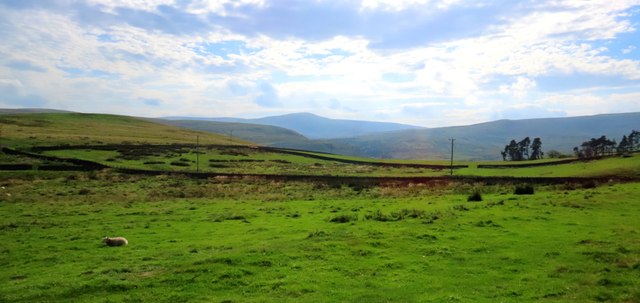
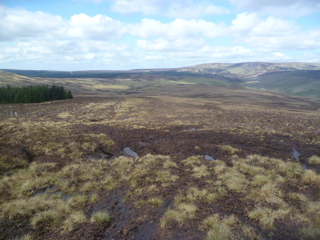
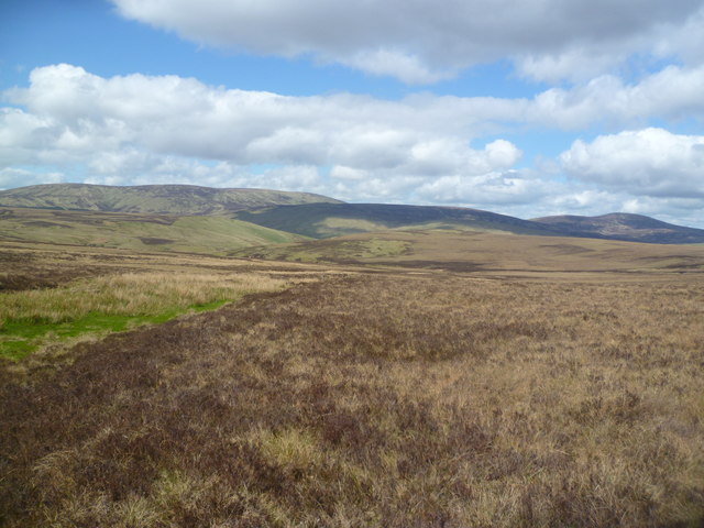
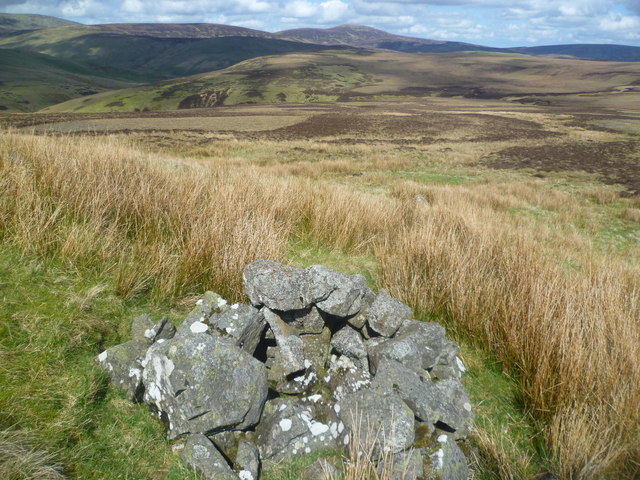
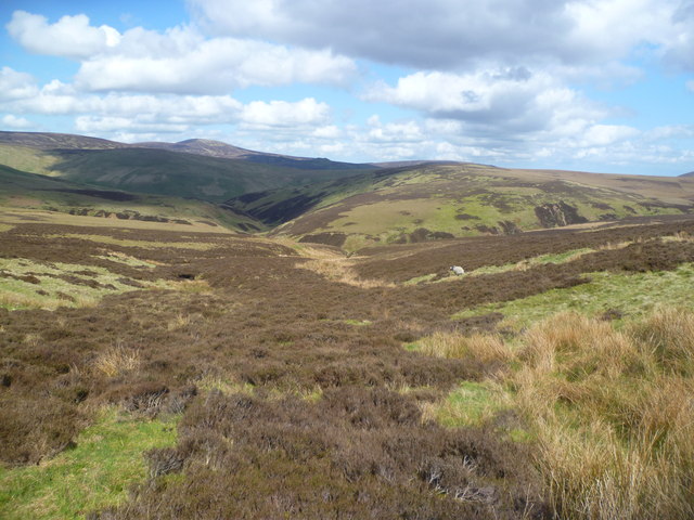
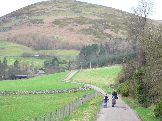
Black Cleugh is a picturesque valley located in Northumberland, England. Situated in the northern part of the county, it forms part of the North Pennines Area of Outstanding Natural Beauty. The valley stretches for approximately 5 miles and is surrounded by rolling hills and moorland, offering stunning views and a peaceful atmosphere.

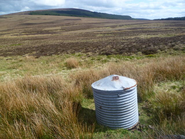
The landscape of Black Cleugh is characterized by its rugged beauty and diverse flora and fauna. The valley is home to a variety of plant species, including heather, bilberry, and cotton grass, which carpet the moorland in vibrant colors during the summer months. The area also provides a habitat for numerous bird species, such as curlews, lapwings, and red grouse, making it a haven for birdwatchers and nature enthusiasts.

Black Cleugh is intersected by a meandering river, which adds to its charm. The river flows through the valley, creating small cascades and pools, perfect for those wishing to explore the area's natural beauty. Visitors can enjoy leisurely walks along the riverbank, taking in the tranquil surroundings and the soothing sound of flowing water.

The valley is also steeped in history, with evidence of ancient settlements and mining activities dating back centuries. Ruins of old mining buildings can still be seen, serving as a reminder of the area's industrial past.

Overall, Black Cleugh offers a unique blend of natural beauty, wildlife, and historical significance, making it an ideal destination for outdoor enthusiasts and those seeking a peaceful retreat in the heart of Northumberland.

If you have any feedback on the listing, please let us know in the comments section below.

Black Cleugh Images

Images are sourced within 2km of 55.436469/-2.1270068 or Grid Reference NT9215. Thanks to Geograph Open Source API. All images are credited.

The Cheviots from Hartside I am at the point where the road to Lynhope and Lynhope Spout ends at Hartside and looking south west across border country to the Cheviot Hills, Kidland Forest and upper Coquetdale.
The Cheviots from Hartside
I am at the point where the road to Lynhope and Lynhope Spout ends at Hartside and looking south west across border country to the Cheviot Hills, Kidland Forest and upper Coquetdale.
Ascending Cushat Law The fellside here churned up by illegal off road moterbikers
Ascending Cushat Law
The fellside here churned up by illegal off road moterbikers
On Cushat Law Looking towards the northern Cheviots
On Cushat Law
Looking towards the northern Cheviots
Ainsey Burn Crossing the col between Cushat Law and Bloodybush Edge. The burn seen as a rush filled gutter on the gently sloping moor.
Ainsey Burn
Crossing the col between Cushat Law and Bloodybush Edge. The burn seen as a rush filled gutter on the gently sloping moor.
Metal Cylinder under Bloodybush Edge Looks like a storage container for use by the sheep farmer. Cushat Law in the distance.
Metal Cylinder under Bloodybush Edge
Looks like a storage container for use by the sheep farmer. Cushat Law in the distance.
Cairn, under Bloodybush Edge A small cairn near a rock outcrop in the moor.
Cairn, under Bloodybush Edge
A small cairn near a rock outcrop in the moor.
Above Redscar Sike Redscar Sike joins the Ainsey Burn to flow into the River Breamish
Above Redscar Sike
Redscar Sike joins the Ainsey Burn to flow into the River Breamish
Salter's Road An ancient trade route
Salter's Road
An ancient trade route
High Bleakhope Looking down from the path to High Cantle to the River Breamish
High Bleakhope
Looking down from the path to High Cantle to the River Breamish
Nagshead Knowe Sheepfolds in upper reaches of the Breamish Valley
Nagshead Knowe
Sheepfolds in upper reaches of the Breamish Valley
The River Breamish near Low Bleakhope
Cairn on High Cantle
Cushat Law from High Cantle
Salters Road at Lint Lands This is an ancient trackway across the Cheviot Hills and is frequently used by off-road motor cyclists
Salters Road at Lint Lands
This is an ancient trackway across the Cheviot Hills and is frequently used by off-road motor cyclists
Towards Shielcleugh Edge and High Cantle from Coldlaw Cairn The empty landscape high above the Upper Breamish Valley. For free route descriptions of walks in the area visit <span class="nowrap"><a title="http://www.cheviotwalks.co.uk" rel="nofollow ugc noopener" href="http://www.cheviotwalks.co.uk">Link</a><img style="margin-left:2px;" alt="External link" title="External link - shift click to open in new window" src="https://s1.geograph.org.uk/img/external.png" width="10" height="10"/></span>
Towards Shielcleugh Edge and High Cantle from Coldlaw Cairn
The empty landscape high above the Upper Breamish Valley. For free route descriptions of walks in the area visit LinkExternal link
Between Rig Cairn and High Cantle Looking across moorland towards a distant Hedgehope Hill and Great Standrop. For free route descriptions of walks in the area visit <span class="nowrap"><a title="http://www.cheviotwalks.co.uk" rel="nofollow ugc noopener" href="http://www.cheviotwalks.co.uk">Link</a><img style="margin-left:2px;" alt="External link" title="External link - shift click to open in new window" src="https://s1.geograph.org.uk/img/external.png" width="10" height="10"/></span>
Between Rig Cairn and High Cantle
Looking across moorland towards a distant Hedgehope Hill and Great Standrop. For free route descriptions of walks in the area visit LinkExternal link
Footbridge over River Breamish This footbridge is on the route of the Salter`s Road in the Upper Breamish Valley. For free detailed walking routes in the area visit <span class="nowrap"><a title="www.cheviotwalks.co.uk" rel="nofollow ugc noopener" href="http://www.cheviotwalks.co.uk">Link</a><img style="margin-left:2px;" alt="External link" title="External link - shift click to open in new window" src="https://s1.geograph.org.uk/img/external.png" width="10" height="10"/></span>
Footbridge over River Breamish
This footbridge is on the route of the Salter`s Road in the Upper Breamish Valley. For free detailed walking routes in the area visit LinkExternal link
Waterfall on the Ainsey Burn A hidden gem of the Upper Breamish Valley. For free detailed walking routes in the area visit <span class="nowrap"><a title="www.cheviotwalks.co.uk" rel="nofollow ugc noopener" href="http://www.cheviotwalks.co.uk">Link</a><img style="margin-left:2px;" alt="External link" title="External link - shift click to open in new window" src="https://s1.geograph.org.uk/img/external.png" width="10" height="10"/></span>
Waterfall on the Ainsey Burn
A hidden gem of the Upper Breamish Valley. For free detailed walking routes in the area visit LinkExternal link
Show me another place!

Black Cleugh is located at Grid Ref: NT9215 (Lat: 55.436469, Lng: -2.1270068)

Unitary Authority: Northumberland

Police Authority: Northumbria

What 3 Words

///gown.threading.cashiers. Near Kirknewton, Northumberland

Related Wikis

Kidland

Kidland is a former civil parish, now in the parish of Alwinton in Northumberland, England, about 2 miles (3 km) northwest of Alwinton village. In 1951...

Linhope

Linhope is a small village in Northumberland, England. It is located in the Cheviots on the River Breamish, and within Northumberland National Park. Linhope...

Hedgehope Hill

Hedgehope Hill is a mountain in the Cheviot Hills of north Northumberland in northeast England, and categorised as a Hewitt. At a height of 714 metres...

The Cheviot

The Cheviot () is an extinct volcano and the highest summit in the Cheviot Hills and in the county of Northumberland. Located in the extreme north of England...

Nearby Amenities

Located within 500m of 55.436469,-2.1270068
The data included in this document is from www.openstreetmap.org. The data is made available under ODbL.

Have you been to Black Cleugh?

Leave your review of Black Cleugh below (or comments, questions and feedback).