Birkin Clough

Valley in Yorkshire Burnley

England

Birkin Clough

Higher House With Widdop Reservoir beyond
Higher House Credit: Kevin Waterhouse

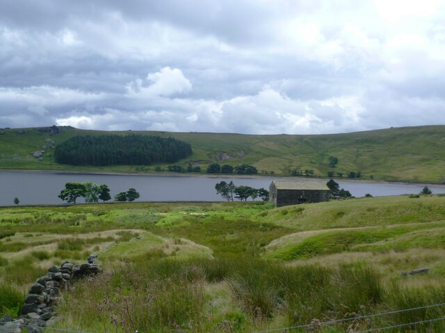
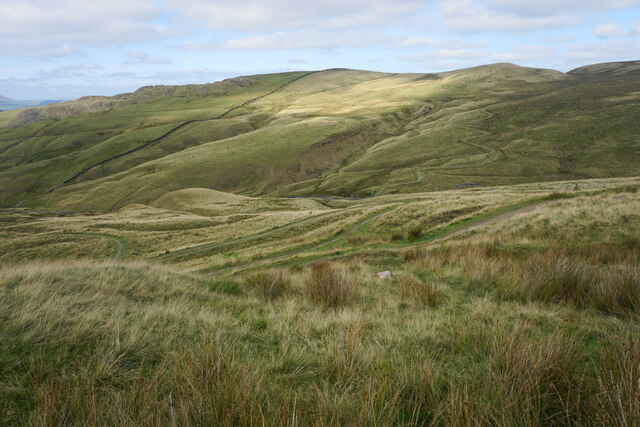
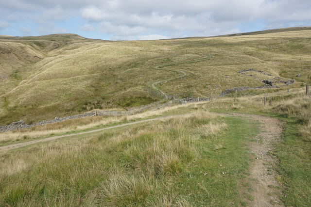
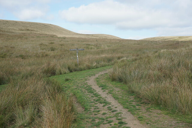
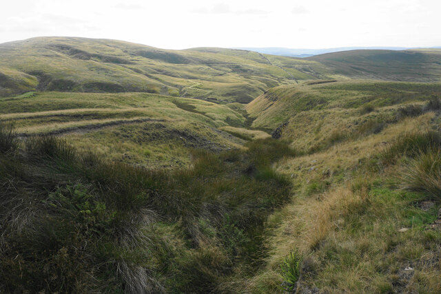
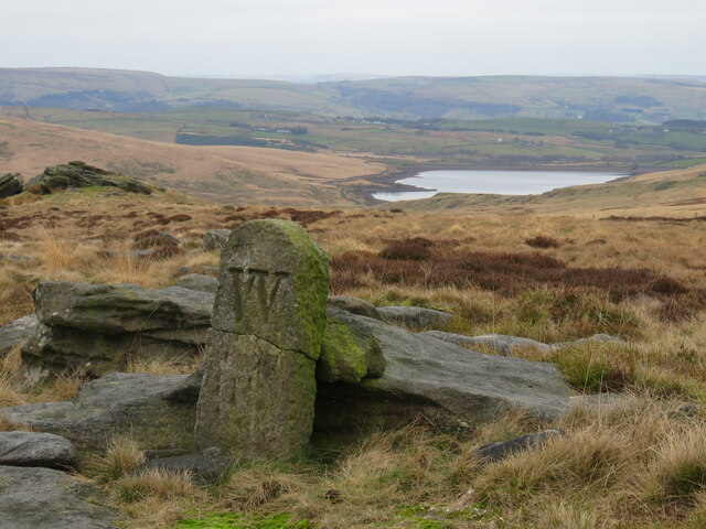
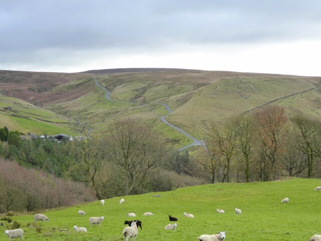
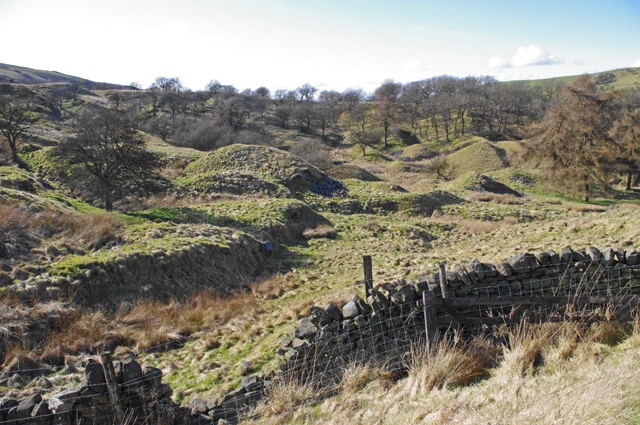
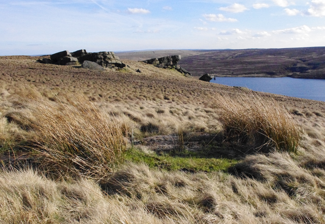
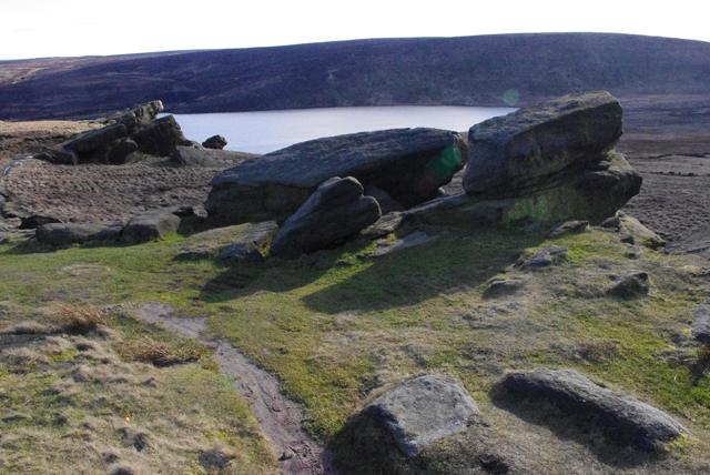
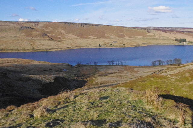
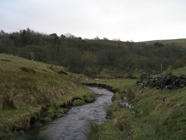
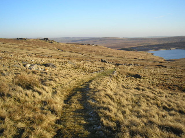
Birkin Clough is a picturesque valley located in the county of Yorkshire, England. Situated in the Peak District National Park, this stunning natural landscape is renowned for its rugged beauty and tranquil atmosphere. The valley is nestled between rolling hills and is characterized by its steep slopes, dense woodlands, and meandering stream that flows through its center.

Birkin Clough is a haven for wildlife enthusiasts and outdoor adventurers alike. The valley is home to a rich variety of flora and fauna, with rare species such as the bilberry bumblebee and the redstart bird being spotted here. The woodlands are adorned with a vibrant display of wildflowers during the spring and summer months, creating a breathtaking sight for visitors.

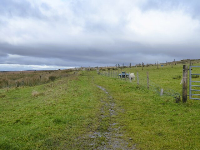
For hikers and nature lovers, Birkin Clough offers an extensive network of footpaths and trails that provide access to the valley's hidden gems. From gentle strolls along the riverbank to more challenging hikes up the valley's steep sides, there is something to cater to all levels of fitness and experience. The valley also boasts several picturesque picnic spots, where visitors can relax and enjoy the tranquility of their surroundings.

Birkin Clough's natural beauty and peaceful ambiance make it a popular destination for those seeking respite from the hustle and bustle of city life. Whether it's a leisurely walk, a bird-watching expedition, or simply a moment of solitude in nature, this idyllic valley offers a truly rejuvenating experience for all who venture into its captivating embrace.

If you have any feedback on the listing, please let us know in the comments section below.

Birkin Clough Images

Images are sourced within 2km of 53.799483/-2.1264166 or Grid Reference SD9133. Thanks to Geograph Open Source API. All images are credited.

Higher House With Widdop Reservoir beyond
Higher House
With Widdop Reservoir beyond
The Pennine Bridleway above Swinden Water The bridleway does a lot of zigzags both on this side and the other side of the valley.
The Pennine Bridleway above Swinden Water
The bridleway does a lot of zigzags both on this side and the other side of the valley.
The Pennine Bridleway crossing Swinden Water A winding route which reflects previous quarrying activity in the valley.
The Pennine Bridleway crossing Swinden Water
A winding route which reflects previous quarrying activity in the valley.
Path junction on Extwistle Moor The Pennine Bridleway continues up onto the moor, while a path leads off left down to Swinden Bridge.
Path junction on Extwistle Moor
The Pennine Bridleway continues up onto the moor, while a path leads off left down to Swinden Bridge.
Grain on Extwistle Moor This forms a tributary of Swinden Water.
Grain on Extwistle Moor
This forms a tributary of Swinden Water.
Boundary stone above Cant Clough Reservoir Broken boundary stone above Cant Clough Reservoir (and near Hare Stones and the Pennine Bridleway). The "W" on the BS  is probably for Worsthorne Estate.
Boundary stone above Cant Clough Reservoir
Broken boundary stone above Cant Clough Reservoir (and near Hare Stones and the Pennine Bridleway). The "W" on the BS is probably for Worsthorne Estate.
Bronte Way A named route to Wycoller, here close to Halifax Road it is marked as a bridle path
Bronte Way
A named route to Wycoller, here close to Halifax Road it is marked as a bridle path
Road to Widdop A minor road climbs out of the Thursden Valley towards Widdop in Yorkshire
Road to Widdop
A minor road climbs out of the Thursden Valley towards Widdop in Yorkshire
New Plantation, Thursden Valley The earthworks are presumably the result of quarrying.
New Plantation, Thursden Valley
The earthworks are presumably the result of quarrying.
Shuttleworth Moor View towards Gorple Upper Reservoir from the Gorple Gate track.
Shuttleworth Moor
View towards Gorple Upper Reservoir from the Gorple Gate track.
Shuttleworth Moor Gritstone outcrops overlooking Gorple Upper Reservoir.
Shuttleworth Moor
Gritstone outcrops overlooking Gorple Upper Reservoir.
Bench mark, Shuttleworth Moor On a gritstone slab beside the Gorple Gate track.
See <span class="nowrap"><a title="http://www.bench-marks.org.uk/bm37296" rel="nofollow ugc noopener" href="http://www.bench-marks.org.uk/bm37296">Link</a><img style="margin-left:2px;" alt="External link" title="External link - shift click to open in new window" src="https://s1.geograph.org.uk/img/external.png" width="10" height="10"/></span>
Bench mark, Shuttleworth Moor
On a gritstone slab beside the Gorple Gate track. See LinkExternal link
Widdop Reservoir View of the reservoir from the Gorple Gate track.
Widdop Reservoir
View of the reservoir from the Gorple Gate track.
Grouse grit on Shuttleworth Moor One concrete block probably contained medicated grit to treat parasites, the other block contains un-medicated grit. Grit is used to aid digestion of the heather. Game keepers were much in evidence on the moors in preparation for the start of the shooting season in August.
Grouse grit on Shuttleworth Moor
One concrete block probably contained medicated grit to treat parasites, the other block contains un-medicated grit. Grit is used to aid digestion of the heather. Game keepers were much in evidence on the moors in preparation for the start of the shooting season in August.
All that remains of New House near Thursden
Pennine Bridleway near Thursden Very well constructed zig-zags on the steep hill near Thursden
Pennine Bridleway near Thursden
Very well constructed zig-zags on the steep hill near Thursden
Thursden Valley
Thursden Valley
The track to Gorple The farm track from Gorple road down to the ruins of Gorple Farm. Gorple Reservoir is also visible.
The track to Gorple
The farm track from Gorple road down to the ruins of Gorple Farm. Gorple Reservoir is also visible.
Show me another place!

Birkin Clough is located at Grid Ref: SD9133 (Lat: 53.799483, Lng: -2.1264166)

Division: West Riding

Administrative County: Lancashire

District: Burnley

Police Authority: Lancashire

What 3 Words

///appendix.nylon.pickles. Near Nelson, Lancashire

Related Wikis

Boulsworth Hill

Boulsworth Hill is a large expanse of moorland, the highest point of the South Pennines of south-eastern Lancashire, England, separating the Borough of...

Trawden Brook

Trawden Brook is a minor river in Lancashire, England. It is 3.48 miles (5.6 km) long and has a catchment area of 4.40 square miles (11.4 km2).Rising on...

Worsthorne-with-Hurstwood

Worsthorne-with-Hurstwood is a civil parish in the Borough of Burnley, in Lancashire, England. Situated on the eastern outskirts of Burnley, in 2011 it...

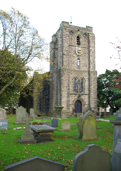
St John the Evangelist's Church, Worsthorne

St John the Evangelist's Church is in Church Square in the village of Worsthorne, Lancashire, England. It is an active Anglican parish church in the deanery...

Briercliffe

Briercliffe (historically Briercliffe-with-Extwistle) is a civil parish in the borough of Burnley, in Lancashire, England. It is situated 3 miles (4.8...

Hurstwood

Hurstwood is a rural hamlet on the eastern outskirts of Burnley in Lancashire, England. It is in the civil parish of Worsthorne-with-Hurstwood and the...

Worsthorne

Worsthorne is a rural village on the eastern outskirts of Burnley in Lancashire, England. It is in the civil parish of Worsthorne-with-Hurstwood and the...

Fother Royd Wood

Fother Royd Wood is a woodland in Lancashire, England, near Worsthorne. It covers a total area of 1.03 hectares (2.55 acres). It is owned and managed by...

Nearby Amenities

Located within 500m of 53.799483,-2.1264166
Ford: yes
Lat/Long: 53.7980096/-2.1217217
Natural: rock
Lat/Long: 53.799648/-2.125666
Natural: rock
Lat/Long: 53.7996425/-2.1255882
Natural: rock
Lat/Long: 53.7996773/-2.1256248
The data included in this document is from www.openstreetmap.org. The data is made available under ODbL.

Have you been to Birkin Clough?

Leave your review of Birkin Clough below (or comments, questions and feedback).