Outer Quickening Cleugh

Valley in Northumberland

England

Outer Quickening Cleugh

Davidson's Burn in the Uswayford Plantation Davidson's Burn in a corridor of bracken, heather and extremely hummocky grass as it passes through the upper reaches of the Uswayford Plantation. Had hoped there may be a faint path down stream but no sign. 450m above sea level, this plantation creeps up almost to the border ridge.
Davidson's Burn in the Uswayford Plantation Credit: Steve Revell

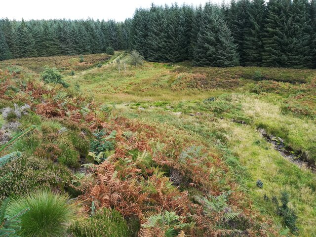
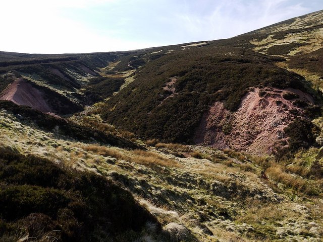
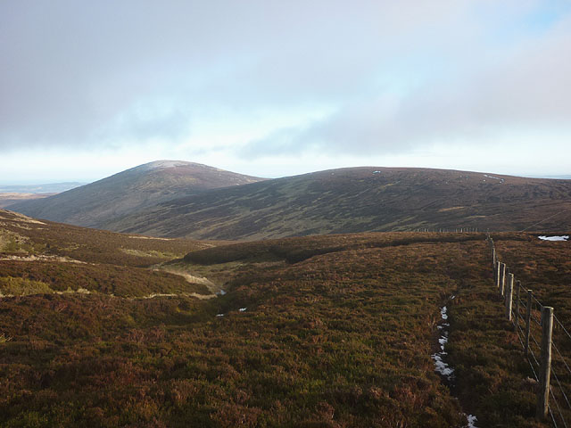
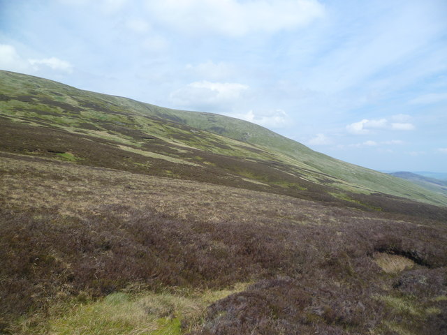
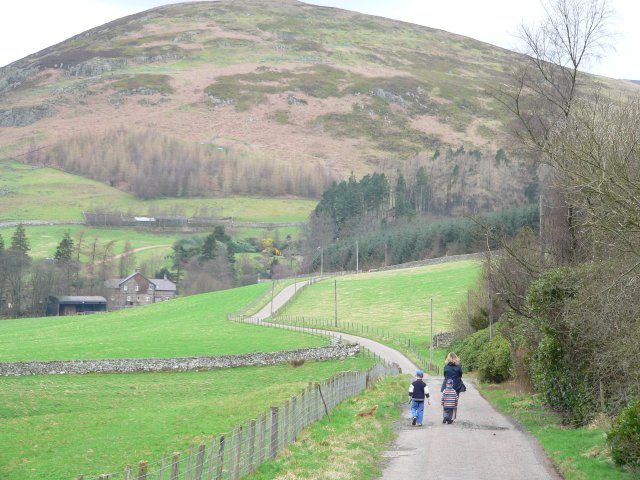
Outer Quickening Cleugh is a picturesque valley located in the county of Northumberland, England. Nestled amidst the rolling hills and verdant countryside, this valley offers a tranquil and idyllic setting for those seeking a retreat from the hustle and bustle of city life.

The valley is characterized by its lush green meadows, meandering streams, and dense woodland, creating a diverse and rich ecosystem. As part of the Northumberland National Park, Outer Quickening Cleugh is home to various species of flora and fauna, including rare wildflowers, birds, and small mammals.

Visitors to Outer Quickening Cleugh can enjoy a range of outdoor activities. The valley boasts numerous walking trails, allowing visitors to explore its natural beauty at their own pace. These trails offer breathtaking views of the surrounding countryside, making it a popular destination for hikers and nature enthusiasts.

For those interested in history, Outer Quickening Cleugh has several archaeological sites dating back to the Neolithic period. These sites include ancient burial mounds and stone circles, providing insight into the valley's rich cultural heritage.

The valley is also known for its peaceful atmosphere, making it an ideal location for relaxation and contemplation. Visitors can find secluded spots along the streams or enjoy a picnic amidst the picturesque surroundings.

Overall, Outer Quickening Cleugh is a hidden gem in Northumberland, offering a serene and unspoiled natural environment for visitors to enjoy. Whether it's exploring the trails, immersing oneself in history, or simply taking in the beauty of the landscape, this valley provides a truly enchanting experience.

If you have any feedback on the listing, please let us know in the comments section below.

Outer Quickening Cleugh Images

Images are sourced within 2km of 55.448765/-2.1481358 or Grid Reference NT9017. Thanks to Geograph Open Source API. All images are credited.

Davidson's Burn in the Uswayford Plantation Davidson's Burn in a corridor of bracken, heather and extremely hummocky grass as it passes through the upper reaches of the Uswayford Plantation. Had hoped there may be a faint path down stream but no sign. 450m above sea level, this plantation creeps up almost to the border ridge.
Davidson's Burn in the Uswayford Plantation
Davidson's Burn in a corridor of bracken, heather and extremely hummocky grass as it passes through the upper reaches of the Uswayford Plantation. Had hoped there may be a faint path down stream but no sign. 450m above sea level, this plantation creeps up almost to the border ridge.
Pond, Comb Fell Hedgehope Hill is on the right.
Pond, Comb Fell
Hedgehope Hill is on the right.
Fence corner, Comb Fell Cold Law Cairn can be seen on the ridge ahead. This can be a very boggy area of peat hags. Compare this photo from 2009: <a href="https://www.geograph.org.uk/photo/1510689">NT9118 : Fence corner , Comb Fell</a>
Fence corner, Comb Fell
Cold Law Cairn can be seen on the ridge ahead. This can be a very boggy area of peat hags. Compare this photo from 2009: NT9118 : Fence corner , Comb Fell
Harthope Burn from the slopes of Comb Fell Bright pink exposures of rock by the stream below catch the eye.
Harthope Burn from the slopes of Comb Fell
Bright pink exposures of rock by the stream below catch the eye.
Pink igneous rock outcrop by upper Harthope Burn See also <a href="https://www.geograph.org.uk/photo/2877676">NT9119 : Ridge of pink igneous rock by upper Harthope Burn</a>
Pink igneous rock outcrop by upper Harthope Burn
Ridge of pink igneous rock by upper Harthope Burn I wasn't sure about my title or description for this interesting geological formation, and was surprised to find that such a prominent feature did not appear to have been previously described or illustrated. It is possible that the ridge alongside the upper Harthope Burn only became uncovered to this extent in recent years, possibly following the large storms in 2009 that caused so much damage in Cheviot valleys further down. An existing geological field guide excursion in the valley has its final site at Harthope Linn (The Cheviot - early Devonian rocks, granite and basement by Peter Allen, Chapter 4, Northumbran Rocks and Landscape: A Field Guide, Yorkshire Geological Society 1995).

An email request for assistance in its interpretation sent to the Natural History Society of Northumbria was kindly answered by geologist, Brian Young. Although unfamiliar with the exact location and not having a rock specimen, he offered me the following likely interpretation:

"The place shown lies well within the outcrop of the Cheviot Granite as shown by the British Geological Survey 1:50 000 scale Sheet 5 (The Cheviot).

The Harthope valley, for much of its course, is determined by a prominent NE-SW trending fault assumed by at least one author to be a shear fault of Hercynian age.

My suggestion is that the pink material forming the prominent ridge in your picture is an exposure of granite, almost certainly affected in some way by proximity to this major fault line. A common feature of the rocks of the Cheviot is the local presence of patchy zones of deep alteration which renders the rocks rather soft and prone to erosion. Various theories have been put forward to account for this alteration, though no definitive answer has yet emerged. It is possible that the rock in your picture includes examples of this sort of alteration."

A second photo of the outcrop just below the ridge <a href="https://www.geograph.org.uk/photo/2877661">NT9119 : Pink igneous rock outcrop by upper Harthope Burn</a> does give a hint of a shattered rock surface that may indeed be a form of eroded modified granite. I must get back up there and collect a bit for a closer look.
Ridge of pink igneous rock by upper Harthope Burn
I wasn't sure about my title or description for this interesting geological formation, and was surprised to find that such a prominent feature did not appear to have been previously described or illustrated. It is possible that the ridge alongside the upper Harthope Burn only became uncovered to this extent in recent years, possibly following the large storms in 2009 that caused so much damage in Cheviot valleys further down. An existing geological field guide excursion in the valley has its final site at Harthope Linn (The Cheviot - early Devonian rocks, granite and basement by Peter Allen, Chapter 4, Northumbran Rocks and Landscape: A Field Guide, Yorkshire Geological Society 1995). An email request for assistance in its interpretation sent to the Natural History Society of Northumbria was kindly answered by geologist, Brian Young. Although unfamiliar with the exact location and not having a rock specimen, he offered me the following likely interpretation: "The place shown lies well within the outcrop of the Cheviot Granite as shown by the British Geological Survey 1:50 000 scale Sheet 5 (The Cheviot). The Harthope valley, for much of its course, is determined by a prominent NE-SW trending fault assumed by at least one author to be a shear fault of Hercynian age. My suggestion is that the pink material forming the prominent ridge in your picture is an exposure of granite, almost certainly affected in some way by proximity to this major fault line. A common feature of the rocks of the Cheviot is the local presence of patchy zones of deep alteration which renders the rocks rather soft and prone to erosion. Various theories have been put forward to account for this alteration, though no definitive answer has yet emerged. It is possible that the rock in your picture includes examples of this sort of alteration." A second photo of the outcrop just below the ridge NT9119 : Pink igneous rock outcrop by upper Harthope Burn does give a hint of a shattered rock surface that may indeed be a form of eroded modified granite. I must get back up there and collect a bit for a closer look.
Comb Fell from slope below Cheviot Coldlaw Cairn can be seen on the ridge to the right. Cushat Law is the hill behind. The hills to its left are Wether Cairn and Hogdon Law.
Comb Fell from slope below Cheviot
Coldlaw Cairn can be seen on the ridge to the right. Cushat Law is the hill behind. The hills to its left are Wether Cairn and Hogdon Law.
Fence on Scotsman's Knowe Looking towards Comb Fell and the shapely Hedgehope Hill, second highest summit in the Cheviots.
Fence on Scotsman's Knowe
Looking towards Comb Fell and the shapely Hedgehope Hill, second highest summit in the Cheviots.
The upper reaches of Harthope Burn Up here the burn is just a trickle and the vague footpath constantly switches from one side to the other. Hedgehope Hill is the shapely fell left-of-centre.
The upper reaches of Harthope Burn
Up here the burn is just a trickle and the vague footpath constantly switches from one side to the other. Hedgehope Hill is the shapely fell left-of-centre.
Eroded ridge of soft, red rock by Harthope Burn A curious arete of soft, red material (almost like soil) in the upper reaches of the burn. I managed to tiptoe along the crest.
Eroded ridge of soft, red rock by Harthope Burn
A curious arete of soft, red material (almost like soil) in the upper reaches of the burn. I managed to tiptoe along the crest.
Salter's Road An ancient trade route
Salter's Road
An ancient trade route
Near Scotsman's Knowe Looking towards The Cheviot
Near Scotsman's Knowe
Looking towards The Cheviot
Eroded Peat Drainage channel which probably feeds Harthope Burn
Eroded Peat
Drainage channel which probably feeds Harthope Burn
Ascending Comb Fell Help required at times
Ascending Comb Fell
Help required at times
Near the head of Harthope burn. A Cheviot walk.
Near the head of Harthope burn.
A Cheviot walk.
Maisy explores the sandy ridge I tried to follow the dog but the ridge becomes very narrow, high up and the material of which it is made has the consistency of coarse sand. My earlier discussion of its geology is here <a href="https://www.geograph.org.uk/photo/2877676">NT9119 : Ridge of pink igneous rock by upper Harthope Burn</a>
There is another photo here <a href="https://www.geograph.org.uk/photo/3798748">NT9119 : Eroded ridge of soft, red rock by Harthope Burn</a>
Maisy explores the sandy ridge
I tried to follow the dog but the ridge becomes very narrow, high up and the material of which it is made has the consistency of coarse sand. My earlier discussion of its geology is here NT9119 : Ridge of pink igneous rock by upper Harthope Burn There is another photo here NT9119 : Eroded ridge of soft, red rock by Harthope Burn
Crag near Harthope Burn The location is just above the pink sandy ridge <a href="https://www.geograph.org.uk/photo/4604393">NT9119 : Maisy explores the sandy ridge</a> part of which is just visible behind.
Crag near Harthope Burn
The location is just above the pink sandy ridge NT9119 : Maisy explores the sandy ridge part of which is just visible behind.
Path in upper part of Harthope Burn
Show me another place!

Outer Quickening Cleugh is located at Grid Ref: NT9017 (Lat: 55.448765, Lng: -2.1481358)

Unitary Authority: Northumberland

Police Authority: Northumbria

What 3 Words

///edit.diplomas.trend. Near Kirknewton, Northumberland

Nearby Locations

Outer Quickening Cleugh

Related Wikis

Cheviot Hills

The Cheviot Hills (), or sometimes The Cheviots, are a range of uplands straddling the Anglo-Scottish border between Northumberland and the Scottish Borders...

The Cheviot

The Cheviot () is an extinct volcano and the highest summit in the Cheviot Hills and in the county of Northumberland. Located in the extreme north of England...

Hedgehope Hill

Hedgehope Hill is a mountain in the Cheviot Hills of north Northumberland in northeast England, and categorised as a Hewitt. At a height of 714 metres...

Kidland

Kidland is a former civil parish, now in the parish of Alwinton in Northumberland, England, about 2 miles (3 km) northwest of Alwinton village. In 1951...

Windy Gyle

Windy Gyle is a mountain in the Cheviot Hills range, on the border between England and Scotland. Like the other hills in the area, it is rounded and grass...

Linhope

Linhope is a small village in Northumberland, England. It is located in the Cheviots on the River Breamish, and within Northumberland National Park. Linhope...

Threestoneburn Stone Circle

Threestoneburn Stone Circle is an archaeological site, a stone circle near the village of Ilderton and about 5 miles (8 km) south of Wooler, in Northumberland...

Barrow Burn Meadows

Barrow Burn Meadows is a Site of Special Scientific Interest (SSSI) in north Northumberland, England. The site is a species-rich hay meadow of a sort now...

Have you been to Outer Quickening Cleugh?

Leave your review of Outer Quickening Cleugh below (or comments, questions and feedback).