Weir Clough

Valley in Lancashire

England

Weir Clough

Terraced Housing, Woodhouses On Ashton Road
Terraced Housing, Woodhouses Credit: Kevin Waterhouse

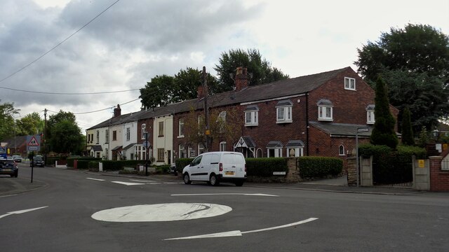
Weir Clough is a picturesque valley located in the county of Lancashire, England. Situated in the Rossendale district, it is a charming rural area renowned for its natural beauty and tranquil surroundings.

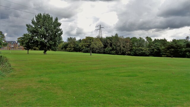
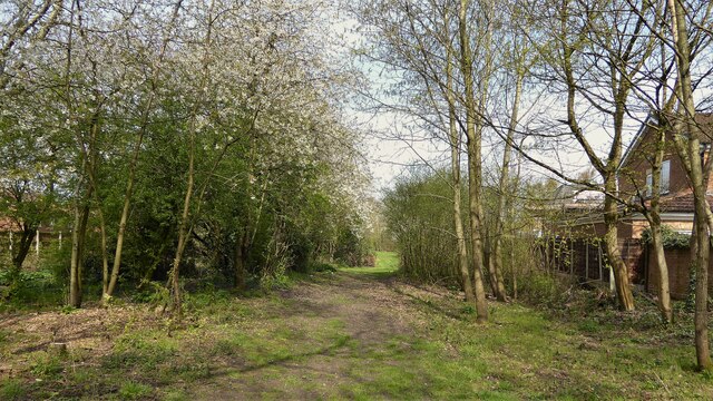
The valley is characterized by its lush greenery, rolling hills, and a meandering stream that runs through its heart. The stream, known as the Weir Water, adds to the scenic charm of the area, glistening in the sunlight as it winds its way through the valley. The sound of the gently flowing water creates a soothing ambiance, making it a popular spot for relaxation and contemplation.

Weir Clough is also home to a diverse range of flora and fauna, making it a haven for nature lovers and wildlife enthusiasts. The valley is adorned with a variety of trees, including oak, beech, and birch, which provide a habitat for numerous bird species and small mammals.

In addition to its natural beauty, Weir Clough offers a range of outdoor activities for visitors to enjoy. The valley is crisscrossed by a network of walking trails, allowing visitors to explore its scenic vistas and discover hidden gems along the way. It is also a popular spot for picnicking, with several designated areas providing a perfect setting for a leisurely outdoor meal.

Weir Clough is a true gem in the Lancashire countryside, offering an escape from the hustle and bustle of urban life. Its idyllic setting, abundant wildlife, and recreational opportunities make it a must-visit destination for those seeking a peaceful retreat in nature.

If you have any feedback on the listing, please let us know in the comments section below.
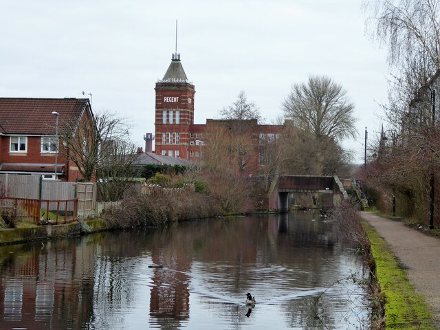
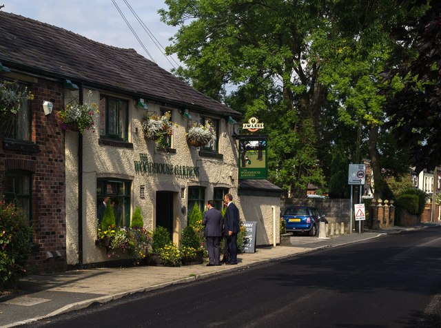
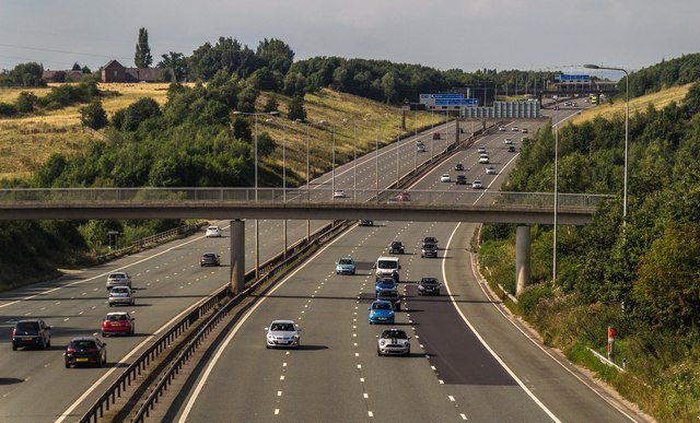
Weir Clough Images

Images are sourced within 2km of 53.493022/-2.1494519 or Grid Reference SJ9099. Thanks to Geograph Open Source API. All images are credited.

Terraced Housing, Woodhouses On Ashton Road
Terraced Housing, Woodhouses
On Ashton Road
Brookdale Golf Club Land View from the public footpath that now is curtailed with the removal of Ash Bridge across the River Medlock
Brookdale Golf Club Land
View from the public footpath that now is curtailed with the removal of Ash Bridge across the River Medlock
Route of former Hollinwood Canal The former Hollinwood branch of the Ashton Canal has been in-filled as it heads away from Cutler Hill Bridge. The former canal is under the trees on the left of this view and further to the left a footpath follows the canal line to Landsberg Road. There is then a deviation to reach Roman Road the former public footpath appears to have been extinguished.
Route of former Hollinwood Canal
The former Hollinwood branch of the Ashton Canal has been in-filled as it heads away from Cutler Hill Bridge. The former canal is under the trees on the left of this view and further to the left a footpath follows the canal line to Landsberg Road. There is then a deviation to reach Roman Road the former public footpath appears to have been extinguished.
Tannersfield Canal Footbridge On the Rochdale Canal, this is bridge No.79A
Tannersfield Canal Footbridge
On the Rochdale Canal, this is bridge No.79A
Back Lane Bridge This is bridge No.79 on the Rochdale Canal. Regent Mill towers over the scene, a trick of the perspective.
Back Lane Bridge
This is bridge No.79 on the Rochdale Canal. Regent Mill towers over the scene, a trick of the perspective.
Former pub, Oldham Road, Manchester (1) Once the Weavers Arms, a Vaux pub with glazed tile front.
It has been closed since at least 2011 (<a href="https://www.geograph.org.uk/photo/2248107">SD8801 : The Weavers Arms</a>) and now mainly acts as an advertising hoarding for the Manchester Tile Centre.
Former pub, Oldham Road, Manchester (1)
Once the Weavers Arms, a Vaux pub with glazed tile front. It has been closed since at least 2011 (SD8801 : The Weavers Arms) and now mainly acts as an advertising hoarding for the Manchester Tile Centre.
Woodhouses The Woodhouse Garden public house at Woodhouses.
Woodhouses
The Woodhouse Garden public house at Woodhouses.
M60 M60 Motorway.
M60
M60 Motorway.
Bungalow on Stamford Drive, Woodhouses A bungalow on Stamford Drive in the Woodhouses area of Failsworth in Greater Manchester, England.
Bungalow on Stamford Drive, Woodhouses
A bungalow on Stamford Drive in the Woodhouses area of Failsworth in Greater Manchester, England.
M60 M60 crossing the River Medlock.
M60
M60 crossing the River Medlock.
Medlock Road at Bottom of Woodhouses
Ashton Road crossing the M60
Stannybrook Road from Daisy Nook Garden Centre exit
Ashton Road East, Failsworth
Woodhouse Green and Failsworth from the air The M60 motorway dominates the scene.
Woodhouse Green and Failsworth from the air
The M60 motorway dominates the scene.
Cottages, Bottom of Woodhouses
The Dog and Partridge, Woodhouses On Medlock Road.
The Dog and Partridge, Woodhouses
On Medlock Road.
Sign for the Dog and Partridge, Woodhouses
Show me another place!

Weir Clough is located at Grid Ref: SJ9099 (Lat: 53.493022, Lng: -2.1494519)

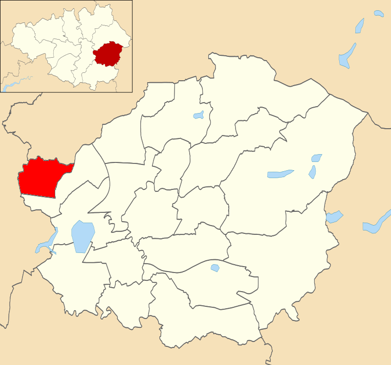
Unitary Authority: Oldham

Police Authority: Greater Manchester

What 3 Words

///ranges.scarcely.spun. Near Droylsden, Manchester

Related Wikis

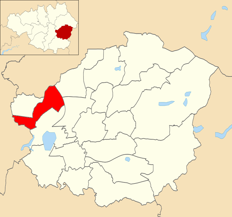
Droylsden West (ward)

Droylsden West is an electoral ward of Tameside, England. It is represented in Westminster by Angela Rayner Labour MP for Ashton-under-Lyne. == Councillors... ==

Saxon Mill, Droylsden

Saxon Mill, Droylsden was a cotton spinning mill in Droylsden, Tameside, Greater Manchester, England. It was built in the 1907, taken over by the Lancashire...

Droylsden railway station

Droylsden railway station served the town of Droylsden, Greater Manchester, England. == History == The station was opened on 13 April 1846 by the Ashton...

Littlemoss High School

Littlemoss High School for Boys was a comprehensive school in Littlemoss, Droylsden, Tameside, England. It merged with Droylsden High School, Mathematics...

Droylsden East (ward)

Droylsden East is an electoral ward of Tameside, England. It is represented in Westminster by Angela Rayner Labour MP for Ashton-under-Lyne. == Councillors... ==

Littlemoss

Littlemoss is a suburb of Droylsden, in the Tameside District, in the English county of Greater Manchester. Littlemoss village is predominantly a farming...

Clayton Bridge railway station

Clayton Bridge railway station, Manchester, was a railway station that served the locality between 1846 and 1968. == Construction, opening and ownership... ==

Droylsden

Droylsden is a town in Tameside, Greater Manchester, England, 4.1 miles (6.6 km) east of Manchester city centre and 2.2 miles (3.5 km) west of Ashton-under...

Nearby Amenities

Located within 500m of 53.493022,-2.1494519
Barrier: block
Lat/Long: 53.4941612/-2.1517651
Parking
Lat/Long: 53.4940602/-2.1522139
Barrier: kissing_gate
Foot: yes
Lat/Long: 53.4940591/-2.1520676
Barrier: kissing_gate
Foot: yes
Lat/Long: 53.4919702/-2.1469172
Barrier: kissing_gate
Foot: yes
Lat/Long: 53.4919035/-2.1470058
Post Box
Lat/Long: 53.4909326/-2.1524935
Bus Stop
Sunnyside Road/Surrey Avenue
Bus: yes
Naptan AtcoCode: 1800EH36511
Naptan Bearing: E
Naptan CommonName: Sunnyside Road/Surrey Avenue
Naptan Indicator: A Playground
Naptan Landmark: PLAYGROUND
Naptan NaptanCode: mandawad
Naptan PlusbusZoneRef: MNCRPIC
Naptan ShortCommonName: Surrey Avenue
Naptan Street: SUNNYSIDE ROAD
Naptan Verified: no
Network: TfGM
Public Transport: platform
Source: naptan_import
Lat/Long: 53.4895504/-2.153763
Power: tower
Lat/Long: 53.4933628/-2.1441631
Power: tower
Lat/Long: 53.4931777/-2.1536152
Power: tower
Lat/Long: 53.4934873/-2.1497957
Power: tower
Lat/Long: 53.4926489/-2.1559916
Power: tower
Lat/Long: 53.4960978/-2.1512602
Glo Health and Beauty
Shop: hairdresser
Lat/Long: 53.488565/-2.1491816
Fast Food
Chinese 4 U
Cuisine: chinese
Lat/Long: 53.4885331/-2.1490931
Shop: convenience
Lat/Long: 53.4909639/-2.1525083
Fast Food
China Box (Chinese)
Cuisine: fish_and_chips
Lat/Long: 53.4908334/-2.1524405
Power: tower
Lat/Long: 53.4931769/-2.1536171
Power: tower
Lat/Long: 53.493488/-2.1497708
Power: tower
Lat/Long: 53.4933683/-2.1441409
Power: tower
Lat/Long: 53.4951363/-2.1539363
Generator Method: photovoltaic
Generator Output Electricity: yes
Generator Source: solar
Generator Type: solar_photovoltaic_panel
Location: roof
Power: generator
Lat/Long: 53.4917399/-2.1550924
Generator Method: photovoltaic
Generator Output Electricity: yes
Generator Source: solar
Generator Type: solar_photovoltaic_panel
Location: roof
Power: generator
Lat/Long: 53.4917368/-2.1549395
Generator Method: photovoltaic
Generator Output Electricity: yes
Generator Source: solar
Generator Type: solar_photovoltaic_panel
Location: roof
Power: generator
Lat/Long: 53.4915389/-2.1558192
Generator Method: photovoltaic
Generator Output Electricity: yes
Generator Source: solar
Generator Type: solar_photovoltaic_panel
Location: roof
Power: generator
Lat/Long: 53.4913011/-2.1555349
Generator Method: photovoltaic
Generator Output Electricity: yes
Generator Source: solar
Generator Type: solar_photovoltaic_panel
Location: roof
Power: generator
Lat/Long: 53.4910234/-2.1553311
Generator Method: photovoltaic
Generator Output Electricity: yes
Generator Source: solar
Generator Type: solar_photovoltaic_panel
Location: roof
Power: generator
Lat/Long: 53.4907953/-2.1551245
Generator Method: photovoltaic
Generator Output Electricity: yes
Generator Source: solar
Generator Type: solar_photovoltaic_panel
Location: roof
Power: generator
Lat/Long: 53.4907905/-2.1552318
Generator Method: photovoltaic
Generator Output Electricity: yes
Generator Source: solar
Generator Type: solar_photovoltaic_panel
Location: roof
Power: generator
Lat/Long: 53.4908112/-2.1558675
Generator Method: photovoltaic
Generator Output Electricity: yes
Generator Source: solar
Generator Type: solar_photovoltaic_panel
Location: roof
Power: generator
Lat/Long: 53.4908224/-2.156007
Generator Method: photovoltaic
Generator Output Electricity: yes
Generator Source: solar
Generator Type: solar_photovoltaic_panel
Location: roof
Power: generator
Lat/Long: 53.4905814/-2.155669
Generator Method: photovoltaic
Generator Output Electricity: yes
Generator Source: solar
Generator Type: solar_photovoltaic_panel
Location: roof
Power: generator
Lat/Long: 53.4905687/-2.1553633
Generator Method: photovoltaic
Generator Output Electricity: yes
Generator Source: solar
Generator Type: solar_photovoltaic_panel
Location: roof
Power: generator
Lat/Long: 53.4917016/-2.1535903
Generator Method: photovoltaic
Generator Output Electricity: yes
Generator Source: solar
Generator Type: solar_photovoltaic_panel
Location: roof
Power: generator
Lat/Long: 53.4916394/-2.1532041
Generator Method: photovoltaic
Generator Output Electricity: yes
Generator Source: solar
Generator Type: solar_photovoltaic_panel
Location: roof
Power: generator
Lat/Long: 53.4916043/-2.1530968
Generator Method: photovoltaic
Generator Output Electricity: yes
Generator Source: solar
Generator Type: solar_photovoltaic_panel
Location: roof
Power: generator
Lat/Long: 53.4915692/-2.152968
Generator Method: photovoltaic
Generator Output Electricity: yes
Generator Source: solar
Generator Type: solar_photovoltaic_panel
Location: roof
Power: generator
Lat/Long: 53.4914176/-2.1537566
Generator Method: photovoltaic
Generator Output Electricity: yes
Generator Source: solar
Generator Type: solar_photovoltaic_panel
Location: roof
Power: generator
Lat/Long: 53.4912469/-2.1522009
Generator Method: photovoltaic
Generator Output Electricity: yes
Generator Source: solar
Generator Type: solar_photovoltaic_panel
Location: roof
Power: generator
Lat/Long: 53.4912149/-2.1522278
Generator Method: photovoltaic
Generator Output Electricity: yes
Generator Source: solar
Generator Type: solar_photovoltaic_panel
Location: roof
Power: generator
Lat/Long: 53.4917543/-2.1494678
Generator Method: photovoltaic
Generator Output Electricity: yes
Generator Source: solar
Generator Type: solar_photovoltaic_panel
Location: roof
Power: generator
Lat/Long: 53.4914798/-2.1494302
Generator Method: photovoltaic
Generator Output Electricity: yes
Generator Source: solar
Generator Type: solar_photovoltaic_panel
Location: roof
Power: generator
Lat/Long: 53.4916298/-2.1480542
Generator Method: photovoltaic
Generator Output Electricity: yes
Generator Source: solar
Generator Type: solar_photovoltaic_panel
Location: roof
Power: generator
Lat/Long: 53.4908862/-2.1497789
Generator Method: photovoltaic
Generator Output Electricity: yes
Generator Source: solar
Generator Type: solar_photovoltaic_panel
Location: roof
Power: generator
Lat/Long: 53.4912086/-2.1467802
Generator Method: photovoltaic
Generator Output Electricity: yes
Generator Source: solar
Generator Type: solar_photovoltaic_panel
Location: roof
Power: generator
Lat/Long: 53.4897822/-2.1516616
Generator Method: photovoltaic
Generator Output Electricity: yes
Generator Source: solar
Generator Type: solar_photovoltaic_panel
Location: roof
Power: generator
Lat/Long: 53.4897024/-2.1514497
Generator Method: photovoltaic
Generator Output Electricity: yes
Generator Source: solar
Generator Type: solar_photovoltaic_panel
Location: roof
Power: generator
Lat/Long: 53.489872/-2.1530831
Generator Method: photovoltaic
Generator Output Electricity: yes
Generator Source: solar
Generator Type: solar_photovoltaic_panel
Location: roof
Power: generator
Lat/Long: 53.4898735/-2.1529383
Generator Method: photovoltaic
Generator Output Electricity: yes
Generator Source: solar
Generator Type: solar_photovoltaic_panel
Location: roof
Power: generator
Lat/Long: 53.4901257/-2.1530322
Generator Method: photovoltaic
Generator Output Electricity: yes
Generator Source: solar
Generator Type: solar_photovoltaic_panel
Location: roof
Power: generator
Lat/Long: 53.4901241/-2.1531314
Generator Method: photovoltaic
Generator Output Electricity: yes
Generator Source: solar
Generator Type: solar_photovoltaic_panel
Location: roof
Power: generator
Lat/Long: 53.4901736/-2.1536196
Generator Method: photovoltaic
Generator Output Electricity: yes
Generator Source: solar
Generator Type: solar_photovoltaic_panel
Location: roof
Power: generator
Lat/Long: 53.4901704/-2.1537295
Ford: yes
Lat/Long: 53.4929812/-2.1461869
The data included in this document is from www.openstreetmap.org. The data is made available under ODbL.

Have you been to Weir Clough?

Leave your review of Weir Clough below (or comments, questions and feedback).