Broomhope Cleugh

Valley in Northumberland

England

Broomhope Cleugh

Lisle Burn View looking up Lisle Cleugh.
Lisle Burn Credit: Peter McDermott

Broomhope Cleugh is a picturesque valley located in Northumberland, England. Situated within the North Pennines Area of Outstanding Natural Beauty, this hidden gem offers a tranquil and idyllic setting for nature enthusiasts and hikers alike.

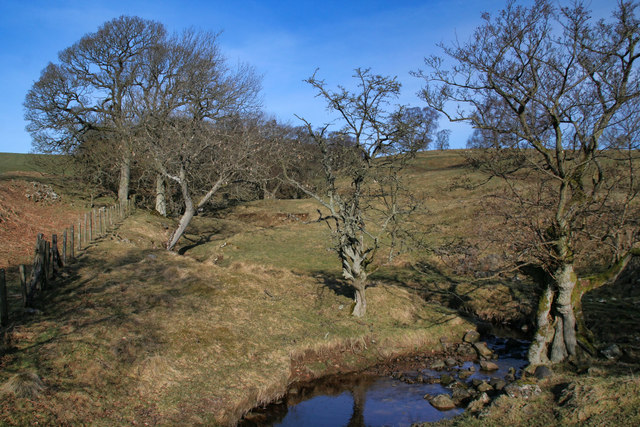
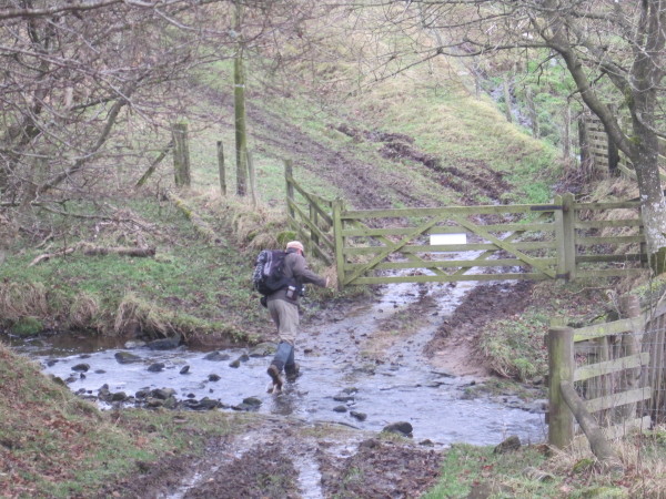
The cleugh, which is the local term for a deep and narrow ravine, is surrounded by rolling hills and lush greenery. It is characterized by its dramatic landscape, with steep slopes covered in heather and ancient woodlands. The valley is dissected by a small stream, adding to its natural beauty and providing a peaceful soundtrack to the area.

The flora and fauna of Broomhope Cleugh are diverse and abundant. The valley is home to a variety of wildflowers, including bluebells and primroses, which create a vibrant tapestry of colors during the spring and summer months. The woodlands are filled with oak, birch, and rowan trees, providing a rich habitat for a wide range of bird species, including buzzards and owls.

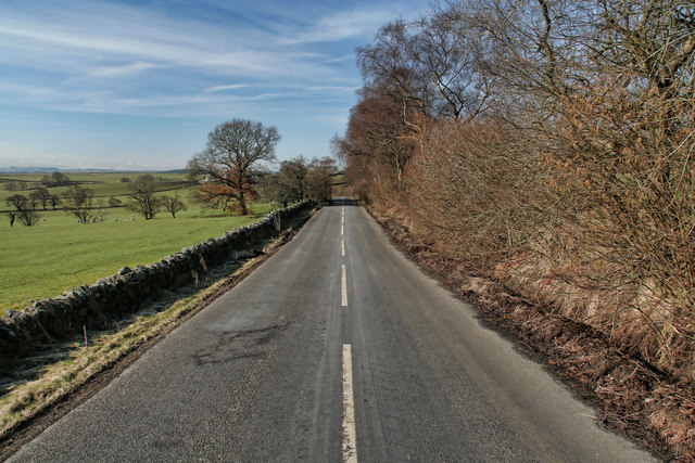
For those who enjoy outdoor activities, Broomhope Cleugh offers a network of walking trails and footpaths, allowing visitors to explore the valley and its surroundings. The trails vary in difficulty, catering to both casual strollers and experienced hikers. Along the way, walkers can enjoy breathtaking views of the valley and the surrounding Northumberland countryside.

Overall, Broomhope Cleugh is a natural haven that showcases the beauty of Northumberland's landscape. Its peaceful atmosphere, stunning scenery, and diverse wildlife make it a must-visit destination for nature lovers and those seeking a break from the hustle and bustle of everyday life.

If you have any feedback on the listing, please let us know in the comments section below.

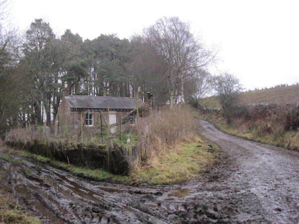
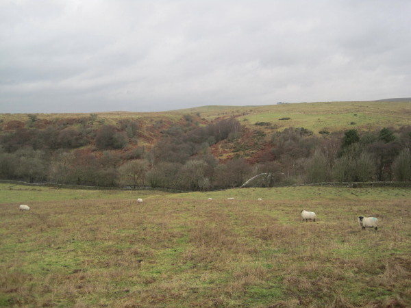
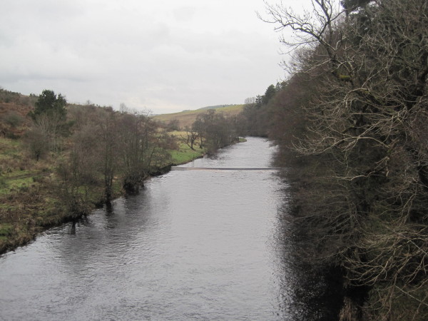
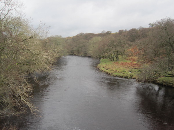
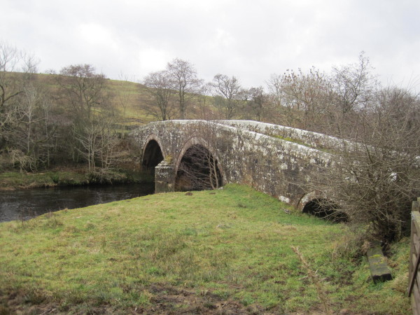
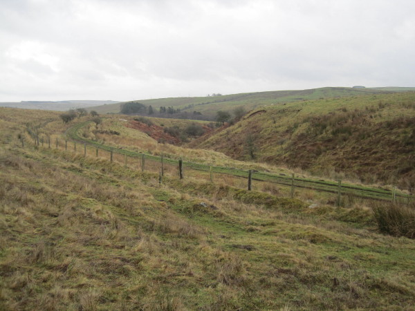
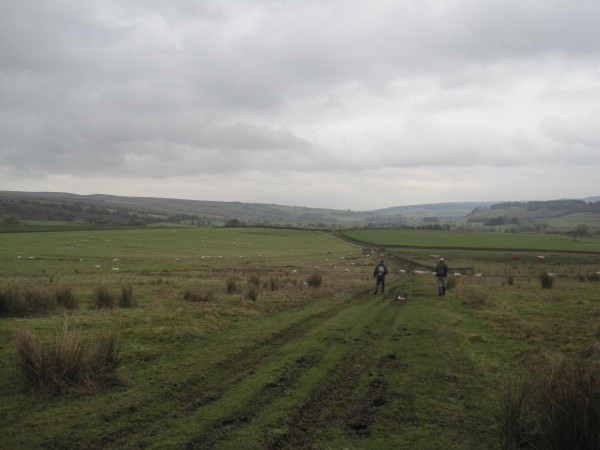
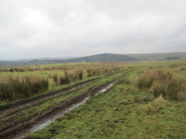
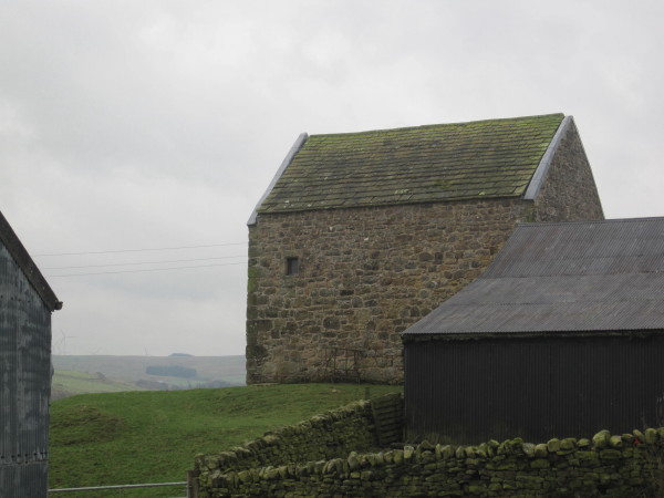
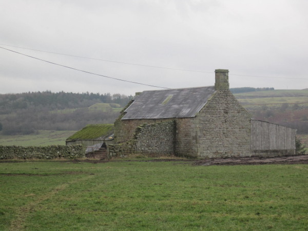
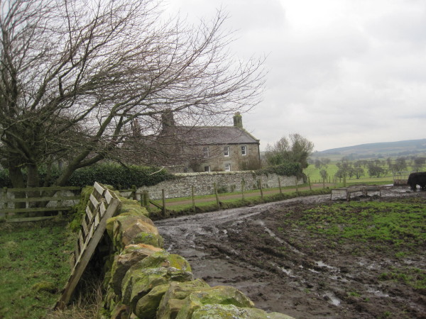
Broomhope Cleugh Images

Images are sourced within 2km of 55.148723/-2.1867325 or Grid Reference NY8883. Thanks to Geograph Open Source API. All images are credited.

Lisle Burn View looking up Lisle Cleugh.
Lisle Burn
View looking up Lisle Cleugh.
Hot Hill Road crossing Hothill Burn at Hothill Wood.
Hot Hill
Road crossing Hothill Burn at Hothill Wood.
Platelayer's Hut, Wannie Line near Redesmouth
Interior of Platelayer's Hut, Wannie Line near Redesmouth
Crossing Cottage near Rede Bridge
River Rede Valley and Rede Bridge
River Rede from Rede Bridge
Rede Bridge and the River Rede
By-way towards Rede Bridge
By-way towards Hole
By-way towards Hole
By-Way towards Redesmouth or Rede Bridge
Hole Bastle (Bellingham) This bastle is 16th century in date and is built partly over a Bronze Age round cairn. The bastle overlooks the valley of the River Rede and is well preserved. The building measures 10.5m by 6.6m in plan and stands two storeys high, measuring 14m tall to the tops of the gables. The original entrance into the ground floor lies through the west wall, but there is now another later entrance through the east side. On the outside of the bastle is a stone staircase which leads up to the first floor. Some of the windows were inserted in the 19th century, but original 16th century ones are visible in the east and north walls. Inside the bastle, the ground floor is covered by a barrel vault and there is a ladder hole for access to the first floor. Here there are wall cupboards, a fireplace and a stair to the attic. This is Grade II* Listed Building and a Scheduled Monument protected by law.
<span class="nowrap"><a title="http://www.keystothepast.info/durhamcc/K2P.nsf/K2PDetail?readform&PRN=N8064" rel="nofollow ugc noopener" href="http://www.keystothepast.info/durhamcc/K2P.nsf/K2PDetail?readform&PRN=N8064">Link</a><img style="margin-left:2px;" alt="External link" title="External link - shift click to open in new window" src="https://s1.geograph.org.uk/img/external.png" width="10" height="10"/></span>
Hole Bastle (Bellingham)
This bastle is 16th century in date and is built partly over a Bronze Age round cairn. The bastle overlooks the valley of the River Rede and is well preserved. The building measures 10.5m by 6.6m in plan and stands two storeys high, measuring 14m tall to the tops of the gables. The original entrance into the ground floor lies through the west wall, but there is now another later entrance through the east side. On the outside of the bastle is a stone staircase which leads up to the first floor. Some of the windows were inserted in the 19th century, but original 16th century ones are visible in the east and north walls. Inside the bastle, the ground floor is covered by a barrel vault and there is a ladder hole for access to the first floor. Here there are wall cupboards, a fireplace and a stair to the attic. This is Grade II* Listed Building and a Scheduled Monument protected by law. LinkExternal link
Shawbush near Hole, Bellingham
Ford and By-Way through Conheath Burn
Hole Farmhouse (Bellingham) A late 18th or early 19th century farmhouse.
<span class="nowrap"><a title="http://www.keystothepast.info/durhamcc/K2P.nsf/K2PDetail?readform&PRN=N14031" rel="nofollow ugc noopener" href="http://www.keystothepast.info/durhamcc/K2P.nsf/K2PDetail?readform&PRN=N14031">Link</a><img style="margin-left:2px;" alt="External link" title="External link - shift click to open in new window" src="https://s1.geograph.org.uk/img/external.png" width="10" height="10"/></span>
Hole Farmhouse (Bellingham)
A late 18th or early 19th century farmhouse. LinkExternal link
The River Rede. Viewed from Redes bridge.
The River Rede.
Viewed from Redes bridge.
Farmland track that leads down to the River Rede. An evening walk.
Farmland track that leads down to the River Rede.
An evening walk.
Show me another place!

Broomhope Cleugh is located at Grid Ref: NY8883 (Lat: 55.148723, Lng: -2.1867325)

Unitary Authority: Northumberland

Police Authority: Northumbria

What 3 Words

///torched.reshaping.uncouth. Near Corsenside, Northumberland

Related Wikis

Redesmouth

Redesmouth is a village in Northumberland, England, just over 1 mile (1.6 km) to the south-east of Bellingham. == Governance == Redesmouth is in the parliamentary...

Reedsmouth railway station

Reedsmouth is a closed railway station in Northumberland, England. It was a junction station where the Wansbeck Railway (Morpeth to Reedsmouth) joined...

Woodburn railway station

Woodburn was a stone-built railway station with substantial goods sidings in Northumberland, on the Wansbeck Railway between Morpeth and Reedsmouth. It...

River Rede

The Rede is a river in Northumberland, England. The river rises on Carter Fell on the Anglo-Scottish border feeding Catcleugh Reservoir and joins the River...

Nearby Amenities

Located within 500m of 55.148723,-2.1867325
Power: pole
Lat/Long: 55.1470825/-2.1929184
Power: pole
Lat/Long: 55.1475518/-2.1918171
Power: pole
Lat/Long: 55.1480319/-2.1906948
Power: pole
Lat/Long: 55.1484867/-2.1896335
Power: pole
Lat/Long: 55.1489632/-2.1885449
Power: pole
Lat/Long: 55.1494361/-2.1874794
Power: pole
Lat/Long: 55.1495564/-2.1852443
Power: pole
Lat/Long: 55.1496291/-2.1838471
Power: pole
Lat/Long: 55.1496938/-2.1824832
Power: pole
Lat/Long: 55.1497772/-2.1810866
Power: pole
Lat/Long: 55.1498469/-2.1797049
Barrier: cattle_grid
Lat/Long: 55.1510604/-2.1854917
The data included in this document is from www.openstreetmap.org. The data is made available under ODbL.

Have you been to Broomhope Cleugh?

Leave your review of Broomhope Cleugh below (or comments, questions and feedback).