Leek

Settlement in Staffordshire Staffordshire Moorlands

England

Leek

Old Milepost by the A53, Buxton Road, Leek Parish The milestone is located north west of Haregate, on the verge in front of drystone wall and hedge, on the south east side of road. Parish of Leek (Staffordshire Moorlands District). Cast iron post, green iron bobbin design, erected by the Leek & Hassop, Middlehills & Buxton turnpike trust in the 19th century. The milestone appears to have been relocated from the farm junction further North.

Inscription reads:- : LEEK / 1 / MILE : : BUXTON / 11 / MILES : : WM GREEN. MACCLESFIELD :

Grade II Listed. List Entry Number: 1268634
<span class="nowrap"><a title="https://historicengland.org.uk/listing/the-list/list-entry/1268634" rel="nofollow ugc noopener" href="https://historicengland.org.uk/listing/the-list/list-entry/1268634">Link</a><img style="margin-left:2px;" alt="External link" title="External link - shift click to open in new window" src="https://s1.geograph.org.uk/img/external.png" width="10" height="10"/></span>

Milestone Society National ID: ST_LKBX01
Old Milepost by the A53, Buxton Road, Leek Parish Credit: J Higgins

Leek is a market town located in the county of Staffordshire, England. Situated on the edge of the Peak District National Park, it lies approximately 10 miles north-east of Stoke-on-Trent. With a population of around 20,000, it serves as a bustling center for the surrounding rural areas.

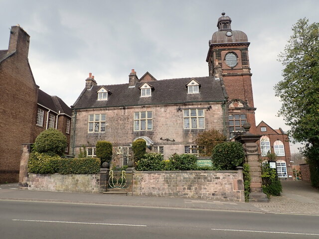
The town of Leek has a rich history, dating back to Saxon times. It grew significantly during the Industrial Revolution when it became renowned for its textile industry, particularly silk weaving and dyeing. Many of the historic buildings in the town, including the splendid Victorian Butter Market, reflect this prosperous period.

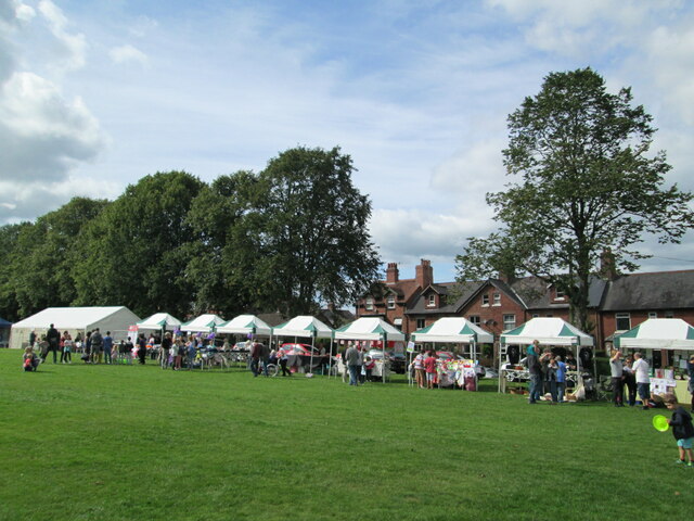
Leek is known for its vibrant market tradition, with a weekly market taking place every Wednesday and a monthly fine food market, which attracts visitors from both the local area and further afield. The town center is a hub of activity, offering a diverse range of shops, cafes, and restaurants, as well as a variety of independent boutiques and antique shops.

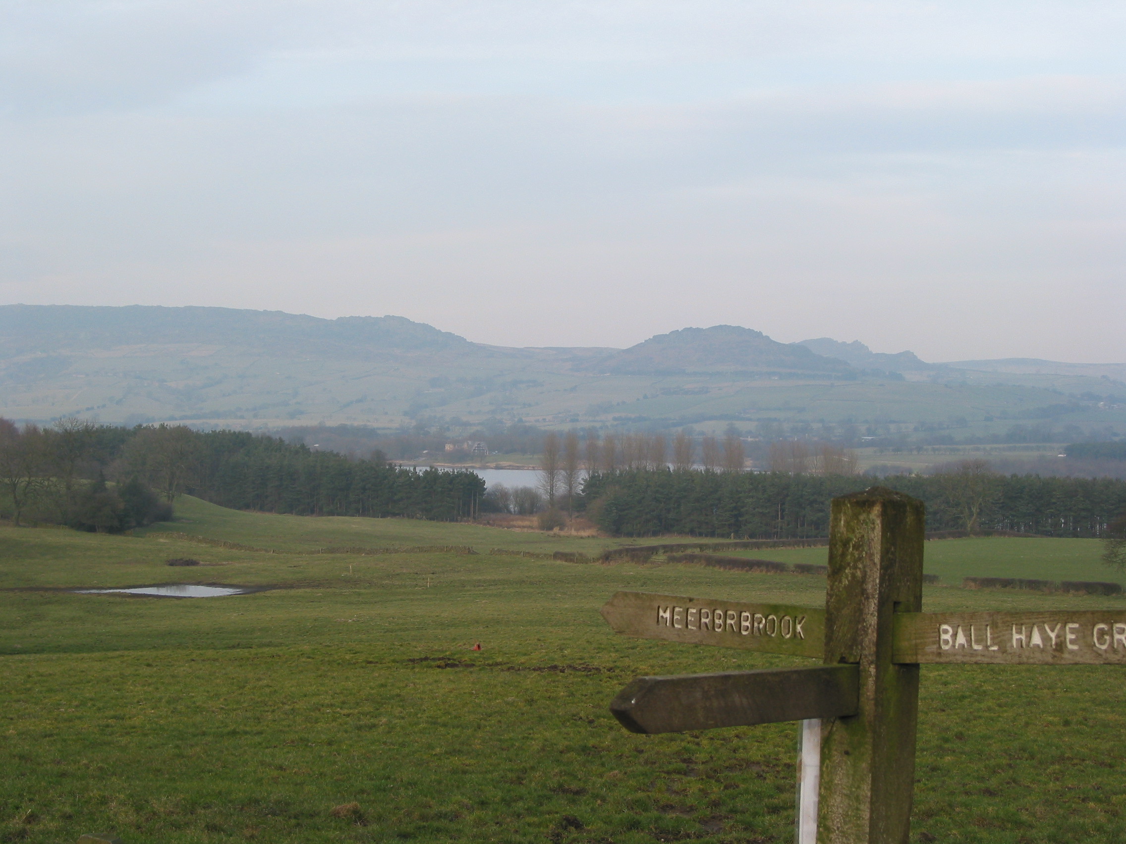
Surrounded by picturesque countryside, Leek offers plenty of opportunities for outdoor activities. The nearby Roaches and Ramshaw Rocks are popular destinations for hikers and climbers, providing stunning panoramic views of the surrounding countryside. In addition, Rudyard Lake, just a few miles away, offers boating, fishing, and walking opportunities.

Leek is also home to several notable landmarks, such as St. Edward's Church, which dates back to the 12th century, and the Nicholson Institute, a cultural and community center housed in a beautiful Victorian building.

Overall, Leek, Staffordshire, is a charming market town that seamlessly blends its rich history with a bustling present-day atmosphere, offering a range of amenities and outdoor pursuits for residents and visitors alike.

If you have any feedback on the listing, please let us know in the comments section below.
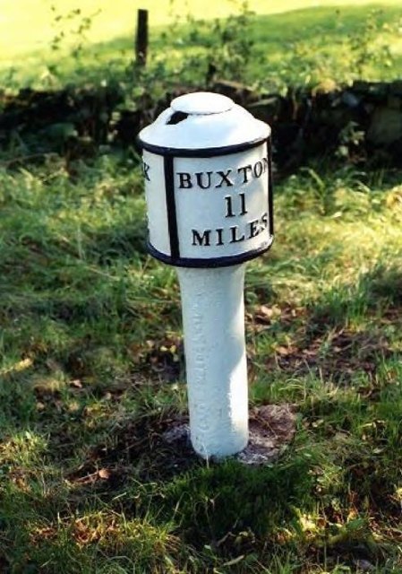
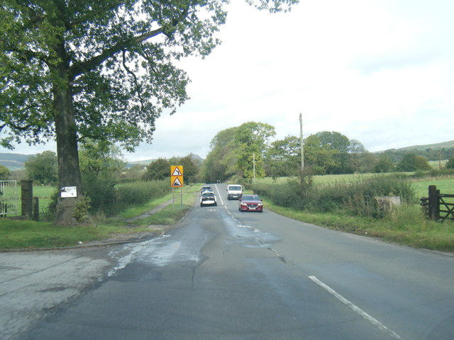
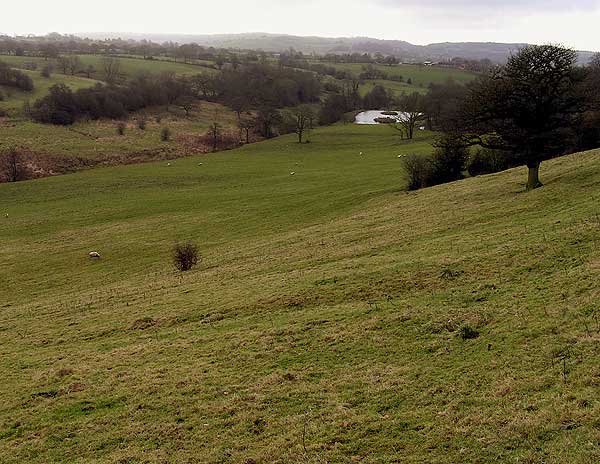
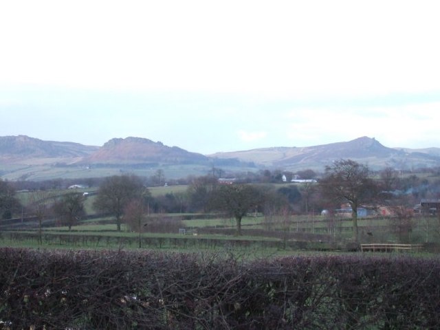
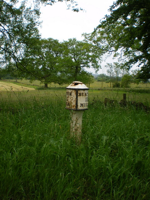
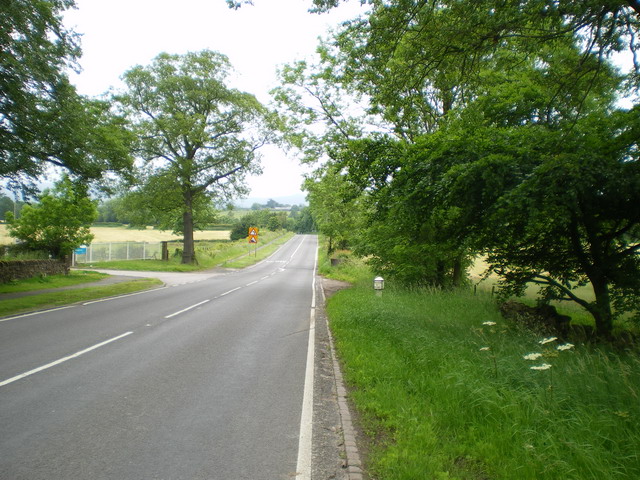
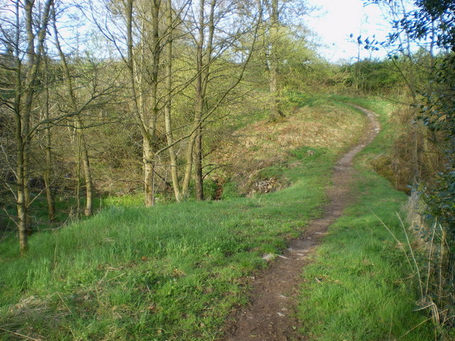
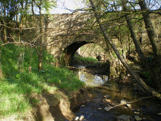
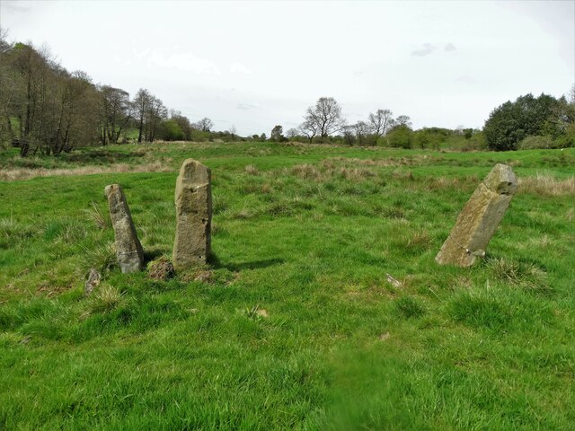
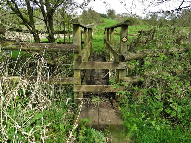
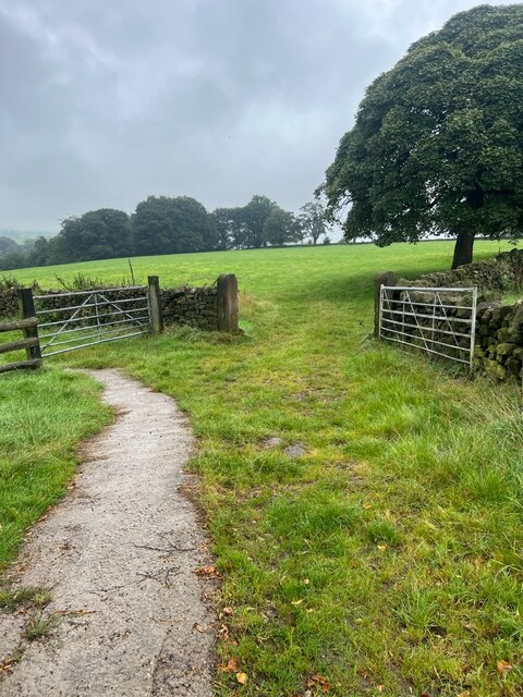
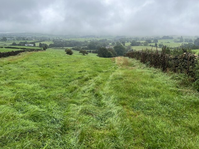
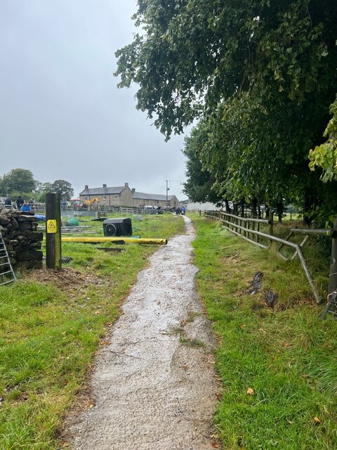
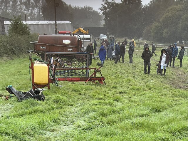
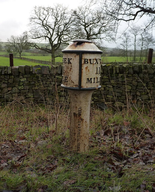
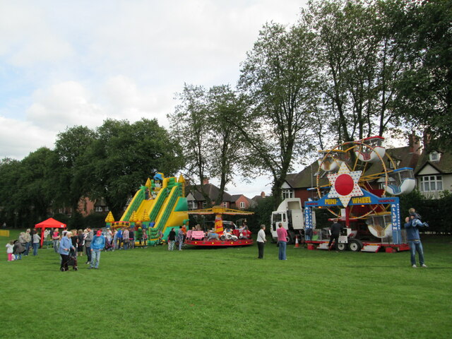
Leek Images

Images are sourced within 2km of 53.105666/-2.021447 or Grid Reference SJ9856. Thanks to Geograph Open Source API. All images are credited.

Old Milepost by the A53, Buxton Road, Leek Parish The milestone is located north west of Haregate, on the verge in front of drystone wall and hedge, on the south east side of road. Parish of Leek (Staffordshire Moorlands District). Cast iron post, green iron bobbin design, erected by the Leek & Hassop, Middlehills & Buxton turnpike trust in the 19th century. The milestone appears to have been relocated from the farm junction further North.

Inscription reads:- : LEEK / 1 / MILE : : BUXTON / 11 / MILES : : WM GREEN. MACCLESFIELD :

Grade II Listed. List Entry Number: 1268634
<span class="nowrap"><a title="https://historicengland.org.uk/listing/the-list/list-entry/1268634" rel="nofollow ugc noopener" href="https://historicengland.org.uk/listing/the-list/list-entry/1268634">Link</a><img style="margin-left:2px;" alt="External link" title="External link - shift click to open in new window" src="https://s1.geograph.org.uk/img/external.png" width="10" height="10"/></span>

Milestone Society National ID: ST_LKBX01
Old Milepost by the A53, Buxton Road, Leek Parish
The milestone is located north west of Haregate, on the verge in front of drystone wall and hedge, on the south east side of road. Parish of Leek (Staffordshire Moorlands District). Cast iron post, green iron bobbin design, erected by the Leek & Hassop, Middlehills & Buxton turnpike trust in the 19th century. The milestone appears to have been relocated from the farm junction further North. Inscription reads:- : LEEK / 1 / MILE : : BUXTON / 11 / MILES : : WM GREEN. MACCLESFIELD : Grade II Listed. List Entry Number: 1268634 LinkExternal link Milestone Society National ID: ST_LKBX01
A53 Buxton Road leaving Leek
Hidden valley Valley of brook running southwards towards the River Churnet
Hidden valley
Valley of brook running southwards towards the River Churnet
Roaches View across the fields towards The Roaches and the Winking Man.  See <a href="https://www.geograph.org.uk/gridref/SK0062">SK0062</a> for closeup of these rocks.
Roaches
View across the fields towards The Roaches and the Winking Man. See SK0062 for closeup of these rocks.
Edge End milepost detail One of a small number of cast iron mileposts along the Leek to Buxton road, most of which are in much the same parlous state as this one.
Edge End milepost detail
One of a small number of cast iron mileposts along the Leek to Buxton road, most of which are in much the same parlous state as this one.
The Edge End milepost in its setting Beside the A53, and more or less opposite the entrance to the Leek water treatment works.
The Edge End milepost in its setting
Beside the A53, and more or less opposite the entrance to the Leek water treatment works.
Narrow bridge beside the road to Thorncliffe This narrow path, and a bridge over the stream, lie beside the modern lane up from Haregate to Thorncliffe. It's well-used by horseriders, but not much else.
Narrow bridge beside the road to Thorncliffe
This narrow path, and a bridge over the stream, lie beside the modern lane up from Haregate to Thorncliffe. It's well-used by horseriders, but not much else.
Thorncliffe Lane bridge The bridge over the stream on the lane that leads up to Thorncliffe village.
Thorncliffe Lane bridge
The bridge over the stream on the lane that leads up to Thorncliffe village.
Countryside east of Leek Below Holly House
Countryside east of Leek
Below Holly House
Footbridge in the valley West of Hare House
Footbridge in the valley
West of Hare House
Farm gates The track leading to the fields.
Farm gates
The track leading to the fields.
Narrow grass field A narrow field marked on the OS map.
Narrow grass field
A narrow field marked on the OS map.
Farm track The track leading back to Dee Bank farm.
Farm track
The track leading back to Dee Bank farm.
Farm sale A few of the final lots for sale shortly, it is raining quite heavily now so not many viewers to be tempted to buy.
Farm sale
A few of the final lots for sale shortly, it is raining quite heavily now so not many viewers to be tempted to buy.
The Edge End milepost The milepost was erected by the local  Leek & Hassop, Middlehills & Buxton turnpike trust in the 19th century, and possibly (although the old maps don't seem to support this theory) it originally lay 100 yards or so to the north, outside the entrance to Edge End Farm. It was Grade II listed <span class="nowrap"><a title="https://historicengland.org.uk/listing/the-list/list-entry/1268634" rel="nofollow ugc noopener" href="https://historicengland.org.uk/listing/the-list/list-entry/1268634">Link</a><img style="margin-left:2px;" alt="External link" title="External link - shift click to open in new window" src="https://s1.geograph.org.uk/img/external.png" width="10" height="10"/></span> & <span class="nowrap"><a title="https://britishlistedbuildings.co.uk/101268634-milepost-at-ngr-sk-00012-57696-leek" rel="nofollow ugc noopener" href="https://britishlistedbuildings.co.uk/101268634-milepost-at-ngr-sk-00012-57696-leek">Link</a><img style="margin-left:2px;" alt="External link" title="External link - shift click to open in new window" src="https://s1.geograph.org.uk/img/external.png" width="10" height="10"/></span> in 1972.
The Edge End milepost
The milepost was erected by the local Leek & Hassop, Middlehills & Buxton turnpike trust in the 19th century, and possibly (although the old maps don't seem to support this theory) it originally lay 100 yards or so to the north, outside the entrance to Edge End Farm. It was Grade II listed LinkExternal link & LinkExternal link in 1972.
Funfair in Leek A funfair on Westwood Recreation Ground in Leek.
Funfair in Leek
A funfair on Westwood Recreation Ground in Leek.
Funfair in Leek Stalls at the fair on Westwood Recreation Ground in Leek.
Funfair in Leek
Stalls at the fair on Westwood Recreation Ground in Leek.
Greystones House This attractive 17th century house in Leek is a grade II* listed building. The tower behind belongs to the Nicholson Institute, now Leek Public Library. The Institute was built in 1882
Greystones House
This attractive 17th century house in Leek is a grade II* listed building. The tower behind belongs to the Nicholson Institute, now Leek Public Library. The Institute was built in 1882
Show me another place!

Leek is located at Grid Ref: SJ9856 (Lat: 53.105666, Lng: -2.021447)

Administrative County: Staffordshire

District: Staffordshire Moorlands

Police Authority: Staffordshire

What 3 Words

///villas.regulates.scripted. Near Leek, Staffordshire

Nearby Locations

Leek Leek

Related Wikis

Nicholson War Memorial

The Nicholson War Memorial in Leek, Staffordshire, England is a 1925 war memorial. It was commissioned by local manufacturer Sir Arthur Nicholson and his...

Buxton & Leek College

Buxton & Leek College is a college of Further and Higher Education operating at their campuses and facilities in Buxton, Derbyshire, Leek, Staffordshire...

Leek, Staffordshire

Leek is a market town and civil parish in the county of Staffordshire, England, on the River Churnet. It is situated about 10 miles (16 km) north east...

St Edward the Confessor's Church, Leek

St Edward the Confessor's Church is an active Anglican church in Leek, Staffordshire, England. The building, which dates back to the 13th century, is listed...

Staffordshire Moorlands

Staffordshire Moorlands is a local government district in Staffordshire, England. Its council, Staffordshire Moorlands District Council, is based in Leek...

All Saints' Church, Leek

All Saints' Church is an Anglican church in Leek, Staffordshire, England. It is a Grade I listed building. It was designed by Norman Shaw, and built in...

Leek High School

Leek High School is a mixed upper school (termed 'high school') located in Leek, Staffordshire, England. As of 2021, the number of students at the school...

The Meadows School, Leek

The Meadows School is a mixed special school co-located with Leek High School in Leek, Staffordshire, England.In 2014 Ofsted said “Students make good...

Nearby Amenities

Located within 500m of 53.105666,-2.021447
Traffic Signals
Lat/Long: 53.1042013/-2.025789
Traffic Signals
Lat/Long: 53.1070483/-2.0208514
Leek
Name En: Leek
Name Ru: Лик
Place: town
Population: 20768
Wikidata: Q2070717
Wikipedia: en:Leek, Staffordshire
Lat/Long: 53.1057636/-2.0242837
Crossing
Crossing: marked
Crossing Markings: yes
Lat/Long: 53.1066801/-2.0249618
Genetix Gym
Leisure: fitness_centre
Lat/Long: 53.1068445/-2.0283742
Scout Hall
Ye Old Grammar School
Operator: 2nd Leek Scout Group
Lat/Long: 53.1068137/-2.0281719
Post Box
Post Box Type: pillar
Ref: ST13 711
Royal Cypher: EIIR
Royal Cypher Wikidata: Q33102113
Lat/Long: 53.1066263/-2.0255738
Telephone
Defibrillator
Booth: K6
Covered: booth
Defibrillator Location: inside old red phone box at the corner of the Market Place, Leek
Emergency: defibrillator
Listed Status: Grade II
Man Made: telephone_box
Old Phone: +44 1538 383596
Postal Code: ST13 5HJ
Lat/Long: 53.1066263/-2.02561
Fountain
Lat/Long: 53.1073568/-2.0244697
Clinic
Moorlands House
Healthcare: clinic
Note: not sure if this is actually a clinic or not
Operator: North Staffordshire NHS Trust
Lat/Long: 53.1072806/-2.0241641
Crossing
Button Operated: yes
Crossing: traffic_signals
Crossing Island: no
Crossing Ref: puffin
Lat/Long: 53.106829/-2.0241084
University
Buxton & Leek College
Operator: University of Derby
Wheelchair: yes
Lat/Long: 53.1073174/-2.0232792
Pub
Benks Free House
Old Name: Union Inn
Toilets Wheelchair: no
Wheelchair: no
Lat/Long: 53.107168/-2.022894
University
Tovell Building, Buxton & Leek College
Toilets Wheelchair: yes
Wheelchair: yes
Lat/Long: 53.1076856/-2.0225981
Traffic Signals
Lat/Long: 53.1073756/-2.018672
Crossing
Crossing: uncontrolled
Crossing Ref: zebra
Lat/Long: 53.1043679/-2.0218271
Post Box
Ref: ST13 723
Lat/Long: 53.1048476/-2.0164947
Restaurant
Pabna
Addr Housenumber: 16-18
Addr Postcode: ST13 5AS
Addr Street: Ashbourne Road
Cuisine: indian
Delivery: yes
Fhrs Id: 1259811
Source Addr: FHRS Open Data
Takeaway: yes
Lat/Long: 53.1048496/-2.019065
Post Box
Ref: ST13 708
Lat/Long: 53.1042394/-2.0199224
Gills General Store
Shop: convenience
Lat/Long: 53.1031451/-2.0226411
Bicycle Parking
Bicycle Parking: stands
Capacity: 12
Lat/Long: 53.1042311/-2.0219869
Old Phone: +44 1538 383678
Removed Amenity: telephone
Lat/Long: 53.1052522/-2.0213496
Fast Food
Moorland Balti
Cuisine: indian
Lat/Long: 53.1047732/-2.0196912
Cafe
Hungry Horse Cafe
Lat/Long: 53.1046298/-2.0228319
NFU Mutual Insurance
Brand: NFU Mutual
Brand Wikidata: Q6953815
Office: insurance
Lat/Long: 53.1042529/-2.025209
Post Box
Check Date: 2021-05-23
Collection Times: Mo-Fr 09:00, Sa 07:00
Ref: ST13 713
Royal Cypher: GVIR
Royal Cypher Wikidata: Q33102169
Lat/Long: 53.1024874/-2.0244746
Peak Weavers Hotel
Addr Housenumber: 21
Addr Postcode: ST13 5NW
Addr Street: King Street
Fhrs Id: 1259701
Source Addr: FHRS Open Data
Tourism: hotel
Lat/Long: 53.1033814/-2.0258057
The Green Man Motel
Tourism: hotel
Lat/Long: 53.1032178/-2.0250381
Barrier: bollard
Lat/Long: 53.1064057/-2.0284419
Barrier: bollard
Lat/Long: 53.10645/-2.0288196
Old Phone: +44 1538 398363
Removed Amenity: telephone
Lat/Long: 53.103509/-2.0275583
Old Phone: +44 1538 383629
Postal Code: ST13 5EF
Removed Amenity: telephone
Lat/Long: 53.1053237/-2.0266509
Post Box
Collection Times: Mo-Fr 18:00; Sa 12:15
Post Box Design: type_c
Post Box Type: pillar
Ref: ST13 1300
Royal Cypher: EIIR
Royal Cypher Wikidata: Q33102113
Lat/Long: 53.1056317/-2.02667
Cafe
Duck Goose
Lat/Long: 53.105865/-2.0268927
Post Box
Ref: ST13 730
Lat/Long: 53.1075282/-2.0151697
Lloyds Pharmacy
Shop: chemist
Lat/Long: 53.1059157/-2.0196175
Barrier: bollard
Lat/Long: 53.1061227/-2.0208327
Crossing
Crossing: zebra
Lat/Long: 53.1061227/-2.020934
The Corner Cupboard Convenience Store
Shop: convenience
Lat/Long: 53.1062052/-2.0169027
Barrier: bollard
Lat/Long: 53.1055008/-2.0205504
Noexit: yes
Lat/Long: 53.1062725/-2.0223209
Bus Stop
Leek Bus Station
Bus: yes
Naptan AtcoCode: 3800C809200
Naptan CommonName: Bus Station
Naptan Indicator: adj
Naptan Landmark: Leek Bus Station
Naptan LocalityName: Leek Town Centre
Naptan NaptanCode: stadagmj
Naptan ShortCommonName: Bus Stn
Naptan Street: Cromwell Terrace
Naptan Verified: no
Note: Variable Bay
Public Transport: platform
Source: naptan_import
Lat/Long: 53.104694/-2.0213384
Bus Stop
Staffs Moorlands District Coucnil
Bus: yes
Naptan AtcoCode: 3800C810100
Naptan Bearing: N
Naptan CommonName: Staffs Moorlands District Coucnil
Naptan Indicator: Opp
Naptan Landmark: Council Offices
Naptan Street: Stockwell Street
Naptan Verified: no
Public Transport: platform
Source: naptan_import
Lat/Long: 53.1067168/-2.0244231
Bus Stop
Staffs Moorlands District Council
Bus: yes
Naptan AtcoCode: 3800C810101
Naptan Bearing: E
Naptan CommonName: Staffs Moorlands District Council
Naptan Indicator: Adj
Naptan Landmark: Market Street
Naptan Street: Stockwell Street
Naptan Verified: no
Public Transport: platform
Source: naptan_import
Lat/Long: 53.1069417/-2.0238406
Bus Stop
Osbourne Street
Bus: yes
Naptan AtcoCode: 3800C819801
Naptan Bearing: W
Naptan CommonName: Osbourne Street
Naptan Indicator: Adj
Naptan Landmark: Osbourne Street
Naptan Street: Buxton Road
Naptan Verified: no
Public Transport: platform
Source: naptan_import
Lat/Long: 53.1075992/-2.0156401
Bus Stop
Prince Street
Bus: yes
Naptan AtcoCode: 3800C819802
Naptan Bearing: E
Naptan CommonName: Prince Street
Naptan Indicator: Adj
Naptan Landmark: Prince Street
Naptan Street: Buxton Road
Naptan Verified: no
Public Transport: platform
Source: naptan_import
Lat/Long: 53.1077071/-2.01567
Bus Stop
Parker Street
Bench: no
Bin: no
Bus: yes
Naptan AtcoCode: 3800C821101
Naptan Bearing: E
Naptan CommonName: Parker Street
Naptan Indicator: Adj
Naptan Landmark: Parker Street
Naptan Street: Ashbourne Road
Naptan Verified: no
Public Transport: platform
Shelter: no
Source: naptan_import
Tactile Paving: no
Lat/Long: 53.1048935/-2.0150864
Bus Stop
Parker Street
Bench: no
Bin: no
Bus: yes
Naptan AtcoCode: 3800C821201
Naptan Bearing: W
Naptan CommonName: Parker Street
Naptan Indicator: Opp
Naptan Landmark: Parker Street
Naptan Street: Ashbourne Road
Naptan Verified: no
Public Transport: platform
Shelter: no
Source: naptan_import
Tactile Paving: no
Lat/Long: 53.1048216/-2.0154449
Bus Stop
Vicarage Road
Bus: yes
Naptan AtcoCode: 3800C821701
Naptan Bearing: N
Naptan CommonName: Vicarage Road
Naptan Indicator: Adj
Naptan Landmark: Vicarage Rd
Naptan Street: Ball Haye Rd
Naptan Verified: no
Public Transport: platform
Source: naptan_import
Lat/Long: 53.1092255/-2.0207496
Bus Stop
Rose Bank Street
Bus: yes
Naptan AtcoCode: 3800C821801
Naptan Bearing: S
Naptan CommonName: Rose Bank Street
Naptan Indicator: Adj
Naptan Landmark: Rose Bank St
Naptan Street: Ball Haye Rd
Naptan Verified: no
Public Transport: platform
Source: naptan_import
Lat/Long: 53.1074996/-2.0208384
Bus Stop
Rose Bank Street
Bus: yes
Naptan AtcoCode: 3800C821802
Naptan Bearing: NW
Naptan CommonName: Rose Bank Street
Naptan Indicator: Opp
Naptan Landmark: Rose Bank St
Naptan Street: Ball Haye Rd
Naptan Verified: no
Public Transport: platform
Source: naptan_import
Lat/Long: 53.1076433/-2.0211074
Bus Stop
King Street
Bench: no
Bin: no
Bus: yes
Lit: yes
Naptan AtcoCode: 3800C822001
Naptan Bearing: SW
Naptan CommonName: King Street
Naptan Indicator: Adj
Naptan Landmark: King St
Naptan Street: Broad St
Naptan Verified: no
Public Transport: platform
Shelter: no
Source: naptan_import
Tactile Paving: no
Lat/Long: 53.1037229/-2.0267216
Bus Stop
King Street
Bench: no
Bin: no
Bus: yes
Lit: yes
Naptan AtcoCode: 3800C822002
Naptan Bearing: NE
Naptan CommonName: King Street
Naptan Indicator: Opp
Naptan Landmark: King St
Naptan Street: Broad St
Naptan Verified: no
Public Transport: platform
Shelter: no
Source: naptan_import
Tactile Paving: no
Lat/Long: 53.1039297/-2.0265276
Bus Stop
Leek Town Centre, Compton / Selbourne Road
Bench: no
Bin: no
Bus: yes
Naptan AtcoCode: 3800C822201
Naptan Bearing: S
Naptan CommonName: Selbourne Road
Naptan Indicator: opp
Naptan Landmark: Selbourne Road
Naptan LocalityName: Leek Town Centre
Naptan NaptanCode: stagjwdp
Naptan ShortCommonName: Selbourne Rd
Naptan Street: Compton
Naptan Verified: no
Public Transport: platform
Shelter: no
Source: naptan_import
Tactile Paving: no
Lat/Long: 53.1014402/-2.0238973
Bus Stop
Leek Town Centre, Compton / Selbourne Road
Bench: no
Bin: no
Bus: yes
Lit: yes
Naptan AtcoCode: 3800C822202
Naptan Bearing: N
Naptan CommonName: Selbourne Road
Naptan Indicator: adj
Naptan Landmark: Selbourne Road
Naptan LocalityName: Leek Town Centre
Naptan NaptanCode: stagjwdt
Naptan ShortCommonName: Selbourne Rd
Naptan Street: Compton
Naptan Verified: no
Public Transport: platform
Shelter: no
Source: naptan_import
Tactile Paving: no
Lat/Long: 53.1017368/-2.0241514
Bus Stop
Leek Town Centre, Compton / Duke Street
Bus: yes
Naptan AtcoCode: 3800C822401
Naptan Bearing: N
Naptan BusStopType: CUS
Naptan CommonName: Duke Street
Naptan Indicator: opp
Naptan Landmark: St Mary's Church
Naptan LocalityName: Leek Town Centre
Naptan ShortCommonName: Duke St
Naptan Street: Compton
Naptan Verified: no
Public Transport: platform
Source: naptan_import
Lat/Long: 53.1036243/-2.0251682
Bus Stop
Leek Town Centre, Compton / Duke Street
Bench: no
Bus: yes
Naptan AtcoCode: 3800C822402
Naptan Bearing: S
Naptan CommonName: Duke Street
Naptan Indicator: adj
Naptan Landmark: Brook Street
Naptan LocalityName: Leek Town Centre
Naptan NaptanCode: stagjwgd
Naptan ShortCommonName: Duke St
Naptan Street: Compton
Naptan Verified: no
Public Transport: platform
Shelter: no
Source: naptan_import
Lat/Long: 53.1032739/-2.0247497
Bus Stop
Moorland Medical Centre
Bus: yes
Naptan AtcoCode: 3800C892501
Naptan Bearing: W
Naptan CommonName: Moorland Medical Centre
Naptan Indicator: Adj
Naptan Landmark: Moorland Medical Centre
Naptan Street: Buxton Rd
Naptan Verified: no
Public Transport: platform
Source: naptan_import
Lat/Long: 53.1070412/-2.0203303
Bus Stop
Moorland Medical Centre
Bus: yes
Naptan AtcoCode: 3800C892502
Naptan Bearing: E
Naptan CommonName: Moorland Medical Centre
Naptan Indicator: Opp
Naptan Landmark: Moorland Medical Centre
Naptan Street: Buxton Rd
Naptan Verified: no
Public Transport: platform
Source: naptan_import
Lat/Long: 53.1071581/-2.0202109
Pub
The Blue Mugge
Addr Housenumber: 17
Addr Postcode: ST13 6LJ
Addr Street: Osborne Street
Fhrs Id: 1259739
Source Addr: FHRS Open Data
Toilets Wheelchair: no
Wheelchair: no
Lat/Long: 53.1068522/-2.0160221
Turning Circle
Lat/Long: 53.1013746/-2.0228605
Crossing
Crossing: traffic_signals
Crossing Ref: puffin
Lat/Long: 53.1054371/-2.0214049
Traffic Signals
Traffic Signals: signal
Lat/Long: 53.1057641/-2.0209754
Pharmacy
Superdrug
Brand: Superdrug
Brand Wikidata: Q7643261
Brand Wikipedia: en:Superdrug
Healthcare: pharmacy
Lat/Long: 53.1056102/-2.0226891
Pharmacy
Boots
Brand: Boots
Brand Wikidata: Q6123139
Brand Wikipedia: en:Boots (company)
Healthcare: pharmacy
Website: https://www.boots.com/stores/164-leek-derby-street-st13-6ht
Lat/Long: 53.1058915/-2.0245501
Pharmacy
Well Pharmacy
Brand: Well Pharmacy
Brand Wikidata: Q7726524
Brand Wikipedia: en:Well Pharmacy
Dispensing: yes
Drive Through: no
Healthcare: pharmacy
Website: https://finder.well.co.uk/store/leek-ball-haye-street
Lat/Long: 53.1064024/-2.020782
WHSmith
Brand: WHSmith
Brand Wikidata: Q1548712
Brand Wikipedia: en:WHSmith
Internet Access: no
Shop: books
Lat/Long: 53.1058952/-2.0246954
Disused Shop: department_store
Old Name: Wilko
Wheelchair: yes
Lat/Long: 53.104892/-2.0254597
Iceland
Brand: Iceland
Brand Wikidata: Q721810
Brand Wikipedia: en:Iceland (supermarket)
Contact Website: https://www.iceland.co.uk/store-finder/store?StoreID=1683&StoreName=LEEK
Shop: frozen_food
Lat/Long: 53.1045184/-2.0251005
Bank
Leek Building Society
Addr Housenumber: 50
Addr Postcode: ST13 5DL
Addr Street: St Edward Street
Atm: no
Lat/Long: 53.1051744/-2.0265541
White Hart
Tourism: guest_house
Lat/Long: 53.1067659/-2.0249981
Pub
One Recovery
Addr Housenumber: 1-5
Addr Postcode: ST13 5JF
Addr Street: Russell Street
Opening Hours Signed: no
Website: http://www.littlepoland.co.uk/
Lat/Long: 53.1053611/-2.0241342
J. W. Ash & Sons
Addr Housenumber: 19-21
Addr Postcode: ST13 6JN
Addr Street: Ball Haye Street
Fhrs Id: 1259703
Shop: butcher
Source Addr: FHRS Open Data
Lat/Long: 53.1064027/-2.0210279
Restaurant
Maazi Leek
Addr Housename: Cross Street Mill
Addr Postcode: ST13 6BL
Addr Street: Cross Street
Cuisine: indian
Website: http://www.the-qarma.com/
Lat/Long: 53.1052032/-2.0180026
Home Bargains
Addr Postcode: ST13 5SN
Addr Street: Pickwood Road
Brand: Home Bargains
Brand Wikidata: Q5888229
Brand Wikipedia: en:Home Bargains
Contact Website: https://storelocator.homebargains.co.uk/store/A110/The+Moorlands,+Leek,+Staffordshire
Fhrs Id: 1259907
Shop: variety_store
Source Addr: FHRS Open Data
Lat/Long: 53.1047792/-2.0253238
Fast Food
Sea & Earth Fish & Chips
Addr Postcode: ST13 5NS
Addr Street: Broad Street
Cuisine: fish_and_chips
Source Addr: FHRS Open Data
Lat/Long: 53.1034837/-2.0278232
Barrier: height
Lat/Long: 53.1083088/-2.0216218
Barrier: bollard
Lat/Long: 53.1088315/-2.0218254
Cafe
Market Kitchen Cafe
Addr Housenumber: 1
Addr Postcode: ST13 5HG
Addr Street: Stanley Street
Fhrs Id: 1259571
Source Addr: FHRS Open Data
Lat/Long: 53.1057658/-2.0255666
Barrier: bollard
Lat/Long: 53.1056183/-2.0261756
Traffic Calming: cushion
Lat/Long: 53.1081363/-2.0152572
Crossing
Crossing: uncontrolled
Crossing Markings: yes
Lat/Long: 53.1076655/-2.0188617
BBM Bargains store
Shop: variety_store
Lat/Long: 53.1046768/-2.0251556
Bar
Beyond The Pale
Addr City: Leek
Addr Housenumber: 2
Addr Postcode: ST13 5JW
Addr Street: Ball Haye Street
Smoking: outside
Lat/Long: 53.1052791/-2.0207509
Odeon Antiques
Shop: antiques
Lat/Long: 53.1041661/-2.0260827
Restaurant
The Napoli
Cuisine: italian
Lat/Long: 53.1056972/-2.0282513
Grit Bin
Lat/Long: 53.1062607/-2.0205189
Restaurant
Primo Piano
Addr Housenumber: 10a
Addr Postcode: ST13 5HW
Addr Street: Sheepmarket
Cuisine: italian_pizza;mediterranean;italian
Fhrs Id: 1259660
Lat/Long: 53.1060946/-2.0262304
Homeward Studio
Addr City: Leek
Addr Housenumber: 60B
Addr Postcode: ST13 5DL
Addr Street: St Edward Street
Shop: gift
Lat/Long: 53.1046804/-2.0263792
Community Centre
@21 Young People's Place
Operator: Leek Town Centre Youth Project
Operator Type: community
Lat/Long: 53.1064688/-2.0234759
Waste Not... Want Not!
Addr Housenumber: 15
Addr Postcode: ST13 5DR
Addr Street: St Edward Street
Addr Town: Leek
Description: Zero waste store, and a little more! Bring your own containers or buy some here.
Email: wastenot.wantnot.leek@gmail.com
Opening Hours: Tu-Fr 09:00-18:00, Sa 10:00-16:00
Phone: +441538815473
Shop: greengrocer
Lat/Long: 53.1061614/-2.0267102
Crossing
Crossing: traffic_signals
Crossing Ref: puffin
Lat/Long: 53.1053215/-2.0214589
Bicycle Parking
Bicycle Parking: bollard
Capacity: 3
Lat/Long: 53.1057578/-2.0238045
Bicycle Parking
Bicycle Parking: stands
Capacity: 2
Covered: no
Lat/Long: 53.1058496/-2.0251637
Disused Shop: e-cigarette
Old Name: E-Cig And Vaping Emporium
Lat/Long: 53.1060697/-2.026667
Fast Food
Domino's
Brand: Domino's
Brand Wikidata: Q839466
Brand Wikipedia: en:Domino's Pizza
Cuisine: pizza
Drive Through: no
Takeaway: yes
Lat/Long: 53.1059157/-2.0266626
Maleroom Barbers
Shop: hairdresser
Lat/Long: 53.1059647/-2.0258321
Mosaic
Shop: gift
Lat/Long: 53.1059704/-2.0263708
ThePhone.net
Shop: mobile_phone
Lat/Long: 53.1059708/-2.0263128
Fast Food
Abbies
Lat/Long: 53.1059435/-2.0265715
Misco’s Chocolate
Shop: chocolate
Lat/Long: 53.1060723/-2.0265634
Leek Minimarket
Shop: convenience
Lat/Long: 53.1059607/-2.0264701
Chaplins
Clothes: men
Shop: clothes
Lat/Long: 53.105969/-2.0259866
Pronto Delicatessen
Shop: deli
Lat/Long: 53.106093/-2.0261593
Hatters
Shop: coffee
Lat/Long: 53.1060868/-2.025944
Era
Shop: gift
Lat/Long: 53.1059703/-2.0262572
Cuckoo
Shop: furniture
Lat/Long: 53.1059721/-2.0261321
Becalmed
Shop: gift
Lat/Long: 53.106093/-2.0260983
Cafe
Kéik
Lat/Long: 53.1060864/-2.0260116
Pharmacy
Well Pharmacy
Brand: Well Pharmacy
Brand Wikidata: Q7726524
Brand Wikipedia: en:Well Pharmacy
Healthcare: pharmacy
Website: https://finder.well.co.uk/store/leek-derby-street
Lat/Long: 53.105614/-2.0224285
DougieMac Leek
Shop: charity
Lat/Long: 53.1057667/-2.0226982
Mr Simms
Shop: confectionery
Lat/Long: 53.1056414/-2.0222602
Boots Opticians
Brand: Boots Opticians
Brand Wikidata: Q4944037
Brand Wikipedia: en:Boots Opticians
Shop: optician
Short Name: Boots
Lat/Long: 53.105614/-2.0225049
Felicity Rose
Clothes: wedding
Shop: clothes
Lat/Long: 53.1059635/-2.0256549
TUI
Brand: TUI
Brand Wikidata: Q7795876
Brand Wikipedia: en:Thomson Travel Group
Contact Website: https://www.tui.co.uk/shop-finder/tui-holiday-store-53-55-derby-street-leek
Shop: travel_agency
Lat/Long: 53.1057883/-2.022294
Whittaker & Briggs
Office: estate_agent
Lat/Long: 53.1057627/-2.0225726
Wrights
Shop: bakery
Lat/Long: 53.1056414/-2.0223315
Scope
Brand: Scope
Brand Wikidata: Q7434435
Brand Wikipedia: en:Scope (charity)
Shop: charity
Lat/Long: 53.105614/-2.0225887
Bibelot
Shop: hobby
Lat/Long: 53.1060747/-2.0258688
Bank
Leek Building Society
Lat/Long: 53.1057909/-2.0224263
Crossing
Crossing: traffic_signals
Crossing Island: no
Footway: crossing
Surface: asphalt
Tactile Paving: yes
Lat/Long: 53.1047249/-2.0141793
Traffic Signals
Traffic Signals: signal
Traffic Signals Direction: backward
Lat/Long: 53.1054645/-2.0209306
Cycleway: asl
Lat/Long: 53.1054162/-2.021437
Traffic Signals
Traffic Signals: signal
Lat/Long: 53.1053834/-2.0214875
Cycleway: asl
Lat/Long: 53.1053471/-2.0214172
Traffic Signals
Traffic Signals: signal
Lat/Long: 53.1053798/-2.0213638
Bench
Lat/Long: 53.1066193/-2.0258067
Bench
Lat/Long: 53.1068733/-2.0246265
Information: guidepost
Tourism: information
Lat/Long: 53.1068161/-2.024552
Bench
Lat/Long: 53.10618/-2.0231677
Bench
Lat/Long: 53.1061344/-2.0231573
Bench
Lat/Long: 53.1061774/-2.0230872
Bench
Lat/Long: 53.1061872/-2.0228309
Bench
Lat/Long: 53.1061818/-2.022965
Restaurant
Chennai Indian Cuisine
Addr Postcode: ST13 5DZ
Addr Street: High Street
Addr Town: Leek
Cuisine: indian
Old Name: Rajah Tandoori
Phone: +441538387035
Start Date: 2023-10-16
Lat/Long: 53.10567/-2.0287266
Old Whyte Interiors
Shop: interior_decoration
Lat/Long: 53.1046986/-2.0259935
Fluid Hairdressing
Shop: hairdresser
Lat/Long: 53.1055523/-2.0267568
Waste Basket
Lat/Long: 53.1059353/-2.0274102
Post Office
Leek Post Office
Addr Postcode: ST13 5DZ
Brand: Post Office
Brand Wikidata: Q1783168
Email: leekpostoffice@gmail.com
Ref Pol Id: 145030
Source Start Date: https://www.giftbypost.co.uk/about-us
Start Date: 2017-11-08
Website: https://www.giftbypost.co.uk
Lat/Long: 53.1056922/-2.0283966
Ab Fabrics
Shop: fabric
Lat/Long: 53.105813/-2.0268613
Little Luxuries
Shop: beauty
Lat/Long: 53.1055167/-2.0267192
Brontë's
Shop: hairdresser
Lat/Long: 53.104815/-2.026446
Green Guys 4 U
Shop: yes
Lat/Long: 53.1058338/-2.0270883
Variety
Shop: music
Lat/Long: 53.1045897/-2.0259352
Leek Pet & Fishing Centre
Shop: pet
Lat/Long: 53.1054006/-2.0262873
Old Barn Antiques
Shop: antiques
Lat/Long: 53.1047624/-2.0260247
Waste Basket
Lat/Long: 53.1057779/-2.0282512
Laura Lees
Shop: antiques
Lat/Long: 53.1046378/-2.0259628
Housey House
Shop: interior_decoration
Lat/Long: 53.1040923/-2.0263502
Lara Grace Interiors
Shop: interior_decoration
Lat/Long: 53.105271/-2.0262399
Leek Jewellers & Goldsmiths
Shop: jewelry
Lat/Long: 53.1058532/-2.0270217
Brotherhood Barbers
Shop: hairdresser
Lat/Long: 53.1051938/-2.0262163
Waste Basket
Lat/Long: 53.1051286/-2.0262489
The Pamper Pit
Shop: beauty
Lat/Long: 53.1053517/-2.0262668
B Newbold (Leek)
Shop: optician
Lat/Long: 53.10492/-2.0261319
The Moorlands Cookshop
Shop: houseware
Lat/Long: 53.1055271/-2.0263775
Defibrillator
Defibrillator Location: on Broad Street outside SO Marketing
Emergency: defibrillator
Indoor: no
Lat/Long: 53.1036247/-2.0273651
Dentist
St. Edward Street Dental Practice
Healthcare: dentist
Lat/Long: 53.1049859/-2.0261473
Toolstation
Brand: Toolstation
Brand Wikidata: Q7824103
Contact Website: https://www.toolstation.com/branches/leek
Opening Hours: Mo-Fr 07:00-20:00; Sa 07:00-18:00; Su 09:00-16:00
Shop: doityourself
Lat/Long: 53.103835/-2.0272746
Waste Basket
Lat/Long: 53.1035108/-2.0275624
Period Features
Shop: interior_decoration
Lat/Long: 53.1038936/-2.0262105
The Gallery
Shop: art
Lat/Long: 53.103868/-2.0262893
Nina Hair & Beauty
Shop: hairdresser
Lat/Long: 53.103033/-2.0246121
Defibrillator
Emergency: defibrillator
Lat/Long: 53.1032038/-2.0249679
The Big Charity Shop
Shop: charity
Lat/Long: 53.104605/-2.0245005
The Denture Studio
Addr City: Stoke on Trent
Addr Housename: The Smithfield Centre
Addr Postcode: ST13 5JW
Addr Street: Cromwell Terrace
Addr Town: Leek
Medical Service Dental Services: yes
Opening Hours: Mo-We 09:30-16:00, Fr 09:30-16:00
Shop: medical_services
Lat/Long: 53.104583/-2.0216504
Legends Tailoring and Alternations
Addr City: Stoke on Trent
Addr Housename: The Smithfield Centre
Addr Postcode: ST13 5JW
Addr Street: Smithfield
Addr Town: Leek
Opening Hours: Mo-Sa 09:00-17:00
Operator: Legends Tailoring and Alternations
Shop: tailor
Lat/Long: 53.1046867/-2.0214277
Railtrail
Addr City: Stoke on Trent
Addr Housename: The Smithfield Centre
Addr Housenumber: 21
Addr Postcode: ST13 5JW
Addr Street: Smithfield
Fax: +44 1538 382525
Opening Hours: Mo-Fr 09:00-17:00
Operator: Railtrail Tours Ltd
Phone: +44 1538 382323
Shop: travel_agency
Website: https://www.railtrail.co.uk
Lat/Long: 53.1047251/-2.0214964
Toilets
Centralkey: nks
Wheelchair: yes
Lat/Long: 53.1048493/-2.0210942
Staffordshire Design and Build Solutions
Addr City: Stoke on Trent
Addr Housename: Smithfield Centre
Addr Housenumber: 20
Addr Postcode: ST13 5JW
Addr Street: Smithfield
Addr Town: Leek
Email: mick.staffordshiredesignbuild@gmail.com
Facebook: staffordshiredesignbuild
Mobile: +44 7952 248107
Phone: +44 1538 422905
Shop: builder
Website: https://www.staffordshiredesignbuild.co.uk/
Lat/Long: 53.1047727/-2.0213326
Office of Karen Bradley MP
Addr City: Stoke on Trent
Addr Housename: Smithfield Centre
Addr Housenumber: 24
Addr Postcode: ST13 5JW
Addr Street: Smithfield
Addr Town: Leek
Email: karen.bradley.mp@parliament.uk
Facebook: karenbradleymoorlandsmp
Office: politician
Phone: +44 1538 382 421
Political Party: Conservative Party
Politician: MP
Website: https://www.karenbradley.co.uk/
Wikipedia: en:Karen Bradley
Lat/Long: 53.1047712/-2.0215686
Addr City: Stoke on Trent
Addr Housename: The Smithfield Centre
Addr Housenumber: 25
Addr Postcode: ST13 5JW
Addr Street: Smithfield
Addr Town: Leek
Shop: vacant
Was Email: smithfieldrecords@gmail.com
Was Name: Smithfield Records
Was Phone: +44 7375 785180
Was Shop: music
Was Website: https://smithfieldrecords.com/
Lat/Long: 53.104809/-2.0216209
GMS Bathrooms
Addr City: Stoke on Trent
Addr Housename: Smithfield Centre
Addr Housenumber: 26
Addr Postcode: ST13 5JW
Addr Street: Smithfield
Addr Town: Leek
Builder: Bathrooms
Email: gms.bathrooms@outlook.com
Facebook: gmsbathrooms
Opening Hours: Mo-Fr 09:00-17:00; Sa 10:00-16:00
Phone: +44 7881 224883
Shop: builder
Lat/Long: 53.1048493/-2.0216811
The Salvation Army
Addr City: Stoke on Trent
Addr Housename: Smithfield Centre
Addr Postcode: ST13 5JW
Addr Street: Smithfield
Addr Town: Leek
Brand: The Salvation Army
Brand Wikidata: Q188307
Opening Hours: Mo-Sa 09:00-17:00
Shop: charity
Lat/Long: 53.1050702/-2.0217467
Hair Design and Beauty
Addr City: Stoke on Trent
Addr Housename: Smithfield Centre
Addr Postcode: ST13 5JW
Addr Street: Smithfield
Addr Town: Leek
Opening Hours: Tu 09:00-17:00; We 09:00-15:00; Th 09:00-14:30; Fr 09:00-18:00; Sa 09:00-15:00
Phone: +44 1538 384755
Shop: hairdresser
Lat/Long: 53.1049895/-2.021633
Fast Food
Turkish Delight
Addr County: Staffordshire
Addr District: Staffordshire Moorlands
Addr Housenumber: 17
Addr Postcode: ST13 5JW
Addr Street: Haywood Street
Addr Town: Leek
Cuisine: pizza;burger;kebab
Fhrs Authority: Staffordshire Moorlands
Fhrs Id: 1259493
Fhrs Local Authority Id: 115140
Opening Hours: Su-Th 16:00-23:30; Fr-Sa 16:00-00:30
Phone: +441538388355
Website: https://foodhub.co.uk/leek/turkish-delight/ordernow
Lat/Long: 53.1049436/-2.0215638
Tiger Bite
Old Name: SFC
Phone: +44 7466 697515
Shop: fast_food
Website: https://tigerbite.co.uk/
Lat/Long: 53.1053102/-2.0208401
Laurel Inn Chinese Restaurant
Shop: fast_food
Lat/Long: 53.1053415/-2.0209548
Bench
Lat/Long: 53.105122/-2.0204604
Bench
Lat/Long: 53.1051651/-2.0204265
Waste Basket
Lat/Long: 53.1052081/-2.0204315
Leek Oatcake Shop
Shop: fast_food
Lat/Long: 53.1044331/-2.0239044
Appliance Warehouse
Shop: appliance
Lat/Long: 53.1044725/-2.0236704
Bus Stop
Leek Bus Station (Stand 5)
Bus: yes
Local Ref: 5
Naptan AtcoCode: 3800C809205
Naptan CommonName: Bus Station
Naptan Indicator: Stand 5
Naptan LocalityName: Leek Town Centre
Naptan ShortCommonName: Bus Stn
Naptan Street: Cromwell Terrace
Public Transport: platform
Source: naptan_import
Lat/Long: 53.1048676/-2.0209608
Bus Stop
Leek Bus Station (Stand 4)
Bus: yes
Local Ref: 4
Naptan AtcoCode: 3800C809204
Naptan CommonName: Bus Station
Naptan Indicator: Stand 4
Naptan LocalityName: Leek Town Centre
Naptan ShortCommonName: Bus Stn
Naptan Street: Cromwell Terrace
Public Transport: platform
Source: naptan_import
Lat/Long: 53.1047835/-2.021128
Bus Stop
Leek Bus Station (Stand 3)
Bus: yes
Local Ref: 3
Naptan AtcoCode: 3800C809203
Naptan CommonName: Bus Station
Naptan Indicator: Stand 3
Naptan LocalityName: Leek Town Centre
Naptan ShortCommonName: Bus Stn
Naptan Street: Cromwell Terrace
Public Transport: platform
Source: naptan_import
Lat/Long: 53.1046994/-2.0212951
Bus Stop
Leek Bus Station (Stand 2)
Bus: yes
Local Ref: 2
Naptan AtcoCode: 3800C809202
Naptan CommonName: Bus Station
Naptan Indicator: Stand 2
Naptan LocalityName: Leek Town Centre
Naptan ShortCommonName: Bus Stn
Naptan Street: Cromwell Terrace
Public Transport: platform
Source: naptan_import
Lat/Long: 53.1046152/-2.0214623
Bus Stop
Leek Bus Station (Stand 1)
Bus: yes
Local Ref: 1
Naptan AtcoCode: 3800C809201
Naptan CommonName: Bus Station
Naptan Indicator: Stand 1
Naptan LocalityName: Leek Town Centre
Naptan ShortCommonName: Bus Stn
Naptan Street: Cromwell Terrace
Public Transport: platform
Source: naptan_import
Lat/Long: 53.1045311/-2.0216295
Atm
Brand: Post Office
Cash In: no
Currency GBP: yes
Drive Through: no
Operator: Post Office
Lat/Long: 53.1057488/-2.0284579
Adrian Wilson Vehicle Sales & Service
Phone: +441538399255
Shop: car_repair
Lat/Long: 53.1055374/-2.0286888
Barrier: bollard
Lat/Long: 53.1061643/-2.0282852
Grit Bin
Lat/Long: 53.1063538/-2.0266145
Fast Food
Pizza Line
Cuisine: pizza
Phone: +441538398700
Takeaway: yes
Website: https://www.pizzaline.net/
Lat/Long: 53.1062362/-2.0267187
Man Made: planter
Lat/Long: 53.1060489/-2.0266031
Waste Basket
Lat/Long: 53.1059936/-2.0265865
Man Made: cross
Lat/Long: 53.106095/-2.0254457
Grit Bin
Lat/Long: 53.1065087/-2.0245087
Vending Machine
Vending: parking_tickets
Lat/Long: 53.106508/-2.0245432
Direction: 180
Traffic Sign: no_entry
Lat/Long: 53.1065141/-2.0245887
Barrier: lift_gate
Lat/Long: 53.1062612/-2.0239125
Grit Bin
Lat/Long: 53.1063478/-2.0239176
Vending Machine
Vending: parking_tickets
Lat/Long: 53.1063616/-2.0239199
Motorcycle Parking
Capacity: 2
Lat/Long: 53.1062813/-2.0234384
Vending Machine
Vending: parking_tickets
Lat/Long: 53.1061091/-2.0230759
Give Way
Lat/Long: 53.1057356/-2.023265
Phone Stop Vape Town
Shop: e-cigarette
Lat/Long: 53.1058472/-2.0243826
Telephone
Booth: KX100
Covered: booth
Lat/Long: 53.1058055/-2.0243881
Clarity Homecare Leek
Office: yes
Lat/Long: 53.1058467/-2.0242865
Pub
The Cock Inn
Lat/Long: 53.105842/-2.0241635
Kenral Perfumery
Shop: perfumery
Lat/Long: 53.1058259/-2.0240153
TF Travel
Shop: travel_agency
Lat/Long: 53.105823/-2.0238853
EE
Brand: EE
Brand Wikidata: Q5322942
Shop: mobile_phone
Lat/Long: 53.1058221/-2.0238167
Delia Metcalfe
Shop: clothes
Lat/Long: 53.1058013/-2.0237647
Max Spielmann
Brand: Max Spielmann
Brand Wikidata: Q76221051
Shop: photo
Lat/Long: 53.1057757/-2.023565
Timpson
Brand: Timpson
Brand Wikidata: Q7807658
Shop: locksmith
Lat/Long: 53.1057744/-2.0235093
Betfred
Brand: Betfred
Brand Wikidata: Q4897425
Shop: bookmaker
Lat/Long: 53.1057726/-2.0234116
Waste Disposal
Lat/Long: 53.1054471/-2.0249237
Description: Except for access
Direction: 180
Maxweight: 7.5
Traffic Sign: maxweight
Lat/Long: 53.1048424/-2.0144816
Description: Except for access
Direction: 180
Maxweight: 7.5
Traffic Sign: maxweight
Lat/Long: 53.1048563/-2.0146451
Vending Machine
Vending: parking_tickets
Lat/Long: 53.1060773/-2.0207318
Vending Machine
Vending: parking_tickets
Lat/Long: 53.1065064/-2.020787
Grit Bin
Lat/Long: 53.1071351/-2.0184696
Advertising: board
Lat/Long: 53.1057123/-2.0244973
Information: guidepost
Tourism: information
Lat/Long: 53.1057993/-2.0244561
Bench
Lat/Long: 53.1058062/-2.0245715
Bench
Lat/Long: 53.1057268/-2.024584
Post Box
Colour: gold
Note: painted gold in honour of Anna Watkins' 2012 Olympic success
Post Box Apertures: 2
Post Box Design: type_c
Post Box Type: pillar
Royal Cypher: EIIR
Lat/Long: 53.1057381/-2.024728
Specsavers
Brand: Specsavers
Brand Wikidata: Q2000610
Shop: optician
Lat/Long: 53.1058975/-2.0248084
Bench
Lat/Long: 53.1057907/-2.024331
Bench
Lat/Long: 53.1057869/-2.02423
Cafe
The Diner
Lat/Long: 53.10519/-2.0255243
Easy Living Mobility
Shop: mobility_scooter
Lat/Long: 53.1051509/-2.0257455
Bedz Bedzz and Bathrooms
Shop: bed
Lat/Long: 53.1042809/-2.0248345
Claire Bears & Company
Shop: gift
Lat/Long: 53.1056599/-2.0263856
Breckles
Shop: health_food
Lat/Long: 53.1057166/-2.026208
Leek Home for Strays
Shop: charity
Lat/Long: 53.1056908/-2.0263076
Bicycle Parking
Bicycle Parking: stands
Capacity: 8
Covered: no
Lat/Long: 53.1038649/-2.0271372
Shop: newsagent
Lat/Long: 53.1041169/-2.0262056
Bar
(Brew)ce's Craft Ales
Lat/Long: 53.105569/-2.0262553
Old Barn Furniture
Shop: furniture
Lat/Long: 53.105582/-2.0262006
Nixon Reeves
Craft: joiner
Lat/Long: 53.1047454/-2.0264089
Halo
Shop: hairdresser
Lat/Long: 53.1047865/-2.02643
Bar
Sparrow Park
Lat/Long: 53.105265/-2.0206744
Fast Food
Caprinos Pizza
Brand: Caprinos
Brand Wikidata: Q125623745
Cuisine: pizza
Website: https://leek.caprinospizza.co.uk
Lat/Long: 53.1053596/-2.0210252
Moe's Traditional Turkish Barbers
Shop: hairdresser
Lat/Long: 53.1053687/-2.0210828
Shop: vacant
Lat/Long: 53.1053714/-2.0211608
Addr City: Leek
Addr Housename: Showroom 8 Smithfield Centre
Addr Postcode: ST13 5JW
Addr Street: Haywood Street
Craft: glaziery
Opening Hours: Mo,We,Fr 10:00-16:00; Sa 10:00-14:00
Phone: +441538386941
Website: https://walkerswindows.co.uk/
Lat/Long: 53.105351/-2.0212434
Possibilities Florists
Shop: florist
Lat/Long: 53.1053064/-2.0213259
Opt2Vape
Shop: e-cigarette
Lat/Long: 53.1052805/-2.0213858
Leek Nailbar
Beauty: nails
Shop: beauty
Lat/Long: 53.1052559/-2.021435
Porters Dry Cleaners
Shop: dry_cleaning
Lat/Long: 53.1052245/-2.0214865
Restaurant
Alberto's Kitchen
Cuisine: pizza
Lat/Long: 53.1051845/-2.0215487
Leek Convenience Store
Shop: convenience
Lat/Long: 53.1051472/-2.0216229
Unleashed
Shop: pet
Lat/Long: 53.1048352/-2.0214055
Shop: vacant
Lat/Long: 53.1048878/-2.0214797
Waste Basket
Lat/Long: 53.1073465/-2.0269022
Crossing
cr
Crossing: unmarked
Crossing Island: yes
Crossing Markings: no
Tactile Paving: yes
Lat/Long: 53.106627/-2.0264699
The data included in this document is from www.openstreetmap.org. The data is made available under ODbL.

Have you been to Leek?

Leave your review of Leek below (or comments, questions and feedback).