Twin Bottom

Valley in Yorkshire Craven

England

Twin Bottom

Watlowes Valley Dry limestone valley leading away from the top of Malham Cove - adopted by the Pennine Way National Trail
Watlowes Valley Credit: Chris Heaton

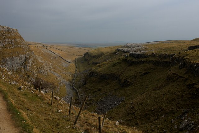
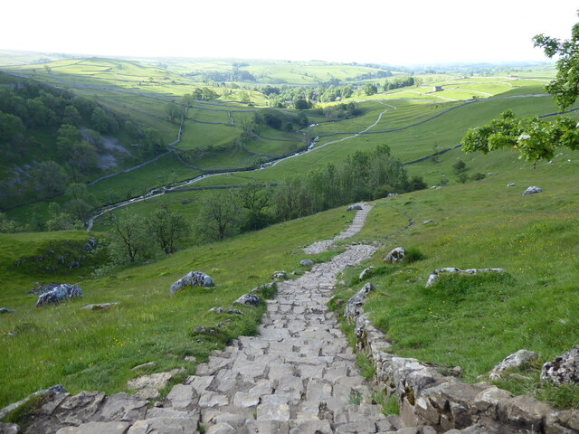
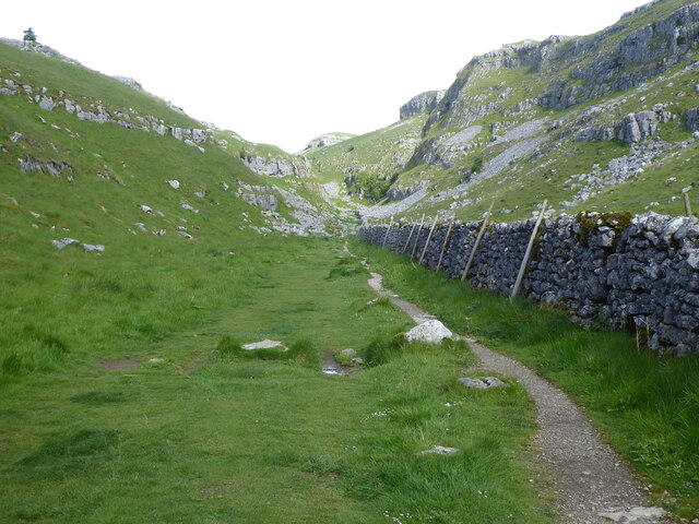
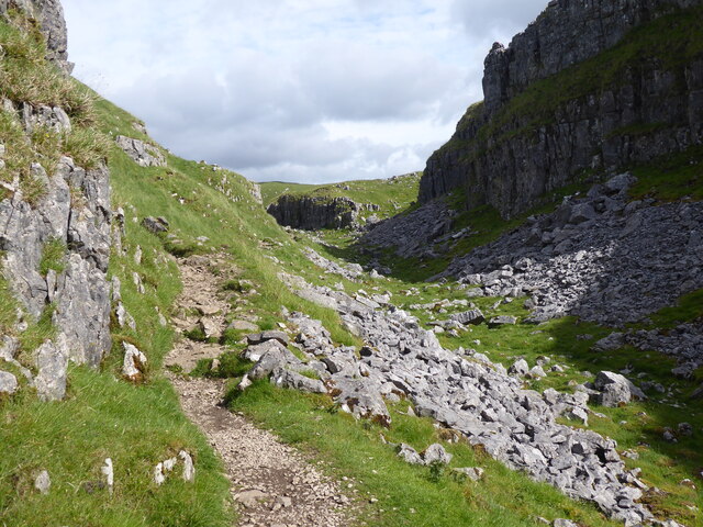
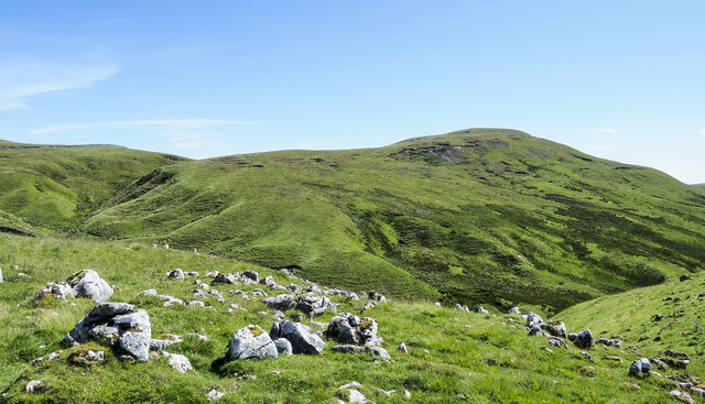
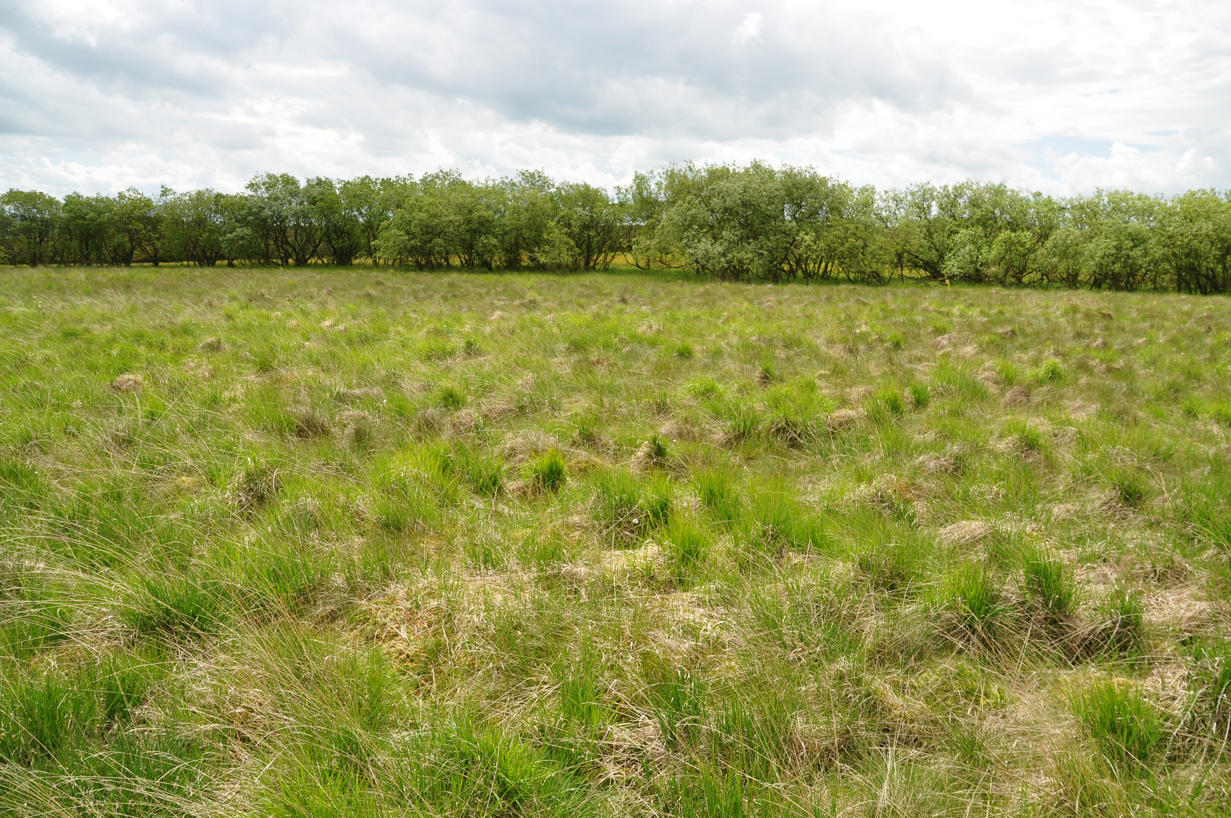
Twin Bottom, Yorkshire, also known as Twin Bottom Valley, is a picturesque and idyllic location nestled in the heart of Yorkshire, England. This quaint valley is situated between two rolling hills, creating a natural and scenic landscape that attracts visitors from near and far.

The valley is named after the two distinct hills that form its boundaries, giving it a unique and memorable character. The lush green meadows and fields that carpet the valley floor create a stunning contrast against the rugged peaks of the surrounding hills.

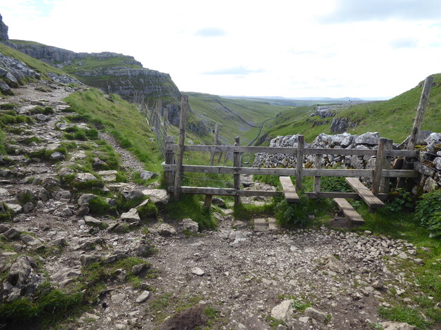
Twin Bottom is renowned for its abundant wildlife and diverse ecosystems. The valley is home to an array of plant and animal species, making it a haven for nature enthusiasts and wildlife lovers. Visitors can spot various species of birds, butterflies, and small mammals as they explore the valley's well-maintained walking trails.

The village of Twin Bottom, situated at the heart of the valley, is a close-knit community that exudes a warm and welcoming atmosphere. The village is characterized by charming cottages, traditional stone buildings, and a quaint village green. It offers a range of amenities, including local shops, cafes, and pubs, catering to both residents and tourists alike.

Twin Bottom also boasts a rich history, with several historical landmarks and heritage sites scattered throughout the valley. These include ancient burial mounds, remnants of old farmsteads, and remnants of an old mill. These historical sites provide a glimpse into the valley's past and offer visitors a chance to step back in time.

Overall, Twin Bottom, Yorkshire, is a hidden gem in the Yorkshire countryside, offering breathtaking natural beauty, diverse wildlife, a close-knit community, and a rich historical heritage. It is a must-visit destination for those seeking tranquility, exploration, and a true taste of rural England.

If you have any feedback on the listing, please let us know in the comments section below.
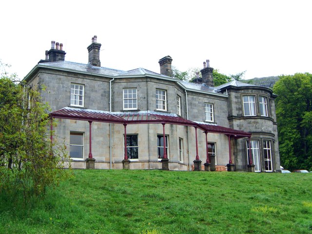
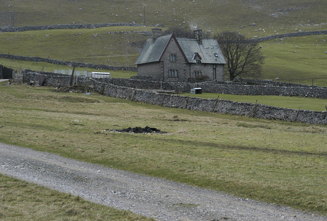
Twin Bottom Images

Images are sourced within 2km of 54.073235/-2.1916164 or Grid Reference SD8764. Thanks to Geograph Open Source API. All images are credited.

Watlowes Valley Dry limestone valley leading away from the top of Malham Cove - adopted by the Pennine Way National Trail
Watlowes Valley
Dry limestone valley leading away from the top of Malham Cove - adopted by the Pennine Way National Trail
The Pennine Way near Malham Cove
The Pennine Way near Ing Scar
The Pennine Way near Comb Hill
North face of Rye Loaf Hill Rye Loaf Hill seen across the valley of Stockdale Beck from the bridleway which is used as the route of two long distance trails - Pennine Bridleway and Dales High Way.
North face of Rye Loaf Hill
Rye Loaf Hill seen across the valley of Stockdale Beck from the bridleway which is used as the route of two long distance trails - Pennine Bridleway and Dales High Way.
Grassy slope north from Grizedales Grizedales appears to be the accepted name for the hill from which the image was made; it rises to 553 metres.
Pen-y-ghent and Fountains Fell are along the central horizon.
Grassy slope north from Grizedales
Grizedales appears to be the accepted name for the hill from which the image was made; it rises to 553 metres. Pen-y-ghent and Fountains Fell are along the central horizon.
Comb Hill - Pennine Way Rough and stony going on the Pennine Way heading southwards from Malham Tarn towards Malham Cove.
Comb Hill - Pennine Way
Rough and stony going on the Pennine Way heading southwards from Malham Tarn towards Malham Cove.
Comb Hill - Pennine Way Path descending a dry valley from Malham Sinks to the Watlowes and Malham Cove. Note the limestone cliffs and screes.
Comb Hill - Pennine Way
Path descending a dry valley from Malham Sinks to the Watlowes and Malham Cove. Note the limestone cliffs and screes.
Watlowes - Dry Valley Spectacular limestone country between Comb Hill and Malham Cove. The valley is dry as Malham Beck has been diverted underground at Malham Sinks before reappearing south of Malham village at Aire Head. Note the limestone crags, pavements, screes and the drystone dyke.
Watlowes - Dry Valley
Spectacular limestone country between Comb Hill and Malham Cove. The valley is dry as Malham Beck has been diverted underground at Malham Sinks before reappearing south of Malham village at Aire Head. Note the limestone crags, pavements, screes and the drystone dyke.
Watlowes - Dry Valley Spectacular limestone country between Comb Hill and Malham Cove. The valley is dry as Malham Beck has been diverted underground at Malham Sinks before reappearing south of Malham village at Aire Head. Note the limestone crags, screes and the drystone dyke.
Watlowes - Dry Valley
Spectacular limestone country between Comb Hill and Malham Cove. The valley is dry as Malham Beck has been diverted underground at Malham Sinks before reappearing south of Malham village at Aire Head. Note the limestone crags, screes and the drystone dyke.
Ing Scar Crag - Limestone Pavement Karst landscape at the head of the dry Watlowes Valley.
Ing Scar Crag - Limestone Pavement
Karst landscape at the head of the dry Watlowes Valley.
Ing Scar Crag - Limestone Pavement Karst landscape at the head of the dry Watlowes Valley.
Ing Scar Crag - Limestone Pavement
Karst landscape at the head of the dry Watlowes Valley.
Smelt chimney Used in conjunction with lead extraction, now an historic listed building
Smelt chimney
Used in conjunction with lead extraction, now an historic listed building
Track by Dean Scar On the track between Water Sinks Gate and Langscar Gate
Track by Dean Scar
On the track between Water Sinks Gate and Langscar Gate
Descending to Langscar Gate Eastern end of a long track from Langcliffe, near Settle
Descending to Langscar Gate
Eastern end of a long track from Langcliffe, near Settle
Track and Wall on Langscar Part of the track that runs towards Langcliffe - adopted by the Pennine Bridleway just beyond the gap in the wall
Track and Wall on Langscar
Part of the track that runs towards Langcliffe - adopted by the Pennine Bridleway just beyond the gap in the wall
Pennine Bridleway between Langscar Gate and Langcliffe Large amounts of money must have been spent on upgrading this track - presumably because it now carries the Pennine Bridleway.
Pennine Bridleway between Langscar Gate and Langcliffe
Large amounts of money must have been spent on upgrading this track - presumably because it now carries the Pennine Bridleway.
Show me another place!

Twin Bottom is located at Grid Ref: SD8764 (Lat: 54.073235, Lng: -2.1916164)

Division: West Riding

Administrative County: North Yorkshire

District: Craven

Police Authority: North Yorkshire

What 3 Words

///wedding.clothed.installs. Near Settle, North Yorkshire

Nearby Locations

Twin Bottom

Related Wikis

Malham Cove

Malham Cove is a large curved limestone formation 0.6 miles (1 km) north of the village of Malham, North Yorkshire, England. It was formed by a waterfall...

Malham

Malham is a village and civil parish in the Craven district of North Yorkshire, England. Before 20th century boundary changes, the village was part of...

Malham Tarn Estate

Malham Tarn Estate is a National Trust property in North Yorkshire, England. The estate is located in the Pennines and lies between Wharfedale and Ribblesdale...

Malham Tarn

Malham Tarn is a glacial lake near the village of Malham in the Yorkshire Dales, England. The lake is one of only eight upland alkaline lakes in Europe...

Friar Garth Farmhouse

Friar Garth Farmhouse is a Grade II listed building in Malham, North Yorkshire, England. It was listed as an historic site by English Heritage on 13 September...

Malham Tarn Field Studies Centre

FSC Malham Tarn, situated near Malham Tarn in the Yorkshire Dales National Park, North Yorkshire, England, occupies a large Georgian country house, leased...

Malham Moor

Malham Moor is a civil parish in the Craven district of North Yorkshire, England. Its population was estimated at 70 in 2015.It has a joint parish council...

St Michael's Church, Kirkby Malham

St Michael's Church is in the village of Kirkby Malham, North Yorkshire, England. It is an active Anglican parish church in the deanery of Bowland and...

Related Videos

Hiking at Malham

Ramblers anonymous a short walk to Malham, Janet's Foss and Gordale Scar.

Welcome to the Ultimate Hiking Adventure at Malham Tarn | Yorkshire Dales - 6 Mile Trail

Lace up your hiking boots and join us on an exhilarating journey through the breathtaking landscapes of Malham Tarn in the ...

The Pennine Way - Day 6 - Malham to Ribblehead - Stellar hiking - 19 miles & 2,925 ft of ascent

Pennine Way Day 6 Malham to Ribblehead, Yorkshire Hiking as good as it gets Today is a fairly long walk of 19 miles from ...

Nearby Amenities

Located within 500m of 54.073235,-2.1916164
Pikedaw Calamine Caverns
Natural: cave_entrance
Source: OS_OpenData_StreetView
Lat/Long: 54.0721075/-2.1896899
Historic: wayside_cross
Lat/Long: 54.0720252/-2.1928504
Natural: sinkhole
Source: EsriWorldImageryClarity
Lat/Long: 54.0719248/-2.1960717
Archaeological Site: mineral_extraction
Historic: mine_shaft
Mineral: lead
Source: OS sheet 132,1851
Source Mineral: OS sheet 132,1851
Lat/Long: 54.0704704/-2.1937698
Natural: sinkhole
Source: EsriWorldImageryClarity
Lat/Long: 54.069999/-2.1903218
Natural: sinkhole
Source: EsriWorldImageryClarity
Lat/Long: 54.0748577/-2.197081
Natural: sinkhole
Source: EsriWorldImageryClarity
Lat/Long: 54.0700865/-2.1880688
Natural: sinkhole
Source: EsriWorldImageryClarity
Lat/Long: 54.0695457/-2.1900429
Natural: sinkhole
Source: EsriWorldImageryClarity
Lat/Long: 54.0694066/-2.1891846
Natural: sinkhole
Source: EsriWorldImageryClarity
Lat/Long: 54.0705713/-2.1903854
Natural: sinkhole
Source: EsriWorldImageryClarity
Lat/Long: 54.0721453/-2.1965759
Historic: mine_shaft
Source: EsriWorldImageryClarity
Lat/Long: 54.0691799/-2.1941086
Natural: sinkhole
Source: EsriWorldImageryClarity
Lat/Long: 54.0718337/-2.1974557
Natural: sinkhole
Source: EsriWorldImageryClarity
Lat/Long: 54.0703574/-2.1913939
lead mine
Archaeological Site: mineral_extraction
Description: extant ponds, walls, small buildings and 11+ nearby active lead mine shafts in OS sheet 132, surveyed 1847
Historic: archaeological_site
Source: OS sheet 132,1851
Lat/Long: 54.0703794/-2.1918177
Archaeological Site: mineral_extraction
Historic: mine_shaft
Mineral: lead
Source: OS sheet 132,1851
Source Mineral: OS sheet 132,1851
Lat/Long: 54.0710214/-2.1934109
Archaeological Site: mineral_extraction
Historic: mine_shaft
Mineral: lead
Source: OS sheet 132,1851
Source Mineral: OS sheet 132,1851
Lat/Long: 54.071009/-2.1949183
Natural: sinkhole
Source: EsriWorldImageryClarity
Lat/Long: 54.0706849/-2.1865233
Archaeological Site: mineral_extraction
Historic: mine_shaft
Mineral: lead
Source: OS sheet 132,1851
Source Mineral: OS sheet 132,1851
Lat/Long: 54.072334/-2.1879717
Natural: sinkhole
Source: EsriWorldImageryClarity
Lat/Long: 54.069728/-2.1899028
Natural: sinkhole
Source: EsriWorldImageryClarity
Lat/Long: 54.070622/-2.1864482
Archaeological Site: mineral_extraction
Historic: mine_shaft
Mineral: lead
Source: OS sheet 132,1851
Source Mineral: OS sheet 132,1851
Lat/Long: 54.0727969/-2.1917211
Natural: sinkhole
Source: EsriWorldImageryClarity
Lat/Long: 54.0698854/-2.1901496
Natural: sinkhole
Source: EsriWorldImageryClarity
Lat/Long: 54.0739201/-2.1938511
Archaeological Site: mineral_extraction
Historic: mine_shaft
Mineral: lead
Source: OS sheet 132,1851
Source Mineral: OS sheet 132,1851
Lat/Long: 54.0713142/-2.1933626
Natural: sinkhole
Source: EsriWorldImageryClarity
Lat/Long: 54.0705527/-2.1864267
Natural: sinkhole
Source: EsriWorldImageryClarity
Lat/Long: 54.0723469/-2.1882828
Natural: sinkhole
Source: EsriWorldImageryClarity
Lat/Long: 54.0696836/-2.1884437
Natural: sinkhole
Source: EsriWorldImageryClarity
Lat/Long: 54.0750343/-2.1963831
Natural: sinkhole
Source: EsriWorldImageryClarity
Lat/Long: 54.0708609/-2.1868344
Natural: sinkhole
Source: EsriWorldImageryClarity
Lat/Long: 54.0702817/-2.1878751
Natural: sinkhole
Source: EsriWorldImageryClarity
Lat/Long: 54.0697595/-2.1901174
Natural: sinkhole
Source: EsriWorldImageryClarity
Lat/Long: 54.0697154/-2.1878644
Archaeological Site: mineral_extraction
Historic: mine_shaft
Mineral: lead
Source: OS sheet 132,1851
Source Mineral: OS sheet 132,1851
Lat/Long: 54.0713804/-2.194178
Natural: sinkhole
Source: EsriWorldImageryClarity
Lat/Long: 54.0701684/-2.187285
Natural: sinkhole
Source: EsriWorldImageryClarity
Lat/Long: 54.0700865/-2.1883579
Natural: sinkhole
Source: EsriWorldImageryClarity
Lat/Long: 54.0696776/-2.1882613
Natural: sinkhole
Source: EsriWorldImageryClarity
Lat/Long: 54.0698977/-2.1870704
Natural: sinkhole
Source: EsriWorldImageryClarity
Lat/Long: 54.0697217/-2.1897097
Archaeological Site: mineral_extraction
Historic: mine_shaft
Mineral: lead
Source: OS sheet 132,1851
Source Mineral: OS sheet 132,1851
Lat/Long: 54.0705998/-2.1946072
Archaeological Site: mineral_extraction
Historic: mine_shaft
Mineral: lead
Source: OS sheet 132,1851
Source Mineral: OS sheet 132,1851
Lat/Long: 54.070502/-2.1933734
Natural: sinkhole
Source: EsriWorldImageryClarity
Lat/Long: 54.0702505/-2.1881004
Archaeological Site: mineral_extraction
Historic: mine_shaft
Mineral: lead
Source: OS sheet 132,1851
Source Mineral: OS sheet 132,1851
Lat/Long: 54.0706091/-2.1935021
Archaeological Site: mineral_extraction
Historic: mine_shaft
Mineral: lead
Source: OS sheet 132,1851
Source Mineral: OS sheet 132,1851
Lat/Long: 54.0726488/-2.1888085
Natural: sinkhole
Source: EsriWorldImageryClarity
Lat/Long: 54.0722651/-2.1884115
Natural: sinkhole
Source: EsriWorldImageryClarity
Lat/Long: 54.0704205/-2.1863516
Archaeological Site: mineral_extraction
Historic: mine_shaft
Mineral: lead
Source: OS sheet 132,1851
Source Mineral: OS sheet 132,1851
Lat/Long: 54.0717991/-2.1937328
Natural: sinkhole
Source: EsriWorldImageryClarity
Lat/Long: 54.0722777/-2.1887012
Natural: sinkhole
Source: EsriWorldImageryClarity
Lat/Long: 54.070943/-2.1869953
Natural: sinkhole
Source: EsriWorldImageryClarity
Lat/Long: 54.0708045/-2.1867593
Archaeological Site: mineral_extraction
Historic: mine_shaft
Mineral: lead
Source: OS sheet 132,1851
Source Mineral: OS sheet 132,1851
Lat/Long: 54.0708137/-2.1907931
Archaeological Site: mineral_extraction
Historic: mine_shaft
Mineral: lead
Source: OS sheet 132,1851
Source Mineral: OS sheet 132,1851
Lat/Long: 54.0706122/-2.1907233
Twin Bottom
Place: locality
Source: OS sheet 132,1851
Lat/Long: 54.0731651/-2.1889745
Hiking: yes
Information: guidepost
Source: GPS survey
Tourism: information
Lat/Long: 54.0716445/-2.1930733
Hiking: yes
Information: guidepost
Source: GPS survey
Tourism: information
Lat/Long: 54.0717664/-2.1874166
Description: Small depression and narrow opening in rock. Appears to be at least partly back-filled
Historic: mine_shaft
Source: survey
Verified: yes
Lat/Long: 54.075538/-2.1871636
Description: Clear open shaft about 0.75 m wide at top. Crudely covered with loose planks when visited 2019-02-02. Accessible from nearby foot path
Historic: mine_shaft
Source: survey
Verified: yes
Lat/Long: 54.0757904/-2.1873567
Description: In hard horizontal rock with metal lid. Lid says the drop is 23 m.
Historic: mine_shaft
Source: survey
Verified: yes
Lat/Long: 54.0717647/-2.1914613
Archaeological Site: mineral_extraction
Historic: mine_shaft
Source: EsriWorldImageryClarity
Lat/Long: 54.0711665/-2.1934354
Archaeological Site: mineral_extraction
Historic: mine_shaft
Source: EsriWorldImageryClarity
Lat/Long: 54.0715159/-2.1946263
Archaeological Site: mineral_extraction
Historic: mine_shaft
Source: EsriWorldImageryClarity
Lat/Long: 54.0716639/-2.1941596
The data included in this document is from www.openstreetmap.org. The data is made available under ODbL.

Have you been to Twin Bottom?

Leave your review of Twin Bottom below (or comments, questions and feedback).