Catterline Den

Valley in Kincardineshire

Scotland

Catterline Den

Looking down into Trollochy Trollochy is a short, cliff girt inlet below Crawton.
Looking down into Trollochy Credit: Gordon Hatton

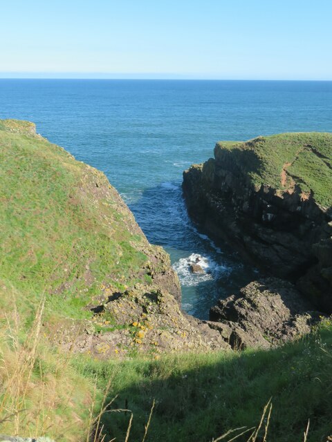
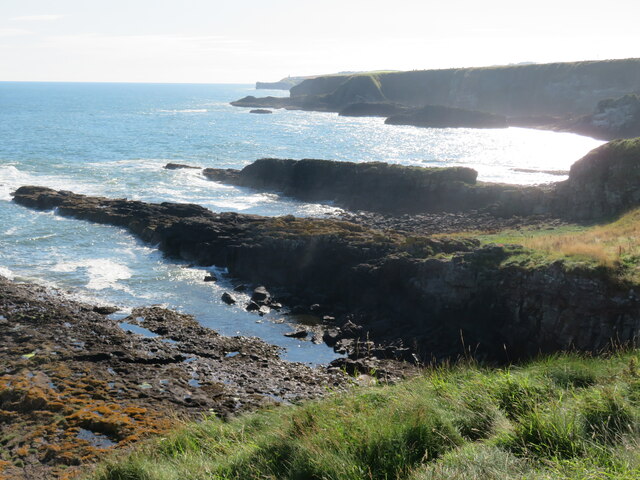
Catterline Den, located in Kincardineshire, Scotland, is a picturesque valley that offers visitors a tranquil and scenic experience. Nestled between rolling hills and cliffs along the coast of the North Sea, the den is renowned for its natural beauty and captivating views.

The den is characterized by its verdant vegetation and diverse wildlife. Lush woodlands of oak, birch, and rowan trees dominate the area, creating a haven for numerous bird species such as the chaffinch, goldfinch, and blackbird. Visitors may also spot small mammals like red squirrels and rabbits.

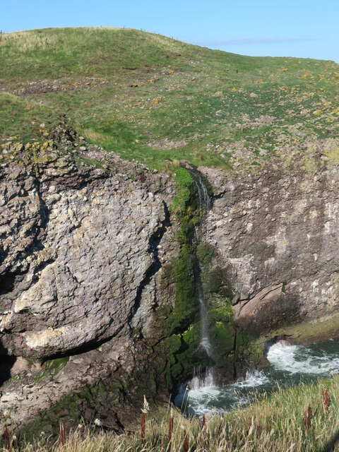
The den is intersected by a meandering stream that flows through the valley, adding to its enchanting ambience. The stream is fed by the surrounding hills and cascades over rocks, creating small waterfalls and pools. These features make it an ideal spot for nature enthusiasts, who can enjoy peaceful walks along the stream's banks or indulge in photography.

Moreover, Catterline Den holds historical significance, as it was once home to several mills that thrived on the abundant water supply. The remnants of these mills can still be seen, serving as reminders of the area's industrial past.

Overall, Catterline Den is a hidden gem in Kincardineshire, offering visitors a chance to immerse themselves in the beauty of nature. Whether it's exploring the woodlands, observing wildlife, or simply enjoying the serenity of the stream, the den provides a tranquil escape from the bustling urban environment.

If you have any feedback on the listing, please let us know in the comments section below.

Catterline Den Images

Images are sourced within 2km of 56.906085/-2.2203825 or Grid Reference NO8679. Thanks to Geograph Open Source API. All images are credited.

Looking down into Trollochy Trollochy is a short, cliff girt inlet below Crawton.
Looking down into Trollochy
Trollochy is a short, cliff girt inlet below Crawton.
Waterfall into the sea at Crawton A wee burn makes a dramatic plunge into the cliff bound inlet of Trollochy at Crawton.
Waterfall into the sea at Crawton
A wee burn makes a dramatic plunge into the cliff bound inlet of Trollochy at Crawton.
Rock ribs extending out into the sea at Crawton The view south from the small headland at Crawton where rocky reefs defy the waves. The view extends along Crawton Bay.
Rock ribs extending out into the sea at Crawton
The view south from the small headland at Crawton where rocky reefs defy the waves. The view extends along Crawton Bay.
Baler at work Tractor with baler working a harvested field near Cowieswells Farm.
Baler at work
Tractor with baler working a harvested field near Cowieswells Farm.
Razorbills and Guillemots Lives most of the year at sea, coming to land to breed. Both birds depends on the health of the marine environment. Fishing nets, pollution at sea and declining fish stocks all threaten these birds.
Razorbills and Guillemots
Lives most of the year at sea, coming to land to breed. Both birds depends on the health of the marine environment. Fishing nets, pollution at sea and declining fish stocks all threaten these birds.
Cliffs at Crawley Bird Sanctuary Not so many birds to be seen on the cliff face due to the devastation of Bird flu on the bird population.
Cliffs at Crawley Bird Sanctuary
Not so many birds to be seen on the cliff face due to the devastation of Bird flu on the bird population.
Daffodil Fields Rows of Daffodils growing by Braidon.
Daffodil Fields
Rows of Daffodils growing by Braidon.
Approaching the Barras turnoff from the A92 Photographer is above the paved roadway surface looking in the southbound direction along A92.
Approaching the Barras turnoff from the A92
Photographer is above the paved roadway surface looking in the southbound direction along A92.
Fields west of Catterline
Catterline Harbour The pier was built in the late 1830s. A few inshore fishing boats still use the harbour.
Catterline Harbour
The pier was built in the late 1830s. A few inshore fishing boats still use the harbour.
Catterline Bay Viewed from the road that leads down to the harbour.
Catterline Bay
Viewed from the road that leads down to the harbour.
Braidon Cottages A narrow road passes some rural dwellings lurking in the haar.
Braidon Cottages
A narrow road passes some rural dwellings lurking in the haar.
Catterline Burn
Catterline Burn
Caravan site, Cloak And cloaked in haar.
Caravan site, Cloak
And cloaked in haar.
A minor road near Catterline You can just see the foglights through the haar. There is a conifer shelter belt on the left, and the trees have thinned the fog enough to get a shot off.
A minor road near Catterline
You can just see the foglights through the haar. There is a conifer shelter belt on the left, and the trees have thinned the fog enough to get a shot off.
Farmland near Mill of Uras
Cotbank of Hilton
Cotbank of Hilton
New house, Cotbank of Hilton
Show me another place!

Catterline Den is located at Grid Ref: NO8679 (Lat: 56.906085, Lng: -2.2203825)

Unitary Authority: Aberdeenshire

Police Authority: North East

What 3 Words

///sprinting.training.late. Near Stonehaven, Aberdeenshire

Nearby Locations

Catterline Den

Related Wikis

Catterline

Catterline is a coastal village on the North Sea in Aberdeenshire, Scotland. It is situated about 5 miles (8.0 km) south of Stonehaven; nearby to the...

Crawton

Crawton is a former fishing community on the southeast Aberdeenshire coast in Scotland, deserted since 1927. Approximately three miles (5 km) south of...
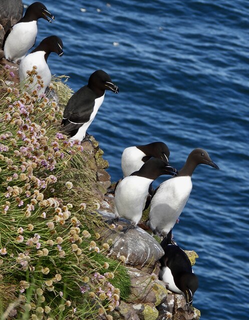
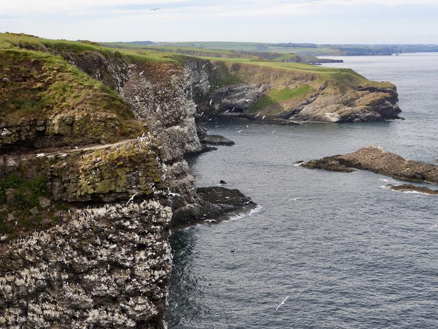
Fowlsheugh

Fowlsheugh is a coastal nature reserve in Kincardineshire, northeast Scotland, known for its 70-metre-high (230 ft) cliff formations and habitat supporting...

Craiglethy

Craiglethy (Scottish Gaelic: Creag Liathach - meaning grey rock) is a small island/skerry off Fowlsheugh on the east coast of Aberdeenshire, Scotland in...

Nearby Amenities

Located within 500m of 56.906085,-2.2203825
Power: pole
Lat/Long: 56.9099146/-2.223265
Power: pole
Lat/Long: 56.9095696/-2.2221632
Material: wood
Power: pole
Lat/Long: 56.9092027/-2.2210404
Material: wood
Power: pole
Lat/Long: 56.9090773/-2.220715
Material: wood
Power: pole
Lat/Long: 56.9103856/-2.2191888
Material: wood
Power: pole
Lat/Long: 56.9099417/-2.2196448
Material: wood
Power: pole
Lat/Long: 56.9094885/-2.220201
Material: wood
Power: pole
Lat/Long: 56.9085862/-2.2213691
Material: wood
Power: pole
Lat/Long: 56.9083125/-2.2219273
Material: wood
Power: pole
Lat/Long: 56.9080508/-2.2224792
Material: wood
Power: pole
Lat/Long: 56.9077512/-2.2231407
Power: pole
Lat/Long: 56.9079634/-2.227871
Power: pole
Lat/Long: 56.9074378/-2.2274644
Power: pole
Lat/Long: 56.9069087/-2.2270431
Power: pole
Lat/Long: 56.9063072/-2.2266913
Power: pole
Lat/Long: 56.9062186/-2.2265438
Power: pole
Lat/Long: 56.9043178/-2.2130418
Power: pole
Lat/Long: 56.9047147/-2.2128501
Power: pole
Lat/Long: 56.9052956/-2.2125362
Power: pole
Lat/Long: 56.9059305/-2.2121971
Power: pole
Lat/Long: 56.902528/-2.2160163
Power: pole
Lat/Long: 56.9029478/-2.2161132
Power: pole
Lat/Long: 56.9033344/-2.216189
Power: pole
Lat/Long: 56.9047664/-2.2136506
Power: pole
Lat/Long: 56.904824/-2.2144511
Power: pole
Lat/Long: 56.9049114/-2.2152284
The data included in this document is from www.openstreetmap.org. The data is made available under ODbL.

Have you been to Catterline Den?

Leave your review of Catterline Den below (or comments, questions and feedback).