Fairy Glen

Valley in Worcestershire Wyre Forest

England

Fairy Glen

Staffordshire and Worcestershire Canal near Whittington in Staffordshire The Staffordshire and Worcestershire Canal is meandering south towards Kidderminster and Stourport.
Staffordshire and Worcestershire Canal near Whittington in Staffordshire Credit: Roger Kidd

Fairy Glen is a picturesque valley located in Worcestershire, England. Nestled within the Malvern Hills, this enchanting natural wonder offers visitors a serene escape from the hustle and bustle of everyday life.

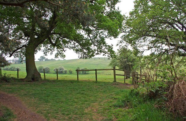
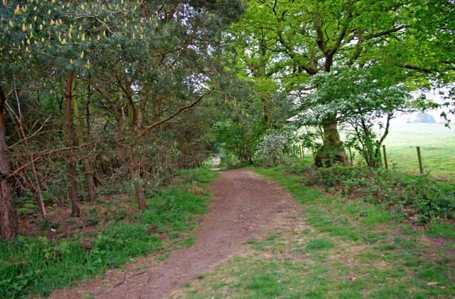
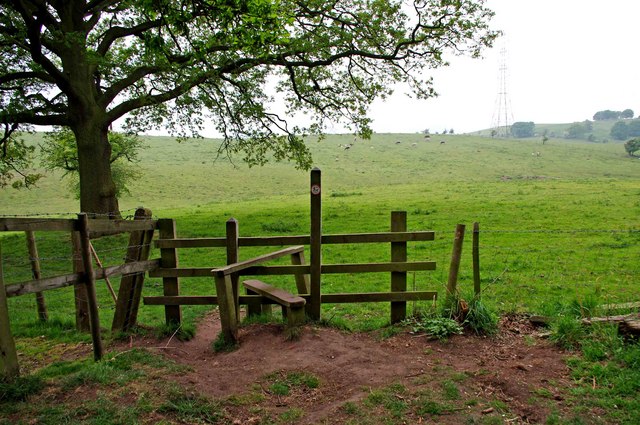
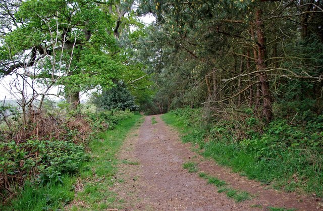
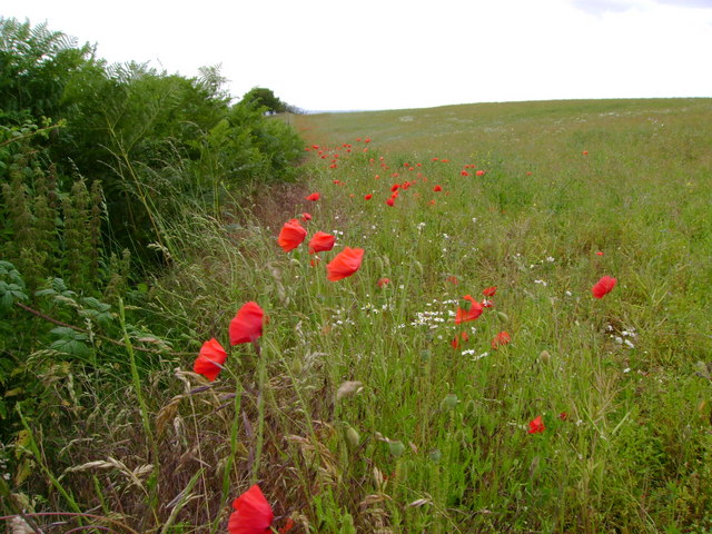
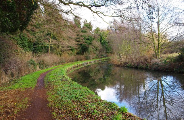
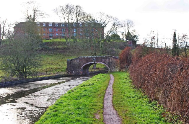
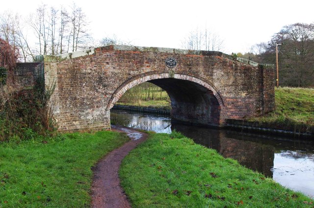
The Glen is characterized by its lush greenery, cascading waterfalls, and meandering streams. As visitors venture into the valley, they are greeted by a symphony of birdsong and the calming sound of rushing water. The landscape is dotted with ancient oak trees, wildflowers, and ferns, creating a magical atmosphere that feels straight out of a fairytale.

The Glen's main attraction is undoubtedly its waterfalls. Here, visitors can witness the spectacle of water tumbling down moss-covered rocks, creating a mesmerizing display of nature's power. The waterfalls vary in size and intensity, providing a delightful sensory experience for all who visit.

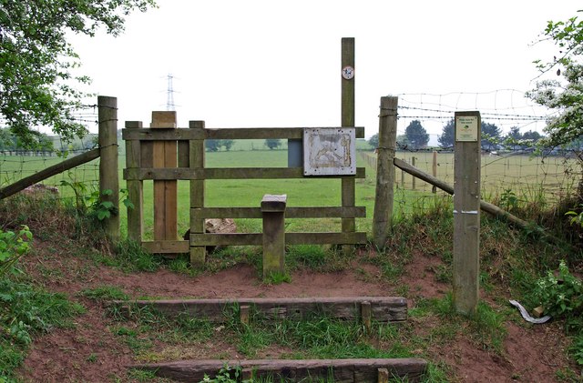
The valley also offers several walking trails, allowing visitors to explore the Glen at their own pace. These trails meander through the valley, offering breathtaking views of the surrounding hills and valleys. Along the way, visitors may encounter wildlife such as deer, foxes, and a variety of bird species, adding to the area's natural charm.

Fairy Glen is a popular destination for nature enthusiasts, photographers, and those seeking a tranquil retreat. Its unspoiled beauty and peaceful ambiance make it a perfect spot for relaxation, meditation, and reconnecting with nature. Whether one is looking to enjoy a leisurely stroll, capture stunning photographs, or simply immerse themselves in the wonders of the natural world, Fairy Glen is sure to leave a lasting impression on all who visit.

If you have any feedback on the listing, please let us know in the comments section below.

Fairy Glen Images

Images are sourced within 2km of 52.426864/-2.1975364 or Grid Reference SO8681. Thanks to Geograph Open Source API. All images are credited.

Staffordshire and Worcestershire Canal near Whittington in Staffordshire The Staffordshire and Worcestershire Canal is meandering south towards Kidderminster and Stourport.
Staffordshire and Worcestershire Canal near Whittington in Staffordshire
The Staffordshire and Worcestershire Canal is meandering south towards Kidderminster and Stourport.
Canalside heron south of Whittington in Staffordshire This bird was so "cool" about people that it declined to fly off while we passed close by and a cyclist walked by it, heading north. Staffordshire and Worcestershire Canal.
Canalside heron south of Whittington in Staffordshire
This bird was so "cool" about people that it declined to fly off while we passed close by and a cyclist walked by it, heading north. Staffordshire and Worcestershire Canal.
Canalside heron south of Whittington in Staffordshire This bird was so "cool" about people that it declined to fly off while we passed close by and a cyclist walked by it, heading north. Staffordshire and Worcestershire Canal.

<a href="https://www.geograph.org.uk/photo/7685237">SO8581 : Canalside heron south of Whittington in Staffordshire</a>
Canalside heron south of Whittington in Staffordshire
This bird was so "cool" about people that it declined to fly off while we passed close by and a cyclist walked by it, heading north. Staffordshire and Worcestershire Canal. SO8581 : Canalside heron south of Whittington in Staffordshire
Austcliff Bridge near Caunsall in Worcestershire The Staffordshire and Worcestershire Canal is meandering towards Cookley, Kidderminster and Stourport.
Austcliff Bridge is No 24. It is an accommodation Bridge which also carries a public footpath. Beyond the bridge is a canal overflow weir leading directly into the River Stour which is close by.
Austcliff Bridge near Caunsall in Worcestershire
The Staffordshire and Worcestershire Canal is meandering towards Cookley, Kidderminster and Stourport. Austcliff Bridge is No 24. It is an accommodation Bridge which also carries a public footpath. Beyond the bridge is a canal overflow weir leading directly into the River Stour which is close by.
Canal at Austcliff Bridge near Caunsall in Worcestershire The Staffordshire and Worcestershire Canal is meandering towards Cookley, Kidderminster and Stourport.
Austcliff Bridge is No 24. It is an accommodation Bridge which also carries a public footpath. Beyond the bridge is a canal overflow weir leading directly into the River Stour which is close by.
Canal at Austcliff Bridge near Caunsall in Worcestershire
The Staffordshire and Worcestershire Canal is meandering towards Cookley, Kidderminster and Stourport. Austcliff Bridge is No 24. It is an accommodation Bridge which also carries a public footpath. Beyond the bridge is a canal overflow weir leading directly into the River Stour which is close by.
Austcliff Bridge near Caunsall in Worcestershire The Staffordshire and Worcestershire Canal is meandering towards Cookley, Kidderminster and Stourport.
Austcliff Bridge is No 24. It is an accommodation Bridge which also carries a public footpath. Beyond the bridge is a canal overflow weir leading directly into the River Stour which is close by.
Austcliff Bridge near Caunsall in Worcestershire
The Staffordshire and Worcestershire Canal is meandering towards Cookley, Kidderminster and Stourport. Austcliff Bridge is No 24. It is an accommodation Bridge which also carries a public footpath. Beyond the bridge is a canal overflow weir leading directly into the River Stour which is close by.
Southwestern edge of Bunkers Hill Wood near Whittington Here is the very edge of the wood, beyond which are fields. A permissive footpath goes off to the left, and another, behind the photographer, goes along the west boundary of the wood to the entrance on Whittington Hall Lane. The last stretch of this is a public footpath. On the right of this view is a stile, which gives access to what appears to be a new public footpath, across fields, which is not shown on the 2006 edition of OS Explorer Map sheet 219.
Southwestern edge of Bunkers Hill Wood near Whittington
Here is the very edge of the wood, beyond which are fields. A permissive footpath goes off to the left, and another, behind the photographer, goes along the west boundary of the wood to the entrance on Whittington Hall Lane. The last stretch of this is a public footpath. On the right of this view is a stile, which gives access to what appears to be a new public footpath, across fields, which is not shown on the 2006 edition of OS Explorer Map sheet 219.
Permissive footpath on edge of Bunkers Hill Wood, near Whittington This is one of the many permissive footpaths within the wood. Here it is running along the edge of the wood.
Permissive footpath on edge of Bunkers Hill Wood, near Whittington
This is one of the many permissive footpaths within the wood. Here it is running along the edge of the wood.
Stile at southwest corner of Bunkers Hill Wood near Whittington In the southwest corner of the wood is this stile. On the other side is what appears to be a new public footpath, as it is not shown on the 2006 edition of OS Explorer Map sheet 219. The little disc on the post is marked Staffordshire County Council, and requests that dogs be kept on leads. It is not obvious, on the ground, quite where the path goes but there are fields adjacent to this part of the wood, with some livestock in them.
Stile at southwest corner of Bunkers Hill Wood near Whittington
In the southwest corner of the wood is this stile. On the other side is what appears to be a new public footpath, as it is not shown on the 2006 edition of OS Explorer Map sheet 219. The little disc on the post is marked Staffordshire County Council, and requests that dogs be kept on leads. It is not obvious, on the ground, quite where the path goes but there are fields adjacent to this part of the wood, with some livestock in them.
Permissive footpath on edge of Bunkers Hill Wood, near Whittington This permissive footpath is heading for the entrance off Whittington Hall Lane. Further on it is a public footpath.
Permissive footpath on edge of Bunkers Hill Wood, near Whittington
This permissive footpath is heading for the entrance off Whittington Hall Lane. Further on it is a public footpath.
Stile at start of footpath from Bunkers Hill Wood to Whittington Hall Lane The footpath starts at the stile, and go west across fields to Whittington Hall Lane.
Stile at start of footpath from Bunkers Hill Wood to Whittington Hall Lane
The footpath starts at the stile, and go west across fields to Whittington Hall Lane.
Poppies at field margin Poppies, bracken, nettles and bramble all flourishing at the edge of a rape seed field.
Poppies at field margin
Poppies, bracken, nettles and bramble all flourishing at the edge of a rape seed field.
Looking towards Caunsall Bridge, Caunsall The bridge takes a minor road across the Staffs & Worcs Canal.
Looking towards Caunsall Bridge, Caunsall
The bridge takes a minor road across the Staffs & Worcs Canal.
Caunsall Bridge, Caunsall The bridge takes a minor road across the Staffs & Worcs Canal.
Caunsall Bridge, Caunsall
The bridge takes a minor road across the Staffs & Worcs Canal.
Staffordshire & Worcestershire Canal near Caunsall The canal was one of those that never closed, and indeed at the time of nationalisation in 1948 it was still making a profit, and still run from its original offices in Wolverhampton. It was an early "contour canal", and opened in 1772. The Chief Engineer was James Brindley.
Staffordshire & Worcestershire Canal near Caunsall
The canal was one of those that never closed, and indeed at the time of nationalisation in 1948 it was still making a profit, and still run from its original offices in Wolverhampton. It was an early "contour canal", and opened in 1772. The Chief Engineer was James Brindley.
Looking towards Clay House Bridge, near Caunsall The bridge connects two fields, possibly there may once have been a road running over it. The large building in the background is known as Westley Court. It provides 71 luxury apartments, and is built on the site of a house built about 1750 and originally known as Clee Hall, and later as Westley Court.
Looking towards Clay House Bridge, near Caunsall
The bridge connects two fields, possibly there may once have been a road running over it. The large building in the background is known as Westley Court. It provides 71 luxury apartments, and is built on the site of a house built about 1750 and originally known as Clee Hall, and later as Westley Court.
Name plaque on Clay House Bridge near Caunsall The bridges on the Staffordshire & Worcesterashire Canal are named and numbered. This is number 25 and named Clay House Bridge. There no longer seems to be a building called Clay House in the vicinity.

<a href="https://www.geograph.org.uk/photo/2734311">SO8580 : Clay House Bridge near Caunsall</a>.
Name plaque on Clay House Bridge near Caunsall
The bridges on the Staffordshire & Worcesterashire Canal are named and numbered. This is number 25 and named Clay House Bridge. There no longer seems to be a building called Clay House in the vicinity. SO8580 : Clay House Bridge near Caunsall.
Clay House Bridge near Caunsall A bridge over the Staffs & Worcs Canal, which connects two fields.

<a href="https://www.geograph.org.uk/photo/2734290">SO8580 : Name plaque on Clay House Bridge near Caunsall</a>.
Clay House Bridge near Caunsall
A bridge over the Staffs & Worcs Canal, which connects two fields. SO8580 : Name plaque on Clay House Bridge near Caunsall.
Show me another place!

Fairy Glen is located at Grid Ref: SO8681 (Lat: 52.426864, Lng: -2.1975364)

Administrative County: Worcestershire

District: Wyre Forest

Police Authority: West Mercia

What 3 Words

///finders.purses.outermost. Near Kinvere, Staffordshire

Nearby Locations

Fairy Glen

Related Wikis

Caunsall

Caunsall is a hamlet in Worcestershire, England a few miles to the north of Kidderminster and close to the villages of Kinver, Cookley and Wolverley. It...

Iverley

Iverley is an area of the parish of Kinver in Staffordshire that has no road link to the rest of the parish. It is notable as being the most southerly...

Axborough

Axborough is a low wooded hill east of Cookley in north Worcestershire, England. == History == Its Saxon name meant hassock grass barrow. This does not...

Churchill, Wyre Forest

Churchill is a village and former civil parish, now in the parish of Churchill and Blakedown, in the Wyre Forest district of Worcestershire, England. It...

Nearby Amenities

Located within 500m of 52.426864,-2.1975364
Power: tower
Source: bing
Lat/Long: 52.4289213/-2.1936383
Power: tower
Source: bing
Lat/Long: 52.4254914/-2.194175
Barrier: stile
Source: survey
Lat/Long: 52.427934/-2.1967095
Barrier: stile
Source: survey
Lat/Long: 52.4274888/-2.2020064
Power: pole
Lat/Long: 52.4225645/-2.1958495
The data included in this document is from www.openstreetmap.org. The data is made available under ODbL.

Have you been to Fairy Glen?

Leave your review of Fairy Glen below (or comments, questions and feedback).