Leeds

Settlement in Kent Maidstone

England

Leeds

Oast House Two round kiln oast house.
Oast House Credit: Oast House Archive

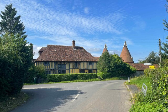
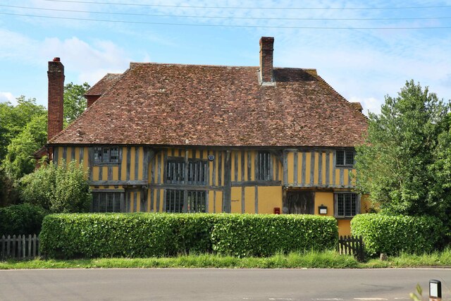
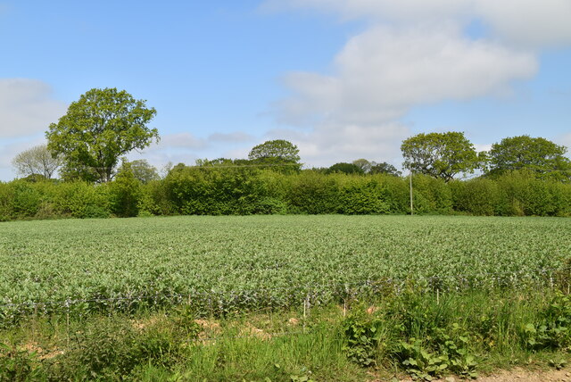
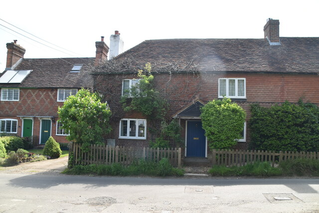
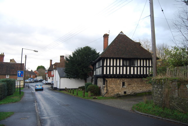
Leeds is a small village located in the county of Kent, in southeastern England. Situated approximately 5 miles southeast of Maidstone, it is nestled in the picturesque landscape of the Kent Downs, an Area of Outstanding Natural Beauty. With a population of around 1,900 residents, Leeds maintains a charming and close-knit community atmosphere.

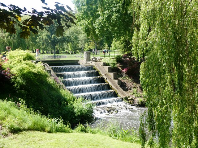
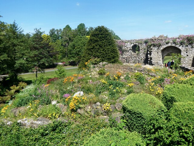
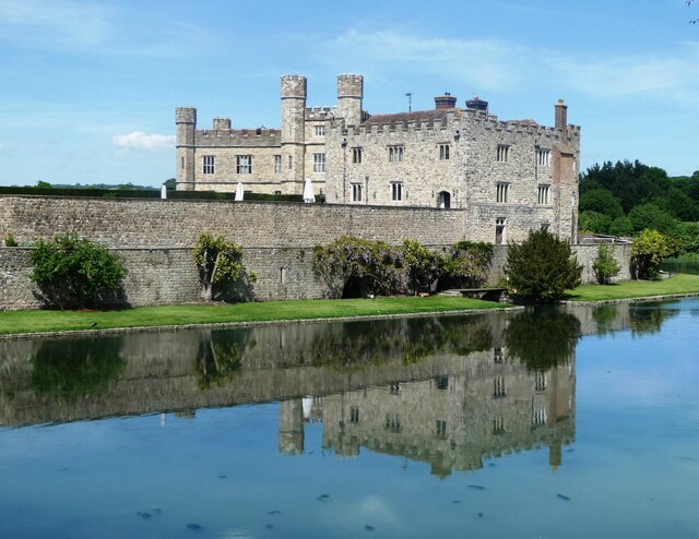
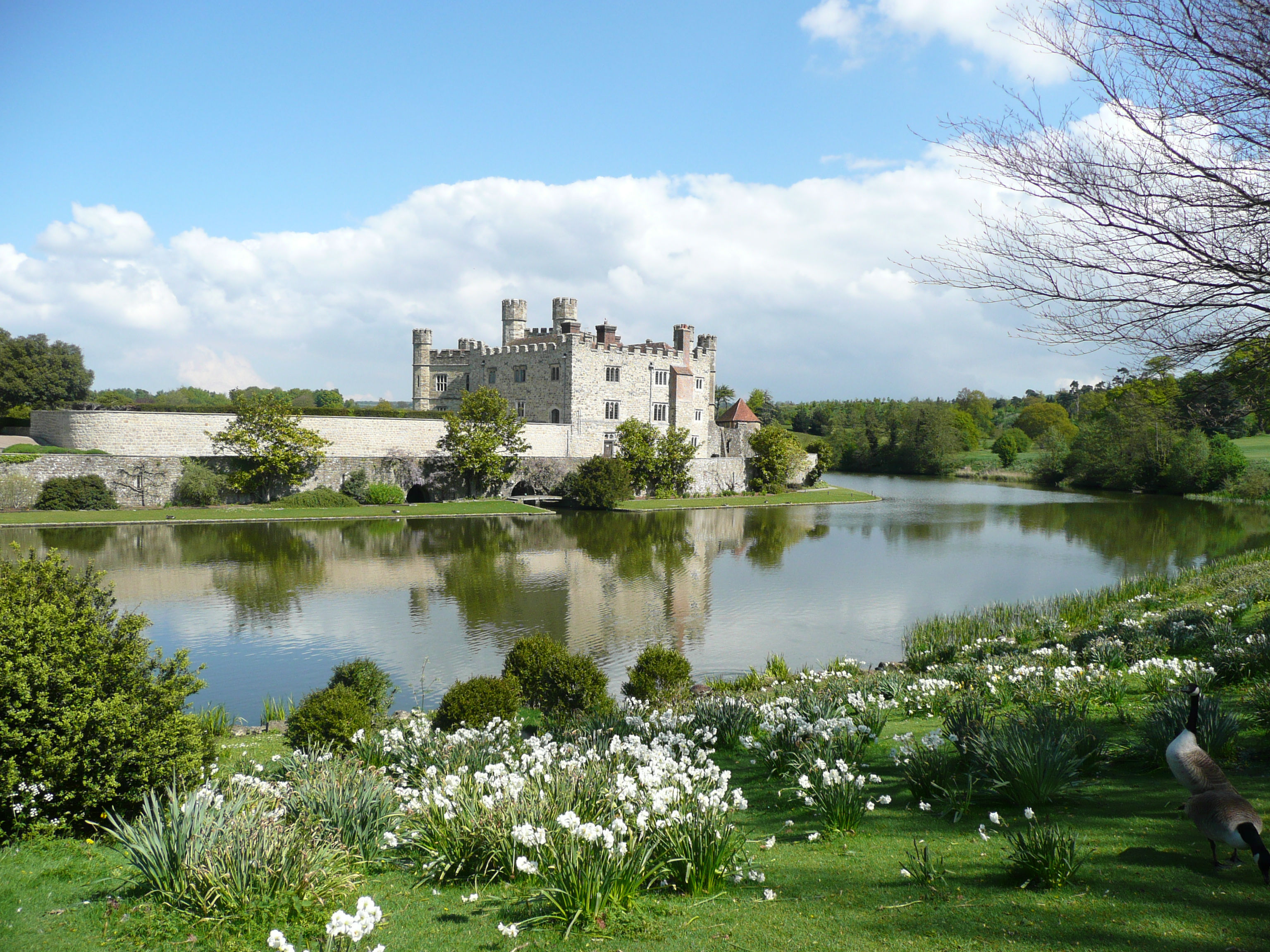
The village is renowned for its historic Leeds Castle, a magnificent fortress dating back to the 12th century. Often referred to as the "loveliest castle in the world," it is surrounded by a moat and breathtaking gardens, attracting visitors from all over the globe. The castle offers a range of activities and events throughout the year, including jousting tournaments, falconry displays, and guided tours.

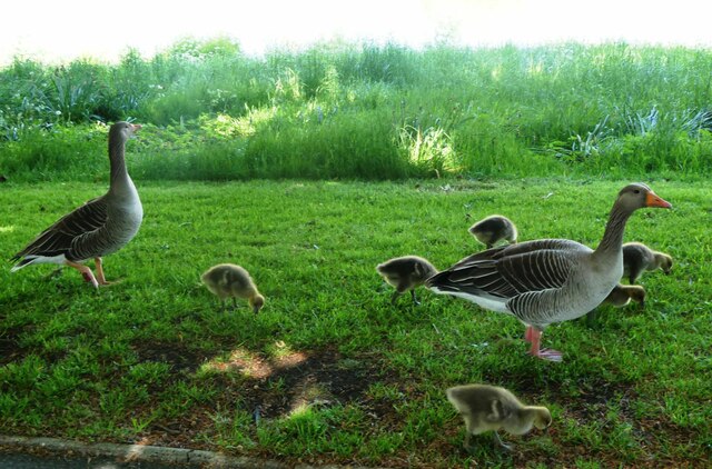
Leeds also boasts a traditional village green, complete with a cricket pitch and a duck pond, providing a tranquil setting for leisurely walks and picnics. The local parish church, St. Nicholas, is a beautiful example of medieval architecture and holds regular services for the community.

The village is well-served by a range of amenities, including a primary school, village hall, post office, and a few local shops and cafes. For more extensive shopping and entertainment options, residents can easily access the nearby town of Maidstone.

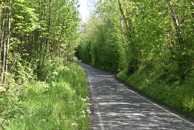
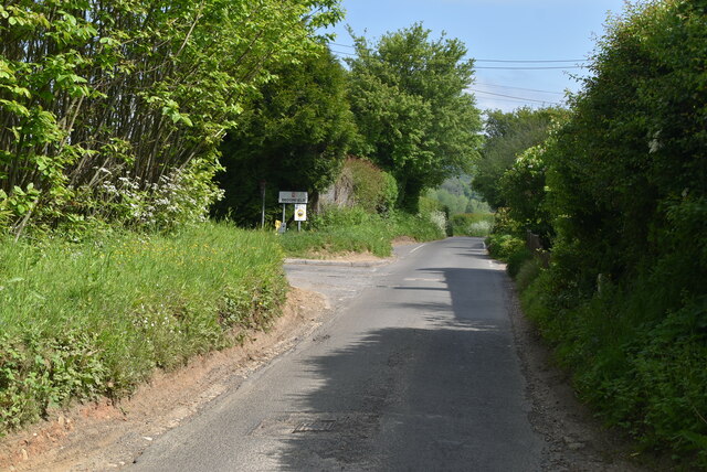
Leeds enjoys excellent transport links, with access to the A20 road and the M20 motorway, making it convenient for commuters and visitors alike. Additionally, the village is serviced by a regular bus service connecting it to surrounding areas.

Overall, Leeds offers a peaceful and idyllic setting, with its rich history, natural beauty, and strong community spirit, making it a highly desirable place to live or visit in Kent.

If you have any feedback on the listing, please let us know in the comments section below.
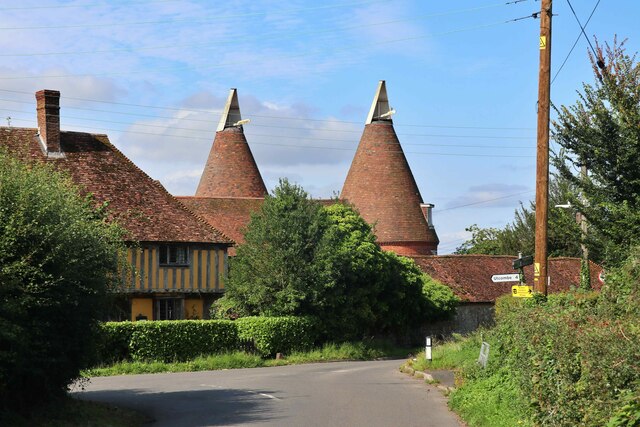
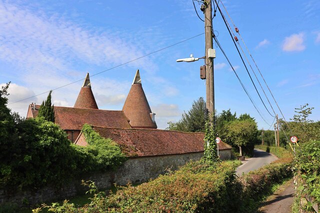
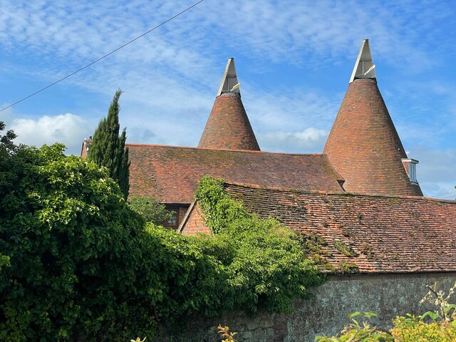
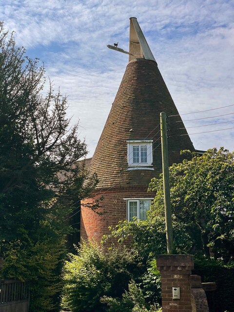
Leeds Images

Images are sourced within 2km of 51.246634/0.606965 or Grid Reference TQ8252. Thanks to Geograph Open Source API. All images are credited.

Oast House Two round kiln oast house.
Oast House
Two round kiln oast house.
Oast House Two round kiln oast house.
Oast House
Two round kiln oast house.
Oast House Two round kiln oast house.
Oast House
Two round kiln oast house.
Oast House Two round kiln oast house.
Oast House
Two round kiln oast house.
Sheiling Hall and Shieling Oast/Ambleside Oast Left; Sheiling Hall (formerly Langley Corner Farmhouse) is a Grade II listed Wealden Hall House.
Right: Shieling Oast/Ambleside Oast.
Sheiling Hall and Shieling Oast/Ambleside Oast
Left; Sheiling Hall (formerly Langley Corner Farmhouse) is a Grade II listed Wealden Hall House. Right: Shieling Oast/Ambleside Oast.
Sheiling Hall  Sheiling Hall (formerly Langley Corner Farmhouse) is a Grade II listed Wealden Hall House.
Sheiling Hall
Sheiling Hall (formerly Langley Corner Farmhouse) is a Grade II listed Wealden Hall House.
Cowl of Oast House Two round kiln oast house.
Cowl of Oast House
Two round kiln oast house.
View of the cascade at Leeds Castle, Broomfield With the footbridge in the foreground.
View of the cascade at Leeds Castle, Broomfield
With the footbridge in the foreground.
View of the cascade at Leeds Castle, Broomfield
Leeds Castle, Broomfield Rockery by the entrance.
Leeds Castle, Broomfield
Rockery by the entrance.
Mallard duck with 9 ducklings, Leeds Castle On the Great Water.
Mallard duck with 9 ducklings, Leeds Castle
On the Great Water.
Pink footed geese, Leeds Castle With six gosling.
Pink footed geese, Leeds Castle
With six gosling.
Leeds Castle, Broomfield Leeds Castle has been a Norman stronghold; the private property of six of England’s medieval queens; a palace used by Henry VIII and his first wife Catherine of Aragon; a Jacobean country house; a Georgian mansion; an elegant early 20th century retreat  and, in the 21st century, it has become one of the most visited historic buildings in Britain.
Leeds Castle, Broomfield
Leeds Castle has been a Norman stronghold; the private property of six of England’s medieval queens; a palace used by Henry VIII and his first wife Catherine of Aragon; a Jacobean country house; a Georgian mansion; an elegant early 20th century retreat and, in the 21st century, it has become one of the most visited historic buildings in Britain.
Arable field by Broomfield Rd
Broomfield Rd
Broomfield Rd
Broomfield Rd
Broomfield Rd
Park Barn Rd
Park Barn Rd
Bulmershe House
Bulmershe House
Show me another place!

Leeds is located at Grid Ref: TQ8252 (Lat: 51.246634, Lng: 0.606965)

Administrative County: Kent

District: Maidstone

Police Authority: Kent

What 3 Words

///candle.weeknight.smokers. Near Harrietsham, Kent

Nearby Locations

Leeds Swing Gate Shaw

Related Wikis

Leeds, Kent

Leeds is a village and civil parish in the Maidstone district of Kent, England. == Location == The village is located five miles (8.0 km) to the east of...

Leeds Priory

Leeds Priory, also known as Leeds Abbey, was a priory in Leeds, Kent, England, that was founded in 1119 and dissolved in 1539. A mansion was later built...

St Nicholas Church, Leeds

St Nicholas is a Church of England parish church in Leeds, Kent first built in the 11th century with additions in the next five centuries. It is a Grade...

Ashbank

Ashbank is a small settlement near Leeds in Kent, England.

Leeds Castle

Leeds Castle is a castle in Kent, England, 7 miles (11 km) southeast of Maidstone. It is built on islands in a lake formed by the River Len to the east...

Caring, Kent

Caring is a settlement south of Bearsted, near the town of Maidstone in Kent, England. It is located amid several farms on the River Len, a tributary...

Langley, Kent

Langley is a village and civil parish in the Maidstone District of Kent, England. The parish is located on the A274 road leading south from Maidstone to...

Broomfield and Kingswood

Broomfield and Kingswood is a civil parish in the Maidstone district of Kent, England. The parish lies to the east of Maidstone, south of the A20 road...

Nearby Amenities

Located within 500m of 51.246634,0.606965
Leeds
Place: village
Source: npe
Lat/Long: 51.2479216/0.6100851
Bus Stop
The George
Naptan AtcoCode: 2400A021340A
Naptan Bearing: SW
Naptan CommonName: The George
Naptan Indicator: adj
Naptan Landmark: The George PH
Naptan NaptanCode: kntawgwj
Naptan Street: Lower Street
Naptan Verified: no
Source: naptan_import
Lat/Long: 51.248985/0.6122162
Bus Stop
Forge Lane
Naptan AtcoCode: 2400A021350A
Naptan Bearing: SW
Naptan CommonName: Forge Lane
Naptan Indicator: opp
Naptan Landmark: Forge Ln
Naptan NaptanCode: kntawgwm
Naptan Street: Lower St
Naptan Verified: no
Source: naptan_import
Lat/Long: 51.2467818/0.6073623
Bus Stop
Ten Bells
Naptan AtcoCode: 2400A021360A
Naptan Bearing: SW
Naptan CommonName: Ten Bells
Naptan Indicator: o/s
Naptan Landmark: Burnt Barn Lane
Naptan NaptanCode: kntawgwp
Naptan Street: Upper Street
Naptan Verified: no
Source: naptan_import
Lat/Long: 51.2436282/0.605192
Bus Stop
Ten Bells
Naptan AtcoCode: 2400A021410A
Naptan Bearing: NE
Naptan CommonName: Ten Bells
Naptan Indicator: opp
Naptan Landmark: Burgess Hall Drive
Naptan NaptanCode: kntawjam
Naptan Street: Upper Street
Naptan Verified: no
Source: naptan_import
Lat/Long: 51.2438701/0.6052344
Bus Stop
Forge Lane
Naptan AtcoCode: 2400A021420A
Naptan Bearing: NE
Naptan CommonName: Forge Lane
Naptan Indicator: adj
Naptan Landmark: Abbey Farm
Naptan NaptanCode: kntawjap
Naptan Street: Lower Street
Naptan Verified: no
Source: naptan_import
Lat/Long: 51.2469153/0.6074271
Bus Stop
The George
Naptan AtcoCode: 2400A021430A
Naptan Bearing: NE
Naptan CommonName: The George
Naptan Indicator: opp
Naptan Landmark: The George PH
Naptan NaptanCode: kntawjat
Naptan Street: Lower Street
Naptan Verified: no
Source: naptan_import
Lat/Long: 51.2489529/0.6120424
Post Box
Ref: ME17 167
Lat/Long: 51.2458688/0.6064317
Post Box
Brand: Royal Mail
Brand Wikidata: Q638098
Operator: Royal Mail
Operator Wikidata: Q638098
Post Box Mounting: stone_wall
Post Box Type: wall
Ref: ME17 2
Lat/Long: 51.2487734/0.611761
Barrier: stile
Lat/Long: 51.2500381/0.6111575
Barrier: stile
Lat/Long: 51.2504918/0.6095516
Barrier: stile
Lat/Long: 51.2506407/0.6092613
The data included in this document is from www.openstreetmap.org. The data is made available under ODbL.

Have you been to Leeds?

Leave your review of Leeds below (or comments, questions and feedback).