Black Cleugh

Valley in Northumberland

England

Black Cleugh

Footpath leading out of the forest Towards Corby Pike.
Footpath leading out of the forest Credit: Russel Wills

Black Cleugh is a picturesque valley located in the county of Northumberland, England. Situated amidst the stunning North Pennines Area of Outstanding Natural Beauty, it offers an idyllic and unspoiled environment for nature lovers and outdoor enthusiasts.

The valley is characterized by its rolling hills, lush green meadows, and meandering streams. It is encompassed by rugged moorland, creating a dramatic backdrop that is typical of the Northumberland landscape. The area is renowned for its rich biodiversity, with a plethora of plant and animal species thriving in this diverse ecosystem.

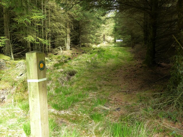
Black Cleugh is a haven for walkers and hikers, with numerous trails crisscrossing the valley. These trails provide the perfect opportunity to explore the region's natural beauty and take in breathtaking views from vantage points along the way. The valley is also intersected by the Pennine Way, a famous long-distance footpath that attracts hikers from all over the world.

In addition to its natural beauty, Black Cleugh boasts a rich cultural heritage. The historic remnants of lead mining can be found scattered throughout the valley, serving as a reminder of its industrial past. Visitors can also discover ancient stone circles and burial mounds, providing a glimpse into the area's prehistoric roots.

Overall, Black Cleugh is a hidden gem in Northumberland, offering a perfect blend of natural beauty, outdoor activities, and historical significance. Whether it be for a leisurely stroll or a challenging hike, this valley promises a memorable and enriching experience for all who visit.

If you have any feedback on the listing, please let us know in the comments section below.

Black Cleugh Images

Images are sourced within 2km of 55.303892/-2.2329206 or Grid Reference NT8501. Thanks to Geograph Open Source API. All images are credited.

Footpath leading out of the forest Towards Corby Pike.
Footpath leading out of the forest
Towards Corby Pike.
Trig point on Corby Pike At 368m with flush bracket number S7922.
Looking up the valley of Sills Burn towards Featherwood, in the trees.
Trig point on Corby Pike
At 368m with flush bracket number S7922. Looking up the valley of Sills Burn towards Featherwood, in the trees.
A shelter on Corby Pike Just a few metres NE of the trig point this appears a shelter for walkers rather than a dilapidated sheepfold.
A shelter on Corby Pike
Just a few metres NE of the trig point this appears a shelter for walkers rather than a dilapidated sheepfold.
Pond holding water to fight fires A distinctive feature to photograph!  
Many of the forest rides are very similar with no identifying features.
Pond holding water to fight fires
A distinctive feature to photograph! Many of the forest rides are very similar with no identifying features.
High seat Used by marksmen to control roe deer in the woods.
It is considered safer to be shooting downwards.
Several deer crossed the roads but did not wait to be photographed!
High seat
Used by marksmen to control roe deer in the woods. It is considered safer to be shooting downwards. Several deer crossed the roads but did not wait to be photographed!
Forestry road In Stewartshiels Plantation.
Forestry road
In Stewartshiels Plantation.
Sheepfold beside a pond This sheepfold appears to have been 'modified' by soldiers on exercise inserting 'gunloops' in the wall to observe or fire on 'the enemy'.
Sheepfold beside a pond
This sheepfold appears to have been 'modified' by soldiers on exercise inserting 'gunloops' in the wall to observe or fire on 'the enemy'.
Stewartshiels Burn Flowing down to a pond beyond the sheepfold.
A cuckoo was calling in the nearby woods.
Stewartshiels Burn
Flowing down to a pond beyond the sheepfold. A cuckoo was calling in the nearby woods.
Cattle graze beyond a sheepfold Above the Stewartshiels Burn at the edge of the woods.
Cattle graze beyond a sheepfold
Above the Stewartshiels Burn at the edge of the woods.
The open road Across Otterburn Ranges.
Heading for Holystone.
The open road
Across Otterburn Ranges. Heading for Holystone.
Range road, Otterburn Junction on Jock's Knowe looking towards Bluestone Edge.
Range road, Otterburn
Junction on Jock's Knowe looking towards Bluestone Edge.
Road, Otterburn Ranges Looking into a ferocious wind.
Road, Otterburn Ranges
Looking into a ferocious wind.
Tussocky ground Looking towards Corby Pike from one of the range roads.
Tussocky ground
Looking towards Corby Pike from one of the range roads.
Bluestone Edge Range apparatus on Bluestone Edge.
Bluestone Edge
Range apparatus on Bluestone Edge.
Wet moorland, Otterburn Ranges Looking into yet another totally unappetising square from the fortunate corner of an estate road. Close enough for me - never mind metal objects, the going looks like it is going to kill me.
Wet moorland, Otterburn Ranges
Looking into yet another totally unappetising square from the fortunate corner of an estate road. Close enough for me - never mind metal objects, the going looks like it is going to kill me.
Tofthouse Road The military ranges at Otterburn are farmed - but beasts have to be pretty hardy to make weight on the poor quality grazing. This area was occupied by cattle, one beast walking along the road.
Tofthouse Road
The military ranges at Otterburn are farmed - but beasts have to be pretty hardy to make weight on the poor quality grazing. This area was occupied by cattle, one beast walking along the road.
Cattle off Tofthouse Road Hardy beasts, living on very rough grazing.
Cattle off Tofthouse Road
Hardy beasts, living on very rough grazing.
Tofthouse Road A cow on one of the range roads at Otterburn.  The white gate is closed when firing is in progress.
Tofthouse Road
A cow on one of the range roads at Otterburn. The white gate is closed when firing is in progress.
Show me another place!

Black Cleugh is located at Grid Ref: NT8501 (Lat: 55.303892, Lng: -2.2329206)

Unitary Authority: Northumberland

Police Authority: Northumbria

What 3 Words

///switch.someone.scoping. Near Rochester, Northumberland

Nearby Locations

Black Cleugh

Related Wikis

Northumberland National Park

Northumberland National Park is the northernmost national park in England. It covers an area of more than 1,050 square kilometres (410 sq mi) between the...

Rochester, Northumberland

Rochester is a small village and civil parish in north Northumberland, England. It is 5 miles (8 km) north-west of Otterburn on the A68 road between Corbridge...

Bremenium

Bremenium is an ancient Roman fort (castrum) located at Rochester, Northumberland, England. The fort is one of the defensive structures built along Dere...

A68 road

The A68 is a major road in the United Kingdom, running from Darlington in England to the A720 in Edinburgh, the capital of Scotland. It crosses the Anglo...

Featherwood Roman Camps

Featherwood Roman Camps are neighbouring archaeological sites in Northumberland, England, 1 mile (1.6 km) north of Featherwood and about 3 miles (5 km...

Cottonshopeburnfoot

Cottonshopeburnfoot is a hamlet in Redesdale in Northumberland, England. It lies on the A68 road, 2 miles south east of the village of Byrness. The hamlet...

Usway Burn

The Usway Burn is an upland river on the southern flanks of the Cheviot Hills, in the Northumberland National Park, England. It is a tributary of the River...

Otterburn Hall

Otterburn Hall is an English country house and estate in Otterburn, Northumberland. It is situated in 500 acres (200 ha) of deer park and woodland in...

Have you been to Black Cleugh?

Leave your review of Black Cleugh below (or comments, questions and feedback).