Sipton Cleugh

Valley in Northumberland

England

Sipton Cleugh

Heather moorland with cairn The expanse of almost featureless heather lies to the north of Tedham Moss above the eastern side of Allendale. The cairn marks, or is close to a local spot height given as 502 m. on OS maps.
Heather moorland with cairn Credit: Trevor Littlewood

Sipton Cleugh is a picturesque valley located in the county of Northumberland, England. Nestled within the stunning countryside, it is renowned for its natural beauty and tranquil atmosphere. The valley is situated about 6 miles southwest of the town of Hexham, and covers an area of approximately 10 square miles.

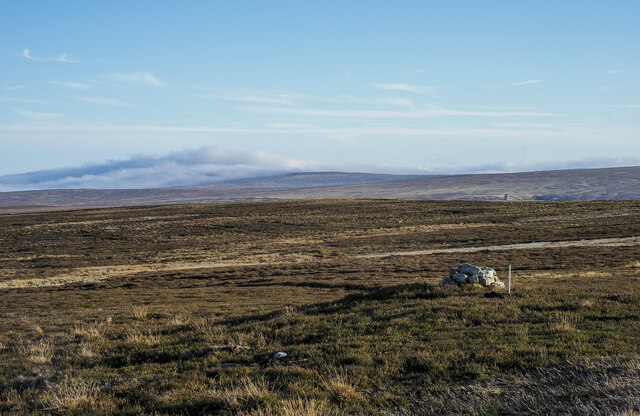
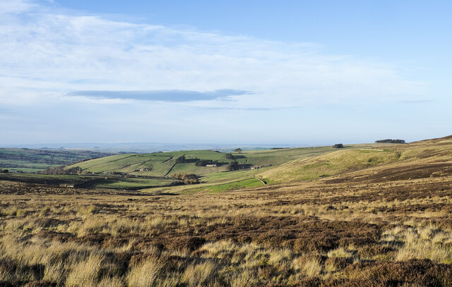
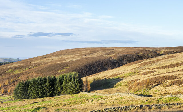
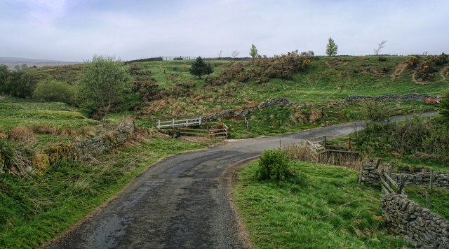
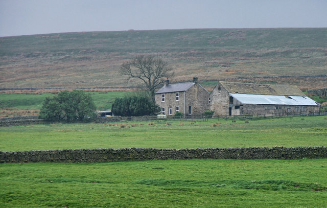
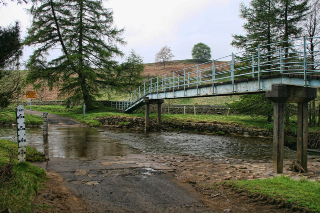
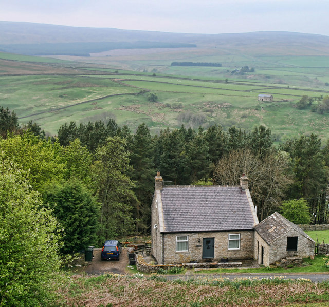
Sipton Cleugh is characterized by its rolling hills, lush meadows, and dense woodlands, making it a haven for nature enthusiasts and outdoor adventurers. The valley is crisscrossed by a network of footpaths and bridleways, offering ample opportunities for hiking, cycling, and horseback riding. The Sipton Cleugh Burn, a small river that runs through the valley, adds to the charm and serenity of the landscape.

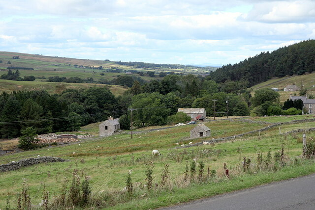
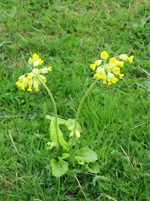
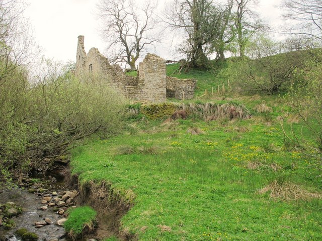
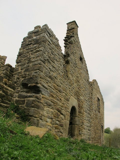
The area is also steeped in history, with traces of ancient settlements and Roman remains scattered throughout. Ruins of old farmsteads and stone circles can be found, providing a glimpse into the valley's rich past. Wildlife is abundant in Sipton Cleugh, with a variety of bird species, mammals, and plant life thriving in the diverse habitats.

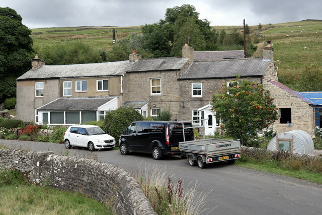
Although primarily rural, Sipton Cleugh is within close proximity to nearby amenities and attractions. The bustling market town of Hexham offers a range of shops, restaurants, and cultural sites, including the iconic Hexham Abbey. The Northumberland National Park is also nearby, providing opportunities for further exploration and discovery.

In conclusion, Sipton Cleugh is a captivating valley in Northumberland, offering a blend of natural beauty, historical significance, and recreational opportunities. Whether seeking solitude in nature or embarking on an adventure, this enchanting valley is sure to leave a lasting impression on visitors.

If you have any feedback on the listing, please let us know in the comments section below.

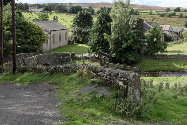
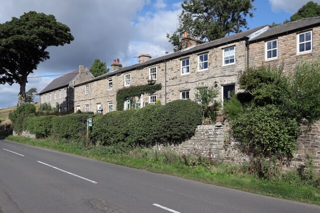
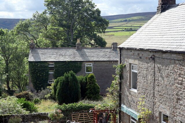
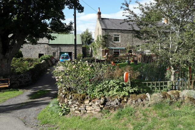
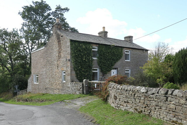
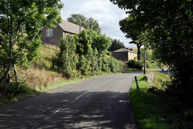
Sipton Cleugh Images

Images are sourced within 2km of 54.846335/-2.2305082 or Grid Reference NY8550. Thanks to Geograph Open Source API. All images are credited.

Heather moorland with cairn The expanse of almost featureless heather lies to the north of Tedham Moss above the eastern side of Allendale. The cairn marks, or is close to a local spot height given as 502 m. on OS maps.
Heather moorland with cairn
The expanse of almost featureless heather lies to the north of Tedham Moss above the eastern side of Allendale. The cairn marks, or is close to a local spot height given as 502 m. on OS maps.
Moorland descending towards head of Swampy Sike The shallow bowl of moorland gathers water for Swampy Sike which shortly becomes known as Sinderhope Burn in the valley of Sinder Hope. That in turn feeds into the River East Allen.
Moorland descending towards head of Swampy Sike
The shallow bowl of moorland gathers water for Swampy Sike which shortly becomes known as Sinderhope Burn in the valley of Sinder Hope. That in turn feeds into the River East Allen.
Location of Sipton Lead Mines The capped shaft of the Blackett Level at Sipton can be seen left, centre. This photo was taken as an attempt to reproduce an old photograph. The mine buildings were pulled down in 1950.

The small building in the field (150 metres South Of Sipton Terrace), just right of centre, was the mine Powder House or explosive Store.

Allen Valleys Local History Group: <span class="nowrap"><a title="http://www.allenvalleyslocalhistory.org.uk/photo/sipton-mine-0002-162/" rel="nofollow ugc noopener" href="http://www.allenvalleyslocalhistory.org.uk/photo/sipton-mine-0002-162/">Link</a><img style="margin-left:2px;" alt="External link" title="External link - shift click to open in new window" src="https://s1.geograph.org.uk/img/external.png" width="10" height="10"/></span> <span class="nowrap"><a title="https://web.archive.org/web/20220918142027/http://www.allenvalleyslocalhistory.org.uk/photo/sipton-mine-0002-162/" rel="nofollow ugc noopener" href="https://web.archive.org/web/20220918142027/http://www.allenvalleyslocalhistory.org.uk/photo/sipton-mine-0002-162/">Archive Link</a><img style="margin-left:2px;" alt="External link" title="External link - shift click to open in new window" src="https://s1.geograph.org.uk/img/external.png" width="10" height="10"/></span>
Location of Sipton Lead Mines
The capped shaft of the Blackett Level at Sipton can be seen left, centre. This photo was taken as an attempt to reproduce an old photograph. The mine buildings were pulled down in 1950. The small building in the field (150 metres South Of Sipton Terrace), just right of centre, was the mine Powder House or explosive Store. Allen Valleys Local History Group: LinkExternal link Archive LinkExternal link
Lowshield Close, Ellershope Bridge, Spartylea View of 'Spartylea Corner' c.1910 on Allen Valleys Local History Group website: <span class="nowrap"><a title="http://www.allenvalleyslocalhistory.org.uk/photo/spartylea-1910-0033-003/" rel="nofollow ugc noopener" href="http://www.allenvalleyslocalhistory.org.uk/photo/spartylea-1910-0033-003/">Link</a><img style="margin-left:2px;" alt="External link" title="External link - shift click to open in new window" src="https://s1.geograph.org.uk/img/external.png" width="10" height="10"/></span> <span class="nowrap"><a title="https://web.archive.org/web/20220918172320/http://www.allenvalleyslocalhistory.org.uk/photo/spartylea-1910-0033-003/" rel="nofollow ugc noopener" href="https://web.archive.org/web/20220918172320/http://www.allenvalleyslocalhistory.org.uk/photo/spartylea-1910-0033-003/">Archive Link</a><img style="margin-left:2px;" alt="External link" title="External link - shift click to open in new window" src="https://s1.geograph.org.uk/img/external.png" width="10" height="10"/></span>
Lowshield Close, Ellershope Bridge, Spartylea
View of 'Spartylea Corner' c.1910 on Allen Valleys Local History Group website: LinkExternal link Archive LinkExternal link
St Peter's Church & Corn Mill from east There is a similar view c.1905 on the website of the Allen Valleys Local History Group: <span class="nowrap"><a title="http://www.allenvalleyslocalhistory.org.uk/photo/allendale-1905-0031-052/" rel="nofollow ugc noopener" href="http://www.allenvalleyslocalhistory.org.uk/photo/allendale-1905-0031-052/">Link</a><img style="margin-left:2px;" alt="External link" title="External link - shift click to open in new window" src="https://s1.geograph.org.uk/img/external.png" width="10" height="10"/></span> <span class="nowrap"><a title="https://web.archive.org/web/20220918172001/http://www.allenvalleyslocalhistory.org.uk/photo/allendale-1905-0031-052/" rel="nofollow ugc noopener" href="https://web.archive.org/web/20220918172001/http://www.allenvalleyslocalhistory.org.uk/photo/allendale-1905-0031-052/">Archive Link</a><img style="margin-left:2px;" alt="External link" title="External link - shift click to open in new window" src="https://s1.geograph.org.uk/img/external.png" width="10" height="10"/></span>
St Peter's Church & Corn Mill from east
There is a similar view c.1905 on the website of the Allen Valleys Local History Group: LinkExternal link Archive LinkExternal link
Spartylea Terrace, Spartylea
Old Post Office, Spartylea There is another photo here <a href="https://www.geograph.org.uk/photo/7286475">NY8448 : Old Post Office, Spartylea</a>

The current Post Office is in the building on the right <a href="https://www.geograph.org.uk/photo/7286472">NY8549 : Post Office, Spartylea</a>.

There is an old postcard view of the Post Office and Sparty Lea here: <span class="nowrap"><a title="http://www.allenvalleyslocalhistory.org.uk/photo/spartylea-1910-0037-015/" rel="nofollow ugc noopener" href="http://www.allenvalleyslocalhistory.org.uk/photo/spartylea-1910-0037-015/">Link</a><img style="margin-left:2px;" alt="External link" title="External link - shift click to open in new window" src="https://s1.geograph.org.uk/img/external.png" width="10" height="10"/></span> <span class="nowrap"><a title="https://web.archive.org/web/20220918171534/http://www.allenvalleyslocalhistory.org.uk/photo/spartylea-1910-0037-015/" rel="nofollow ugc noopener" href="https://web.archive.org/web/20220918171534/http://www.allenvalleyslocalhistory.org.uk/photo/spartylea-1910-0037-015/">Archive Link</a><img style="margin-left:2px;" alt="External link" title="External link - shift click to open in new window" src="https://s1.geograph.org.uk/img/external.png" width="10" height="10"/></span>
Old Post Office, Spartylea
There is another photo here NY8448 : Old Post Office, Spartylea The current Post Office is in the building on the right NY8549 : Post Office, Spartylea. There is an old postcard view of the Post Office and Sparty Lea here: LinkExternal link Archive LinkExternal link
Post Office, Spartylea
Old Post Office, Spartylea
Road at Spartylea The old chapel is on the left <a href="https://www.geograph.org.uk/photo/6637472">NY8548 : Primitive Methodist Chapel, Spartylea</a> with the terrace further along the road <a href="https://www.geograph.org.uk/photo/7286457">NY8548 : Spartylea Terrace, Spartylea</a>.
Road at Spartylea
The old chapel is on the left NY8548 : Primitive Methodist Chapel, Spartylea with the terrace further along the road NY8548 : Spartylea Terrace, Spartylea.
Small plantation near to Sipton Burn Sipton Burn flows in the valley beyond the trees.
The flat-topped moorland dome is Sipton Law.
Small plantation near to Sipton Burn
Sipton Burn flows in the valley beyond the trees. The flat-topped moorland dome is Sipton Law.
Cowslips on Mill Haugh
Rowantree Stob After restoration - see <a href="https://www.geograph.org.uk/photo/461309">NY8351 : Rowantree Stob</a>.
Rowantree Stob
After restoration - see NY8351 : Rowantree Stob.
Knock Shield Road crossing Knockshield Burn at Knock Shield.
Knock Shield
Road crossing Knockshield Burn at Knock Shield.
High Knock Shield High Knock Shield Farm in Allendale.
High Knock Shield
High Knock Shield Farm in Allendale.
River East Allen Ford and footbridge over the River East Allen near Rye Close.
River East Allen
Ford and footbridge over the River East Allen near Rye Close.
Plantation Lodge Cottage at the north end of Sipton Plantation.
Plantation Lodge
Cottage at the north end of Sipton Plantation.
Show me another place!

Sipton Cleugh is located at Grid Ref: NY8550 (Lat: 54.846335, Lng: -2.2305082)

Unitary Authority: Northumberland

Police Authority: Northumbria

What 3 Words

///envy.permanent.kilts. Near Alston, Cumbria

Nearby Locations

Sipton Cleugh

Related Wikis

Sinderhope

Sinderhope is a hamlet situated on the east Allen Valley in south-west Northumberland. The population is spread over farms in an area approximately 25...

Acton, Northumberland

Acton is a small hamlet in Northumberland, north-east England, about 3 miles (5 km) south of Allendale Town. Acton is usually Anglo-Saxon Old English...

Hexhamshire Moors

Hexhamshire Moors is a Site of Special Scientific Interest covering an extensive area of moorland in the Wear Valley district of north-west County Durham...

Allendale Moors

Allendale Moors is a Site of Special Scientific Interest (SSSI) in Northumberland, England. The upland moorland ridge site is listed for its heath, flush...

Related Videos

Have you been to Sipton Cleugh?

Leave your review of Sipton Cleugh below (or comments, questions and feedback).