Copy Clough

Valley in Lancashire Burnley

England

Copy Clough

WWII Lancashire: Ghost Signs of the Home Front  (22) -
Emergency Water Supply, Hand Bridge, Todmorden Road, Burnley

"EWS Hatch"

A rare EWS sign of metal on the bridge over the River Calder. "EWS Hatch" may refer to a facility to obtain an emergency supply of water from the river (below the bridge).

<a href="https://www.geograph.org.uk/photo/6945367">SD8432 : WWII Lancashire: Ghost Signs of the Home Front  (23)</a>
WWII Lancashire: Ghost Signs of the Home Front (22) Credit: Mike Searle

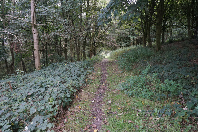
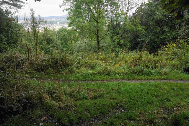
Copy Clough is a small valley located in Lancashire, England. Situated in the southern part of the county, it is nestled within the picturesque Pendle Hill region. The valley is renowned for its outstanding natural beauty, with lush greenery, rolling hills, and meandering streams.

The name "Copy Clough" is believed to have originated from the Old English words "copy" meaning a small depression or hollow, and "clough" referring to a ravine or steep-sided valley. This aptly describes the topographical features of the area.

The valley is a popular destination for nature enthusiasts, hikers, and photographers. It offers numerous walking trails that showcase the stunning countryside, providing breathtaking views of the surrounding landscape. Visitors can explore the diverse flora and fauna, including wildflowers, birds, and small mammals.

The tranquil ambiance of Copy Clough makes it an ideal spot for those seeking peace and solitude. Its remote location ensures that it remains relatively unspoiled by human activity. The absence of major roads or urban developments adds to its charm and allure.

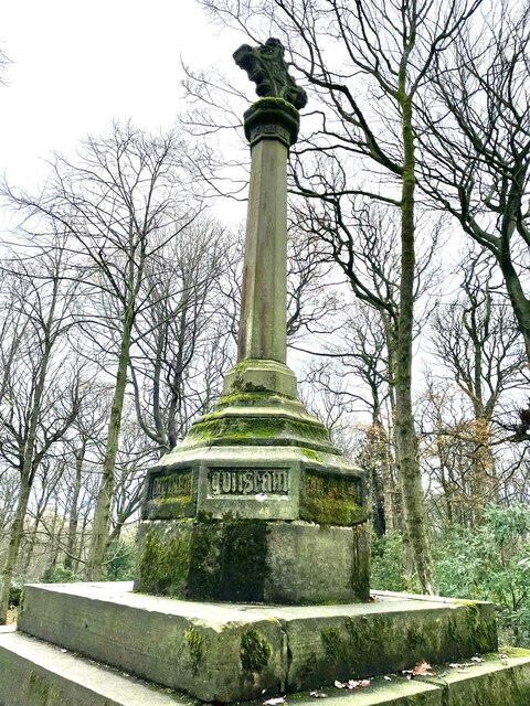
The valley is also of historical significance, with traces of prehistoric settlements and ancient burial mounds dating back thousands of years. It has been a site of archaeological interest, attracting researchers and historians.

Overall, Copy Clough in Lancashire offers a serene and idyllic escape from the hustle and bustle of modern life. Its natural beauty, rich biodiversity, and historical significance make it a hidden gem in the region, attracting nature lovers and history enthusiasts alike.

If you have any feedback on the listing, please let us know in the comments section below.
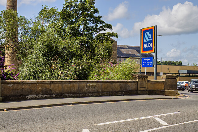
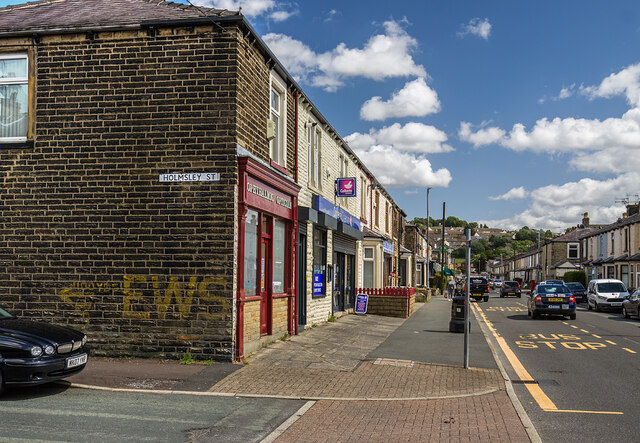
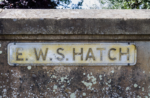
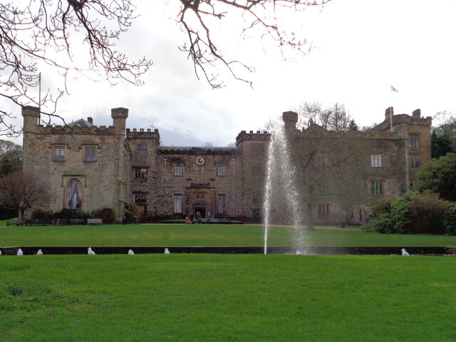
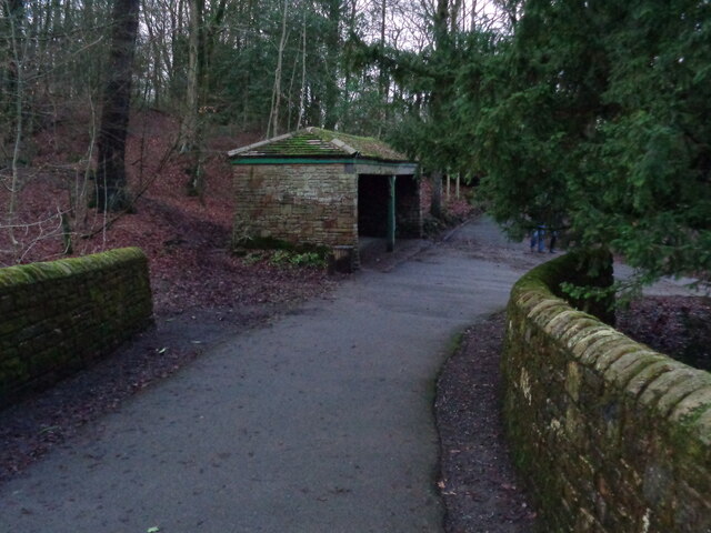
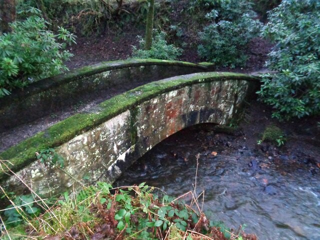
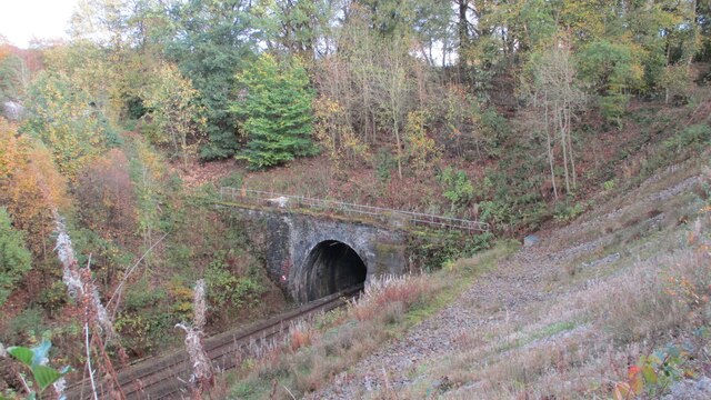
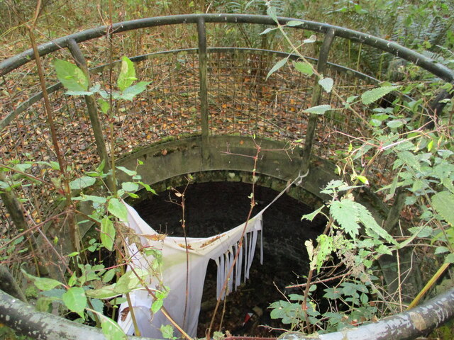
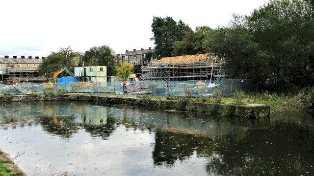
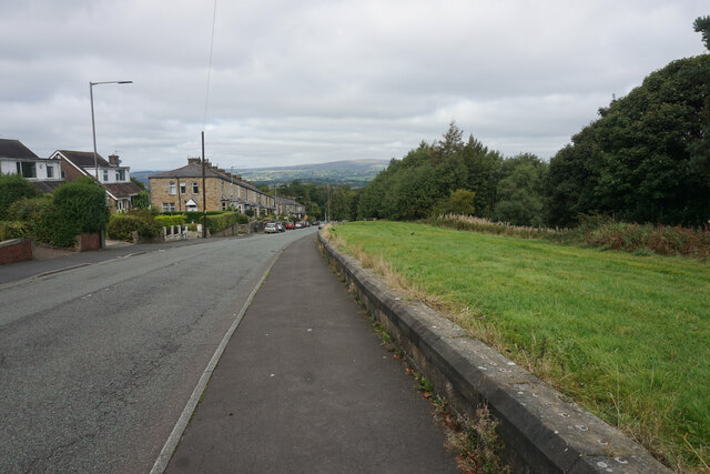
Copy Clough Images

Images are sourced within 2km of 53.770781/-2.2308196 or Grid Reference SD8430. Thanks to Geograph Open Source API. All images are credited.

WWII Lancashire: Ghost Signs of the Home Front  (22) -
Emergency Water Supply, Hand Bridge, Todmorden Road, Burnley

"EWS Hatch"

A rare EWS sign of metal on the bridge over the River Calder. "EWS Hatch" may refer to a facility to obtain an emergency supply of water from the river (below the bridge).

<a href="https://www.geograph.org.uk/photo/6945367">SD8432 : WWII Lancashire: Ghost Signs of the Home Front  (23)</a>
WWII Lancashire: Ghost Signs of the Home Front (22)
- Emergency Water Supply, Hand Bridge, Todmorden Road, Burnley "EWS Hatch" A rare EWS sign of metal on the bridge over the River Calder. "EWS Hatch" may refer to a facility to obtain an emergency supply of water from the river (below the bridge). SD8432 : WWII Lancashire: Ghost Signs of the Home Front (23)
WWII Lancashire: Ghost Signs of the Home Front  (24) -
Emergency Water Supply, Holmsley Street, at junction with Lyndhurst Road, Burnley

"EWS 100 yds"

<a href="https://www.geograph.org.uk/photo/6945363">SD8432 : WWII Lancashire: Ghost Signs of the Home Front  (25)</a>
WWII Lancashire: Ghost Signs of the Home Front (24)
- Emergency Water Supply, Holmsley Street, at junction with Lyndhurst Road, Burnley "EWS 100 yds" SD8432 : WWII Lancashire: Ghost Signs of the Home Front (25)
WWII Lancashire: Ghost Signs of the Home Front  (25) -
Emergency Water Supply, Holmsley Street, at junction with Lyndhurst Road, Burnley

"EWS 100 yds"

                              *********
START: <a href="https://www.geograph.org.uk/photo/6944970">SJ8498 : WWII Lancashire: Ghost Signs of the Home Front  (1)</a>
WWII Lancashire: Ghost Signs of the Home Front (25)
- Emergency Water Supply, Holmsley Street, at junction with Lyndhurst Road, Burnley "EWS 100 yds" ********* START: SJ8498 : WWII Lancashire: Ghost Signs of the Home Front (1)
WWII Lancashire: Ghost Signs of the Home Front  (23) -
Emergency Water Supply,  Hand Bridge, Todmorden Road, Burnley

"EWS Hatch"

<a href="https://www.geograph.org.uk/photo/6945359">SD8432 : WWII Lancashire: Ghost Signs of the Home Front  (24)</a>
WWII Lancashire: Ghost Signs of the Home Front (23)
- Emergency Water Supply, Hand Bridge, Todmorden Road, Burnley "EWS Hatch" SD8432 : WWII Lancashire: Ghost Signs of the Home Front (24)
Old Wayside Cross in Tiwneley Park, Burnley Foldys' Cross, an old market cross base in a new cross. Moved to the intersection of footpaths leading towards Todmorden road in Towneley Park, 300 metres southwest of Towneley Hall in Burnley. Grade II Listed <span class="nowrap"><a title="https://historicengland.org.uk/listing/the-list/list-entry/1247301" rel="nofollow ugc noopener" href="https://historicengland.org.uk/listing/the-list/list-entry/1247301">Link</a><img style="margin-left:2px;" alt="External link" title="External link - shift click to open in new window" src="https://s1.geograph.org.uk/img/external.png" width="10" height="10"/></span>. See also <a title="https://www.geograph.org.uk/photo/3569776" href="https://www.geograph.org.uk/photo/3569776">Link</a> and <a title="https://www.geograph.org.uk/photo/1133733" href="https://www.geograph.org.uk/photo/1133733">Link</a>.

Milestone Society National ID: LABU_BUR03
Old Wayside Cross in Tiwneley Park, Burnley
Foldys' Cross, an old market cross base in a new cross. Moved to the intersection of footpaths leading towards Todmorden road in Towneley Park, 300 metres southwest of Towneley Hall in Burnley. Grade II Listed LinkExternal link. See also Link and Link. Milestone Society National ID: LABU_BUR03
The Singing Ringing Tree One of East Lancashire's Panopticons
The Singing Ringing Tree
One of East Lancashire's Panopticons
The Singing Ringing Tree One of East Lancashire's Panopticons, but I do not think the view is better from on top of the structure
The Singing Ringing Tree
One of East Lancashire's Panopticons, but I do not think the view is better from on top of the structure
The junction of Manchester Road and Rossendale Road
Towneley Hall The north east frontage
Towneley Hall
The north east frontage
Park Shelters At Boggart Bridge in Towneley Park Wilderness
Park Shelters
At Boggart Bridge in Towneley Park Wilderness
Ornamental Footbridge In the Wilderness of Towneley Park over Copy Clough
Ornamental Footbridge
In the Wilderness of Towneley Park over Copy Clough
Towneley Railway Tunnel The north portal
Towneley Railway Tunnel
The north portal
Beehive Coke Oven The charging hole decorated for Halloween
Beehive Coke Oven
The charging hole decorated for Halloween
Finsley Gate Wharf Renovations underway on the old depot buildings. A former dockyard on the Leeds and Liverpool Canal
Finsley Gate Wharf
Renovations underway on the old depot buildings. A former dockyard on the Leeds and Liverpool Canal
Rosehill Road A residential suburb of Burnley which is significantly higher than the town centre.
Rosehill Road
A residential suburb of Burnley which is significantly higher than the town centre.
Path in Rose Hill The path is on the wooded hillside which separates Rose Hill from the town centre of Burnley.
Path in Rose Hill
The path is on the wooded hillside which separates Rose Hill from the town centre of Burnley.
Junction of paths in Rose Hill There is just a glimpse of Burnley town centre through the trees.
Junction of paths in Rose Hill
There is just a glimpse of Burnley town centre through the trees.
Burnley F.C. - Turf Moor Claret & Blue Army to the fore below the giant TV screen in the southeast corner of Turf Moor prior to kick-off.
<span class="nowrap"><a title="www.burnleyfootballclub.com" rel="nofollow ugc noopener" href="http://www.burnleyfootballclub.com">Link</a><img style="margin-left:2px;" alt="External link" title="External link - shift click to open in new window" src="https://s1.geograph.org.uk/img/external.png" width="10" height="10"/></span>
Burnley F.C. - Turf Moor
Claret & Blue Army to the fore below the giant TV screen in the southeast corner of Turf Moor prior to kick-off. LinkExternal link
Show me another place!

Copy Clough is located at Grid Ref: SD8430 (Lat: 53.770781, Lng: -2.2308196)

Administrative County: Lancashire

District: Burnley

Police Authority: Lancashire

What 3 Words

///entire.pillow.factor. Near Burnley, Lancashire

Nearby Locations

Copy Clough Copy Wood

Related Wikis

Towneley Colliery

Towneley Colliery or Towneley Desmesne was a coal mine on the Burnley Coalfield in Burnley, Lancashire, England. Sunk in the late 1860s, it was linked...

Towneley Park

Towneley Park is owned and managed by Burnley Borough Council and is the largest and most popular park in Burnley, Lancashire, England. The main entrance...

Towneley railway station

Towneley railway station was a station in Lancashire which served Burnley Wood and the nearby Towneley Hall on the eastern edge of Burnley. Opened on 12...

Burnley Wood

Burnley Wood is a district and former electoral ward of Burnley, Lancashire. In broad terms the area lies between Parliament Street in the north and Hufling...

Unity College, Burnley

Unity College is a mixed 11-16 comprehensive school in Burnley, Lancashire, England. == History == === Former school === Towneley High School originally...

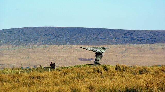
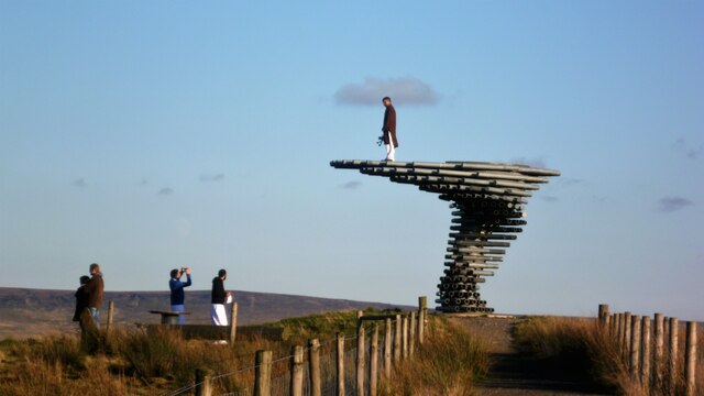
Singing Ringing Tree (sculpture)

The Singing Ringing Tree is a wind powered sound sculpture resembling a tree set in the landscape of the Pennine hill range overlooking Burnley, in Lancashire...

Habergham Eaves

Habergham Eaves is a civil parish in the borough of Burnley, in Lancashire, England. The parish consists of a rural area south of Burnley, and suburban...

Cliviger

Cliviger is a civil parish in the Borough of Burnley, in Lancashire, England. It is situated to the southeast of Burnley, and northwest of Todmorden....

Nearby Amenities

Located within 500m of 53.770781,-2.2308196
Created By: YahooApplet 1.0
Lat/Long: 53.772186/-2.2369211
Created By: YahooApplet 1.0
Lat/Long: 53.7718816/-2.236213
Created By: YahooApplet 1.0
Lat/Long: 53.7710949/-2.234179
Traffic Signals
Traffic Signals: signal
Traffic Signals Direction: forward
Lat/Long: 53.7696801/-2.2255878
Traffic Signals
Traffic Signals: signal
Traffic Signals Direction: backward
Lat/Long: 53.7702585/-2.2263926
Traffic Signals
Traffic Signals: signal
Traffic Signals Direction: forward
Lat/Long: 53.7692748/-2.2251474
Traffic Signals
Traffic Signals: signal
Traffic Signals Direction: backward
Lat/Long: 53.7694899/-2.2251481
Traffic Signals
Traffic Signals: signal
Traffic Signals Direction: forward
Lat/Long: 53.7702745/-2.2266979
Traffic Signals
Traffic Signals: signal
Traffic Signals Direction: forward
Lat/Long: 53.7705287/-2.2267447
Bus Stop
Picnic Area
Bus: yes
Public Transport: platform
Lat/Long: 53.7728604/-2.228516
Bus Stop
Picnic Area
Bus: yes
Naptan AtcoCode: 2500DCL601
Naptan NaptanCode: landmtmt
Public Transport: platform
Lat/Long: 53.7739345/-2.2304147
Bus Stop
Turning Circle
Bus: yes
Public Transport: platform
Lat/Long: 53.7751923/-2.23168
Give Way
Lat/Long: 53.7701891/-2.2266323
The data included in this document is from www.openstreetmap.org. The data is made available under ODbL.

Have you been to Copy Clough?

Leave your review of Copy Clough below (or comments, questions and feedback).